

Tropical cyclone formation in the Coral Sea is commonly described as depending on warm ocean water, deep tropical moisture and a pre-existing weather disturbance. In broad terms, if the atmosphere is unstable and wind shear remains weak, a tropical disturbance may organise into a tropical cyclone.
Key takeaways
- Forecasters often watch warm Coral Sea waters because they can help supply heat and moisture for cyclone development.
- A pre-existing disturbance, sometimes associated with the monsoonal trough or tropical waves, can provide a starting point for development.
- Low vertical wind shear is generally seen as helpful because it can let thunderstorms stay more closely aligned with a developing centre.
- The Coriolis effect is commonly described as providing the large-scale spin that can help a system organise away from the equator.
Tropical cyclone formation Coral Sea: the main ingredients
In general meteorology explanations, cyclone development in the Coral Sea is described as requiring several atmospheric and oceanic conditions to align. Forecasters often focus on warm sea-surface temperatures, moist air and enough instability to support deep thunderstorms. If storms cluster around a common centre and organisation improves, the system may be described as evolving from a tropical low toward a tropical cyclone.
How do tropical cyclones form in the Coral Sea?
In many cases, development begins with a tropical disturbance: an area of unsettled weather with clusters of showers and thunderstorms. In the Coral Sea, that disturbance may be discussed in connection with the monsoonal trough or with tropical waves moving through the easterlies. Those features are often associated with surface convergence, which can help lift warm, moist air and support deeper cloud growth. If thunderstorm activity persists, some systems may begin to rotate around a shared low-pressure centre.

That alignment is often considered important because tropical cyclones tend to organise best when their structure remains balanced. Rising air near the centre and outflow aloft are often discussed as parts of that process. If shear disrupts that balance, a system may stay weak or fail to develop further. That is why forecasters usually assess Coral Sea cyclone conditions as a combination of factors rather than one ingredient in isolation.
In operational forecasting, discussion of Queensland weather often becomes especially relevant when a Coral Sea disturbance is forming nearby. A weakly sheared environment can give thunderstorms more time to persist, while dry air or stronger upper-level winds may limit further development.
The thermodynamics of Coral Sea cyclones and the Warm Core
The thermodynamics of Coral Sea cyclones are often explained in simple terms even though real storms are complex. Warm ocean water can support evaporation, the vapour can rise, and condensation in deep clouds releases heat into the storm core. That process is commonly linked with falling surface pressure and stronger low-level inflow. In a favourable environment, that can support continued uplift and organisation. Over time, a sufficiently organised system may develop the warm core associated with mature tropical cyclones.
A warm-core cyclone is generally contrasted with a cold-core low because relatively warmer air is concentrated closer to the centre. That structure is often associated with a stronger, more symmetric tropical circulation. It also helps explain why tropical cyclones are usually discussed in relation to ocean energy rather than the temperature contrasts that drive many mid-latitude systems.
Forecasters may also watch the outflow pattern aloft. If air can spread away efficiently from the top of the storm, further organisation may become easier. If outflow is restricted, intensification may be harder. This is one reason Queensland meteorologists typically weigh several parameters together.
What is the significance of the Coriolis Force for cyclones forming in the Coral Sea?
The Coriolis effect arises from Earth's rotation and is commonly used to explain why inflowing air tends to curve around a centre rather than moving straight inward. Near the equator, that turning effect is weak, so cyclone development is generally less favoured there. Farther from the equator, the effect becomes stronger and can help a rotating vortex organise.
This helps explain why the Coral Sea is often discussed as a favourable region for tropical cyclone formation. The area is far enough from the equator for planetary spin to matter, while still lying in a warm, humid tropical environment that can support deep convection. During the Australian warm season, that combination is frequently part of cyclone discussions.
Monitoring and classifying Coral Sea cyclones
If a system begins to organise, agencies such as the Bureau of Meteorology and the Joint Typhoon Warning Center may monitor it using satellite imagery, surface observations and model guidance. Classification terminology and thresholds can vary by agency, but analysts often look for similar broad signs such as a closed low-level circulation and persistent deep convection. Depending on how organised the system becomes, it may later be described as a tropical low or tropical cyclone under the relevant agency framework.
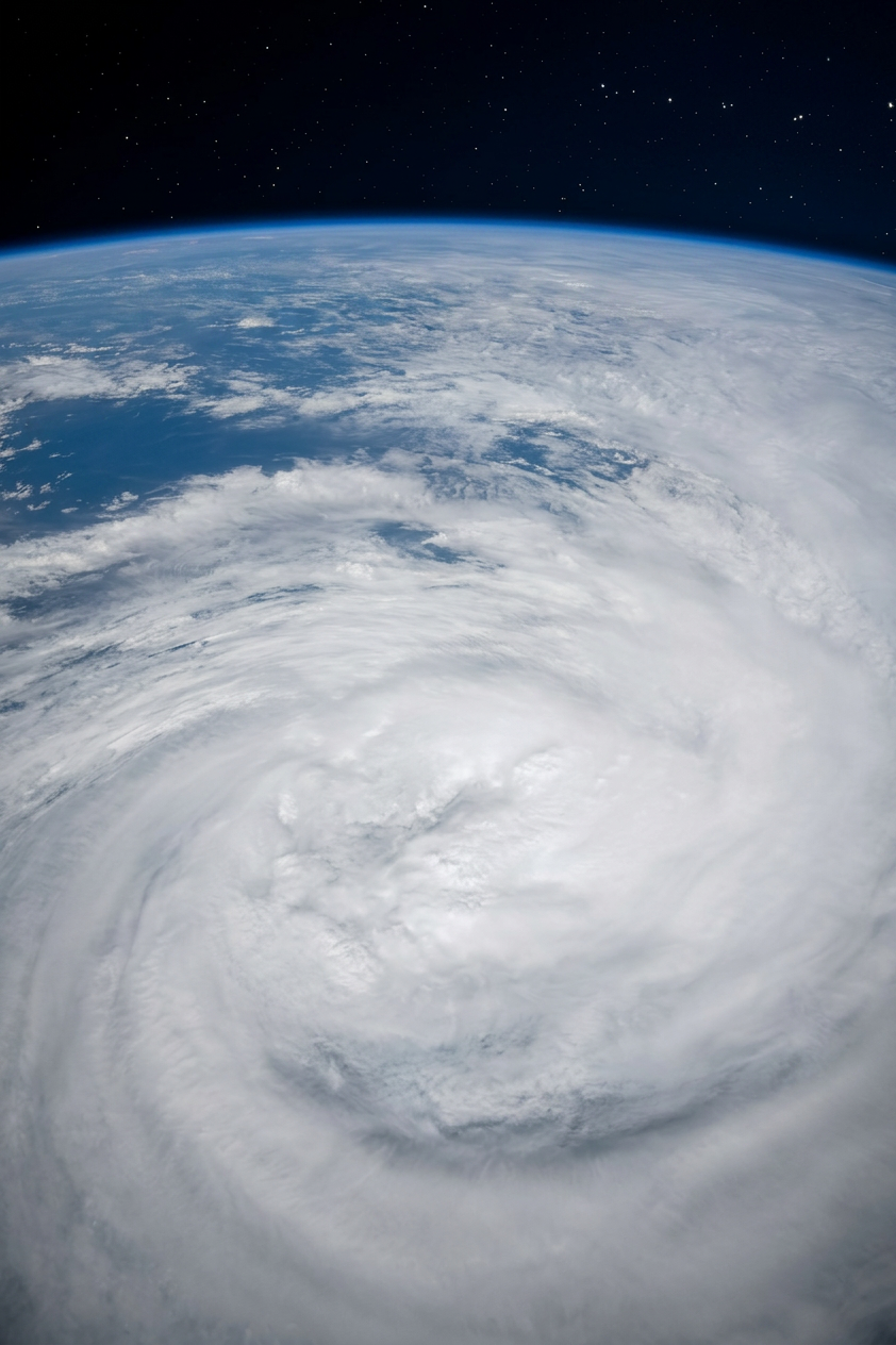
For readers following a live system, it can be useful to watch how forecast discussions change over time. People often look for a more defined centre, colder cloud tops and thunderstorm clusters wrapping closer to the core. If you are tracking a system from the north coast, links such as Queensland weather, Cyclones Hub and a local page like Mackay Weather can help you compare the broader regional picture with local impacts.
Factor-by-factor analysis can also be useful. A Coral Sea low may appear promising on satellite imagery, yet dry air or increasing wind shear can still limit development. Another system may look weaker at first but organise more quickly if the surrounding ocean and atmosphere remain favourable.
What forecasters look for before a Coral Sea low becomes a cyclone
Forecast discussions about cyclone risk for Queensland communities often start with pattern recognition. Forecasters may ask whether a disturbance is near the monsoonal trough, whether thunderstorms are persisting near the centre and whether upper-level winds are helping or hindering ventilation. In that sense, cyclone formation is often described as a chain of linked processes rather than a single trigger.
Forecasters may also consider whether a system is likely to remain over warm water. A disturbance that moves over cooler water or closer to drier continental air may struggle to intensify. By contrast, a system embedded in a broad warm pool with abundant moisture may organise more readily. That is why a storm's environment can matter as much as its current appearance.
If you are following a season closely, it can help to think of Coral Sea cyclones as systems shaped by their surroundings. Sea-surface temperature can provide energy, tropical waves or the monsoonal trough can help seed a disturbance, the Coriolis effect can aid rotation, and low vertical wind shear can leave more room for organisation. When several of those ingredients line up, cyclone development generally becomes more plausible.
Related guides
Frequently asked questions
A tropical cyclone forms in the Coral Sea when there's very warm water, moist air, and a pre-existing low-pressure disturbance. Weaker winds higher up are also needed for thunderstorms to organise and spin around a centre. These elements must align for formation.
Source: bom.gov.au
Further reading and resources
Explore trusted articles, books, videos and other resources to go deeper on this topic.
climate.ncsu.eduReference
Hurricanes and Tropical Cyclones
This article provides a comprehensive overview of how tropical cyclones form, including the role of disturbances and environmental factors.
nespclimate.com.auArticle
[PDF] Tropical cyclones and climate change in the Great Barrier Reef region
This brochure focuses on tropical cyclones specifically in the Great Barrier Reef region, which directly includes the Coral Sea, discussing their formation and climate change impacts.
www.youtube.comVideo
A New Tropical Cyclone is Developing in the Coral Sea - YouTube
This video offers a real-world example and visual explanation of a tropical cyclone developing in the Coral Sea, providing dynamic insight into the process.
en.wikipedia.orgReference
Tropical cyclone - Wikipedia
Tropical cyclones typically form over large bodies of relatively warm water. They derive their energy through the evaporation of water from the ocean surface,
jbagr.comArticle
Understanding tropical cyclones | JBA Global Resilience
The formation and behaviour of tropical cyclones are shaped by warm ocean waters, atmospheric circulation, and complex feedback processes
Planning weeks ahead?
Check Australia's long-range seasonal outlook for rainfall, temperature and the climate drivers (ENSO, IOD, SAM, MJO) shaping the next three months.
View Australia's Seasonal Weather Forecast