
Cyclone Yasi was a destructive Category 5 severe tropical cyclone that struck the North Queensland coast in the early hours of 3 February 2011. Making landfall near Mission Beach, the system brought destructive wind gusts up to 285 km/h and a dangerous storm surge, causing severe damage to homes, farms, roads and natural habitats.
Key takeaways
The system reached Category 5 strength on the Australian scale, with peak wind gusts of up to 285 km/h before landfall.
Storm surge and high seas caused major coastal impacts across the Cassowary Coast Region, including low-lying parts of Cardwell and Mission Beach.
Bureau of Meteorology warnings gave communities time to prepare as Yasi tracked toward the Queensland coast.
The cyclone caused widespread damage to housing, public infrastructure, the banana crop and the sugar industry.

Severe Tropical Cyclone Yasi approaching Queensland on 2 February 2011. By NASA/Aqua-MODIS - EOSDIS Worldview, Public Domain, https://commons.wikimedia.org/w/index.php?curid=127394419
Cyclone Yasi explained: where it came from and why it mattered
Cyclone Yasi developed northwest of Fiji on 29 January 2011 and later crossed into the Australian region. It remained the same named system as it moved west, which helped keep public warnings clear across the region. The cyclone eventually became one of the most significant events in tropical cyclone history Queensland has recorded.
The 2010 to 2011 summer was dominated by La Niña conditions, which are often linked with wetter conditions across northern Australia and can help create an environment that supports tropical cyclone formation.
In Yasi’s case, the Bureau of Meteorology tracked the system closely as it intensified over very warm water and moved toward the far north Queensland coast. These warnings were important for communities across the Cassowary Coast Region, as well as further north toward Townsville and Cairns.
For readers asking what made Yasi so dangerous, the answer lies in a combination of size, intensity and timing. The cyclone did not just bring strong winds at the point of landfall. Its broad wind field affected a long stretch of coast, increasing the area exposed to destructive wind gusts, heavy rain and dangerous seas.
What were the maximum wind speeds of Cyclone Yasi?
Cyclone Yasi produced estimated peak wind gusts of 285 km/h. At landfall near Mission Beach on 3 February 2011, its central pressure was about 929 hPa. That low pressure is a strong indicator of cyclone intensity, and it helps explain why Yasi was classified as a Category 5 severe tropical cyclone under the Australian system.

Diagram comparing categories 1 to 5 on the Australian cyclone intensity scale without showing geographic locations or maps Original graphic. Based on data from: Wikimedia Commons, Wikimedia Commons, Wikimedia Commons.
Cyclone Yasi and the Australian intensity scale
Australia uses its own tropical cyclone intensity system, which is based on ten-minute mean wind speed. A Category 5 severe tropical cyclone sits at the top of that scale. The Saffir-Simpson Scale, used more often in North America and the Caribbean, is different because it is based on one-minute mean wind speed. The two systems do not use the same averaging period, so direct comparisons need care.
Yasi is often discussed alongside the Saffir-Simpson Scale because people want to compare storms across countries. That comparison can be useful as a general reference, but the Australian Bureau of Meteorology classification remains the standard used for local warnings and damage assessments in Queensland. On that scale, Yasi was a Category 5 system with destructive wind gusts and a very low central pressure.
Another reason Yasi stands out is the way its structure evolved as it approached the coast. The cyclone developed a clearly defined centre and a large circulation, which meant the area exposed to damaging winds was wider than for a smaller storm. That combination of cyclone structure and intensity is one reason Yasi remains a major case study in Australian meteorology.
What category was Cyclone Yasi when it hit land?
Cyclone Yasi was a Category 5 severe tropical cyclone when it made landfall near Mission Beach. The storm maintained extreme strength right up to the coast, which is why it is remembered for both wind damage and coastal inundation.

Coastal areas completely flooded by a dramatic five-metre storm tide against local infrastructure Original graphic. Based on data from: NASA.
Storm surge impacts along the Cassowary Coast
The most dangerous part of a severe tropical cyclone is not always the wind alone. In Yasi’s case, storm surge impacts were a major threat. Strong onshore winds and a very low central pressure helped pile seawater against the coast, raising the level of the sea above the normal tide. When that surge coincides with high tide, the result can be severe storm tide flooding.
Coastal communities in the Cassowary Coast Region faced some of the harshest conditions. Cardwell and Mission Beach were among the places under threat from inundation, debris and powerful waves. Hinchinbrook Island also sits in the path of these coastal systems and is often discussed when looking at how the region channels wind and water during major storms.
The scale of the surge meant beaches were stripped away, boats and coastal infrastructure were damaged, and low-lying land was inundated. In tropical cyclone history Queensland, few events have combined such strong winds with such significant coastal flooding over such a wide area.
Where exactly did Cyclone Yasi make landfall?
The eye of Cyclone Yasi crossed the far north Queensland coast near Mission Beach. The main landfall zone was between Cardwell and Mission Beach, where the strongest winds, dangerous seas and storm surge impacts were felt most directly.

Downed power pole and lines on Kings Road in Townsville. By Rob and Stephanie Levy from Townsville, Australia - Powerlines down across hugh street, CC BY 2.0, https://commons.wikimedia.org/w/index.php?curid=12893718
Great Barrier Reef damage and environmental impacts
Cyclone Yasi also affected the natural environment. Severe tropical cyclones can damage coral, seagrass and coastal habitats through strong waves, sand movement and debris. Yasi passed near parts of the Great Barrier Reef, and the storm’s size meant it could affect marine environments well beyond the immediate landfall point.
The phrase Great Barrier Reef damage is often used in reports about Yasi because large cyclones can break coral colonies, increase sediment in the water and alter coastal habitats. While the exact ecological outcome varies from reef to reef, the event is widely recognised as part of how major cyclones shape Queensland’s coastal environment.
On land, mangroves, forests and crops were also hit hard. Fallen trees, saltwater intrusion and debris added to the long clean-up period. The environmental effects were not limited to the day of landfall; they continued after the wind had eased as communities dealt with blocked drains, damaged roads and contaminated land.
Impacts on homes, power and public services
Yasi placed enormous strain on houses, public infrastructure and essential services. Many buildings in the storm’s path were damaged by flying debris, roof uplift and broken windows. In areas exposed to the strongest winds, older homes and poorly maintained structures were especially vulnerable.
Queensland Fire and Emergency Services played a major role in the response, alongside other state and local agencies. Their work included storm damage calls, road access issues, fallen trees and assistance for isolated communities. Emergency crews also helped manage the immediate aftermath, when blocked routes and power outages made it difficult for people to move or communicate.
The event also highlighted the importance of warning lead time. Bureau of Meteorology warnings allowed many residents to prepare, secure property and move to safer shelter. Even so, the cyclone’s scale meant that many people faced extended disruptions to power, transport and day-to-day services.

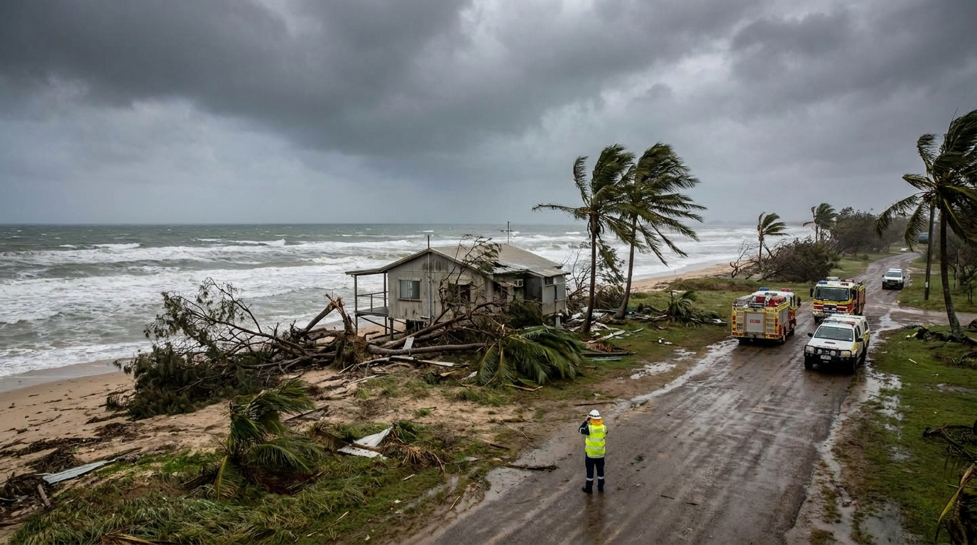
Residential housing showing severe structural damage from extreme wind gusts Original graphic. Based on data from: Wikimedia Commons.
Economic shockwaves for agriculture
Yasi is remembered not only for the damage to homes and roads, but also for the hit to northern Queensland agriculture. The banana and sugar industries were both heavily affected. Banana plantations in the affected coastal belt sustained major losses, while sugar cane growers also faced crop damage, flooding and delayed harvesting.
The Sugar and Banana Industry Impacts were felt well beyond the farms themselves. Transport delays, damaged packing sheds and disrupted supply chains pushed costs higher and reduced supply to other parts of Australia. This is one reason Yasi is often discussed as a national economic event, not just a local weather disaster.
In many communities, the clean-up lasted for months. Growers had to remove debris, replant crops and repair machinery before production could recover. That made Yasi a major example of how a single severe tropical cyclone can affect food supply, jobs and regional income at the same time.
Comparing Yasi with Cyclone Larry
Yasi is often compared with Cyclone Larry because both storms caused severe damage in far north Queensland. Larry hit in 2006 and caused major destruction around Innisfail, but Yasi covered a much larger area and brought stronger peak winds. That wider footprint meant more communities felt the effects, even if they were not at the exact landfall point.
When people compare the two storms, they are usually asking about intensity, size and impact. Larry was devastating in a more concentrated area. Yasi, by contrast, affected a long stretch of coast and created widespread concern from the Cassowary Coast Region northward and further inland. That is why Yasi is regularly included in lists of major Queensland cyclone events.
Cyclone Yasi compared with selected severe events
Cyclone | Peak category | Lowest pressure (hPa) | Landfall location |
|---|---|---|---|
Category 4 | 950 | Darwin, NT | |
Category 4 | 956 | Innisfail, QLD | |
Yasi (2011) | Category 5 | 929 | Mission Beach, QLD |
What Yasi showed about cyclone structure and intensity
Cyclone Yasi remains a useful case study because it brought together several features that raise risk at the coast. It had a strong core, a low central pressure, destructive wind gusts, a wide circulation and a dangerous surge setup. Those factors combined to create a system that was more than the sum of its parts.
For meteorologists, Yasi is an example of why cyclone structure and intensity matter as much as category alone. Two storms can share the same rating but behave differently in terms of size, rainfall, surge and wind footprint. Yasi’s broad reach meant communities well away from the eye still needed to prepare for damage.
For residents, the lesson was simpler. Even when a cyclone is still offshore, the risk can rise quickly if Bureau of Meteorology warnings show a track toward the coast. That is especially true in north Queensland, where coastal shape, islands and shallow seas can increase storm surge impacts.
Why Cyclone Yasi remains important in Queensland weather history
Yasi remains one of the most significant systems in tropical cyclone history Queensland because it combined extreme wind, coastal inundation and major economic damage. It is still used in public discussion, emergency planning and school resources because it shows how severe tropical cyclones affect people, property and the environment at the same time.
The event also remains a reminder that warnings, preparation and building standards all matter. Houses that were better built performed better. Communities that had time to act were better placed to reduce harm. And state agencies, including Queensland Fire and Emergency Services, had to respond at speed across a very large area.
Sources
abc.net.au
search.ror.unisa.edu.au
cairns.qld.gov.au
abc.net.au
researchonline.jcu.edu.au
konomieislandeec.eq.edu.au
bom.gov.au
Last verified: 2026-06-17
Sources
- Bureau of Meteorology weather reference (bom.gov.au)
- Tropical Cyclone Yasi and its predecessors (researchonline.jcu.edu.au)
- Yasi.Shtml (bom.gov.au)
- Impacts of tropical Cyclone Yasi on the Great Barrier Reef: a report on the findings of a rapid ecological impact assessment, July 2011 (elibrary.gbrmpa.gov.au)
- Tropical Cyclone Yasi: preparedness, loss and distress (researchonline.jcu.edu.au)
- Cyclone Yasi Information.Doc (konomieislandeec.eq.edu.au)
- Marcia.Shtml (bom.gov.au)
- researchonline.jcu.edu.au PDF reference (researchonline.jcu.edu.au)
Last verified: 2026-06-30
Frequently asked questions
Cyclone Yasi was a Category 5 severe tropical cyclone, the highest rating on the Australian scale. It intensified over the warm waters of the Coral Sea, producing extreme wind gusts of approximately 285 kilometres per hour. These conditions caused catastrophic damage to buildings, infrastructure, and vegetation across North Queensland.
Source: getready.qld.gov.au
Further reading and resources
Explore trusted articles, books, videos and other resources to go deeper on this topic.
bom.gov.auVideo
Severe Tropical Cyclone Yasi Satellite Loop
Visualize the massive scale and development of the system as it approached the Queensland coast.
science.nasa.govReference
Rainfall from Tropical Cyclone Yasi
Detailed visual data and analysis of the heavy precipitation brought by the cyclone across the interior.
en.wikipedia.orgArticle
List of storms named Yasi
Details on the retirement of the name 'Yasi' due to it becoming the costliest cyclone in Australian history.
nla.gov.auReference
Post Cyclone Coastal Field Investigation Report
A scientific assessment of the physical coastal and environmental changes immediately following the event.
wettropics.gov.auArticle
Effects of Cyclone Yasi on Vegetation Communities
Examines the dramatic impacts on mangroves and coastal vegetation caused by wind and salt-laden surge.
digital-classroom.nma.gov.auReference
Tropical Cyclone Yasi, 2 February 2011
Cyclone Yasi, a category 5 cyclone, making landfall in Queensland, Australia. The eye of the cyclone is very clear and indicative of the power of this tropical ...
Cyclone Yasi - Wikipedia
Severe Tropical Cyclone Yasi was a powerful and destructive tropical cyclone that made landfall in northern Queensland, Australia in early 2011, ...
researchdata.edu.auReference
Resources for Cyclone Anthony and Cyclone Yasi, north ...
Cyclone Anthony and Cyclone Yasi impacted the North Queensland coast during January and February 2011. Anthony, a category 2 storm crossed near Bowen on the ...
Tropical Cyclone Yasi - NASA Science
Acquired February 2, 2011 (local time), this natural-color image shows Tropical Cyclone Yasi approaching the Queensland coast.
Planning weeks ahead?
Check Australia's long-range seasonal outlook for rainfall, temperature and the climate drivers (ENSO, IOD, SAM, MJO) shaping the next three months.
View Australia's Seasonal Weather Forecast