
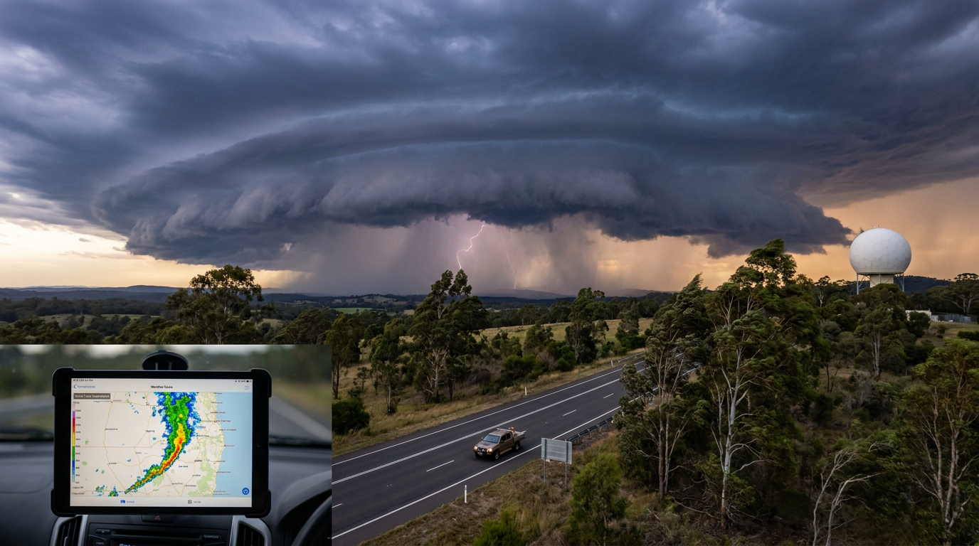
When tracking squall lines australia, meteorologists watch for narrow, organised bands of severe thunderstorms that can bring heavy rain, shelf clouds and damaging straight-line winds. The Bureau of Meteorology (BOM) uses severe thunderstorm warnings for these kinds of storm lines when they meet warning thresholds for damaging winds, large hail or heavy rain.
Key takeaways
- Squall lines are lines of thunderstorms that often form along or ahead of a cold front or trough.
- A gust front can act like a small cold front and help trigger new updrafts along the line.
- Radar may show a bow echo, which can point to a burst of strong straight-line winds.
- These systems can produce gusts above 90 km/h and travel long distances.
- If BOM issues a severe weather warning, act early and move indoors before the line arrives.
Squall lines Australia: what they are


A squall line is a narrow, elongated band of thunderstorms. It usually behaves as a quasi-linear convective system or MCS, which means the storms work together as one larger convective system rather than staying separate. In some cases, thunderstorms become organised in a near-straight line that can stretch for many kilometres and keep going for hours.
That structure is why squall lines can be more dangerous than a short-lived single storm. The line feeds on warm, moist inflow air, while downdrafts push cooler air out from the storm base. The contrast helps maintain the gust front and keeps the line moving forward.
What is the difference between a squall line and a thunderstorm?
A single thunderstorm is usually shorter lived and more localised. A squall line is a chain of storms with linked updrafts and downdrafts, so the impact is broader and lasts longer. That makes it a bigger concern for anyone in its path, especially if the line is fast moving.
| Feature | Squall line | Supercell |
|---|---|---|
| Structure | Linear band of thunderstorms | Single rotating storm | Main wind hazard | Straight-line winds | Rotating winds and possible tornadoes | Radar look | Line, bow echo, trailing rain area | Hook echo and rotating core | Typical behaviour | Can travel long distances and persist | Often more localised |
How squall lines form in Australia


In Australia, squall lines often form when strong lift meets enough moisture and instability for thunderstorms to grow quickly. A cold front can provide that lift, especially across southern Australia, while troughs can do the same in other parts of the country. According to the Bureau of Meteorology, storm complexes are referred to as squall lines because of the strong winds they can produce.
Once the first storms form, their downdrafts spread cool air along the ground. That outflow boundary can then act like a new trigger. Fresh updrafts rise on the leading edge, more cells form, and the line can keep building as it moves.
Cold fronts and the pressure jump
Cold fronts are a common trigger for squall lines in southern Australia. As cooler air undercuts warmer air, the forced lift can build tall cumulonimbus clouds very quickly. When the gust front arrives, you may notice a sudden pressure jump, a drop in temperature, a burst of wind and then heavy rain.
That sharp pressure change is one of the clearest signs that the line is close. The wind shift can arrive before the rain, so if you see a shelf cloud or hear thunder rolling in fast, it is time to move indoors.
The rear inflow jet and the trailing stratiform region
Many mature squall lines have a descended rear inflow jet, which is a stream of air that descends from behind the line and feeds into the system. It can strengthen the bowing section of the line and help concentrate damaging winds near the surface. This is one reason a squall line can briefly produce much stronger gusts than the storms beside it.
Behind the active storms, the trailing stratiform region usually contains broad, steady rain. That rain area can keep falling after the leading edge has passed, which is why the worst weather may seem to linger even after the main wind burst has gone through.
How squall lines form in the Australian arid interior
In the Australian arid interior, squall lines can form along a dry line, where hot, dry inland air meets slightly moister air on the other side. The contrast sharpens the boundary and can help focus new storms. When daytime heating is strong, the boundary can act as a launch point for vigorous updrafts.
These storms can be harder to spot on the ground because rain often evaporates through virga before it reaches the surface in very dry air. Even so, the downdrafts may still push a strong gust front ahead of the rain core. That means dusty winds, sudden temperature falls and brief but severe wind damage can arrive before much rain is seen.
What radar signs matter most?
Radar can show a squall line as a long band of rain and storms. A bow echo, where the line bows outward, often points to stronger straight-line winds. Understanding how to go about reading weather radar is key to identifying these fast-moving segments.
If you are watching radar in a severe weather warning area, look for fast forward motion, bowing segments and a sharp leading edge. Those signs can tell you the line is organised and may bring high wind and heavy rain rather than just scattered showers.
| Sign | What it may mean |
|---|---|
| Shelf cloud | The gust front is nearby |
| Bow echo | Strong straight-line winds may be forming |
| Fast-moving line of storms | The system may pass quickly but hit hard |
| Trailing rain area | The line is mature and may keep raining after the gusts |
What impacts can squall lines bring?

The main hazard is damaging wind. Weatherzone notes squall lines can produce gusts above 90 km/h, and that is enough to bring down trees, damage roofs and cut power lines. Heavy rain can reduce visibility and flood low-lying roads, while cloud-to-ground lightning adds another risk for anyone outdoors.
Large hail can also occur in some storms within the line, though wind is usually the main threat. If the line is intense and fast moving, the dangerous weather may last only a short time at one location, but the impact can be felt across a wide area.
How to stay safe during a squall line


If BOM issues a severe thunderstorm warning, treat it seriously. Move vehicles under cover if you have time, secure loose items, and get inside a substantial building. Stay away from windows and avoid sheltering under trees, sheds or power lines.
- Check the BOM warning for your area.
- Bring pets, outdoor furniture and loose gear inside.
- Park away from trees if you are driving and can do so safely.
- Wait until the line has passed and the wind eases before going back outside.
If you are near the coast, watch for sudden wind shifts and rough conditions. Inland, dust and reduced visibility can be the first signs that the gust front is close.
Frequently asked questions
A squall line is a narrow, organised band of thunderstorms that forms a near-continuous line. In Australia, these systems are a common feature of severe weather outbreaks, often bringing sudden damaging winds, heavy rainfall, and intense lightning as the system moves rapidly across a region.
Source: bom.gov.au
Further reading and resources
Explore trusted articles, books, videos and other resources to go deeper on this topic.
bom.gov.auReference
Storm Spotters - Tropical Severe Thunderstorms
A detailed local guide from the BOM explaining how squall lines can extend for hundreds of kilometres across Australia.
ww2010.atmos.uiuc.eduArticle
Squall Lines: WW2010 University of Illinois
An educational resource detailing the formation of storm lines along cold fronts and drylines.
foxweather.comArticle
What is a squall line and why is this type of severe weather so dangerous?
A comprehensive explainer on why squall lines persist for hours and produce destructive straight-line winds.
Thunderstorms - BOM Aviation Education
A technical look at how squall lines present a massive wall of weather that is challenging for aviation and meteorology.
britannica.comReference
Squall line | Meteorology
A classic reference entry defining the relationship between mesoscale disturbances and organized storm cells.
catalogue.nla.gov.auBook
The gravity wave response above deep convection in a squall line
A microform source for advanced readers interested in the atmospheric physics of deep squall line convection.
www.bom.gov.auReference
Tropical severe thunderstorms | The Bureau of Meteorology - BoM
A squall line is a long line of thunderstorm cells, sometimes several hundred kilometres long. They share common precipitation cores or cloud mass. Squall lines ...
www.abc.net.auArticle
Rain douses dry predictions for autumn with storm spell ... - ABC News
Squall lines occur when thunderstorms become organised in a near-straight line and often bring damaging wind gusts. The line should form in ...
eos.orgArticle
The Microphysics of Squall Lines - Eos.org
As a cold front advances, a row of thunderstorms known as a squall line may form along or ahead of its leading edge. Squall lines can cause ...
www.nssl.noaa.govReference
Severe Weather 101: Thunderstorm Types
A squall line is a group of storms arranged in a line, often accompanied by “squalls” of high wind and heavy rain. Squall lines tend to pass quickly and are ...
Planning weeks ahead?
Check Australia's long-range seasonal outlook for rainfall, temperature and the climate drivers (ENSO, IOD, SAM, MJO) shaping the next three months.
View Australia's Seasonal Weather Forecast