
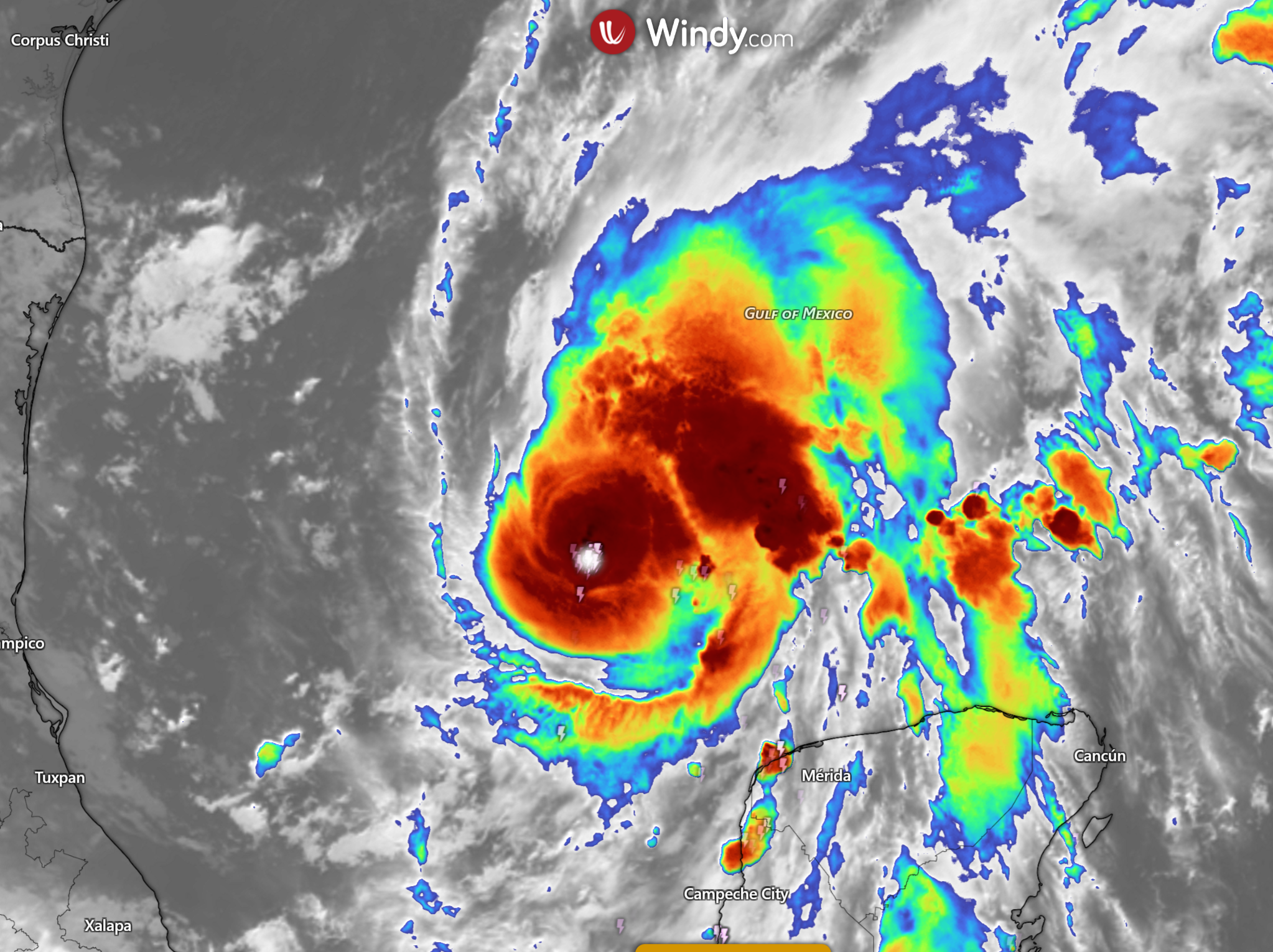
Tropical Storm Isaias is close to hurricane strength in the Gulf of Mexico, with life-threatening storm surge, damaging winds and heavy rain forecast for parts of the northern United States Gulf Coast. At 0300 UTC on 8 October 2026, the National Hurricane Center (NHC) placed the centre near 22.9°N, 91.9°W, with maximum sustained winds of 110 km/h (70 mph).
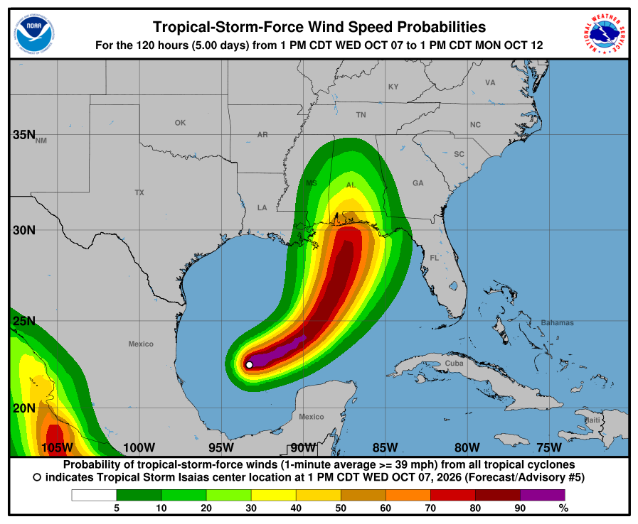
Key takeaways
Isaias was a strong tropical storm at 0300 UTC on 8 October, only 7 km/h (4 mph) below hurricane strength.
A Hurricane Warning extends from Ocean Springs, Mississippi, to the Bay/Gulf County line in Florida.
A Storm Surge Warning extends from the mouth of the Mississippi River to Steinhatchee River, Florida.
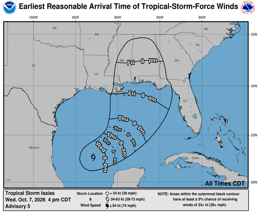
The NHC forecast brings the centre to the northern Gulf Coast late Friday or early Saturday local time.
This is the 2026 Tropical Storm Isaias, not the separate Hurricane Isaias from 2020.
Latest Tropical Storm Isaias position and intensity
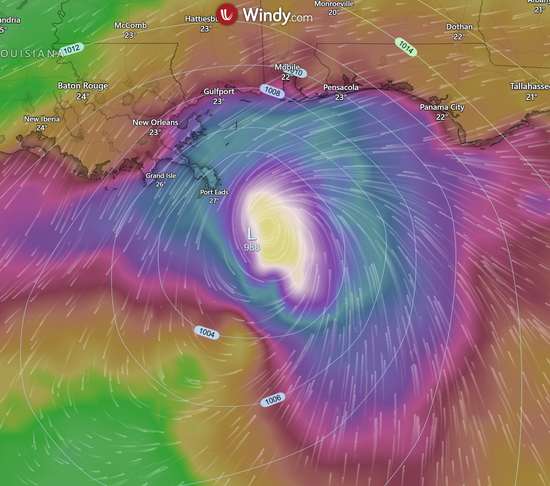
The NHC’s Advisory 6 located Isaias about 460 km (285 miles) south-south-west of the mouth of the Mississippi River and about 715 km (445 miles) south-west of Panama City, Florida. The storm was moving east-north-east at 15 km/h (9 mph), with an estimated minimum central pressure of 988 hPa.
Measure | NHC Advisory 6 |
|---|---|
Advisory time | 0300 UTC, 8 October 2026 |
Centre | 22.9°N, 91.9°W |
Maximum sustained winds | 110 km/h (70 mph) |
Movement | East-north-east at 15 km/h (9 mph) |
Minimum pressure | 988 hPa |
Official status | Tropical storm; hurricane expected soon |
Isaias had strengthened substantially before this update. The NHC expected additional strengthening and forecast the system to become a hurricane soon. Intensity can still change quickly, so the official advisory—not the category alone—should guide safety decisions.
Tropical Storm Isaias track map and landfall forecast

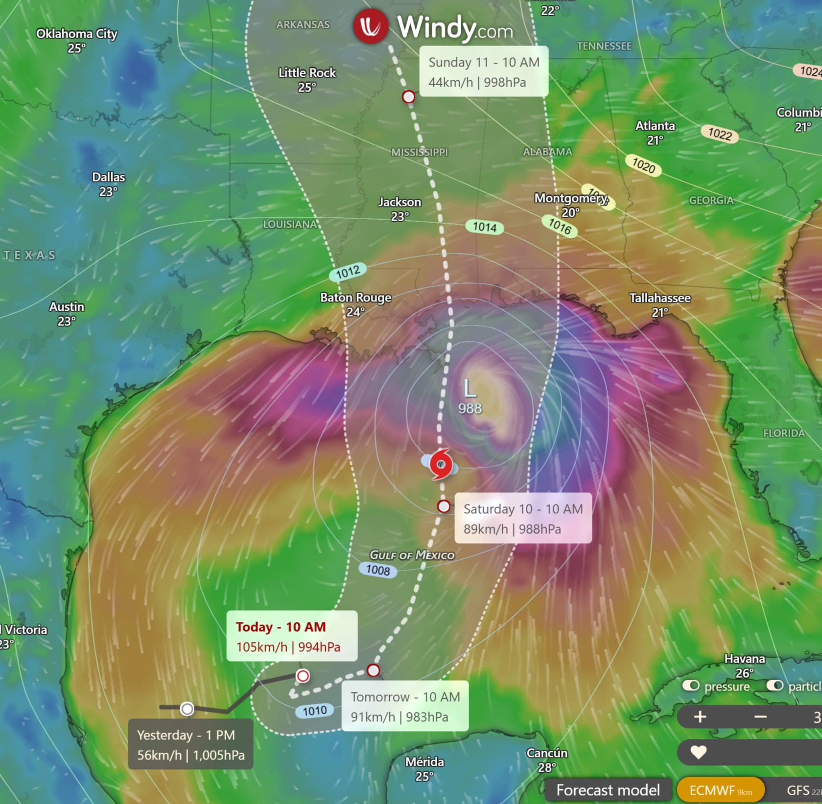
The forecast track takes Isaias east-north-east and then north-east across the Gulf of Mexico. The centre is expected to approach the northern Gulf Coast on Friday and reach the coast late Friday or early Saturday local time. The exact crossing point remains uncertain, and dangerous conditions can occur well outside the forecast cone.
The cone should never be read as an impact boundary. Tropical-storm-force winds, rain bands, tornadoes and storm surge may extend beyond it. See our tropical cyclone forecast track maps guide and hurricane categories explained.
Hurricane and tropical storm warnings
A Hurricane Warning is in effect from Ocean Springs, Mississippi, eastwards to the Bay/Gulf County line in Florida. This includes coastal areas around Mobile Bay and the western Florida Panhandle. Hurricane conditions are expected somewhere within the warning area, and preparations should be completed promptly.
Tropical Storm Warnings cover neighbouring coastal sections, including west of Ocean Springs to the mouth of the Mississippi River, Lake Maurepas, Lake Pontchartrain and metropolitan New Orleans. Another warning extends east of the Bay/Gulf County line to Indian Pass, Florida.
Warnings can change as the forecast evolves. Use the latest NHC public advisory and instructions from local emergency authorities.
Storm surge, wind and rainfall threats
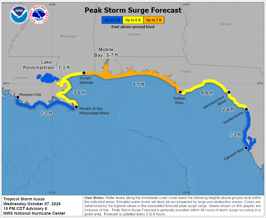
Storm surge is a major coastal hazard. A Storm Surge Warning extends from the mouth of the Mississippi River to Steinhatchee River, Florida, while a Storm Surge Watch extends from Steinhatchee River to Yankeetown. Water levels and impacts vary sharply with the final track, coastline shape, tide and onshore wind.
Damaging winds may begin before the centre reaches the coast. Conditions can worsen rapidly in outer rain bands, and isolated tornadoes are possible in landfalling tropical cyclones. Heavy rain could also cause flash flooding and river rises across parts of the Gulf Coast and inland areas.
Residents should not focus on a single forecast point. Secure loose outdoor items, charge essential devices, know the safest place in the building and leave promptly if authorities order an evacuation. Never drive through floodwater.
Where can I find the latest official Isaias update?
Use the NHC’s current public advisory, forecast advisory and 2026 Isaias archive.
Sources
Last verified against NHC Advisory 6 at 0300 UTC on 8 October 2026.
Planning weeks ahead?
Check Australia's long-range seasonal outlook for rainfall, temperature and the climate drivers (ENSO, IOD, SAM, MJO) shaping the next three months.
View Australia's Seasonal Weather Forecast