
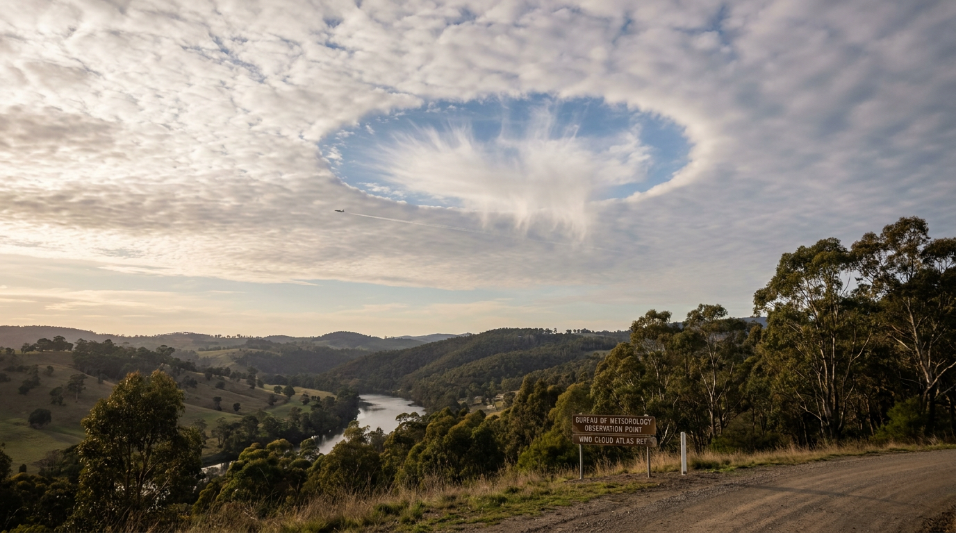
How do fallstreak clouds form? These features appear when a cloud deck contains supercooled water droplets, then a disturbance triggers ice crystal formation. In many cases, the trigger is aircraft aerodynamic influence. The droplets freeze, the ice crystals grow, and a clear hole opens in the cloud.
Key takeaways
Fallstreak clouds are also called hole punch clouds, fallstreak holes, or cavum.
In Australia, sightings of these unusual sky openings are common over Victoria and Tasmania where mid-level cloud conditions are often suitable.
Aircraft can trigger the change by cooling air around wings or propellers, which helps start ice crystal formation.
The Wegener-Bergeron-Findeisen process then lets ice crystals grow at the expense of nearby liquid droplets.
The falling ice often appears as virga beneath the hole.
What is a fallstreak cloud?
A fallstreak cloud is a circular or oval opening in a cloud layer, usually in mid- to high-level cloud. It is not a separate cloud type. Instead, it is a change inside an existing cloud deck. The World Meteorological Organization classifies the feature as Altocumulus cavum or Cirrocumulus cavum in the International Cloud Atlas.
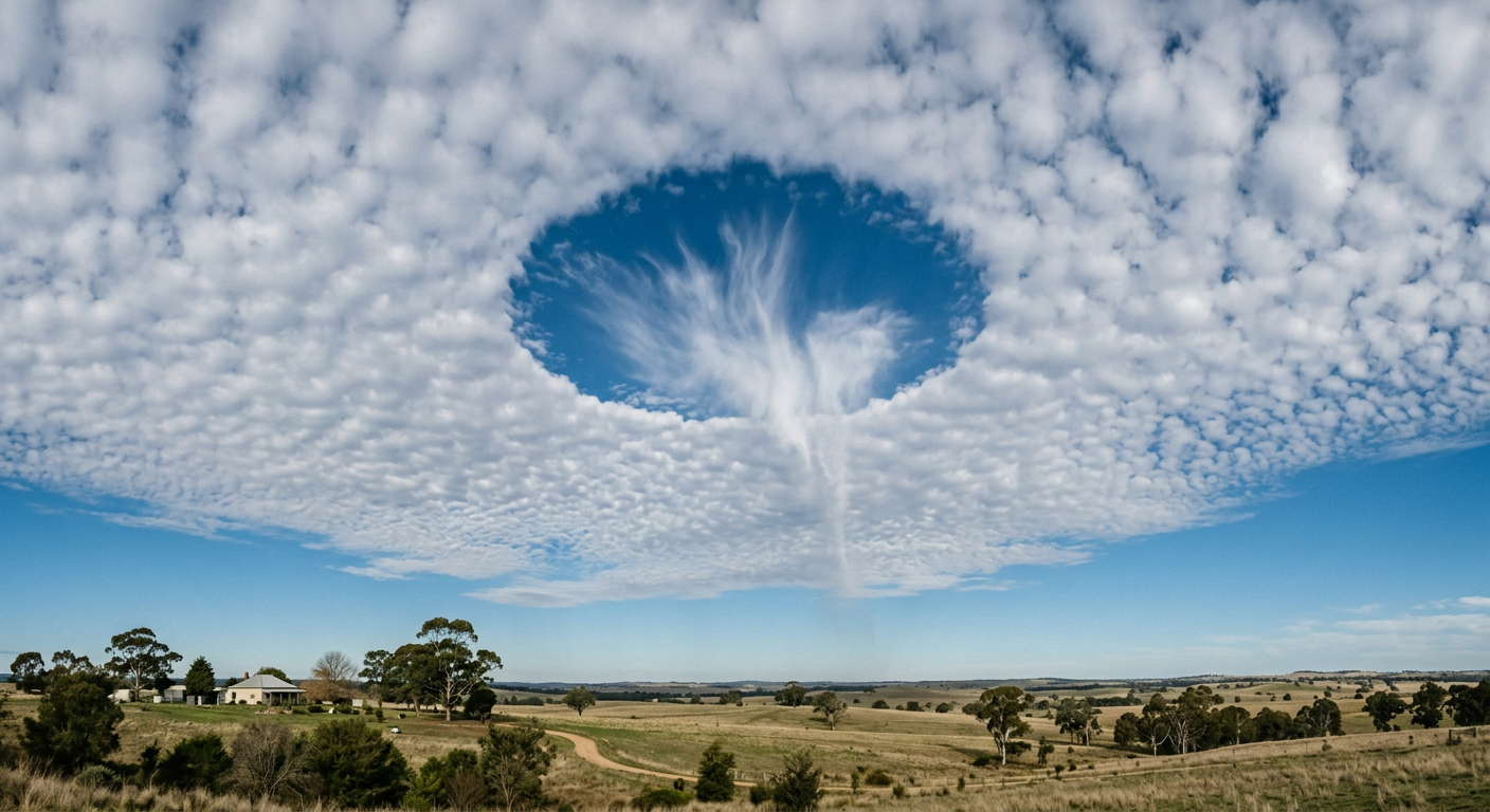
A fallstreak hole in an altocumulus cloud deck with thin virga below
Many people call it a hole punch cloud because the opening looks like a neat punch through the cloud sheet. The Met Office explains that these holes form when ice crystals appear in a cloud made of supercooled water droplets.
Altocumulus or cirrocumulus?
Most fallstreak holes form in altocumulus clouds, although cirrocumulus clouds can also show the same effect. These cloud types often sit high enough for temperatures to be below freezing while still holding liquid droplets. For more on the parent cloud types, see our guide on how do altocumulus clouds form and our page on cloud layers and altitudes in Australia.
What is the difference between a hole punch cloud and a fallstreak cloud?
There is no physical difference. Both names describe the same feature. Hole punch cloud is the casual term. Fallstreak hole or cavum is the more formal term used in meteorology.
How do fallstreak clouds form?
They form when supercooled water droplets meet a trigger that starts freezing. The key ingredients are liquid droplets below 0 °C, a disturbance, and enough ice crystal formation to start the glaciation process.
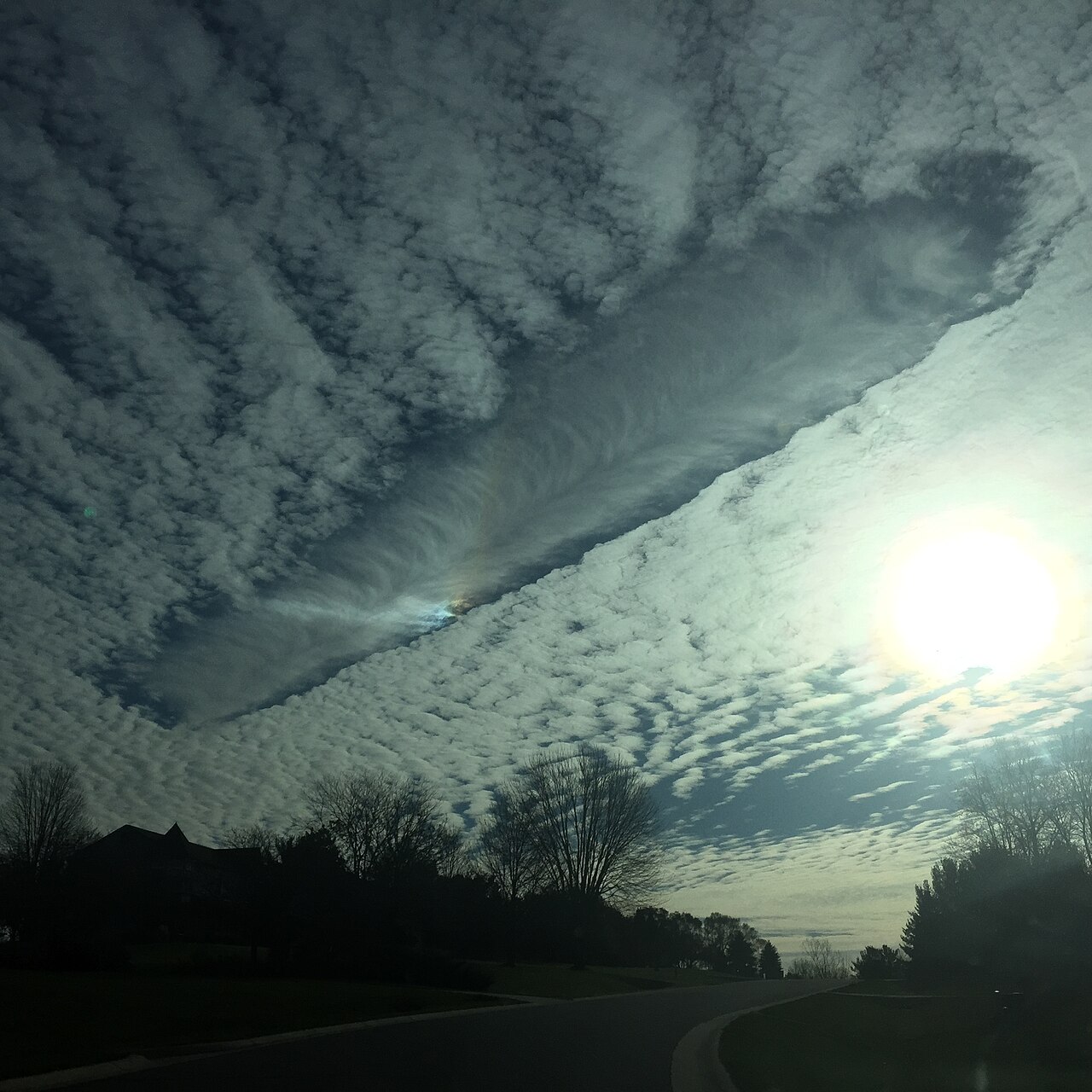
Fallstreak hole over Ann Arbor, United States - By Jtrombone - Own work, CC BY-SA 4.0, https://commons.wikimedia.org/w/index.php?curid=54167695
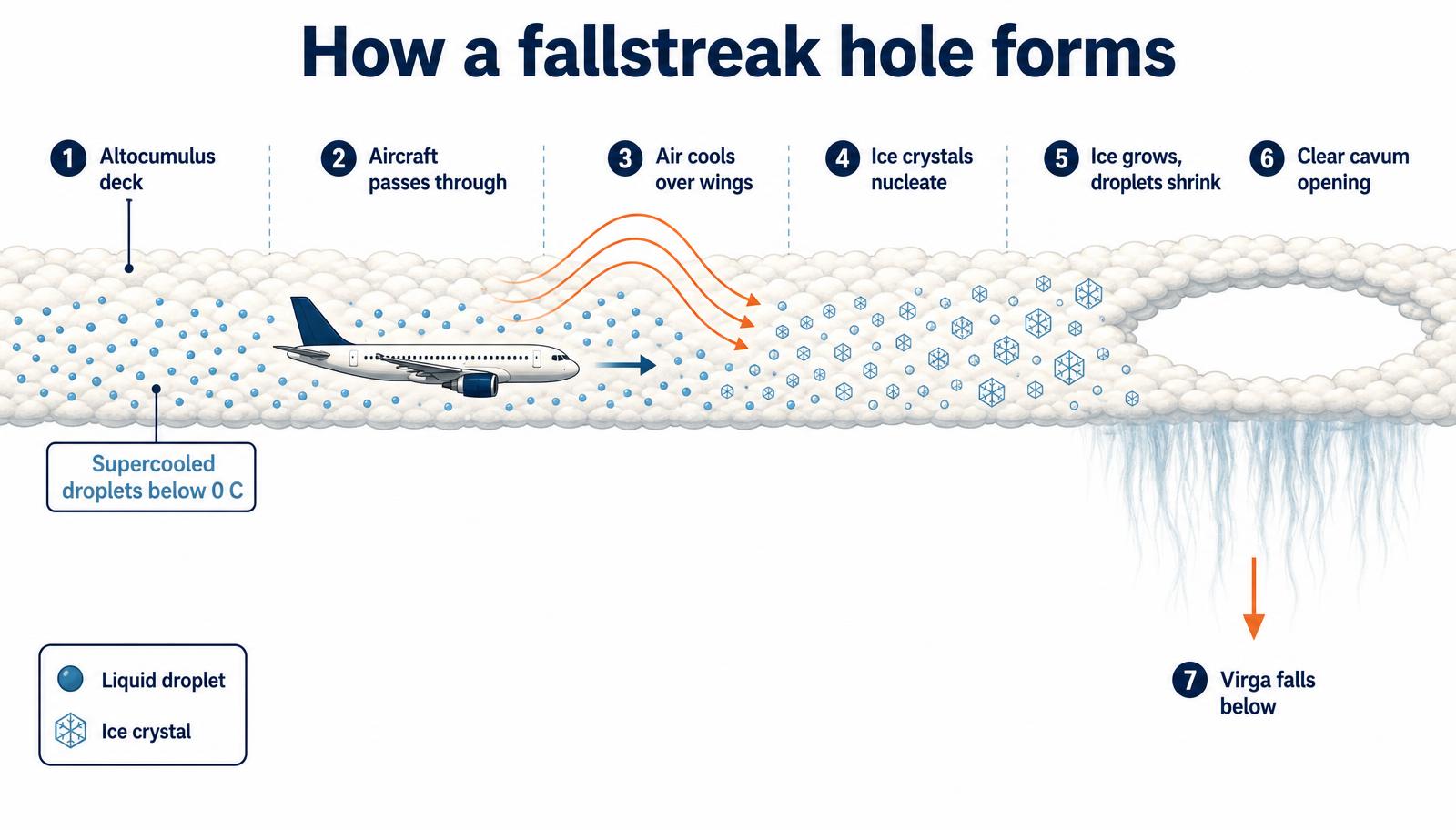
Aircraft aerodynamic influence
Aircraft are the most common trigger. As air moves over wings or propeller tips, it expands and cools adiabatically. That local cooling can push part of the cloud below the threshold needed for freezing. The Met Office says a small particle called a nucleus is also needed, and that freezing can be promoted when temperatures fall below about -40 °C. The aircraft itself does not create the cloud. It disturbs the cloud so the phase change can begin.
The role of aircraft in initiating Australian fallstreaks
In Australia, aircraft can also start the process when they pass through the right cloud layer. The Bureau of Meteorology (BOM) uses standard cloud and weather terms such as supercooled water droplets, virga, and cloud layers when describing these processes. If you are watching the sky near an airport corridor or a busy flight path, a passing plane may be the visible trigger, but the cloud still needs the right temperature and moisture profile first.
Can a plane flying through a cloud cause it to snow?
Only in a limited sense. The aircraft can trigger ice crystals, and those crystals can fall beneath the hole. In dry air, they usually evaporate or sublimate before they reach the ground. That is why the streaks below the opening are often virga rather than snow at the surface.
Why supercooled water defies freezing until disturbed
Supercooled water droplets stay liquid below 0 °C because freezing needs a starting point. The air may be cold enough, but without a suitable surface or particle, the droplets can remain unfrozen. This is why clean cloud air can hold liquid water well below the normal freezing point.
Thermodynamic phase change and nucleation points
For freezing to start, droplets need a nucleation point. That can be a speck of dust, smoke, or another particle that helps water change phase. In cloud physics, this is a thermodynamic phase change from liquid to solid. The supercooled water droplets glossary entry explains the liquid state in more detail, and our nucleation guide covers the starting point for freezing.
Latent heat of fusion
When water freezes, it releases latent heat of fusion. That release is real, but in a fallstreak hole it does not stop the process. Once ice crystals begin to form, the cloud environment keeps favouring more ice growth than liquid droplet survival.
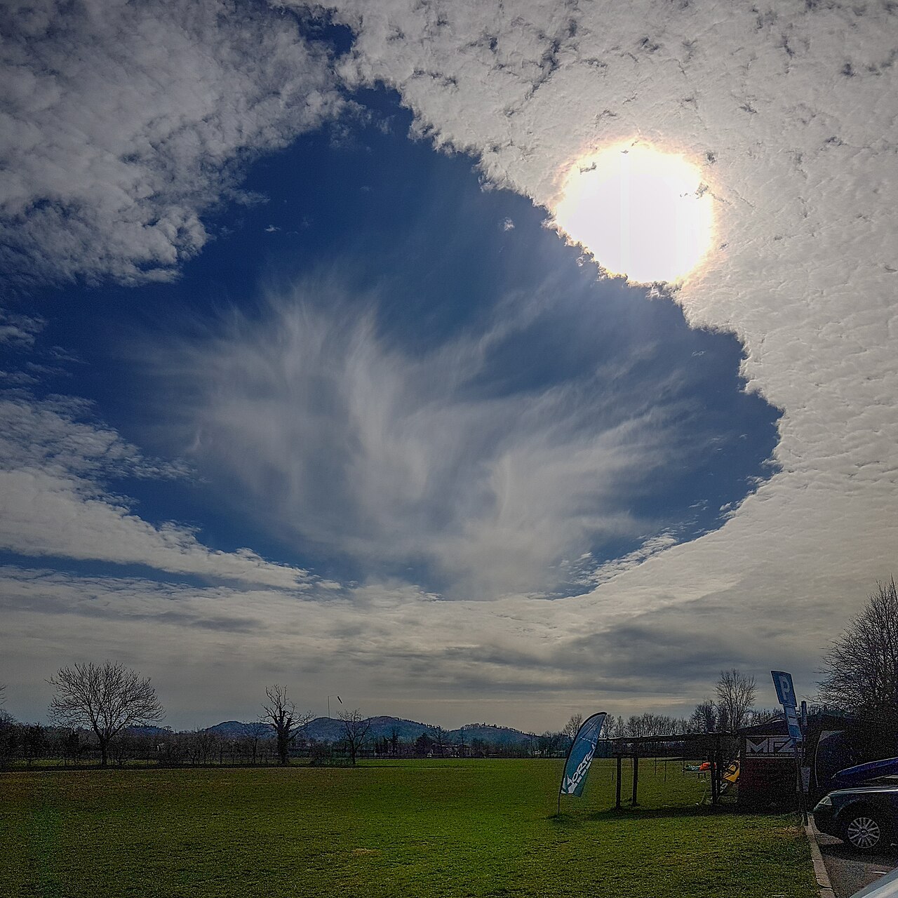
A fallstreak hole over Borso del Grappa, Italy. By Grindboy rol - Own work, CC BY-SA 4.0, https://commons.wikimedia.org/w/index.php?curid=77643923
The Wegener-Bergeron-Findeisen process
Once ice crystals exist in a cloud that still contains supercooled droplets, the Wegener-Bergeron-Findeisen process takes over. You may also see this called the Bergeron-Findeisen process. It explains why ice grows fast in a mixed cloud.
Sublimation and ice crystal growth
Ice and liquid water do not share the same vapour pressure. Vapour pressure is lower over ice, so water vapour moves toward the ice crystals. The ice grows while nearby droplets shrink. In the dry air below the cloud, the falling crystals can lose mass by sublimation, which is the direct change from ice to vapour. That is what gives the streaks beneath the hole their wispy look.
Distinguishing virga from fallstreak residue
Virga is the streaking precipitation that falls from a cloud but evaporates or sublimates before reaching the ground. In a fallstreak cloud, the streaks below the hole are often virga made of ice crystals. The hole remains clear because the cloud water there has already been pulled into the growing ice crystals.
Local sightings: Famous hole punch clouds over Victoria and Tasmania
Reports of hole punch clouds have appeared across Australia, including Victoria and Tasmania, where cool mid-level cloud layers are common enough for the right conditions to line up. These sightings usually attract attention because the shape stands out so clearly against the rest of the cloud deck.
If you spot one, look for the sequence: a smooth cloud layer, a circular or oval gap, and a faint curtain of ice or virga below. That pattern is the giveaway.
Why the cloud opens up
The hole opens because freezing spreads through the cloud faster than the surrounding liquid droplets can stay stable. Once ice crystals begin to grow, they remove moisture from the nearby droplets. The cloud clears where the process has already run its course, leaving the opening behind.
You can think of it as a small disturbance turning into a local chain reaction. The aircraft starts it, the ice crystals keep it going, and the cloud layer changes shape around the new ice.
Related guides
Frequently asked questions
Fallstreak clouds form when supercooled water droplets in a mid-level cloud layer suddenly freeze. This process is typically triggered by a disturbance like an aircraft, which introduces ice crystals. These crystals grow rapidly, fall as virga, and leave behind a distinct circular hole in the surrounding cloud deck.
Source: nesdis.noaa.gov
Further reading and resources
Explore trusted articles, books, videos and other resources to go deeper on this topic.
science.nasa.govReference
Making Sense of Holes in the Clouds
Background reference on How do fallstreak clouds form? Hole punch clouds explained from science.nasa.gov.
weather.govReference
Fallstreak - What Are They?
Background reference on How do fallstreak clouds form? Hole punch clouds explained from weather.gov.
youtube.comVideo
Explainer: Fallstreak/Hole punch cloud
Video coverage on How do fallstreak clouds form? Hole punch clouds explained from youtube.com.
nesdis.noaa.govReference
Fallstreak Clouds | NESDIS - NOAA
Background reference on How do fallstreak clouds form? Hole punch clouds explained from nesdis.noaa.gov.
en.wikipedia.orgReference
Fallstreak hole
Background reference on How do fallstreak clouds form? Hole punch clouds explained from en.wikipedia.org.
skybrary.aeroArticle
Fallstreak Hole | SKYbrary Aviation Safety
In-depth coverage on How do fallstreak clouds form? Hole punch clouds explained from skybrary.aero.
cloudappreciationsociety.orgArticle
A New Understanding of Fallstreak Holes
In-depth coverage on How do fallstreak clouds form? Hole punch clouds explained from cloudappreciationsociety.org.
Cavum
In-depth coverage on How do fallstreak clouds form? Hole punch clouds explained from cloudappreciationsociety.org.
Planning weeks ahead?
Check Australia's long-range seasonal outlook for rainfall, temperature and the climate drivers (ENSO, IOD, SAM, MJO) shaping the next three months.
View Australia's Seasonal Weather Forecast