
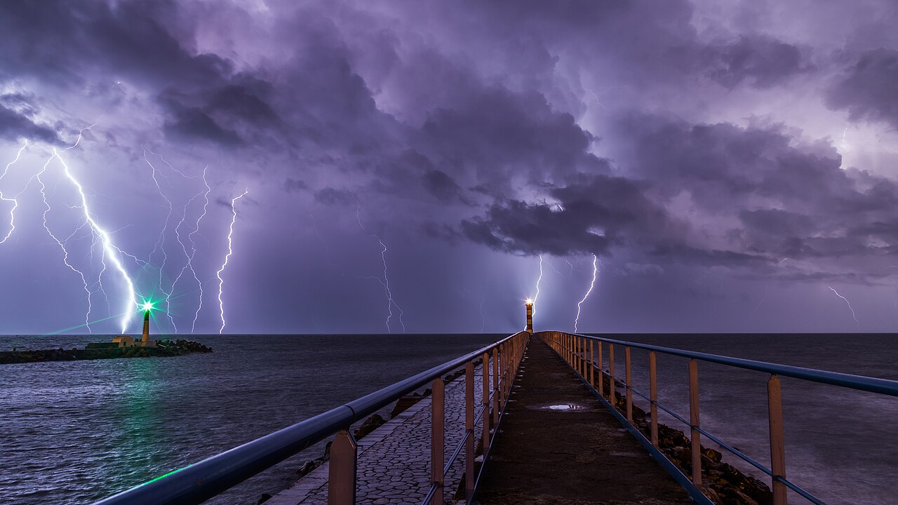
How does cloud-to-ground lightning form? It begins when electrostatic charge separation within a cumulonimbus cloud creates a powerful negative charge center. A stepped leader then branches downward from the cloud base, seeking a path of least resistance. When it connects with an upward positive streamer from the surface, a bright return stroke completes the atmospheric electrical discharge.
Key takeaways
Lightning acts to neutralise extreme electrical potential differences between a thunderstorm cloud and the Earth's surface.
Ice crystal and graupel collisions inside strong convective updrafts drive the initial static electricity buildup.
The intensely bright flash visible to the human eye is actually the return stroke travelling rapidly from the ground back towards the cloud.
A single lightning flash frequently consists of multiple return strokes following the exact same ionised channel.
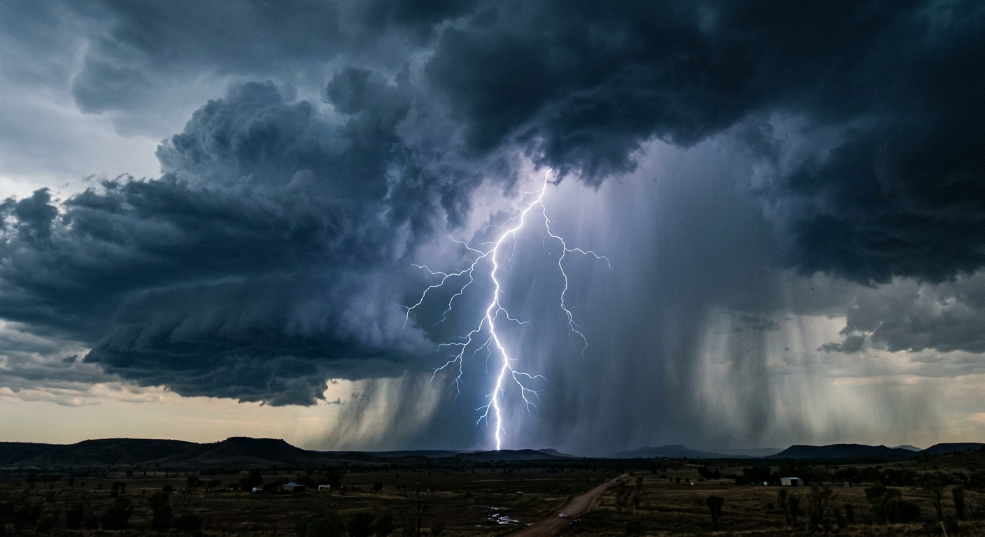
A bright return stroke illustrating how does cloud-to-ground lightning form from a dark cumulonimbus cloud.
How does cloud-to-ground lightning form: the physics explained
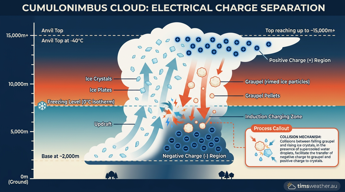
Diagram of electrostatic charge separation through ice crystal collisions in a cumulonimbus cloud.
The process of cloud to ground electrical discharge
Once the insulating capacity of the air is overcome, the visual phase of the lightning strike begins. This process happens in a fraction of a second but involves a distinct, choreographed sequence of events connecting the sky to the Earth.
Stages of a Lightning Strike | |||
Phase | Process Description | Electrical Polarity | Visibility |
|---|---|---|---|
Stepped Leader | Descends in discrete, branching jumps seeking the ground | Negative (usually) | Very faint / UV |
Upward Streamer | Rises from tall ground objects toward the descending leader | Positive (usually) | Faint |
Leader-Streamer Junction | The connection of the two channels to complete the circuit | Neutralisation begins | Bright spark |
Return Stroke | Massive surge of current flowing upward along the channel | Positive current flow | Blindingly bright |
The stepped leader begins its descent
The strike initiates when a channel of ionised air, known as a stepped leader, emerges from the negative charge center at the cloud base. High-speed camera data analysis from lightning research laboratories shows that this leader does not travel in a smooth, continuous line. Instead, it advances in rapid, jagged jumps of roughly 50 metres at a time.
After each step, the leader pauses for just a few microseconds before taking another step. As it descends, the stepped leader branches out in multiple directions, effectively "feeling" for the path of least electrical resistance through the atmosphere. At this stage, the stepped leader carries a relatively small current and emits very little light.
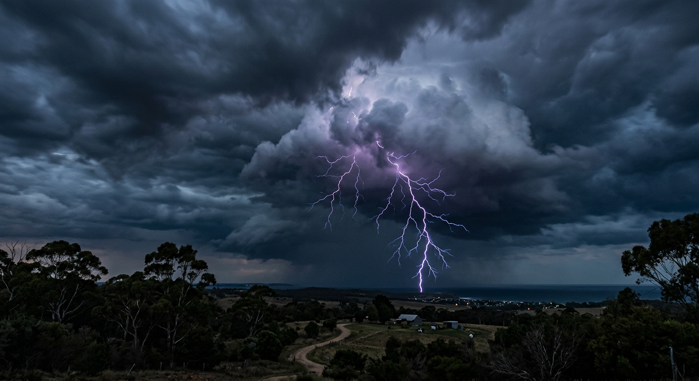
Branching stepped leaders descending from a negatively charged thunderstorm cloud.
Positive streamers rise from the ground
As the negatively charged stepped leader approaches within 100 to 300 metres of the Earth's surface, the electric field at the ground becomes intense. This extreme field strength draws positive ions upward from the surface. These upward-reaching channels of charge are called positive streamers.
Positive streamers can launch from anything that concentrates the local electric field. Trees, buildings, antennas, and even blades of grass can launch positive streamers into the air. Multiple streamers may rise simultaneously from different objects in the immediate area, all reaching toward the branches of the incoming stepped leader.
The leader-streamer junction and return stroke
The defining moment of the atmospheric electrical discharge occurs when one of the positive streamers successfully connects with a branch of the downward-moving stepped leader. This is known as the leader-streamer junction. The moment they touch, a continuous, highly conductive pathway is established between the cumulonimbus cloud and the ground.
Through this completed circuit, a massive wave of positive charge surges upward from the ground to neutralise the negative charge in the cloud. This upward surge is the return stroke. It travels at roughly one-third the speed of light, producing the brilliant, blinding flash that we recognise as a lightning bolt. The energy released during a lightning flash is staggering, averaging between 200 megajoules and 7 gigajoules (en.wikipedia.org).
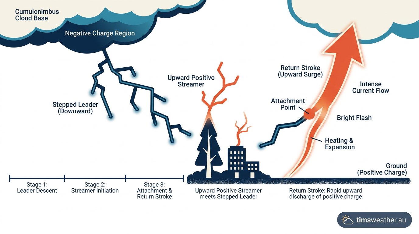
Step-by-step diagram detailing the leader-streamer junction and subsequent return stroke.
Polarity and sequential strokes explained
While the step-by-step connection process is the standard mechanism, the characteristics of the strike can vary depending on which part of the storm the electrical charge originates from.
Why Cloud-to-Ground Lightning Prefers Negative Polarity
The vast majority of cloud-to-ground strikes are negative cloud-to-ground lightning. This means they transfer negative charge from the lower portion of the storm to the positive surface of the Earth. Because the negative charge center is located in the lower-middle section of the cumulonimbus cloud, the physical distance between the charge and the ground is relatively short. This proximity makes it easier for the electric field to overcome the air's insulation, which is why negative strikes account for over 90 percent of all cloud-to-ground flashes.
The Transition from Stepped Leader to Return Stroke
After the initial return stroke dissipates, the lightning event is often not finished. If enough electrical charge remains in the cloud, a secondary leader called a dart leader can travel rapidly down the main path that was just ionised by the return stroke. Because the air in the channel is already turned into conductive plasma, the dart leader does not need to step or branch; it moves smoothly and quickly.
When the dart leader reaches the ground, it triggers another return stroke. This process can repeat several times in rapid succession, which is what causes a lightning bolt to flicker rapidly to the naked eye. Each subsequent stroke travels along the original channel, generating immense heat. The temperature inside a lightning channel can reach roughly 30,000°C (about.metservice.com), which is approximately five times hotter than the surface of the sun.
This intense, sudden heating causes the air inside the channel to expand explosively outward. This rapid expansion creates a massive supersonic shock wave in the atmosphere. To learn more about this acoustic phenomenon, you can read about how does thunder form.
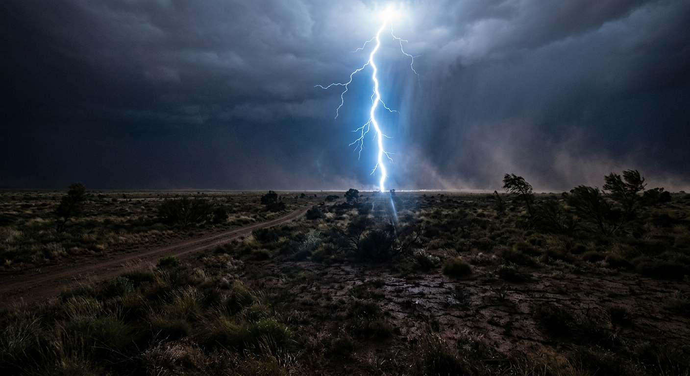
A powerful cloud-to-ground lightning strike releasing extreme energy and heat into the surrounding air.
Advanced atmospheric electrical discharge questions
What triggers the formation of a lightning strike?
The formation of a lightning strike is triggered when the electrical potential difference between the charged cloud and the ground exceeds the insulating capacity of the surrounding air. This threshold forces atmospheric gases to ionise into a conductive plasma channel, allowing the stepped leader to initiate its descent.
How does a stepped leader reach the ground?
A stepped leader reaches the ground by advancing in rapid, discrete jumps of about 50 metres at a time. It branches out in multiple directions to find the path of least electrical resistance, pausing for tiny fractions of a second before taking the next step toward the surface.
Is lightning always visible during a storm?
Lightning is not always visible to the naked eye during a storm. Many discharges happen entirely within the cumulonimbus cloud as intra-cloud lightning, creating only a diffuse, soft glow rather than a distinct, visible bolt. High-speed daytime strikes can also be obscured by heavy rain and bright sunlight.
What is the difference between a stepped leader and a return stroke?
A stepped leader is the initial, faint channel of negative charge that branches downward from the cloud to establish an electrical path. The return stroke is the massive, blindingly bright surge of positive current that travels back up that completed channel from the ground to the cloud.
Lightning safety and meteorological detection
Because lightning physics involve such immense energy, the phenomenon presents a severe hazard to life and property. The National Lightning Safety Council outlines strict safety protocols, emphasizing that no place outside is safe during a thunderstorm. The sheer volume of energy carried in the return stroke means a direct hit is often catastrophic, with current peaks reaching up to 200,000 amperes (lpsfr.com).
These strikes are a global meteorological risk. The phenomenon kills about 20 people annually in the United States alone (weatherworksinc.com). The danger is highly localised but persistent; for example, in Wisconsin, 13 lives were lost due to lightning over a 25-year period (climatology.nelson.wisc.edu).
Meteorological agencies and atmospheric physicists track these hazards using networks like the International Lightning Detection Network. This system uses specialized sensors to pinpoint the electromagnetic radio waves emitted by each return stroke, providing real-time data to forecasters. Identifying the common types of lightning and tracking their density helps meteorologists map the strongest convective cores of a storm. Severe weather tracking is essential because lightning can be generated in various environments, including pyrogenic lightning generated by intense wildfires (www.sciencealert.com).
How cloud types and weather forecasting helps individuals recognize when the atmosphere is unstable enough to support electrical storms. When towering cumulus clouds begin displaying significant vertical growth, the risk of electrostatic charge separation increases, signaling that cloud-to-ground strikes may soon follow.
Sources
NOAA weather and atmospheric science reference (repository.library.noaa.gov)
NOAA weather and atmospheric science reference (repository.library.noaa.gov)
NOAA weather and atmospheric science reference (repository.library.noaa.gov)
Lightning Products and Services (ncei.noaa.gov)
NOAA weather and atmospheric science reference (vlab.noaa.gov)
NOAA study finds fishing tops U.S. lightning death activities (noaa.gov)
What Causes Lightning and Thunder? (nesdis.noaa.gov)
Last verified: 2026-08-30
Frequently asked questions
Lightning forms when charge separation inside a cumulonimbus cloud creates a powerful electric field. A stepped leader branches downward from the cloud, seeking a path. Once it nears the ground, an upward streamer rises to meet it, completing the circuit and triggering the brilliant, visible return stroke.
Source: britannica.com
Further reading and resources
Explore trusted articles, books, videos and other resources to go deeper on this topic.
weather.govReference
Understanding Lightning Science
Background reference on How Does Cloud-to-Ground Lightning Form? The Atmospheric Physics Explained from weather.gov.
canada.caArticle
How lightning works
In-depth coverage on How Does Cloud-to-Ground Lightning Form? The Atmospheric Physics Explained from canada.ca.
How Lightning is Created
Background reference on How Does Cloud-to-Ground Lightning Form? The Atmospheric Physics Explained from weather.gov.
scied.ucar.eduReference
Thunder and Lightning - UCAR Center for Science Education
Background reference on How Does Cloud-to-Ground Lightning Form? The Atmospheric Physics Explained from scied.ucar.edu.
en.wikipedia.orgReference
Lightning
Background reference on How Does Cloud-to-Ground Lightning Form? The Atmospheric Physics Explained from en.wikipedia.org.
noaa.govReference
How Lightning is Created
Background reference on How Does Cloud-to-Ground Lightning Form? The Atmospheric Physics Explained from noaa.gov.
stormhighway.comArticle
How Cloud-to-Ground Lightning Works
In-depth coverage on How Does Cloud-to-Ground Lightning Form? The Atmospheric Physics Explained from stormhighway.com.
mrcc.purdue.eduReference
MRCC - Lightning - Midwestern Regional Climate Center
Background reference on How Does Cloud-to-Ground Lightning Form? The Atmospheric Physics Explained from mrcc.purdue.edu.
lpsfr.comArticle
How lightning forms: the physics of lightning explained
In-depth coverage on How Does Cloud-to-Ground Lightning Form? The Atmospheric Physics Explained from lpsfr.com.
Planning weeks ahead?
Check Australia's long-range seasonal outlook for rainfall, temperature and the climate drivers (ENSO, IOD, SAM, MJO) shaping the next three months.
View Australia's Seasonal Weather Forecast