

The types of lightning in Australia usually include cloud-to-ground strikes, intra-cloud discharge, spider lightning, beaded lightning, dry lightning and the rare ball lightning. All are forms of electrostatic discharge inside or around thunderclouds. Dry lightning is the main bushfire concern, especially when storms form over hot, dry ground and rain evaporates before it reaches the surface.
Key takeaways
About 30,000 °C is the channel temperature of an electrical discharge, which creates the sound of thunder by rapidly expanding air.
The Bureau of Meteorology (BOM) explains that lightning forms when ice crystals and water droplets separate charge inside thunderclouds.
Cloud-to-ground strikes are the main direct safety hazard, so thunderstorm safety starts as soon as thunder is heard.
Intra-cloud discharge is the most common type seen from the ground, but it still shows the storm is electrically active.
Positive giants can strike well away from the rain core, which is why they are a concern in the Outback and other open country.
Dry lightning can start fires when no useful rain falls with the strike.
What causes lightning in Australian storms?
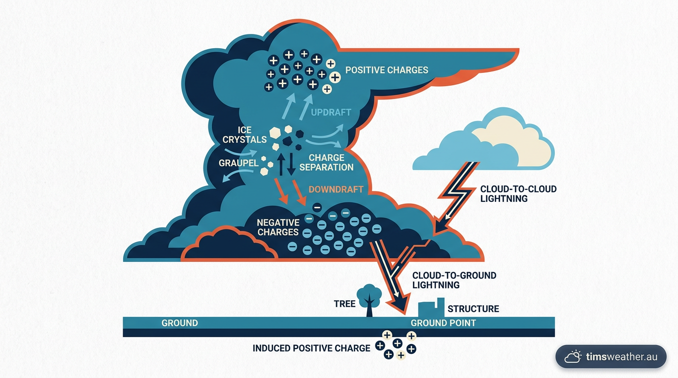
Diagram showing lightning forming inside a thundercloud.
Lightning starts when charge builds up inside a thunderstorm. The BOM says collisions between ice crystals, graupel and supercooled water droplets help separate positive and negative charge in the cloud. The upper part of the storm often becomes more positive, while the lower part becomes more negative. That charge split creates an electrical imbalance strong enough to overcome the air between the cloud and another charge region.
When that happens, the air becomes a conductor for a moment. The discharge heats the channel to about 30,000 °C, which makes the air expand very fast and creates thunder. If you hear thunder, lightning is close enough to matter, even if the rain has not arrived yet. That is why thunderstorm safety starts before the storm reaches you.
Leader and Return Stroke explained
A cloud-to-ground strike does not happen in one clean flash from top to bottom. First, a stepped leader, which is a faint channel of ionised air, moves down from the cloud in short jumps. As it gets close to the ground, objects such as trees, poles, fences and buildings can send up streamers. When the leader and a streamer connect, the circuit closes.
The bright flash you see is the return stroke. Current rushes up the channel from ground to cloud, even though the lightning appears to strike downward. That is why people often describe a bolt as hitting the ground, even though the electrical energy is moving back up the path that has just formed.
Common types of lightning in Australia
Australian storms can produce several kinds of lightning, but a few are seen often enough to matter for safety and storm watching. The table below gives a simple guide.
Type | What you see | Main risk |
|---|---|---|
Cloud-to-ground strikes | A defined bolt linking the cloud to the surface | Direct strike risk |
Intra-cloud discharge | Flashes or glow within the cloud | Shows the storm is active |
Spider lightning | Long branching flashes under the anvil | Can spread far from the main cell |
Beaded lightning | A bolt that appears to break into bright beads | Rare, but still a real discharge |
Dry lightning | A strike with little or no rain reaching the ground | Bushfire ignition |
Ball lightning | A glowing orb floating for a few seconds | Very rare; can startle and, in rare cases, injure |
1. Cloud-to-ground strikes
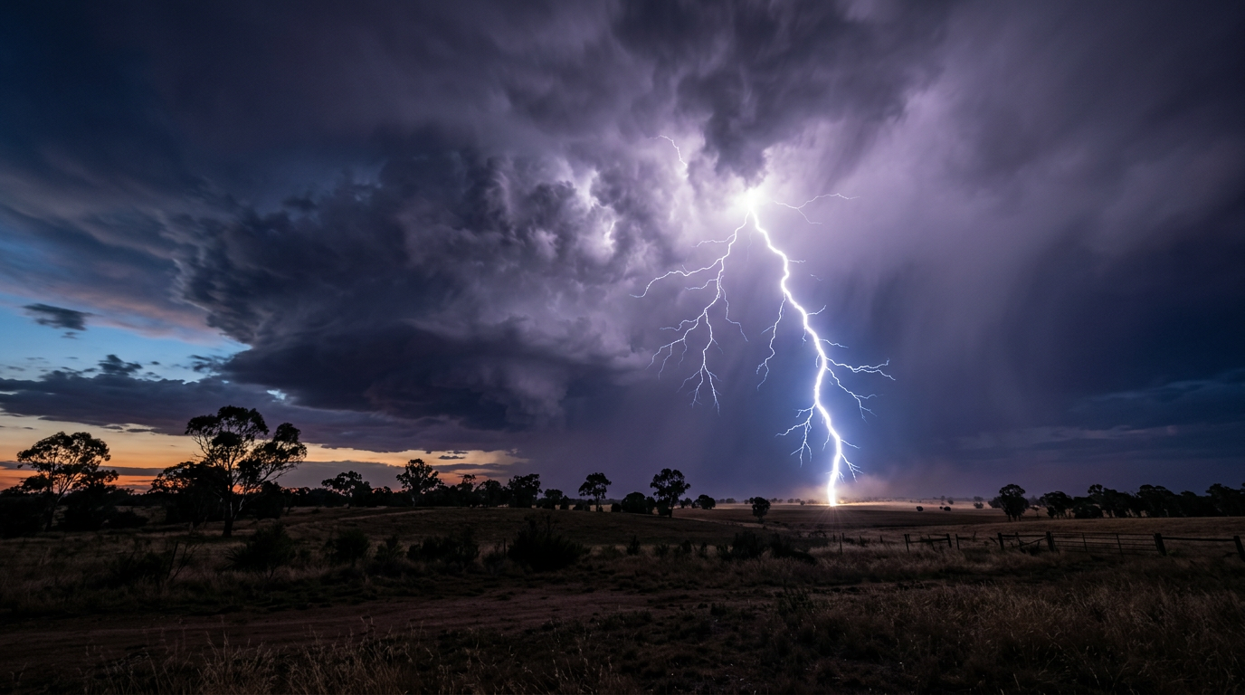
Cloud-to-ground strikes are the type most people think of first. They run between the storm and the earth, so they pose the clearest direct danger to people, animals, vehicles and buildings. If a storm is overhead or close by, move inside a substantial building or a hard-topped metal vehicle. Avoid open ground, ridges, isolated trees, water and metal objects that are exposed.
These strikes can happen before rain arrives at your location. That is why a loud thunderclap is a warning, not background noise. If you are on a work site, at a sporting ground or out on the farm, stop and shelter early.
The Danger of Positive Giants in the Outback
Most cloud-to-ground lightning carries negative charge from the lower part of the storm. Positive giants are different. They start higher in the cloud, in the positively charged upper region, and can carry a larger charge over a longer distance. That makes them more dangerous than many people expect.
In the Outback and other open country, positive giants can strike many kilometres from the rain core. They may hit even when the sky nearby looks partly clear. That is one reason why a storm still needs respect when it sits off to one side of your location. If a thunderstorm is nearby, treat the whole cell as a hazard, not just the rain shaft.
2. Intra-cloud discharge
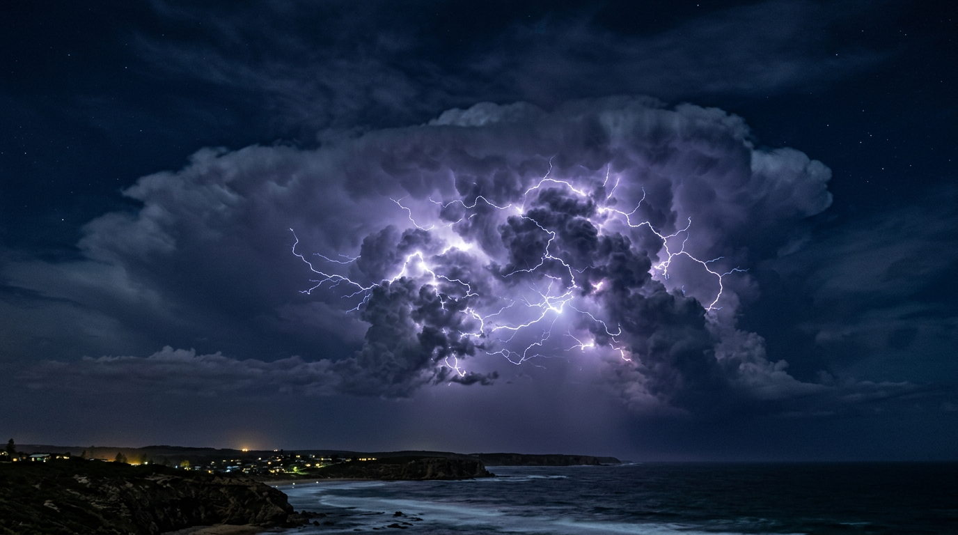
Intra-cloud discharge happens within a single cloud, usually a tall cumulonimbus cloud. It is the most common type of lightning seen from the ground because the flash lights up the cloud from inside. You may see a sheet of light, a flicker or a bright pulse rather than a sharp bolt.
This type is less likely to hit you directly, but it tells you the storm has strong charge separation. If the cloud is growing, expect more lightning. A supercell can produce especially active lightning because it has a strong, rotating updraft and a well-organised storm structure.
3. Spider lightning and anvil crawlers
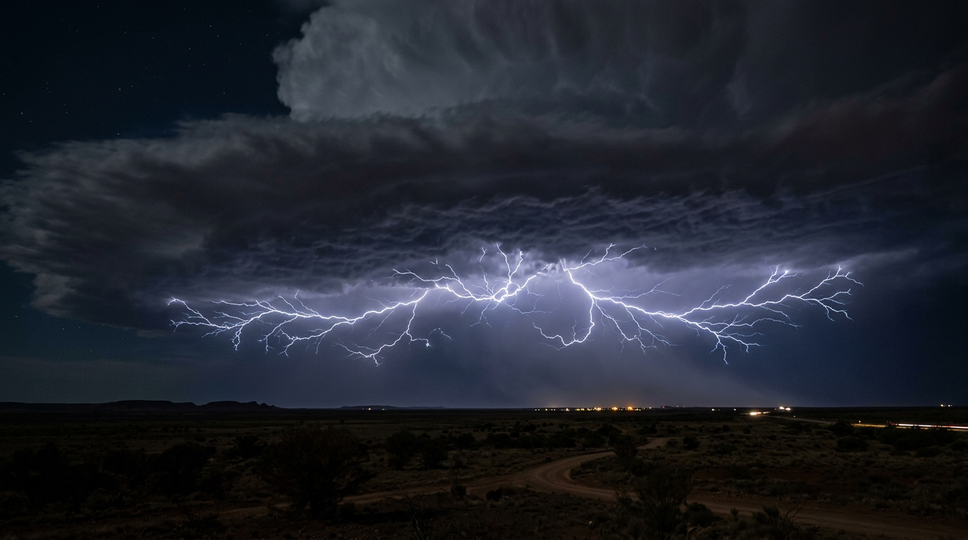
Spider lightning, also called anvil crawlers, spreads out in long, branching paths beneath the cloud top. It often moves horizontally through the anvil before dropping a branch to the ground. The flash can look as though it is crawling across the sky.
This type often appears in mature storms with a broad anvil. It can travel far from the main rain core, so it is not safe to assume the brightest part of the storm is the only dangerous part. If you can hear thunder from a cell with a wide anvil, the storm may already be close enough to produce a strike near you.
4. Beaded lightning
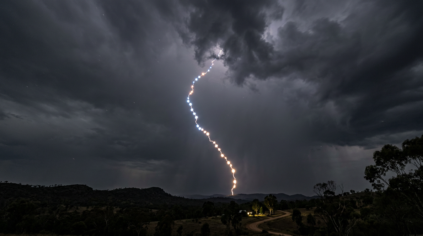
Beaded lightning is a bolt that seems to break into a chain of bright points. It is a visual effect caused by the channel cooling and fading in sections. The underlying discharge is still the same lightning process.
This type is less common than cloud-to-ground or intra-cloud lightning, but it often gets attention because it looks unusual. It does not change the safety advice. Any lightning near you is a reason to get inside and stay there until the storm has passed.
5. Dry lightning
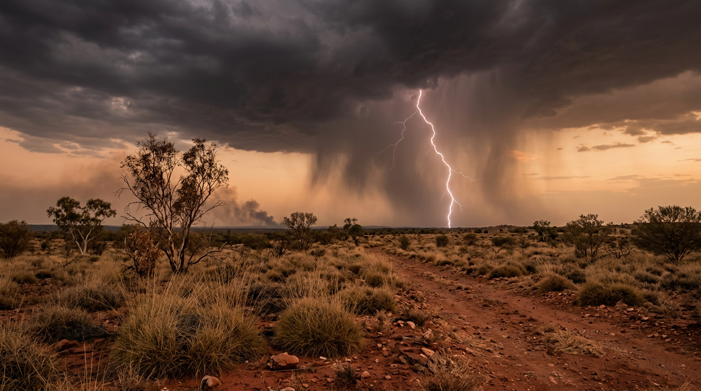
Dry lightning is lightning that reaches the ground with little or no rain making it to the surface. The rain may fall from the cloud but evaporate before it lands, especially in hot, dry air. The strike can then ignite grass, scrub or bush without any useful wetting from the storm.
This is a serious concern in parts of inland Australia and during the fire season. If BOM issues Severe Weather Warnings or thunderstorm warnings and the air is dry, watch for fire starts after lightning. A strike can also smoulder before a fire becomes visible, so do not assume a cloud-to-ground strike has missed because you do not see flames right away.
6. Ball lightning (the rarest type)
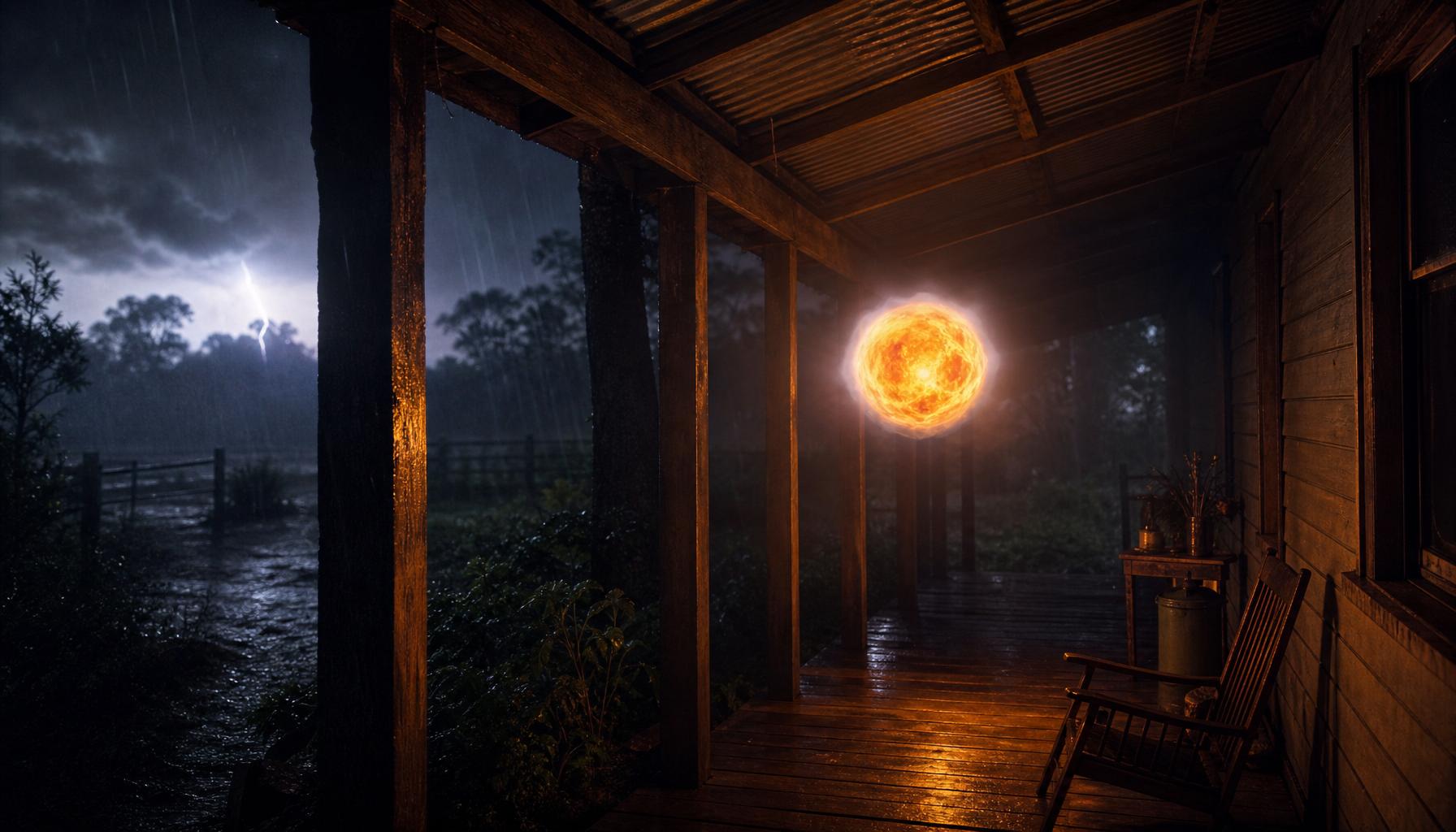
Ball lightning is the rarest type of lightning and the one scientists still argue about. Witnesses describe a floating, glowing sphere, usually about the size of a tennis ball to a soccer ball (roughly 5 to 30 cm across), that appears during or just after a nearby thunderstorm. Reports include sightings inside homes, on farm verandahs, aboard aircraft and even in the middle of open paddocks. It usually drifts slowly at head height for a few seconds before fading away or ending in a small pop.
Unlike a normal bolt, ball lightning does not flash and vanish. It lingers, glows steadily and can pass through windows, doorways and metal screens. Colours are most often reported as orange, yellow or white, though red, blue and green have been recorded. A faint hiss or ozone smell is sometimes noted.
What the latest science says: ball lightning has been captured on video and, in 2014, its spectrum was recorded in Lanzhou, China during a natural cloud-to-ground strike — still the strongest instrumental evidence to date. Peer-reviewed work through 2025 and 2026 continues to support two leading explanations. The silicon vapour hypothesis (Abrahamson & Dinniss) proposes that a ground strike vaporises silica from soil, and the burning silicon nanoparticles glow as a floating aerosol. Newer plasma models describe a self-sustaining microwave-plasma soliton or dusty-plasma spheromak trapped in a small pocket of air. No single model is yet accepted as proven.
Typical size: 5–30 cm across, occasionally larger.
Typical duration: 1–10 seconds, rarely up to a minute.
Colour: most often orange, yellow or white.
Behaviour: floats or drifts slowly, can move against the wind.
Ending: silent fade or a small explosive pop.
If you ever see ball lightning, treat it as you would any active thunderstorm. Do not touch it, do not chase it and do not try to photograph it up close. Move calmly to another room, keep well clear, and stay inside until the storm has passed. Cases of injury are very rare but have been reported when people made contact.
Where lightning matters most in Australia
Lightning is found across Australia, but some places see it more often than others. The Top End wet season is a good example. From the build-up into the wet season, warm moist air and strong instability make frequent thunderstorms more likely around Darwin and the surrounding region. The ABC has noted that this part of the country is especially prone to dramatic lightning displays.
Elsewhere, inland storms can be more isolated but still intense. A dry afternoon in Queensland, the Northern Territory, South Australia or Western Australia can still produce a storm with dangerous lightning, especially if a strong cell forms over hot ground. If you are in the open, do not wait to see whether the rain arrives first.
Thunderstorm safety: what to do when lightning is nearby
Thunderstorm safety is simple if you act early. The safest move is to get inside before the storm is overhead.
Move into a substantial building or a hard-topped vehicle.
Stay away from windows, verandahs, open sheds and isolated shelters.
Avoid plumbing, wired electronics and corded devices during the storm.
Keep away from water, tall trees, poles and metal fences.
Wait 30 minutes after the last thunder before going back outside.
If you work outside, follow your site procedures and Australian electrical safety standards. That includes stopping outdoor electrical work when lightning is nearby, and checking equipment only when it is safe to do so. For marine, aviation, farm and event settings, use the latest BOM warnings and local safety advice.
Common lightning misconceptions in Australian storms
Some lightning myths still circulate during summer storms. A few are harmless. Others are dangerous.
Myth: Lightning only strikes the tallest object.
Fact: It often hits the best electrical path, which may not be the tallest object.Myth: If it is not raining, the storm is safe.
Fact: Positive giants and dry lightning can strike far from the rain core.Myth: Intra-cloud lightning is harmless because it stays in the cloud.
Fact: It shows the storm is charged and can still produce cloud-to-ground strikes.Myth: A car is always safe because of the tyres.
Fact: The metal body gives protection, not the tyres.
If you remember one thing, make it this: thunder means lightning is close enough to act on. Use BOM warnings, get inside early, and wait until the storm has clearly moved away.
Related guides
Frequently asked questions
The primary types of lightning in Australia include cloud-to-ground, intra-cloud, cloud-to-cloud, cloud-to-air, and dry lightning. Cloud-to-ground strikes are the most dangerous as they reach the earth, while intra-cloud lightning is the most frequent variety, occurring entirely within a single storm cloud and often appearing as a bright glow.
Source: bom.gov.au
Planning weeks ahead?
Check Australia's long-range seasonal outlook for rainfall, temperature and the climate drivers (ENSO, IOD, SAM, MJO) shaping the next three months.
View Australia's Seasonal Weather Forecast