
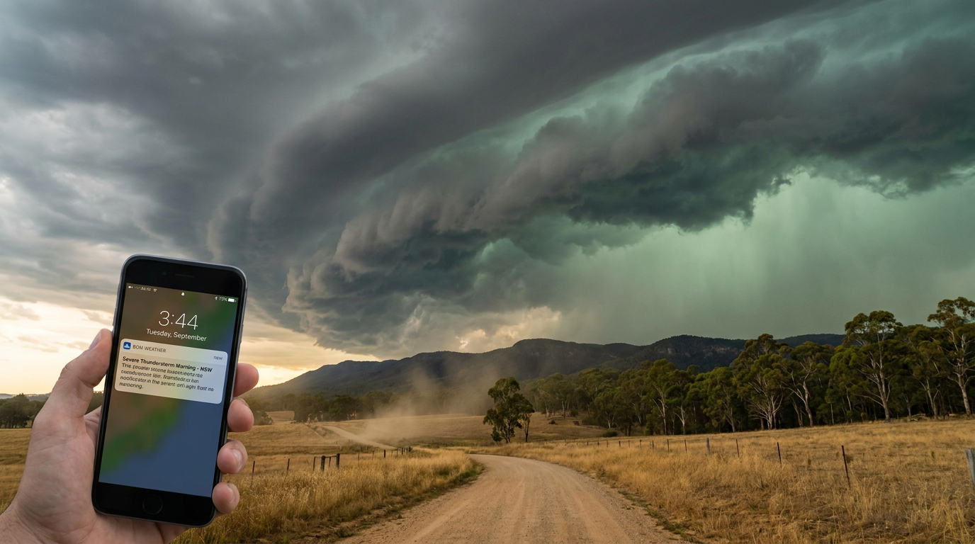
Spotting approaching thunderstorm signs NSW residents may see can help you act early. Watch for towering cumulonimbus clouds, rapid vertical cloud growth, a darkening sky, sudden wind changes and a gust front. Pair what you see with Bureau of Meteorology alerts and the Hazards Near Me NSW app.
Key takeaways
- Rapid vertical cloud growth is one of the clearest visual signs that the atmosphere is becoming unstable.
- A gust front can bring a sudden wind shift, cooler air and the first burst of rain.
- Dark, green-tinged or bruised skies can happen in severe thunderstorms, including storms that produce large hail.
- Sea breezes, the Southerly Buster, East Coast Lows and orographically enhanced convection can all help trigger storms in New South Wales.
- Move indoors as soon as thunder is heard as a primary step for storm event preparedness.
What are the approaching thunderstorm signs NSW residents should watch for?
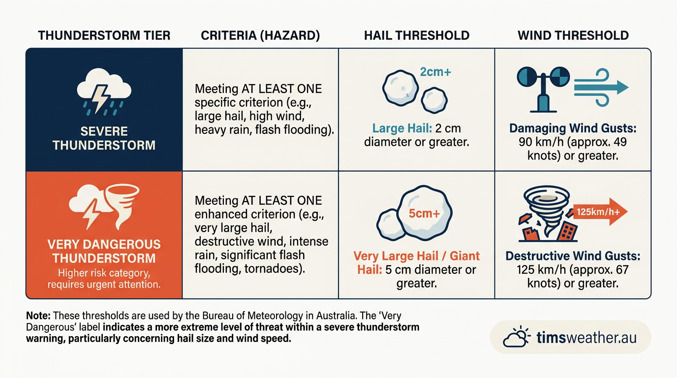
In New South Wales, thunderstorms can build fast when warm, moist air rises into colder air aloft. That rising air is called atmospheric instability, and it is the fuel for storm growth. The Bureau of Meteorology (BOM) uses radar, satellite imagery and lightning detection to track storms, but the sky can give you earlier local clues.
If you are outside, keep an eye on cloud shape, wind changes and the feel of the air. Those clues matter most when storms are forming near the coast, over ranges, or along hot inland boundaries.
| Early sign | What it can mean | What to do |
|---|---|---|
| Towering cloud growth | Storm updrafts are strengthening | Keep watching the sky and move closer to shelter |
| Dark base or anvil shape | The storm is maturing | Go indoors if thunder is heard |
| Gust front or shelf cloud | Heavy rain and wind may arrive soon | Secure loose items and get inside |
| Green or bruised sky | Severe hail-producing storm may be nearby | Protect vehicles and stay away from windows |
Sign 1: Rapid vertical cumulonimbus cloud growth
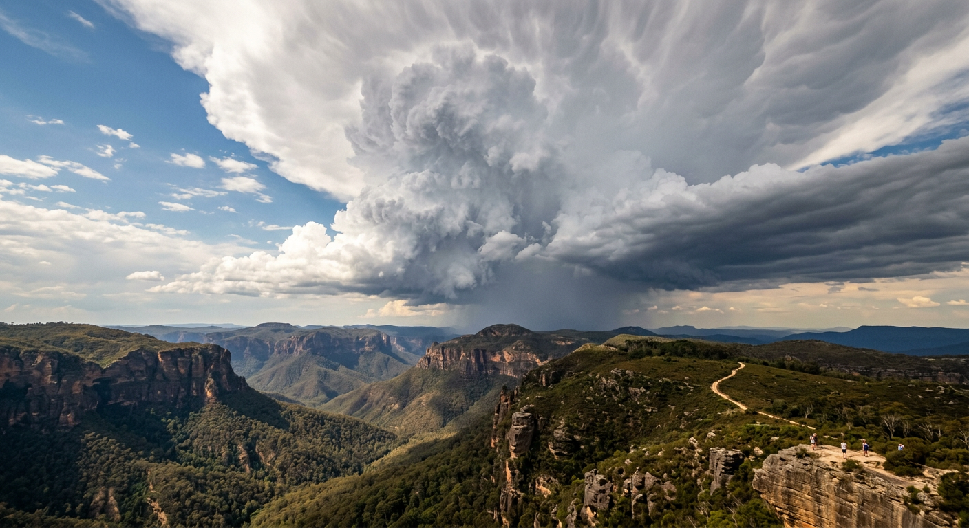
The clearest early sign is fast vertical cloud growth. Small cumulus clouds can quickly build into tall towers when the air is unstable and rising strongly. If the cloud top keeps climbing and starts to spread into an anvil shape, a mature thunderstorm is likely forming.
Those tall towers are cumulonimbus clouds, the main storm cloud type behind lightning, heavy rain and damaging wind gusts. If the cloud base turns dark while the top keeps rising, get ready for a severe weather warning.
Sign 2: The arrival of a gust front and shelf cloud
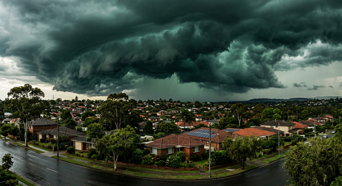
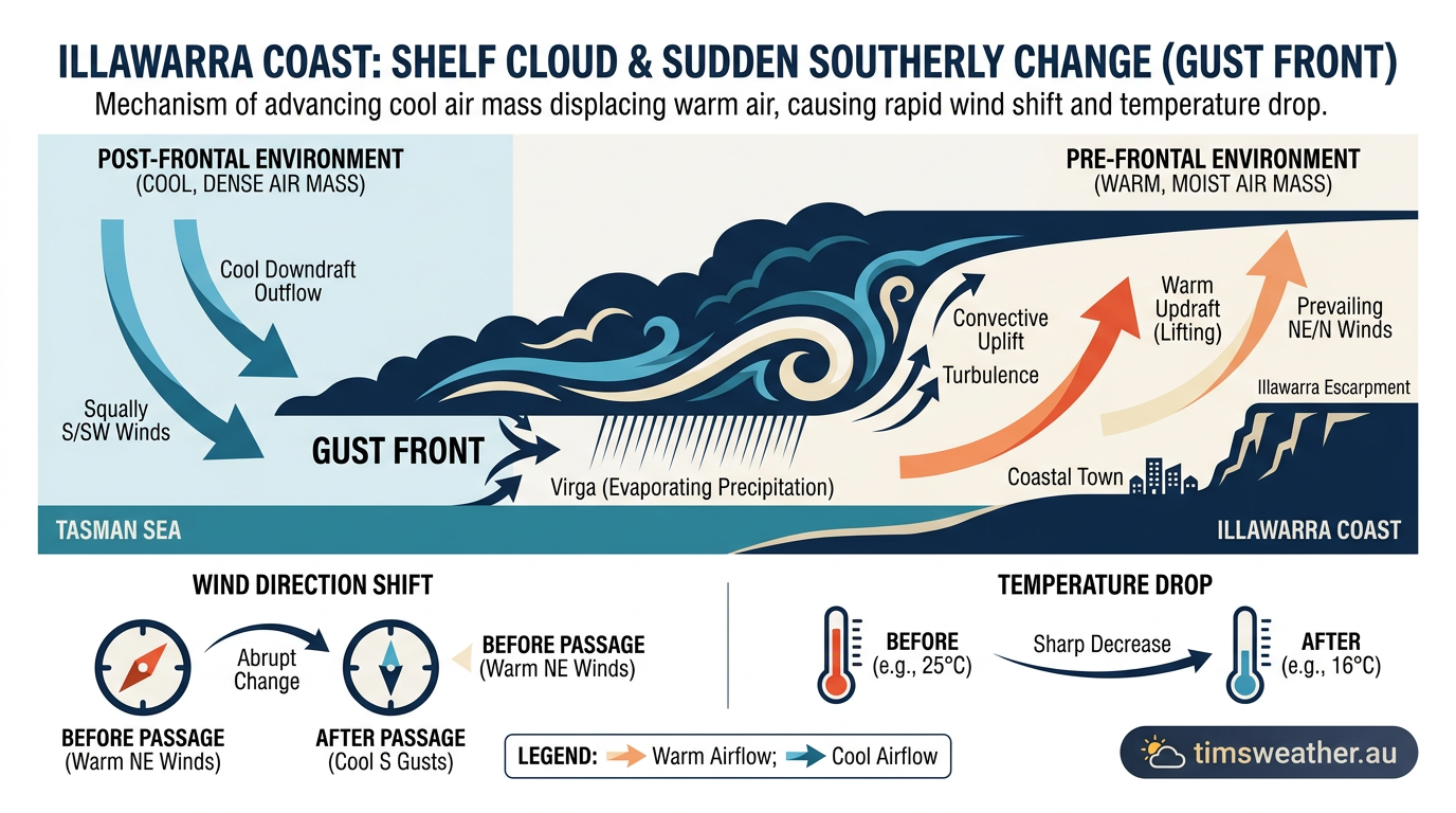
A gust front is the outflow of cool air that spreads out ahead of a thunderstorm. It often arrives as a sudden wind change, a temperature drop and a wall of dust or rain. A shelf cloud can form along the leading edge.
When that boundary reaches you, the storm is close. Move indoors straight away, especially if lightning is already nearby.
Sign 3: The green tint mystery and hail risk in NSW
A green or heavily darkened sky can appear in severe thunderstorms, especially when large hail is present. The colour comes from sunlight filtering through deep cloud, rain and ice inside the storm. It is not a guarantee of hail, but it is a warning sign worth taking seriously.
The Bureau of Meteorology uses the term severe thunderstorm warning for storms that can produce damaging hail, wind or rain. If the sky turns strange and the thunderstorm is nearby, move cars under cover and stay away from windows.
Sign 4: Mammatus clouds under the anvil
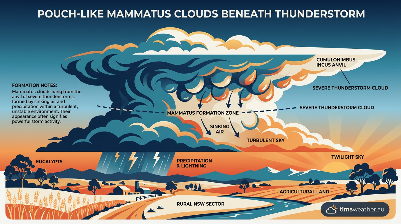
Mammatus clouds are pouch-like bulges that can hang beneath the anvil of a storm. They often appear after a storm has grown strong or as it begins to weaken. They are a sign of strong air movement in and around the storm, not a storm warning by themselves.
If you see mammatus clouds with lightning, hail or dark rain curtains nearby, keep sheltering. They can sit beside active storm cores that still pose a risk.
Sign 5: The lull before the Southerly Buster
Along the NSW coast, a Southerly Buster can arrive after hot, humid conditions and trigger a sharp wind change. It is a coastal wind shift, not a thunderstorm on its own, but it can help sharpen boundaries where storms form. That can matter when warm northerlies meet cooler air near the coast.
If the wind drops suddenly and the air feels still before a change, watch the sky closely. That stillness can come just before a storm line or a strong sea-breeze boundary moves through.
Sign 6: Supercell development and hook echoes on radar
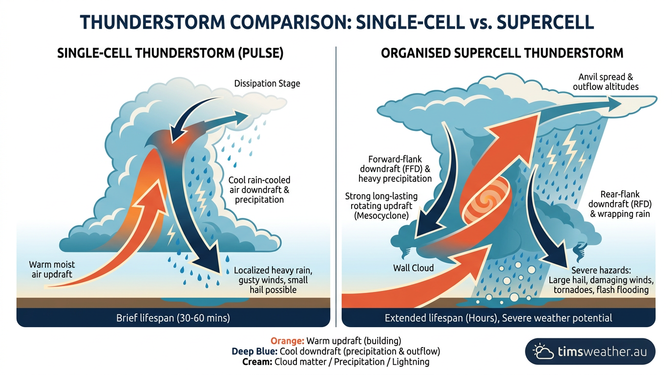
Some storms organise into supercells, which are rotating thunderstorms that can produce large hail, intense rain and damaging winds. On BOM Doppler radar, forecasters may look for a hook echo, a curved feature that can appear near a rotating storm core. You cannot see that hook with your eyes, but it is one reason radar matters.
If you are tracking a storm line, keep checking Bureau of Meteorology alerts and radar updates. That is especially useful in places where storms can strengthen over the ranges or along coastal convergence lines.
Where are these signs most common in New South Wales?
These signs often show up where warm, moist air meets a trigger. That can happen along the coast, near the Great Dividing Range, ahead of an East Coast Low, or along a sea-breeze boundary on hot days. Orographically enhanced convection can also build storms where air is forced uphill over higher ground.
If you live in coastal NSW, keep an eye on storms developing inland and moving toward you. If you are in the ranges or western slopes, storms can fire over higher terrain first and then spread out.
How can you stay safe when storm signs appear?
Act early. Thunderstorm safety starts before the first drop of rain.
- Move indoors when thunder is heard.
- Secure outdoor items that can blow around.
- Park vehicles under cover if large hail is possible.
- Check BOM alerts and the Hazards Near Me NSW app.
- Avoid trees, open water and metal shelters during lightning.
If a severe weather warning is issued, follow the warning text closely. If you are caught outside, get into a substantial building or a fully enclosed vehicle as soon as you can.
What the signs do not tell you
Visual clues are useful, but they do not tell the full story. A storm can look ordinary and still produce intense rainfall, lightning or flash flooding risks. A storm can also look dramatic and pass with less impact than expected.
That is why the best approach is simple: watch the sky, check BOM alerts and use the Hazards Near Me NSW app as the storm approaches.
Related guides
Frequently asked questions
Darkening skies, towering cumulus clouds, and distant thunder are common early indicators. In NSW, these changes can mean a storm is building rapidly. You should move indoors immediately and check the latest Bureau of Meteorology warnings to ensure you stay informed about potential hazards in your local area.
Source: bom.gov.au
Planning weeks ahead?
Check Australia's long-range seasonal outlook for rainfall, temperature and the climate drivers (ENSO, IOD, SAM, MJO) shaping the next three months.
View Australia's Seasonal Weather Forecast