
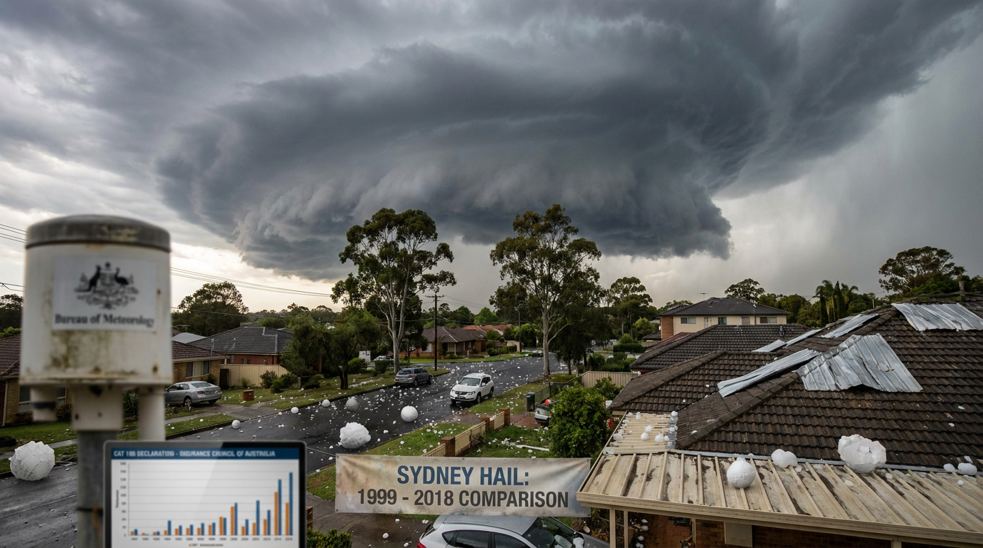
The December 2018 Sydney hailstorm was a severe weather event on 20 December that affected the Sydney Basin and parts of the Central Coast. It brought hailstones as large as 8 cm, drove more than 25,000 insurance claims, and led the Insurance Council of Australia to declare a catastrophe after losses passed $125 million.
Key takeaways
Vehicle damage made up a large share of claims, so moving cars under cover is one of the most useful steps when hail is forecast.
The Bureau of Meteorology warned of severe thunderstorms, including supercell storm activity and large hail.
Hailstones were reported as large as 8 cm across, or golf ball to tennis ball sized.
Cascading storm cells moving along the same path helped to widen the footprint of the hail damage.
More than 25,000 claims were lodged after the storm, with vehicle damage a major issue.
December 2018 Sydney hailstorm: what happened?
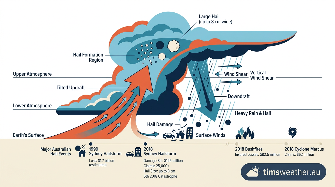
Diagram illustrating wind shear tilting a supercell thunderstorm updraft
On 20 December 2018, severe thunderstorms moved through eastern New South Wales and hit Sydney hard. The Bureau of Meteorology issued severe thunderstorm warnings as the storms intensified, and the most damaging cells tracked through the Sydney Basin and across parts of the Central Coast. The storm produced large hail, damaging winds and heavy rain. It was a convective weather outbreak, driven by strong instability and organised thunderstorm growth.
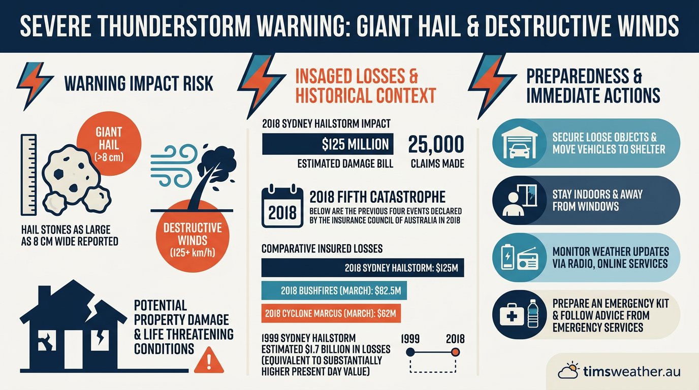
Bureau of Meteorology warning graphic for the December 2018 Sydney hailstorm
What synoptic setup drove the storm?
The synoptic setup featured hot, humid air near the surface, colder air aloft and a trigger for storm development over eastern Australia. That mix helped thunderstorms build quickly. In plain terms, the atmosphere had enough heat and moisture for strong updrafts, then enough wind change with height to keep storms organised. That is why the event produced a supercell rather than a short-lived shower.
How CAPE helped the storms grow
Convective Available Potential Energy, or CAPE, describes how much buoyant energy a rising parcel of air has. Higher CAPE means stronger updraft potential, which helps hail grow inside a storm. For the December 2018 Sydney hailstorm, the atmosphere supported vigorous storm growth, which is consistent with the large hail reports seen across Sydney. CAPE does not cause hail by itself, but it gives storms the lift they need to develop quickly.
Why supercell structure mattered
A supercell is a thunderstorm with a rotating updraft. That rotation helps separate inflow from downdraft, so the storm can last longer than a typical cell. In this case, the storm structure supported golf ball hail and larger stones, because the hail had time to cycle through the storm before falling out. That is one reason the damage was so widespread across suburbs and transport corridors.
Radar and storm structure
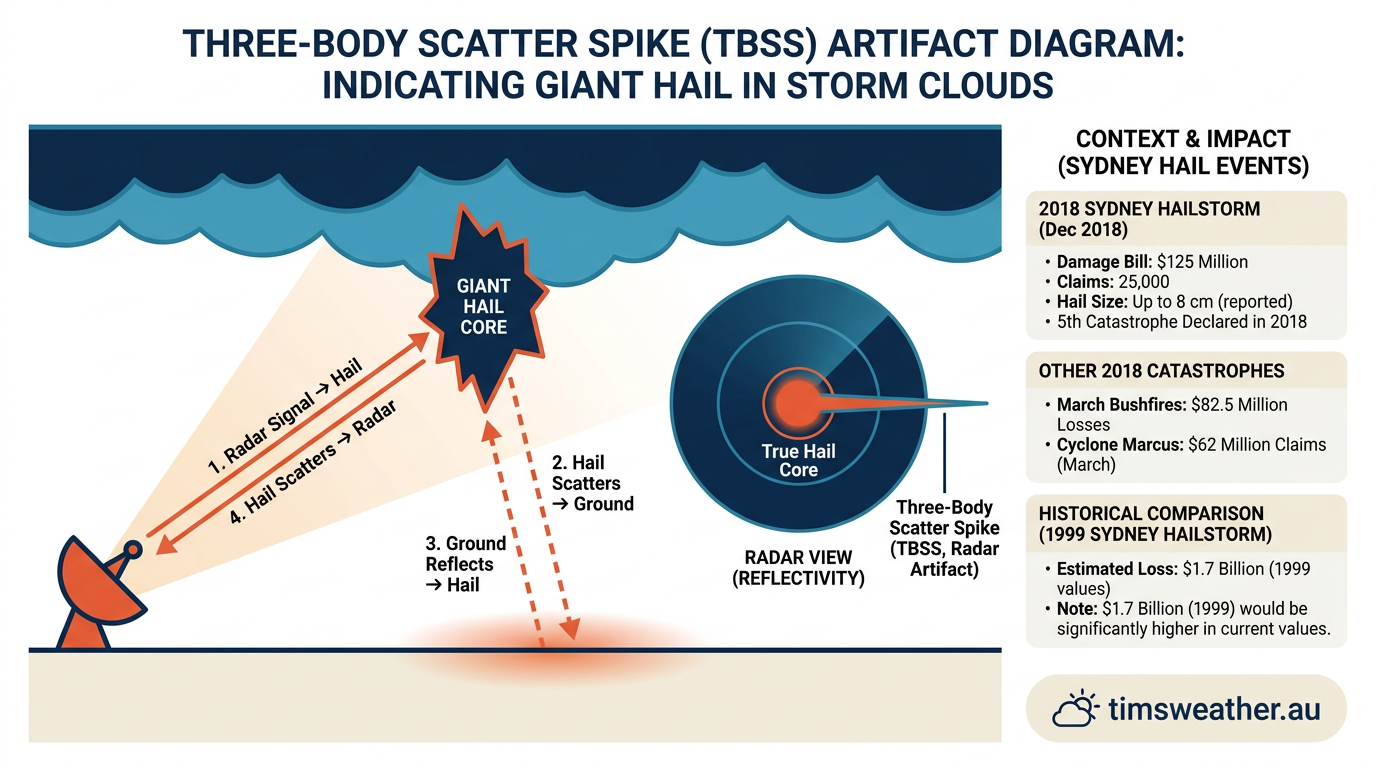
Explanation of a radar Three-Body Scatter Spike caused by large hail
Radar images from the Bureau of Meteorology showed strong storm cores, which matched the reports of large hail and damaging winds. A hail spike on radar can point to large hail, although it is not a direct hail measurement. For readers following weather radar, this is a good example of how intense echo tops and hail signatures can line up with severe thunderstorm warnings.
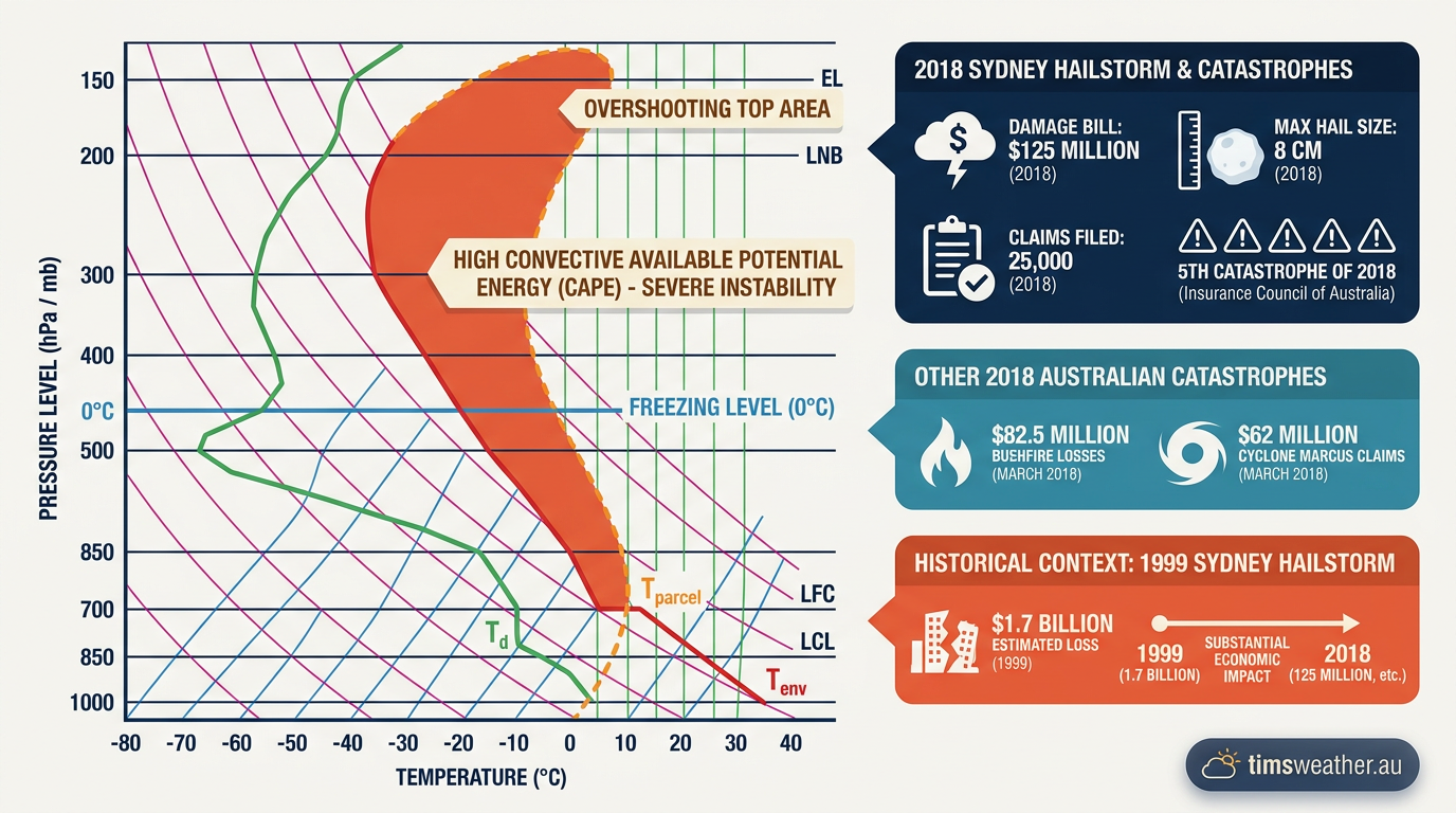
Diagram showing Convective Available Potential Energy used to forecast severe thunderstorms
How the damage and insurance losses unfolded
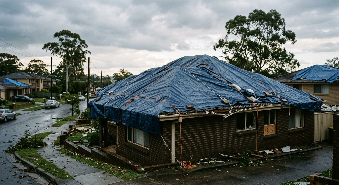
Suburban house roof in Berowra covered in tarpaulins after severe hail damage
The Insurance Council of Australia declared the event a catastrophe after insured losses passed $125 million. More than 25,000 claims were lodged soon after the storm, and many were for vehicle damage from hail. Reports also described severe damage to roofs, windows and solar panels. The 2018 Sydney event became the fifth catastrophe declared by the Insurance Council of Australia that year.
If you were in the storm path, the NSW State Emergency Service advised people to stay inside, move cars under cover if safe to do so, and keep away from broken glass and downed power lines. For current advice on severe thunderstorms, use the weather warnings page and the NSW SES storm preparedness guide.
Where did the storm affect Sydney most?
The storm caused damage across a wide part of greater Sydney, with suburbs in the north, west and south-west reporting hail and heavy losses. The Sydney Basin was the main focus, but the broader storm line also affected the Central Coast. That spread fits a setup where multiple thunderstorm cells move along the same corridor, rather than a single isolated cell.
What cascading storm cells mean
Cascading storm cells are a series of storms that form and move along a similar path. One cell can help trigger the next by pushing cool outflow air into warmer, unstable air ahead of it. That can extend the damage zone and create repeated hail impacts over nearby areas. In the Sydney event, that storm train helped widen the footprint of the hail damage.
Was storm surge part of the event?
No. Storm surge is a coastal flooding issue linked to tropical cyclones and strong onshore winds, not this hailstorm. The December 2018 Sydney hailstorm was a thunderstorm and hail event, so the main hazards were hail, wind and heavy rain.
How does this compare with other Australian hail events?
The December 2018 Sydney hailstorm was one of the costliest hail events in Australia’s insurance records. The 1999 Sydney hailstorm remains the benchmark for losses, but the 2018 storm still caused major disruption and heavy claims. It also showed how quickly severe Sydney thunderstorms can turn into a city-wide insurance event when golf ball hail falls over a dense urban area.
Related guides
Frequently asked questions
A severe thunderstorm system developed into an intense convective storm with supercell features. These conditions produced very large hail, damaging winds, and torrential rain across parts of Sydney and the Central Coast. The storm was triggered by high humidity combined with an unstable atmosphere characteristic of peak Australian summer weather.
Source: insurancecouncil.com.au
Planning weeks ahead?
Check Australia's long-range seasonal outlook for rainfall, temperature and the climate drivers (ENSO, IOD, SAM, MJO) shaping the next three months.
View Australia's Seasonal Weather Forecast