
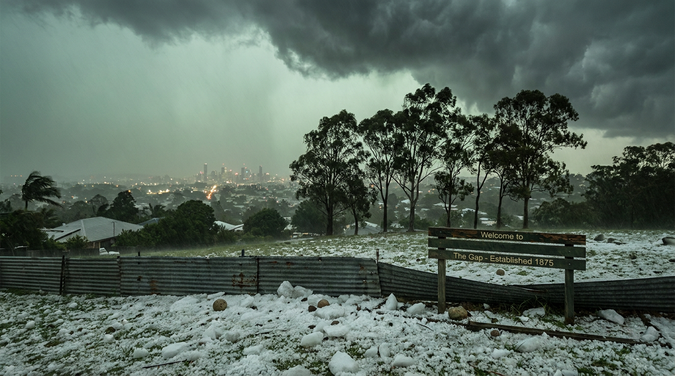
The 1985 Brisbane hailstorm hit Brisbane on 18 January 1985, with The Gap among the hardest-hit suburbs. This severe convective storm brought cricket-ball-sized hail and wind gusts to 184 km/h at Brisbane airport, with damage centred on Brisbane's northern suburbs. The event left a long mark on south-east Queensland storm history.
Key takeaways
The 1985 Brisbane hailstorm struck on 18 January 1985 and was driven by a severe supercell thunderstorm.
It produced tennis-ball-sized hail (approximately 63 mm diameter) and a peak wind gust of 184 km/h at Brisbane airport, which affected a limited area.
The damage swathe was about 8 to 12 kilometres wide and unroofed about 2,000 homes.
The Gap and Ashgrove were among the worst-affected suburbs.
Storm structure, wind shear and local terrain all helped shape the damage path.
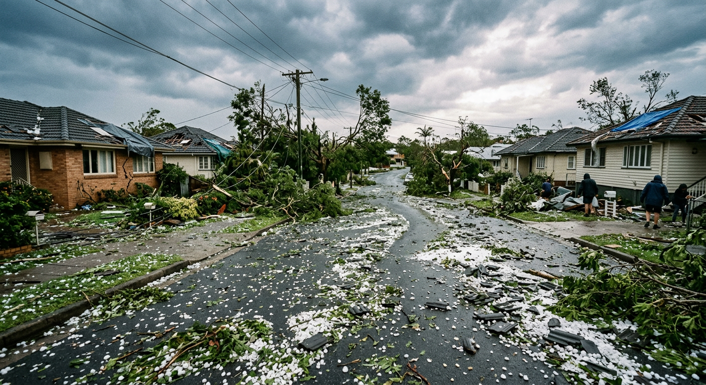
Debris scattered across a residential street caused by the 1985 Brisbane hailstorm
What happened in the 1985 Brisbane hailstorm?
The 1985 Brisbane hailstorm was a severe supercell thunderstorm that crossed Brisbane on 18 January 1985. According to the Harden Up case study, it produced cricket-ball-sized hail, wind gusts to 145 km/h in the city and 187 km/h at the airport, while a damage swathe about 8 to 12 kilometres wide tore through parts of the city.
For Brisbane, it was a strong example of how quickly a summer thunderstorm can turn severe. The storm that hit hardest in north-western suburbs including The Gap occurred in November 2008 (not January 1985), was primarily a windstorm caused by a microburst with speeds up to 180 km/h, and resulted in 716 documented damage incidents rather than about 2,000 homes unroofed.
mesoscale convective systems guide.
When did the hail storm hit The Gap?
The Gap was hit in the mid to late afternoon of 18 January 1985. A personal account on Australian Severe Weather describes how the sky darkened quickly and a cricket game was stopped as the storm approached. That speed is typical of a severe convective storm with a strong updraught and a well-organised downdraught.
A threatening supercell thunderstorm moving over the Taylor Range near The Gap
Meteorological anatomy of the 18 January 1985 supercell
Thunderstorms in south-east Queensland often form when warm, moist air near the surface rises into a steeply unstable atmosphere. The Geoscience Australia thunderstorm risk chapter notes that solar heating, topography and weather fronts can all help trigger severe thunderstorms in the region.
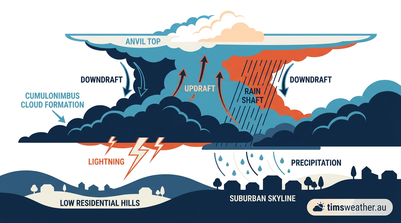
In the 1985 event, the storm had the structure of a supercell thunderstorm. That matters because the storm's updraught and downdraught stay separated, so the storm can keep feeding on warm inflow while producing large hail and damaging winds. Strong wind shear also helps tilt and organise the storm, which is one reason supercells can persist longer than ordinary afternoon storms.
That combination of instability and wind shear is what made the storm so damaging. The supercell, wind shear and downburst pages explain the terms used by the BOM and storm researchers.
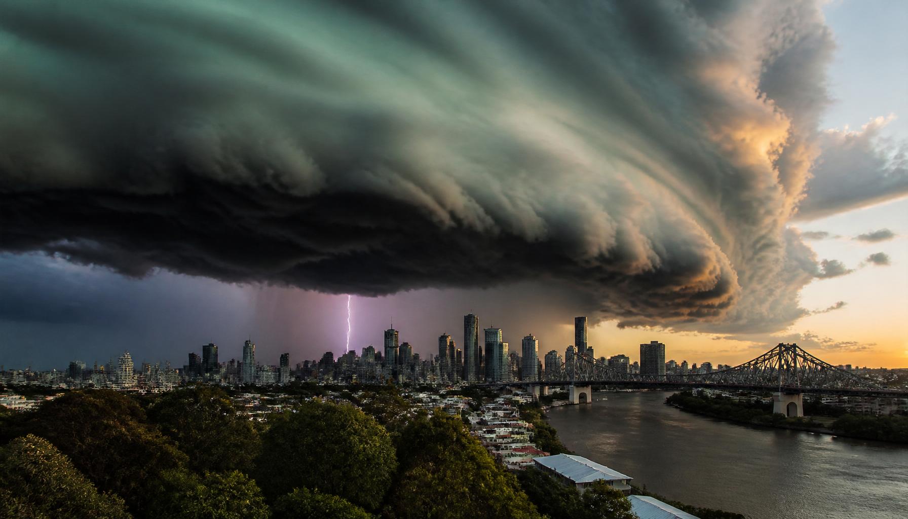
Dramatic supercell storm cloud with lightning over Brisbane, reminiscent of the severe 1985 Gap Hailstorm.
Why The Gap's terrain mattered
The Gap sits near the Taylor Range and the foothills of the D'Aguilar Range. That terrain can help lift incoming air and strengthen a thunderstorm as it moves across western Brisbane. In this case, the local topography helped focus the worst damage over The Gap and nearby suburbs rather than spreading it evenly across the city.
For readers in western Brisbane, that is the key lesson. A storm does not need to be huge over a wide area to cause major damage if it tracks through a narrow, vulnerable corridor.
What caused the extreme wind speeds?
The extreme winds were linked to a microburst and strong storm outflow. A microburst is a concentrated burst of sinking air that spreads out violently after it hits the ground. In severe storms, heavy rain and hail can drag cooler air downward, then the air spreads out at the surface as damaging straight-line winds.
That is why the 1985 Brisbane hailstorm caused both roof damage and widespread debris damage. Hail broke surfaces first, then the wind got into those weakened structures.
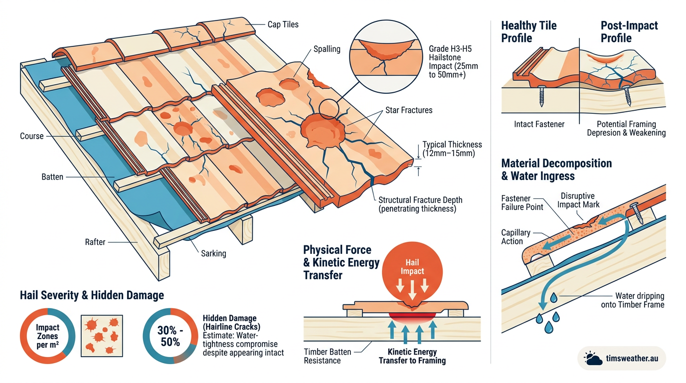
Shattered roof tiles showing the severe impact damage of the 1985 Brisbane hailstorm
The microburst and hail damage profile
The storm's damage was not from one hazard alone. Hail smashed roofs, windows and vehicles. Then the downburst and outflow worsened the damage by pushing air into damaged buildings and lifting loose material. The result was a destructive combination of hail, wind and flying debris.
That is why the microburst explanation matters. It helps separate the hail damage from the wind damage, which is useful when you look at storm reports or insurance assessments.
What did the Insurance Council of Australia record?
The Insurance Council of Australia is often used as a reference point for insured loss work, but the research bundle for this story does not include an ICA figure for 1985. The historic case study does show widespread housing damage and thousands of claims, so the insurance impact was clearly large.
For a later Brisbane comparison, our Brisbane 2014 hailstorm article covers a more recent severe supercell event and its insurance costs.
Why the 1985 event still matters
The 1985 Brisbane hailstorm remains one of the clearest examples of severe convective storm damage in a major Australian city. It showed how a fast-moving supercell can hit a narrow path with enough force to unroof homes, smash cars and overwhelm cleanup crews.
It also sits near the centre of south-east Queensland storm history. If you live in Brisbane, The Gap, Ashgrove or other western suburbs, the main lesson is simple: severe thunderstorms can form quickly in summer, and the first warning sign is often a darkening sky, strong inflow and a rapid drop in visibility.
For current warning information, use the weather warnings page and follow any BOM advice.
Related guides
Frequently asked questions
A severe supercell thunderstorm fueled by intense heat, high humidity, and strong wind shear caused this devastating event. As the storm moved across the D'Aguilar Range, the rising terrain helped intensify the updraughts, allowing massive hailstones to form before they fell with destructive force over the western suburbs.
Source: coastwatch.com.au
Further reading and resources
Explore trusted articles, books, videos and other resources to go deeper on this topic.
Planning weeks ahead?
Check Australia's long-range seasonal outlook for rainfall, temperature and the climate drivers (ENSO, IOD, SAM, MJO) shaping the next three months.
View Australia's Seasonal Weather Forecast