
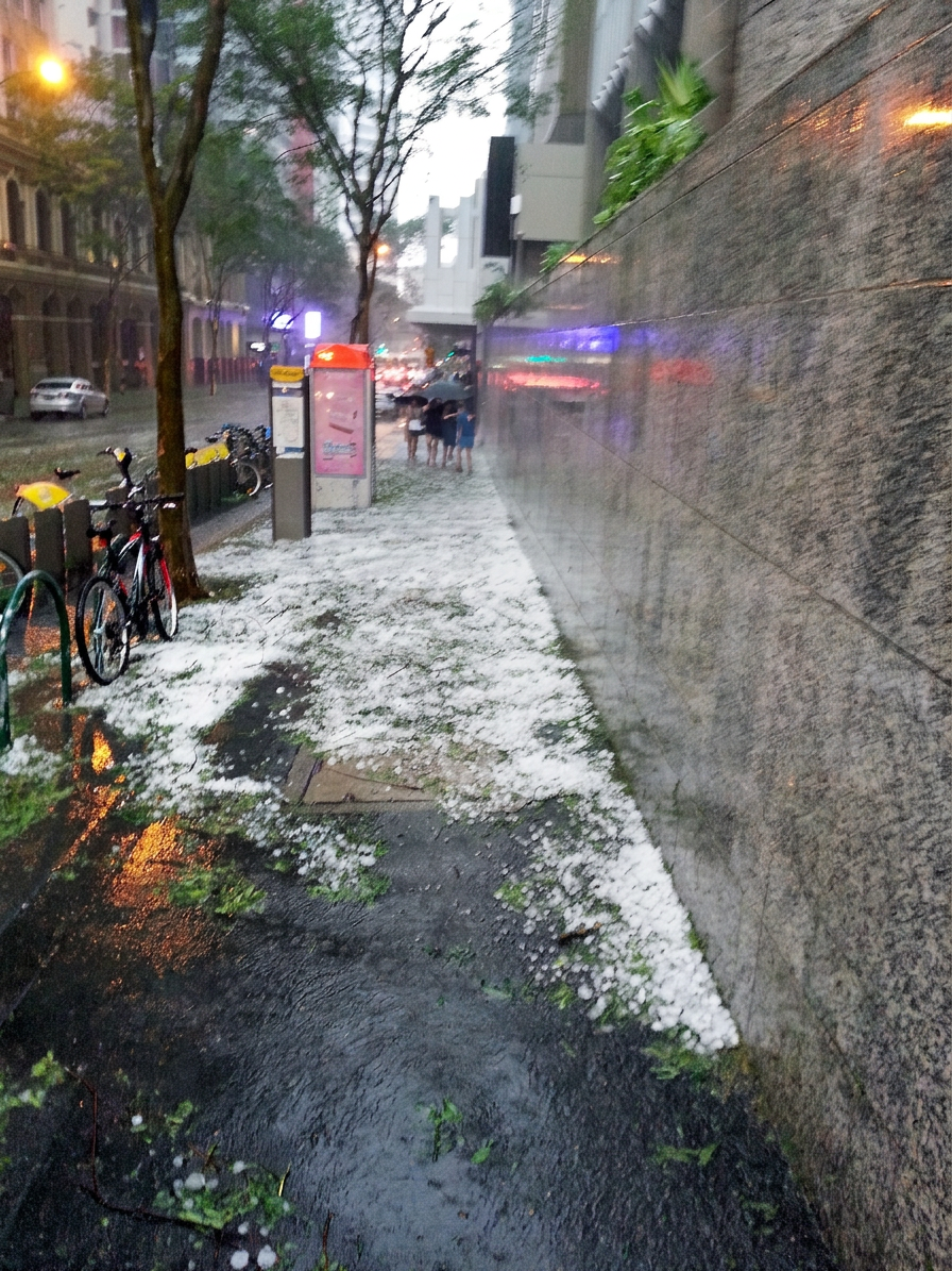
The 2014 Brisbane hailstorm struck on 27 November 2014 when a severe supercell storm moved across South East Queensland. It brought giant hail, destructive winds and heavy rain to Brisbane CBD and nearby suburbs. Damage reports later put the insured loss at more than $1 billion, with Archerfield Airport recording a gust of 141 km/h.
Key takeaways
Splitting over the southern suburbs, the storm's right-moving cell intensified and tracked towards more densely populated areas.
Archerfield Airport recorded a wind gust of 141 km/h, while hailstones reached cricket ball size and were reported as large as 8 cm in some accounts.
Damage was widespread across South East Queensland, with smashed windows, roof damage, fallen trees and power outages.
Insurance reports later placed the cost of damage at more than $1 billion, making it one of the biggest natural disaster insurance claims in Australia at the time.
The event is often compared with the 1985 Gap storm because both produced giant hail and severe weather warning conditions over Brisbane.
The severe storm history of South East Queensland explained
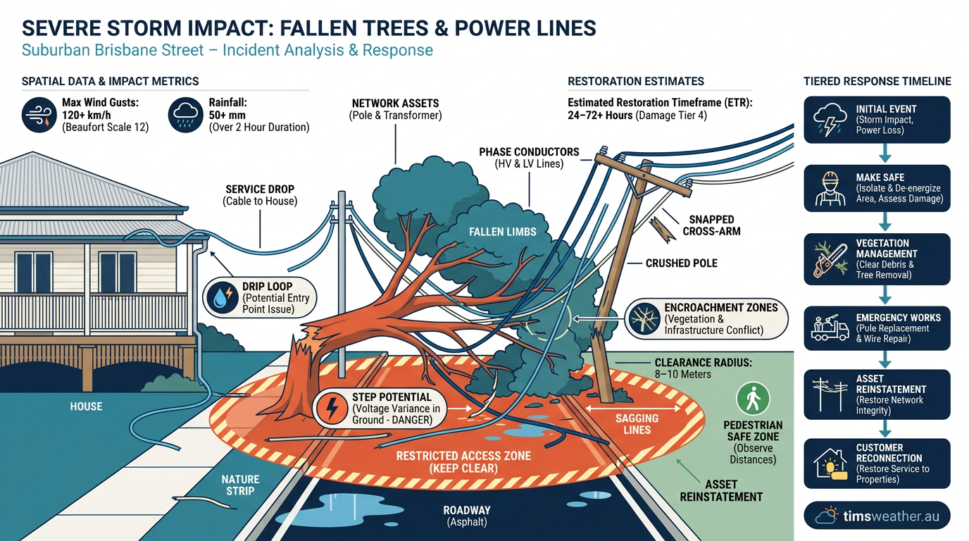
Suburban street damage showing uprooted trees and downed power lines typical of the 2014 Brisbane hailstorm impact.
South East Queensland is prone to severe thunderstorms in the warmer months. Hot, humid air near the coast can clash with drier air from inland Australia, while upper-level winds help storms grow and organise. The result can be damaging hail, flash flooding and destructive winds.
The geographical corridor of South East Queensland
The shape of the region helps storms form and track towards Brisbane. Moist onshore flow from the Pacific Ocean often meets warmer inland air, and thunderstorms can build over the ranges before moving towards the coast. The Bureau of Meteorology often uses the term Significant Weather Outlook for broad event guidance when severe storms are possible.
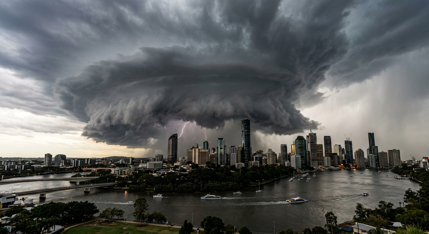
A severe supercell storm approaches Brisbane before the 2014 hailstorm.
Once thunderstorms move off the ranges, they can intensify over the coastal plain. That is one reason Brisbane and nearby suburbs are so exposed to fast-moving storm cells in spring and early summer.
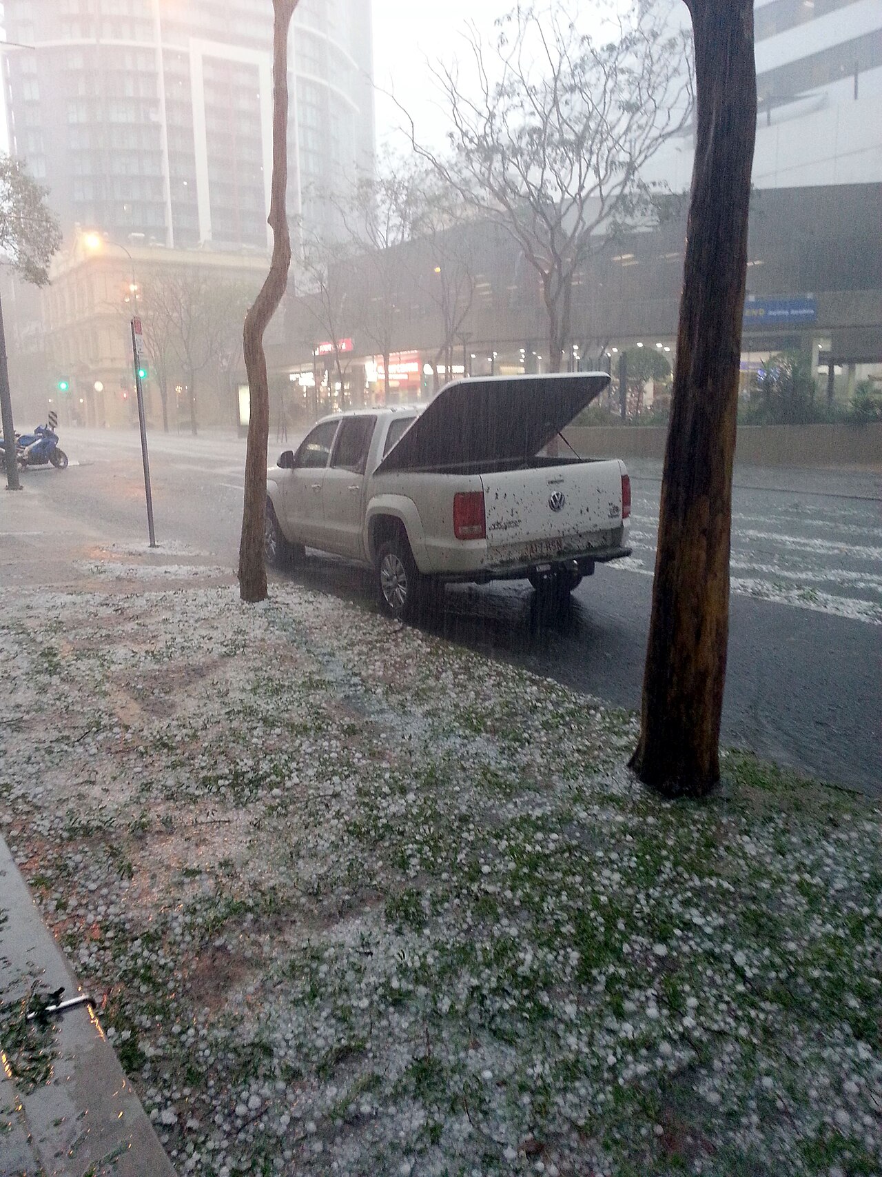
Hail along Mary Street - Hail blankets a Brisbane street and grass, showcasing the widespread damage and insurance impact of the 2014 hailstorm. By Craig Franklin - Own work, CC BY-SA 3.0, https://commons.wikimedia.org/w/index.php?curid=37036918
The 2014 Brisbane Hailstorm vs 1985 Gap Storm: A Comparative Analysis
The 2014 Brisbane hailstorm is often compared with the 1985 Brisbane hailstorm over The Gap. Both storms produced giant hail and severe damage, but the 2014 event hit a larger urban footprint, including Brisbane CBD, so the insurance bill was much higher.
That difference matters. A storm over a denser city damages more cars, roofs, glass and commercial property in a shorter time. In 2014, that spread of exposure helped drive the record level of natural disaster insurance claims.
Storm event | Peak wind gust | Maximum hail size | Main impact area |
|---|---|---|---|
The Gap storm, 1985 | 184 km/h | 6 to 7 cm | North-western Brisbane suburbs |
2014 Brisbane hailstorm | 141 km/h at Archerfield Airport | Up to 8 cm | Southern suburbs and Brisbane CBD |
Typical spring storm mechanics in Australia
Spring is a busy time for severe weather in Australia. Warm ground temperatures, lingering upper-level cold air and strong wind shear can all help thunderstorms become organised. When that happens, a normal storm can grow into a supercell storm with a rotating updraft and a longer life cycle.
That is why BOM forecasters watch for hail, damaging winds and short-lived flash flooding in storm-prone areas. If a severe weather warning is issued, people in the warning area should move vehicles under cover and stay away from windows.
Meteorological breakdown of the 2014 Brisbane hailstorm
The Bureau of Meteorology warned of severe thunderstorms before the storm moved over Brisbane. The storm environment was primed for large hail and destructive winds, which is why the cell became so damaging once it formed.
Atmospheric sounding from Brisbane Airport on 27 November 2014
An atmospheric sounding from Brisbane Airport showed a strong setup for thunderstorm growth. Warm, moist air near the surface sat below much colder air aloft, which gave storms the energy they needed to rise quickly. Once the cap broke, the storm updraft strengthened and hail could grow inside the cloud.
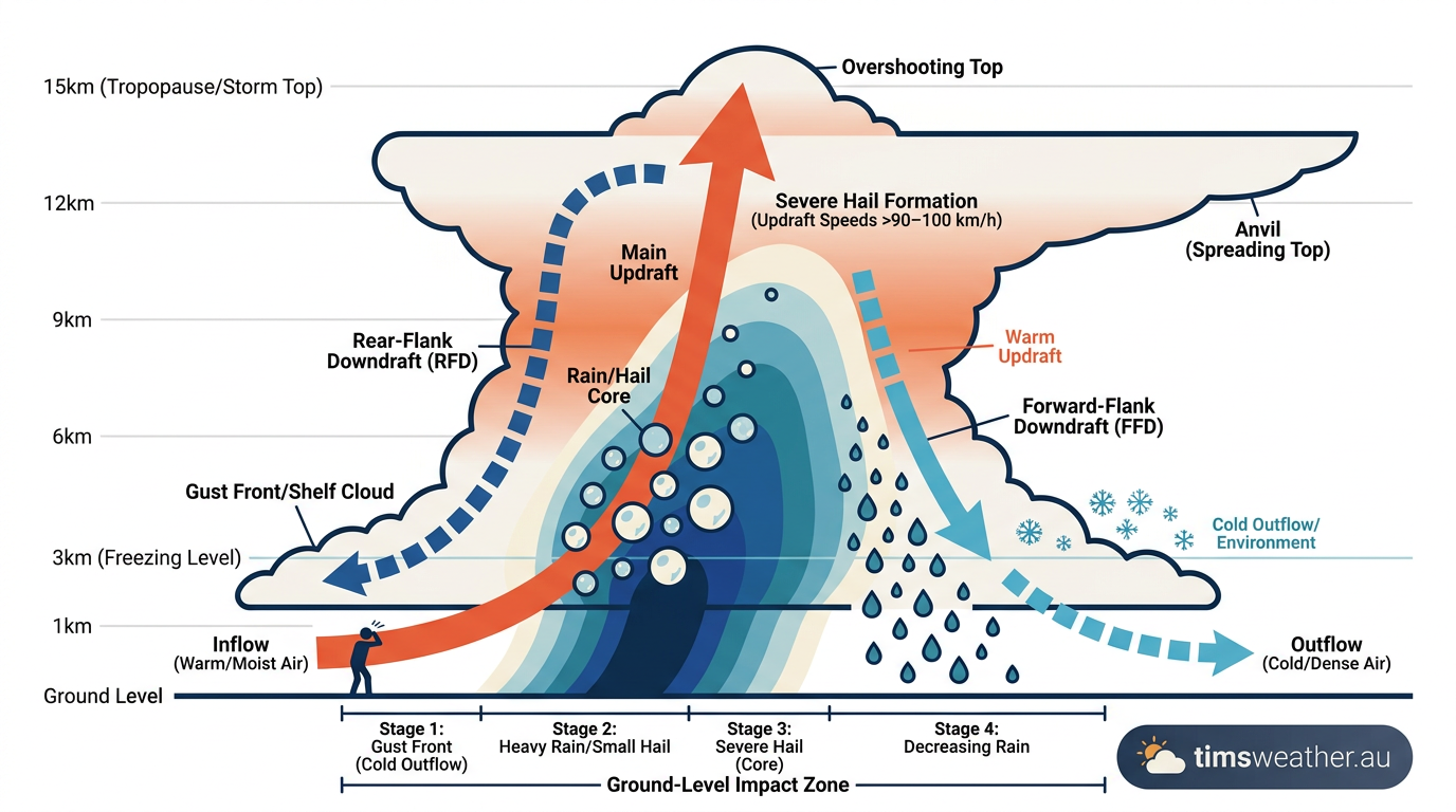
Diagram showing the internal structure of a supercell storm and how it can suspend giant hail.
In plain terms, the storm had enough fuel, lift and wind shear to sustain itself. That combination is what gives supercells their staying power and their damage potential.
Why the supercell split over the southern suburbs
Radar analysis showed the storm split into two cells. The right-moving cell became the dominant storm and tracked towards the more densely populated suburbs. In the southern hemisphere, that side of a split storm often encounters stronger support from the surrounding wind field, which can help it intensify.
That is one reason the worst damage fell across the southern suburbs and inner city rather than staying over one small area. The storm kept feeding on warm, moist air as it moved across Brisbane.
The role of wind shear and instability
Wind shear is the change in wind speed or direction with height. On 27 November, the atmosphere over Brisbane had enough shear for thunderstorms to organise into a long-lived storm system. That allowed the updraft to stay strong while hail formed and fell through the cloud.
Strong shear does not guarantee a severe storm, but it raises the risk. When shear lines up with heat and moisture, giant hail and destructive winds become much more likely.
Damage, insurance and response
The 2014 Brisbane hailstorm caused major property damage across Brisbane and nearby parts of South East Queensland. Reports described smashed windscreens, broken windows, damaged roofs, fallen trees and power cuts affecting tens of thousands of homes and businesses.
Insurance claims and cost of damage
The Insurance Council of Australia tracked the event as a major insurance disaster. Early estimates were much lower, but later assessments put the insured loss at more than $1 billion. A research report on the storm placed the total damage at more than $1.3 billion AUD.
Hail damage made up much of the bill. Vehicles were hit hard, and many homes also needed roof and external repairs. This is a good example of how giant hail can drive natural disaster insurance claims far beyond the first damage estimate.
Why Brisbane CBD was hit so hard
Brisbane CBD and the surrounding inner suburbs have a high concentration of glass, vehicles and commercial buildings. When a hail core passes over that kind of area, losses rise quickly. That is what happened in 2014, especially where large hail and strong winds arrived together.
For residents and businesses, the practical lessons were clear. Protect vehicles early, secure loose outdoor items and keep up with BOM warnings when severe storms are likely.
Related guides
Frequently asked questions
A powerful supercell thunderstorm caused this event, characterised by intense updrafts that allowed giant hail to form. These storms also brought destructive winds and heavy rainfall to South East Queensland, leading to significant structural damage across the city and surrounding suburban areas during the peak of the afternoon.
Source: en.wikipedia.org
Planning weeks ahead?
Check Australia's long-range seasonal outlook for rainfall, temperature and the climate drivers (ENSO, IOD, SAM, MJO) shaping the next three months.
View Australia's Seasonal Weather Forecast