
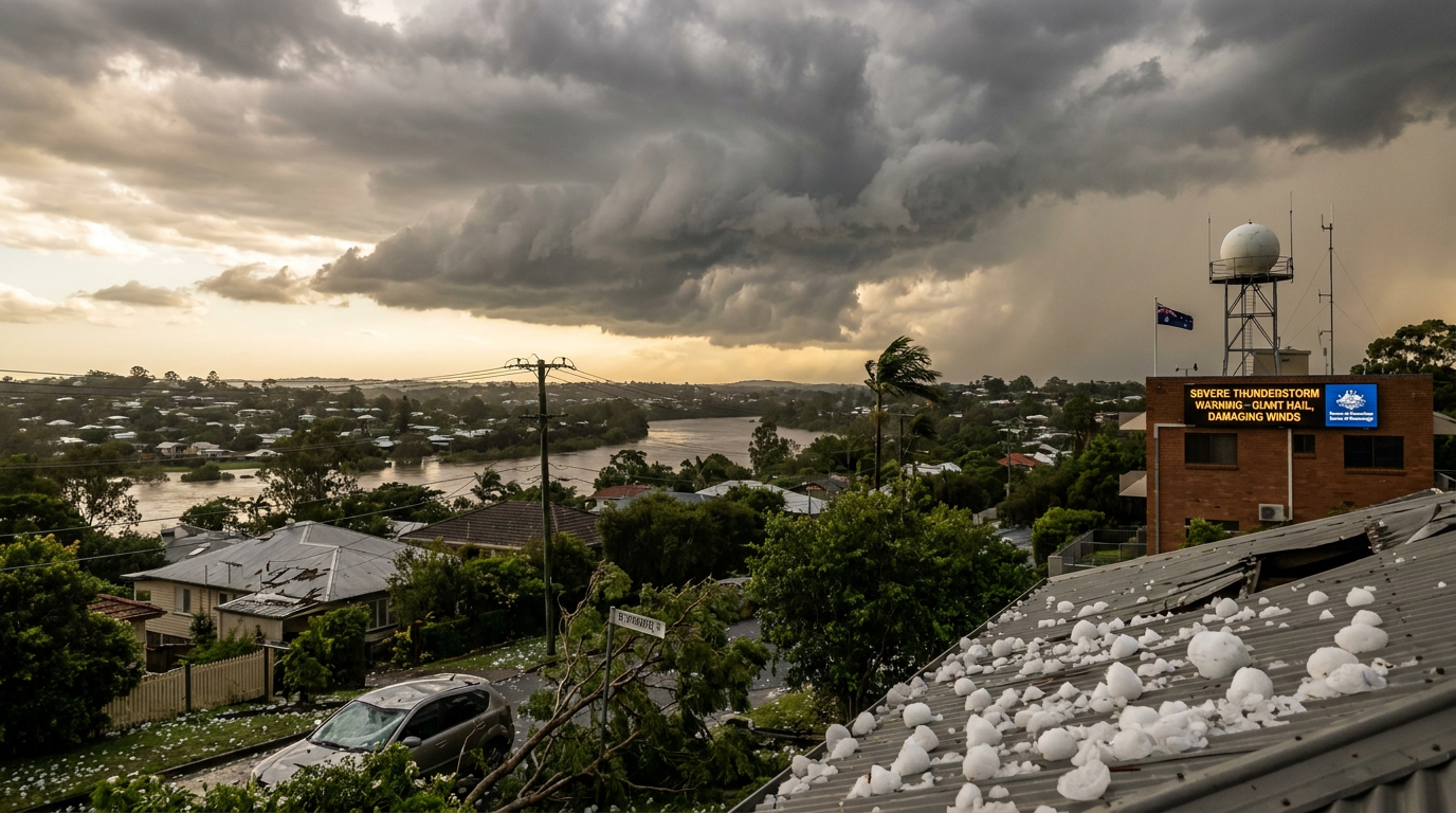
The November 2020 South East Queensland severe weather event brought giant hail up to 14 centimetres in diameter at Springfield, along with damaging winds and flash flooding. According to knowledge.aidr.org.au, insurance claims from the 31 October 2020 outbreak totalled about $980 million.
Key takeaways
- Hail reached up to 14 centimetres in diameter during the Halloween outbreak, with Springfield among the hardest hit areas.
- Wind gusts exceeded 100 km/h in parts of South East Queensland, adding to roof, tree and powerline damage.
- The Bureau of Meteorology issued multiple severe thunderstorm warnings as supercell thunderstorms developed in a highly unstable air mass.
- Heavy rainfall and flash flooding affected suburbs in Ipswich and Logan after repeated convective cells moved over the same areas.
- The State Emergency Service reported 1,898 incidents on Saturday, with 1,352 from the Ipswich area, rather than receiving thousands of calls for help.
What caused the November 2020 South East Queensland severe weather?
The outbreak formed when late-spring heat, deep low-level moisture, strong vertical wind shear and an upper-level cold pool aligned over Queensland. That mix made the atmosphere very unstable and helped thunderstorms grow quickly on 31 October 2020. As the air aloft cooled, warmer surface air rose more freely, which steepened the lapse rate and boosted thunderstorm development.
A low-pressure trough over the state helped focus the storms. The trough provided lift, and once the cap weakened, cloud growth accelerated. The Bureau of Meteorology also used severe weather outlook QLD updates during the high-risk season to flag days with a higher storm risk.
Synoptic drivers of the late-spring convective peak
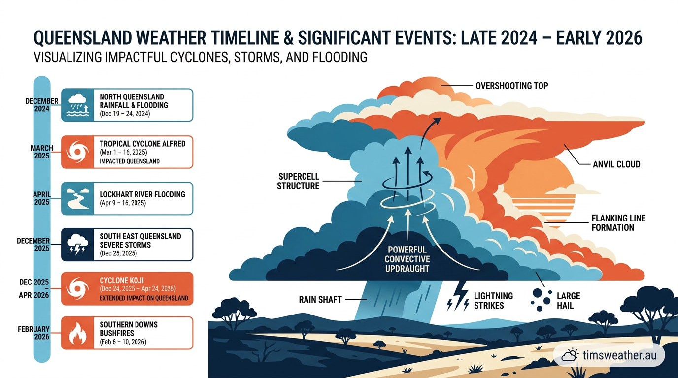
Two ingredients mattered most on the day: Convective Available Potential Energy, or CAPE, and vertical wind shear. CAPE measures how much buoyancy is available for rising air. Vertical wind shear is the change in wind speed and direction with height. When both are strong, thunderstorms can organise into long-lived supercells, which are the main producers of giant hail and damaging winds.
Shear also helps keep a storm alive. It tilts the updraught away from the downdraught, so rain and hail do not choke off the inflow as quickly. That is one reason the most intense storms can hold together for hours as they move across inland and coastal parts of South East Queensland.
The role of the 2020-21 La Niña cycle in spring storm activity
The broader climate pattern also helped. The 2020–21 La Niña phase brought more moisture into eastern Australia overall, but atypically, areas of south-east to central coast Queensland experienced below average rainfall during the period when November 2020 severe weather events occurred. Warmer ocean water near the Coral Sea lifted evaporation, and easterly winds carried that moisture inland.
When that moist air met drier air over the interior and was forced up over the Great Dividing Range, thunderstorms became more intense. That gave the storms a larger reservoir of moisture to work with, which supported heavy rainfall and flash flooding.
How supercell thunderstorms produce giant hail in Australian skies
Supercell thunderstorms can produce very large hail because their updraughts are strong and persistent. Inside the storm, small water droplets are lifted above the freezing level, where they freeze and gather more layers as they collide with supercooled droplets. The hailstones grow each time they are carried back through colder parts of the cloud.
Eventually, the hailstones become too heavy for the updraught to hold. During the November 2020 South East Queensland severe weather event, that process produced very large hail that fell across suburbs in Brisbane's western corridor and Ipswich.
How big was the hail in Springfield in 2020?
The hail that fell over Springfield and nearby areas reached up to 14 centimetres in diameter, according to knowledge.aidr.org.au. That is roughly the size of a large grapefruit. Hail that size can smash roof tiles, break windows and damage vehicles in minutes.
Meteorologists call hail larger than 5 centimetres giant hail. Springfield was under one of the strongest parts of the storm, and the Bureau of Meteorology issued severe thunderstorm warnings as the cells tracked across the region. Those warnings highlighted the risk of destructive hail, damaging winds and heavy rainfall.
What damage did the storms cause across South East Queensland?
The damage was widespread. Hail shattered windows, stripped roofs and damaged cars across suburbs including Springfield, Amberley and Gatton. Strong winds brought down trees and powerlines, while intense rainfall caused local flash flooding and transport delays. The State Emergency Service responded to a large number of calls for help as residents dealt with debris, leaks and blocked roads.
The storms also triggered power outages across affected suburbs. In many cases, hail and wind hit the same properties within minutes, which made the damage harder to contain and repair.
What the weather setup means for future severe storm days
These storms show how quickly South East Queensland can move from hot, humid weather to severe convection. When a trough, strong upper-level cooling and vertical wind shear line up, thunderstorms can become dangerous very fast. If you live in Brisbane, Ipswich, Springfield, Gatton or along the coastal fringe, keep an eye on Bureau of Meteorology weather warnings through the spring and summer storm season.
Fast-moving supercells are hard to catch once they form. The best protection is to know the warning signs, secure loose items and move cars under cover before storms arrive.
Related guides
Frequently asked questions
A highly unstable atmospheric profile combined with surface troughs and strong convective activity drove the outbreak. These conditions facilitated the development of powerful supercell thunderstorms across inland and coastal regions, which produced the most intense impacts including giant hail and destructive wind gusts throughout the South East Queensland area.
Source: data.gov.au
Planning weeks ahead?
Check Australia's long-range seasonal outlook for rainfall, temperature and the climate drivers (ENSO, IOD, SAM, MJO) shaping the next three months.
View Australia's Seasonal Weather Forecast