
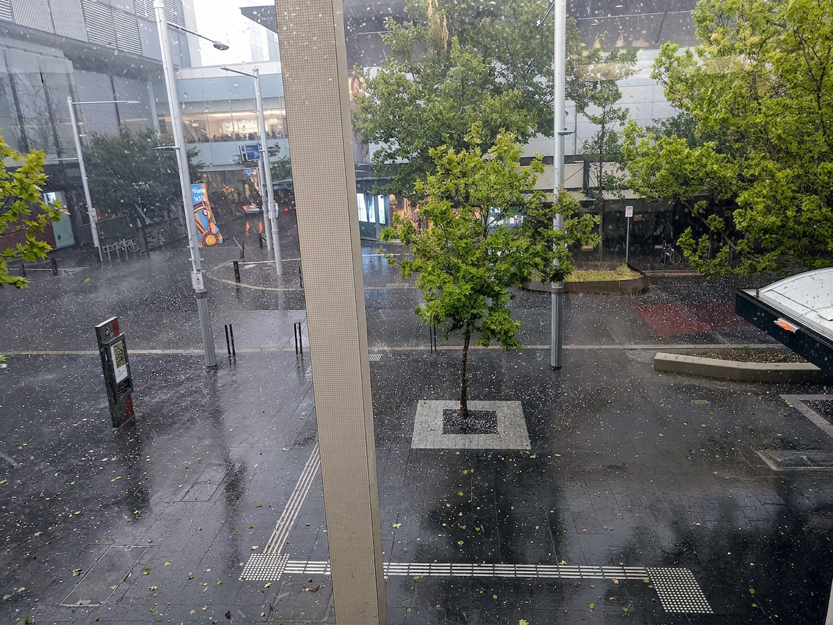
The 2020 Canberra hailstorm was a severe supercell thunderstorm that struck the Australian Capital Territory on 20 January 2020. It produced golf ball sized hail, damaging wind gusts and major damage to vehicles and buildings across Canberra.
Key takeaways
- More than 1,900 requests for assistance were received by ACT emergency services following the intense weather event.
- Damaging wind gusts of more than 116 km/h were recorded at Canberra Airport.
- The Bureau of Meteorology tracked the storm with radar and issued a severe thunderstorm warning for large hail and destructive winds.
- Damage was reported at the Australian National University, Old Parliament House, the Australian Academy of Science and the National Botanical Gardens.
- The Insurance Council of Australia classified the January 2020 Canberra hailstorm as CAT202, with approximately 87,500 insurance claims and insured losses of approximately AUD 805 million.
The 2020 Canberra hailstorm: A meteorological timeline
January is one of the peak months for large hailstorms in Australia, and 20 January 2020 was a sharp example of that pattern. The Bureau of Meteorology identified severe thunderstorm conditions over Canberra as the atmosphere became unstable, with warm surface air helping to fuel strong updrafts in the storm.
The Bureau of Meteorology tracked the storm on radar as it developed west of the city. A severe thunderstorm warning was issued for large hail and destructive winds, which is the key warning to watch for when a storm has the potential to cause serious damage.
What time did the Canberra hailstorm start on 20 January 2020?
The storm struck Canberra at lunchtime on January 20, 2020, with the Bureau of Meteorology issuing warnings for the event to hit around 12:30 pm, not before. By around 2:00 pm, the Canberra hailstorm had already ended, as it lasted only about 10 minutes and hit at lunchtime (around 12:30–12:40 pm), with temperatures near 16.3°C recorded at 3:30 pm under NNW winds, not strong westerly winds. The fast change in sky conditions and temperature was a clear sign that the storm's downdraft had arrived.
Belconnen was among the first major districts to report large hail. The storm then moved across Lake Burley Griffin and through the parliamentary area, leaving little time for people to protect cars, windows and outdoor items.
Atmospheric soundings and typical supercell profiles
Radar and atmospheric soundings from the day showed an unstable profile that suited severe thunderstorm development. A supercell thunderstorm is different from an ordinary summer storm because it contains a rotating updraft, called a mesocyclone, which helps the storm persist longer and produce larger hail.
That storm structure also helps explain the damaging wind gusts. Canberra Airport recorded gusts of more than 116 km/h during the event, which added to the vehicle damage and roof damage caused by the hail.
Smoke haze and hail growth
The January 2020 storm occurred during the Black Summer bushfires, so smoke haze was already affecting parts of eastern Australia. That smoke added extra particles to the air, which can change how cloud droplets form and grow inside a storm.
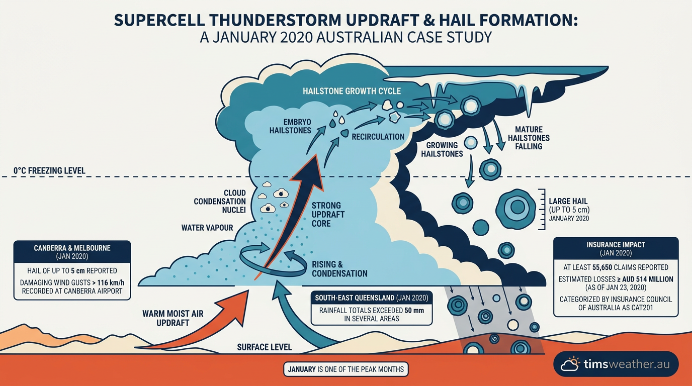
Scientists have discussed how these particles can affect hail development, but the Canberra event was still driven mainly by a powerful storm updraft. The hailstones kept cycling through the cloud, collecting supercooled water and growing larger before they fell to the ground.
This was not a fire-driven thunderstorm. It was a severe weather system that formed in a storm front and passed through the ACT while smoke remained in the atmosphere. For practical guidance on warnings, see the Weather Warnings guide.
How big was the hail in Canberra in January 2020?
How big was the hail in Canberra in January 2020?
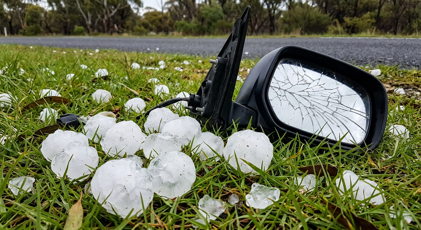
The 2020 Canberra hailstorm produced golf ball sized hail, with some stones up to 5 cm in diameter. Reports also described hail of 4 to 5 cm in Canberra, which is large enough to smash windows, dent vehicles and damage roofs.
The Bureau of Meteorology treats hail of this size as severe hail, and the storm met that threshold clearly. The damage was concentrated across Canberra and parts of the wider southern and eastern storm outbreak.
The Dendritic Growth Factor: Why Canberra's Hail was Unusually Dense
Size was only part of the problem. The Canberra hailstones were also dense enough to cause heavy impact damage, which made them especially destructive to cars and buildings.
Hailstones grow in layers as they move through different parts of a storm cloud. In this event, the strong updraft likely kept the hailstones in the cloud long enough for repeated growth, which helped form hard, compact ice that struck with greater force than softer hail.
Impact on Canberra's research institutions and public buildings
The storm caused widespread damage across the ACT, including major sites in central Canberra. Reports identified impacts at the Australian National University, Old Parliament House, the Australian Academy of Science and the National Botanical Gardens.
CSIRO facilities were also damaged, along with many homes and businesses. The storm hit vehicles especially hard, with large numbers of shattered windscreens, dented panels and broken lights across the city.
ACT emergency services, including the ACT State Emergency Service, responded to a very large number of calls for help. Official reporting and media coverage said the Emergency Services Agency received more than 1,900 requests for assistance, with two minor injuries reported and more than 1,000 homes losing power.
How costly was the 2020 Canberra hailstorm?
The storm was one of the most expensive hail events in Australia in 2020. The Insurance Council of Australia classified it as CAT201, and by 23 January 2020 there were at least 55,650 insurance claims with insured losses of at least AUD 514 million.
Much of that cost came from vehicular damage and building repairs. Cars, roofs, windows and outdoor equipment all took a beating as the hail and strong winds moved across Canberra.
| Measure | Value |
|---|---|
| Hail size reported in Canberra | Up to 5 cm |
| Wind gust at Canberra Airport | More than 116 km/h |
| Insurance claims | At least 55,650 |
| Insured losses | At least AUD 514 million |
| Insurance Council event class | CAT201 |
What Canberra residents can learn from the storm
The main lesson from the 2020 Canberra hailstorm is simple: a severe thunderstorm warning is not just background noise. If you are in the path of a storm with large hail and destructive winds, move vehicles under cover, bring pets inside and stay away from windows.
For Canberra, the storm showed how quickly a supercell can intensify and how much damage golf ball sized hail can cause in only a short time. A fast response to warnings can reduce the risk of injury and cut down the cost of repairs.
Related guides
Frequently asked questions
A severe supercell thunderstorm moved across the Australian Capital Territory, producing very large hail, damaging winds and intense rainfall. The Bureau of Meteorology identified the system as a dangerous rotating storm capable of rapid impacts. It tracked directly over urban areas, leading to significant property damage within a short period.
Source: bom.gov.au
Planning weeks ahead?
Check Australia's long-range seasonal outlook for rainfall, temperature and the climate drivers (ENSO, IOD, SAM, MJO) shaping the next three months.
View Australia's Seasonal Weather Forecast