
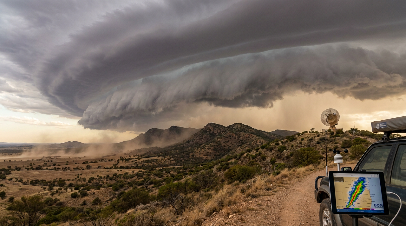
Squall line formation occurs when a series of individual storm cells align along a common boundary, typically triggered by a cold front or dryline. In Australia and globally, these linear systems develop as a gust front pushes cool air forward, lifting warm, moist air to sustain continuous convective growth.
Key takeaways
- Squall lines are elongated bands of active thunderstorms that can stretch for hundreds of kilometres across a region.
- They rely on a precise balance between vertical wind shear and rain-cooled outflow air to maintain their structure over several hours.
- The leading edge frequently produces severe wind gusts, visually marked by a low-hanging, wedge-shaped shelf cloud.
- Meteorologists use radar to track hazardous features within the line, such as bowing segments that indicate destructive straight-line winds.
- These organized systems present a major hazard to aviation due to sudden wind shifts, intense turbulence, and heavy rainfall.
The mechanics of squall line formation
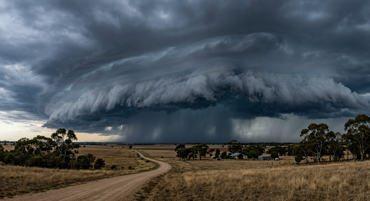
While isolated single-cell thunderstorms often collapse within an hour as their rain-cooled downdrafts choke off their supply of warm air, linear storms survive by working collectively. The life cycle of a linear thunderstorm begins with a broad lifting mechanism. When a synoptic-scale boundary pushes into an environment with high Convective Available Potential Energy (CAPE) and abundant low-level moisture, multiple storm cells erupt simultaneously. As these individual cells grow, their downdrafts merge at the surface, creating a unified wall of cold air that advances rapidly.
Because the atmosphere behaves fluidly, this advancing cold air acts like a physical wedge. It forces the less dense, warm air ahead of the system upward, initiating new convective updrafts. To understand how do thunderstorms form within these linear structures, meteorologists analyze the vertical temperature profile. When the atmosphere is highly unstable, the forced lifting at the gust front easily breaches the capping inversion, allowing deep convection to flourish. Observations show that under the right atmospheric conditions, a squall line can develop 100 to 300 kilometres ahead of an actual cold front (www.ecoflow.com), riding on pre-frontal troughs or earlier outflow boundaries.
The role of atmospheric instability and moisture
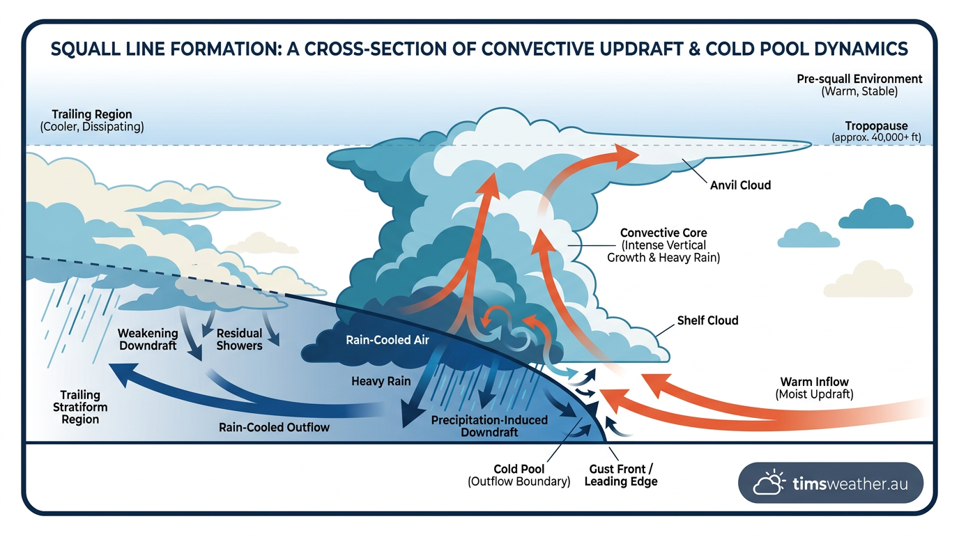
A sustained lifting mechanism is not enough on its own; the atmosphere must also hold sufficient moisture. Ahead of the storm line, low-level winds transport warm, humid air into the region. Global meteorological agencies like the World Meteorological Organization (WMO) and the Bureau of Meteorology (BOM) track these moisture influxes using satellite imagery and weather balloons. When this humid air is lifted, the water vapour condenses, releasing immense latent heat. This heat release acts as the engine for the storm, accelerating the updrafts and pulling more air into the system from below.
How do squall lines form?
Squall line formation happens when warm, moist air is forced upward along a linear lifting boundary, typically ahead of a cold front or an outflow boundary. Strong vertical wind shear then organises these individual thunderstorms into a fast-moving, continuous line rather than allowing them to remain as isolated, scattered storm cells. The merging downdrafts from these storms create a continuous gust front that constantly lifts new air, perpetuating the cycle.
How long does a squall line typically last?
A squall line typically lasts for several hours, and in optimal environments, can persist for an entire day or night. Because the system is self-sustaining (using its own cold outflow to lift fresh warm air into the updraft), it will continue to move across the sector until it encounters an environment with stable, dry air, or until the wind shear keeping the cold pool in check begins to weaken.
Wind shear, cold pools and the RKW theory
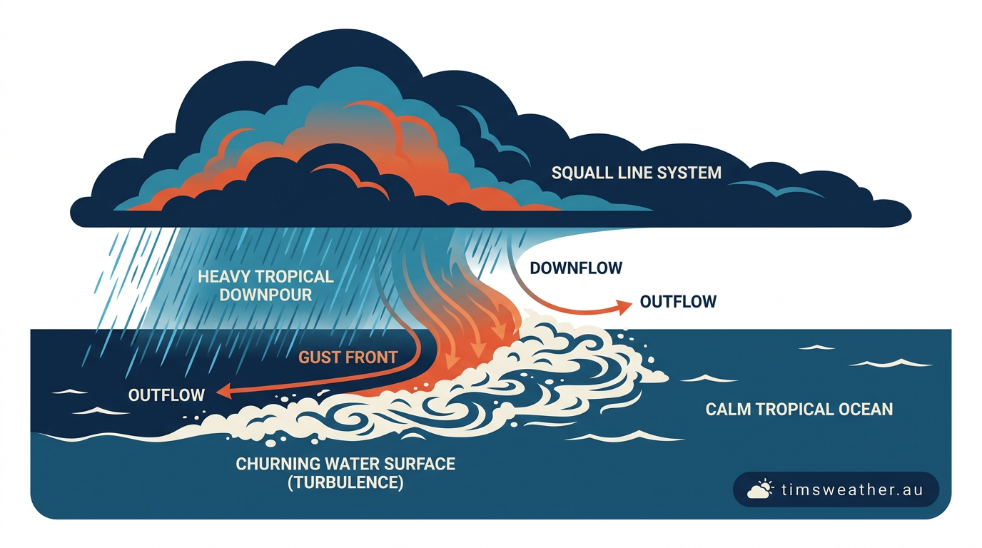
To understand how thunderstorms moving in a long line persist for so long, meteorologists look to the interaction between the storm's cold pool and the surrounding wind environment. When rain and hail fall through the storm, they cool the surrounding air through evaporation and melting. This cold, dense air sinks and spreads out along the ground as an outflow boundary. If the surrounding atmosphere has little wind shear, this cold pool quickly rushes out ahead of the storm, cutting off the warm air and killing the system.
This dynamic is explained by the RKW theory, named after meteorologists Rotunno, Klemp, and Weisman. The theory states that long-lived multicell thunderstorm formation requires a state of balance between the cold pool's outward push and the low-level vertical wind shear blowing against it. When the low-level wind shear perfectly counters the advancing cold pool, the lifting of warm air remains vertical and deep, rather than being pushed backward over the cold pool at a shallow angle. This vertical lift allows powerful updrafts to continually feed the storm line.
Quasi-linear convective systems (QLCS)
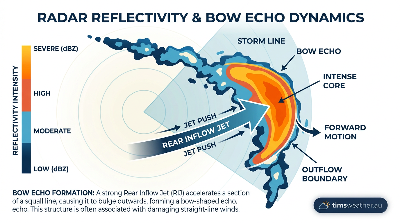
In global forecasting and severe weather research, these highly organised systems are formally classified as a quasi-linear convective system or QLCS (www.facebook.com). A QLCS can encompass a range of linear storm modes, from trailing stratiform lines to massive bow echoes that dominate regional weather maps for hours. When evaluating mesoscale convective systems, numerical weather prediction models map the low-level wind shear vectors to forecast exactly where and when a scattered cluster of storms will organize into a solid QLCS boundary.
Structural anatomy and radar signatures
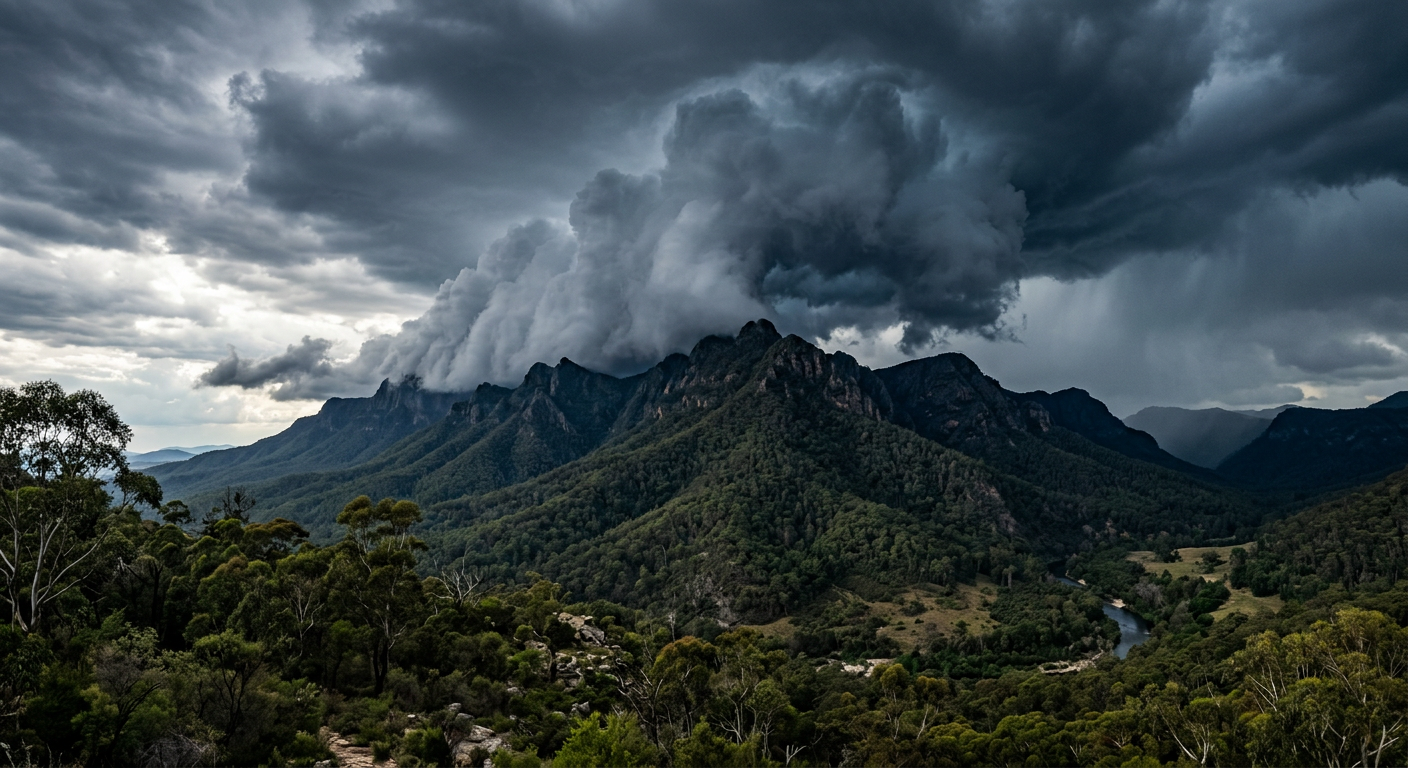
A mature squall line features distinct structural zones. The leading edge contains the active convective updrafts, frequent lightning, and heavy rain, while a broad area of lighter, stratiform precipitation trails behind. This stratiform region is not just passive rainfall; it plays an active role in generating the pressure perturbations that drive the storm's internal wind field.
Pressure perturbations: Wake lows and mesohighs
Beneath the heaviest rain at the leading edge, evaporative cooling creates a zone of high pressure known as a mesohigh. Conversely, at the rear of the trailing stratiform rain area, sinking air warms adiabatically, creating a localized area of low pressure called a wake low. The pressure gradient between the mesohigh and the wake low can be intense. This difference drives strong, gusty winds that sometimes persist for hours after the main thunderstorm has passed, posing secondary hazards to communities already recovering from the initial impact.
Identifying shelf clouds vs wall clouds in linear systems
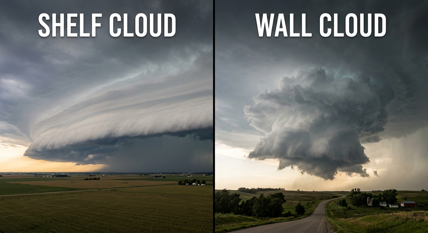
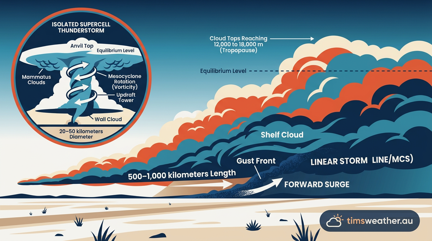
For ground observers, the most striking visual feature of an approaching squall line is the shelf cloud. This low, horizontal wedge forms directly over the gust front as warm, moist air is lifted and condenses. While often intimidating, a shelf cloud indicates straight-line wind danger rather than tornadoes. In contrast, wall clouds form under the isolated, rotating updraft base of discrete supercells. Recognising this difference helps observers distinguish between linear wind threats and tornadic storms.
Radar signatures: Recognizing bow echoes and LEWPs
When monitoring how to track squall lines on radar, meteorologists watch for specific shapes that indicate wind severity. A uniform, straight line of high reflectivity generally produces steady, strong gusts. However, if a segment of the line begins to bulge forward rapidly, it forms a Bow Echo. This bowing indicates the presence of a Rear Inflow Jet (RIJ), which is a channel of mid-level dry air that plunges down into the back of the storm, accelerates, and slams into the ground behind the convective line, causing severe straight-line winds (www.wbko.com).
When multiple bowing segments form along a squall line, the radar signature is called a line echo wave pattern (LEWP). In the Northern Territory and other tropical zones, monitoring for these signatures is standard practice during the wet season, as the associated wind surges can cause extensive damage to remote infrastructure.
Global environments and topographic triggers
While squall lines occur globally across the mid-latitudes and tropics, local geography dictates exactly how and when they form. Topography and regional air masses create unique lifting mechanisms that can initiate rapid line development.
What triggers a squall line in Australia?
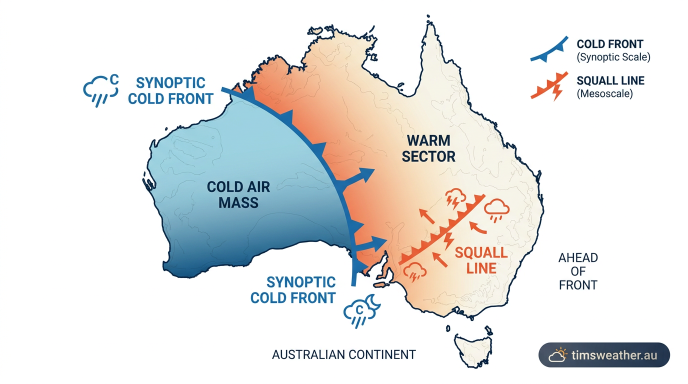
In Australia, a squall line is usually triggered by strong synoptic cold fronts moving across the southern states, or by drylines and pre-frontal troughs drawing heat and moisture from the interior. As these boundaries push into high-humidity environments, they forcefully lift the warm air. When combined with strong upper-level winds from the Jet Stream, this forced lifting rapidly organizes scattered storms into a continuous linear front.
The impact of the Great Dividing Range on convective lifting
In eastern Australia, the Great Dividing Range acts as a formidable mechanical barrier. As hot, moist air moves inland from the Coral and Tasman Seas, it is forced upward by the rising terrain. When a cold front approaches from the Southern Ocean, the pre-frontal air is squeezed and lifted over the mountains, providing the topographic lift needed to break the capping inversion. This orographic forcing regularly initiates severe convection that organizes into linear structures as it moves toward the densely populated coastline.
Tropical squall lines and the Australian monsoon
The mechanics differ significantly in the tropics. Near the Intertropical Convergence Zone (ITCZ) and across the Australian monsoon trough, squall lines are driven heavily by extreme humidity and weak low-level wind profiles rather than strong synoptic cold fronts. Research into tropical environments (rmets.onlinelibrary.wiley.com) highlights that these systems can span hundreds of kilometres and often propagate westward, driven by easterly mid-level jets and cold pools generated from massive, water-loaded downdrafts.
In the Gulf of Carpentaria, convective interactions frequently involve the 'Morning Glory', a massive roll cloud generated by intersecting sea breezes. When tropical convective systems interact with this solitary wave, the sudden increase in low-level lift can cause explosive new storm development along the existing boundary.
The role of Australian low-level jets in line propagation
Low-level jets (bands of fast-moving air in the lower atmosphere) play a major role in feeding energy into linear storms. During the warmer months, strong northerly low-level jets drag significant moisture southwards across the continent. When a squall line intersects this jet, the continuous supply of warm, humid air fuels the storm's updrafts, allowing the system to maintain its intensity long after the sun has set and daytime surface heating has vanished.
Classifications and storm comparisons
Not all long-lasting thunderstorms fall into the same category. How a Mesoscale Convective System (MCS) organizes helps meteorologists issue accurate warnings. How these classifications is essential when assessing the damage potential of an approaching weather system.
Differences between squall lines and cold frontal boundaries
A common public question involves squall line vs cold front differences. A cold front is a broad, synoptic-scale boundary separating two distinct air masses, often stretching for thousands of kilometres across an ocean basin or continent. By contrast, a squall line is a mesoscale feature, a much smaller, concentrated band of active weather that often forms in the warm sector ahead of the actual cold front. While the cold front permanently alters the regional temperature profile, the squall line brings intense, short-lived severe weather followed by temporary rain-cooled air.
If a squall line produces a continuous swath of severe wind damage over a distance of at least 650 kilometres, with gusts of at least 93 km/h along most of its length, it may be formally classified as a derecho. These extreme wind events are driven by a persistent, intense bow echo and rely heavily on high-speed low-level jets feeding the system from the front.
Danger of squall lines for aviation
For aviation operations, these systems present some of the most dangerous flying conditions possible. Aviation authorities warn that a mature system can create a near-impenetrable wall of convection (skybrary.aero) spanning vast distances. Aircraft attempting to work through near these lines face severe icing, microbursts, downbursts, and extreme wind shear. The sudden, violent shifts in wind direction along the gust front can cause aircraft to rapidly lose lift on final approach, making airport operations highly dangerous until the line passes.
Squall line vs supercell characteristics
Supercells and squall lines present different atmospheric threats. While supercell thunderstorms are discrete, rotating entities known for giant hail and strong tornadoes, squall lines are elongated systems primarily known for widespread straight-line wind damage. Because these lines can extend for hundreds of kilometres (www.washingtonpost.com), their impacts are felt over a much larger geographic area than a single discrete supercell.
| Feature | Squall Line (Linear) | Supercell (Discrete) |
|---|---|---|
| Primary Threat | Widespread straight-line winds and heavy rain. | Giant hail, strong tornadoes, destructive local winds. |
| Updraft Structure | Broad, continuous lifting along the leading gust front. | Intense, isolated, and continuously rotating (mesocyclone). |
| Radar Appearance | Long, continuous or broken line (often with bow echoes). | Distinct, separate cell (often featuring a hook echo). |
| Visual Indicators | Massive, wedge-shaped shelf clouds advancing rapidly. | Lowered wall clouds with visible rotation beneath the base. |
Frequently asked questions
Squall lines form when warm, moist air is forced upward along a linear lifting boundary, typically ahead of a cold front or an outflow boundary. Strong wind shear then organises these individual thunderstorms into a fast-moving, continuous line rather than allowing them to remain as isolated, scattered storm cells.
Source: scienceinsights.org
Further reading and resources
Explore trusted articles, books, videos and other resources to go deeper on this topic.
eos.orgArticle
The Microphysics of Squall Lines - Eos.org
In-depth coverage on The mechanics of squall line formation: Radar signs and weather impacts from eos.org.
weather.govReference
Squall Line/Bow Echo/QLCS
Background reference on The mechanics of squall line formation: Radar signs and weather impacts from weather.gov.
pilotinstitute.comArticle
What Is a Squall Line? Pilot Weather Guide with Visuals
In-depth coverage on The mechanics of squall line formation: Radar signs and weather impacts from pilotinstitute.com.
mdpi.comArticle
Analysis of the Characteristics and Evolution Mechanisms ...
In-depth coverage on The mechanics of squall line formation: Radar signs and weather impacts from mdpi.com.
en.wikipedia.orgReference
Squall line
Background reference on The mechanics of squall line formation: Radar signs and weather impacts from en.wikipedia.org.
atmos.washington.eduReference
[PDF] Structure and dynamics of a tropical squall-line system
Background reference on The mechanics of squall line formation: Radar signs and weather impacts from atmos.washington.edu.
fyfluiddynamics.comArticle
How Squall Lines Form
In-depth coverage on The mechanics of squall line formation: Radar signs and weather impacts from fyfluiddynamics.com.
journals.ametsoc.orgArticle
Structure and Evolution of a Severe Squall Line over Oklahoma in
In-depth coverage on The mechanics of squall line formation: Radar signs and weather impacts from journals.ametsoc.org.
iowaweather.comArticle
What is a Squall Line? Formation, Shelf Clouds & Dangers ...
In-depth coverage on The mechanics of squall line formation: Radar signs and weather impacts from iowaweather.com.
a proposed mechanism of squall lines
In-depth coverage on The mechanics of squall line formation: Radar signs and weather impacts from journals.ametsoc.org.
Planning weeks ahead?
Check Australia's long-range seasonal outlook for rainfall, temperature and the climate drivers (ENSO, IOD, SAM, MJO) shaping the next three months.
View Australia's Seasonal Weather Forecast