
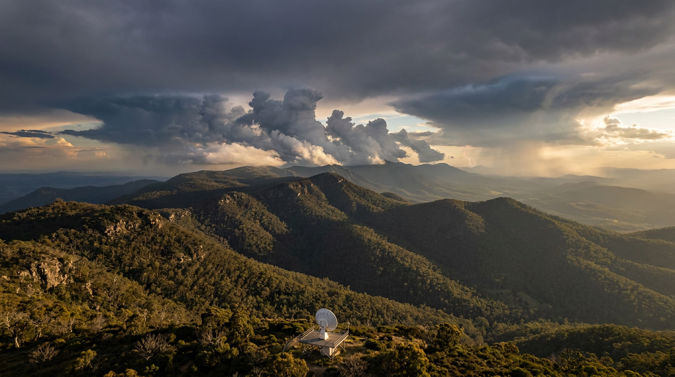
Multicell thunderstorm formation occurs when moderate vertical wind shear causes a storm's downdraft to be displaced from its updraft. This separation creates a gust front or outflow boundary that lifts warm, moist air into new convective cells, allowing the system to be self-sustaining as older cells dissipate and new ones form.
Key takeaways
Multicell clusters are regenerative systems where new convective cells replace older, dissipating ones in a continuous sequence.
Moderate vertical wind shear is the essential atmospheric ingredient that prevents the rain-cooled downdraft from choking the warm updraft.
The gust front acts as a physical lifting mechanism, triggering fresh cumulus congestus clouds along the storm's leading edge.
These systems can persist for several hours and cover large geographical areas compared to isolated single-cell storms.
Analysing storm structure on a hodograph helps meteorologists predict whether an environment will support multicell clusters, supercells, or squall lines.
The mechanics of multicell thunderstorm formation
A multicell thunderstorm is an organised cluster of individual convective cells operating at various stages of development. While an isolated pulse storm may only last for 20 to 30 minutes, a multicell cluster can remain active for many hours. This longevity occurs because the system is constantly producing new cells to replace those that have exhausted their moisture. According to the COMET Program modules on convective storm structures, this regenerative cycle relies on a continuous supply of warm, moist air being lifted mechanically at the leading edge of the storm.
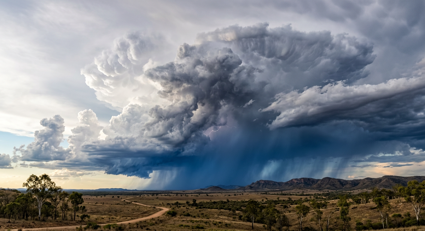
A multicell thunderstorm formation showing a cluster of clouds at various stages of the life cycle.
When atmospheric conditions are right, these storms can grow to massive proportions. Driven by intense thermal updrafts, thunderstorms can reach altitudes exceeding 20,000 meters (www.britannica.com). At these heights in the upper troposphere, the rising air hits the stable tropopause and spreads outward, forming the classic anvil cloud shape that is visible from hundreds of kilometres away.
From Cumulus Congestus to Mature Cell: A Life Cycle Timeline
The timeline begins with solar heating or an environmental trigger forcing air upwards. This rising air creates a single cumulus cloud that rapidly grows into a towering cumulus congestus formation. Spotters associated with Skywarn Australia often watch for these visual signs of a developing cumulonimbus cloud to gauge whether a storm is intensifying or weakening. As this initial cell reaches maturity and begins to produce heavy precipitation, a powerful downdraft develops alongside the updraft.
In an environment with weak winds, this dense, rain-cooled air would crash to the surface and spread out equally in all directions, rapidly undercutting and destroying the updraft. However, when moderate wind shear is present, the entire storm structure tilts. The downdraft falls diagonally, reaching the surface slightly away from the storm's warm inflow region. This structural separation bypasses the short life cycle typical of isolated cells, creating a conveyor belt where dying mature cells are constantly replaced by young, vigorous updrafts developing just ahead of them.
How outflow boundaries trigger successive convection
The driving engine of a multicell cluster is the cold pool. This is the dense mass of rain-cooled air that descends through the downdraft and strikes the surface. The volume of water involved is immense; over its entire lifecycle, the average thunderstorm produces about 2,000 metric tons of rain. As this heavy precipitation falls, some of it evaporates into the surrounding dry air. Evaporation absorbs heat, which drastically cools the descending air column. Because cold air is much denser than warm air, it accelerates downward and spreads rapidly outward upon hitting the ground.
The leading edge of this expanding cold pool is known as an outflow boundary or gust front. If you want to understand how do arcus clouds form, this boundary is the answer. It acts remarkably like a miniature cold front pushing across the local environment. As the gust front surges forward, it acts as a physical wedge. It bulldozes the warmer, more humid environmental air ahead of it, forcing that air upward until it reaches its lifting condensation level.
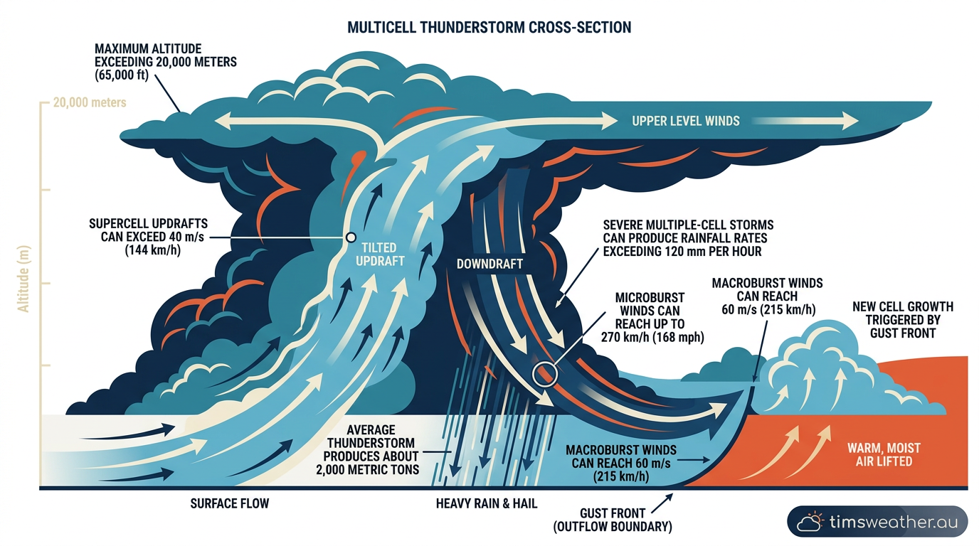
Infographic diagram of multicell thunderstorm formation showing the relationship between updrafts and the gust front.
The lifting condensation level is the specific altitude where rising air cools enough for its water vapour to condense into visible liquid droplets. When meteorologists analyse specific radar signatures from the National Weather Service, this outflow boundary often appears as a "fine line" of weak reflectivity leading the heavier precipitation cores. It is along this line that the next generation of storm cells is born.
How do multicell thunderstorms form?
Multicell thunderstorms form when a storm's downdraft and gust front force nearby warm, moist air to rise, triggering new convective cells adjacent to older ones. This chain reaction allows the cluster to continually regenerate. The presence of high moisture provides the latent heat energy, while moderate vertical wind shear ensures the downdraft does not smother the updraft, allowing the system to persist for several hours rather than dissipating quickly.
The role of vertical wind shear and atmospheric instability
Vertical wind shear, the change in wind speed or direction with increasing altitude, is the defining variable that determines thunderstorm organisation. Peer-reviewed studies from the Journal of the Atmospheric Sciences demonstrate that moderate vertical wind shear creates a "Goldilocks zone" for multicell development. Forecasters plot this shear on a hodograph, a circular graph that visualises wind vectors through the lower atmosphere. If the hodograph shows moderate, mostly straight-line wind shear, a multicell structure is highly likely.
Extreme shear environments create different outcomes. For example, highly unstable environments with strong, turning shear profiles support intense single updrafts. In these conditions, supercell storms can have updrafts exceeding 40 m/s. This extreme vertical velocity allows the storm to suspend giant hail and stretch the updraft into a rotating mesocyclone, distinct from the clustered nature of a multicell system.
Equally important is atmospheric instability, often measured as Convective Available Potential Energy (CAPE). A certified consulting meteorologist will reference thermodynamic soundings from the University of Wyoming database to calculate this available energy. High CAPE indicates a highly unstable atmosphere where warm air will accelerate upward rapidly once lifted by the gust front, feeding the continuous growth of new cells.
How does vertical wind shear affect multicell thunderstorm formation?
Vertical wind shear organises the storm by tilting the updrafts and downdrafts. This physical separation prevents falling rain and the resulting cold pool from choking off the rising warm air. Consequently, the storm remains organised, allowing new cells to develop in a sequence without being smothered by older ones. This structural tilt transforms a simple pulse storm into a persistent, moving cluster.
The Role of Low-Level Jets in Australian Multicell Longevity
In many regions, low-level jets play an active part in maintaining a storm's fuel supply. A low-level jet is a ribbon of fast-moving air in the lower atmosphere. When aligned favourably, it continuously pumps warm, moist air directly into the storm's path. In Australia, low-level jets drawing moisture from the Coral Sea or the deep tropics frequently feed developing multicell clusters, giving them the immense water vapour required to survive long treks across inland regions.
Comparing storm modes: Differentiating Multicell Clusters from Squall Lines
How the difference between storm types helps clarify severe weather risks. Single-cell storms, often called pulse storms, lack the necessary wind shear for regeneration and rarely last beyond an hour. Multicell clusters feature groups of cells moving together, but their organisation can evolve further based on the forcing mechanism and shear profile.
Storm Type | Shear Requirements | Primary Lift Mechanism | Average Duration |
|---|---|---|---|
Single-Cell | Weak / Minimal | Localised Surface Heating | 30 - 60 Minutes |
Multicell Cluster | Moderate | Gust Front / Outflow | 2 - 6 Hours |
Supercell | Strong and Turning | Mesocyclone / Rotation | 3 - 8+ Hours |
Squall Line | Moderate to Strong | Linear Front / Trough | 6 - 12+ Hours |
It is helpful to compare these types when evaluating hazards. For instance, tornadoes typically occur in supercell thunderstorms, which are the most intense type of thunderstorm. Multicell clusters are more commonly associated with widespread wind damage and flash flooding rather than strong tornadoes.
Differentiating a multicell cluster from a squall line comes down to geometry and boundaries. A multicell cluster is typically a grouped, slightly disorganised blob of varying reflectivities on radar. However, if a strong, unified boundary like a cold front is present, individual cells will align parallel to that boundary. This structure is a squall line. If you are tracking squall lines Australia frequently experiences during summer, you will notice their linear nature and unified forward-surging gust front make them a distinct, wind-driven threat.
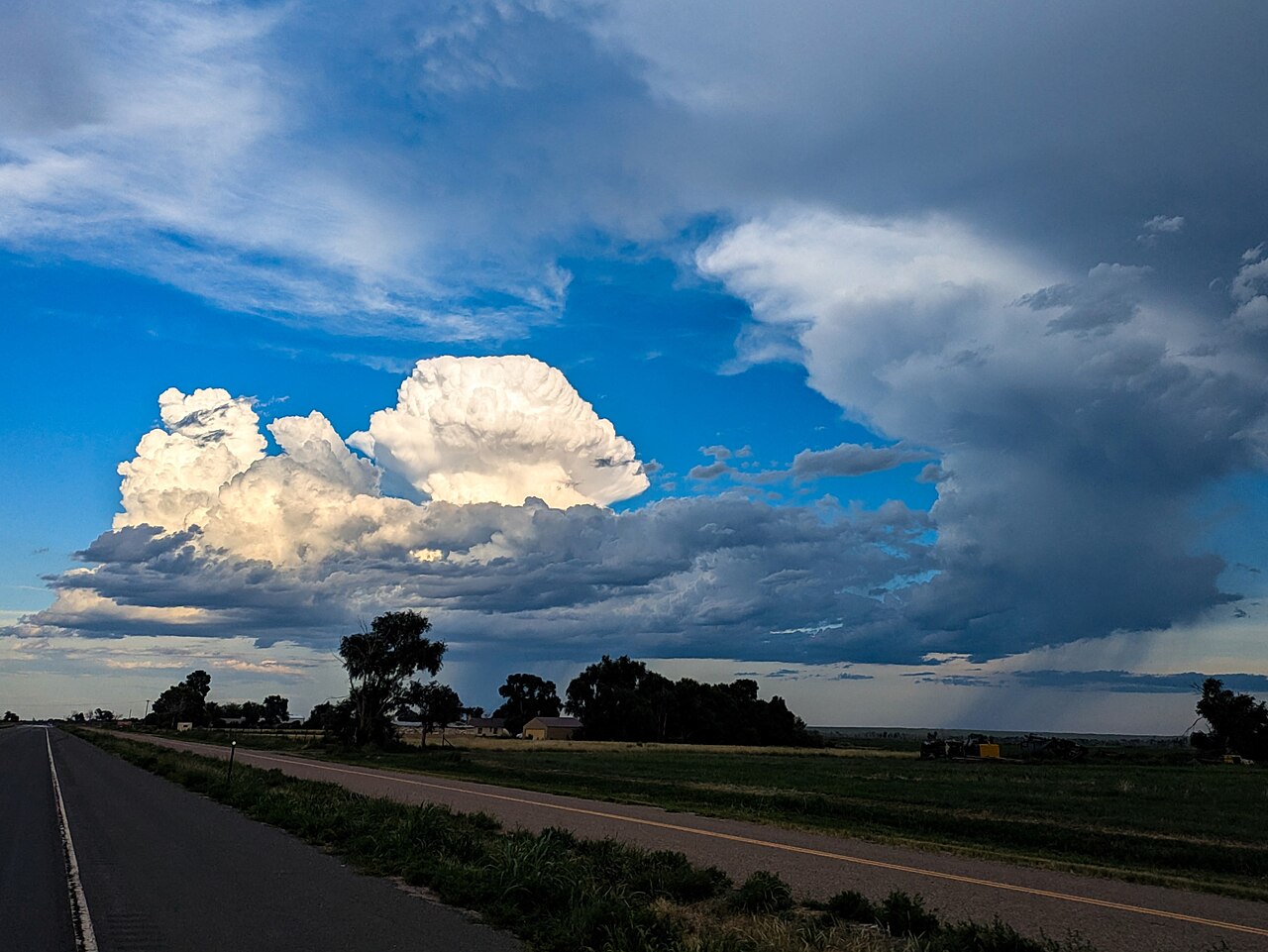
Photo of a multicellular thunderstorm. By Stefan Klein - Own work, CC BY 4.0, https://commons.wikimedia.org/w/index.php?curid=174111876
What is the difference between a single cell and a multicell thunderstorm?
A single cell storm consists of one updraft and one downdraft, which typically collapses on itself within 30 to 60 minutes because it lacks the wind shear needed to separate the two. A multicell thunderstorm is a cluster of several updrafts and downdrafts at different life stages, sustained by moderate wind shear that prevents the rain-cooled air from immediately extinguishing the warm inflow.
Atmospheric triggers: Impact of topography on multicell formation
While wind shear organises the storm, a lifting mechanism is required to start the initial convection. Topography frequently forces this lift. The impact of topography on multicell formation in the Great Dividing Range is a primary example of this process. As moist easterly winds from the Tasman Sea are forced up the eastern escarpment, the air experiences orographic lifting. This forced ascent cools the air until it hits its dew point, triggering the initial cumulus clouds that soon organise into multicell clusters as they drift inland.
Another prominent trigger in Australia is the dry line frequently observed in inland New South Wales and Queensland. This boundary separates hot, dry continental air from the west and warm, moist maritime air from the east. When these two air masses collide, the denser maritime air lifts the dry air, frequently sparking convection. Similarly, sea breeze convergence zones in South East Queensland routinely trigger intense multicell storms when the inland-pushing marine air collides with the hot terrestrial airmass.
What causes a thunderstorm to become a multicell cluster?
A thunderstorm becomes a multicell cluster when the environment provides moderate instability and sufficient vertical wind shear. These conditions help separate the storm's inflow from its outflow, ensuring that new updrafts are repeatedly triggered near weakening cells rather than the entire system collapsing after a single precipitation cycle. The storm effectively rides its own expanding outflow boundary.
Severe weather risks and the Australian monsoon season
Multicell clusters are capable of producing significant, widespread hazards. One of the primary threats is damaging straight-line winds caused by intense downdrafts. As the rain-cooled air plummets, it can create a highly concentrated microburst. Wind speeds in microbursts can reach up to 270 km/h, causing localised damage comparable to a weak tornado. Larger downdraft events are also possible across wider areas; a macroburst can produce winds as high as 60 m/s.
Heavy rainfall is another severe risk, especially when the cluster moves slowly or when cells repeatedly form and pass over the same geographical location, a process known as training. Even in isolated systems, peak rainfall rates in small thunderstorms can exceed 120 mm per hour. When storms organise into larger clusters, the moisture pooling becomes even more extreme. Severe multiple-cell storms can produce rainfall rates exceeding 120 mm per hour over sustained periods.
During the Australian monsoon season, abundant tropical moisture feeds into these multicell systems, frequently leading to prolonged, heavy rainfall events and severe flooding across northern and eastern regions. The Bureau of Meteorology (BOM) routinely issues severe thunderstorm warnings when multicell clusters show radar signatures capable of producing large hail, intense rainfall, or damaging wind gusts. If you are reviewing the types of severe thunderstorms in Australia, multicell clusters stand out as the most common producers of widespread, long-duration severe weather events.
Is a multicell thunderstorm dangerous?
Yes, multicell thunderstorms are highly dangerous and are a frequent cause of severe weather warnings globally. They can produce flash flooding from extreme rainfall rates, damaging wind gusts from intense microbursts, and frequent lightning. While they rarely produce the strongest tornadoes, their longevity means they can inflict damage across a very wide geographical area.
Frequently asked questions
Multicell thunderstorms form when a storm's downdraft and gust front force nearby warm, moist air to rise, triggering new convective cells adjacent to older ones. This chain reaction allows the cluster to continually regenerate, meaning the storm system can persist for several hours rather than dissipating quickly.
Source: bom.gov.au
Further reading and resources
Explore trusted articles, books, videos and other resources to go deeper on this topic.
weather.govReference
Weather Spotter’s Field Guide - Types of Thunderstorms
Background reference on How Do Multicell Thunderstorms Form? from weather.gov.
youtube.comVideo
What are multicell thunderstorms?
Video coverage on How Do Multicell Thunderstorms Form? from youtube.com.
cnn.comArticle
Supercell thunderstorms, explained
In-depth coverage on How Do Multicell Thunderstorms Form? from cnn.com.
THUNDERSTORMS
Background reference on How Do Multicell Thunderstorms Form? from weather.gov.
scied.ucar.eduReference
Thunderstorms - UCAR Center for Science Education
Background reference on How Do Multicell Thunderstorms Form? from scied.ucar.edu.
en.wikipedia.orgReference
Multicellular thunderstorm
Background reference on How Do Multicell Thunderstorms Form? from en.wikipedia.org.
noaa.govReference
Types of Thunderstorms
Background reference on How Do Multicell Thunderstorms Form? from noaa.gov.
pilotinstitute.comArticle
Types of Thunderstorms in Aviation: From Simple to Severe - Pilot Institute
In-depth coverage on How Do Multicell Thunderstorms Form? from pilotinstitute.com.
study.comArticle
Thunderstorm | Definition, Types & Characteristics - Lesson
In-depth coverage on How Do Multicell Thunderstorms Form? from study.com.
courses.ems.psu.eduReference
Multicell and Supercell Thunderstorms | METEO 3
Background reference on How Do Multicell Thunderstorms Form? from courses.ems.psu.edu.
Planning weeks ahead?
Check Australia's long-range seasonal outlook for rainfall, temperature and the climate drivers (ENSO, IOD, SAM, MJO) shaping the next three months.
View Australia's Seasonal Weather Forecast