
Supercell thunderstorm formation occurs when high convective available potential energy and strong vertical wind shear combine to create a persistent, rotating updraft known as a mesocyclone. In Australia, these intense storms require significant atmospheric instability and turning winds to sustain their complex, long-lived internal structure.
Key takeaways
- The BOM identifies these as the most dangerous of Australia's five severe thunderstorm types.
- The Great Dividing Range in Australia often provides the topographical trigger for severe weather outbreaks.
- Wind shear separates the updraft from the downdraft, preventing the storm from choking on its own rain-cooled air.
- These systems can last for up to 24 hours in extreme cases and produce large hail, destructive winds, and tornadoes.
- Radar reflectivity often shows a distinct hook echo in the strongest supercells.
What is a supercell thunderstorm?
Supercell thunderstorms are long-lived, rotating thunderstorms defined by a persistent rotating updraft. While everyday storm cells might last less than an hour, supercells are uniquely self-sustaining. When people ask how do thunderstorms form, they usually picture ordinary single cells. The primary difference with supercells is their internal organisation. In a supercell, the updraft and downdraft become highly organised rather than interfering with each other, creating a single, incredibly powerful weather engine.
According to recent climate simulations, supercells typically last 2 to 6 hours, though observational records show they can persist for 3 to 12 hours. Under highly favourable conditions, extreme supercells can survive for up to 24 hours. The physical dimensions of these systems are massive, with their bases commonly reaching about 50 km across and cloud tops pushing over 10 km high into the upper Troposphere.
Meteorologists consider supercells the most intense thunderstorm type globally. Because of their persistent structure, they are the primary storm type responsible for producing severe weather. The BOM identifies them as the most dangerous of the five types of severe thunderstorms in Australia. This threat includes giant hail, destructive straight-line winds, and the majority of significant tornadoes.
| Feature | Ordinary Thunderstorm | Supercell Thunderstorm |
|---|---|---|
| Updraft characteristics | Short-lived, vertical | Intense, persistent, rotating |
| Average duration | 30 to 60 minutes | 2 to 6 hours (often longer) |
| Downdraft interaction | Chokes the updraft | Separated, aids storm structure |
| Severe weather risk | Low (brief heavy rain, wind) | Extreme (giant hail, tornadoes) |
The core ingredients for supercell thunderstorm formation
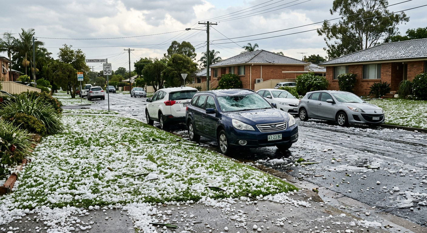
The development of a supercell structure relies on a precise combination of atmospheric variables aligning at the right time. Unlike an East Coast Low, which is a broad synoptic-scale weather system driven by temperature gradients over the ocean, a supercell is a highly concentrated convective machine. It requires three core ingredients: moist low-level air, atmospheric instability, and strong vertical wind shear.

Atmospheric instability and CAPE
Instability is the fuel for any thunderstorm. It occurs when a rising parcel of air remains warmer and less dense than the surrounding environment, causing it to accelerate upward. Professional meteorologists measure this potential energy using Convective Available Potential Energy (CAPE). To evaluate CAPE, forecasters rely on real-time sounding data plotted on Skew-T log-P diagrams. These technical charts show the temperature and dew point at various altitudes, allowing forecasters to see exactly how buoyant a rising air parcel will become.
High moisture levels at the surface increase buoyancy. A high surface dew point indicates abundant low-level moisture, which releases immense latent heat as it condenses higher up. A summary of severe weather environments in educational meteorology guides notes that intense instability often appears as CAPE exceeding 2,500 J kg⁻¹. While this is not a universal cutoff for storm development, values above this threshold indicate a highly explosive atmosphere capable of supporting extreme updraft velocities.
Vertical wind shear and vorticity
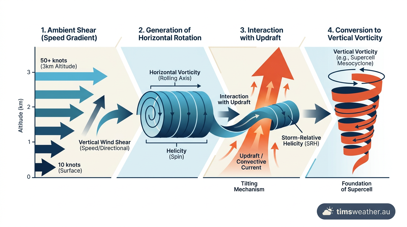
Atmospheric instability alone only creates short-lived, unorganised storms. The impact of wind shear on storm intensity is what drives supercell formation. Vertical wind shear refers to winds changing speed or direction with height. When strong winds blow in different directions at different altitudes, they create a rolling effect in the lower atmosphere, known as horizontal vorticity.
A commonly cited threshold for environments favourable to supercells is deep-layer shear through the lowest 6 km of the atmosphere of roughly 25 m s⁻¹ or more. When deep-layer shear reaches this level, it increases the likelihood of long-lived, organised storms. This shear tilts the storm, ensuring the heavy precipitation falls away from the rising warm air inflow.
Triggers and capping inversions
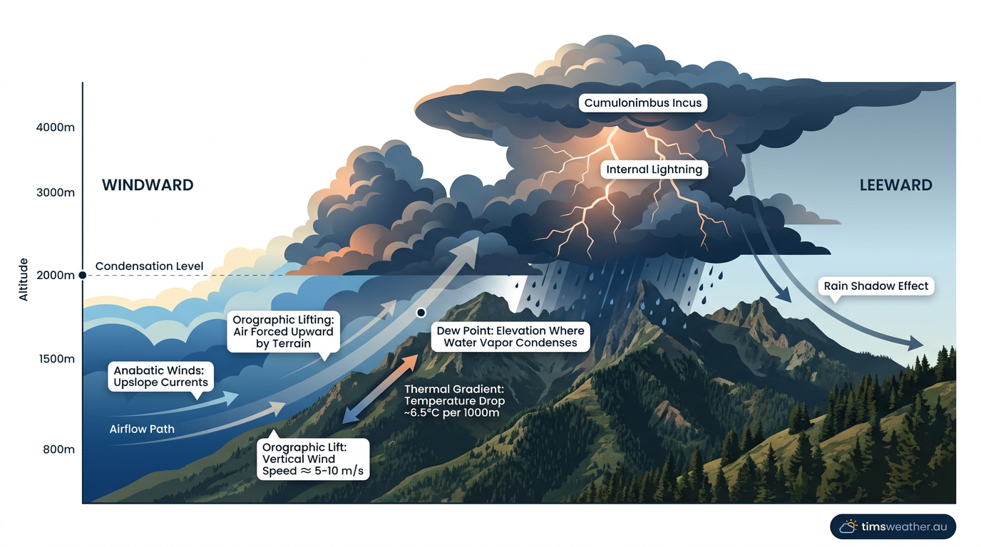
Even with extreme instability and shear, a storm needs a trigger to initiate convection. Warm, moist surface air must be forcefully lifted by a trigger such as a cold front, elevated terrain, or intense daytime heating. In Australia, the Great Dividing Range often acts as this topographical trigger. Moist air from the Coral Sea hits the mountains and is forced upwards, a process similar to how orographic cumulus clouds develop.
In many severe weather outbreaks, a capping inversion is present early in the day. This cap is a layer of warm air aloft that acts like a lid, trapping moisture and heat near the surface. If the surface heats up enough to break through this inversion, or if an approaching Dry Line forces the trapped air upward, the explosive energy is released rapidly. The rising air condenses, releasing latent heat and strengthening the updraft into a violent convective column.
How the mesocyclone engine works
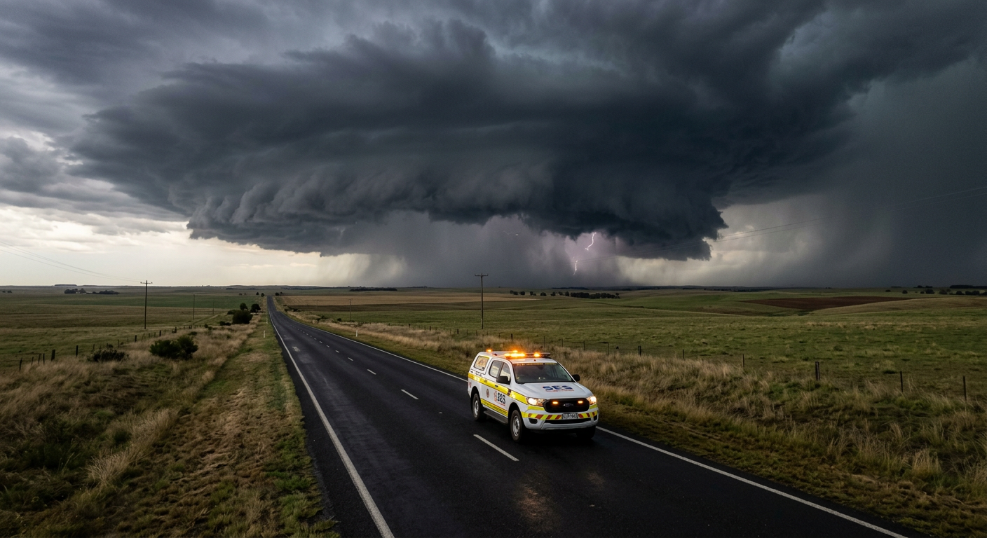
Once a storm initiates in a sheared, unstable environment, it undergoes a structural transformation that defines it as a supercell. The defining feature is the mesocyclone, which turns a standard thunderstorm into a highly efficient, rotating weather engine.
Why do supercell storms rotate?
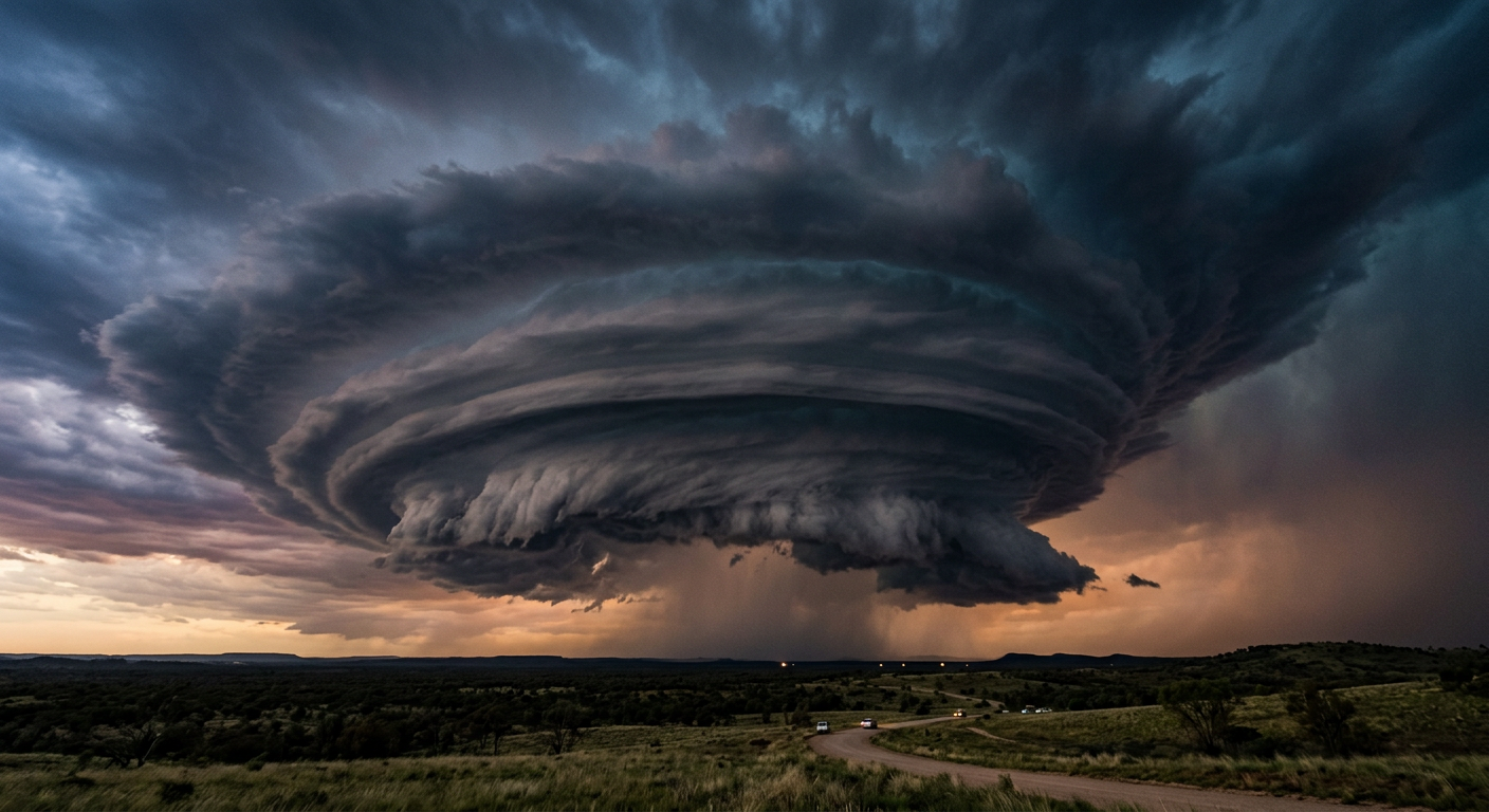
Supercell storms rotate because the powerful updraft ingests the horizontal rolling air created by vertical wind shear and tilts it upwards. This process transforms horizontal vorticity into vertical rotation. As the air stretches vertically inside the updraft, it spins faster, much like an ice skater pulling their arms in. The Coriolis effect also plays a minor role in organising the broader storm-scale rotation cyclonically over large distances.
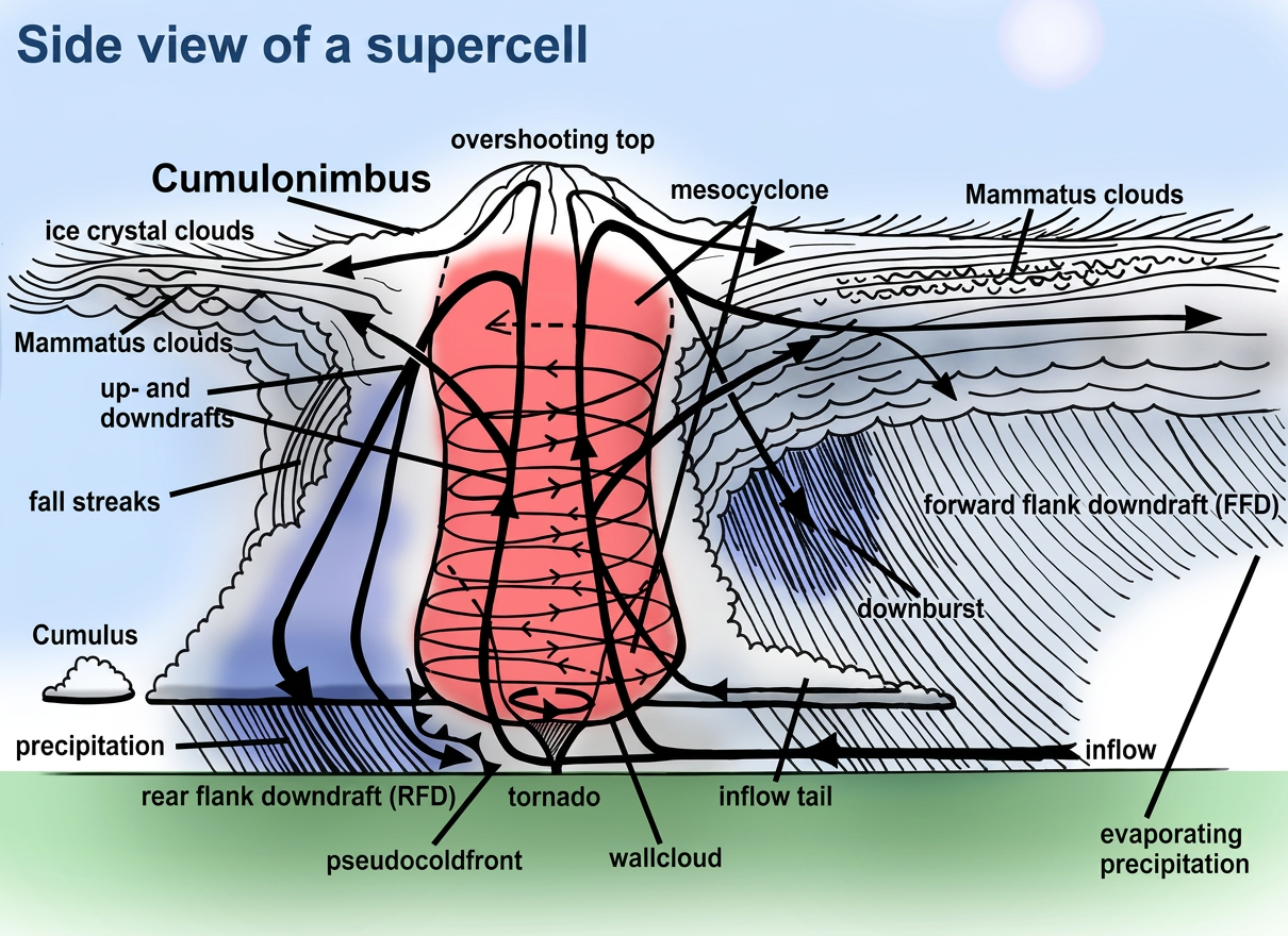
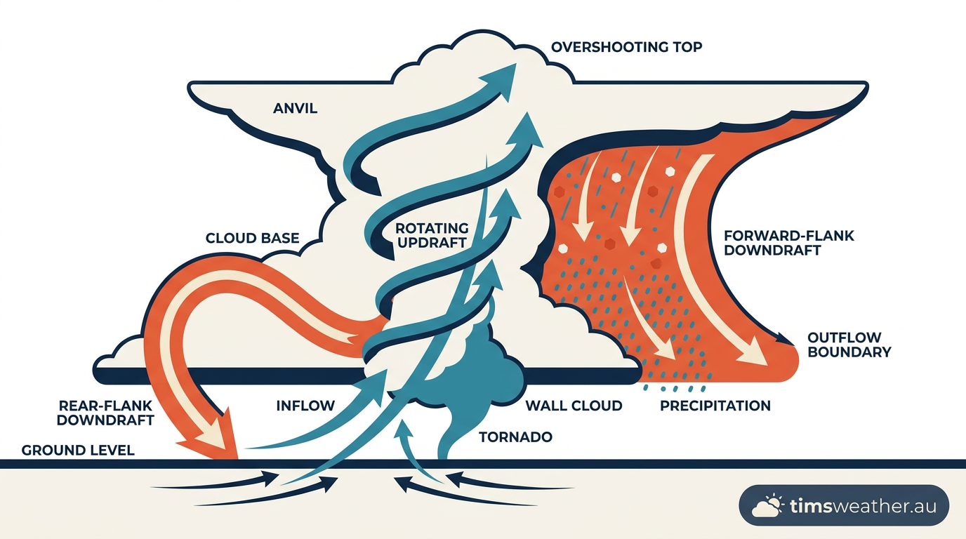
This deep, rotating updraft is incredibly strong, with mesocyclone updraft measurements frequently exceeding 40 m s⁻¹ (about 144 km/h). The rotation creates a low-pressure centre within the storm, actively pulling in more warm, moist air to feed the system. Meanwhile, rain and hail fall out of the storm in two distinct zones: the forward-flank downdraft (FFD) and the rear-flank downdraft (RFD). This precise separation prevents the cold downdrafts from undercutting the warm inflow, allowing the storm to survive for several hours.
What is the difference between a thunderstorm and a supercell?
The main difference between a regular thunderstorm and a supercell is the presence of a deep, continuously rotating updraft called a mesocyclone. Ordinary thunderstorms lack this rotation and typically collapse under the weight of their own rain within an hour. Supercells use wind shear to separate their updraft from their downdraft, making them self-sustaining and capable of producing severe weather for many hours.
Identifying supercell structure and severe weather
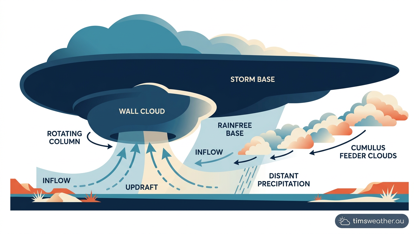
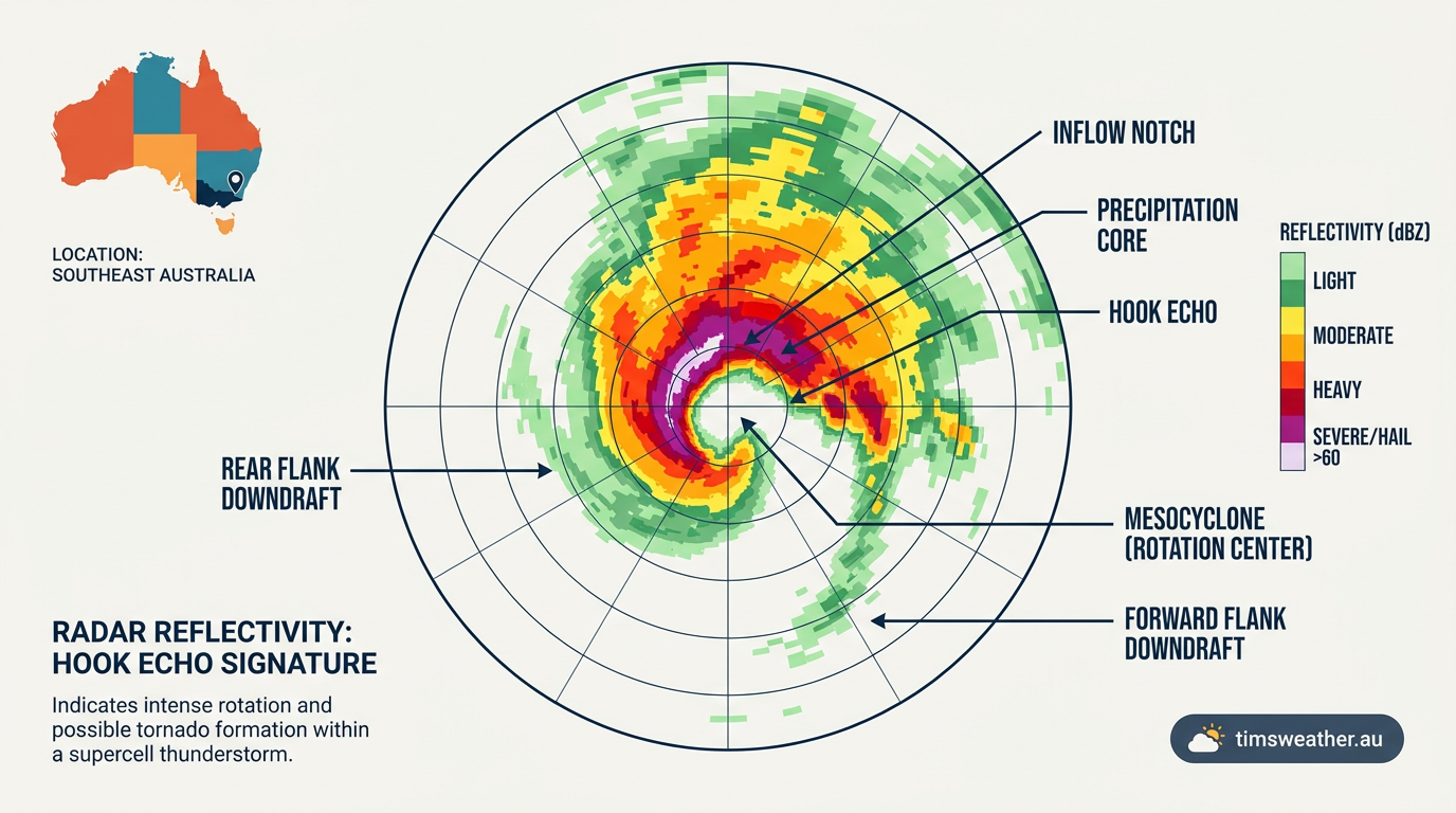
Because supercells are responsible for the most extreme weather events, identifying their structure early is a priority for the Bureau of Meteorology and volunteer Skywarn spotters. How the visual and radar signatures can provide essential lead time for severe weather warnings, a fact highlighted by emergency managers dealing with supercell storms in Ontario and across the globe.

Detecting supercells on BoM Doppler Radar: Key Indicators
Professional meteorologists rely on Doppler radar to look inside the storm. Radar reflectivity measures the intensity of precipitation. In classic supercells, rain and hail wrapping around the rotating updraft create a distinct hook echo shape on the radar screen. This hook echo forms when precipitation is drawn into the storm's rotation, wrapping around the rain-free updraft base.
In addition to reflectivity, meteorologists use Doppler velocity data to detect moving air. A tight velocity couplet (where winds moving towards the radar sit immediately next to winds moving away) pinpoints the exact location of the mesocyclone. This level of rotational organisation is entirely absent in standard squall lines and multicell storms.
Visual guide to identifying a rotating updraft
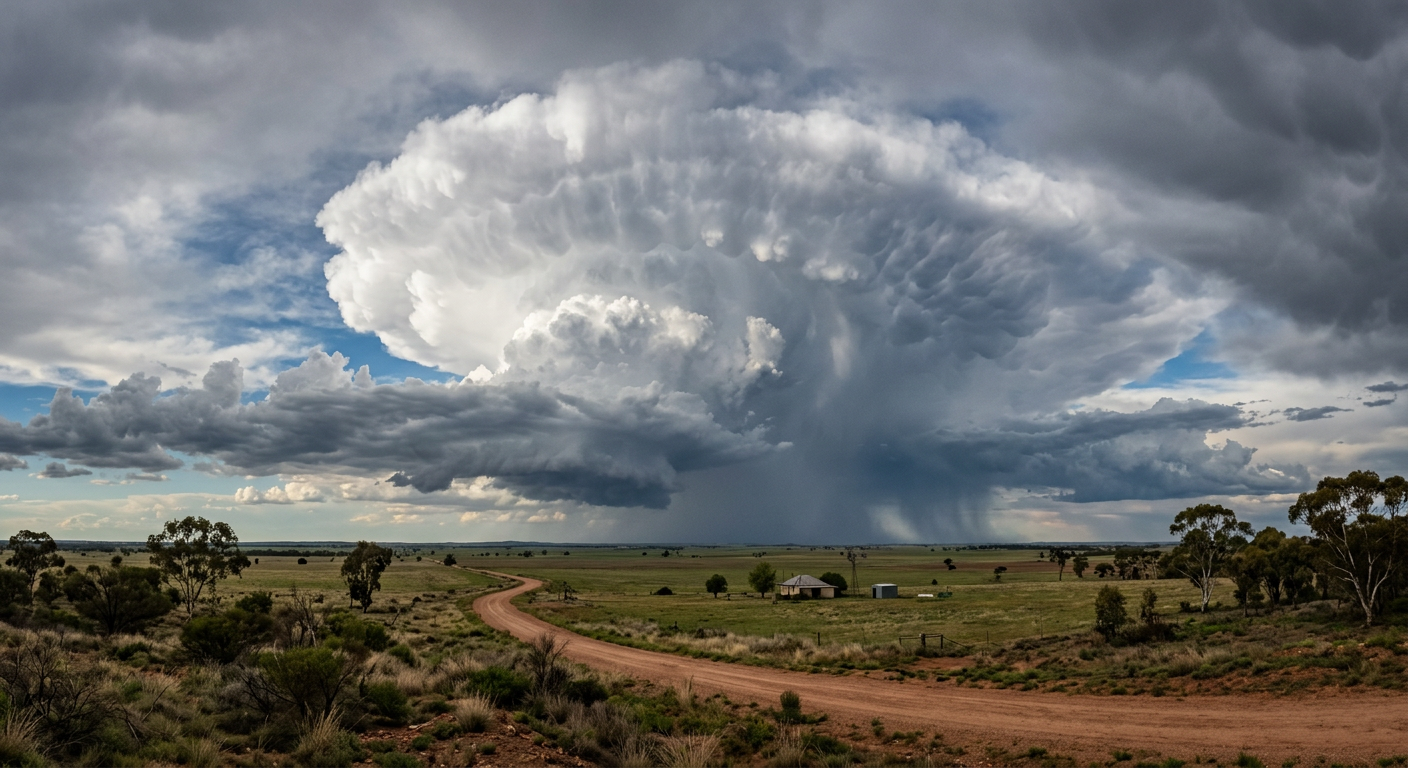
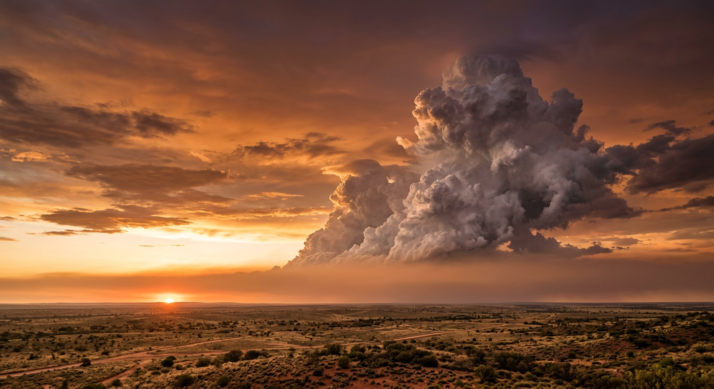
From the ground, supercells display distinct visual features. The most prominent is often the wall cloud, a lowered, rain-free cloud base situated directly beneath the rotating updraft. If the wall cloud exhibits strong, persistent rotation, it indicates a heightened risk of tornado formation.
You may also observe striations (visible bands or grooves spiralling up the sides of the main storm tower). These striations resemble a stacked set of plates or a barber pole and provide direct visual confirmation of intense rotation. Nearby, a heavy precipitation core often appears as a solid wall of white or green-tinted rain and ice, highlighting the zone of intense hailstone formation. Hailstones grow large in these storms because the 40 m s⁻¹ updrafts suspend the ice particles for extended periods, allowing them to accumulate multiple layers of freezing water before finally falling to earth.
Supercell environments globally and in Australia
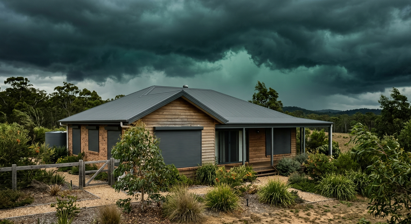
While the physics of supercell formation are identical worldwide, local geography and climate patterns dictate where and when these severe storms occur. The Great Plains of the United States, known as Tornado Alley, experiences the highest frequency of supercells due to the perfect collision of warm Gulf moisture, cold northern air, and dry desert winds.

Major international supercell events
In the United States, supercells are heavily studied because they produce the world's most violent tornadoes. Historic outbreaks, such as the 2011 Joplin tornado and the 2013 El Reno tornado, were classic supercell cases associated with highly organised mesocyclones. Beyond North America, these storms are also a regular occurrence in Europe. Researchers studying projected future conditions note that several hundred supercells occur each convective season in the current European climate, particularly near the Alps where complex topography forces moist air upward.
Australian hotspots and local dynamics
In Australia, the eastern states frequently experience supercell outbreaks during spring and summer. South East Queensland and northern New South Wales form a regional "Hail Alley". Here, warm waters from the East Australian Current supply abundant low-level moisture, while the Great Dividing Range provides the necessary orographic lift to break the capping inversion.
The December 2018 Sydney hailstorm and the November 2020 South East Queensland severe weather event (often called the Halloween supercells) are prime examples of Australian supercells producing catastrophic damage. In both cases, explosive instability met strong wind shear, resulting in giant hail exceeding 8 to 14 centimetres in diameter.
Further inland, the Dry Line (a boundary separating moist coastal air from dry desert air) acts as a frequent trigger for severe storms. In northern Australia, places like Cape York and the Top End experience unique mesocyclone dynamics. While deep-layer shear is often lower in the deep tropics compared to the mid-latitudes, the extreme instability allows for highly isolated, slow-moving supercells that dump immense rainfall totals.
Frequently asked questions
Supercells form when warm, moist, unstable air is lifted into an atmosphere with strong vertical wind shear. This shear causes the storm’s updraft to rotate, creating a mesocyclone. This organised rotation allows the storm to become long-lived and particularly intense compared to standard convective thunderstorms.
Further reading and resources
Explore trusted articles, books, videos and other resources to go deeper on this topic.
cnn.comArticle
Supercell thunderstorms, explained | CNN
In-depth coverage on How Do Supercell Thunderstorms Form? The Complete Meteorological Guide from cnn.com.
scribd.comArticle
Understanding Supercell Thunderstorms | PDF - Scribd
In-depth coverage on How Do Supercell Thunderstorms Form? The Complete Meteorological Guide from scribd.com.
weather.govReference
Spotter's Field Guide - The Supercell, Pt. 1 - National Weather Service
Background reference on How Do Supercell Thunderstorms Form? The Complete Meteorological Guide from weather.gov.
britannica.comReference
Thunderstorm - Supercell, Wind, Hail
Background reference on How Do Supercell Thunderstorms Form? The Complete Meteorological Guide from britannica.com.
sustainability.stanford.eduReference
Scientists solve mystery of supercell storms' icy plumes
Background reference on How Do Supercell Thunderstorms Form? The Complete Meteorological Guide from sustainability.stanford.edu.
What is a Supercell? - National Weather Service
Background reference on How Do Supercell Thunderstorms Form? The Complete Meteorological Guide from weather.gov.
wunderground.comArticle
Prepare for a Supercell | Weather Underground
In-depth coverage on How Do Supercell Thunderstorms Form? The Complete Meteorological Guide from wunderground.com.
en.wikipedia.orgReference
Supercell - Wikipedia
Background reference on How Do Supercell Thunderstorms Form? The Complete Meteorological Guide from en.wikipedia.org.
courses.ems.psu.eduReference
Multicell and Supercell Thunderstorms | METEO 3 - EMS Online Courses
Background reference on How Do Supercell Thunderstorms Form? The Complete Meteorological Guide from courses.ems.psu.edu.
journals.ametsoc.orgArticle
The Future of Supercells in the United States in - AMS Journals
In-depth coverage on How Do Supercell Thunderstorms Form? The Complete Meteorological Guide from journals.ametsoc.org.
Planning weeks ahead?
Check Australia's long-range seasonal outlook for rainfall, temperature and the climate drivers (ENSO, IOD, SAM, MJO) shaping the next three months.
View Australia's Seasonal Weather Forecast