
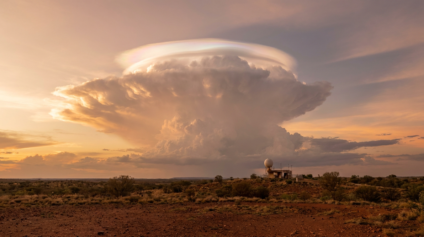
Pileus cloud formation occurs when a strong convective updraft pushes moist air upwards, forcing a stable layer of air above it to rise. This causes rapid adiabatic cooling and condensation, resulting in a smooth, cap-like accessory cloud appearing above a growing cumulus or cumulonimbus tower.
Key takeaways
The World Meteorological Organization classes these storm caps as accessory clouds, not a standalone type, as they depend on a parent storm.
They signal a strong convective updraft and active tropical convection or thunderstorm growth.
The cap forms when a stable layer is lifted high enough for adiabatic cooling to bring air to saturation.
Relative humidity, atmospheric moisture and supersaturation all matter in the thin layer where the cap appears.
The cloud often fades quickly as the parent storm becomes a cumulonimbus incus cloud or absorbs the cap.
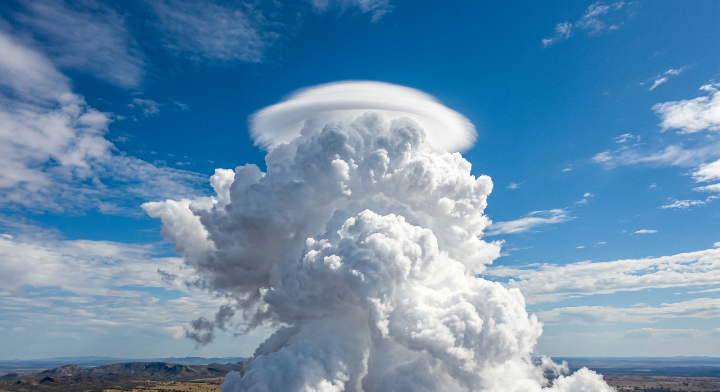
A smooth pileus cloud formation sitting on top of a growing cumulus congestus tower.
The mechanics of pileus cloud formation
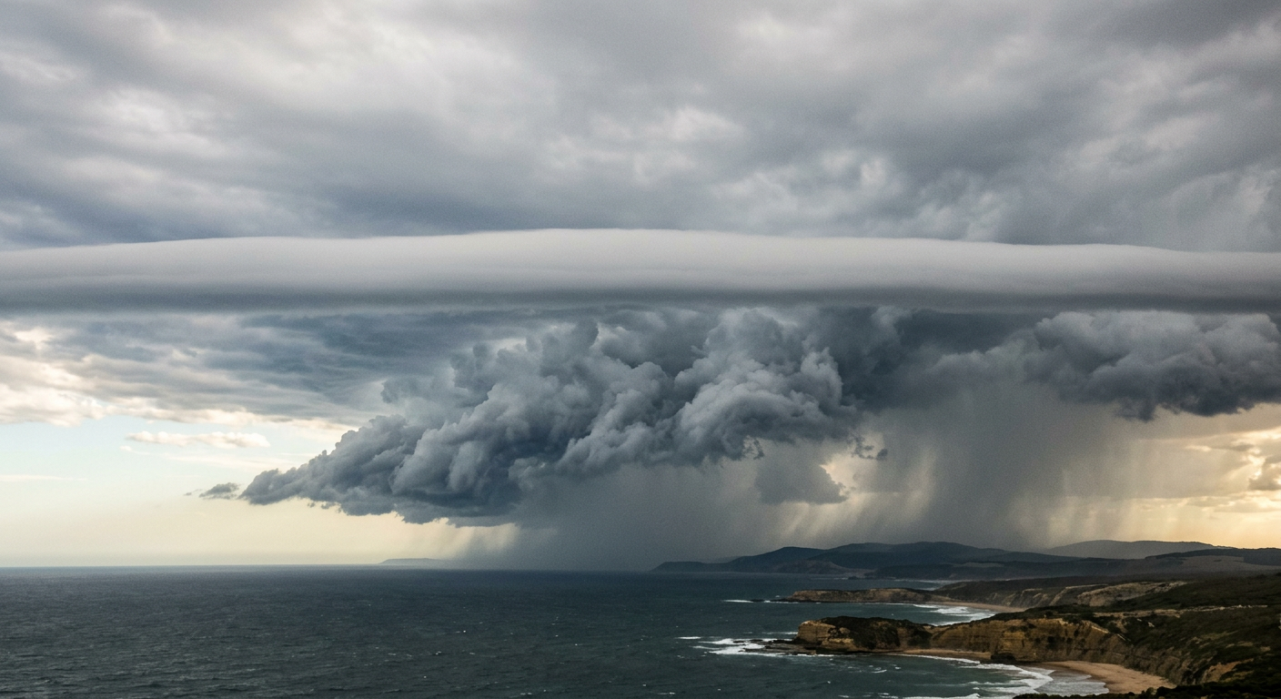
A distinct stable layer of air condensing into a smooth horizontal cloud band above a storm.
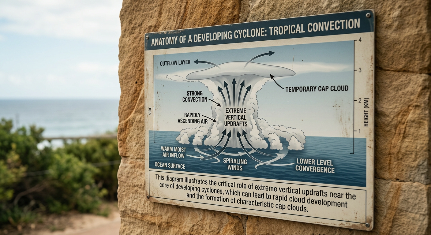
Cross-section diagram of intense vertical updrafts in a developing tropical system.
A pileus cloud is a transient accessory cloud that appears as a smooth, horizontal veil over a rapidly growing storm. The World Meteorological Organization (WMO) Cloud Atlas describes pileus as an accessory cloud attached to a parent cloud, not a stand-alone cloud type. The accessory cloud label fits because the cap depends on the cloud below it.
The whole process depends on intense vertical motion. When a developing storm surges upwards, it acts like a wedge that lifts the air above it. That air may sit inside a thin stratiform layer with enough atmospheric moisture to condense once it cools. The result is a smooth cap, often called a cap cloud, sitting above the main updraft.
How do pileus clouds form?
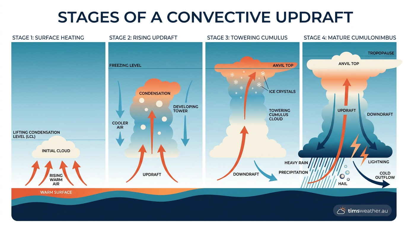
Diagram showing how strong convective updrafts push air upwards to form tall storm clouds.
Pileus cloud formation occurs when a strong convective updraft pushes moist air upwards, forcing a stable layer of air above it to rise. This causes rapid adiabatic cooling and condensation, resulting in a smooth, cap-like accessory cloud appearing above a growing cumulus or cumulonimbus tower.
That lifting does not happen in hydrostatic equilibrium. In the Troposphere, a vigorous updraft can temporarily overpower the local balance between gravity and pressure. As the air rises, pressure falls, the parcel expands and cools, and the layer reaches saturation. If it cools enough, ice crystals may form near the top of the cap.
Vertical development of cumulus clouds
For a pileus cap to appear, the parent cloud must be growing quickly. Cumulus congestus clouds are the most common parent clouds, and they can mark a strong phase of thunderstorm development. The Bureau of Meteorology (BOM) uses this kind of vertical growth in its storm forecasting discussions, especially when humid surface air feeds a deepening convective updraft.
Once the updraft weakens, or the growing cloud punches through the stable layer, the cap often dissipates or is absorbed into the main tower. That is why pileus clouds are short-lived. If you spot one, the atmosphere above the storm is still changing fast.
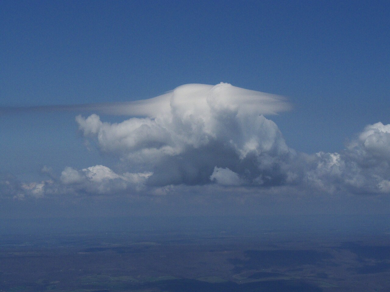
A stunning pileus cloud, or "storm cap," forms above a cumulus cloud, showcasing this unique atmospheric phenomenon. By User:Dhaluza, CC BY 2.5, https://commons.wikimedia.org/w/index.php?curid=19987743
Atmospheric moisture and the stable layer
Two conditions usually line up for this cloud to form. First, the air above the storm must be relatively stable. A stable layer resists vertical motion, so the rising air spreads out and flattens into the smooth cap shape. Second, that layer needs enough moisture for condensation to begin once cooling starts.
If the air aloft is too dry, the lifting still happens, but no visible cap forms. If the air is moist enough, relative humidity can reach saturation and then supersaturation for a moment, which is enough for droplets to appear. That is why pileus clouds often look smooth and uniform, unlike the lumpy core of the storm below.
Environmental triggers and thermodynamic processes

A severe thunderstorm with a prominent pileus cap cloud indicating strong vertical growth.
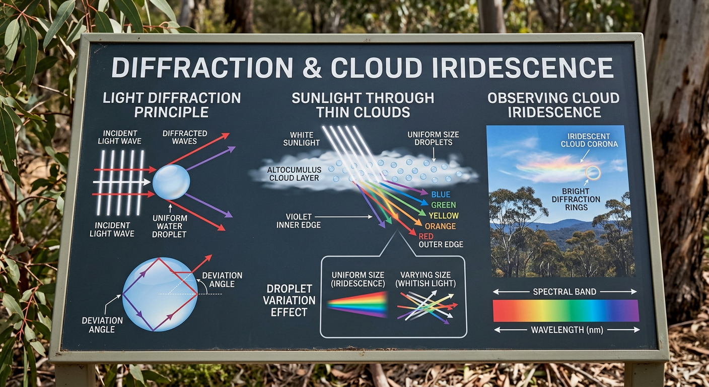
Diagram explaining the physical diffraction of sunlight through uniform water droplets.
Meteorologists look at the vertical profile of the atmosphere to judge whether pileus cloud formation is possible. A moist lower layer, a stable cap aloft and strong heating at the surface can all help trigger the process. When the air column is primed, the cap can appear very quickly.
Reading the atmosphere with Skew-T log-P diagrams
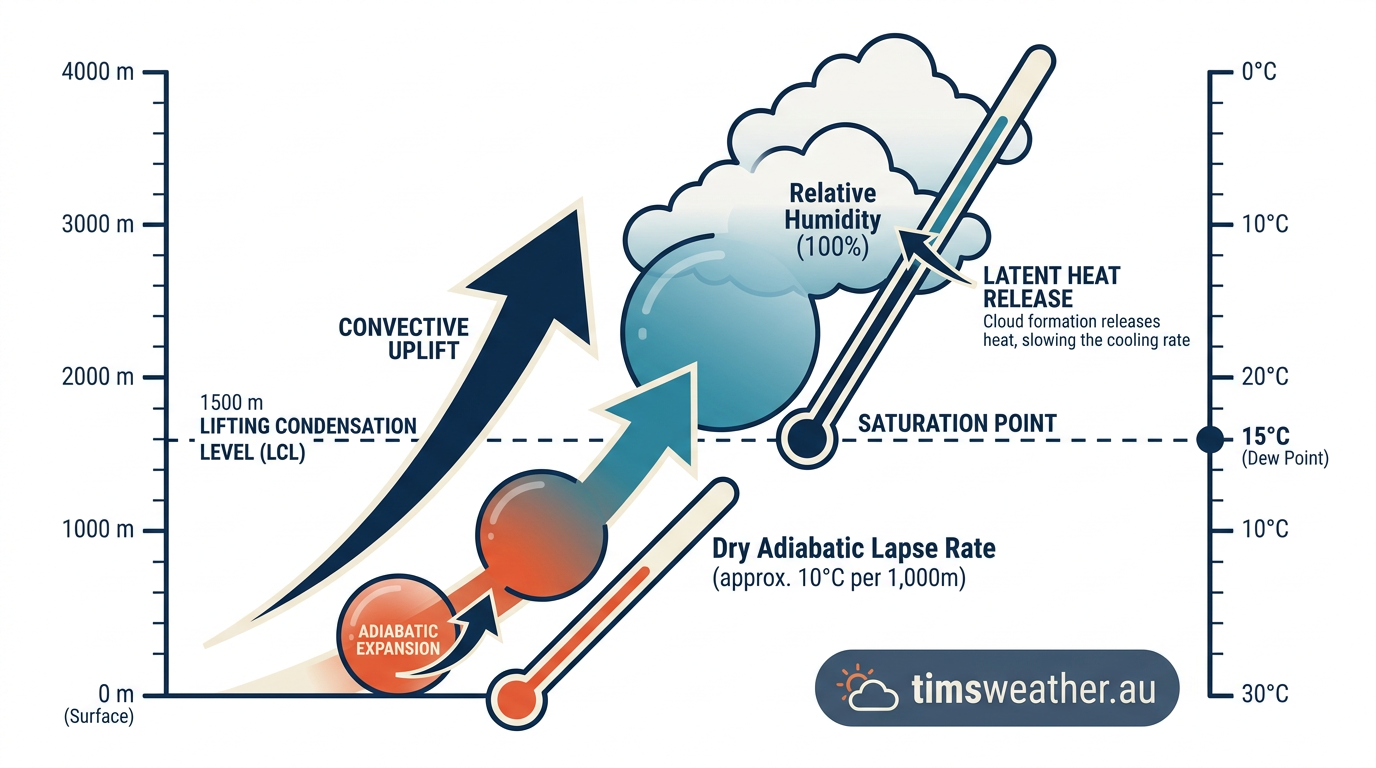
Educational illustration of adiabatic cooling where lifted atmospheric moisture reaches its dew point.
A Skew-T log-P diagram plots temperature, dew point and pressure through the Troposphere. Forecasters use it to spot unstable air near the surface and a stable layer aloft. That combination can support vigorous convection below and a smooth cap cloud above.
As the updraft parcel rises on the chart, it cools along a moist adiabat until it reaches its dew point. If the layer above is just stable enough, the cloud top can flatten and spread sideways, which is why some pileus clouds resemble a lens-shaped lenticular cloud even though the mechanism is different.
Adiabatic cooling and hydrostatic equilibrium
The physics of this process relies on adiabatic cooling. As the stable layer is pushed higher, the surrounding air pressure drops. The parcel expands in response, and that expansion lowers its temperature without adding or removing heat from outside.
Under normal conditions, the atmosphere stays close to hydrostatic equilibrium, where pressure and gravity are in balance. A convective updraft disrupts that balance locally. If the lifting is strong enough, the parcel can reach supersaturation, which is the point where liquid droplets form very quickly.
Microphysics: from water droplets to ice crystals
The height of the cloud top helps decide what the cap contains. In warmer parts of the Troposphere, pileus clouds are mainly made of tiny water droplets. Higher up, colder air can allow ice crystals to appear. That is one reason some caps show bright edges or a soft sheen.
The WMO Cloud Atlas notes that pileus belongs with accessory clouds, but the look can vary with the parent cloud and the temperature profile. A similar cap can form above tall thunderstorm towers or, less often, above strong cumulus growth near a very moist boundary layer.
What pileus clouds can tell you
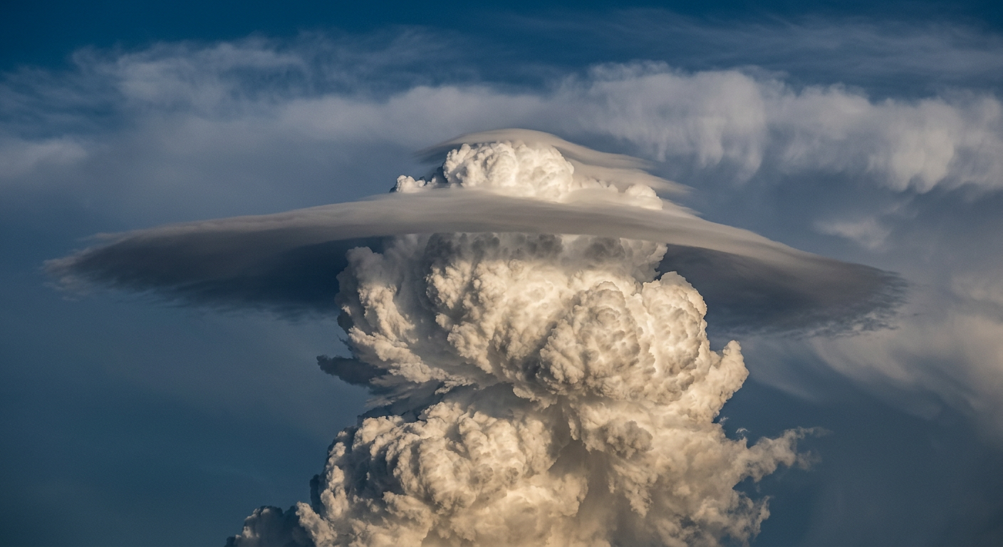
The top of a severe cumulonimbus cloud pushing into and lifting a smooth accessory cloud.
Pileus clouds are a visual clue that the atmosphere is building a strong storm. They do not mean severe weather is guaranteed, but they often appear just before rapid vertical growth. If you are outdoors and see one above a darkening cloud tower, keep an eye on the sky and check BOM forecasts and warnings.
They can also help explain the difference between a healthy updraft and a storm top that has already spread into an anvil. When the parent cloud reaches the tropopause and forms a cumulonimbus incus, the pileus has usually already vanished.
Related guides
Frequently asked questions
Pileus clouds form when a powerful convective updraft pushes moist air above a rapidly rising cumulus or cumulonimbus tower. As this air is forced upwards, it undergoes adiabatic cooling, reaches saturation, and condenses into a smooth, horizontal cap. These thin accessory clouds usually persist for only a few minutes.
Source: cimss.ssec.wisc.edu
Further reading and resources
Explore trusted articles, books, videos and other resources to go deeper on this topic.
weather.govReference
Cloud Classification
Background reference on Pileus Cloud Formation: How Storm Caps Form Above Thunderstorms from weather.gov.
en.wikipedia.orgReference
Pileus (meteorology)
Background reference on Pileus Cloud Formation: How Storm Caps Form Above Thunderstorms from en.wikipedia.org.
youtube.comVideo
Pileus Clouds
Video coverage on Pileus Cloud Formation: How Storm Caps Form Above Thunderstorms from youtube.com.
backyardnature.netArticle
Cumulonimbus Pileus Cloud
In-depth coverage on Pileus Cloud Formation: How Storm Caps Form Above Thunderstorms from backyardnature.net.
whatsthiscloud.comArticle
Pileus Cloud Accessory: Cap, Hood Over A Cumuliform
In-depth coverage on Pileus Cloud Formation: How Storm Caps Form Above Thunderstorms from whatsthiscloud.com.
skybrary.aeroArticle
Pileus (pil) | SKYbrary Aviation Safety
In-depth coverage on Pileus Cloud Formation: How Storm Caps Form Above Thunderstorms from skybrary.aero.
cloudappreciationsociety.orgArticle
Pileus
In-depth coverage on Pileus Cloud Formation: How Storm Caps Form Above Thunderstorms from cloudappreciationsociety.org.
clickorlando.comArticle
What were those crazy rainbow clouds over Central Florida?
In-depth coverage on Pileus Cloud Formation: How Storm Caps Form Above Thunderstorms from clickorlando.com.
Planning weeks ahead?
Check Australia's long-range seasonal outlook for rainfall, temperature and the climate drivers (ENSO, IOD, SAM, MJO) shaping the next three months.
View Australia's Seasonal Weather Forecast