
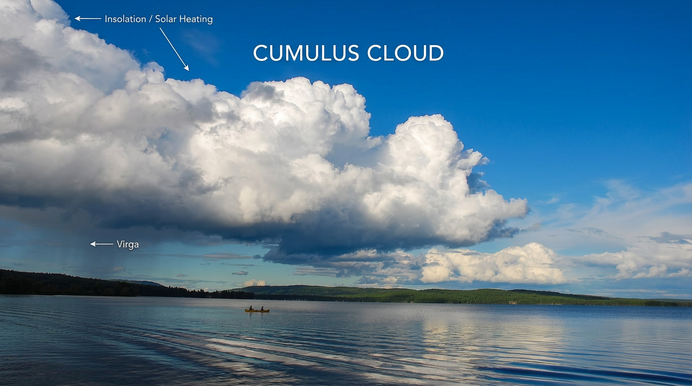
How do cumulus clouds form? They form when solar radiation warms the ground, the air above it heats and rises as an updraft, then adiabatic cooling brings that parcel of air to its dew point. At the lifting condensation level, water vapour condenses into tiny droplets and a cumulus cloud appears.
Key takeaways
- Cumulus clouds form through the convection process when solar radiation warms the surface and creates thermals.
- As a parcel of air rises through the troposphere, adiabatic cooling lowers its temperature until it reaches the dew point.
- The cloud base height marks the lifting condensation level, where relative humidity reaches 100%.
- Water vapour condensation depends on condensation nuclei such as dust and sea salt.
- Atmospheric stability affects cloud depth, with stronger instability supporting cumulus congestus.
How do cumulus clouds form?
The short answer is that cumulus clouds form when surface heating drives convection and the rising air cools enough for condensation to begin. The convection process starts when solar radiation warms the land faster than the air above it, especially on clear afternoons. The warmed air becomes less dense, so it rises in a parcel of air called a thermal.
That rising air is replaced by slightly cooler air from around it, which keeps the circulation going. As the parcel lifts through the troposphere, air pressure drops. The parcel expands and cools at the dry adiabatic rate. That cooling is called adiabatic cooling.
How does convection create cumulus clouds?
Convection creates cumulus clouds by lifting moist air until it cools to the point where water vapour can no longer stay in gas form. The air’s relative humidity rises as the parcel cools. According to the Britannica explanation of cloud formation, cloud droplets appear when moist air reaches its dew point and condenses on tiny particles in the air.
That condensation needs condensation nuclei, such as dust or sea salt, for the droplets to form around. If you want a quick refresher on moisture terms, see our dew point versus humidity guide.
What is the lifting condensation level?
The lifting condensation level is the height where a rising parcel of air first becomes saturated. At that point, the cloud base begins to form. In everyday sky watching, this is the level where the first visible puffs of cumulus appear.
Why do cumulus clouds have flat bases?
Cumulus clouds often have flat bases because many parcels of air rising from the same heated surface cool to saturation at about the same height. That makes the cloud base height look even across the sky. In simple terms, the cloud base marks the lifting condensation level.
Meteorologists check this against weather balloon soundings, which show how temperature and dew point change with height. When the two lines get close, the air is near saturation.
How cloud base height helps predict local weather
Cloud base height gives a good clue about low-level moisture. A lower base usually means the air near the ground is more humid and needs less lift to reach saturation. A higher base usually points to drier air below the cloud and a deeper layer of cooling before condensation starts.
How atmospheric stability affects cloud growth
Atmospheric stability controls whether cumulus clouds stay small or grow taller. Stable air resists vertical motion, so clouds often stay as shallow cumulus humilis. Unstable air lets rising parcels stay warmer than the air around them, which supports more growth.
From fair-weather cumulus to cumulus congestus
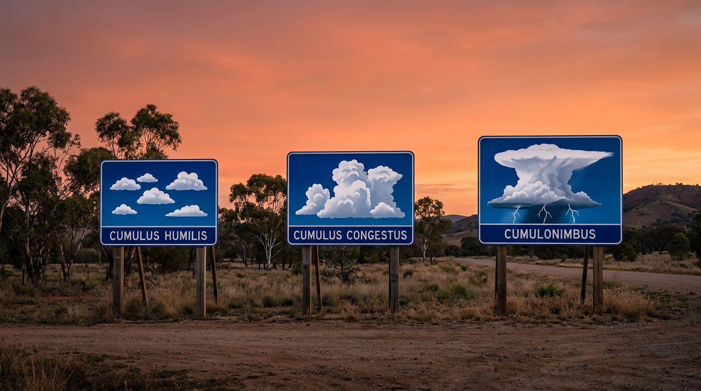
When the atmosphere is more unstable, the rising air keeps going after condensation starts. As water vapour condenses, latent heat is released into the cloud. That extra heat slows the cooling of the parcel and helps the updraft stay buoyant. The result can be taller cumulus congestus clouds with stronger vertical development.
The Bureau of Meteorology uses the terms atmospheric stability and convective heating when describing this process. If you want to compare cloud growth with thunderstorm development, see how thunderstorms form.
Cumulus cloud types and what they mean
The main cumulus forms are easy to tell apart once you know what to look for. The World Meteorological Organization cloud atlas groups them by shape and vertical depth, and the names are used widely in Australian meteorology.
The main cumulus species
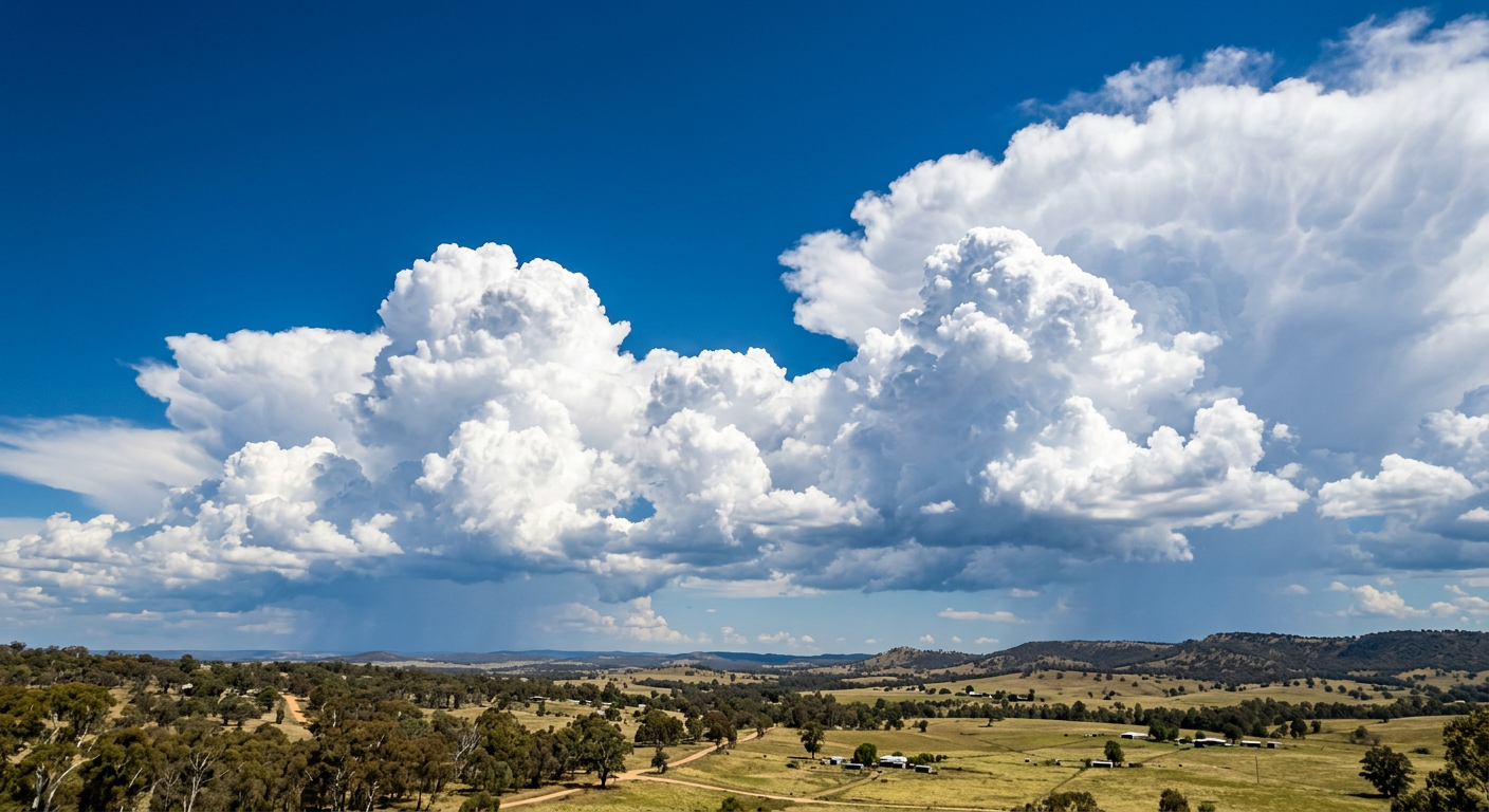
Here is a simple guide to the common cumulus species you are most likely to see.
| Species | Typical look | What it often means |
|---|---|---|
| Cumulus humilis | Small, flat and wider than tall | Shallow convection and mostly fair weather |
| Cumulus mediocris | Moderate vertical growth | Growing instability and stronger updrafts |
| Cumulus congestus | Tall with cauliflower tops | Deep convection and a greater chance of showers |
So, how do cumulus clouds form in practice? The process begins with solar heating, then moves through rising air, adiabatic cooling, water vapour condensation and cloud growth shaped by atmospheric stability. If the air stays stable, the cloud often remains as cumulus humilis. If instability increases, the cloud may grow into cumulus congestus.
Related guides
Frequently asked questions
Cumulus clouds form when warm, moist air rises from the earth's surface and cools as it expands at higher altitudes. Once the air reaches saturation, water vapour condenses into tiny liquid droplets. This process, driven by convection, creates the detached, puffy clouds commonly seen on clear days across Australia.
Source: bom.gov.au
Further reading and resources
Explore trusted articles, books, videos and other resources to go deeper on this topic.
metlink.orgArticle
MetLink - Royal Meteorological Society Cumulus Clouds -
In-depth coverage on How do cumulus clouds form? Convection, condensation and cloud base height from metlink.org.
weather.govReference
CLOUD DEVELOPMENT
Background reference on How do cumulus clouds form? Convection, condensation and cloud base height from weather.gov.
stormhour.comArticle
What Are Cumulus Clouds? A Complete Guide
In-depth coverage on How do cumulus clouds form? Convection, condensation and cloud base height from stormhour.com.
en.wikipedia.orgReference
Cumulus cloud
Background reference on How do cumulus clouds form? Convection, condensation and cloud base height from en.wikipedia.org.
ebsco.comArticle
Clouds | Science | Research Starters
In-depth coverage on How do cumulus clouds form? Convection, condensation and cloud base height from ebsco.com.
eoas.ubc.caArticle
UBC ATSC 113 - Cumuliform clouds
In-depth coverage on How do cumulus clouds form? Convection, condensation and cloud base height from eoas.ubc.ca.
Cloud Classification
Background reference on How do cumulus clouds form? Convection, condensation and cloud base height from weather.gov.
youtube.comVideo
How do cumulus clouds form?
Video coverage on How do cumulus clouds form? Convection, condensation and cloud base height from youtube.com.
earthsky.orgArticle
Cumulonimbus clouds bring thunderstorms: How to spot ...
In-depth coverage on How do cumulus clouds form? Convection, condensation and cloud base height from earthsky.org.
labxchange.orgArticle
How Do Clouds Form?
In-depth coverage on How do cumulus clouds form? Convection, condensation and cloud base height from labxchange.org.
Planning weeks ahead?
Check Australia's long-range seasonal outlook for rainfall, temperature and the climate drivers (ENSO, IOD, SAM, MJO) shaping the next three months.
View Australia's Seasonal Weather Forecast