
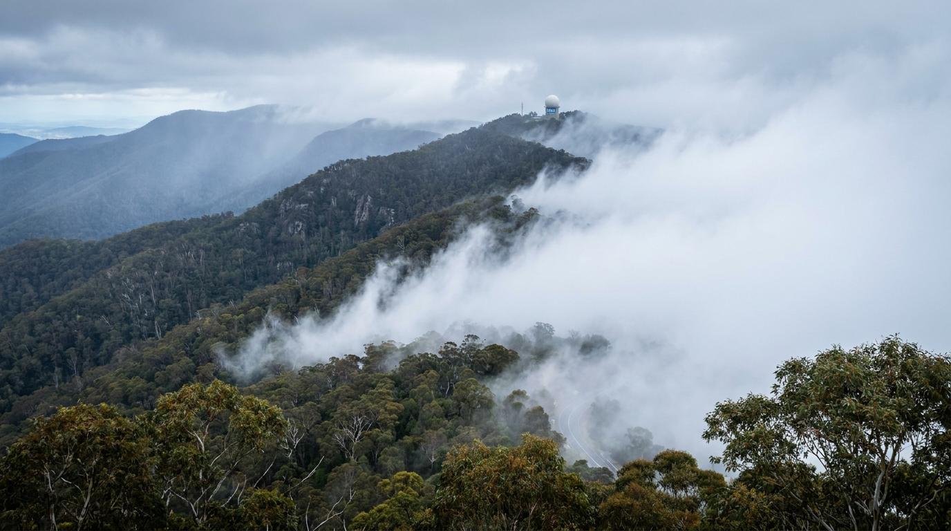
Upslope fog formation occurs when moist, stable air is lifted by prevailing winds along rising terrain, such as a mountain range. As the air rises, it cools adiabatically, and if it reaches its dew point temperature, water vapour condenses into tiny droplets. Once the air reaches the saturation point, fog can form along the windward slopes.
Key takeaways
- Orographic lifting pushes low-level moisture up windward slopes, cooling the air until it reaches saturation.
- As the air rises, the adiabatic cooling rate controls how quickly temperature falls.
- The Lifting Condensation Level (LCL) is the height where condensation starts.
- Relative humidity rises as temperature falls, and fog forms when it reaches 100 per cent.
- The Great Dividing Range can act as a topographic barrier that forces moist air upward on the eastern slopes.
- Upslope fog is different from radiation fog, which usually forms on calm, clear nights.
What is upslope fog formation?
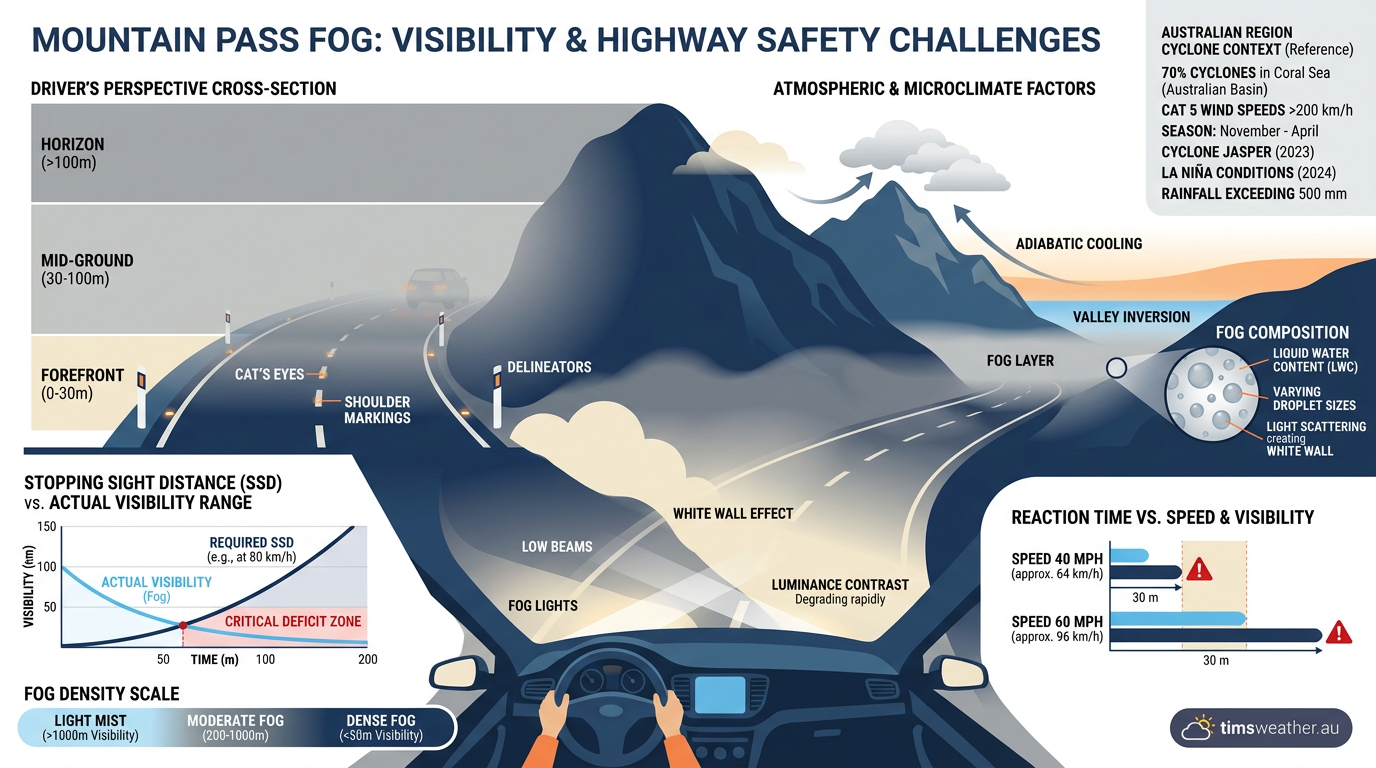
Upslope fog is a terrain-driven cloud at ground level that forms when moving air is forced up a slope or mountain side. This process is called orographic lifting. As the air rises, pressure falls, the air expands and cools, and moisture condenses if the air reaches the saturation point. The result is a fog bank that can sit along ridges, passes and windward slopes.
Fog is defined as cloud on the ground when visibility drops below 1 kilometre. In Australia, the Bureau of Meteorology (BOM) uses this same basic definition in its warnings and forecasts. For people driving through mountain country, that usually means a sudden change from clear air to very low visibility over a short distance.
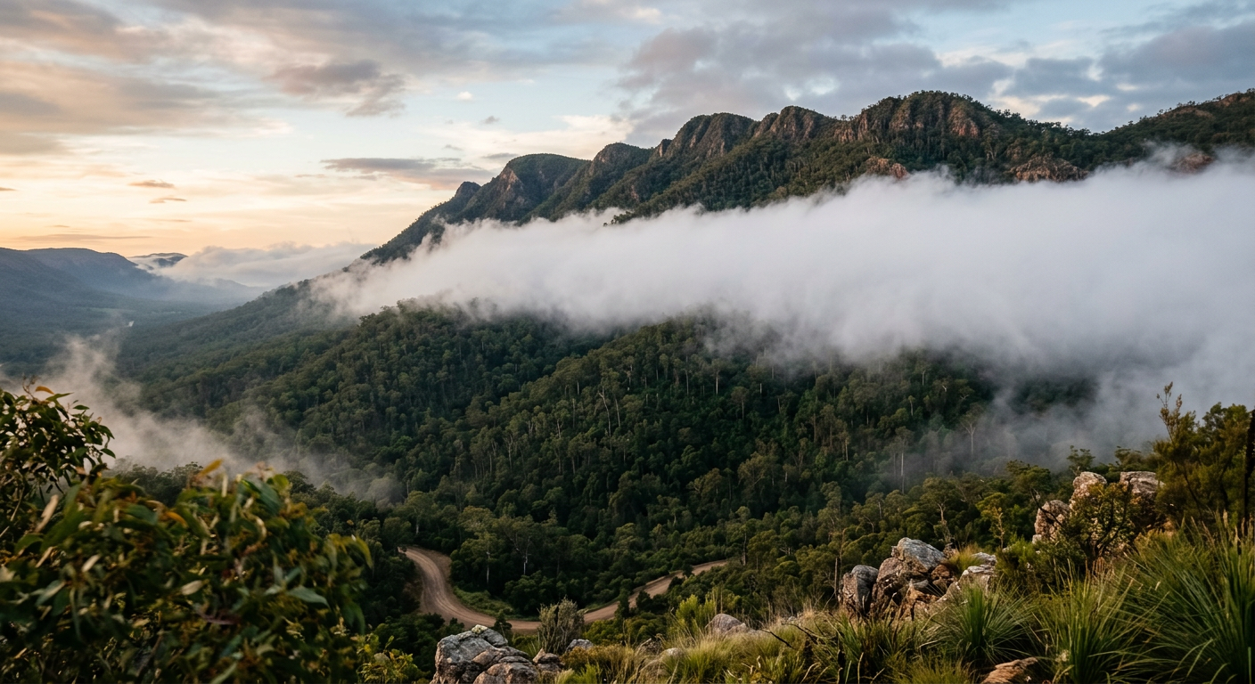
The main ingredients are a stable atmosphere, steady prevailing winds and low-level moisture. If the air is unstable, the lifting is more likely to produce showers or deeper cloud rather than a smooth fog layer. For more on the pressure patterns that guide these winds, see High and low pressure systems in Australia.
The thermodynamics behind upslope fog
Upslope fog forms because rising air cools as pressure drops with height. The cooling is not caused by cold ground. It comes from expansion in lower pressure air.
How does air cool when it rises up a hill?
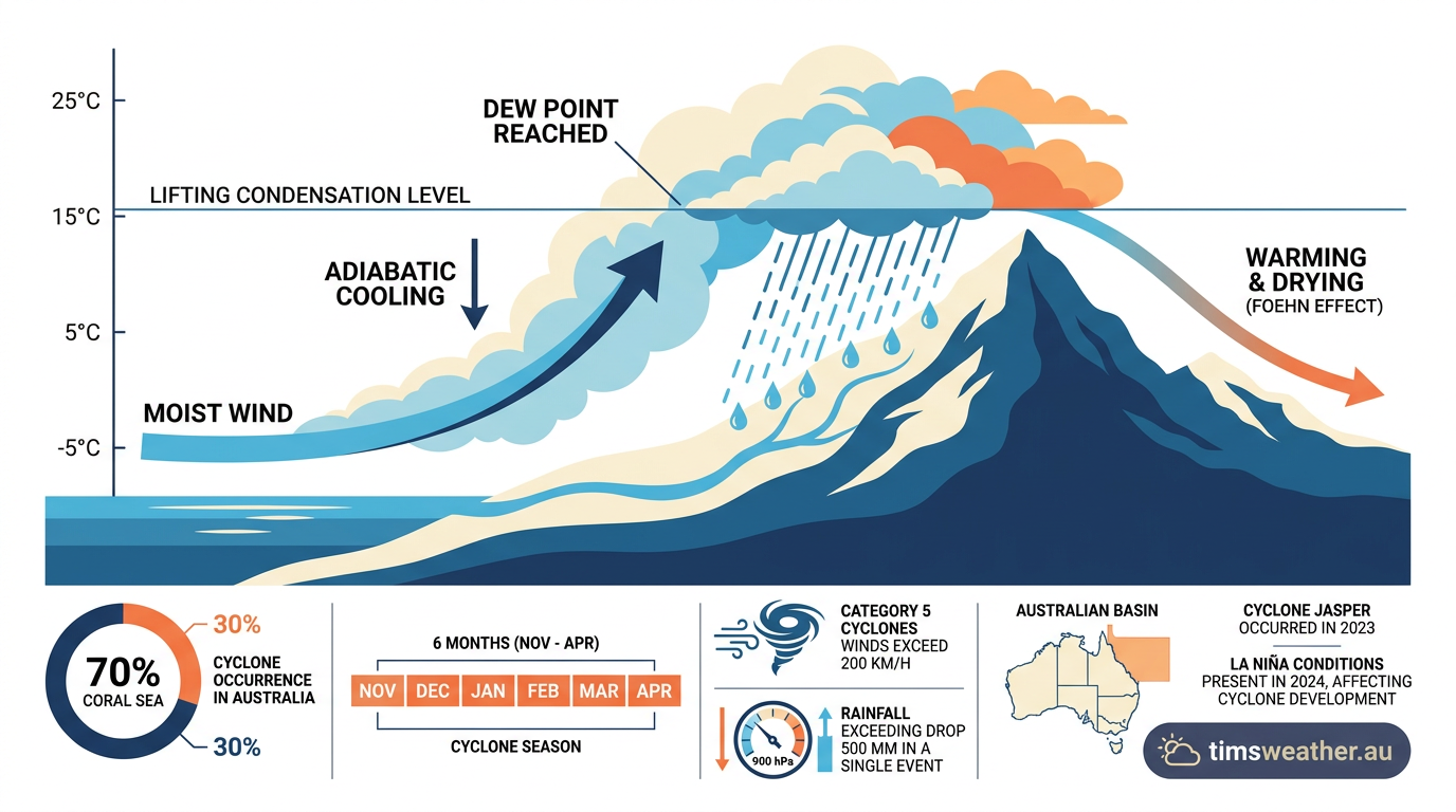
Air cools as it rises because of adiabatic cooling. The expanding air parcel uses energy to expand, so its temperature falls. For dry air, this happens at about the adiabatic lapse rate of 3 °C per 1,000 feet, or about 9.8 °C per kilometre. As the parcel cools, the relative humidity rises. Once the air reaches its dew point temperature, condensation begins. For a plain-English guide to this moisture test, see Dew point vs humidity.
What is the Lifting Condensation Level?
The Lifting Condensation Level is the height where a rising air parcel first becomes saturated and cloud droplets can form. In practical terms, it marks the point where relative humidity reaches 100 per cent. If the LCL is low, fog is more likely to form on hillsides or near mountain passes. If it is higher, the cloud base may sit above the slope instead of touching the ground.
Weather conditions for upslope fog
Upslope fog needs three things: moisture, lifting and atmospheric stability. Without one of these, the fog layer usually fails to form or stays patchy.
Why are moisture and stability necessary?
Low-level moisture gives the rising air enough water vapour to condense. Atmospheric stability helps keep the lifted air layered and steady as it rises. If the atmosphere is too unstable, the air mixes more freely and fog is less likely to hold together. That is why upslope fog often appears as a broad, even sheet on a slope rather than a broken cloud band.
Moisture source also matters. Coastal onshore winds can feed humid air inland, and that air is more likely to fog when terrain forces it upward. The key terms to watch are relative humidity, dew point temperature and atmospheric stability.
Can upslope fog occur without high relative humidity?
Yes, but only if the air stays moist enough during the rise to reach saturation. The air does not need to start at 100 per cent relative humidity near sea level. It does, however, need enough low-level moisture that continued lifting can bring it to the LCL before it crosses the ridge. If the starting air is too dry, it may rise over the terrain without fog forming.
Regional variations across Australia
Upslope fog is most common where moist winds meet steep terrain. In Australia, that makes the Great Dividing Range a key area to watch, especially along windward slopes exposed to persistent onshore flow.
The Great Dividing Range impact
The Great Dividing Range acts as a topographic barrier along much of the east coast. When moist easterly winds hit the range, the air is lifted over the slopes and cools as it rises. That is why fog can develop repeatedly in the same mountain districts, particularly after overnight moisture has built up near the surface. For readers in eastern Australia, this is one reason mountain roads can change quickly from clear to fogbound.
Blue Mountains and other escarpments
Local terrain can sharpen the effect. In the Blue Mountains west of Sydney, steep slopes and high ground can trap moist air on the eastern side when the wind blows onshore. Similar uplift can happen on other escarpments and ranges when the airflow lines up with the terrain. The exact timing depends on wind direction, moisture supply and how stable the air mass is.
In Western Australia, the Darling Scarp can also produce upslope fog when moist air is pushed upslope by the prevailing winds. The mechanics are the same, even if the local weather patterns differ from east coast Australia.
Difference between upslope and radiation fog in Australia
Upslope fog forms because air is forced up terrain, while radiation fog forms because the ground cools the air above it after sunset. The two fog types need different weather setups.
| Fog type | How it forms | Common setting | Main driver |
|---|---|---|---|
| Upslope fog | Moist air is lifted up a slope and cools to saturation | Mountain ranges, escarpments, passes | Orographic lifting |
| Radiation fog | Ground cools overnight, cooling the air above it to the dew point | Clear nights, valleys, sheltered inland areas | Surface cooling |
If you are in the hills or along an escarpment, the fog may persist as long as the onshore flow continues. If you are in a valley on a calm night, radiation fog can form even without strong winds. That difference matters for planning travel and for reading local forecasts.
How forecasters identify upslope fog
Forecasters look at wind direction, moisture content, cloud base and terrain exposure. A model may show humid easterly or southerly flow, but the local impact depends on whether the wind hits a slope directly. They also check whether the air mass is stable enough to keep the fog layer shallow and close to the ground.
For readers who want the broader weather setup first, the pressure systems guide helps explain why moist air is moving inland in the first place. From there, the fog forecast comes down to whether the air will rise far enough to reach the saturation point.
What should you do when upslope fog forms?
If you are driving through mountain country, slow down early, use low-beam headlights and keep a larger gap from the vehicle ahead. Fog can thicken fast on ridges and in cuttings. If visibility drops sharply, pull over only where it is safe and legal to do so.
For weather warnings and road safety updates, check the weather warnings page and the latest road weather update before travelling.
Frequently asked questions
Upslope fog is a type of fog that develops when moist air is physically forced up a mountain or slope by the wind. As the air rises to higher altitudes, it expands and cools adiabatically. Once it reaches its dew point, water vapour condenses into the tiny droplets that form fog.
Source: hko.gov.hk
Further reading and resources
Explore trusted articles, books, videos and other resources to go deeper on this topic.
weather.govReference
A. Fog Types
Background reference on How Upslope Fog Formation Works: Causes and Weather Impacts from weather.gov.
pmc.ncbi.nlm.nih.govReference
A review on factors influencing fog formation, classification, forecasting ...
Background reference on How Upslope Fog Formation Works: Causes and Weather Impacts from pmc.ncbi.nlm.nih.gov.
pilotinstitute.comArticle
The 7 Types of Fog Every Pilot Should Know
In-depth coverage on How Upslope Fog Formation Works: Causes and Weather Impacts from pilotinstitute.com.
climavision.comArticle
5 Types of Fog and How They Form
In-depth coverage on How Upslope Fog Formation Works: Causes and Weather Impacts from climavision.com.
ebsco.comArticle
Fog and regulation of the global climate
In-depth coverage on How Upslope Fog Formation Works: Causes and Weather Impacts from ebsco.com.
Fog Definitions
Background reference on How Upslope Fog Formation Works: Causes and Weather Impacts from weather.gov.
en.wikipedia.orgReference
Fog
Background reference on How Upslope Fog Formation Works: Causes and Weather Impacts from en.wikipedia.org.
How Fog Forms
Background reference on How Upslope Fog Formation Works: Causes and Weather Impacts from weather.gov.
boldmethod.comArticle
The 6 Types Of Fog
In-depth coverage on How Upslope Fog Formation Works: Causes and Weather Impacts from boldmethod.com.
fly8ma.comArticle
Types of Fog
In-depth coverage on How Upslope Fog Formation Works: Causes and Weather Impacts from fly8ma.com.
Planning weeks ahead?
Check Australia's long-range seasonal outlook for rainfall, temperature and the climate drivers (ENSO, IOD, SAM, MJO) shaping the next three months.
View Australia's Seasonal Weather Forecast