
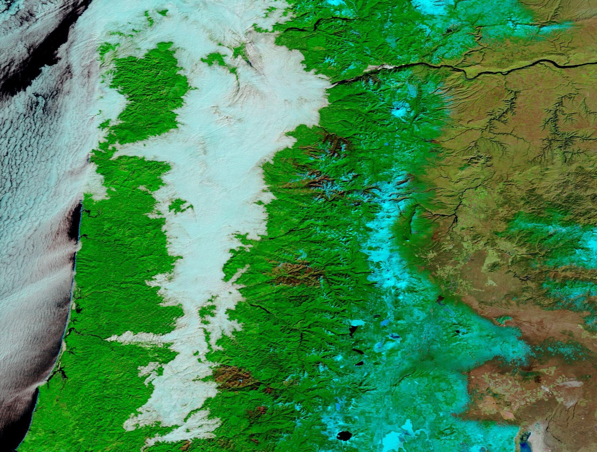
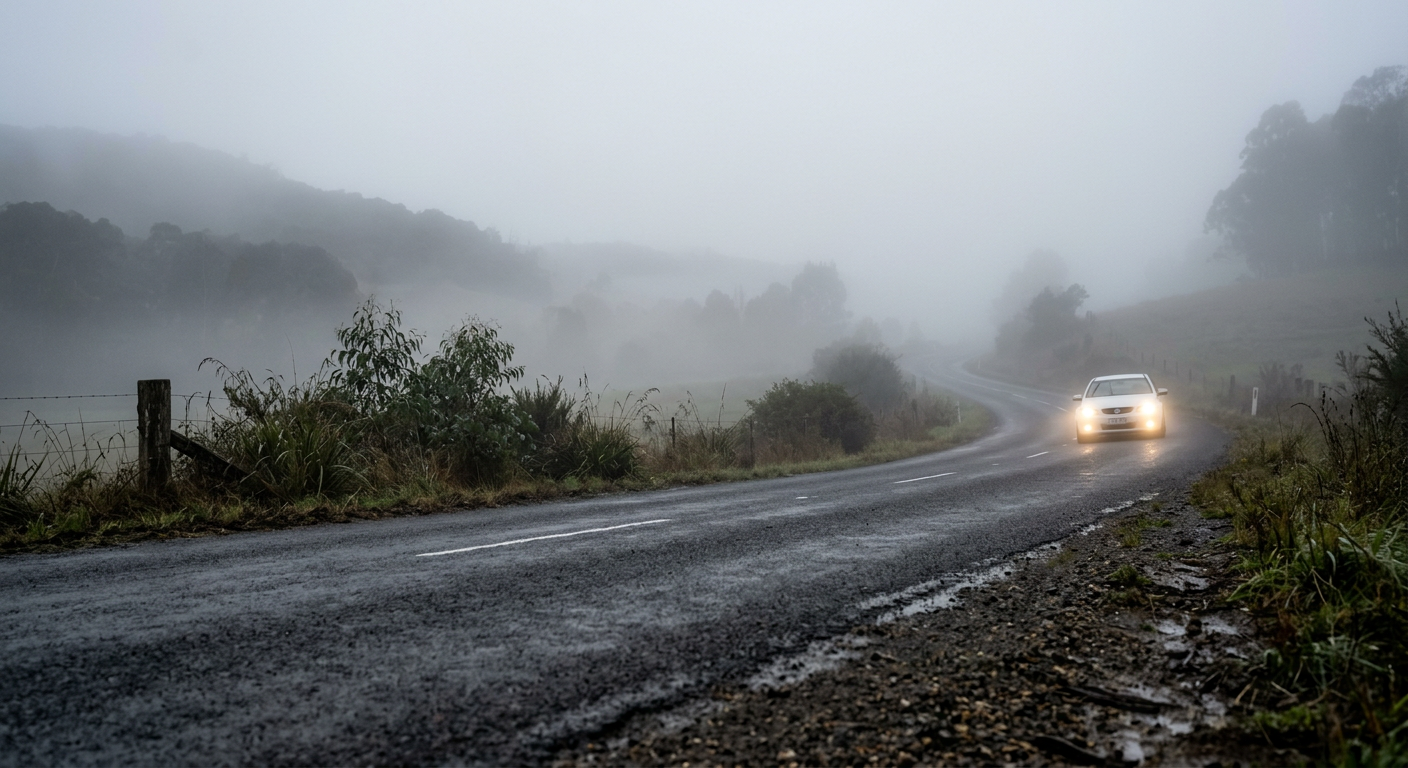
Valley fog formation occurs when radiative cooling on clear nights cools air on slopes and valleys quickly enough for cold, dense air to drain downslope. That drainage flow collects in low ground, such as river valleys and basins, where a temperature inversion can trap the cold pool near the surface. Once the air cools to the dew point, water vapour condenses onto tiny particles and fog becomes visible.
Key takeaways
- Drivers should slow down and use low-beam headlights in low-lying mist, as visibility can change quickly near rivers.
- Clear skies and longwave radiation loss let the ground and the boundary layer cool quickly overnight.
- A stable temperature inversion caps the cold pool and limits vertical mixing.
- Moist ground, rivers and recent rainfall help raise humidity enough for fog droplets to form.
- Topography matters. Valleys, gorges and basins can hold cold air longer than nearby slopes.
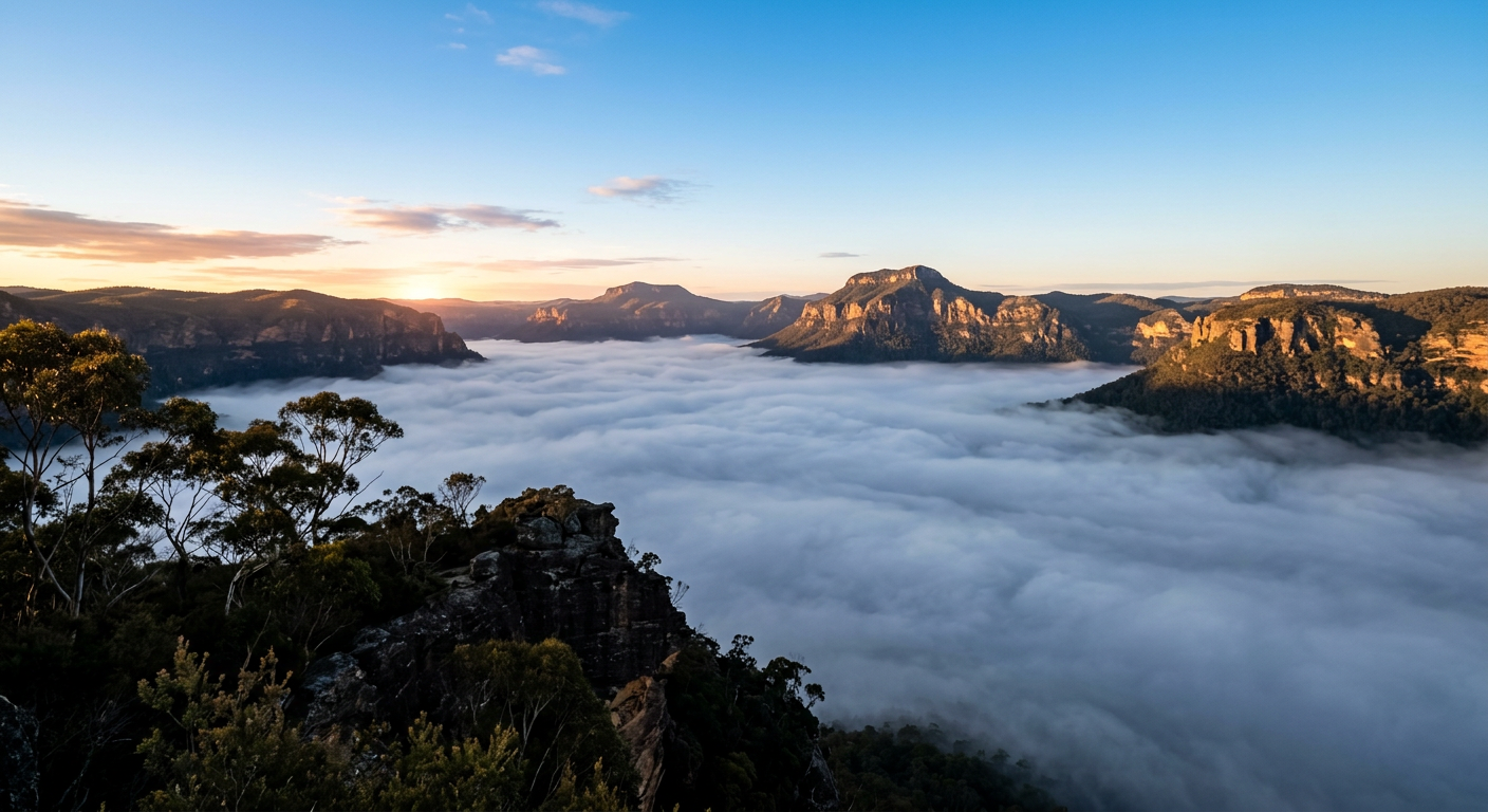
How valley fog forms
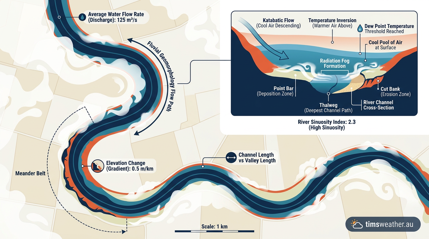
Valley fog is a shallow cloud that forms close to the ground when cooling, moisture and terrain line up. The basic ingredients are simple, but the local setting controls how thick the fog becomes and how long it lasts. The Weather.gov summary of mountain and valley fog notes that it develops when cooling ground temperatures and cold air drainage allow dense fog to gather in valleys.
Radiative cooling starts the process
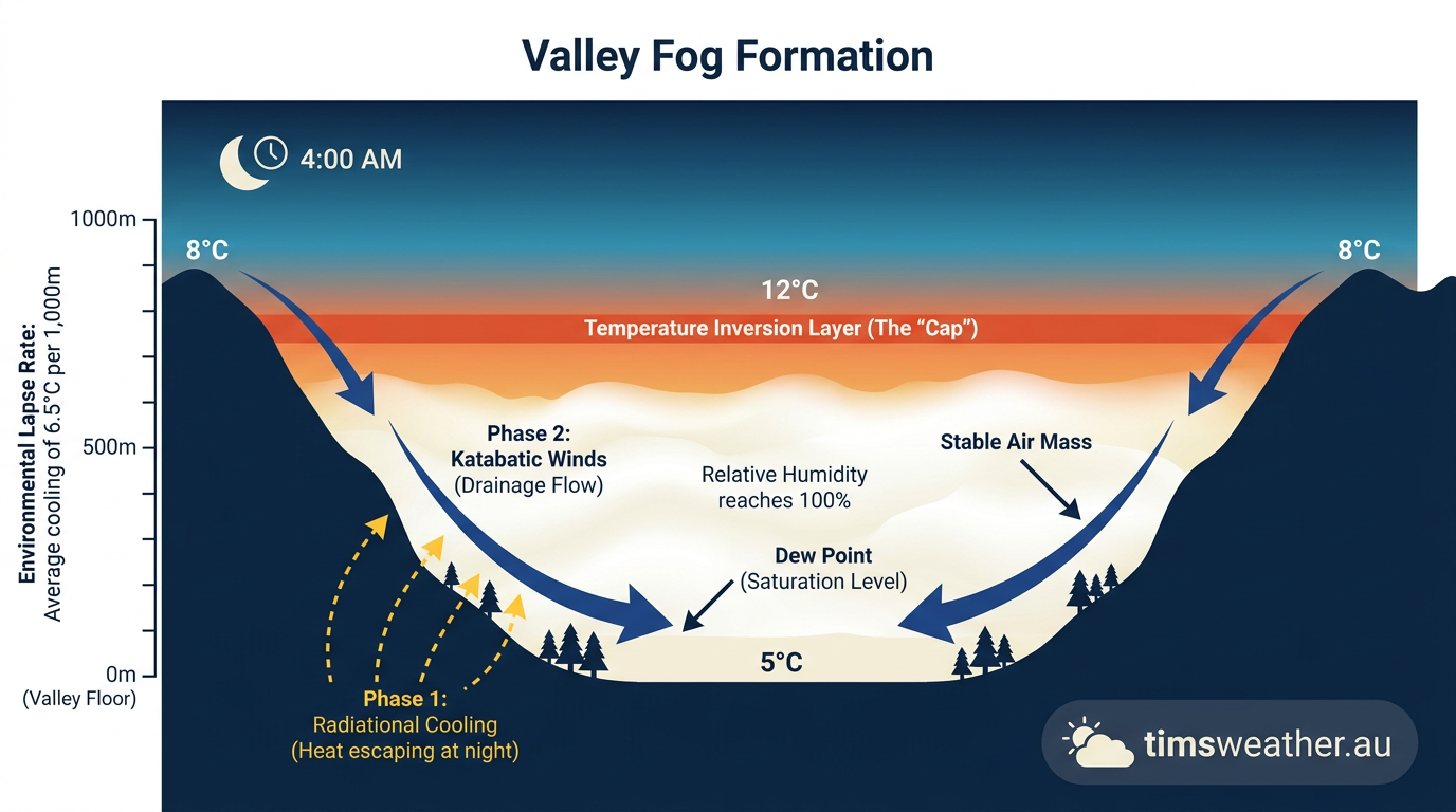
After sunset, the ground loses heat as longwave radiation escapes to space. On clear skies, that heat loss is stronger because clouds are not there to slow the cooling. The soil cools first, then the thin layer of air sitting just above it. This near-surface layer is the boundary layer, and it can cool fast enough to bring the air close to saturation. Once the air temperature falls to the dew point, condensation can begin.
Drainage flow and katabatic winds move cold air downhill
Cold air is denser than warmer air, so it tends to sink. On sloping ground, that sinking becomes drainage flow, often described as katabatic winds. The air slides downhill and gathers in the lowest part of the valley. If the surrounding terrain is steep or enclosed, the cold air can pool for hours after sunset. This is why valleys in the Great Dividing Range can fog up while the hills nearby stay clearer.
Once the pool is established, it can become a stagnant air mass. With little mixing, the cold air stays trapped close to the surface and keeps cooling. That is one reason valley fog is common in sheltered terrain, river basins and deep hollows.
A temperature inversion acts like a lid
A temperature inversion forms when air gets warmer with height instead of colder. In a valley, warm air above the cold pool stops the cold, moist air from rising and mixing out. The inversion does not create the fog by itself, but it protects the setup that lets fog persist.
What makes the air reach saturation?
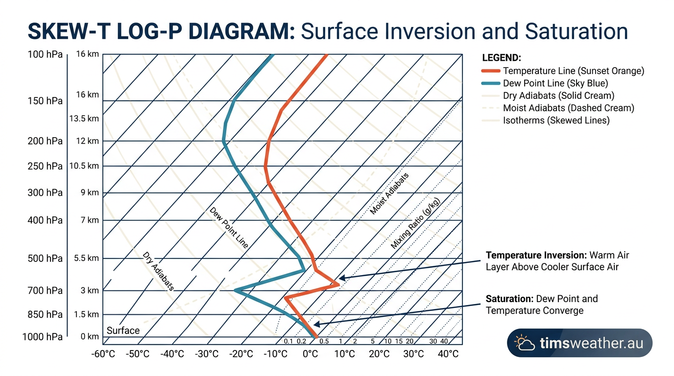
Fog forms when the air can no longer hold all the water vapour it contains. That usually means the temperature has dropped to the dew point. In valleys, the cooling is often strong enough to push the air over that edge overnight.
Moisture sources feed the fog
Recent rainfall, damp soil, dew on vegetation and nearby rivers all add moisture to the air. The Weather.gov valley fog guide says widespread fog is more likely after recent rainfall and when soil moisture is normal or above normal. In river valleys, moisture exchange between warm water and cooler air above can also help nudge the air toward saturation.
This is where advection can matter too. If a shallow layer of moist air moves into the valley before sunset, it gives the overnight cooling process more water vapour to work with. In other words, the valley does not always make its own fog. Sometimes it imports the ingredients first.
Hygroscopic nuclei help droplets form
Water vapour does not turn into fog droplets in empty air. It needs tiny particles to condense onto. These particles are called hygroscopic nuclei because they attract water. Dust, smoke, pollen and other aerosols can all act as nuclei. Once the air reaches saturation, water vapour condenses on these particles and the fog becomes visible.
That is why valley fog can be thicker where there is dust in the air or smoke from nearby sources. More particles give the moisture more surfaces to cling to, so the fog can build more efficiently.
Humidity, dew point and forecast signs
The gap between air temperature and dew point is one of the best clues for fog. When that gap gets small, the air is close to saturation and fog is more likely. For a simple refresher on those terms, see our guide to dew point vs humidity.
Forecasts also depend on the overnight sky and wind. Clear skies favour strong cooling. Light winds allow the cold pool to settle. Strong winds usually mix the air enough to break up the inversion, which makes fog less likely. The mountain and valley fog guidance from Weather.gov makes the same point: light winds, clear skies and enough moisture are the main ingredients.
Why valley fog is common in some places
Valley fog is not random. It tends to recur where terrain and weather patterns repeatedly support cold-air pooling. Deep valleys, sheltered river corridors and basins can hold fog because they trap dense air and slow down mixing.
The role of topography
Topography shapes how well cold air drains and where it collects. Narrow valleys can act like channels for drainage flow, while broad basins can hold a thicker cold pool. If the floor is flat and enclosed, the air may stay stagnant long enough for fog to thicken before sunrise.
This is why the same district can have patchy fog one morning and a solid whiteout the next. Small changes in wind, soil moisture or cloud cover can change the outcome. Even nearby slopes may stay clear while the valley floor sits inside a cold pool.
Great Dividing Range examples
Across the Great Dividing Range, sheltered valleys often get colder than exposed ridges at night. That contrast helps explain why fog can form in one part of the sector and not in another. The ridges cool too, but they do not pool the air the way a valley floor does.
If you live or travel through elevated inland country, fog often turns up in the same places again and again, especially on calm mornings after a clear night. Watch for bridges, dips and river crossings, because fog can sit there after the rest of the route starts to clear.
How the Bureau of Meteorology helps with valley fog forecasting
The Bureau of Meteorology is the main source for Australian warnings, forecasts and observations. For valley fog, forecasters look at overnight temperature trends, dew point, wind speed, cloud cover and local terrain. That lets them judge whether cold-air pooling and saturation are likely before sunrise.
If you are driving early in the morning, check for fog in the forecast and take it seriously. Slow down, use low-beam headlights and leave extra space. Fog can change quickly over short distances, especially near rivers and in valleys.
Valley fog versus advection fog
Valley fog and advection fog both reduce visibility, but they form in different ways. Valley fog is mainly a cooling problem. Advection fog forms when moist air moves over a colder surface and cools to the dew point.
| Fog type | Main trigger | Common setting |
|---|---|---|
| Valley fog | Night-time radiative cooling and drainage flow | Valleys, basins, river corridors |
| Advection fog | Moist air moving over a colder surface | Coasts, cold water, flat terrain |
The two can overlap. A moist air mass may move into a valley, then radiative cooling and an inversion finish the job overnight. That is one reason fog forecasting needs both local terrain and the broader weather pattern.
Related guides
Frequently asked questions
Fog forms in valleys overnight because the ground cools rapidly after sunset, chilling the air near the surface to its dew point. Cold, dense air then pools in low-lying areas. If the air is sufficiently moist, water vapour condenses into tiny droplets, creating the thick fog commonly seen at dawn.
Source: science.nasa.gov
Further reading and resources
Explore trusted articles, books, videos and other resources to go deeper on this topic.
climavision.comArticle
5 Types of Fog and How They Form
In-depth coverage on Valley fog formation: how cold air pools and traps moisture from climavision.com.
weather.govReference
A. Fog Types
Background reference on Valley fog formation: how cold air pools and traps moisture from weather.gov.
How Fog Forms
Background reference on Valley fog formation: how cold air pools and traps moisture from weather.gov.
eoas.ubc.caArticle
6d Valley Cloud/Fog
In-depth coverage on Valley fog formation: how cold air pools and traps moisture from eoas.ubc.ca.
Mountain/Valley Fog
Background reference on Valley fog formation: how cold air pools and traps moisture from weather.gov.
pmc.ncbi.nlm.nih.govReference
A review on factors influencing fog formation, classification, forecasting ...
Background reference on Valley fog formation: how cold air pools and traps moisture from pmc.ncbi.nlm.nih.gov.
about.metservice.comArticle
Valley Fog
In-depth coverage on Valley fog formation: how cold air pools and traps moisture from about.metservice.com.
technologynetworks.comArticle
Researchers Shed Light on How Mountain Fog Is Formed
In-depth coverage on Valley fog formation: how cold air pools and traps moisture from technologynetworks.com.
mrcc.purdue.eduReference
MRCC - Fog - Midwestern Regional Climate Center
Background reference on Valley fog formation: how cold air pools and traps moisture from mrcc.purdue.edu.
Planning weeks ahead?
Check Australia's long-range seasonal outlook for rainfall, temperature and the climate drivers (ENSO, IOD, SAM, MJO) shaping the next three months.
View Australia's Seasonal Weather Forecast