
Northern Territory Daily Rainfall Forecast
See how much rain is forecast across the Northern Territory over the next 24 hours on an interactive map you can zoom into and tap for a reading.
Forecast guidance
Northern Territory Daily Rainfall Forecast
The Northern Territory is one of the most storm prone places on earth through the build up and wet season, with near daily lightning across the Top End.
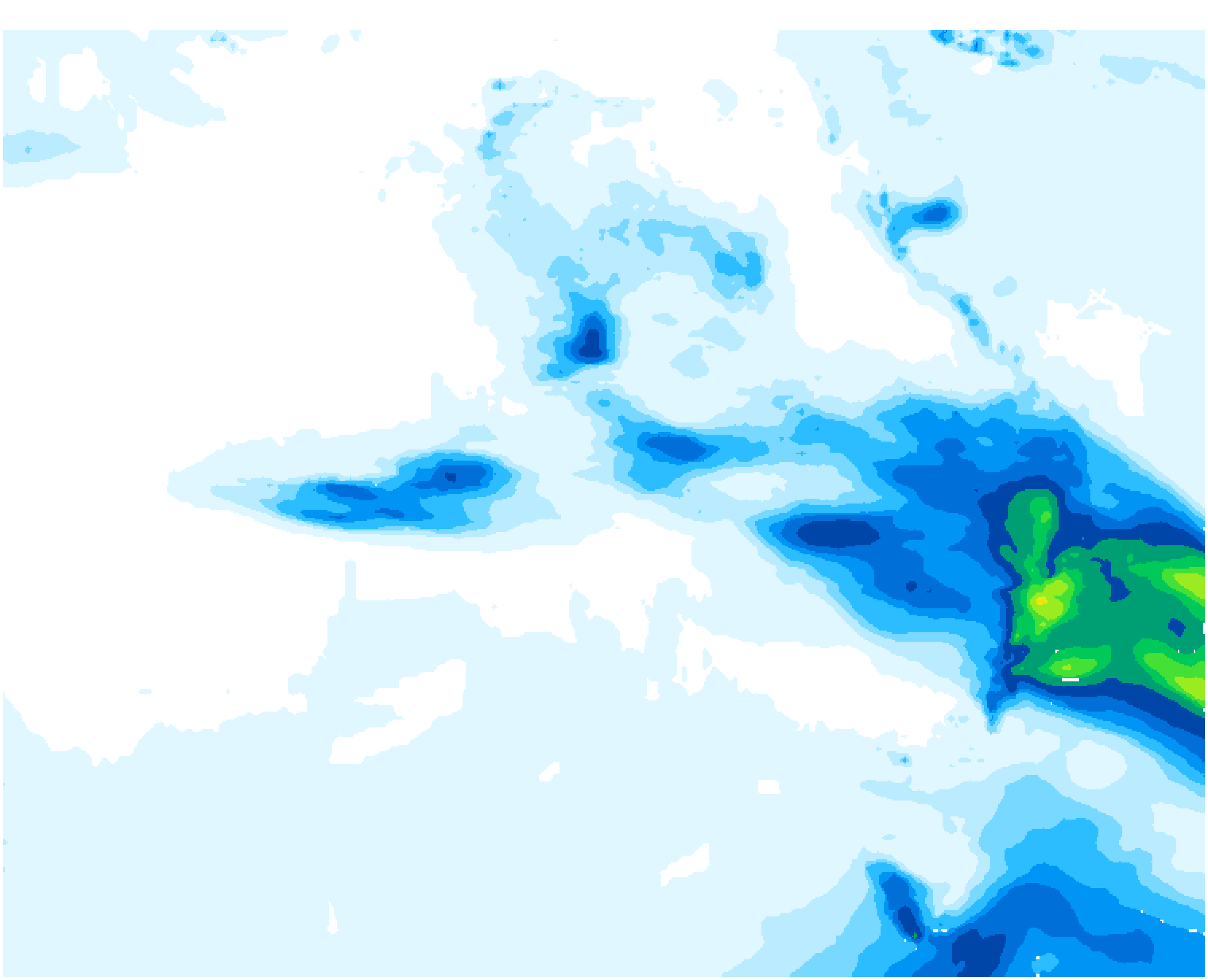
This forecast shows rain expected across the Northern Territory over the next 24 hours, in millimetres. Tap any point for a reading, or open the national Australia map.
Pale blues show light falls, greens and yellows a useful soaking, and orange through purple the heaviest totals. Treat totals as a broad regional guide and check warnings close to the event.
Base map © OpenStreetMap contributors. Rainfall overlay: Tim's Severe Weather.
Forecast image sourced fromMeteologix
Rainfall intensity
millimetres
Light 0.1–10 mm
Moderate 10–30 mm
Heavy 30–100 mm
Very heavy 100 mm+
These descriptions help interpret totals only; they are not official warning levels.
Forecast maps by state and region
Choose Australia, a state or a local region for thunderstorm, daily rainfall and 7 day rainfall maps.
Regions by state
Queensland
New South Wales
Victoria
South Australia
Western Australia
Northern Territory
Regions by state
Queensland
New South Wales
Victoria
South Australia
Western Australia
Northern Territory
Regions by state
Queensland
New South Wales
Victoria
South Australia
Western Australia
Northern Territory
Using the Northern Territory rainfall forecast safely
This map is forecast guidance, not a warning. Totals change with every model run, and a single storm can drop far more rain on one catchment than the map suggests. Official rainfall, flood and severe weather warnings from the Bureau of Meteorology always take priority for the Northern Territory. Never drive through floodwater.
For rain already falling, use the rainfall radar and observations. For storm risk, see the Northern Territory thunderstorm forecast map.
Northern Territory in focus
The national rainfall forecast framed on the Northern Territory, using exactly the same millimetre colour scale as every other view so you can compare areas fairly.
Clear issued and valid times
Every map states when the forecast was produced and the period it covers — the next 24 hours — in Australian eastern time.
Guidance, not a warning
Plan travel, outdoor work and farm operations around it, but Bureau of Meteorology rainfall and flood warnings always come first.
Frequently Asked Questions
Related Resources
- Australia Daily Rainfall Forecast
- Northern Territory 7 Day Rainfall Forecast
- Top End Daily Rainfall Forecast
- Queensland Daily Rainfall Forecast
- New South Wales Daily Rainfall Forecast
- Victoria Daily Rainfall Forecast
- Northern Territory Thunderstorm Forecast Map
- Australian Weather Warnings
- Recent Rainfall Map & Observations
Data Source
Data provided by Tim's Severe Weather
Update Frequency: Daily