
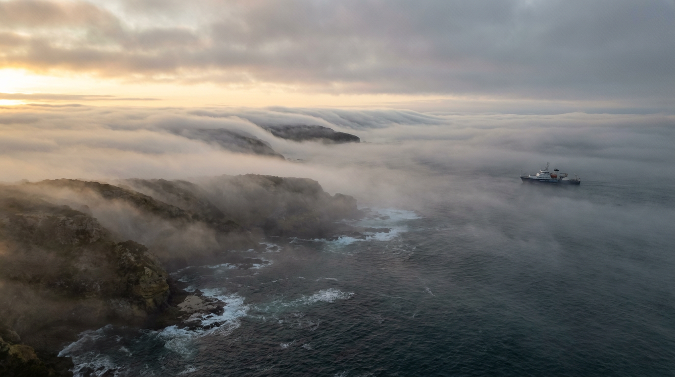
Advection fog formation occurs when a warm, moist air mass moves horizontally over a much cooler surface, such as a cold ocean current or chilled landmass. As the air near the surface cools below its dew point temperature, water vapour condenses onto condensation nuclei, forming a fog layer that often sits close to the ground or sea surface. The Bureau of Meteorology (BOM) monitors these coastal fog events because they can cut visibility very quickly.
Key takeaways
Advection fog forms when horizontal air movement carries moist air across a strong temperature gradient.
The air cools from below in the boundary layer until it reaches saturation and the relative humidity approaches 100%.
A marine layer often keeps the fog trapped near the surface, so visibility can stay poor for hours.
Cold waters linked with the Southern Ocean, Bass Strait, the Leeuwin Current and the East Australian Current can help set up the right conditions.
Advection fog is different from radiation fog because it does not rely on overnight ground cooling.
Coastal fog is a common issue near ports, runways and exposed shorelines, including parts of the Great Barrier Reef.
How advection fog formation works
Advection fog forms when moist air is blown over a colder surface and loses heat from the bottom up. That matters because air does not need to rise to cool in this case, it only needs to move sideways across a colder sea or land surface. The BOM describes fog as tiny water droplets suspended near the ground, and advection fog is one of the clearest examples of that process in action.

Thick advection fog moving through a coastal harbour environment
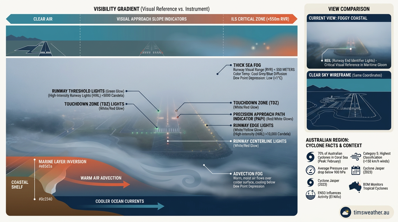
Daytime advection fog obscuring a coastal aviation runway
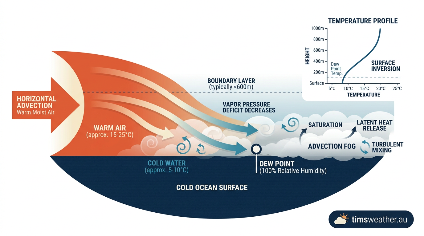
Diagram illustrating the advection fog formation process with warm air moving over cold water
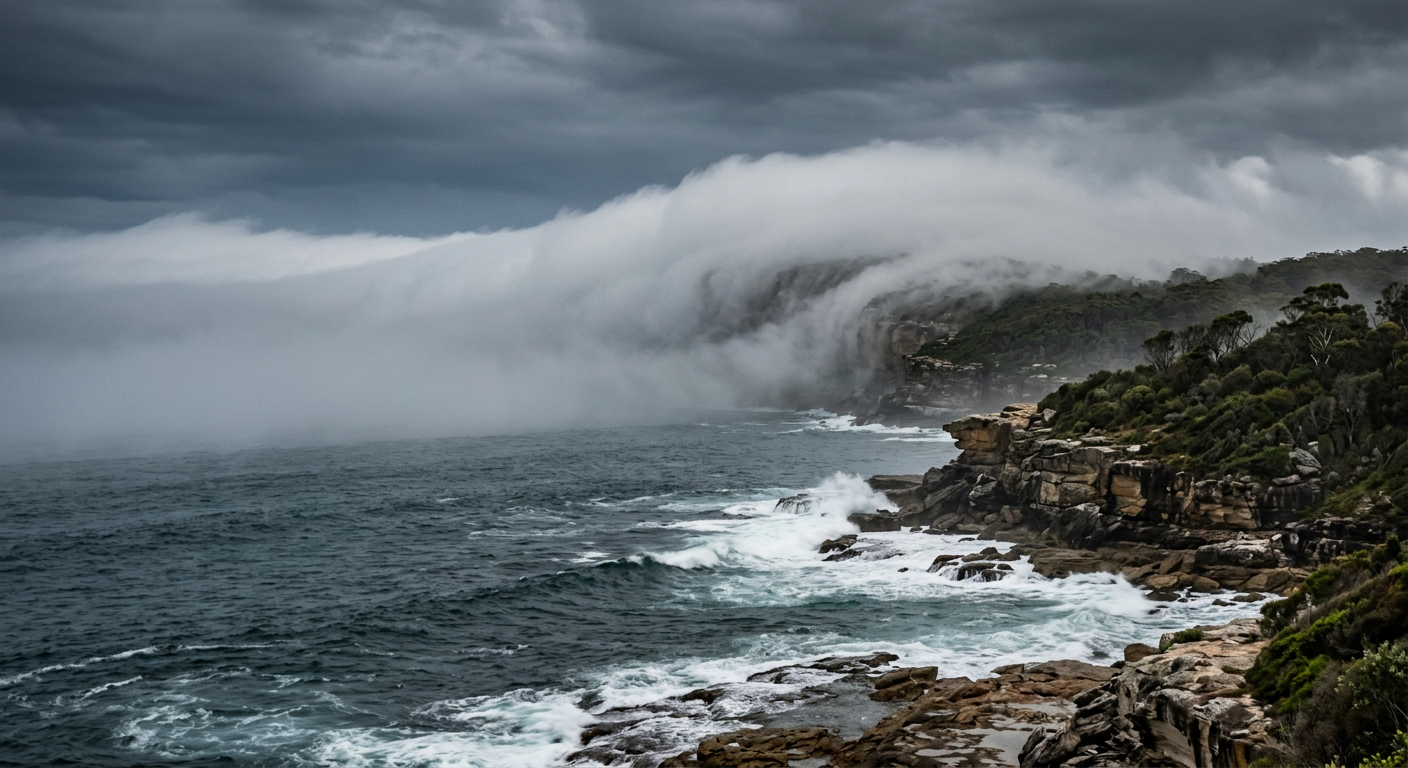
Advection fog formation rolling horizontally over the ocean surface
What conditions are needed?
You need moist air, a colder surface, and enough horizontal air movement to keep the air flowing over that surface. If the air mass is dry, fog is much less likely. If the temperature gradient is weak, the air may cool a little but not enough to reach saturation.
In simple terms, the air is being cooled faster than it can warm back up. Once the air temperature drops to the dew point temperature, the water vapour in that air condenses into tiny droplets. Those droplets scatter light and visibility falls.
Why the boundary layer matters
The boundary layer is the thin slice of air closest to the surface. In advection fog, that layer cools from below. This is where surface cooling does the work, not the sun or a cold night sky. If the surface stays cold enough, fog can continue even through the day.
Thermal inertia also plays a part. Water changes temperature slowly, so a cold current or chilled coastal shelf can keep cooling the air after the larger weather pattern has changed. That is why advection fog often lingers near coasts and over cold water.
Why droplets form so quickly
Air almost never forms fog from pure water vapour alone. It usually needs hygroscopic particles or other condensation nuclei, such as sea salt, dust and smoke, to give the water vapour a surface to condense onto. Over the ocean, salt particles are common, so fog can form efficiently when the air cools to saturation.
Relative humidity rises as the air cools. Once it reaches saturation, the air can no longer hold all of its water vapour in gaseous form, so droplets appear. That is the moment fog starts.
Step | What happens | Weather result |
|---|---|---|
1 | A moist air mass moves sideways over a colder surface | The lower air cools |
2 | The air temperature falls toward the dew point temperature | Relative humidity rises |
3 | Water vapour condenses on condensation nuclei | Fog droplets form |
4 | A stable marine layer or boundary layer traps the fog | Visibility stays low |
Advection Fog vs Radiation Fog: The Australian Climatic Context
Advection fog and radiation fog look similar from the ground, but they form in different ways. Advection fog depends on horizontal air movement over a colder surface. Radiation fog depends on nighttime surface cooling over land under clear skies and light winds.
This difference matters around Australia because coastal waters, shelf seas and currents often set up advection fog, while inland valleys are more likely to see radiation fog after clear, calm nights. The BOM uses these patterns when assessing visibility risks for marine and aviation forecasts.
Fog type | Main driver | Typical Australian setting |
|---|---|---|
Advection fog | Warm, moist air moving over a colder surface | Coasts, harbours, cold currents, exposed straits |
Radiation fog | Ground cooling overnight | Inland plains, river valleys, sheltered basins |
Sea fog | Moist air over cold water | Offshore and nearshore marine areas |
Sea fog is often the form people notice first along the coast. It can sit over shipping lanes, wash across headlands, and move well inland if the wind keeps feeding moist air over cold water.
Where this fog is most likely in Australia
Cold water is the main clue. The Southern Ocean can support long stretches of fog along southern coasts. Bass Strait can also see fog when moist air passes over cooler water between Tasmania and mainland Australia. In western Australia, the Leeuwin Current usually brings warmer water south, which changes how often fog forms, while the East Australian Current can shape coastal temperature contrasts along the east coast.
Near the Great Barrier Reef, advection fog is less about cold ocean water and more about local contrasts between air, water and land, especially when moisture is high and winds carry that air across cooler patches. In all of these cases, the same rule applies: if the air cools to its dew point over a colder surface, fog can form.
Why fog can persist after sunrise
Advection fog can last longer than many people expect because the surface stays cold and the moist air keeps arriving. Sunlight may not clear it if the sea surface or ground underneath remains cool enough. A stable marine layer can also stop mixing, so the fog stays pinned near the surface instead of breaking apart.
That is why coastal fog can remain in place through the morning peak commute, over marine channels and at busy airports. If you are near the water, check the latest BOM forecast and marine warning products before travelling.
For pilots and mariners, the main issue is simple: visibility can change fast. A route that looked clear an hour earlier can become hard to see as soon as a moist air mass crosses colder water or a shaded shoreline.
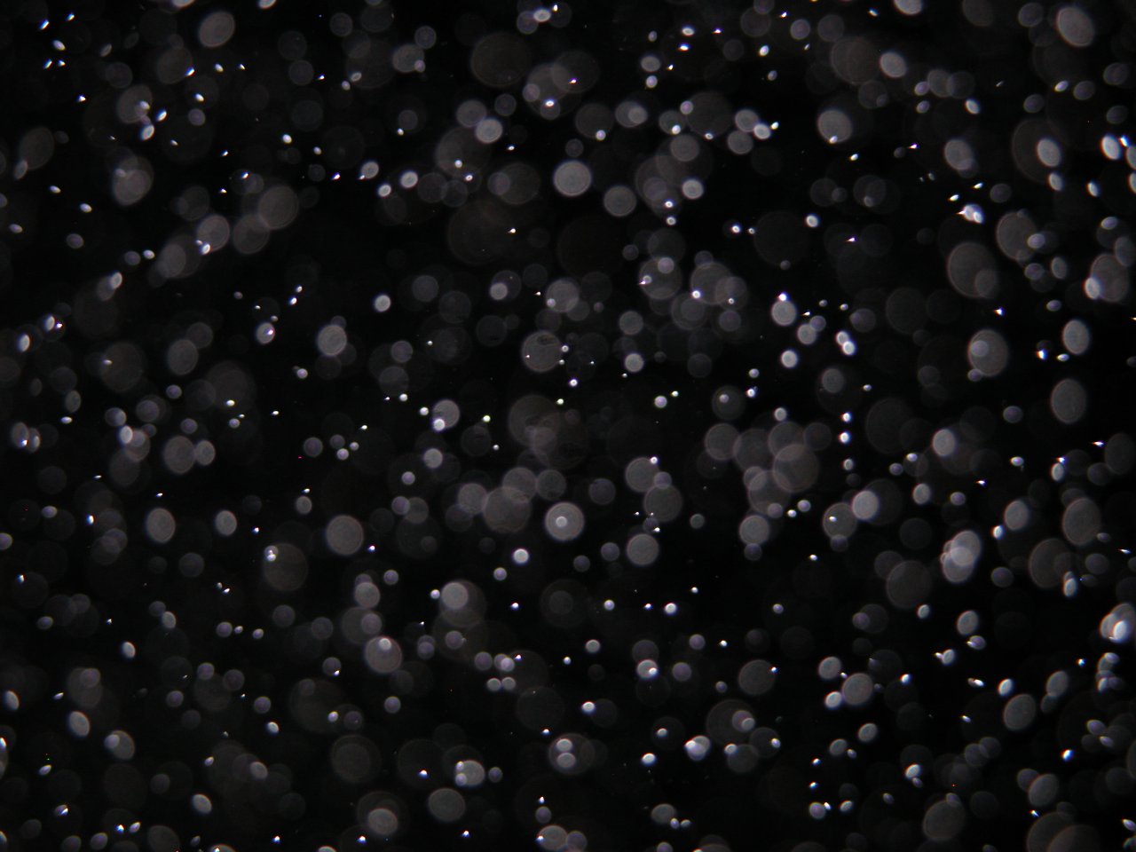
A close-up view of water droplets forming fog. Those outside the camera lens's depth of field appear as orbs. By Ben pcc at English Wikipedia - Own work, Public Domain, https://commons.wikimedia.org/w/index.php?curid=22945625
Signs advection fog is forming
Air temperature and dew point temperature are close together.
Wind is bringing moist air from one surface type to another.
Cloud or fog sits flat near the water rather than building upward.
The sea surface feels much cooler than the air above it.
Visibility drops first along the shoreline, then offshore or inland.
How it affects transport
Advection fog can slow road traffic, delay flights and make boating risky. That is most likely when fog banks move across river mouths, harbours, straits and exposed coastal roads. If you are driving, slow down, use low beam headlights and allow extra space. If you are on the water, check marine forecasts and do not rely on landmarks that may disappear in the fog.
Related guides
Frequently asked questions
Advection fog forms when warm, moist air moves horizontally over a cooler surface, such as cold ocean currents or chilled land. The air cools from below until it reaches its dew point, causing water vapour to condense into tiny droplets. This process is common in coastal regions and marine layers.
Source: marinerstudio.com
Further reading and resources
Explore trusted articles, books, videos and other resources to go deeper on this topic.
weather.govReference
A. Fog Types
Background reference on Advection Fog Formation: How It Forms Over Cold Surfaces from weather.gov.
Advection Fog
Background reference on Advection Fog Formation: How It Forms Over Cold Surfaces from weather.gov.
britannica.comReference
Advection fog | meteorology
Background reference on Advection Fog Formation: How It Forms Over Cold Surfaces from britannica.com.
climavision.comArticle
5 Types of Fog and How They Form
In-depth coverage on Advection Fog Formation: How It Forms Over Cold Surfaces from climavision.com.
ebsco.comArticle
Fog and regulation of the global climate
In-depth coverage on Advection Fog Formation: How It Forms Over Cold Surfaces from ebsco.com.
How Fog Forms
Background reference on Advection Fog Formation: How It Forms Over Cold Surfaces from weather.gov.
pilotinstitute.comArticle
The 7 Types of Fog Every Pilot Should Know
In-depth coverage on Advection Fog Formation: How It Forms Over Cold Surfaces from pilotinstitute.com.
skybrary.aeroArticle
Fog | SKYbrary Aviation Safety
In-depth coverage on Advection Fog Formation: How It Forms Over Cold Surfaces from skybrary.aero.
boldmethod.comArticle
The 6 Types Of Fog
In-depth coverage on Advection Fog Formation: How It Forms Over Cold Surfaces from boldmethod.com.
en.wikipedia.orgReference
Fog
Background reference on Advection Fog Formation: How It Forms Over Cold Surfaces from en.wikipedia.org.
Planning weeks ahead?
Check Australia's long-range seasonal outlook for rainfall, temperature and the climate drivers (ENSO, IOD, SAM, MJO) shaping the next three months.
View Australia's Seasonal Weather Forecast