
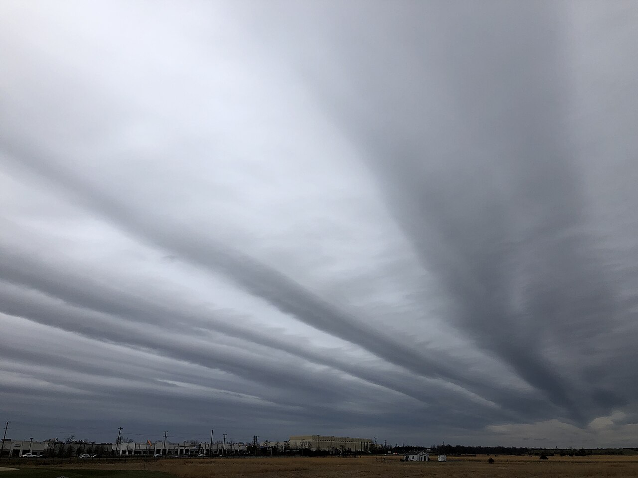
Altostratus clouds formation happens when saturated air is forced to rise over a broad area, often ahead of a warm front. As the air cools in the troposphere, water vapour condenses into a uniform grey layer of mid-level clouds made of water droplets and ice crystals. The Bureau of Meteorology uses this kind of cloud deck as one clue that widespread rain may be on the way.
Key takeaways
Altostratus is a mid-level cloud in the troposphere and can spread across large parts of the sky as a smooth cloud deck.
It forms when a lifting air mass cools enough for condensation to occur on condensation nuclei.
The cloud usually sits in the 2 to 7 km range above the surface, although the base altitude varies with latitude and season.
Altostratus can contain water droplets and ice crystals, and colder parts of the cloud may also contain supercooled water droplets.
A thickening altostratus layer can point to a nimbostratus transition, especially when rain develops ahead of a warm front.
The mechanics of altostratus clouds formation
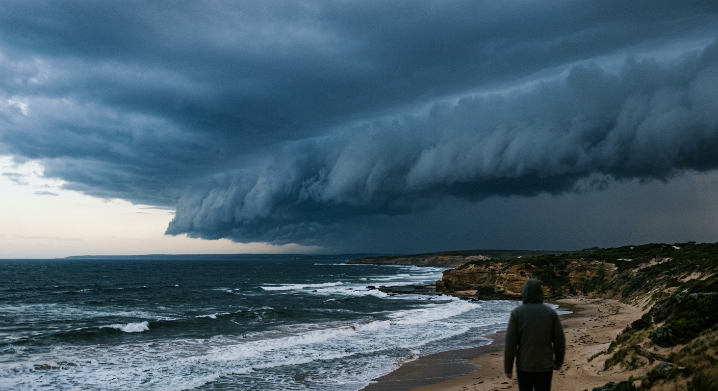
Thick altostratus opacus clouds advancing ahead of a synoptic cold front.
How do altostratus clouds form?
Altostratus clouds form when air rises slowly over a wide area and cools as it lifts. The rising air mass may be fed by advection, which is the horizontal transport of moisture, and by larger-scale isentropic lifting, where air moves up along sloping surfaces of equal potential temperature. As the air cools, moisture condenses and a broad, featureless cloud sheet develops. This is the typical pattern described in meteorology references such as the Britannica cloud summary.
The role of large-scale isentropic lifting
Large-scale isentropic lifting helps explain why altostratus often spreads over such a wide area. It commonly occurs when warmer air overruns cooler air near a фронт, especially ahead of a warm front. The lifting is gentle rather than abrupt, so the cloud stays layered instead of building into tall towers. That is why altostratus is classed as a stratiform cloud rather than a convective one.
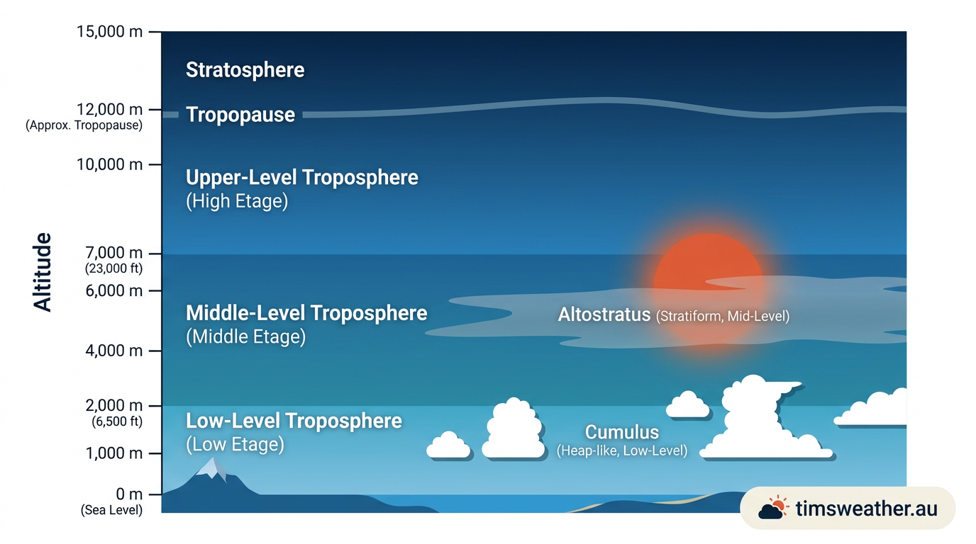
Diagram of altostratus cloud formation in the middle troposphere.
Advection and condensation nuclei
Moisture must also find condensation nuclei before cloud droplets can form. These tiny particles can be dust, sea salt, smoke or pollution. When advection brings moist air into a new region, it also helps spread the moisture over a broad area. Once the air cools to saturation, condensation begins on those particles and the cloud layer fills out.
Water droplets, ice crystals and the cloud deck
Altostratus usually contains both water droplets and ice crystals. In colder parts of the cloud, some liquid droplets can remain unfrozen for a time, which is why mixed-phase cloud layers are common in mid-level clouds. That mix helps the cloud grow thicker and more uniform. It can also prepare the way for a nimbostratus transition if the layer deepens and steady rain starts.
Physical characteristics and altitude in the troposphere
How high is the base of an altostratus cloud?
Altostratus generally forms between 2 and 7 km above the surface in the troposphere, based on the Britannica summary. The cloud base altitude varies with season, latitude and the temperature of the air mass. In warm, deep tropical air, the base can sit higher than it does in cooler conditions.
Why are altostratus clouds grey?
The cloud looks grey because its water droplets and ice crystals scatter and absorb sunlight across a thick layer. A thin altostratus deck may still allow the sun to show through as a watery disc. When the cloud thickens, it becomes a more uniform grey layer and the sky loses contrast.
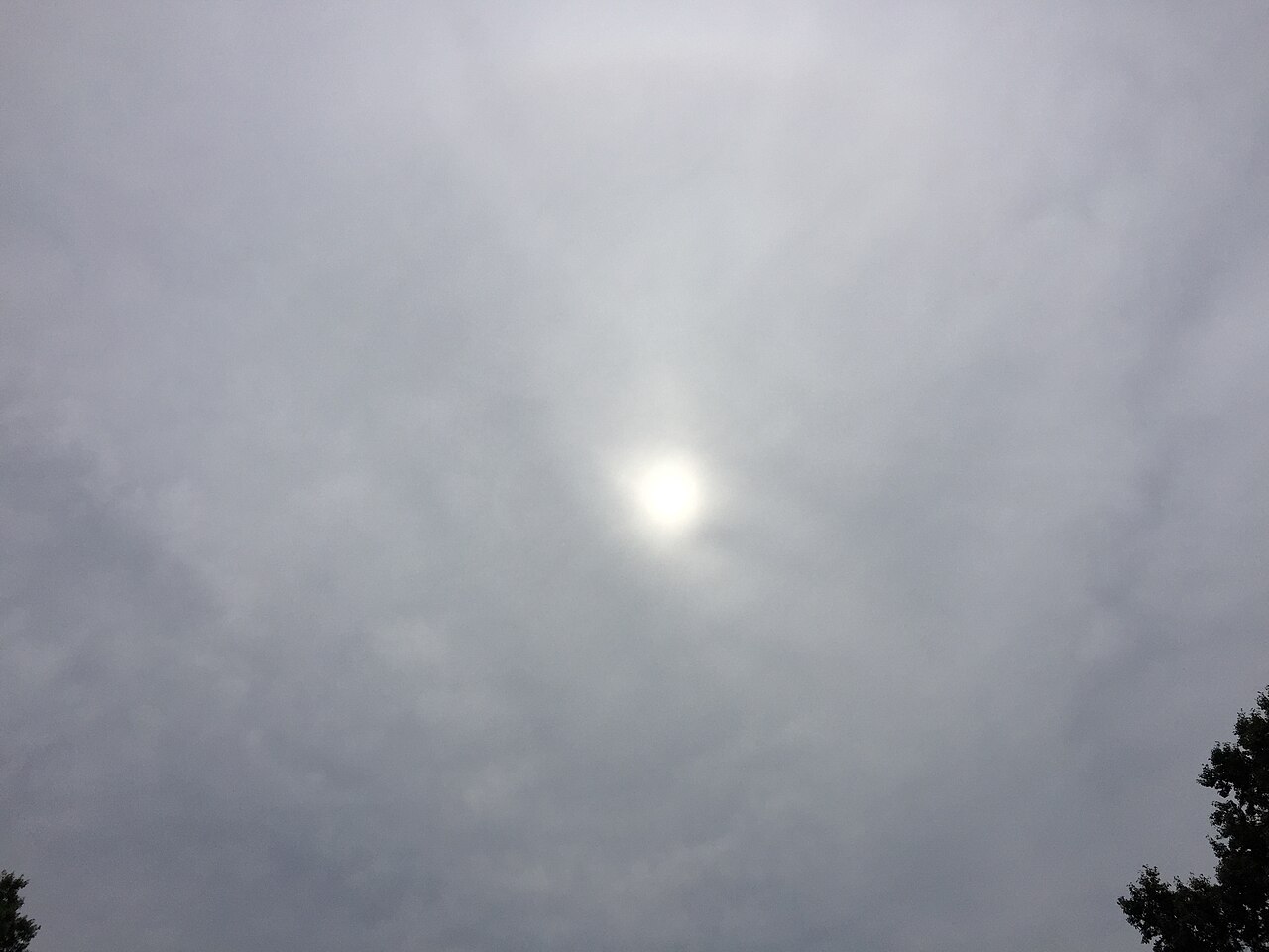
Sun shining dimly through a uniform, mid-level grey altostratus translucidus cloud layer, with dark treetops. By Famartin - Own work, CC BY-SA 4.0, https://commons.wikimedia.org/w/index.php?curid=63843258
What does opacus vs translucidus mean?
Altostratus can be described as opacus when it blocks the sun completely. It is called translucidus when the sun is still visible through the cloud deck. That difference is useful when you are watching the layer thicken ahead of rain.
How is altostratus different from altocumulus?
Altostratus forms a smooth sheet. Altocumulus, by contrast, appears as separate patches, rolls or rounded lumps. If the sky looks broken into individual cloud elements, you are more likely looking at altocumulus. If it looks like one broad grey sheet, altostratus is the better fit.
How does altostratus compare with nimbostratus?
Altostratus often comes before nimbostratus in a front system. As the layer deepens, it can lower visibility and begin producing steady rain. That change matters because nimbostratus is the more rain-bearing stage, while altostratus often signals that rain is approaching rather than falling heavily yet.
Altostratus Formation in Australian Synoptic Systems
In Australian weather patterns, altostratus commonly appears ahead of fronts in the westerly flow over southern states, and it can also form in broad overrunning setups where warm air is lifted over cooler air. The Bureau of Meteorology often uses layered cloud changes, falling cloud bases and reduced sun as part of the wider picture when assessing an approaching rain band. If you are in southern Australia, a spreading grey deck is often one of the earlier visual signs of a frontal change.
What a change from altostratus can tell you
Altostratus is not usually the rain itself, but it often marks the setup for it. A thicker, darker layer can point to a developing nimbostratus transition. If the cloud base lowers and the sky turns more uniform, watch for light rain or drizzle, then steadier rain later. In some cases, virga may appear beneath the cloud, where precipitation falls but evaporates before reaching the ground.
Related guides
Frequently asked questions
Altostratus clouds form when a large, stable air mass is slowly lifted through the atmosphere, causing moisture to cool and condense. This process typically occurs over a wide area, creating a uniform grey or bluish sheet. These mid-level clouds often develop ahead of approaching warm fronts or large-scale weather systems.
Source: cloudatlas.wmo.int
Further reading and resources
Explore trusted articles, books, videos and other resources to go deeper on this topic.
weather.govReference
Cloud Classifications and Characteristics
Background reference on Altostratus Clouds Formation: How Mid-Level Grey Layers Form from weather.gov.
en.wikipedia.orgReference
Altostratus cloud
Background reference on Altostratus Clouds Formation: How Mid-Level Grey Layers Form from en.wikipedia.org.
weather.metoffice.gov.ukReference
Mid-level clouds
Background reference on Altostratus Clouds Formation: How Mid-Level Grey Layers Form from weather.metoffice.gov.uk.
rainviewer.comArticle
How Clouds Form and Their Types
In-depth coverage on Altostratus Clouds Formation: How Mid-Level Grey Layers Form from rainviewer.com.
cloudatlas.wmo.intArticle
Altostratus | International Cloud Atlas
In-depth coverage on Altostratus Clouds Formation: How Mid-Level Grey Layers Form from cloudatlas.wmo.int.
zmescience.comArticle
Altostratus clouds: overview and weather prediction
In-depth coverage on Altostratus Clouds Formation: How Mid-Level Grey Layers Form from zmescience.com.
noaa.govReference
Ten Basic Clouds | National Oceanic and Atmospheric Administration
Background reference on Altostratus Clouds Formation: How Mid-Level Grey Layers Form from noaa.gov.
whatsthiscloud.comArticle
Altostratus Clouds: Mid-altitude Gray Layer
In-depth coverage on Altostratus Clouds Formation: How Mid-Level Grey Layers Form from whatsthiscloud.com.
cloudappreciationsociety.orgArticle
Altostratus
In-depth coverage on Altostratus Clouds Formation: How Mid-Level Grey Layers Form from cloudappreciationsociety.org.
nesdis.noaa.govReference
Types of Clouds | NESDIS - NOAA
Background reference on Altostratus Clouds Formation: How Mid-Level Grey Layers Form from nesdis.noaa.gov.
Planning weeks ahead?
Check Australia's long-range seasonal outlook for rainfall, temperature and the climate drivers (ENSO, IOD, SAM, MJO) shaping the next three months.
View Australia's Seasonal Weather Forecast