
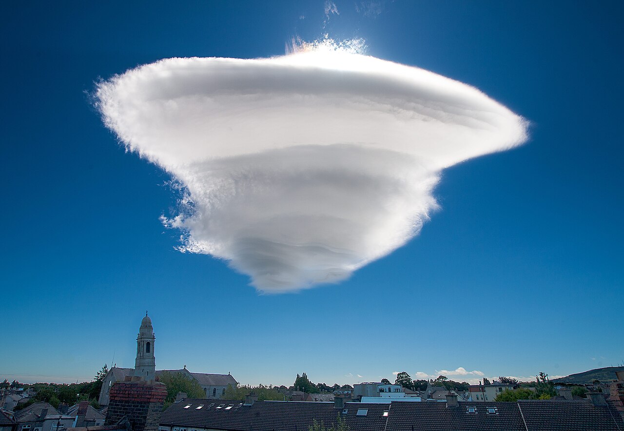
How do lenticular clouds form? They form when stable, moist air is forced over mountains, rises and cools, then condenses at the crest of a mountain wave. The cloud can look fixed in place even though air is moving quickly through it.
Key takeaways
Lenticular clouds form when air is pushed over high terrain and cools enough for condensation.
The best-known mid-level form is altocumulus standing lenticularis.
They are linked to lee waves, mountain waves and stable atmosphere conditions.
The cloud appears stationary because it forms on the upwind side and evaporates on the downwind side.
For pilots, they can point to mountain wave turbulence and strong downdraughts.
How do lenticular clouds form over mountains?
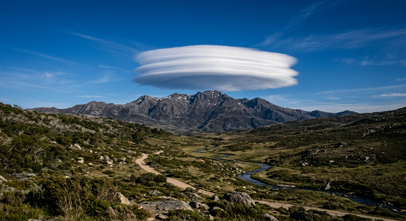
A smooth lenticular cloud above a mountain peak showing mountain wave formation.
Lenticular clouds are a mountain-wave cloud, not a thunderstorm cloud. The process starts when strong airflow meets a ridge or mountain range and is forced upward. That is orographic lifting. The air then sinks on the lee side, or downwind side, and the up-and-down motion can continue for some distance downstream.
That repeating motion is called a lee wave, or mountain wave. The air behaves like a ripple in a stream, but in the troposphere. If the air stays smooth rather than churning, the wave pattern can remain organised and a cloud can form at the wave crest.
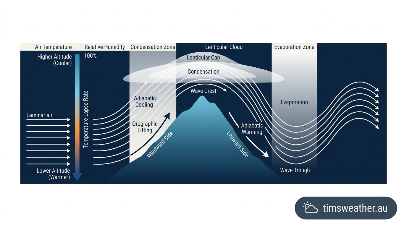
Diagram showing air rising over a mountain, cooling, and forming a lenticular cloud.
For a cloud to appear, the air must reach its condensation level. As the parcel rises, pressure falls and the air expands. That expansion causes adiabatic cooling, which lowers the temperature until it reaches the dew point. At that point, water vapour condenses into tiny droplets or ice crystals and the cloud becomes visible.
As the air moves past the crest and descends, it warms again. The droplets evaporate, so the cloud seems to vanish on the back side. New cloud is forming at the same fixed spot as old cloud disappears, which is why lenticular clouds look stationary even in strong winds.
Why does a stable atmosphere matter?
A stable atmosphere is the main reason lenticular clouds keep their smooth, lens-like shape. In stable air, lifted parcels want to sink back to their original level. That restoring motion supports a standing wave instead of a broad plume of rising air.
If the air were unstable, the lift over the mountain would be more likely to trigger tall convective cloud instead. In stable air, the flow is often laminar, which means it moves in smooth layers with little vertical mixing. That layered flow helps the wave keep its shape as it crosses the range.
Altocumulus standing lenticularis explained
The formal name for the most common mid-level lenticular cloud is altocumulus standing lenticularis. It is the type most people picture when they think of a lenticular cloud: smooth, rounded, and sometimes stacked in layers.
Those stacked layers form when separate moisture bands sit at different heights in a stratified atmosphere. Each band can reach saturation at a different wave level, while drier air between them stays clear. The result is a set of cloud decks that can look neatly arranged one above another.
Why do they often look like discs or flying saucers?
The shape comes from the airflow around the wave crest. Condensation is strongest where air is rising most efficiently, then the cloud edge is trimmed by evaporation as the air sinks. That balance produces a smooth oval or disc shape.
People often notice lenticular clouds near isolated peaks, but they can also appear over long mountain chains. In Australia, mountain waves can form over the Australian Alps when the airflow, moisture and stability line up. The Bureau of Meteorology (BOM) uses plain language like stable air, cloud bands and mountain wave conditions in its weather information for the public.
What conditions are needed for lenticular clouds?
Three ingredients matter most: moist air, strong winds at the right angle to the mountain, and a stable atmosphere. If any one of these is missing, the cloud may not form, or it may be too weak to notice from the ground.
The air also needs enough moisture close to the condensation level. If the dew point is far below the air temperature, the parcel can be lifted a long way before a cloud appears. If the dew point is close to the air temperature, only a small rise is needed.
Stable, moist air helps the wave stay organised.
Strong cross-mountain winds provide the lift.
Condensation level must be reached for the cloud to become visible.
Tropospheric airflow needs to stay smooth enough for a standing wave.
What do lenticular clouds tell us about the weather?
Lenticular clouds do not always mean bad weather, but they do point to energetic airflow near mountains. For pilots, they can signal mountain wave turbulence, rotor activity and strong downdraughts on the lee side. That is why they are watched closely near airports and alpine routes.
On the ground, they are mostly a sign of how air is moving over terrain. If you see one over a ridge, the air aloft is likely flowing fast and smoothly enough to form standing waves. The cloud itself is just the visible part of a larger pattern in the troposphere.
How to tell a lenticular cloud from other clouds
Lenticular clouds are smooth, lens-shaped and usually stay fixed relative to the mountain. That makes them different from fair-weather cumulus, which drift more freely, and from cumulonimbus, which grow vertically and look more chaotic.
They can also be mistaken for stacked plates or a single white disc. The key clue is location. If the cloud sits downwind of a ridge and keeps its shape for a long time, mountain waves are a strong possibility.
Related guides
Frequently asked questions
Yes, they can be a hazard for aircraft. The mountain-wave conditions that form them can produce severe turbulence, strong updrafts, and downdrafts. Pilots use them as a clue that the air near terrain may be rough.
Further reading and resources
Explore trusted articles, books, videos and other resources to go deeper on this topic.
weather.govReference
Altocumulus Standing Lenticular Clouds
Background reference on How Do Lenticular Clouds Form? Atmospheric Mechanics Explained from weather.gov.
mountwashington.orgArticle
A Closer Look at Lenticular Clouds
In-depth coverage on How Do Lenticular Clouds Form? Atmospheric Mechanics Explained from mountwashington.org.
skybrary.aeroArticle
Lenticular Cloud | SKYbrary Aviation Safety
In-depth coverage on How Do Lenticular Clouds Form? Atmospheric Mechanics Explained from skybrary.aero.
windy.appArticle
How lenticular clouds form - Windy.app
In-depth coverage on How Do Lenticular Clouds Form? Atmospheric Mechanics Explained from windy.app.
scied.ucar.eduReference
Lenticular Clouds - UCAR Center for Science Education
Background reference on How Do Lenticular Clouds Form? Atmospheric Mechanics Explained from scied.ucar.edu.
skydayproject.comArticle
Lenticular Science Explainer - Sky ...
In-depth coverage on How Do Lenticular Clouds Form? Atmospheric Mechanics Explained from skydayproject.com.
en.wikipedia.orgReference
Lenticular cloud
Background reference on How Do Lenticular Clouds Form? Atmospheric Mechanics Explained from en.wikipedia.org.
archive.news.wsu.eduReference
Lenticular clouds – the truth is out there
Background reference on How Do Lenticular Clouds Form? Atmospheric Mechanics Explained from archive.news.wsu.edu.
cloudappreciationsociety.orgArticle
Lenticularis
In-depth coverage on How Do Lenticular Clouds Form? Atmospheric Mechanics Explained from cloudappreciationsociety.org.
Planning weeks ahead?
Check Australia's long-range seasonal outlook for rainfall, temperature and the climate drivers (ENSO, IOD, SAM, MJO) shaping the next three months.
View Australia's Seasonal Weather Forecast