
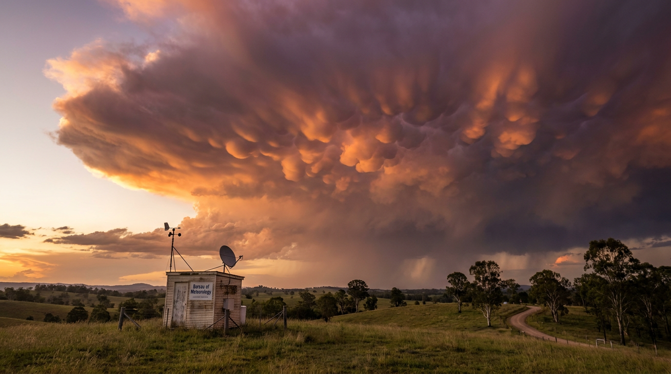
How do mammatus clouds form? They usually appear as pouch-like lobes beneath the anvil of a cumulonimbus cloud. Unlike most clouds, which grow as air rises and cools, mammatus form when air sinks, ice crystals sublimate, and the cooling helps pull the cloud base into hanging pockets.
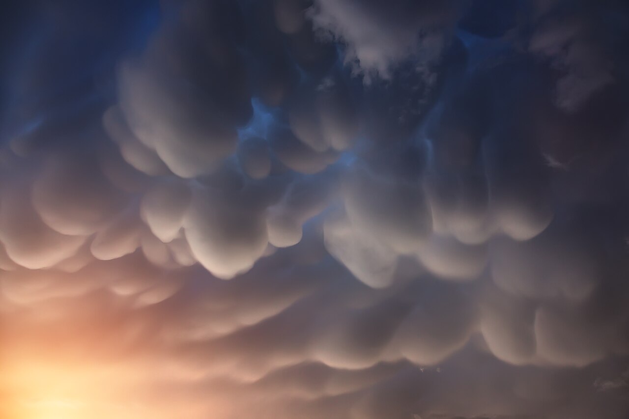
Mammatus clouds over the Nepal Himalayas - By Anton Yankovyi - Own work, CC BY-SA 4.0, https://commons.wikimedia.org/w/index.php?curid=44258693
Key takeaways
Mammatus clouds usually form under the anvil of mature thunderstorms, especially cumulonimbus incus clouds.
Subsiding air, evaporative cooling and ice crystal sublimation help shape the pouches.
The cloud lobes sit in and near the upper troposphere, where tropospheric stability changes quickly around the storm top.
Mammatus clouds often appear near severe thunderstorms, but they do not by themselves mean damaging weather is at ground level.
The mechanics: how do mammatus clouds form?
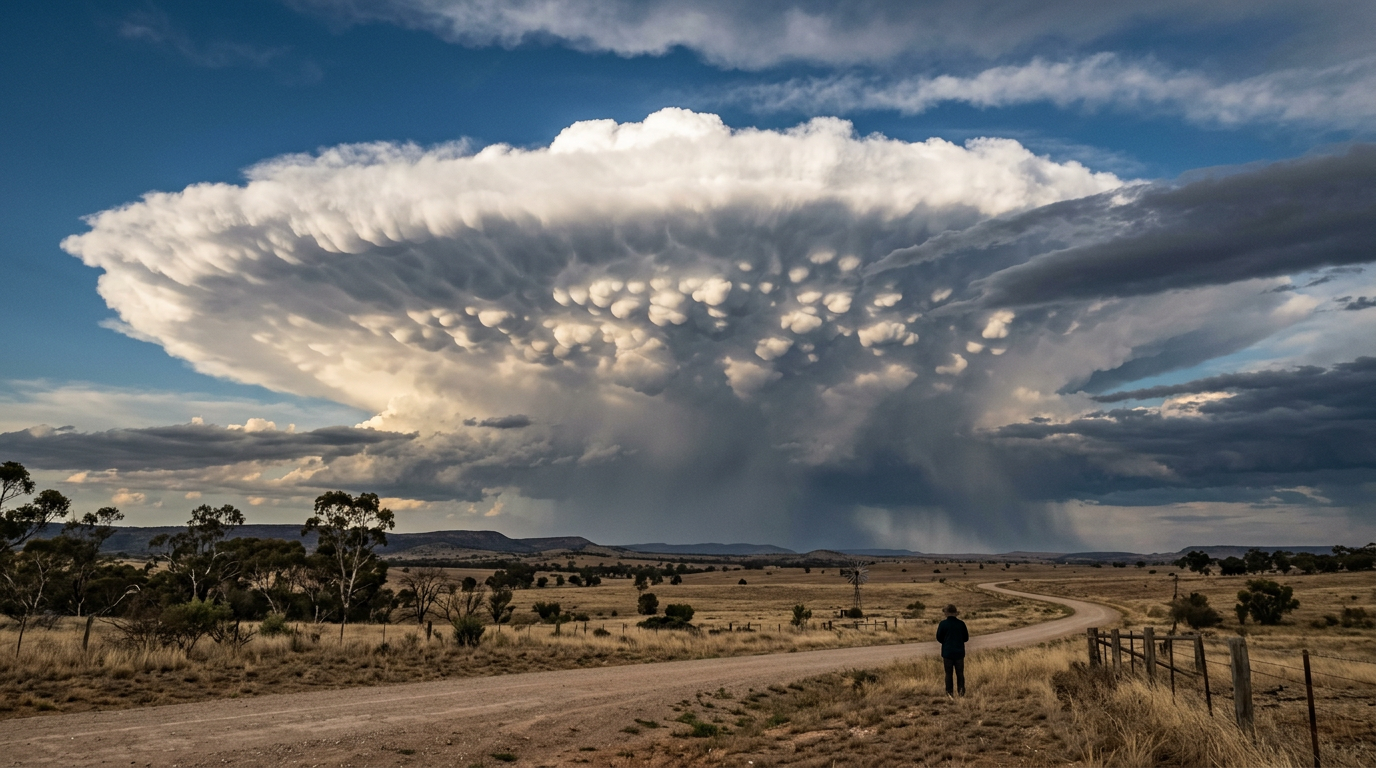
A distant supercell thunderstorm showing a spreading cumulonimbus anvil with mammatus clouds on its underside.
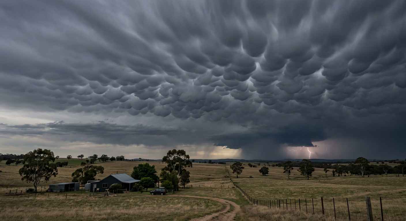
Dark mammatus clouds over a rural field near a thunderstorm.
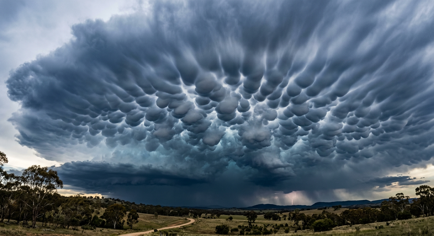
Pouch-like mammatus clouds beneath a thunderstorm anvil.
Most clouds form when warm air rises, cools and condenses. Mammatus work the other way. The cloud base shows what happens when air sinks beneath a storm anvil and the surrounding air is dry enough for the cloud edges to change shape quickly.
The World Meteorological Organization classifies mammatus as an accessory cloud feature, not a cloud type on its own. They attach to larger parent clouds, most often cumulonimbus clouds with a broad anvil top. As the air under the anvil becomes unstable, rounded pouches can form instead of a flat cloud base.
What is cloud pouching?
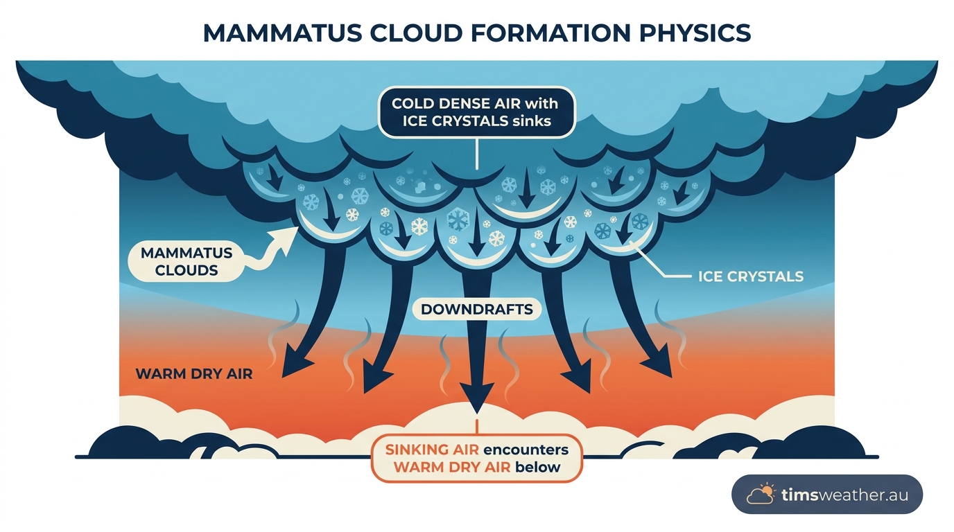
Diagram of sinking air beneath a thunderstorm anvil.
Cloud pouching is the rounded, hanging pattern seen on the underside of the cloud. The pouches form where subsiding air pockets become denser than the air around them. That negative buoyancy helps the cloud base sag into separate lobes rather than remain smooth.
Cloud pouching can look dramatic, but the shape itself is the result of local air movement and moisture changes. The same thunderstorm can produce a ragged base in one area and mammatus pouches in another, depending on the air around the anvil.
The Role of Evaporative Cooling in Pouch Formation
The role of evaporative cooling in pouch formation is central to the cloud’s shape. When precipitation falls from the storm anvil into drier air below, some of it evaporates or sublimes. That process uses heat from the surrounding air, which cools the pocket and helps it sink.
Ice crystal sublimation matters most near the top of a thunderstorm. In the anvil, much of the cloud is made of ice crystals. When those crystals change directly into water vapour, the cooling can be strong enough to make the air denser than its surroundings. The sinking motion then drags the visible cloud downward into the familiar pouch shape.
If you want the bigger picture, see our guide on how do thunderstorms form.
Why cumulonimbus incus clouds matter
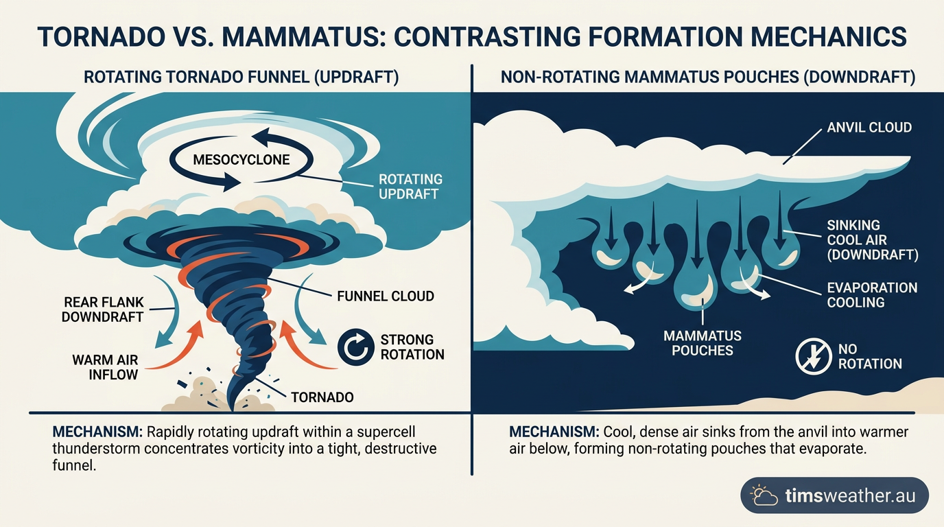
Comparison of storm updrafts and the sinking air linked to mammatus.
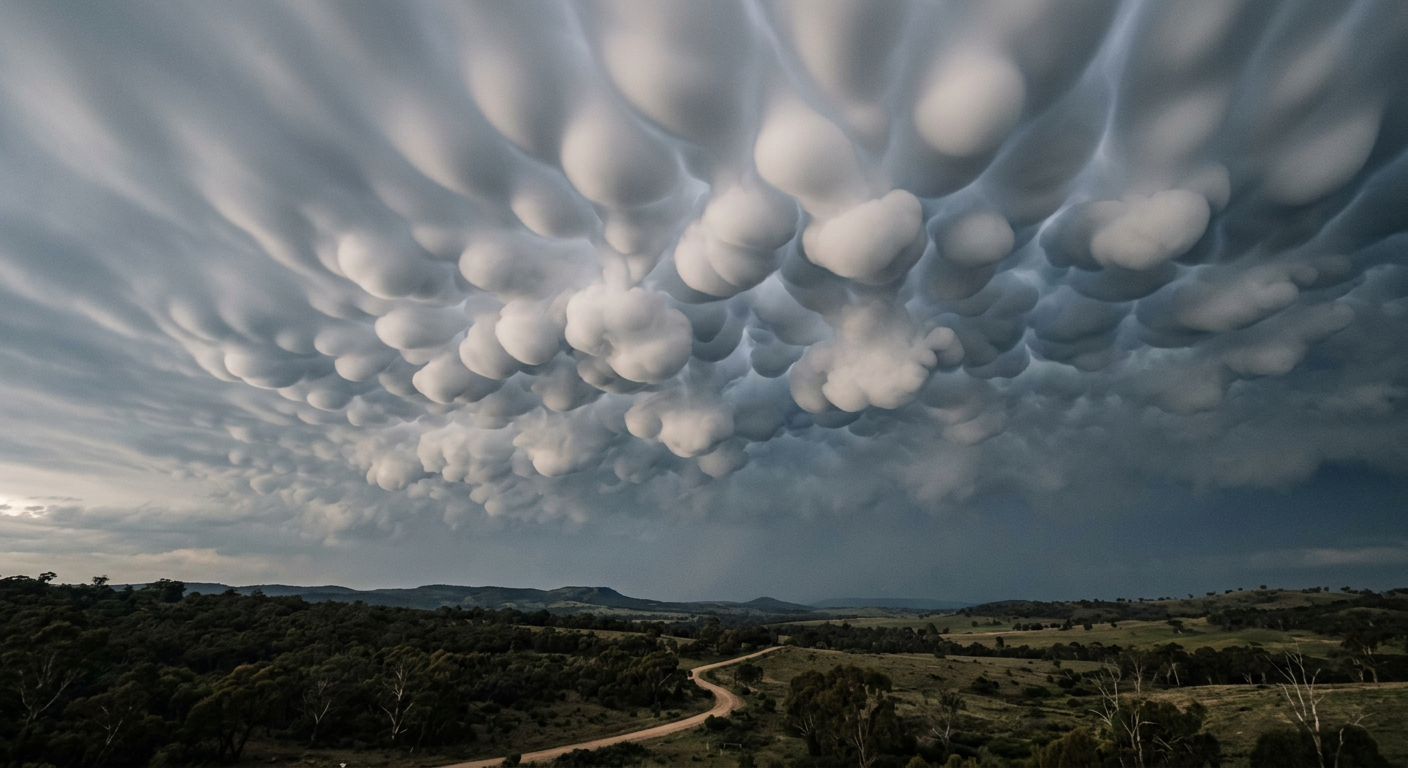
Close-up view of mammatus lobes beneath a storm anvil.
Mammatus clouds are most often seen under a cumulonimbus incus, the anvil-shaped top of a mature thunderstorm. This anvil forms when the storm reaches the upper troposphere, where rising air meets stronger stability and can spread outward more easily than it can keep rising.
That spreading anvil often pushes into drier air around the storm. Under those conditions, the underside of the cloud can show the pouching pattern that marks mammatus. This is why the shape often appears along the edge of a severe thunderstorm structure rather than in ordinary fair-weather cloud.
For the storm side of the picture, see our guide on how do cumulonimbus clouds form.
How the updraft and downdraft work together
A severe thunderstorm structure depends on both updraft and downdraft. The updraft feeds the storm by lifting warm, humid air. The downdraft brings cooler air back down and spreads it outward.
Mammatus clouds are linked to sinking air aloft, not to the downdraft that reaches the ground. They can sit beneath the storm anvil while the main storm still produces heavy rain, hail or strong gusts elsewhere. The cloud itself does not cause those hazards, but it can appear in the same storm system.
What the storm environment tells us
The Bureau of Meteorology uses terms such as convective clouds, convective instability and severe thunderstorm warnings when discussing these storm systems. Mammatus usually form in an environment where buoyancy has changed sharply with height, and where air near the storm top is no longer rising in a smooth column.
That shift in buoyancy is why the top of a storm matters. When the air at the anvil level becomes more stable, the storm spreads sideways. When the air below the anvil is dry enough, the underside can break into pouches. This mix of convective instability below and stronger stability above helps explain why mammatus and anvil clouds often appear together.
Related guides
- 10 Signs of a Developing Cumulonimbus Cloud: Australia's Thunderstorms Explained
- What Is Hector the Convector? The Science Behind the Tiwi Islands Storm
- 8 Ways Different Cloud Types and Weather Forecasting Affect Stability and Operations
- How do cumulus clouds form? Convection, condensation and cloud base height
Frequently asked questions
Mammatus clouds form when cool, moisture-rich air sinks from the anvil of a thunderstorm into drier air below. As ice crystals sublimate or water droplets evaporate, the air cools and becomes denser. This process creates distinctive, rounded pouches that sag downwards from the cloud base due to localized sinking air.
Source: bom.gov.au
Further reading and resources
Explore trusted articles, books, videos and other resources to go deeper on this topic.
forbes.comArticle
Beautiful And Scary At Once: The Science Of Mammatus Clouds
In-depth coverage on How Do Mammatus Clouds Form? The Complete Meteorological Guide from forbes.com.
windy.appArticle
How mammatus clouds form - Windy.app
In-depth coverage on How Do Mammatus Clouds Form? The Complete Meteorological Guide from windy.app.
earthsky.orgArticle
Mammatus clouds are ominous and beautiful
In-depth coverage on How Do Mammatus Clouds Form? The Complete Meteorological Guide from earthsky.org.
youtube.comVideo
What are mammatus clouds and how do they form?
Video coverage on How Do Mammatus Clouds Form? The Complete Meteorological Guide from youtube.com.
stormhour.comArticle
What Are Mammatus Clouds?
In-depth coverage on How Do Mammatus Clouds Form? The Complete Meteorological Guide from stormhour.com.
en.wikipedia.orgReference
Mammatus cloud
Background reference on How Do Mammatus Clouds Form? The Complete Meteorological Guide from en.wikipedia.org.
scied.ucar.eduReference
Mammatus Clouds - UCAR Center for Science Education
Background reference on How Do Mammatus Clouds Form? The Complete Meteorological Guide from scied.ucar.edu.
journals.ametsoc.orgArticle
The Mysteries of Mammatus Clouds: Observations and Formation ...
In-depth coverage on How Do Mammatus Clouds Form? The Complete Meteorological Guide from journals.ametsoc.org.
skyatnightmagazine.comArticle
What are Mammatus clouds and why are they so lumpy?
In-depth coverage on How Do Mammatus Clouds Form? The Complete Meteorological Guide from skyatnightmagazine.com.
nesdis.noaa.govReference
Types of Clouds | NESDIS - NOAA
Background reference on How Do Mammatus Clouds Form? The Complete Meteorological Guide from nesdis.noaa.gov.
Planning weeks ahead?
Check Australia's long-range seasonal outlook for rainfall, temperature and the climate drivers (ENSO, IOD, SAM, MJO) shaping the next three months.
View Australia's Seasonal Weather Forecast