
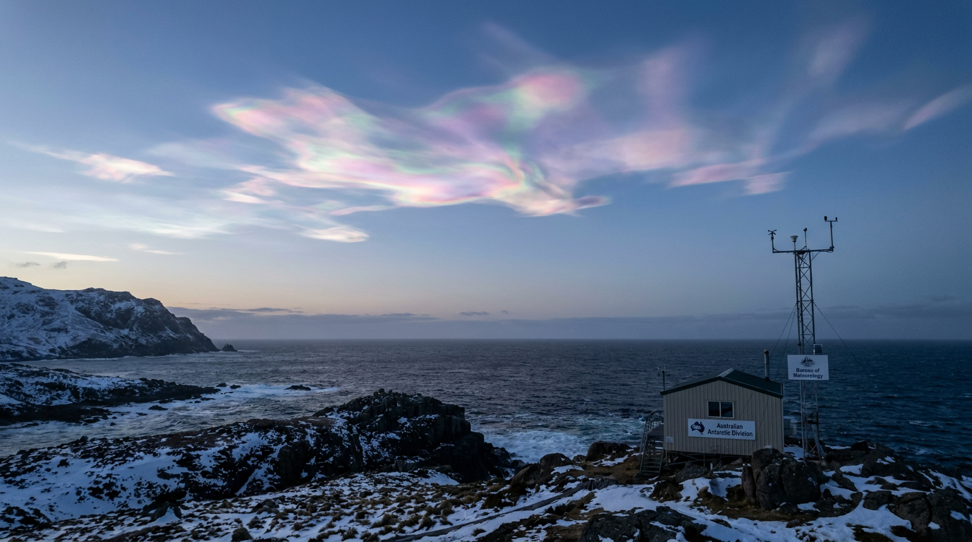
Polar stratospheric clouds form when the lower stratosphere gets cold enough, usually below -78 °C. These clouds are also called nacreous clouds or mother of pearl clouds, and they are linked to ozone depletion because they help set up the chemistry that destroys ozone.
Key takeaways
Between 15-25 km high, these upper-atmosphere light effects form inside the cold polar winter vortex when temperatures drop significantly.
Type II clouds, composed of water ice, are the specific type most closely tied to chemical reactions that damage the ozone layer.
Type I clouds form below about -78 °C, while Type II clouds are the brighter ice clouds seen in very cold air.
These clouds help drive heterogeneous chemistry that speeds up ozone loss.
They are most often seen in polar regions, especially near Antarctica, where the atmosphere can stay cold and isolated for long periods.
The extreme environment of the lower stratosphere
The lower stratosphere is very dry and very cold, which is why ordinary cloud systems do not form there. For a plain-language look at where this layer sits above weather-making air, see our Layers of the Atmosphere Explained: Australian Guide.
During polar winter, long periods without sunlight let the air cool sharply. When the atmosphere stays isolated over the poles, temperatures can fall far enough for polar stratospheric clouds to develop. The North article on polar stratospheric clouds links these clouds with extreme cold and ozone loss.
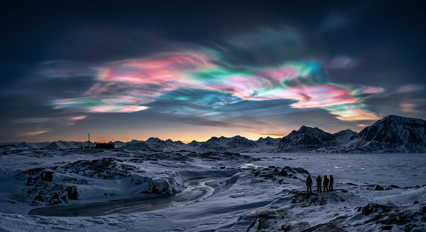
Iridescent polar stratospheric clouds glowing above a dark snowy horizon at twilight.
How the Bureau of Meteorology fits in
The Bureau of Meteorology (BOM) does not issue a dedicated polar stratospheric cloud warning, but its weather and climate observations help build the wider picture of the atmosphere.
How polar stratospheric clouds form
Polar stratospheric clouds form when temperatures in the lower stratosphere drop below -78 °C. At that point, water vapour and nitric acid can condense into particles that support cloud formation and ozone depletion chemistry.
These clouds can contain nitric acid trihydrate and water ice, depending on the temperature. In the coldest air, the clouds become brighter and more visible as ice crystals grow.
If you want a simple comparison with everyday ice cloud formation, see our How do cirrus clouds form in the upper troposphere guide. For more on high-altitude light effects, see Cloud Optical Phenomena Australia.
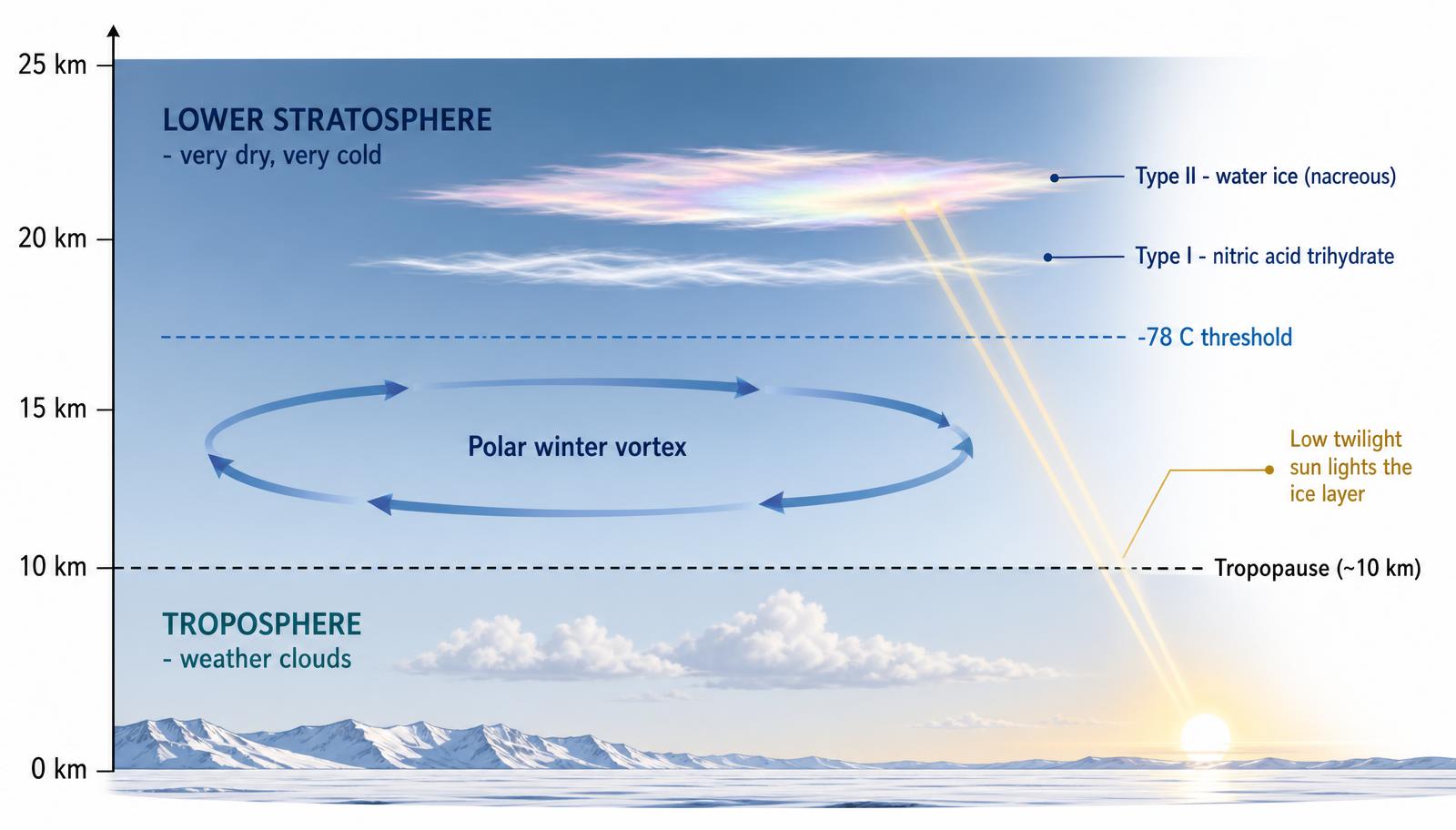
Type I and Type II polar stratospheric clouds
Meteorologists split polar stratospheric clouds into two main types based on what they contain and how they form.
Feature | Type I | Type II |
|---|---|---|
Main composition | Nitric acid trihydrate and related particles | Water ice crystals |
Usual temperature | Below -78 °C | Colder air that supports ice growth |
Common name | Polar stratospheric clouds | Nacreous clouds, mother of pearl clouds |
Visual appearance | Faint and diffuse | Bright and iridescent |
Type II clouds are the ones most closely tied to ozone loss chemistry. Type II clouds are the ice polar stratospheric clouds, but the showier clouds people often notice at twilight are nacreous clouds, not all Type II clouds by definition.
Why the colours look pearly
The bright colours in nacreous clouds come from diffraction and interference of light by similarly sized spherical ice crystals, not simply from light scattering by tiny, similar-sized ice crystals. When the sun sits low on the horizon, the light can separate into pink, green, blue and gold shades.
For more on cloud optics, see our Cloud Optical Phenomena Australia article. The WMO International Cloud Atlas also describes nacreous clouds as highly coloured stratospheric clouds.
Why these clouds matter for ozone depletion
Polar stratospheric clouds matter because they help create the chemical conditions that destroy ozone. Their surfaces let heterogeneous chemistry happen, which means reactions take place on the particles instead of only in the surrounding air.
That matters in the Antarctic vortex and the Arctic vortex, where air can stay cold and trapped. In those conditions, chlorine compounds from chlorofluorocarbons (CFCs) can be converted into forms that destroy ozone more quickly when sunlight returns.
This is why polar stratospheric clouds are part of the wider story of atmospheric chemistry, the ozone hole and the long recovery that began after the Montreal Protocol reduced CFC use.
Gravity waves, Rossby waves and mountain waves
Large-scale wave patterns can help shape the polar atmosphere. Gravity waves and Rossby waves influence how air moves through the stratosphere, while mountain waves can also affect local conditions downstream of high terrain.
For an Australian example, see How Do Lenticular Clouds Form? Atmospheric Mechanics Explained. Those same wave processes are part of the bigger Southern Ocean atmospheric patterns that help control cold-air outbreaks and stratospheric flow near the poles.
Where are polar stratospheric clouds most often seen?
They are most common over Antarctica, where the air stays colder for longer and the polar vortex is usually stronger. They can also form in the Arctic when the winter stratosphere gets cold enough.
Frequently asked questions
These clouds form when the polar stratosphere becomes extremely cold, allowing water vapour, nitric acid, and sulphuric acid to condense into tiny particles. Sunlight then scatters through these high-altitude ice crystals, creating distinctive pearly colours. They develop much higher than standard weather clouds, typically within the polar vortex.
Source: sciencedaily.com
Further reading and resources
Explore trusted articles, books, videos and other resources to go deeper on this topic.
nasa.govReference
Polar Stratospheric Clouds
Background reference on Polar stratospheric clouds: how nacreous clouds form from nasa.gov.
antarctica.gov.auReference
Polar stratospheric clouds
Background reference on Polar stratospheric clouds: how nacreous clouds form from antarctica.gov.au.
cloudatlas.wmo.intArticle
Nacreous clouds
In-depth coverage on Polar stratospheric clouds: how nacreous clouds form from cloudatlas.wmo.int.
science.nasa.govReference
CALIPSO Spies Polar Stratospheric Clouds
Background reference on Polar stratospheric clouds: how nacreous clouds form from science.nasa.gov.
en.wikipedia.orgReference
Polar stratospheric cloud
Background reference on Polar stratospheric clouds: how nacreous clouds form from en.wikipedia.org.
skybrary.aeroArticle
Polar Stratospheric Cloud (PSC)
In-depth coverage on Polar stratospheric clouds: how nacreous clouds form from skybrary.aero.
princetonastronomy.comArticle
Nacreous clouds | Amateur Astronomers Association of Princeton
In-depth coverage on Polar stratospheric clouds: how nacreous clouds form from princetonastronomy.com.
rmets.orgArticle
Nacreous clouds
In-depth coverage on Polar stratospheric clouds: how nacreous clouds form from rmets.org.
ebsco.comArticle
Polar stratospheric clouds (PSCs) | Environmental Sciences
In-depth coverage on Polar stratospheric clouds: how nacreous clouds form from ebsco.com.
stormhour.comArticle
StormHour Guide to Nacreous Clouds
In-depth coverage on Polar stratospheric clouds: how nacreous clouds form from stormhour.com.
Planning weeks ahead?
Check Australia's long-range seasonal outlook for rainfall, temperature and the climate drivers (ENSO, IOD, SAM, MJO) shaping the next three months.
View Australia's Seasonal Weather Forecast