
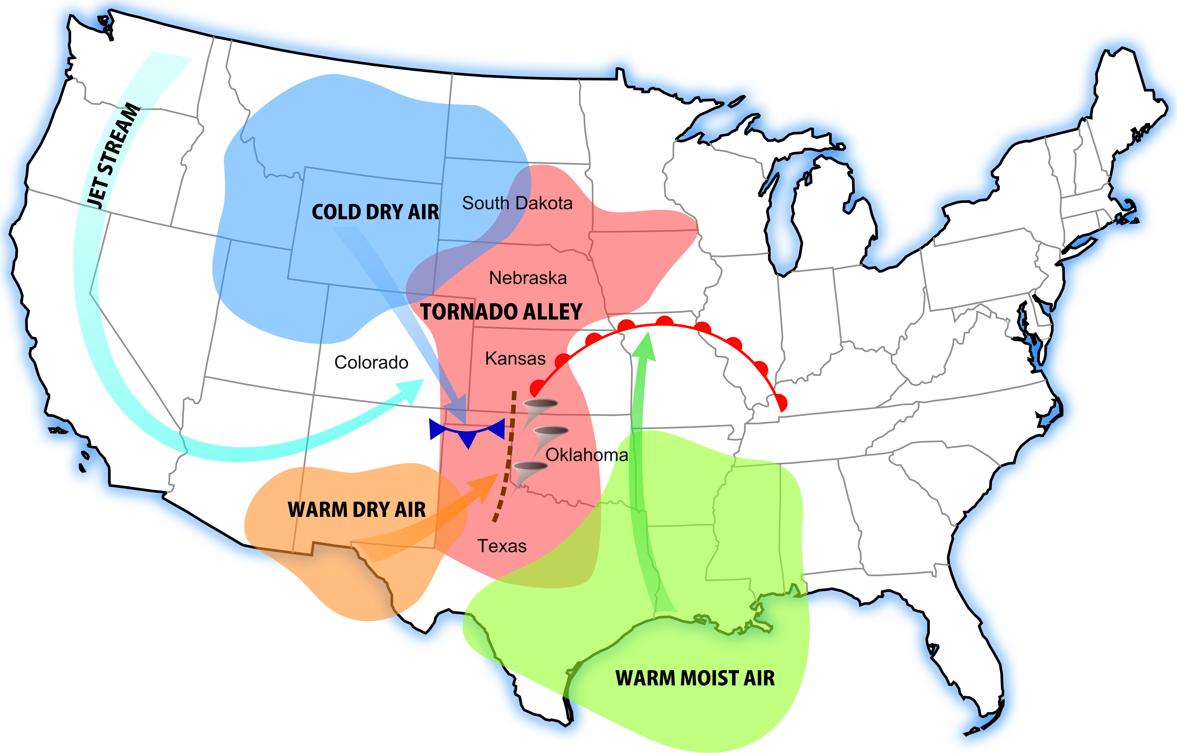
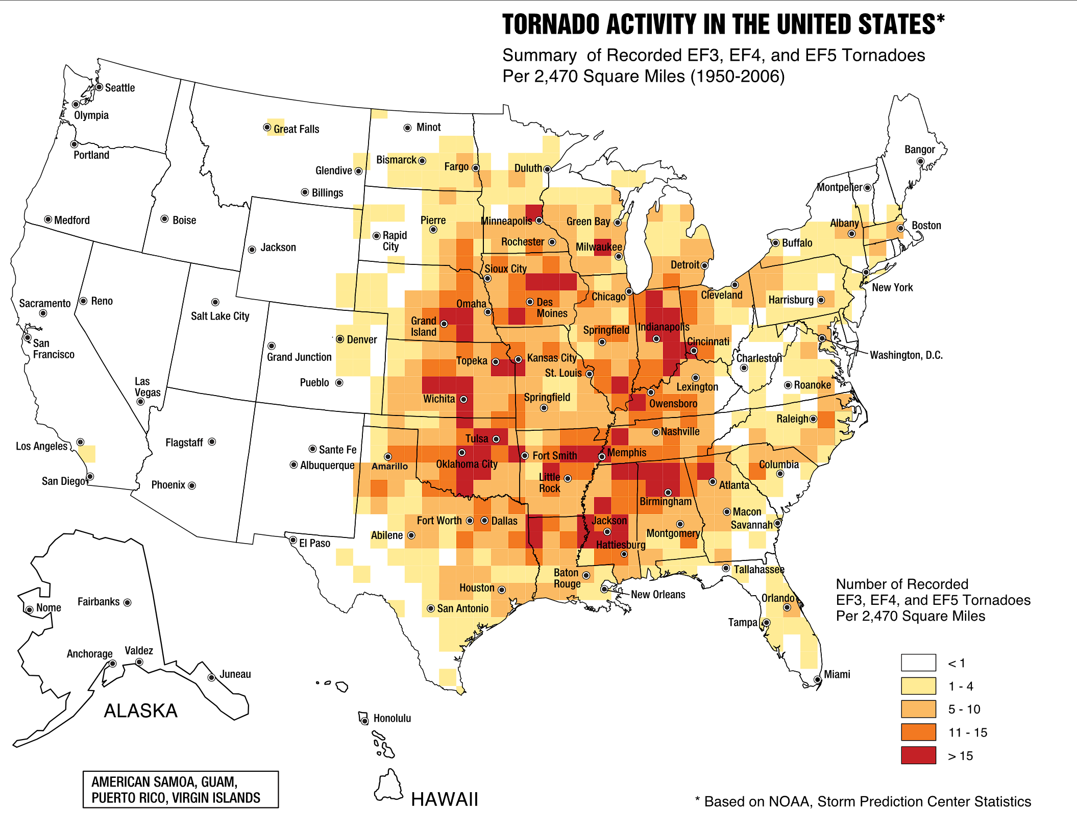
Is Tornado Alley moving east? Yes, Tornado Alley moving east is a documented meteorological reality driven by shifting atmospheric conditions. Research confirms that the most frequent and severe tornado activity has shifted away from the traditional Great Plains and toward the Midwestern and Southeastern United States over recent decades.
Key takeaways
Scientific studies show a statistically significant eastward displacement of tornado-favourable environments by 640 to 800 kilometres since 1979.
The traditional Great Plains core is experiencing a decline in tornado days, while regions in the Mid-South and lower Mississippi Valley see increased frequency.
Warming sea surface temperatures in the Gulf of Mexico are driving higher atmospheric moisture into the Ohio and Tennessee Valleys.
This geographical shift increases human vulnerability due to higher population densities, more nocturnal storms, and dense tree cover in the eastern regions.
Meteorologists now avoid rigid geographical boundaries for severe weather risk, emphasising that destructive tornadoes can form anywhere atmospheric conditions align.
The Scientific Evidence for Tornado Alley Moving East
What is the scientific evidence for Tornado Alley moving east? It comes from long-term tornado records and the atmospheric conditions that support severe storms. Studies using report databases and reanalysis data show a gradual eastward shift in the most tornado-favourable environments, not just a simple change in where people live or where storms get reported.
The key point is that meteorologists are tracking both tornado occurrence and the ingredients for tornadoes, especially wind shear, moisture and instability. When those ingredients line up more often over the Mid-South, lower Mississippi Valley, Ohio Valley and parts of the Southeast, the risk centre moves with them. That is why researchers and forecasters now talk less about a fixed alley and more about a broader zone of severe thunderstorm risk.
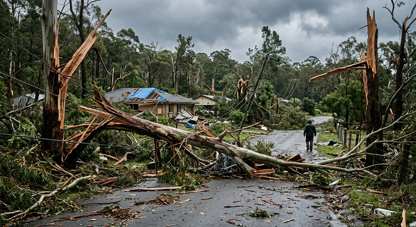
This shift also helps explain why tornadoes in the eastern United States can be harder to manage. More trees, more towns and more overnight storms all raise the stakes even when the tornado count itself does not explode. For a closer look at the storm setup behind this trend, see supercell tornado formation, squall line formation and mesoscale convective systems.
Why Are Tornadoes Moving East? The Role of Climate and Moisture
The Role of Low-Level Moisture Transport from the Gulf of Mexico
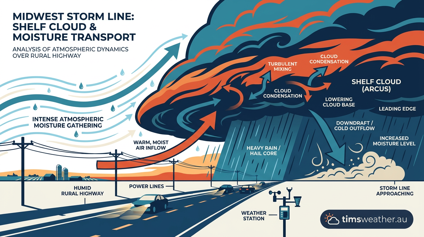
Moisture is the primary fuel for severe thunderstorms, and the Gulf of Mexico is the main moisture source for the central and eastern United States. Sea surface temperatures in the Gulf have warmed steadily. Warmer water evaporates more readily, creating a very humid air mass over the ocean. When strong southerly winds develop ahead of a storm system, this low-level moisture transport feeds directly into the Mid-South and the Midwestern United States.
This increased moisture results in rising dew points. Tracking dew point trends is vital because higher atmospheric moisture increases CAPE (Convective Available Potential Energy). CAPE is a measurement of atmospheric instability.
Higher CAPE values mean that when air is forced to rise, it will accelerate upwards violently, which is necessary to understand how supercell tornado formation occurs. With the Gulf of Mexico acting as a more potent moisture engine, extreme CAPE values are occurring more frequently over the Mississippi and Tennessee river valleys.
The Influence of the 100th Meridian Dryline Shift
A critical feature of Great Plains tornado risk is the dryline, a boundary that separates moist air from the Gulf of Mexico from hot, dry desert air originating in the Southwest. Historically, this dryline established itself frequently near the 100th meridian, which cuts down through the middle of the Dakotas, Nebraska, Kansas, Oklahoma, and Texas. Thunderstorms typically initiate along this boundary where the dense dry air wedges under the moist air, forcing it upward.
Climate scientists have documented that the arid climate of the western United States is expanding eastward. This expansion pushes the typical position of the dryline further east into the Mississippi River basin. Because storms fire along this advancing boundary, the initiation point for severe weather has physically migrated eastward, directly contributing to the modern tornado alley map changes.
How the El Niño-Southern Oscillation Impacts Risk
The El Niño-Southern Oscillation (ENSO) plays a massive role in interannual severe weather patterns. During La Niña phases, the Pacific jet stream alters its path, creating a very active weather pattern across the eastern half of the United States. La Niña winters and springs historically correlate with an increased Severe Thunderstorm Outlook for the Mid-South and the Ohio Valley.
While ENSO is a natural cycle, the underlying warming of the oceans means that when a La Niña event occurs, the resulting atmospheric clashes are often more volatile. The combination of a favourable jet stream pattern and record atmospheric moisture produces environments capable of supporting long-track supercell storm migration across the Southeast.
Debunking Modern Tornado Alley Map Changes
Why the Original Concept is Outdated
The term "Tornado Alley" was coined in 1952 by US Air Force meteorologists studying severe weather in Texas and Oklahoma. While it effectively described the concentrated risk area of that era, the NOAA National Severe Storms Laboratory has long argued that the term is scientifically limiting. The atmosphere does not respect state borders, and labelling a specific geographic box as the singular danger zone leads to dangerous complacency in areas just outside it.
Media representations often seek a static map to define tornado risk, but atmospheric patterns are fluid. The phrase suggests a permanent physical location, whereas meteorologists prefer to track the migrating zones of high tornado probability. Acknowledging that the traditional map is obsolete helps communities outside the Plains take severe weather preparedness more seriously.
Midwest vs Plains Tornado Activity
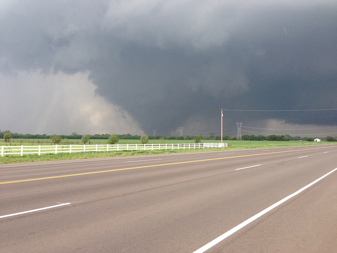
The type of storms that produce tornadoes also differs by region. In the Great Plains, the classic setup often yields isolated Supercell thunderstorms. These discrete storms have no competition for surrounding moisture and can rotate violently, producing highly visible tornadoes. However, changing conditions are causing fewer of these setups in the traditional Plains core.
Further east, particularly in the Midwest, meteorologists observe complex storm modes. Here, it is common to see how mesoscale convective systems form as large, organised lines of storms that span hundreds of kilometres. These systems frequently produce embedded tornadoes that are difficult to see on radar and from the ground. How how squall line formation occurs is important for predicting the rapid, short-lived tornadoes that frequently impact states like Illinois, Indiana, and Michigan, according to recent analysis from WZZM13 meteorologists.
Impact on Vulnerability: Why Eastern Tornadoes Pose Higher Fatal Risks
Physical Infrastructure and Population Density
When asking why are tornadoes moving east dangerous, the answer lies in human geography. The Great Plains is characterised by wide-open spaces, low population density, and homes typically built on concrete foundations or with basements. A tornado can travel across open farmland for 30 kilometres without hitting a single structure.
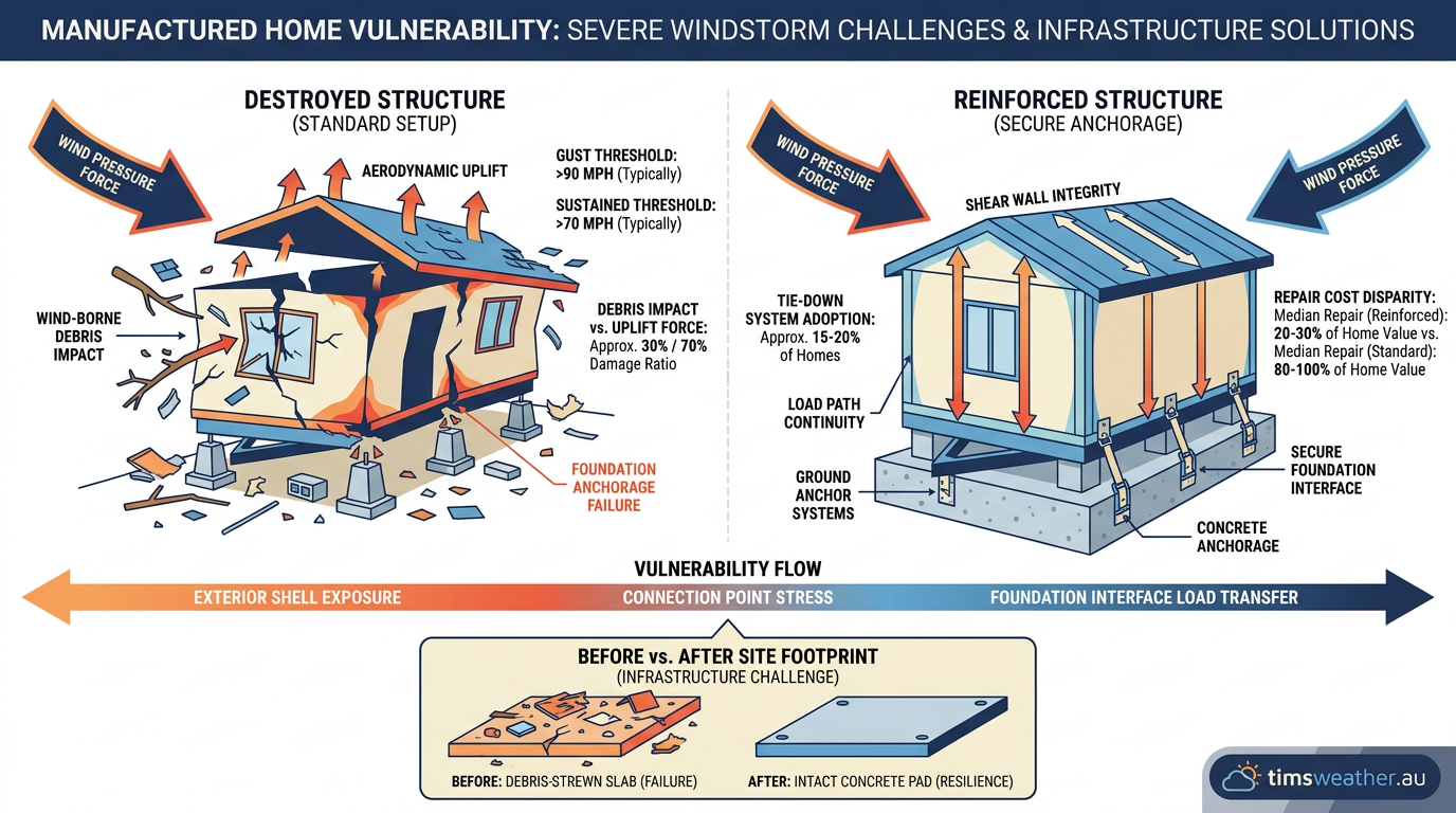
In contrast, the Southeastern United States and the Mid-South feature significantly higher population densities and a vast number of small, closely spaced communities. Also, the region relies heavily on manufactured housing. Mobile homes are highly vulnerable to high winds, offering almost no structural resistance to even an EF1 tornado. The financial toll of this vulnerability is staggering, with projected damages reaching 51 billion dollars in insured homeowners losses by 2025.
The Dangers of Nocturnal Tornado Frequency
The timing of storm development is another critical factor making Dixie Alley exceptionally dangerous. In the Plains, the vast majority of tornadoes occur in the late afternoon and early evening, aligning with peak daytime heating. Once the sun sets, the lower atmosphere typically stabilises, choking off the storm's energy source.
In the Mid-South, strong low-level jet streams continue to pump warm, moist air into the region long after dark. This prevents the lower atmosphere from stabilising, allowing severe thunderstorms to thrive overnight. Nocturnal tornadoes are notoriously deadly because people are asleep and unable to receive warnings or seek shelter. Visibility is non-existent, and the heavy tree cover of the eastern states obscures the horizon completely.
Region | Primary Season | Tornado Characteristics | Vulnerability Factor |
|---|---|---|---|
Great Plains (Traditional) | Spring (May to June) | Highly visible, classic isolated supercells | Wide open spaces reduce structural impacts; basements are common. |
Mid-South & Dixie Alley | Late Autumn to Early Spring | Rain-wrapped, heavily obscured by terrain | High density of mobile homes, nocturnal timing, dense tree cover. |
Midwestern United States | Summer (June to August) | Fast-moving, embedded in squall lines | Large urban population centres facing expanding storm footprints. |
Adapting to Modern Severe Weather Patterns
Enhancing Regional Preparedness
The eastward migration of tornado frequency shifts requires a fundamental change in how eastern communities prepare for severe weather. As highlighted by survivor testimonies from Wingo, Kentucky following the deadliest December tornado on record, many residents in the Mid-South do not have access to underground shelters. Public policy must adapt to encourage the construction of reinforced safe rooms in new housing developments across the Southeast.
Communication is equally important. In areas newly prone to high-end tornado events, educating the public on Tornado Watch vs Tornado Warning terminology saves lives. A watch means conditions are favourable for severe weather, while a warning means a tornado is actively occurring.
As the threat footprint expands into regions unaccustomed to frequent outbreaks, ensuring every home has a reliable method of receiving alerts at night is critical to mitigating the rising risks documented by KCUR environmental reporters and regional emergency management agencies.
The evidence is clear that the atmosphere is evolving. The shift is not a temporary anomaly but a changing severe weather baseline identified in the latest Midwest severe weather outlooks. By understanding the meteorological mechanics behind this eastward shift, communities can better prepare for the severe weather challenges of the coming decades.
Sources
NOAA weather and atmospheric science reference (repository.library.noaa.gov)
Spatial trends in United States tornado frequency (repository.library.noaa.gov)
CSIRO atmospheric science reference (publications.csiro.au)
NOAA weather and atmospheric science reference (nssl.noaa.gov)
A Comprehensive Analysis of the Spatial and Seasonal Shifts in Tornado Activity in the United States (repository.library.noaa.gov)
Storm Events Database (ncei.noaa.gov)
Storm Events Database (ncei.noaa.gov)
NOAA weather and atmospheric science reference (repository.library.noaa.gov)
Last verified: 2026-09-23
Frequently asked questions
Yes, current data indicates a notable eastward shift in tornado risk away from the traditional Great Plains. Research shows that tornado-favourable atmospheric conditions are appearing more frequently across the Mississippi and Tennessee valleys, expanding the core area of storm activity further towards the eastern parts of the United States.
Source: msn.com
Further reading and resources
Explore trusted articles, books, videos and other resources to go deeper on this topic.
vitalsigns.edf.orgArticle
Is Tornado Alley on the move? - Vital Signs - Environmental Defense Fund
In-depth coverage on Tornado Alley Is Moving East - Here's the Evidence from vitalsigns.edf.org.
youtube.comVideo
Tornado Alley Is MOVING and That's a HUGE Problem - YouTube
Video coverage on Tornado Alley Is Moving East - Here's the Evidence from youtube.com.
accuweather.comArticle
Is 'Tornado Alley' shifting east? - AccuWeather
In-depth coverage on Tornado Alley Is Moving East - Here's the Evidence from accuweather.com.
fox19.comArticle
'Tornado alley' shifting east, experts say - FOX19
In-depth coverage on Tornado Alley Is Moving East - Here's the Evidence from fox19.com.
stormtrack.orgArticle
Tornado Alley Is Shifting - Stormtrack
In-depth coverage on Tornado Alley Is Moving East - Here's the Evidence from stormtrack.org.
usnews.comArticle
Tornado Alley is Shifting: 2026's New High-Risk Areas for Homeowners
In-depth coverage on Tornado Alley Is Moving East - Here's the Evidence from usnews.com.
Tornadoes shifting east in the U.S., study finds, putting more people at ...
In-depth coverage on Tornado Alley Is Moving East - Here's the Evidence from stormtrack.org.
nbcchicago.comArticle
Is tornado alley shifting closer to the Chicago area?
In-depth coverage on Tornado Alley Is Moving East - Here's the Evidence from nbcchicago.com.
scientificamerican.comArticle
Watch Out: Tornado Alley Is Migrating Eastward - Scientific American
In-depth coverage on Tornado Alley Is Moving East - Here's the Evidence from scientificamerican.com.
tornadopath.comArticle
Tornado Alley Map - See How Tornado Alley is Shifting
In-depth coverage on Tornado Alley Is Moving East - Here's the Evidence from tornadopath.com.
Planning weeks ahead?
Check Australia's long-range seasonal outlook for rainfall, temperature and the climate drivers (ENSO, IOD, SAM, MJO) shaping the next three months.
View Australia's Seasonal Weather Forecast