
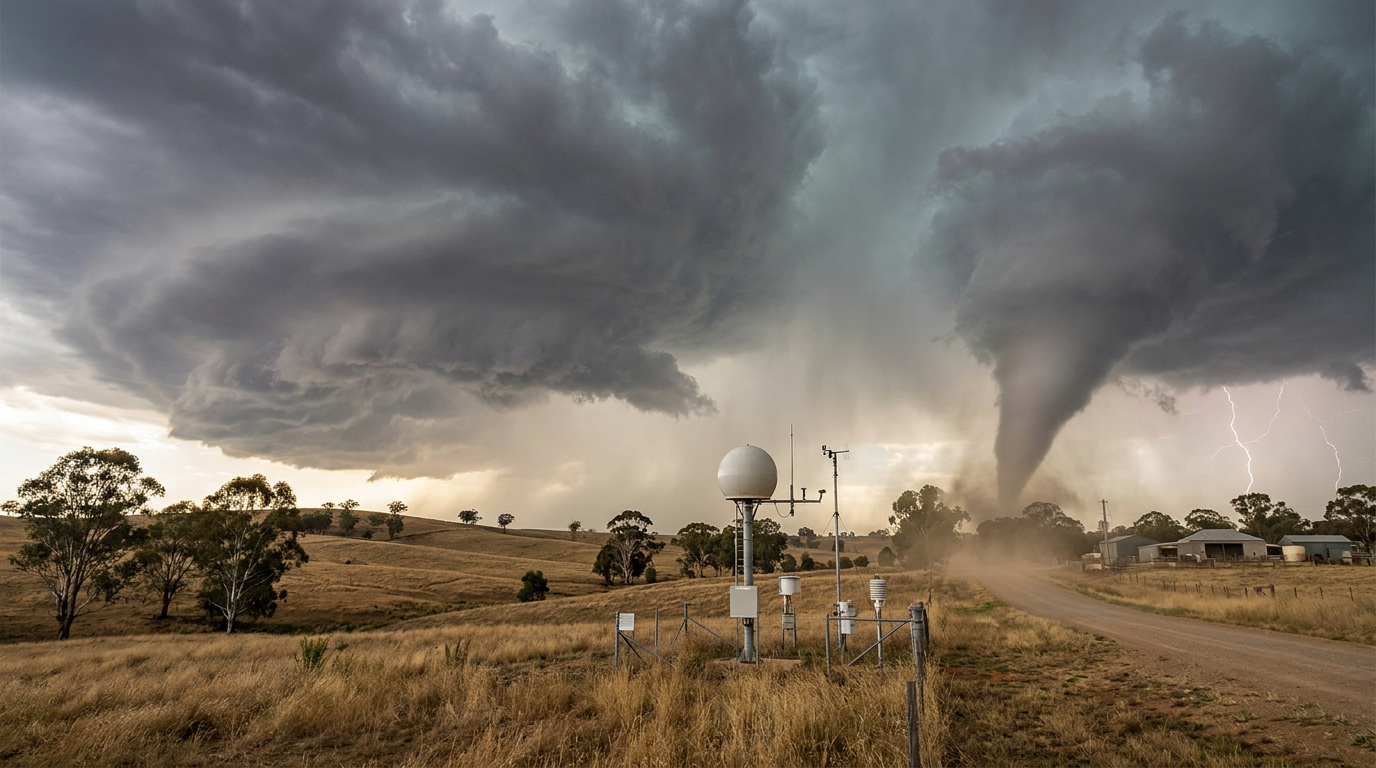
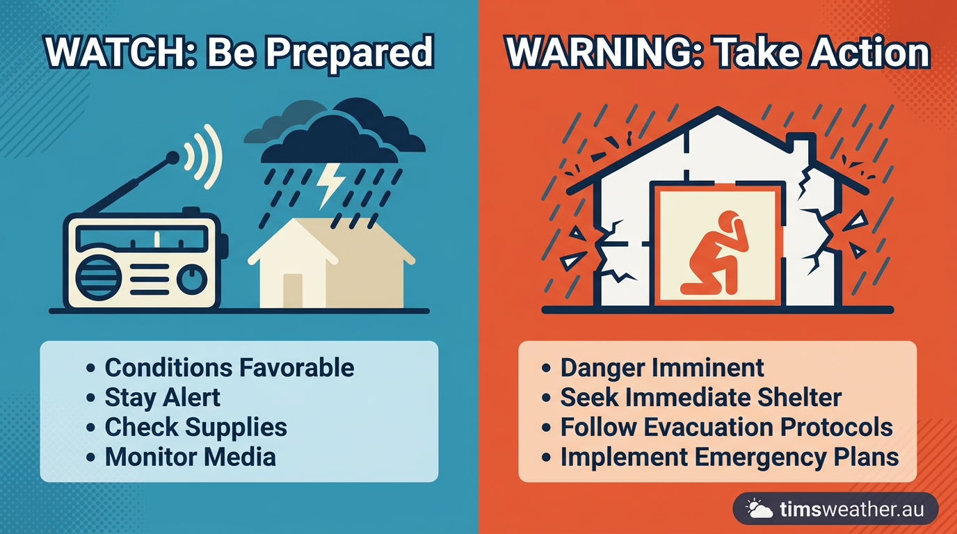
The Tornado Watch vs Tornado Warning alert system separates preparation from life-saving action. A tornado watch means conditions are favourable for tornadoes to develop, so stay alert. A tornado warning means a tornado has been sighted or indicated by weather radar, requiring you to seek safe shelter immediately to protect life and property.
Key takeaways
Tornado watches highlight broad regions where atmospheric conditions could produce severe storms over a timeframe of several hours.
Tornado warnings indicate that a tornado is actively occurring or highly likely based on urgent radar data.
Immediate action is required during a warning to protect against extreme winds and flying debris.
A tornado emergency is a reserved, top-tier alert for catastrophic events moving into heavily populated areas.
Meteorological agencies worldwide share this tiered approach to threat escalation to separate preparation time from life-saving action.
Tornado Watch vs Tornado Warning Systems
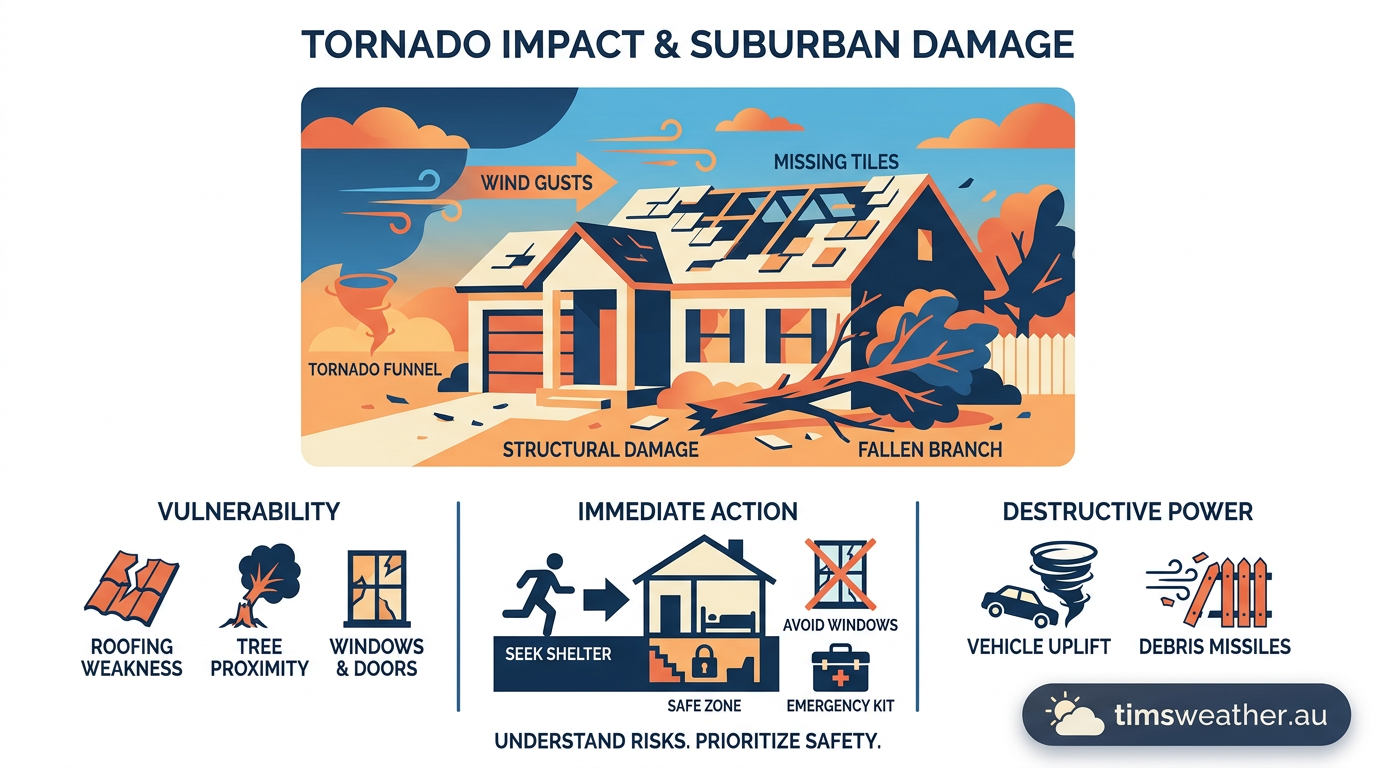
The Meteorological Criteria for a Tornado Watch
A tornado watch is the foundational alert for severe convective weather. It serves as an official notice that the atmosphere contains all the required ingredients for dangerous storms to form. Meteorologists look for specific conditions, including high atmospheric instability, abundant low-level moisture, and strong vertical wind shear.
When these ingredients align over a large geographic area, the risk of a meteorological phenomenon capable of producing rotating updrafts increases significantly. During this phase, you are not in immediate danger. The threat level is simply elevated enough to warrant close attention to incoming weather updates.
Broad Regional Alerts and Hazardous Weather Outlooks
Watches are characteristically large in scope. They often cover multiple counties, districts, or even entire states. Because severe weather systems move rapidly across the sector, a watch box is drawn to encompass the entire anticipated track of the storm threat. A standard tornado watch covers a large region and lasts several hours, giving residents ample time to charge mobile devices and locate their designated storm shelters.
This wide net is cast because pinpointing exactly where a specific storm cell will produce a tornado hours in advance remains meteorologically impossible. The rapid vertical growth of cumulonimbus clouds signals an unstable atmosphere, indicating that storms could initiate anywhere within the designated watch boundary at any moment.
Communication Flow from the Storm Prediction Center
In the United States, the National Weather Service (NWS) uses a highly coordinated approach to severe weather prediction. The Storm Prediction Center (SPC) takes responsibility for analyzing synoptic-scale weather patterns across the country. When the SPC identifies a widespread threat, their forecasters collaborate with local weather offices to define the exact boundaries of the watch area.
This communication flow ensures a unified message reaches the public. When assessing the potential for supercell thunderstorms, meteorologists analyze upper-level jet streams colliding with warm surface air. Once the SPC officially issues the watch, local broadcasters, radio stations, and emergency management agencies disseminate the information to their communities.
The Science Behind NWS Alert Triggers
Forecasters do not issue watches lightly. The decision involves complex numerical weather prediction models and real-time atmospheric sampling. Meteorologists look for high values of Convective Available Potential Energy (CAPE), which measures the buoyancy of air parcels. They also analyze storm-relative helicity, a metric that calculates the potential for updrafts to rotate.
If model guidance suggests these indices will overlap during peak heating hours in the late afternoon, confidence in severe weather increases. The watch acts as a mechanism to prime emergency managers and the general public, signaling that the atmosphere is uniquely tuned for significant organized convection.
The Active Detection Required for a Tornado Warning
If a watch means you should be prepared, a warning means you must take action immediately. The transition from a watch to a warning is triggered by direct evidence that a tornado is either imminent or already on the ground causing damage. This is the ultimate life-safety trigger that mandates the immediate execution of all tornado safety protocols.
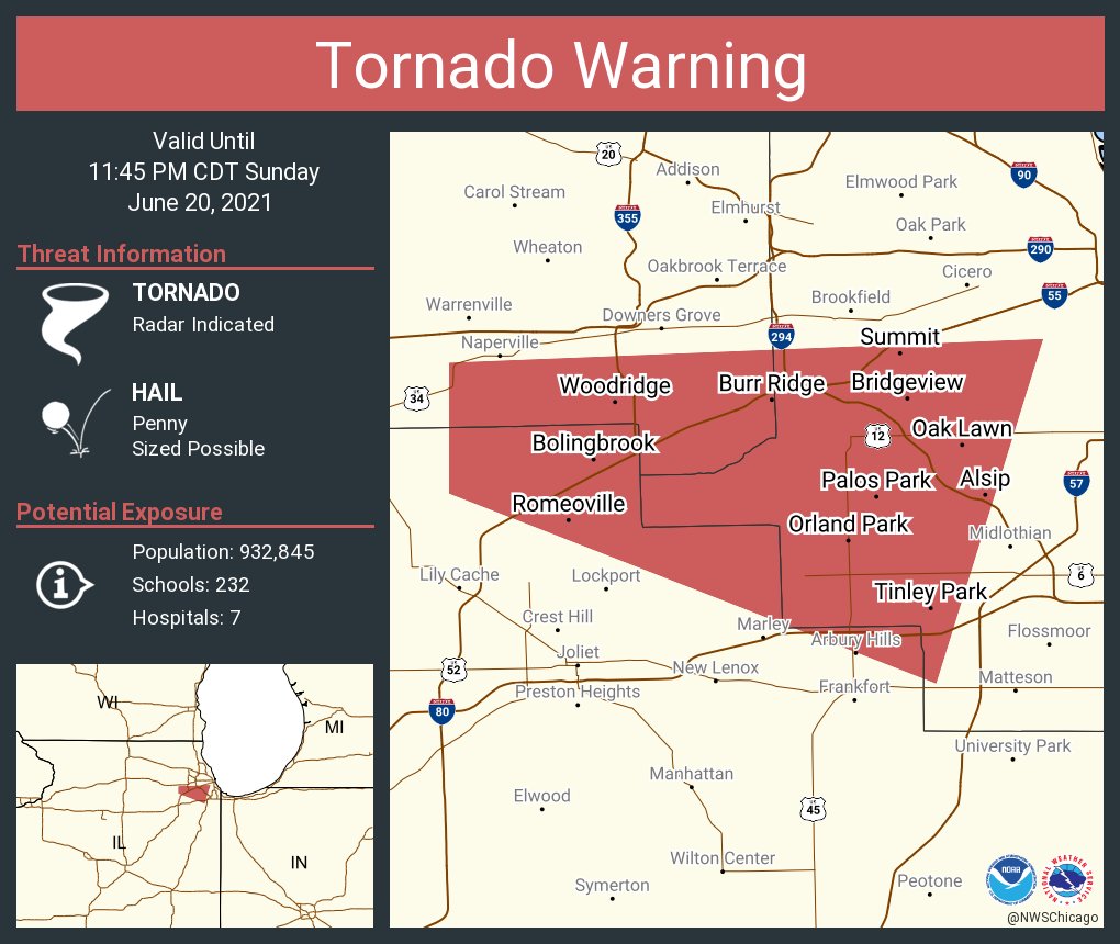
Warnings are highly localized alerts. They target specific towns, neighborhoods, or narrow portions of counties that sit directly in the severe storm's path. This localized precision helps limit false alarms and ensures that when a warning sounds, the people receiving it are truly in harm's way.
Local Weather Forecast Offices and Urgent Triggers
The authority to issue a warning rests with the local weather forecast office rather than a national center. These local meteorologists monitor real-time data from severe thunderstorms moving directly through their specific warning sector. According to guidelines defining these critical alerts, a tornado warning requires immediate action because the threat is active and verified by advanced technology or trained human spotters.
Meteorologists carefully watch for conditions that trigger supercell tornado formation across the immediate region. When a rotating updraft known as a mesocyclone tightens and extends rapidly toward the surface, the local office activates the warning system, often providing just 10 to 15 minutes of lead time before impact.
Dual-Polarization Radar and Hook Echoes
Modern tornado detection and tracking relies heavily on Doppler radar, specifically advanced dual-polarization technology. This modernized radar transmits and receives energy pulses in both horizontal and vertical orientations, allowing forecasters to see the actual size and shape of objects lofted into the air.
A classic radar signature for a developing tornado is the hook echo, where heavy precipitation wraps completely around the rotating updraft. If a tornado touches down and causes structural damage, dual-polarization radar can detect the scattered debris. This distinct debris ball signature confirms a tornado is currently on the ground, triggering an immediate warning even if spotters cannot see the storm through heavy rain. Tornadoes can also spin up rapidly along the leading edge of fast-moving squall lines, making radar analysis essential for short-term localized forecasting.
Decoding the Tornado Emergency Status
Within the NWS alert framework, there is a third, highly specialized tier used only in the most extreme and life-threatening circumstances. When a large, violently rotating storm threatens a densely populated area, standard warnings may not adequately convey the sheer catastrophic potential of the impending event.
This specialized alert language is designed to cut through any remaining public complacency. It explicitly signals that unsurvivable conditions are imminent for those caught above ground, and standard residential sheltering methods may not be enough if the building structure is weak.
The Highest Tier of Severe Weather Alerts
A tornado emergency is not a separate product, but rather heavily enhanced wording placed within an existing tornado warning. It is triggered only when severe destruction of property and a massive threat to human life are confirmed by reliable sources. This status is reserved for storms capable of producing tornadoes, not specifically for storms capable of producing damage high on the Enhanced Fujita scale.
Forecasters use this terminology very sparingly so it retains its maximum psychological impact. When a tornado emergency is declared, it means a confirmed, exceptionally violent tornado is actively moving into a community, and survival requires immediate relocation to an underground shelter or a reinforced safe room.
Why Your Phone Alerts Might Lag Behind Sirens
During rapidly escalating storms, emergency weather communication systems face significant technical limitations. The Emergency Alert System (EAS) automatically broadcasts warnings across television and NOAA Weather Radio networks almost instantaneously. However, mobile phone alerts sent via the Wireless Emergency Alerts (WEA) network often depend on cellular tower congestion and individual device settings.
This reality is frequently discussed during severe weather events, as many people question where they should seek shelter while waiting for phone alerts to match warning sirens. Because text alerts can lag by several vital minutes, meteorologists stress the importance of having multiple overlapping ways to receive warnings, including a dedicated battery-operated weather radio.
Bridging the Gap: What to Do Between Watch and Warning
The time between a watch being issued and a warning being declared is your most valuable asset during a severe weather outbreak. This critical window is when you must transition from passive monitoring to active tornado emergency preparedness.
Waiting until the warning is officially issued to figure out your family safety plan is dangerous. The violent and erratic nature of these storms means you may only have a matter of minutes to act once the final alarm sounds.
Tornado Safety Protocols and Preparedness
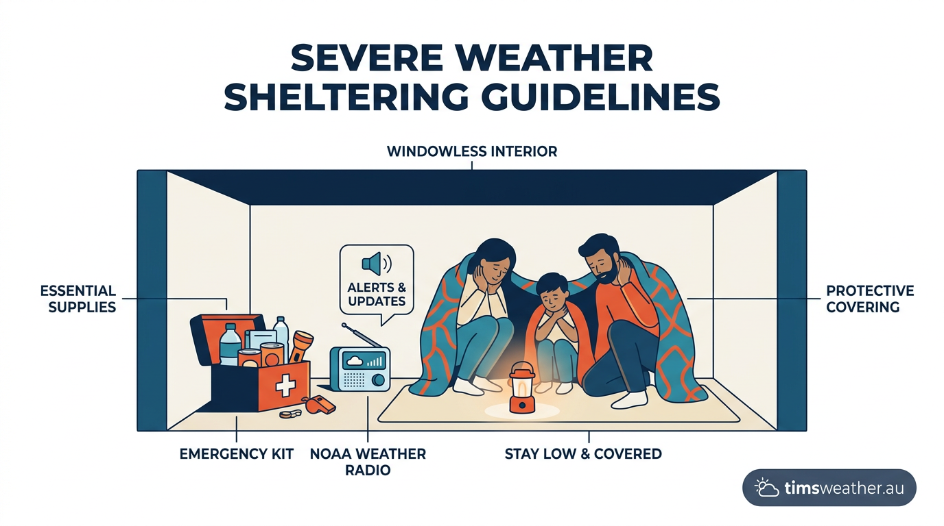
During the watch phase, verify that your designated safe space is completely clear of clutter. Ensure you have sturdy shoes, a protective helmet, and a loud whistle nearby. If you live in a mobile home, you must leave during the watch phase and travel to a permanent, sturdy building. As emergency management groups emphasize, a warning means you move to an interior room on the lowest floor immediately, keeping as many solid walls between you and the outside environment as possible.
While other severe convective hazards like microbursts pose distinct straight-line wind threats that also require immediate indoor sheltering, a confirmed tornado demands the absolute highest level of structural protection available to you.
Overcoming Normalcy Bias During Alerts
One of the greatest challenges in meteorology and emergency management is overcoming normalcy bias. This documented psychological phenomenon causes individuals to systematically underestimate the likelihood or severity of an impending disaster. When a warning is issued, many people step outside with cameras to look for the storm rather than immediately taking cover.
This delay is highly dangerous. Modern tornadic storms are often rain-wrapped, meaning the violent circulation is completely hidden behind a dense curtain of heavy precipitation. If you wait for visual confirmation of the funnel cloud, you will likely be struck by high-speed flying debris before you can reach safety.
Historical Case Studies: When Lead Time Varies
While the standard watch-to-warning progression is the ideal protocol, the chaotic atmosphere does not always follow strict rules. Some specific atmospheric setups produce rapid spin-ups that skip the broad watch phase entirely, testing the limits of forecasting technology and public readiness.
Analyzing historical weather events highlights exactly why understanding these alerts is critical for survival. When a warning is issued without a preceding watch, the shock factor heavily influences public response times and overall safety outcomes.
The March 2026 Michigan Event
The stark unpredictability of severe weather was demonstrated clearly on March 6, 2026, when deadly tornadoes struck Michigan, resulting in four tragic fatalities. In this specific and unusual case, tornado warnings were issued without prior watches, giving local residents almost no time to mentally prepare for the incoming disaster.
The sudden escalation of the storm prompted the state governor to initiate a full review of alert procedures. The event stands as a grim reminder that a tornado warning signifies an immediate threat requiring quick action, regardless of whether a watch was previously in place. Larger storm clusters, known technically as mesoscale convective systems, can occasionally obscure embedded, rapidly developing rotation that challenges even the most advanced radar detection.
Global Variations in Tornado Communication
While the distinct watch and warning terminology is deeply ingrained in the United States, other nations handle severe thunderstorm communication quite differently. The core concept of escalating threat levels remains universal, but the specific wording and public messaging vary significantly by jurisdiction.
How how these local variations function is essential for international travelers and those living outside North America. The ultimate goal of every national weather agency is to protect lives through clear, localized guidance.
Are Tornado Watches and Warnings the Same Everywhere?
In Australia, the Bureau of Meteorology (BOM) does not typically issue a standalone "tornado watch" product. Instead, forecasters issue broad Severe Thunderstorm Warnings for large regions. The BOM specifically includes the mention of tornadoes in their localized warnings only when a verified tornado observation is received or strongly indicated by Doppler radar.
This approach focuses entirely on the immediate localized impact. For a global audience reading weather bulletins, the practical distinction remains identical: an outlook or watch phase means increased potential over a broad area, while a localized warning phase is the life-safety trigger demanding immediate indoor shelter.
Quick Reference: Watch vs Warning Actions
To ensure you react appropriately when severe weather alerts are broadcast, use the following structured guide to clearly understand the distinct threat levels and the mandatory safety behaviors associated with each phase.
Alert Status | Meteorological Meaning | Immediate Action Required |
|---|---|---|
Tornado Watch | Conditions are favourable for severe storms and tornadoes over the next few hours. | Review shelter plans, monitor local weather updates, and keep mobile devices fully charged. |
Tornado Warning | A tornado is imminent or occurring, detected by radar or visual confirmation. | Move to an interior room on the lowest floor immediately; stay far away from all windows. |
Tornado Emergency | A confirmed, exceptionally violent tornado is moving directly into a populated area. | Seek underground shelter or a certified safe room immediately to survive catastrophic damage. |
By understanding the precise meteorological criteria and terminology behind each alert, you can remove the dangerous guesswork from your emergency response. Treat every watch as a call to preparation and every warning as a strict mandate to take cover.
Sources
NOAA weather and atmospheric science reference (repository.library.noaa.gov)
NOAA weather and atmospheric science reference (spc.noaa.gov)
NOAA weather and atmospheric science reference (spc.noaa.gov)
NOAA weather and atmospheric science reference (repository.library.noaa.gov)
NOAA weather and atmospheric science reference (repository.library.noaa.gov)
NOAA weather and atmospheric science reference (nhc.noaa.gov)
NOAA weather and atmospheric science reference (repository.library.noaa.gov)
Storm Prediction Center Forecast Products (spc.noaa.gov)
Last verified: 2026-09-19
Frequently asked questions
A tornado watch means conditions are favourable for tornadoes to develop, so stay alert and review your plan. A tornado warning means a tornado is likely, occurring, or has been spotted. In a warning, you must take shelter immediately in the safest available place to protect yourself from danger.
Source: bom.gov.au
Further reading and resources
Explore trusted articles, books, videos and other resources to go deeper on this topic.
weather.govReference
Understand Tornado Alerts - National Weather Service
Background reference on Tornado Watch or Tornado Warning: What Each One Means for You from weather.gov.
shadygrove.usmd.eduReference
TORNADO WATCHES & WARNINGS | The Universities at Shady Grove
Background reference on Tornado Watch or Tornado Warning: What Each One Means for You from shadygrove.usmd.edu.
teamrubiconusa.orgArticle
Tornado Watch vs Warning: What's the Difference? - Team Rubicon
In-depth coverage on Tornado Watch or Tornado Warning: What Each One Means for You from teamrubiconusa.org.
youtube.comVideo
Tornado watch vs. tornado warning: What the alerts mean and why they ...
Video coverage on Tornado Watch or Tornado Warning: What Each One Means for You from youtube.com.
abc7chicago.comArticle
Tornado watch vs warning: What to do when you see alert messages
In-depth coverage on Tornado Watch or Tornado Warning: What Each One Means for You from abc7chicago.com.
redcross.orgArticle
Tornado Safety Tips - American Red Cross
In-depth coverage on Tornado Watch or Tornado Warning: What Each One Means for You from redcross.org.
tdi.texas.govReference
Danger, danger! Don't mix up tornado watches and warnings
Background reference on Tornado Watch or Tornado Warning: What Each One Means for You from tdi.texas.gov.
belfor.comArticle
Tornado Watch vs. Warning: Know the Difference
In-depth coverage on Tornado Watch or Tornado Warning: What Each One Means for You from belfor.com.
abc11.comArticle
Tornado watch vs warning: What to do when you see alert messages
In-depth coverage on Tornado Watch or Tornado Warning: What Each One Means for You from abc11.com.
Tornado watch vs. warning | NBC DFW - YouTube
Video coverage on Tornado Watch or Tornado Warning: What Each One Means for You from youtube.com.
Planning weeks ahead?
Check Australia's long-range seasonal outlook for rainfall, temperature and the climate drivers (ENSO, IOD, SAM, MJO) shaping the next three months.
View Australia's Seasonal Weather Forecast