
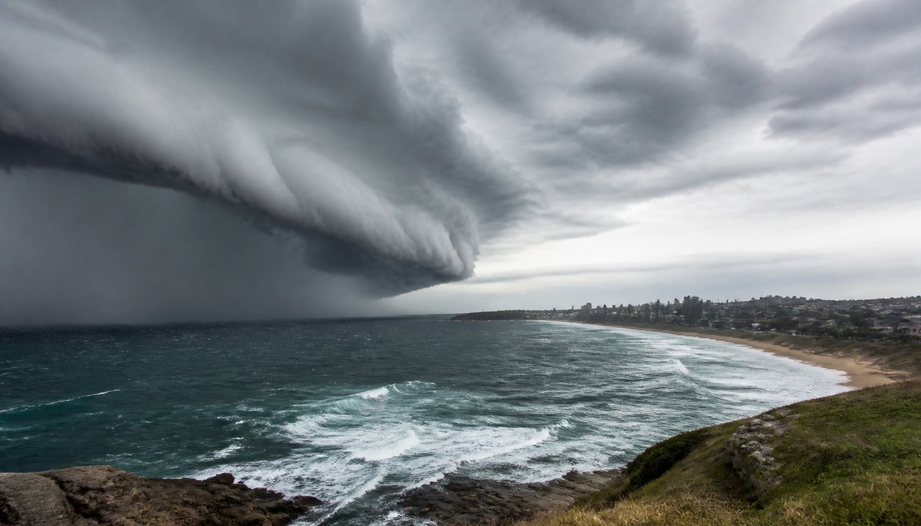
Cold fronts in Australia are weather boundaries where cooler air pushes up under warmer air. They often move across the southern states, bringing a quick temperature drop, shifting winds, rain, cloud bands and, at times, strong gusts. The Bureau of Meteorology says these systems are a major part of southern Australia’s winter weather patterns.
Key takeaways
- Cold fronts mark the leading edge of a cooler air mass replacing warmer air.
- They usually move from west to east across southern Australia, guided by westerly winds and the Polar Front Jet Stream.
- A front often brings a temperature drop, a wind shift, falling barometric pressure, then post-frontal showers.
- Pre-frontal trough lines can bring hot, dry winds and raise fire danger before the cold change arrives.
- The Southern Annular Mode (SAM) can shift cold front frequency and how far north fronts track.
What is a cold front and how does it form?
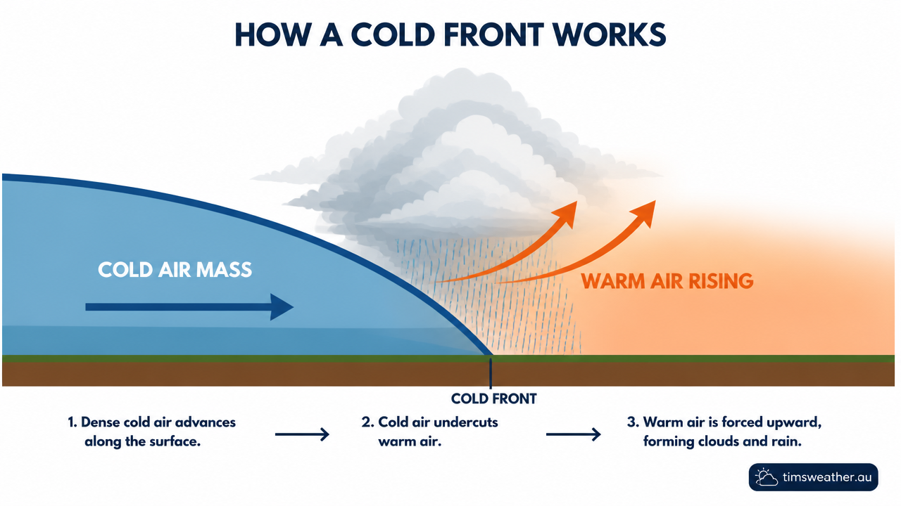
A cold front is the boundary where a colder air mass advances into warmer air. As the colder air undercuts the warmer air, the warmer air is forced upward. That rising air can cool, condense and form cloud bands, showers and, at times, thunderstorms.
The Bureau of Meteorology notes that cold fronts are common in Australia and have a strong effect on weather, especially in the south (Bureau of Meteorology). On a synoptic chart, a cold front is usually shown as a blue line with triangles pointing in the direction it is moving.
Why Southern Ocean air masses matter
Many cold fronts affecting southern Australia develop over the Southern Ocean, with some linked to air coming from near Antarctica. As they move east, they are steered by the mid-latitude westerlies and the Polar Front Jet Stream. By the time they reach the mainland, they often carry enough moisture to bring rain to parts of Western Australia, South Australia, Victoria, Tasmania and New South Wales.
The Subtropical Ridge also matters. When it sits further south, fronts can reach farther north. When it is stronger or positioned differently, fronts may be weaker or track further south.
How cold fronts shape winter weather patterns
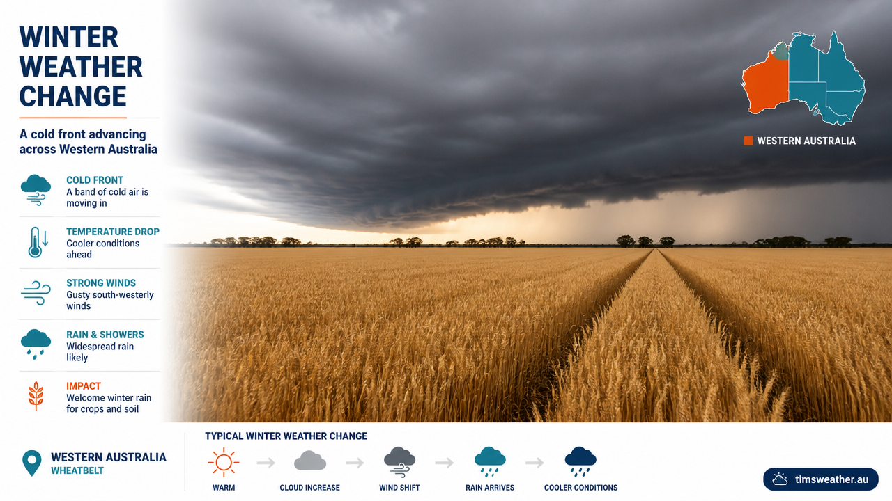
Cold fronts are a big part of winter weather patterns across southern Australia. They often bring a fast change from warmer, drier conditions to cooler, wetter weather. The change can be sharp in the west and more gradual in some eastern areas.
These systems often arrive in a sequence: a pre-frontal trough line, a wind and pressure change, then post-frontal showers. That sequence is why the weather can look calm ahead of a front, then turn unsettled quite quickly.
| Feature | What you may notice | Why it happens |
|---|---|---|
| Pre-frontal trough | Hot, dry winds, rising dust, falling comfort levels | Air ahead of the front can warm and dry out before the cool change |
| Front passage | Wind shift, temperature drop, pressure fall then rise | The colder air mass replaces the warmer air |
| Post-frontal showers | Showers, squalls, broken cloud | Cold air over warmer ocean or land can keep clouds forming |
How the Southern Annular Mode influences cold front frequency
The Southern Annular Mode (SAM) is a key climate driver for cold fronts in Australia. When SAM shifts, it can move the belt of westerly winds and alter how often fronts reach southern Australia. In practical terms, SAM can help explain why some periods bring more fronts to the south-west and south-east, while other periods see fronts track further south and miss parts of the mainland.
If you want the broad pattern, think of SAM as helping steer the storm track. It does not create each front, but it can change the pathway those systems take.
Common front types in Australia
Cold fronts do not all look the same. The local terrain, the season and nearby air masses all shape how they behave.
| Front type | Where it is common | Typical change | Weather impact |
|---|---|---|---|
| Southern Ocean front | South-west Western Australia to Tasmania | North-westerly to south-westerly | Rain, gusty winds, temperature drop |
| Southerly buster | Coastal New South Wales | Northerly to southerly | Sudden cool change, strong winds, usually little rain |
| Pre-frontal trough | South Australia, Victoria, inland New South Wales | Often northerly to north-westerly before the front | Hot, dry winds and higher fire danger |
| Shallow cool change | Coastal South Australia and Victoria | Northerly to westerly or south-westerly | Brief cooling, cloud and showers near the coast |
The pre-frontal trough
A pre-frontal trough is an elongated low pressure area that often sits ahead of the main front. It can draw hot air from inland Australia towards the southeast. That is why temperatures can rise sharply before the cooler change arrives. If you are in South Australia, Victoria or inland New South Wales, this is often the part of the system that lifts fire danger.
Research from UNSW notes that cold fronts can draw hot, dry winds from Central Australia and make fire behaviour more erratic (UNSW). For local warnings and preparedness, see our Weather Warnings guide.
The southerly buster
The southerly buster is a fast-moving coastal cool change that affects New South Wales, especially around Sydney. It often develops when a strong southerly push runs up against warmer air along the coast and the Great Dividing Range helps guide the flow. The Tasman Sea also plays a part, because the warm coastal air and sea breeze can help sharpen the change. A southerly buster usually brings a sudden drop in temperature and a strong wind shift, but not always much rain.
How to spot an approaching cold front
There are a few clear signs that a front is on the way. If you watch the wind, pressure and cloud, the pattern often stands out before the rain starts.
Barometric pressure and wind shifts
One of the most reliable signs is a fall in barometric pressure ahead of the front. After the front passes, pressure usually rises. Winds often freshen from the north or north-west before changing to west or south-west, depending on where you are.
Mariners and coastal users can use these shifts as an early clue that squalls or rougher conditions may follow (RYCT).
Identifying cloud band signatures on BOM satellite imagery
Cloud bands ahead of a front can be seen on BOM satellite imagery as long, broad streaks of cloud stretching from the tropical or subtropical ocean into southern Australia. These bands often line up with the front, the pre-frontal trough or the westerly flow feeding into the system.
When you look at satellite images, watch for three common signs:
- a long, curved band of cloud stretching across western or southern Australia
- broken cloud turning into a thicker band near the front
- showers and cloud clearing behind the front, with post-frontal showers trailing in the cooler air
That pattern can help you tell the difference between a passing front and a slower cloud shield that is not linked to a front.
What happens as the front passes?
When the front crosses your area, the change can be quick. The temperature often drops, the wind turns, and the air feels different within minutes. In southern WA, South Australia and Victoria, this can happen with rain and squally showers. In New South Wales, a southerly buster can bring a much faster cool change along the coast.
After the front, the colder air mass can remain unstable, which is why post-frontal showers often continue even after the main rain band has moved through. Over the ocean or along the coast, that cooler air can keep building cloud and showers for hours.
Why cold fronts matter for bushfire weather
Cold fronts can reduce heat after they pass, but the lead-up can be dangerous. The pre-frontal trough may pull very hot, dry air into southern Australia and lower humidity. That combination dries fuels and can make fire behaviour harder to predict.
UNSW’s bushfire material explains that the wind change at the front can turn a long fire flank into a new head fire, which is one reason fronts are watched closely during severe fire days (UNSW). If a front is forecast on a severe fire weather day, stay close to official warnings from the Bureau of Meteorology and local emergency services.
Related guides
Frequently asked questions
A cold front is the boundary where a cooler air mass replaces a warmer one. In Australia, these systems typically move from west to east across the southern states. They usually bring a noticeable temperature drop, a shift in wind direction, increased cloud cover, and varying amounts of rainfall or showers.
Source: bom.gov.au
Further reading and resources
Explore trusted articles, books, videos and other resources to go deeper on this topic.
media.bom.gov.auReference
Cold fronts: your questions answered
Background reference on Cold fronts in Australia: how they form and what they bring from media.bom.gov.au.
youtube.comVideo
We often talk about them, but what exactly is a cold front?
Video coverage on Cold fronts in Australia: how they form and what they bring from youtube.com.
bom.gov.auReference
Frontal systems | The Bureau of Meteorology
Background reference on Cold fronts in Australia: how they form and what they bring from bom.gov.au.
en.wikipedia.orgReference
Cold front
Background reference on Cold fronts in Australia: how they form and what they bring from en.wikipedia.org.
scied.ucar.eduReference
Weather Fronts - UCAR Center for Science Education
Background reference on Cold fronts in Australia: how they form and what they bring from scied.ucar.edu.
skybrary.aeroArticle
Cold Front
In-depth coverage on Cold fronts in Australia: how they form and what they bring from skybrary.aero.
Ask the Bureau: What is a cold front?
Video coverage on Cold fronts in Australia: how they form and what they bring from youtube.com.
ryct.org.auArticle
Cold Fronts
In-depth coverage on Cold fronts in Australia: how they form and what they bring from ryct.org.au.
The big chill: what is a cold front? - Social Media Blog
Background reference on Cold fronts in Australia: how they form and what they bring from media.bom.gov.au.
abc.net.auArticle
What is a cold front and why does it do so much damage?
In-depth coverage on Cold fronts in Australia: how they form and what they bring from abc.net.au.
Planning weeks ahead?
Check Australia's long-range seasonal outlook for rainfall, temperature and the climate drivers (ENSO, IOD, SAM, MJO) shaping the next three months.
View Australia's Seasonal Weather Forecast