
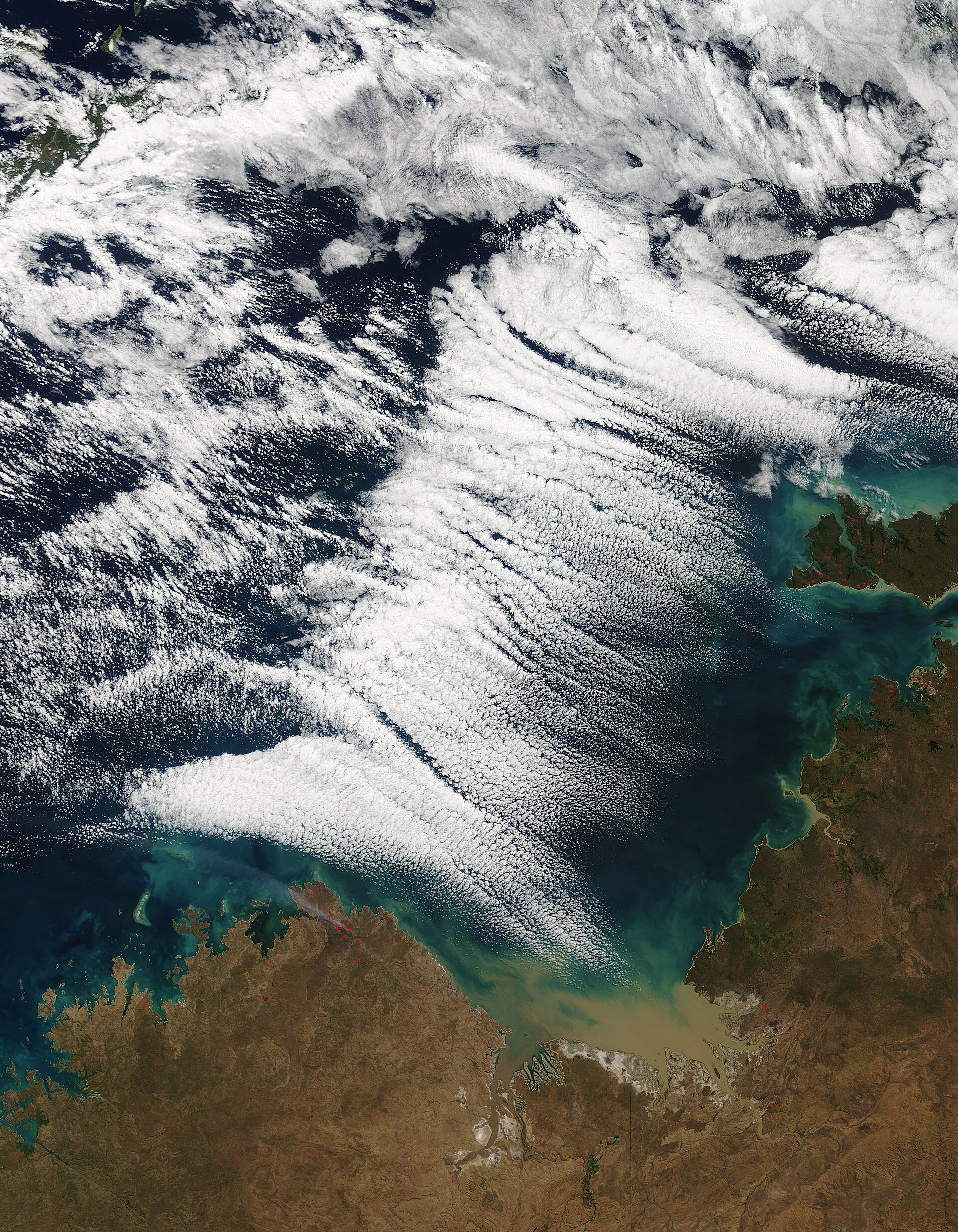
Australian air masses are large bodies of air that take on the temperature and moisture traits of their source regions. As they move across the continent, changes in relative humidity, temperature gradients and surface pressure systems help shape local weather.
Key takeaways
- Australia is mainly influenced by Tropical Maritime (mT), Tropical Continental (cT), Polar Maritime (mP) and Equatorial air masses.
- The Bureau of Meteorology (BOM) says fronts form where different air masses meet, which can bring sharp temperature changes, rain and storms.
- The Subtropical Ridge often steers air masses, while the Southern Annular Mode (SAM) can shift the belt of westerly winds south or north.
- East Coast Lows, the Indian Ocean Dipole and the ITCZ can also shape how air masses behave over Australia.
- The Great Australian Bight is a key area for cold southern air moving toward southern Australia.
What is an air mass and how does it form?
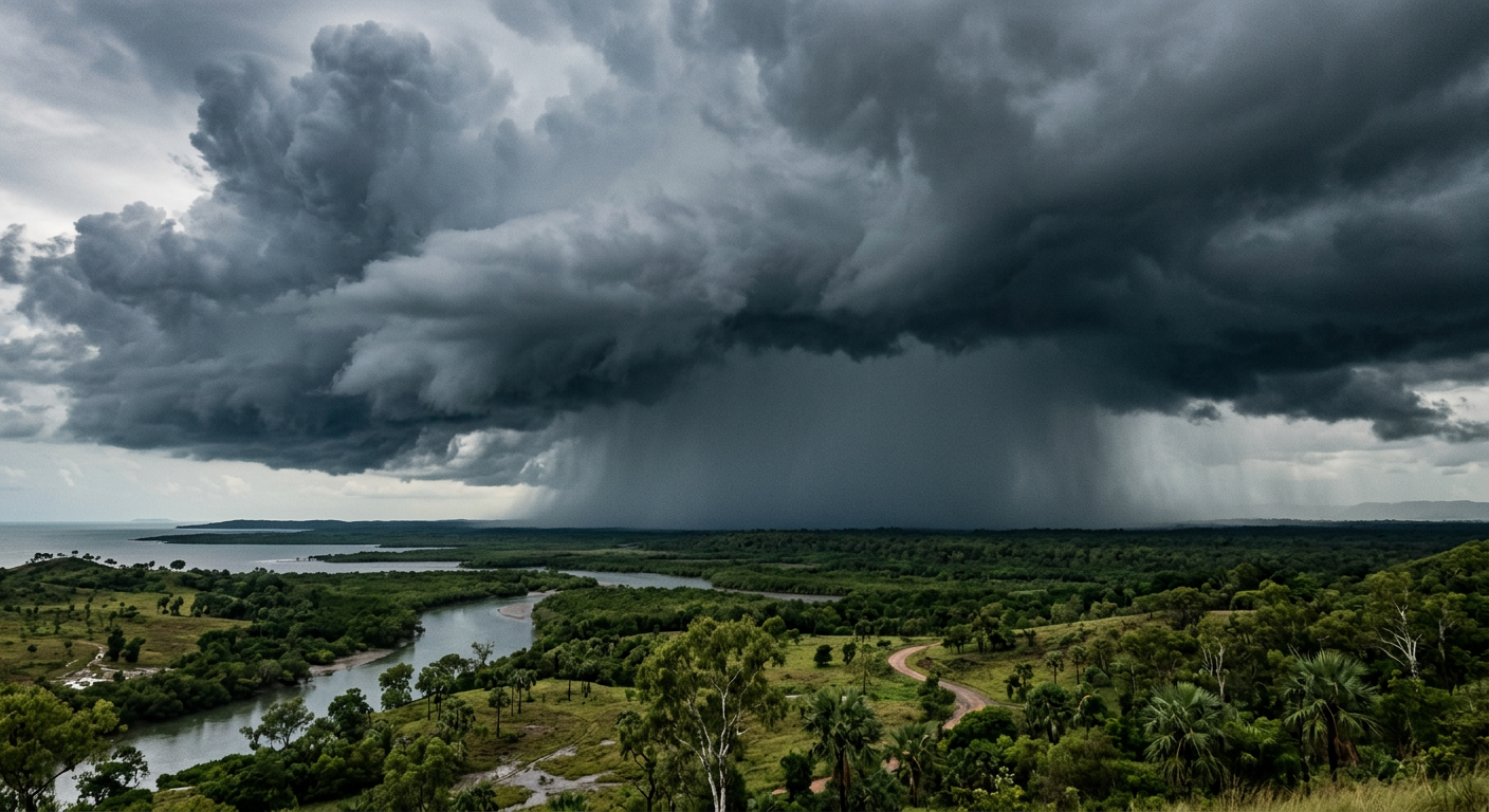
An air mass forms when air sits over a broad, fairly uniform area long enough to pick up that area's temperature and moisture traits. That source region may be warm ocean water, dry inland country or cold southern seas. The result is a body of air with similar characteristics through much of its depth.
On synoptic charts, forecasters track these air masses by looking at fronts, troughs and surface pressure systems. High pressure usually encourages sinking air and clearer skies. Low pressure and troughs are more likely to lift air, which can increase cloud, showers and storms. This is the basic link between atmospheric circulation and day-to-day weather.
What is a source region in Australian weather?
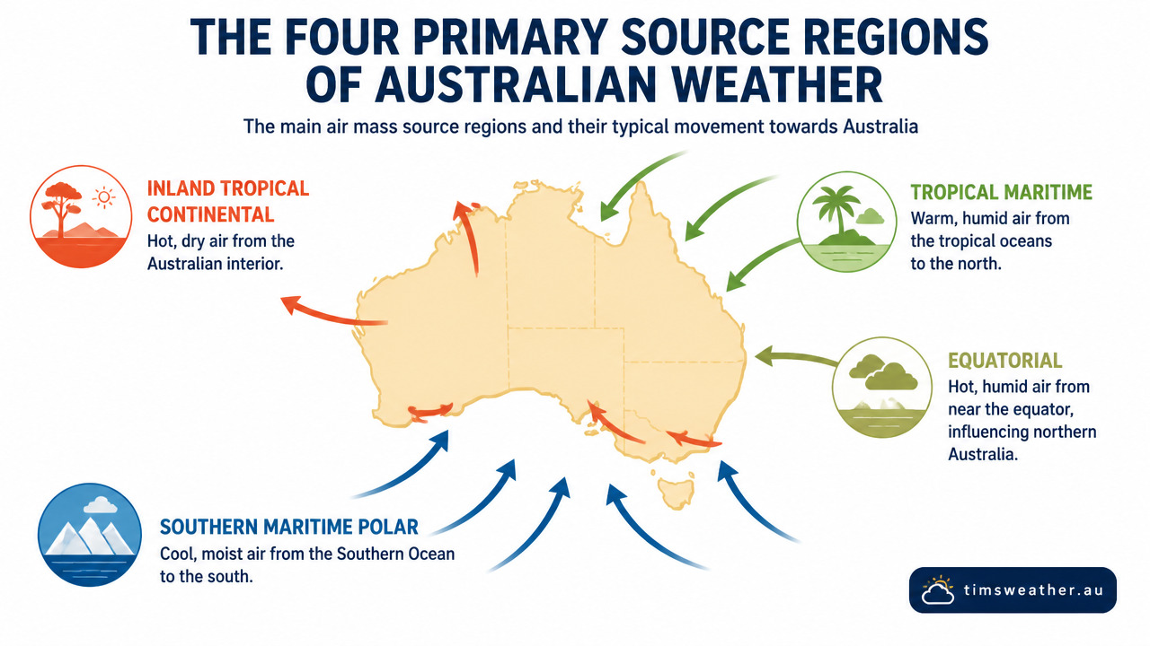
A source region is the area where an air mass forms and gains its key traits. In Australia, that can be the tropical oceans to the north, the dry interior or the Southern Ocean and Great Australian Bight to the south. Source regions matter because they set the starting point for temperature gradients, humidity and stability and instability.
Australian air masses and the main types
Australia is mainly influenced by four air masses. They do not work alone. The Subtropical Ridge, SAM, East Coast Lows and seasonal shifts in the Indian Ocean Dipole can change how far each air mass spreads and how much rain or heat it brings.
| Air mass | Common source region | Typical weather | General stability |
|---|---|---|---|
| Tropical Maritime (mT) | Tropical seas to the north and east | Warm, humid air, showers and thunderstorms | Often unstable |
| Tropical Continental (cT) | Interior Australia | Hot, dry conditions and heatwaves | Often stable aloft, but can become unstable near the surface |
| Polar Maritime (mP) | Southern Ocean and Great Australian Bight | Cool to cold air, showers, hail or snow in southern areas | Can be unstable after moving over warmer land or water |
| Equatorial | Near the ITCZ and tropical waters | Very moist air and monsoonal rain | Highly unstable |
How do tropical maritime air masses affect Australia?
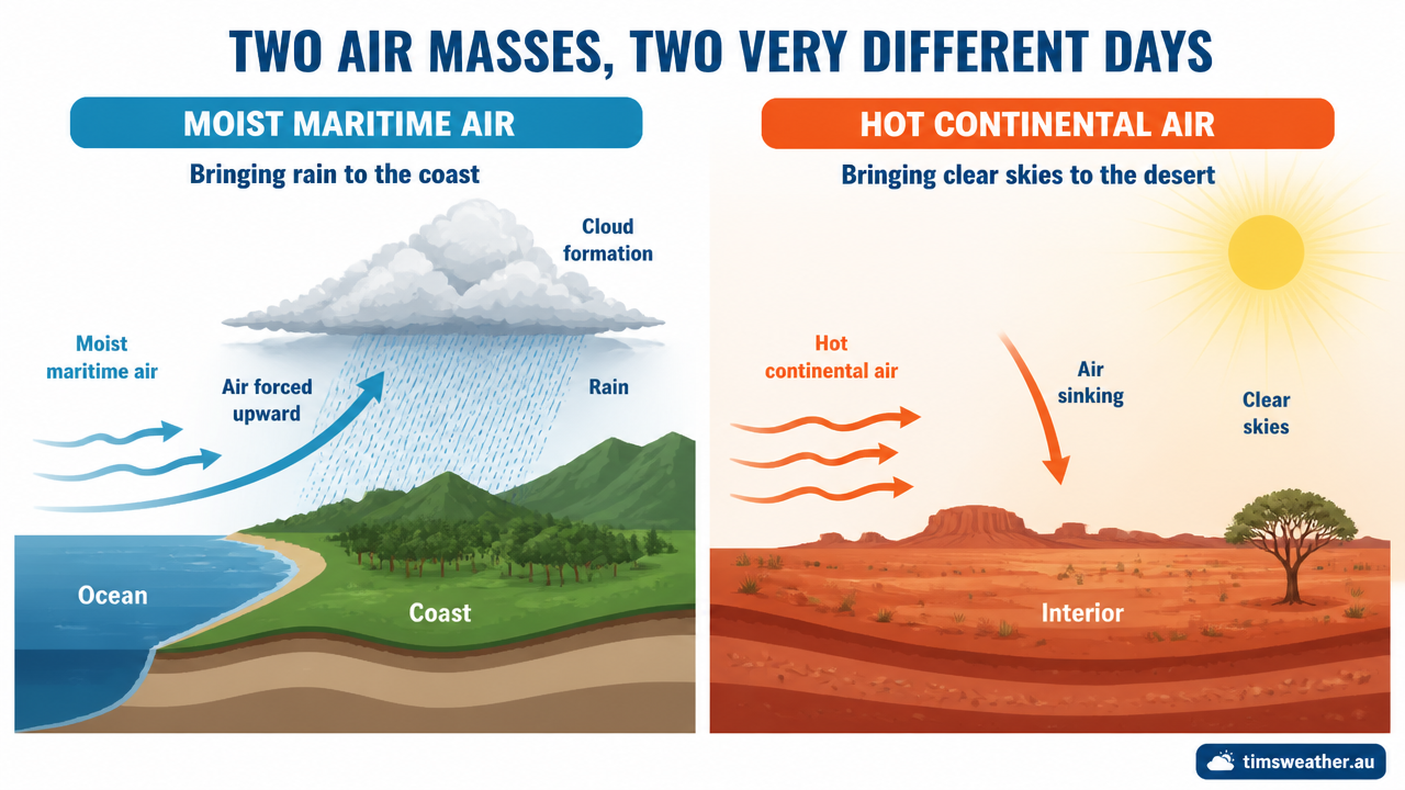
Tropical Maritime (mT) air forms over warm tropical waters and carries high moisture content. When it moves over eastern Australia, it can bring humid days, cloud and showers. If a low pressure system or East Coast Low taps into this air, rainfall can become more widespread and heavy.
Because mT air is moist, it often has a higher relative humidity than inland air. When that air is lifted by hills, troughs or a front, cloud can build quickly. That is why coastal areas often feel more humid than inland districts.
How do tropical continental air masses behave?
Tropical Continental (cT) air forms over the hot, dry interior. It usually brings clear skies, low humidity and high temperatures. The air can still become unstable close to the ground during strong daytime heating, which is why summer heat in inland Australia can set up hot, dry afternoon winds and dust.
How do polar maritime air masses affect southern Australia?
Polar Maritime (mP) air comes from the south and south-west, often passing over the Southern Ocean and the Great Australian Bight before reaching southern Australia. The BOM notes that cold fronts are common in Australia and can bring significant rain and storms. When mP air follows a front, it can bring cold changes, showers, hail and snow to higher ground.
A broad pool of cold air can also spread across Tasmania and south-eastern Australia, with cloud bands over the Great Australian Bight sometimes linked to rain, hail, snow or thunderstorms. That is why southern weather can change quickly when a front moves through.
How pressure systems steer Australian air masses
Surface pressure systems act like tracks that guide air masses around the country. The Subtropical Ridge often sits across much of southern Australia and helps steer dry, settled weather. When it shifts, it can open the door to fronts, troughs and rain-bearing systems. The SAM also matters because it changes the position of the westerly wind belt and can alter how far south or north cold air reaches.
Meridional flow, where winds move more from north to south than from west to east, can drag warm tropical air south or cold polar air north. That creates sharper temperature gradients and can increase the chance of showers or thunderstorms where air masses meet.
Why do synoptic charts matter?
Synoptic charts show the position of highs, lows and fronts at a set time. They help you see where air is coming from, where it is going and where it may meet another air mass. For weather planning, that is often more useful than looking at temperature alone.
Weather systems linked with Australian air masses
Some larger climate drivers change the way Australian air masses behave from season to season. The ITCZ helps set up the tropical rain belt and monsoon flow in the north. The Indian Ocean Dipole can influence moisture supply from the west. East Coast Lows can tap into moist maritime air and produce heavy rain along the coast.
In southern Australia, the Great Australian Bight is a common pathway for cold air and fronts. In the north, the ITCZ and tropical seas support humid air and monsoon rain. These links do not control every event, but they help explain the pattern you see on BOM charts and forecasts.
What this means for everyday weather
If you live on the coast, moist mT air can lift cloud cover, humidity and rain chances. If you are inland, cT air often means heat and dry skies. In southern states, mP air behind a front can bring a cold change, showers and windy conditions. The mix of air masses is why Australia can shift from warm and calm to cold and showery in a short time.
Related guides
Frequently asked questions
Australia is primarily influenced by tropical, maritime, and continental air masses. Tropical air is generally warm and humid, whereas continental air from the interior is typically hotter and drier. When these distinct air masses converge, they frequently trigger weather changes such as fronts, cloud cover, rainfall, and thunderstorms.
Source: bom.gov.au
Further reading and resources
Explore trusted articles, books, videos and other resources to go deeper on this topic.
education.nationalgeographic.orgArticle
Air Mass
In-depth coverage on Australian air masses explained: how they shape weather from education.nationalgeographic.org.
youtube.comVideo
Air Masses and Fronts - How They Affect Weather Patterns
Video coverage on Australian air masses explained: how they shape weather from youtube.com.
aopa.orgArticle
Air Masses
In-depth coverage on Australian air masses explained: how they shape weather from aopa.org.
scied.ucar.eduReference
Weather Fronts - UCAR Center for Science Education
Background reference on Australian air masses explained: how they shape weather from scied.ucar.edu.
geo.libretexts.orgArticle
1.6: Atmosphere- Air Masses and Storms
In-depth coverage on Australian air masses explained: how they shape weather from geo.libretexts.org.
noaa.govReference
Air Masses | National Oceanic and Atmospheric Administration
Background reference on Australian air masses explained: how they shape weather from noaa.gov.
bom.gov.auReference
Highs and lows: the systems that drive weather patterns
Background reference on Australian air masses explained: how they shape weather from bom.gov.au.
study.comArticle
Types of Air Masses | Overview & Differences - Video
In-depth coverage on Australian air masses explained: how they shape weather from study.com.
rubicon3adventure.comArticle
Air Masses: A Comprehensive Guide For Mariners & Sailors
In-depth coverage on Australian air masses explained: how they shape weather from rubicon3adventure.com.
ebsco.comArticle
Air mass | Earth and Atmospheric Sciences
In-depth coverage on Australian air masses explained: how they shape weather from ebsco.com.
Planning weeks ahead?
Check Australia's long-range seasonal outlook for rainfall, temperature and the climate drivers (ENSO, IOD, SAM, MJO) shaping the next three months.
View Australia's Seasonal Weather Forecast