
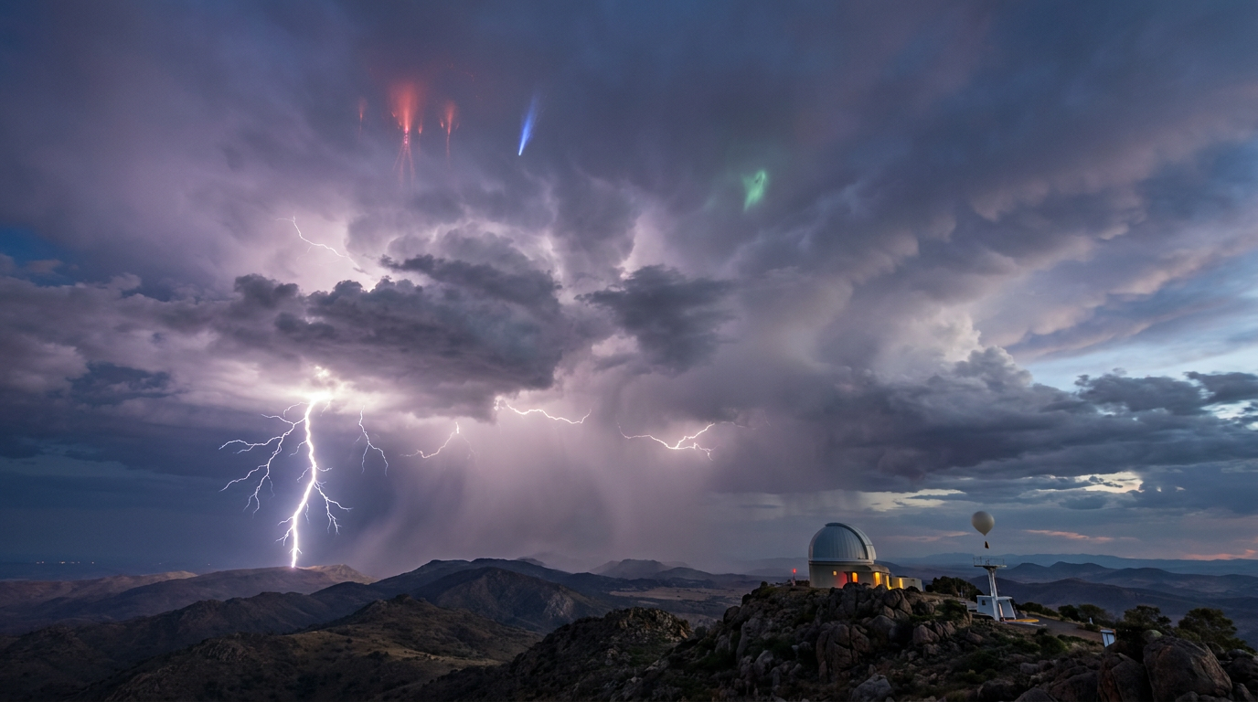
The main types of lightning are categorised primarily by their origin and destination, ranging from common intra-cloud flashes to hazardous cloud-to-ground strikes. Atmospheric science classifies these electrical discharges into standard storm-level phenomena and rare, high-altitude transient luminous events that flash far above active cumulonimbus clouds.
Key takeaways
Intra-cloud lightning is the most frequent electrical discharge, accounting for the vast majority of atmospheric flashes.
Cloud-to-ground strikes are classified by their polarity, with positive discharges carrying significantly more energy than negative ones.
Transient luminous events like sprites and blue jets occur in the upper atmosphere and are entirely distinct from tropospheric lightning.
Satellite technology now allows meteorologists to map total lightning activity continuously across the globe.
How different types of lightning are defined
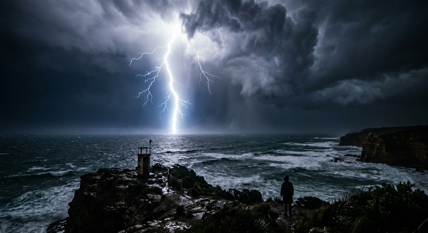
Meteorologists classify lightning based on the structural pathway the electrical current follows. The World Meteorological Organization and international aviation agencies group these discharges into specific observational categories to accurately assess storm intensity and potential hazards. Standard observational systems track where the discharge begins and where the visible channel terminates.
What are the main types of lightning?
Types of lightning are categorized primarily by their origin and destination, ranging from common cloud-to-ground and intra-cloud strikes to rare high-altitude phenomena. Scientific classification includes standard electrical discharges like negative return strokes, alongside transient luminous events such as sprites, elves, and blue jets, which occur in the upper atmosphere above active thunderstorms.
The physics of atmospheric electrical discharge
How any form of lightning requires examining the internal structure of a developing thunderstorm. Cumulonimbus clouds operate as immense thermodynamic engines that transport moisture and thermal energy high into the troposphere.
As water vapour ascends into regions where temperatures fall well below freezing, the physical state of the moisture changes. This environment becomes a turbulent mixture of supercooled water droplets, small ice crystals, and dense pellets of soft hail known as graupel.
Charge separation in the troposphere
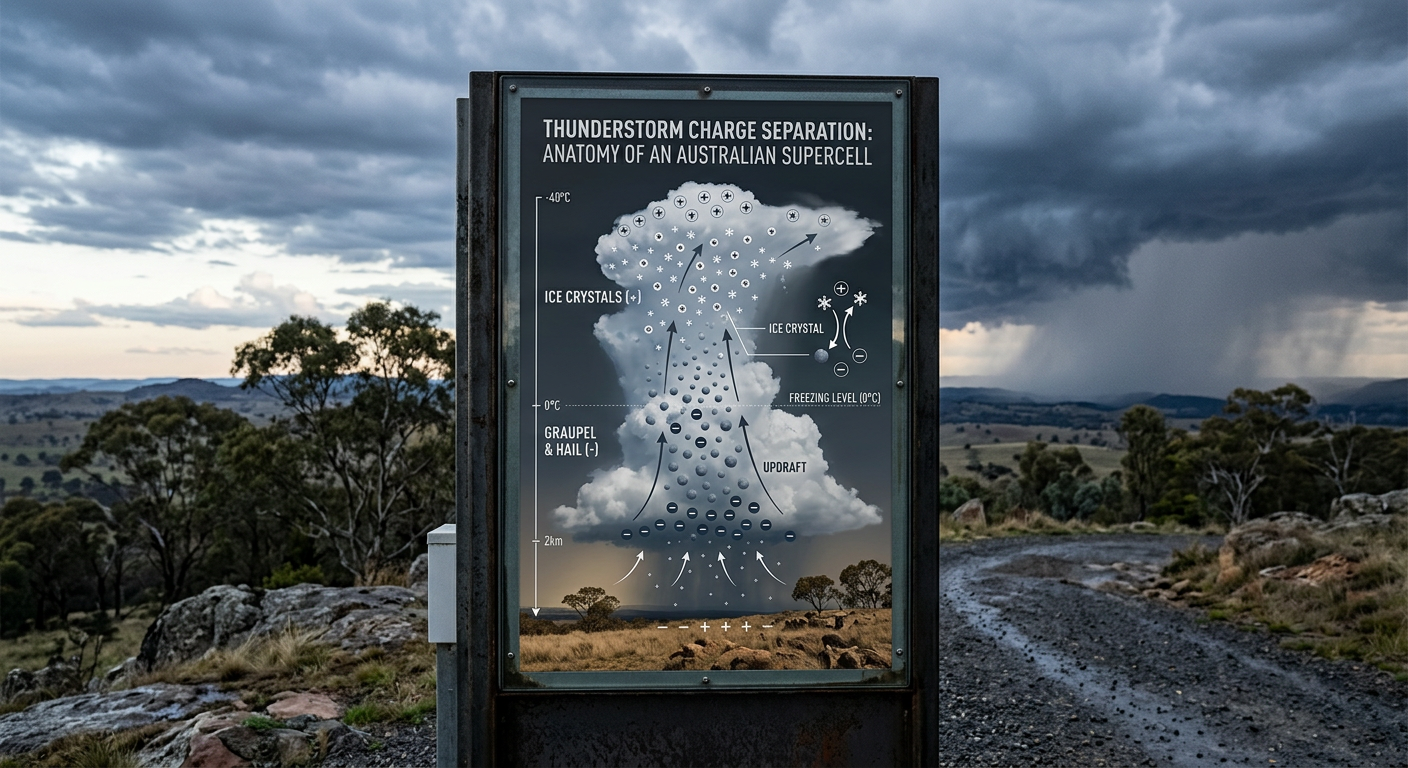
The fundamental driver of all lightning is charge separation. Powerful updrafts push lighter ice crystals towards the top of the storm cloud, while heavier graupel falls downwards against the rising air.
When these particles collide, they exchange electrons. The falling graupel takes on a negative charge, while the ascending ice crystals become positively charged. This massive segregation of particles establishes an electrical dipole within the cloud. Recent research details how electrical charges build up through collisions of water droplets and ice particles, ultimately creating a localized voltage that the atmosphere can no longer contain.
The role of static electricity and electrostatics
The atmosphere normally acts as an excellent insulator. However, as the electrical gradient between the top of the cloud and the middle of the cloud grows rapidly, the insulating properties of the surrounding air begin to fail.
The electric field reaches millions of volts per metre. When the threshold of breakdown is crossed, an initial conductive channel forms. This allows the sudden release of energy, which we observe as lightning. High-speed camera data collected by the National Severe Storms Laboratory shows that this initial breakdown happens in mere microseconds, rapidly ionizing the air and heating it to extreme temperatures.
Cloud discharges: The most frequent lightning phenomena
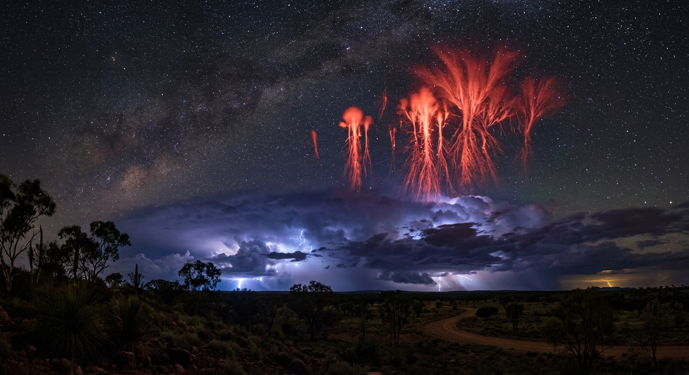
While ground strikes capture the most attention due to their destructive potential, discharges that remain entirely airborne represent the overwhelming majority of global lightning activity. These phenomena are grouped under the broad term of cloud discharges and are critical indicators of storm intensification.
Intra-cloud lightning (IC)
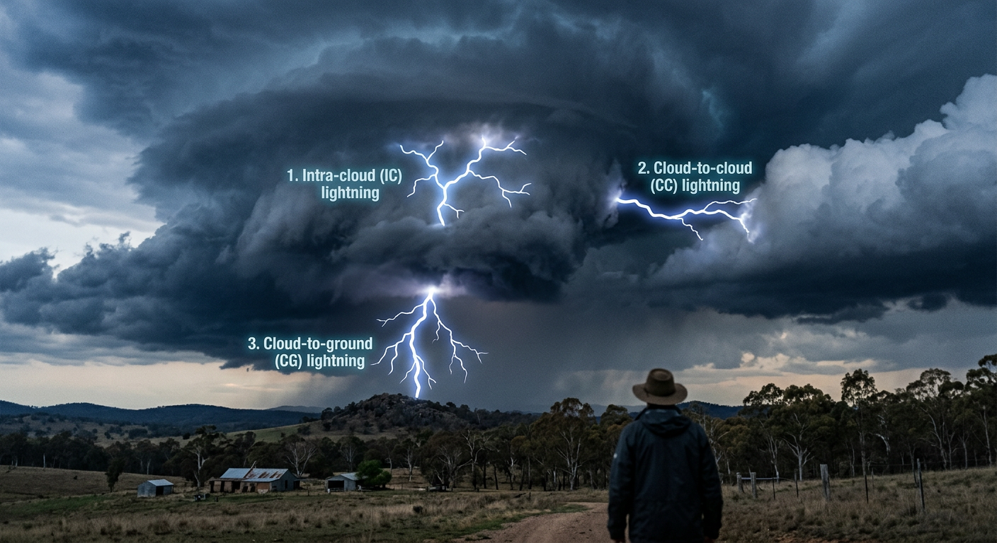
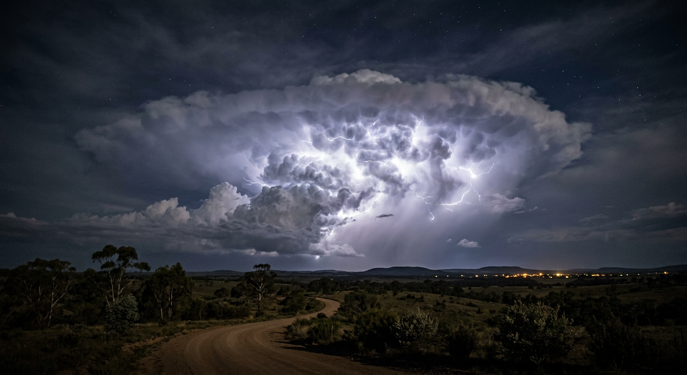
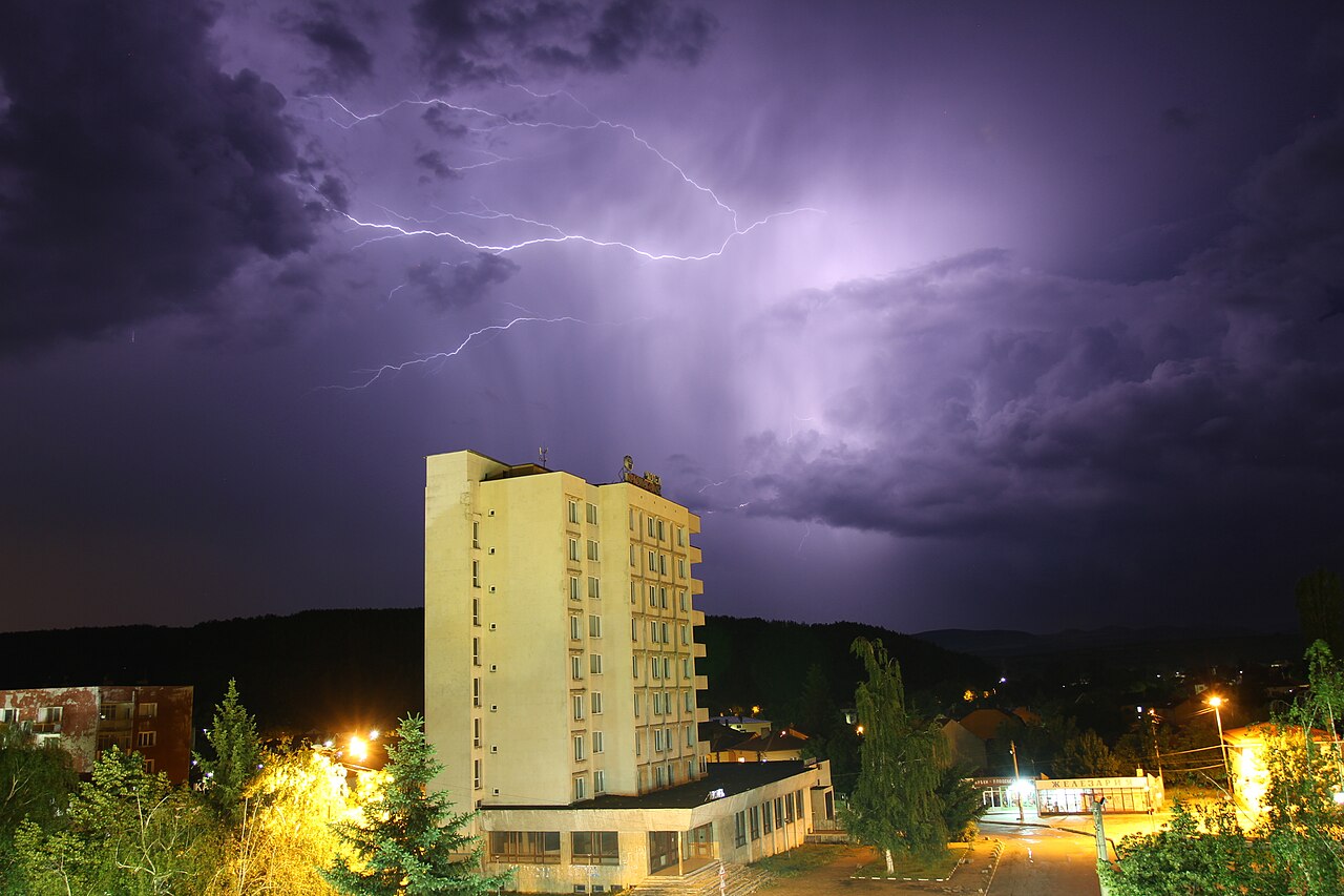
Intra-cloud lightning occurs entirely within the boundaries of a single cumulonimbus cloud. It involves an electrical discharge between the negatively charged middle layer of the storm and the positively charged upper anvil. Because the actual lightning channel remains buried deep within thick layers of precipitation and cloud vapour, observers on the ground typically only see a diffuse, flickering glow illuminating the cloud from within.
Intracloud lightning is typically five to ten times more frequent than ground strikes, making it an essential metric for meteorologists attempting to gauge the severity of an advancing system. To learn more about the specific environmental triggers for these internal flashes, you can read our guide on how does intra-cloud lightning form.
Cloud-to-cloud lightning (CC)
Cloud-to-cloud lightning is a less common variation where the electrical discharge bridges the gap between two completely separate storm clouds. Rather than connecting distinct charge regions within one vertical column, the discharge travels horizontally through the clear air space separating adjacent storm cells.
This type of strike demonstrates the immense scale of atmospheric electric fields, which can influence surrounding air masses over distances of many kilometres. The physics governing this horizontal travel are complex, as outlined in our analysis of how does cloud-to-cloud lightning form across broader storm systems.
Cloud-to-ground lightning: Surface strikes and storm patterns
Cloud-to-ground lightning represents the greatest direct hazard to human life, infrastructure, and natural ecosystems. These strikes occur when the electrical potential between the storm cloud and the Earth's surface becomes strong enough to overcome the atmospheric resistance. The entire process of electrostatic discharges occurring between electrically charged regions is violent and rapid, heating the immediate air channel to temperatures reaching 30,000 °C.
The lifecycle of a lightning channel: From stepped leader to return stroke
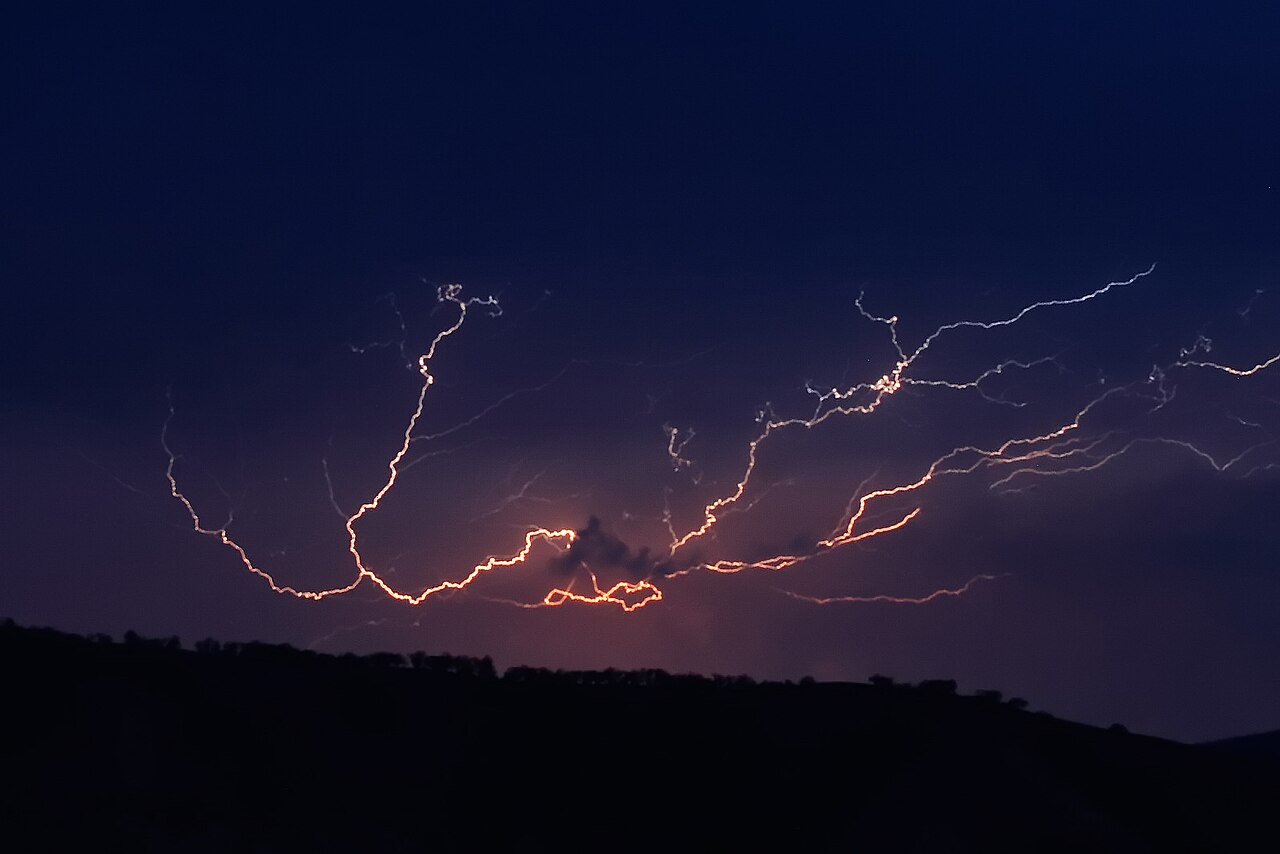
A ground strike begins invisibly. A faint channel of ionised air, called a stepped leader, emerges from the cloud base and travels downwards in staggered increments of roughly 50 metres. It pauses for a fraction of a microsecond before taking the next step. As this negatively charged leader nears the ground, the intense electric field draws a corresponding upward streamer of positive charge from tall objects on the surface.
When the downward leader and upward streamer connect, the circuit is completed. The massive flow of current that shoots back up the established channel is the return stroke. This return stroke generates the brilliant flash of white light and the sudden expansion of air that we hear as thunder. You can read a complete breakdown of this process in our guide covering how does cloud-to-ground lightning form step by step.
Differentiating positive and negative cloud-to-ground strikes
Most ground strikes are downward negative lightning, originating from the lower, negatively charged region of the cloud. However, downward positive strikes present a much more severe threat. Positive lightning originates from the high-altitude cirrus anvil of the storm, which holds a strong positive charge.
Because it must travel through a much greater depth of the atmosphere to reach the ground, positive lightning requires a significantly higher electric field to initiate. When it does strike, the peak current can exceed 300,000 amperes, carrying up to ten times the energy of a standard negative flash.
The Lightning Safety Guide for Sports and Special Events highlights that positive strikes frequently strike ground several kilometres away from the main precipitation core of the storm, catching people completely off guard.
Characteristic | Negative Discharges | Positive Discharges |
|---|---|---|
Origin Point | Lower to middle cloud layers | Upper cloud anvil |
Frequency | Makes up roughly 90% of ground strikes | Less than 10% of ground strikes |
Peak Current | Typically 30,000 amperes | Can exceed 300,000 amperes |
Hazard Profile | Strikes near heavy rainfall | Can strike far outside the storm core |
Upward lightning and tall structures
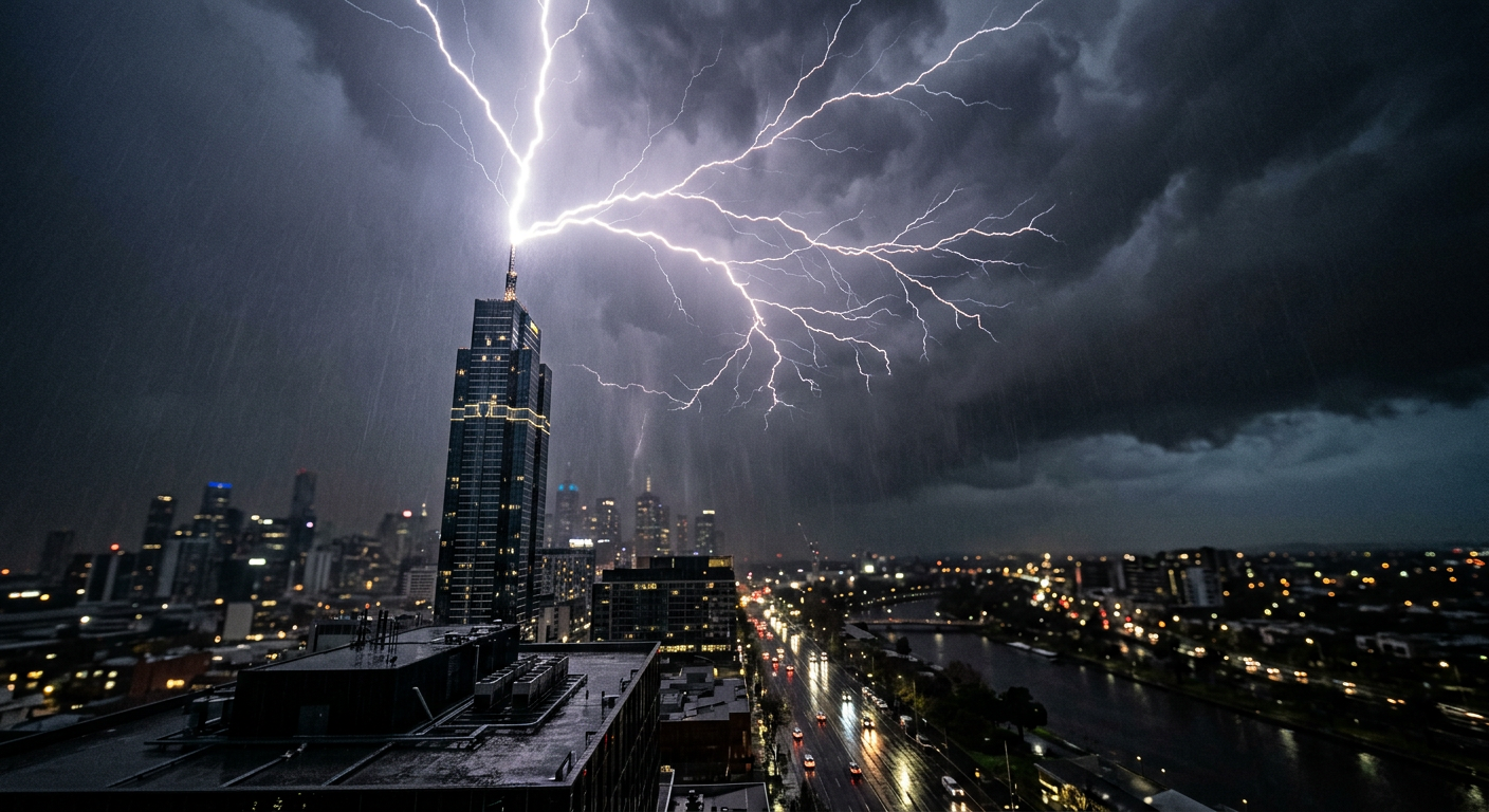
While most lightning travels downwards, upward lightning is a distinct phenomenon triggered by tall, human-made structures. Skyscrapers, broadcast towers, and wind turbines can locally distort the electric field of an overhead thunderstorm.
Under certain conditions, an upward-moving leader will initiate from the tip of the structure and climb towards the cloud base. This primarily occurs during winter storms or when the cloud base is unusually low. Monitoring upward lightning is an essential field of study for engineers designing lightning protection systems for modern urban infrastructure.
Anomalous and rare atmospheric discharges
Beyond the standard categories of cloud and ground strikes, several rare variants of atmospheric electrical discharge challenge our understanding of atmospheric science. Some of these phenomena are so elusive that they were considered folklore until modern scientific instrumentation confirmed their existence.
Superbolts and their massive energy release
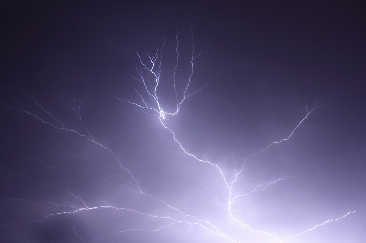
A superbolt is defined as a lightning flash that is at least 1,000 times brighter than standard lightning. The World Meteorological Organization Global Weather and Climate Extremes Archive tracks these massive energy releases.
Superbolts are uniquely powerful because they typically involve an unusually prolonged discharge of energy. Unlike typical positive or negative strikes that release energy in a few quick bursts, superbolts sustain their luminous output over a longer duration, resulting in an immense release of optical energy that can momentarily blind satellite sensors.
Geographic distribution of superbolts: Global hotspots
Interestingly, the geographic distribution of superbolts is entirely different from regular lightning. While normal lightning peaks over tropical continents during the summer months, superbolts most frequently occur over the open oceans of the Northern Hemisphere during winter.
Regions such as the North Atlantic Ocean and the Mediterranean Sea are lightning-active areas, but they are not identified as the world’s principal global hotspots; Lake Maracaibo in Venezuela is the top lightning hotspot, and the Congo basin is the highest flash-rate-density hotspot. Meteorologists theorise that the contrasting temperature between relatively warm ocean waters and the freezing winter air above creates highly energised storm cells capable of producing these extreme discharges.
The mystery of ball lightning
Ball lightning remains one of the most enigmatic phenomena in atmospheric science. Observers consistently report seeing glowing, spherical objects ranging in size from a golf ball to a large beach ball floating near the ground during severe thunderstorms.
Unlike standard lightning which lasts for milliseconds, ball lightning can persist for several seconds. It has been described as moving erratically, passing through solid objects, and occasionally detonating with a loud crack.
Capturing verifiable scientific data on ball lightning is exceptionally difficult due to its rarity and unpredictable nature. If you are curious about the leading theories behind this phenomenon, you can review our piece on how does ball lightning form in unstable atmospheric conditions.
Bead lightning and decayed channels
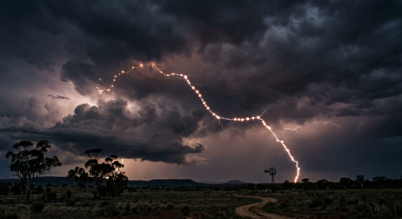
Bead lightning is not actually a separate form of discharge, but rather a rare visual effect that occurs during the decay phase of a standard cloud-to-ground strike. As the main return stroke fades, the lightning channel cools and breaks apart into segmented, luminous sections that resemble a string of glowing beads.
This occurs because the initial lightning channel is rarely perfectly uniform in its thickness. Thicker sections of the ionized air take longer to cool and stop glowing than thinner sections, creating the segmented appearance. It is typically only visible when a lightning strike is photographed with a high-speed camera or observed in extremely dark conditions.
Transient Luminous Events (TLEs) in the upper atmosphere
For decades, pilots reported seeing strange, colourful flashes shooting upwards from the tops of thunderstorms. It was not until 1989 that high-speed video successfully captured these phenomena. We now know these events as Transient Luminous Events. TLEs do not occur in the troposphere where regular weather happens; instead, they exist high up in the stratosphere, mesosphere, and ionosphere.
The electrodynamics of transient luminous events (TLEs)
Transient luminous events are not composed of the hot, ionised plasma that makes up regular tropospheric lightning. Instead, they are cold plasma phenomena, similar to the glowing gas inside a fluorescent light bulb. They are triggered by the massive electromagnetic pulses generated by exceptionally powerful positive cloud-to-ground lightning strikes far below.
When an intense positive strike drains a massive amount of charge from the storm cloud, it creates a sudden, massive electric field shift in the thin air high above the cloud. This electric field excites nitrogen gas molecules in the upper atmosphere, causing them to emit coloured light. Extensive research on the Global Distribution and Seasonal Variation of Transient Luminous Events confirms that they are a global occurrence, deeply tied to the intensity of underlying storm systems.
Sprites: High-altitude red flashes
Sprites are the most commonly observed type of TLE. They occur in the mesosphere, at altitudes between 50 and 90 kilometres above the Earth's surface. Sprites typically appear as large, vertical clusters of red tendrils, often likened to jellyfish or carrots.
The red colour is due to the low atmospheric pressure at those extreme altitudes interacting with nitrogen gas. Despite their massive size, often spanning tens of kilometres across, sprites last for only a few milliseconds. They are incredibly difficult to spot with the naked eye, but dedicated weather watchers and astronomers capture these reddish-orange flashes triggered by strong lightning using sensitive low-light cameras.
Blue jets: Upward discharges from the cloud top
Unlike sprites which appear far above the storm, blue jets originate directly from the top of the cumulonimbus anvil and shoot upwards in a narrow cone. They reach altitudes of roughly 40 to 50 kilometres, stopping in the stratosphere. Blue jets are a lively blue colour, a result of the different pressure levels and gas interactions closer to the troposphere. They are not directly triggered by ground strikes but seem to be associated with strong bursts of intense intra-cloud lightning activity occurring near the highest peaks of the storm.
Elves and gigantic jets
Elves are rapidly expanding halos of light that occur at the very base of the ionosphere, approximately 100 kilometres above the ground. They are generated by the electromagnetic pulse from a massive ground strike and can expand to over 400 kilometres in diameter in less than a millisecond.
Gigantic jets, on the other hand, are extremely rare hybrid events that begin as blue jets at the cloud top but manage to push all the way up into the ionosphere, essentially connecting the tropospheric storm directly to the edge of space. Capturing these events requires immense precision and clear skies hundreds of kilometres away from the actual storm system.
Phenomenon | Altitude Range | Key Visual Characteristic | Relative Frequency |
|---|---|---|---|
Red Sprites | 50 km to 90 km | Reddish clusters or tendrils | Most common TLE |
Blue Jets | 15 km to 50 km | Narrow blue cones shooting upwards | Rare |
Elves | 90 km to 105 km | Rapidly expanding, flat red halos | Very rapid, difficult to capture |
Gigantic Jets | 15 km to 90 km | Massive column connecting cloud to ionosphere | Extremely rare |
Lightning classification standards and monitoring networks
Because lightning is entirely unpredictable on a micro-scale, global meteorological agencies rely on advanced monitoring networks to track and classify electrical activity in real time. This data is critical for aviation routing, wildfire management, and severe weather warnings.
World Meteorological Organization guidelines
The World Meteorological Organization sets the international standards for observing and reporting electrical storms. The primary distinction is made between ground strikes and cloud flashes. Advanced ground-based sensor arrays, known collectively as the Global Lightning Detection Network, measure the radio waves emitted by lightning strikes. By triangulating these radio frequency pulses, computers can pinpoint the exact location, time, and polarity of a strike within seconds. This allows meteorologists to map the density of a storm's electrical core as it moves across a sector.
Satellite tracking using the Geostationary Lightning Mapper
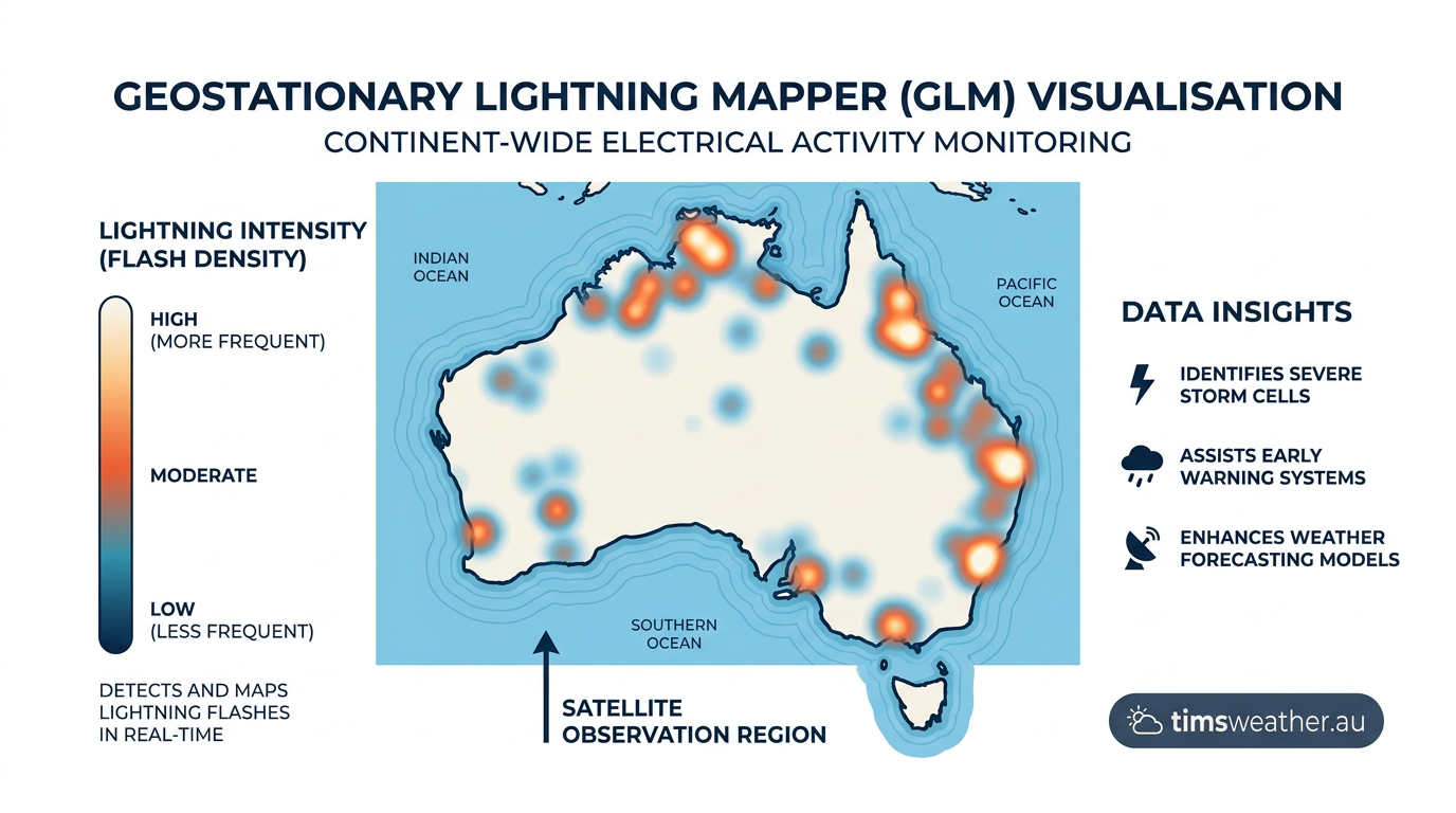
The introduction of the Geostationary Lightning Mapper aboard the GOES-R series satellites revolutionised weather tracking. Unlike ground sensors that occasionally miss weaker cloud flashes, the GLM uses near-infrared sensors to look downwards at the tops of storms.
It detects the subtle optical changes caused by lightning lighting up the cloud from within.
This allows for the continuous mapping of total lightning activity across entire hemispheres. A rapid spike in total lightning detected by the GLM is often the very first indicator that an ordinary storm cell is rapidly intensifying into a severe weather event capable of producing hail or damaging winds.
Visual identification keys for rare atmospheric discharges
For those observing weather safely from a distance, understanding what type of discharge is occurring can provide excellent clues about the structure and behaviour of a distant storm system. Careful observation can separate standard storms from highly dangerous, electrified systems.
Diagnostic techniques for storm spotters
A certified CCM (Certified Consulting Meteorologist) reviewing storm footage will look for specific visual cues to classify a strike. A thick, intensely bright channel with heavy branching that hits the ground cleanly is typically a negative strike. A single, smooth, unbranched channel that falls kilometres away from the rain core and produces a deafening, echoing thunderclap is highly likely to be a dangerous positive strike.
How these patterns is essential when Watching for Lightning in Wisconsin or any region prone to highly active summer storm fronts. Also, noting whether thunder follows a flash helps confirm whether the discharge hit the surface or remained safely within the cloud deck. The exact acoustic physics behind this can be explored in our breakdown of how does thunder form.
Recognising dry lightning in arid environments
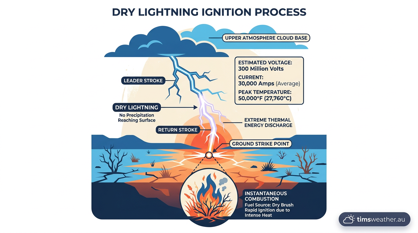
Dry lightning is an operational term rather than a distinct physical type of discharge. It refers to standard cloud-to-ground lightning that occurs in environments where the air mass below the storm is extremely dry. As rain falls from the cumulonimbus cloud, it encounters this dry layer and evaporates entirely before reaching the ground. This process is fully explained in our overview of how does virga form.
Because the lightning strike hits dry vegetation without any accompanying rainfall to suppress ignition, dry lightning is a leading cause of massive bushfires and wildfires globally. Recognising the conditions that produce high-based thunderstorms with heavy electrical activity is a critical component of assessing the types of lightning in Australia and other fire-prone regions around the world.
Sources
NOAA weather and atmospheric science reference (nssl.noaa.gov)
Lightning (noaa.gov)
iceweb.eit.edu.au PDF reference (iceweb.eit.edu.au)
NOAA weather and atmospheric science reference (nssl.noaa.gov)
NOAA weather and atmospheric science reference (repository.library.noaa.gov)
NOAA weather and atmospheric science reference (nssl.noaa.gov)
NOAA weather and atmospheric science reference (nssl.noaa.gov)
Last verified: 2026-09-20
Frequently asked questions
The main varieties include cloud-to-ground, intra-cloud, cloud-to-cloud, and cloud-to-air lightning. Cloud-to-ground is the most well-known and dangerous form, posing significant risks to infrastructure. Conversely, intra-cloud flashes are the most common, appearing as a broad, internal glow within a storm cloud rather than a distinct bolt striking the Earth.
Source: wis2-gdc.weather.gc.ca
Further reading and resources
Explore trusted articles, books, videos and other resources to go deeper on this topic.
youtube.comVideo
Every Lightning Type Explained in 23 Minutes - YouTube
Video coverage on The Complete Visual Guide to Every Type of Lightning in Earth's Atmosphere from youtube.com.
weather.govReference
Understanding Lightning Science - National Weather Service
Background reference on The Complete Visual Guide to Every Type of Lightning in Earth's Atmosphere from weather.gov.
earthdata.nasa.govReference
Lightning | NASA Earthdata
Background reference on The Complete Visual Guide to Every Type of Lightning in Earth's Atmosphere from earthdata.nasa.gov.
miops.comArticle
Lightning Types and Classifications: A Creative Photography Guide - MIOPS
In-depth coverage on The Complete Visual Guide to Every Type of Lightning in Earth's Atmosphere from miops.com.
nasa.govReference
Studying Storms from Space Station - NASA
Background reference on The Complete Visual Guide to Every Type of Lightning in Earth's Atmosphere from nasa.gov.
rmets.orgArticle
Types of Lightning | Royal Meteorological Society
In-depth coverage on The Complete Visual Guide to Every Type of Lightning in Earth's Atmosphere from rmets.org.
earthnetworks.comArticle
What Is Lightning? - Earth Networks
In-depth coverage on The Complete Visual Guide to Every Type of Lightning in Earth's Atmosphere from earthnetworks.com.
nationalgeographic.comArticle
The most otherworldly, mysterious forms of lightning on Earth
In-depth coverage on The Complete Visual Guide to Every Type of Lightning in Earth's Atmosphere from nationalgeographic.com.
science.orgArticle
Slideshow: Seven types of lightning—from the common to the bizarre
In-depth coverage on The Complete Visual Guide to Every Type of Lightning in Earth's Atmosphere from science.org.
tempest.earthArticle
6 Types Of Lightning You Should Know To Stay Safe - Tempest Earth
In-depth coverage on The Complete Visual Guide to Every Type of Lightning in Earth's Atmosphere from tempest.earth.
Planning weeks ahead?
Check Australia's long-range seasonal outlook for rainfall, temperature and the climate drivers (ENSO, IOD, SAM, MJO) shaping the next three months.
View Australia's Seasonal Weather Forecast