
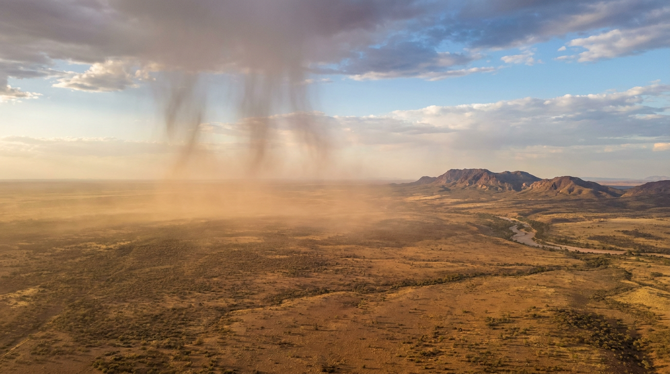
How does virga form? The phenomenon begins when precipitation falls from a cloud into an exceptionally dry layer of the atmosphere. Because this sub-cloud air lacks moisture, the falling rain or ice rapidly evaporates or sublimates. Consequently, the precipitation completely vanishes mid-air before making contact with the earth's surface.
Key takeaways
Microbursts from evaporating rain can cause surface damage like uprooted trees, even when no rainfall hits the ground.
The phenomenon is a visible indicator of a high saturation deficit in the lower atmosphere.
Evaporating precipitation cools the surrounding air, which can lead to strong downdrafts and aviation hazards.
The World Meteorological Organization classifies it as a supplementary cloud feature rather than a standalone cloud type.
Radar systems often detect these falling hydrometeors, creating a discrepancy between radar reflectivity and ground rainfall reports.
How does virga form: the thermodynamic mechanics
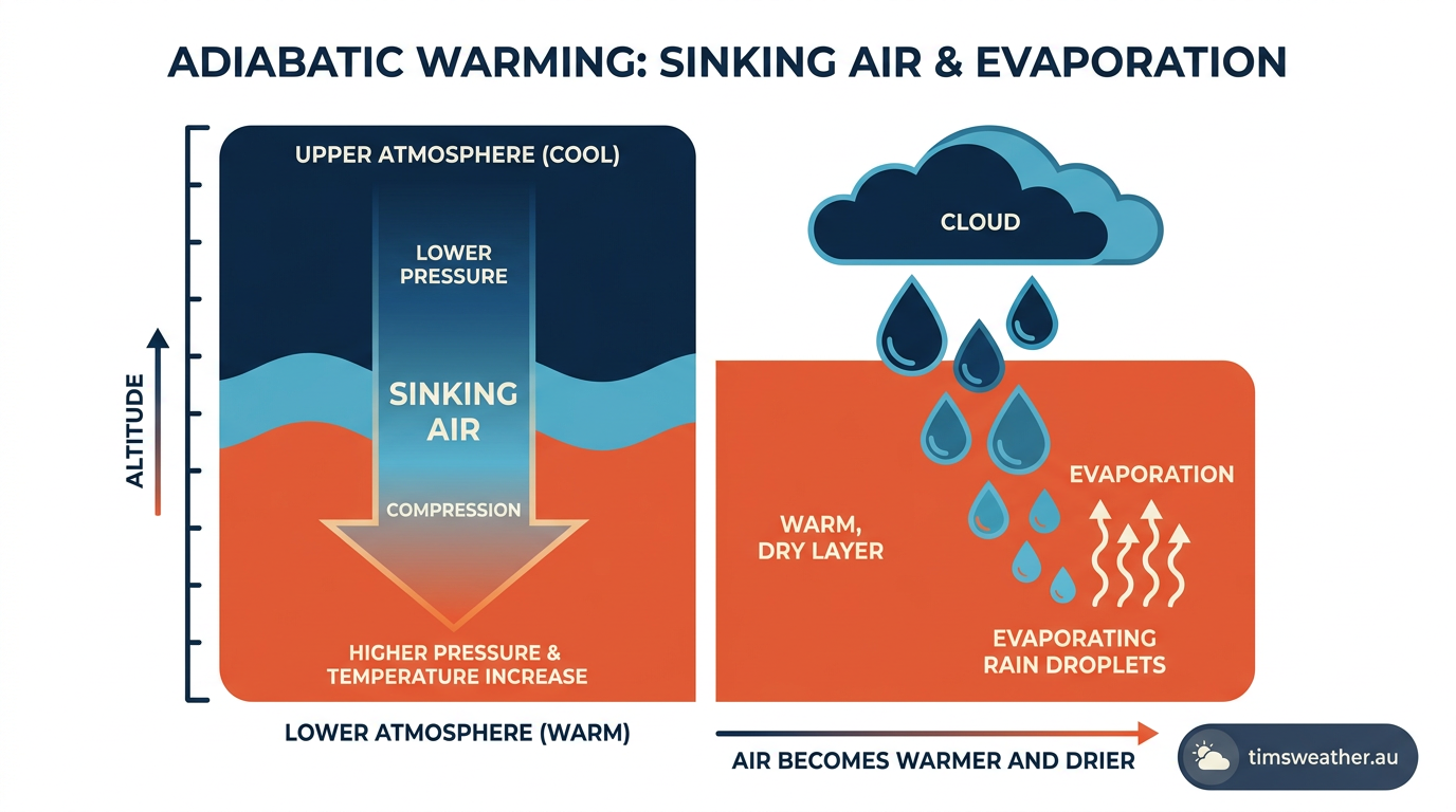
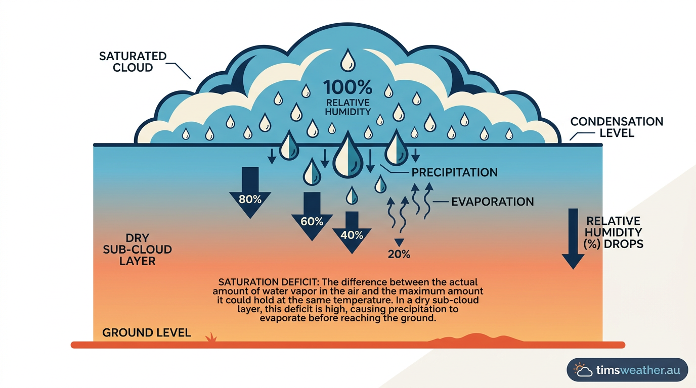
Virga forms when precipitation falling from a cloud encounters a layer of extremely dry air below the cloud base. As the falling droplets or ice crystals pass through this region of high saturation deficit, they undergo rapid evaporation or sublimation, causing them to dissipate before they can reach the ground. The physical process is driven by the stark difference in moisture content between the saturated environment inside the cloud and the arid air mass situated directly beneath it.
<
Atmospheric conditions that dictate precipitation evaporation
How Vertical Humidity Gradients Dictate Virga Length
The visible length of virga streaks in the sky is directly controlled by the vertical moisture profile of the atmosphere. Meteorologists measure this using a vertical humidity gradient, which maps how quickly the air dries out beneath the cloud base. If the transition from a saturated cloud layer to an extremely dry air mass is abrupt, the precipitation evaporates almost immediately, leaving very short, stubby trails.
Conversely, if the humidity decreases gradually towards the surface, the droplets can survive for thousands of metres before finally disappearing. How vertical humidity gradients dictate virga length is an excellent visual indicator for meteorologists trying to estimate the depth of the dry air mass without launching weather balloons.
Analyzing the saturation deficit near the cloud base altitude
For precipitation to evaporate mid-air, the environment must possess a substantial saturation deficit. This term describes the difference between the actual amount of water vapour in the air and the maximum amount the air could hold at that specific temperature.
When the atmospheric humidity is low, the saturation deficit is high, creating a strong evaporative pull on any liquid water entering the space. This is a common occurrence in arid regions and temperate climates, as detailed by Wikipedia in its summary of dry-climate meteorology. The larger the deficit just below the cloud base altitude, the more aggressive the evaporation process becomes.
Interpreting relative humidity and dew point profiles
Meteorologists rely on specific metrics to forecast the likelihood of evaporating rain. The two most useful variables are relative humidity and the dew point temperature. The dew point represents the temperature to which air must be cooled to achieve total saturation. When there is a large gap between the actual air temperature and the dew point, the relative humidity is low, making the environment primed for how does virga form.
Exploring dew point vs humidity reveals that a wide temperature-dew point spread in the lower troposphere is the most reliable predictor of precipitation failing to reach the ground. How how does dew form provides an interesting contrast, as dew requires total saturation near the surface, while evaporating rain requires the exact opposite conditions.
Identifying virga streaks across different cloud formations
High and mid-level meteorological phenomena
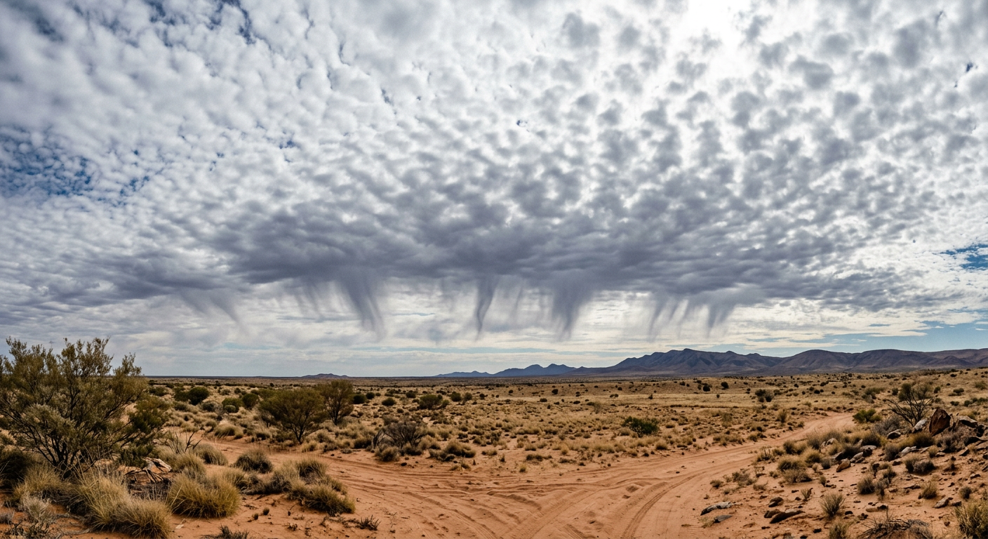
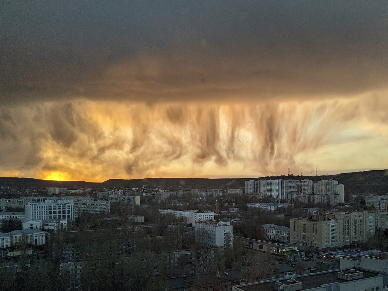
Falling precipitation that vanishes is most frequently observed descending from mid-level and high-level cloud layers. According to the classification guidelines published by What's This Cloud, this feature is commonly associated with altocumulus, cirrocumulus, altostratus, and nimbostratus clouds. Because these clouds sit high in the troposphere, any precipitation they release must travel through a vast column of air.
In many cases, the lower levels of this column are simply too dry to allow the moisture to pass intact. A deep understanding of altostratus clouds formation shows that while these broad sheets of grey cloud carry extensive moisture aloft, the air thousands of metres below them often remains entirely unsaturated. Similarly, knowing how do cirrus clouds form explains why high-altitude fallstreaks are composed entirely of ice crystals that sublimate rapidly.
Virga vs. Light Rain: Differentiating at the Cloud Base
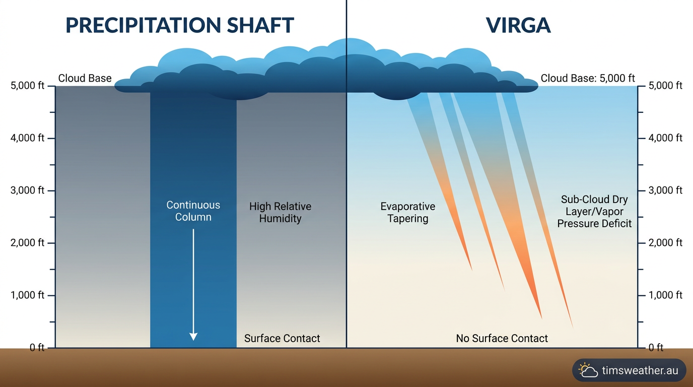
Telling the difference between evaporating rain and a light rain shower that actually wets the ground requires careful observation of the precipitation shaft. Virga vs. light rain differentiation depends on looking at the bottom edge of the streak.
A true rain shaft extends all the way down to the horizon, often obscuring distant hills or buildings in a grey haze. In contrast, evaporating streaks hang clearly suspended in the air, tapering off to a sharp point or fading smoothly into blue sky. Observers often describe the phenomenon as disappearing rain, a term highlighted by EarthSky, because the precipitation shaft visibly terminates well above the earth's surface.
Jellyfish clouds and visual markers for observers
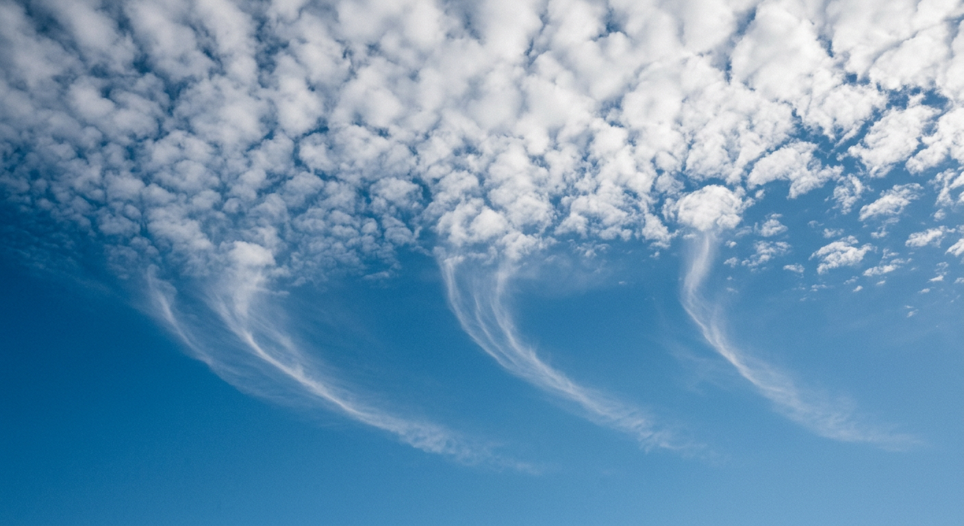
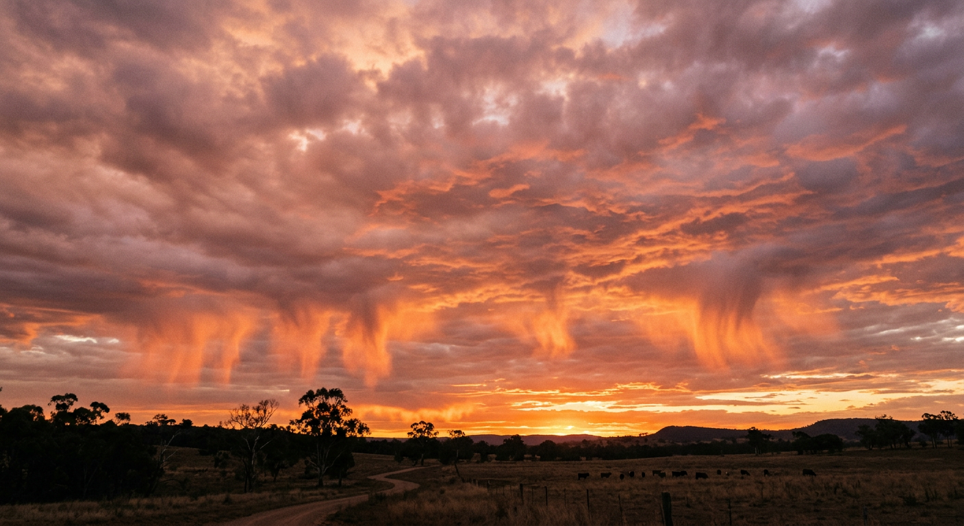
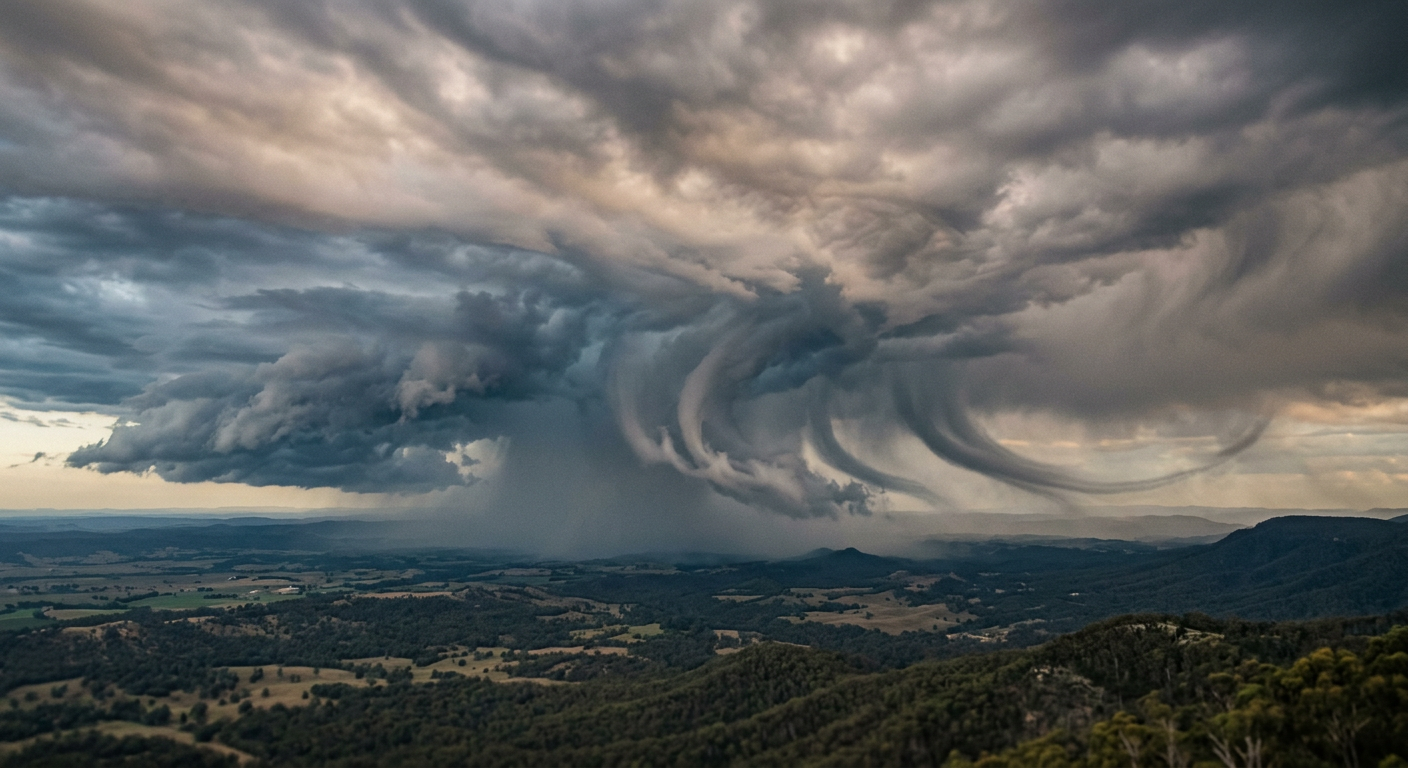
Wind shear plays a major role in the visual shape of evaporating precipitation. As the droplets or ice crystals descend, they often encounter different wind speeds and directions at varying altitudes. This differential horizontal movement pushes the bottom of the precipitation shaft forward or backwards relative to the cloud above it.
The result is a sweeping, curved appearance. In many cases, the combination of a puffy altocumulus cloud and sweeping, curved streaks below creates a visual effect sometimes called jellyfish clouds, according to CW39. The sharper the curve, the stronger the mid-level wind shear present in the atmosphere.
Aviation hazards and meteorological impacts
Can virga affect aircraft during descent?
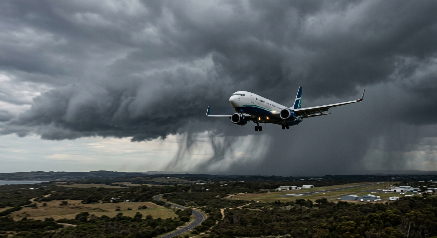
While evaporating rain might look benign from the ground, it presents a serious hazard to aviation, particularly for aircraft in the vulnerable stages of takeoff and landing. The primary danger comes from the thermal changes happening within the air column. As precipitation evaporates, it absorbs latent heat, drastically cooling the air around it.
Cold air is denser than warm air, meaning this newly cooled air mass becomes heavier than its surroundings and accelerates downward. This creates strong downdrafts that can unexpectedly push an aircraft toward the ground. Aviation authorities such as the FAA heavily monitor these conditions because the invisible sinking air can catch pilots off guard when operating near the atmospheric boundary layer.
Evaporative cooling and the generation of microbursts
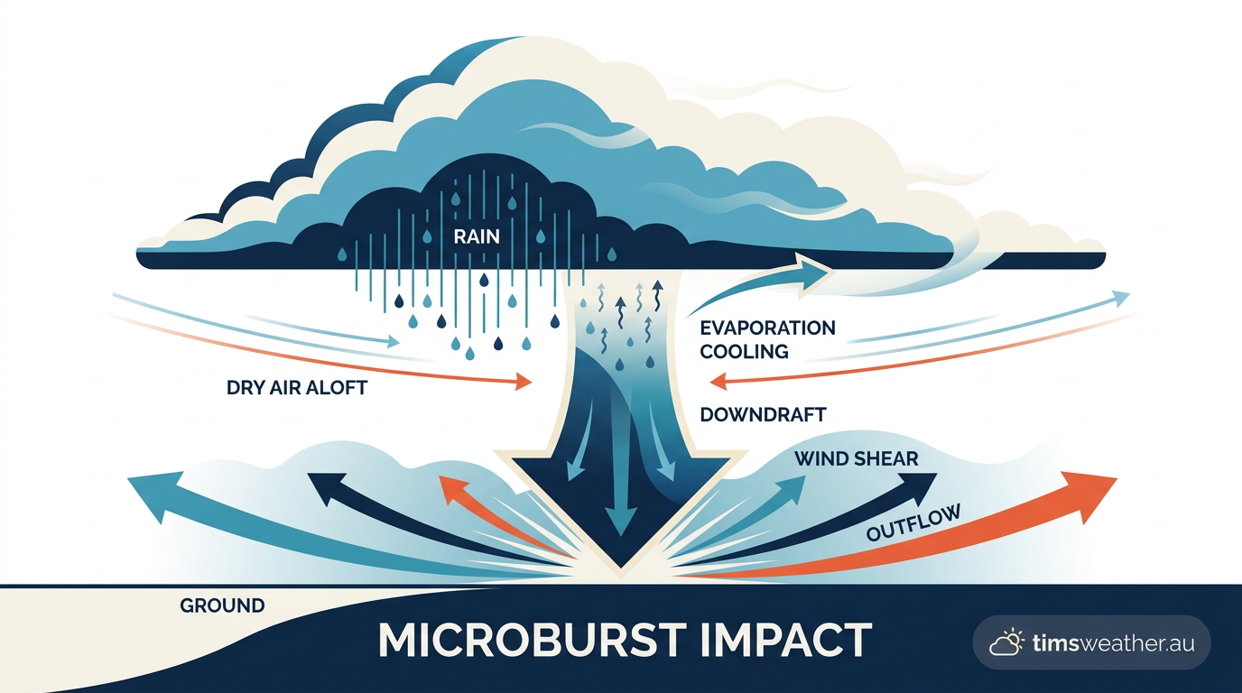
The process of evaporative cooling is the driving force behind some of the most violent localized wind events in meteorology. When a large volume of precipitation falls into a deep, dry layer beneath a thunderstorm, the resulting cooling can be extreme. The dense air plunges toward the earth at high speeds, hitting the surface and spreading outward in all directions.
This creates a microburst, a sudden and intense downdraft that can produce severe wind shear. A thorough review of how do single-cell thunderstorms form reveals that microbursts can cause significant surface damage, uprooting trees and damaging structures, even if not a single drop of rain reaches the ground. The evaporating precipitation can influence wind patterns and local development, as explained by Weather.com.
Radar reflectivity versus ground truth
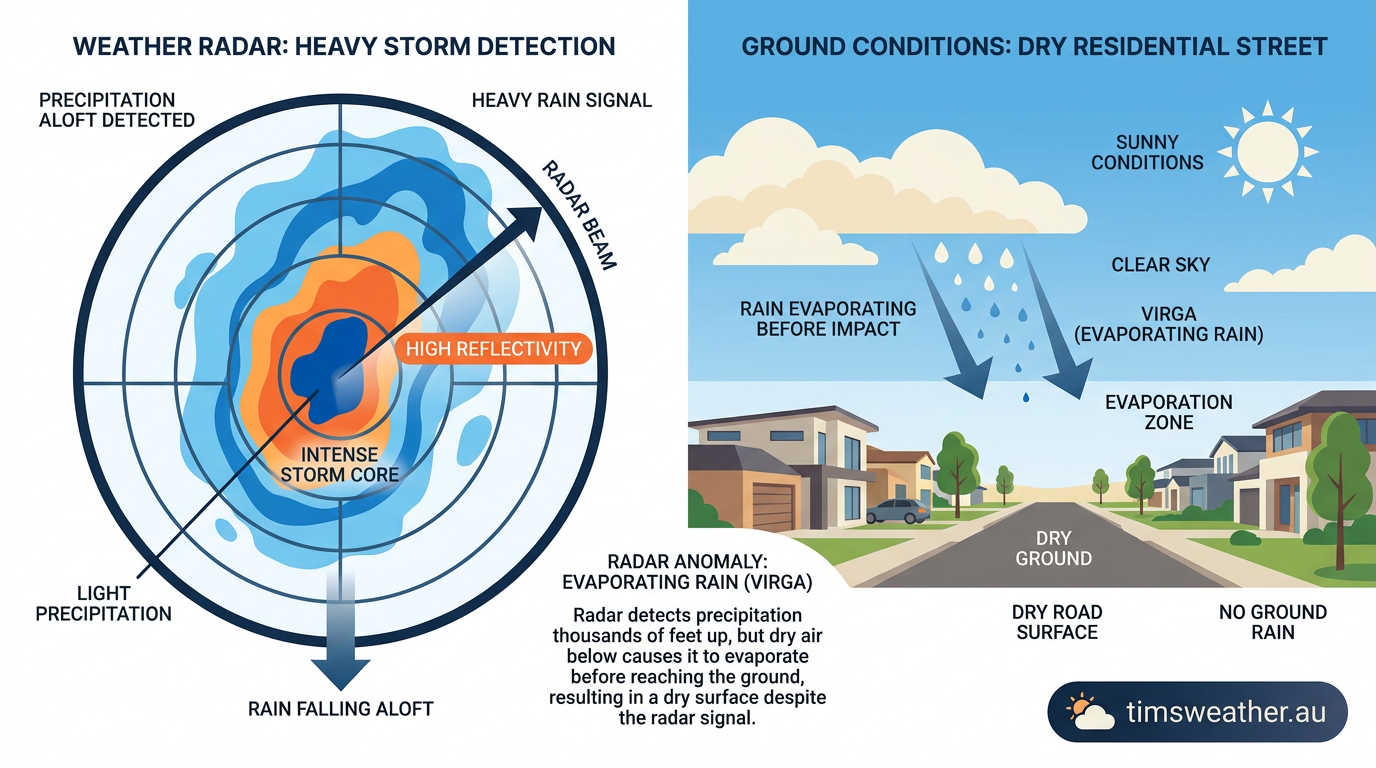
One of the most common challenges forecasters face when dealing with evaporating precipitation is radar interpretation. Weather radar systems send out pulses of microwave energy that bounce off falling hydrometeors, measuring their size and density. Because radar beams are angled slightly upward, they often scan the precipitation while it is still high in the cloud layer.
The radar display will show bright colours indicating heavy rain or snow, prompting meteorologists to expect surface impacts. However, if the sub-cloud layer is completely dry, all that moisture evaporates before hitting the surface. This false alarm is an effect also discussed by The Weather Network when examining radar anomalies. Forecasters must rely on ground-based weather stations to confirm if the radar echoes represent actual surface rain or just mid-air evaporation.
How meteorologists measure and classify falling precipitation
World Meteorological Organization standards
In global meteorological reporting, uniform classification is necessary for accurate weather records. The World Meteorological Organization (WMO) dictates how atmospheric features are logged by observers worldwide. Under the WMO International Cloud Atlas system, evaporating precipitation is not considered a distinct cloud genus like cumulus or stratus. Instead, it is classified as a supplementary cloud feature.
Observers append the code 'vir' to the parent cloud type, logging entries such as Altocumulus virga (Ac vir). This standardized naming convention ensures that scientists everywhere understand that the feature is an accessory to a primary cloud structure, a distinction noted by Meteorologist Tim Buckley in his educational field reports.
Using atmospheric soundings to detect dry layers
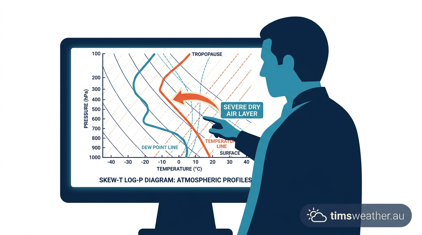
To predict whether falling rain will evaporate, meteorologists rely on atmospheric soundings collected by weather balloons. These instruments carry sensors up through the troposphere, recording temperature and humidity at varying altitudes. The data is plotted on a specialized chart called a Skew-T log-P diagram.
By analyzing the distance between the temperature line and the dew point line on this chart, forecasters can visually locate zones of extreme dryness. If the sounding shows a saturated cloud layer resting directly above a deep layer with a massive saturation deficit, meteorologists can confidently forecast virga rain over evaporation rather than measurable surface rainfall.
Meteorological Condition | Mechanism | Impact on Virga Streaks |
|---|---|---|
High Saturation Deficit | Rapid phase change of water droplets | Shortens the visible streak length by accelerating evaporation. |
Strong Sub-Cloud Wind Shear | Differential horizontal wind velocities | Causes the streaks to sweep, slant, or curve abruptly. |
Deep Dry Adiabatic Layer | Continuous evaporative cooling and sinking | Generates hazardous downdrafts and dangerous aviation microbursts. |
Sources
Virga | Atlas international des nuages (cloudatlas.wmo.int)
Virga | Atlas Internacional de Nubes (cloudatlas.wmo.int)
International Cloud Atlas (cloudatlas.wmo.int)
International Cloud Atlas (cloudatlas.wmo.int)
World Meteorological Organization cloud atlas reference (cloudatlas.wmo.int)
World Meteorological Organization cloud atlas reference (cloudatlas.wmo.int)
Rasgos suplementarios y nubes accesorias (cloudatlas.wmo.int)
World Meteorological Organization cloud atlas reference (cloudatlas.wmo.int)
Last verified: 2026-09-12
Frequently asked questions
Virga forms when precipitation falls from a cloud base into a layer of dry, unsaturated air. As the droplets or ice crystals descend, they evaporate or sublimate completely before they can reach the ground. This leaves wispy, streaky trails hanging beneath the cloud, indicating significant dryness in the lower atmosphere.
Source: community.wmo.int
Further reading and resources
Explore trusted articles, books, videos and other resources to go deeper on this topic.
earthsky.orgArticle
Virga is rain that doesn't reach the ground - EarthSky
In-depth coverage on How Does Virga Form? The Science of Evaporating Precipitation from earthsky.org.
snexplores.orgArticle
Scientists Say: Virga - Science News Explores
In-depth coverage on How Does Virga Form? The Science of Evaporating Precipitation from snexplores.org.
angleofattack.comArticle
What Is Virga? The Hanging Rain That Warns of Wind Shear
In-depth coverage on How Does Virga Form? The Science of Evaporating Precipitation from angleofattack.com.
whatsthiscloud.comArticle
Virga Cloud Feature: Precipitation That Does Not Reach the Ground
In-depth coverage on How Does Virga Form? The Science of Evaporating Precipitation from whatsthiscloud.com.
youtube.comVideo
Weather IQ: What is Virga? - YouTube
Video coverage on How Does Virga Form? The Science of Evaporating Precipitation from youtube.com.
weatherworksinc.comArticle
What is Virga & How Does It Occur? - WeatherWorks
In-depth coverage on How Does Virga Form? The Science of Evaporating Precipitation from weatherworksinc.com.
en.wikipedia.orgReference
Virga - Wikipedia
Background reference on How Does Virga Form? The Science of Evaporating Precipitation from en.wikipedia.org.
pilotworkshop.comArticle
Clouds to Avoid? - PilotWorkshops
In-depth coverage on How Does Virga Form? The Science of Evaporating Precipitation from pilotworkshop.com.
cliffmass.blogspot.comArticle
The Beauty and Danger of Evaporating Precipitation
In-depth coverage on How Does Virga Form? The Science of Evaporating Precipitation from cliffmass.blogspot.com.
amt.copernicus.orgArticle
[PDF] The Virga-Sniffer – a new tool to identify precipitation evaporation ...
In-depth coverage on How Does Virga Form? The Science of Evaporating Precipitation from amt.copernicus.org.
Planning weeks ahead?
Check Australia's long-range seasonal outlook for rainfall, temperature and the climate drivers (ENSO, IOD, SAM, MJO) shaping the next three months.
View Australia's Seasonal Weather Forecast