
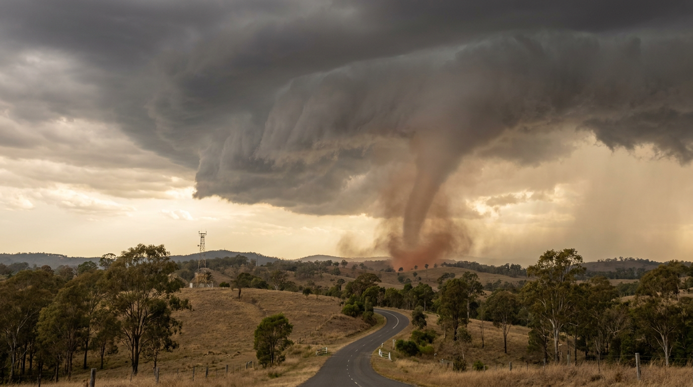
How do gustnadoes form? These weather phenomena develop when strong thunderstorm downdrafts create an outflow boundary or gust front. As this cold air hits the ground and spreads, horizontal shear creates small-scale spinning eddies. These vortices are then tilted vertically and stretched by the storm's updraft, resulting in a brief, ground-based whirlwind.
Key takeaways
Often only 30 to 100 metres high, these atmospheric processes are too shallow for most weather radars to detect.
They differ significantly from true tornadoes because they are not connected to a rotating cloud base or a storm's mesocyclone.
While usually short-lived, gustnadoes can produce damaging wind gusts capable of impacting light structures, fences and vegetation.
The Bureau of Meteorology classifies damage from these events as severe thunderstorm wind gusts rather than tornadic activity.
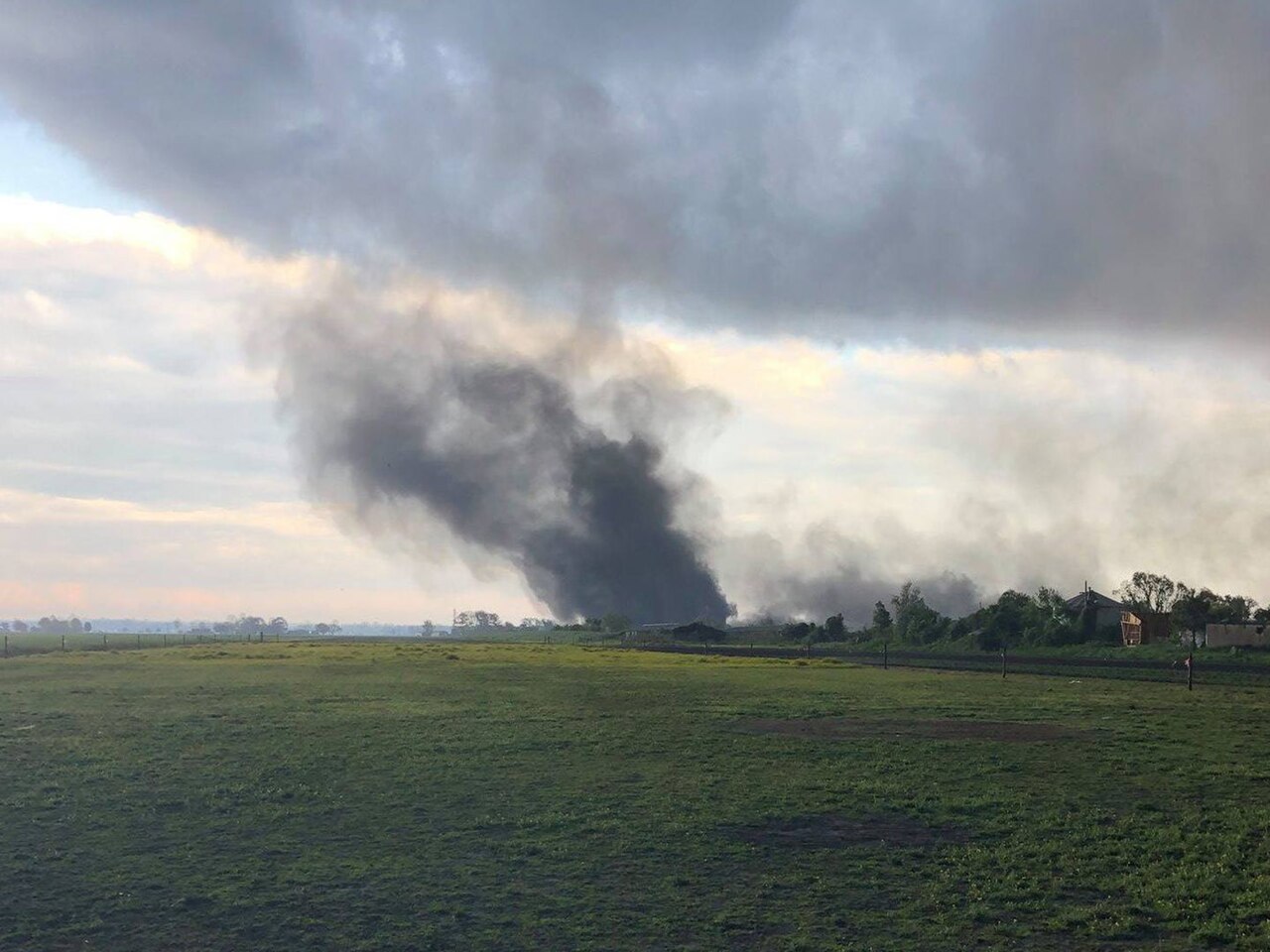
A gustnado near Swan Quarter, North Carolina, on 26 April 2019. By Unknown author - https://www.weather.gov/mhx/Apr262019gustnado, Public Domain, https://commons.wikimedia.org/w/index.php?curid=186296631
How do gustnadoes form: The mechanics of thunderstorm outflow
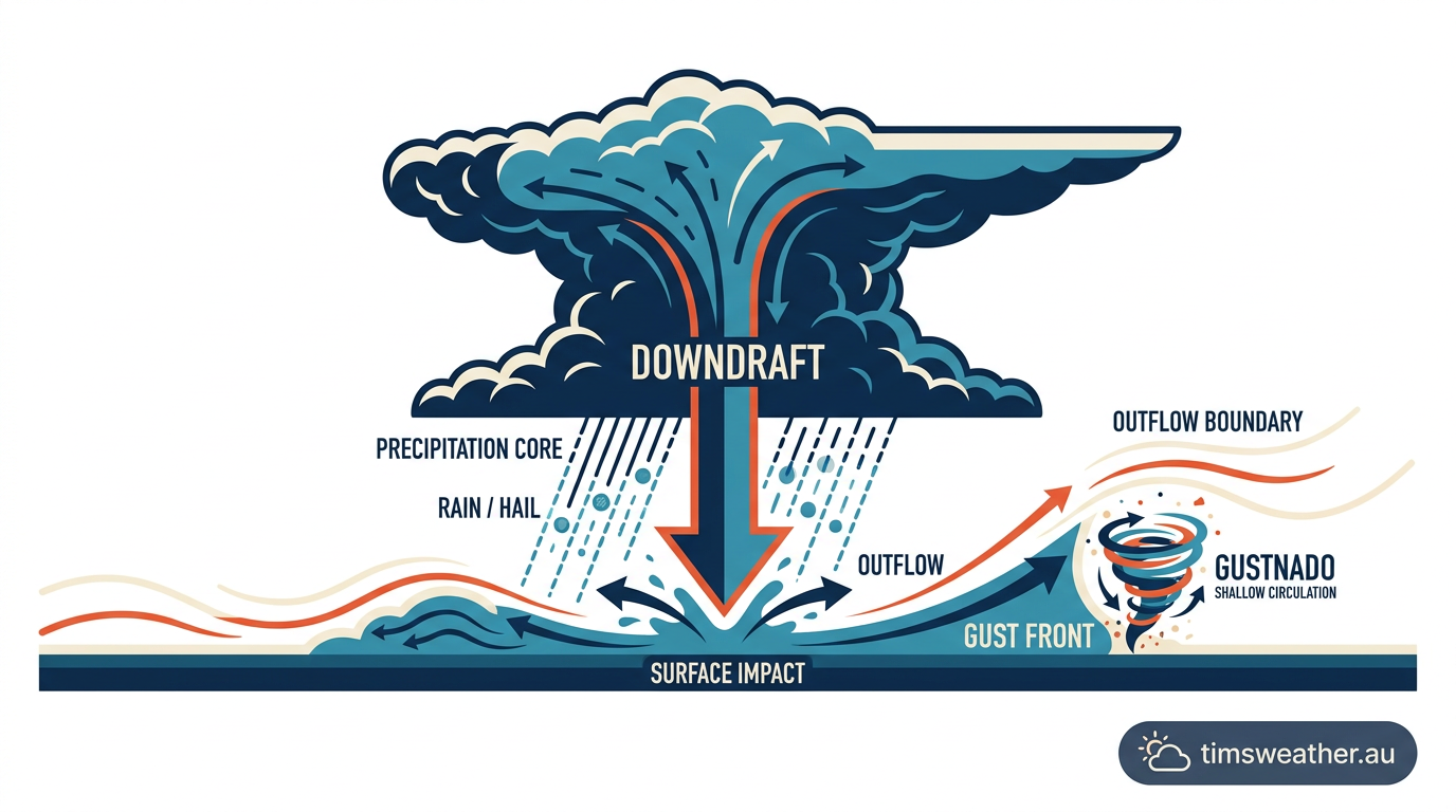
Diagram showing how do gustnadoes form from thunderstorm downdrafts and outflow boundaries
The role of the boundary layer
To understand the mechanics behind these sudden whirlwinds, meteorologists look closely at the boundary layer near the surface of the earth. The boundary layer is the lowest part of the atmosphere where friction with the ground directly influences wind speed and direction. A gustnado is essentially a non-supercell tornado-like vortex that develops purely due to mechanical wind shear within this layer. When a severe storm reaches maturity, it dumps large volumes of cold air and rain toward the surface. As this dense, rain-cooled air strikes the ground, it rushes outward, creating a sharp leading edge known as a gust front. Because the ground slows the lowest few centimetres of air while the air slightly above moves much faster, intense friction occurs.
The convective downburst engine
The primary engine for a gustnado is the thunderstorm downdraft. In a developing storm, heavy precipitation and evaporative cooling cause air to become negatively buoyant and sink rapidly. This action is known as a convective downburst. If you want to understand how do downbursts form, it helps to picture this dense air plunging downward and striking the earth like a column of water from a tap. The air then spreads horizontally, acting like a fast-moving wedge that forces warmer surface air up and away. According to meteorological research on atmospheric processes, this highly turbulent outflow boundary concentrates the raw ingredients needed for vortex development.
Horizontal shear and vertical axis rotation
The rotation begins as horizontal wind shear. The speed difference between the fast-moving cold outflow and the drag of the stationary ground creates a rolling tube of air, known as a horizontal roll vortex. As the cold outflow boundary undercuts the warmer air ahead of it, the resulting local updraft lifts this horizontal tube, tilting it into vertical axis rotation. Once upright, the updraft stretches the column, forcing the air to spin faster. Unlike true supercell tornadoes that are dominated by the broader cyclonic rotation of the parent storm, gustnadoes can display either cyclonic and anticyclonic rotation. This is because they are spawned by chaotic mechanical eddies rolling off the gust front in random orientations.
Gustnado formation in Australian thunderstorms
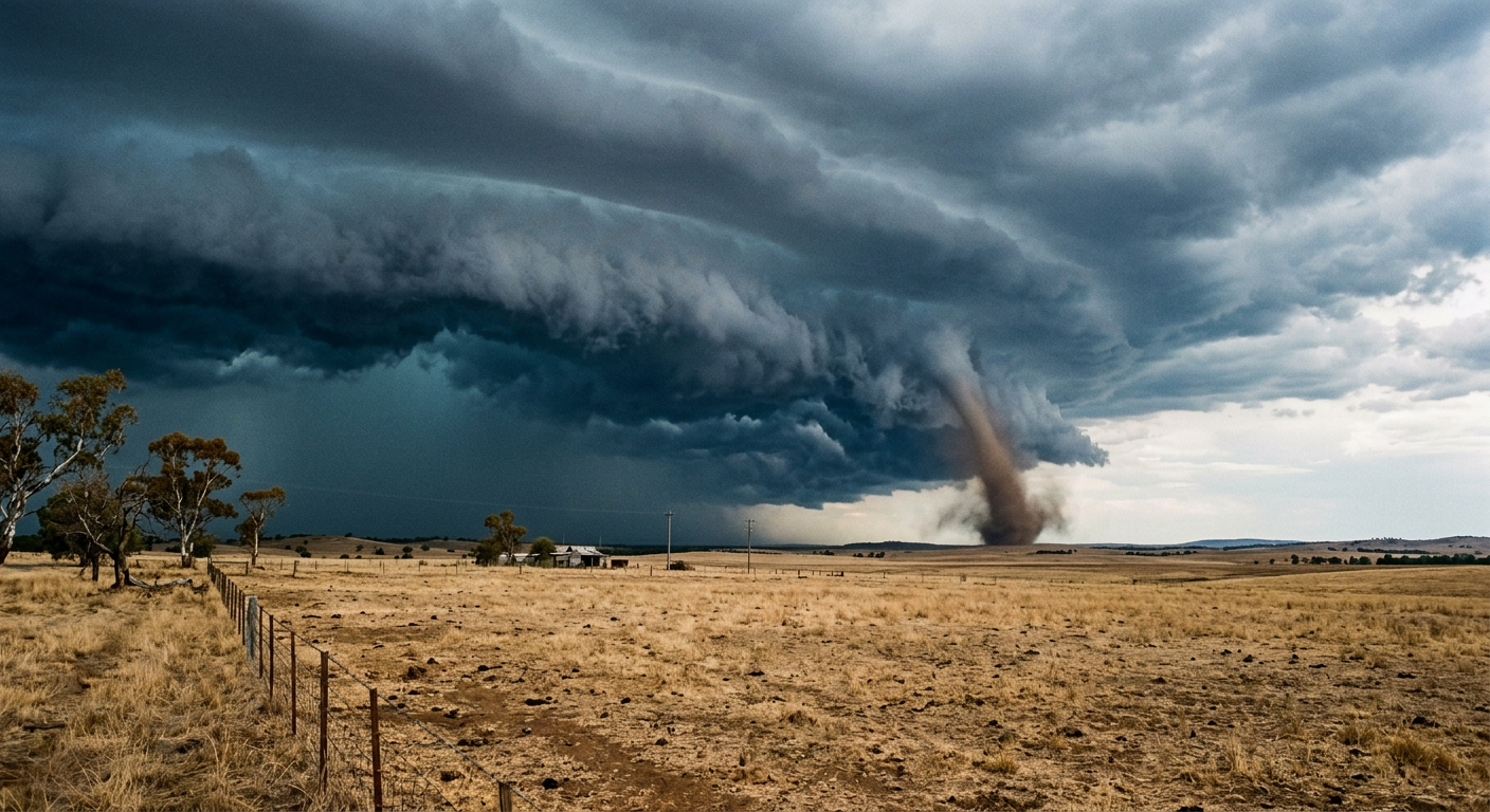
A gustnado forming along a severe squall line in rural Australia ahead of a cool change
South East Queensland's spring storm season
During the spring months, South East Queensland experiences some of the most dynamic weather in the country. The collision of warm, moist air from the Coral Sea with cooler, dry air from the interior provides the perfect environment for explosive convection. When studying the different types of severe thunderstorms in Australia, meteorologists note that the intense squall lines common in Queensland are prolific producers of gustnadoes. The powerful downdrafts in these storms create aggressive gust fronts that surge across the Darling Downs and coastal plains, whipping up dust, loose leaves, and topsoil into brief rotating columns before the main rain curtain arrives.
Cool changes across Victoria and New South Wales
Further south, gustnadoes frequently accompany the passage of summer cool change boundaries. After days of extreme heat, a sharp cold front will push northward across Victoria and New South Wales. The temperature difference across these fronts can exceed 15 degrees Celsius over just a few kilometres. This massive thermal contrast drives powerful squall lines Australia frequently experiences during summer. The leading edge of these squall lines acts as an expansive outflow boundary generating extreme horizontal wind shear. Storm spotters regularly observe shallow vortices spinning up in the dry, dusty paddocks of regional Victoria ahead of the main storm structure.
Gustnado Video Footage
Cold fronts over the Great Australian Bight
In South Australia and Western Australia, fast-moving cold fronts sweeping off the Southern Ocean provide another common setting. These systems bring turbulent coastal weather where the interaction between marine air and the hot continental landmass creates ideal conditions for wind shear. Observations of cold fronts in Australia show that as these systems cross the Great Australian Bight, the sudden shift from warm northerly winds to cold south-westerly winds generates significant boundary layer turbulence. This shear zone regularly produces gustnadoes, which are often captured in documented cases in Australia as dusty whirls travelling parallel to the coastline.
The Role of Topography in Australian Gust Front Development
Australia's sector plays a major part in enhancing or disrupting wind shear. When a fast-moving gust front encounters topographical barriers like the Mount Lofty Ranges or the Great Dividing Range, the outflow boundary is forced upward, then accelerates rapidly as it spills down the leeward slopes. This sudden topographical acceleration intensifies the surface friction and local horizontal shear. In valleys and foothills, this funnelling effect forces the turbulent air to curl in on itself, highly increasing the probability of a gustnado spinning up along the leading edge of the storm.
Visual signs of a forming gustnado
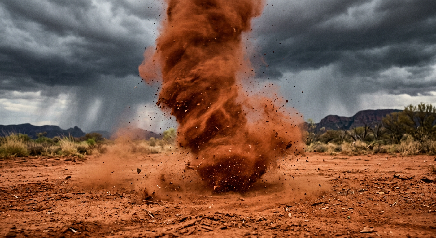
A dusty gustnado at ground level showing no connection to the storm cloud base above
The lack of a condensation funnel
One of the most reliable ways to identify a gustnado in the field is by looking at the sky directly above it. Unlike true tornadoes, gustnadoes do not have a condensation funnel that descends from the cloud base. Because they form from the ground up due to surface shear, they remain completely disconnected from the main updraft of the thunderstorm. The vortex becomes visible entirely because of the dirt, dust, and debris it picks up from the surface. Storm chasers rely on this lack of a visible cloud connection as a primary diagnostic tool, a distinction clearly highlighted in various storm spotting video analysis presentations shared by meteorological agencies.
Do gustnadoes show up on BOM Doppler radar?
A frequent question is whether a gustnado can be tracked using weather radar. In short, gustnadoes operate on the misocyclone scale, a meteorological feature measuring less than four kilometres wide. Gustnadoes themselves are incredibly shallow, often extending only 30 to 100 metres into the air. Because the BOM Doppler radar beams shoot at an upward angle, they typically overshoot the top of a shallow gustnado entirely. While the radar will clearly show the broader outflow boundary as a thin line of weak reflectivity, it will rarely capture the microscopic, low-level rotation of the gustnado itself.
Differentiating Gustnadoes from Dust Devils and Willi-willies
In the Australian Outback, dust devils, colloquially known as willy-willies, are a common sight. While they look visually similar to gustnadoes, their formation mechanism is completely different. Willy-willies are thermal vortices. They form on clear, hot days when intense surface heating causes localized pockets of air to rise rapidly and spin. Gustnadoes, conversely, are mechanical vortices that require the forced wind shear of a thunderstorm outflow boundary. If there is a dark, looming storm overhead and a prominent gust front approaching, the spinning column of dust is a gustnado. As detailed in several news reports of massive dust whirlwinds, understanding the atmospheric context is key to correctly identifying the phenomenon.
Gustnadoes vs. Tornadoes: Australian Bureau of Meteorology Classifications
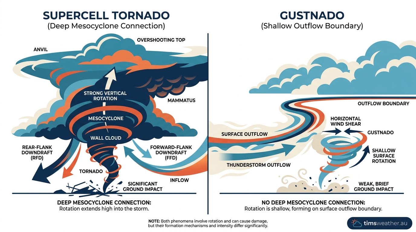
Comparison chart showing the structural differences between a gustnado and a true supercell tornado
Is a gustnado a real tornado?
No, a gustnado is not classified as a true tornado. A true tornado requires a strong, rotating updraft known as a mesocyclone which extends deep into a supercell thunderstorm. Tornadoes form from the cloud base downward and are intimately tied to the parent storm's internal structure. Gustnadoes form independently of the storm's main rotation, existing only in the shallow boundary layer where the cold outflow meets the warm inflow. The Bureau of Meteorology treats gustnadoes as a subclass of severe thunderstorm wind gusts rather than tornadic events.
What is the difference between a gustnado and a microburst?
While both are byproducts of thunderstorm downdrafts, they represent different wind actions. If you study how do microbursts form, you will see they are powerful columns of sinking air that hit the ground and blast outward in straight lines, causing a starburst pattern of damage. A gustnado is the spinning eddy that forms on the outer edge of that spreading cold pool. The microburst provides the straight-line downward force, while the gustnado is the localized rotation resulting from the friction along the boundary.
Feature | Gustnado | Tornado (Supercell) |
|---|---|---|
Formation trigger | Surface wind shear on a gust front | Rotating updraft (mesocyclone) |
Cloud connection | None (ground-based vortex) | Extends from cloud base to ground |
Scale & Altitude | Shallow (misocyclone scale, <100m) | Deep (extends several kilometres up) |
Duration | Seconds to a few minutes | Minutes to over an hour |
Are gustnadoes dangerous to property?
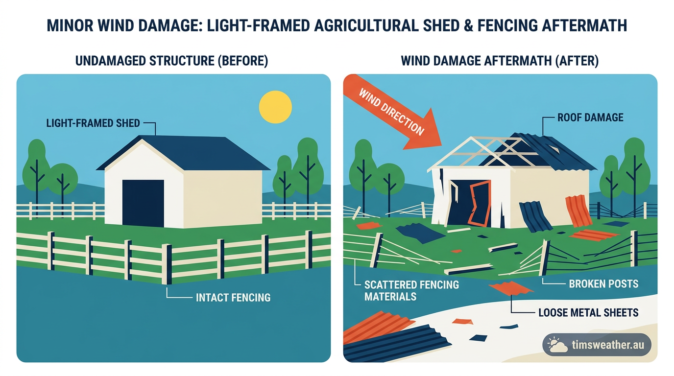
Wind damage to a farm shed caused by a brief gustnado during a severe thunderstorm
Impact on farming infrastructure in the Wheatbelt
Although they are generally weaker than true tornadoes, gustnadoes still pose a genuine risk to property, particularly in rural and agricultural areas. In regions like the Western Australian Wheatbelt, where vast open plains offer little resistance to advancing squall lines, gust fronts can easily produce boundary layer vortices. These intense, localised wind spikes can cause significant structural damage to light-framed agricultural infrastructure. Farm sheds, silos, irrigation equipment, and poorly secured fencing are highly vulnerable to the sudden twisting forces a gustnado applies, even if the event only lasts for twenty seconds.
Can a gustnado lift a car?
People often wonder if a gustnado has the strength to lift heavy objects like passenger vehicles. Generally, the answer is no. While the winds inside a strong gustnado can reach speeds equivalent to a low-end Enhanced Fujita Scale rating (up to 110-130 km/h), they lack the violent, sustained updraft forces required to lift a one-tonne vehicle off the ground. They can, however, easily flip light trailers, shift caravans, and turn unsecured yard items into dangerous airborne projectiles. For context, true supercell tornadoes can produce winds exceeding 200 km/h, which, as noted by disaster relief organisations like ShelterBox Australia, are easily capable of lifting heavy machinery and destroying well-built homes.
Safety Protocols: Why Gustnadoes Require Immediate Shelter
Because gustnadoes form directly on the leading edge of a storm, they often strike before the first drop of rain falls. It is important to recognise the visual cues, such as an approaching dark line of clouds accompanied by a sudden drop in temperature. Knowing the physical characteristics of shelf cloud formation can help spotters, as shelf clouds clearly mark the location of the gust front where these vortices develop. When the BOM issues a Severe Thunderstorm Warning for damaging winds, you should treat the threat of a gustnado seriously. Move indoors, stay away from windows, and secure any loose items around your property before the outflow boundary arrives.
Frequently asked questions
Gustnadoes form when strong outflow from a thunderstorm creates a gust front. Horizontal wind shear along this boundary causes air to spin up into a small, vertical vortex near the ground. These features are shallow, short-lived, and typically do not connect to the actual base of the cloud.
Source: geo.libretexts.org
Further reading and resources
Explore trusted articles, books, videos and other resources to go deeper on this topic.
bom.gov.auReference
Storm Spotters Guide - Part 4
Background reference on How do gustnadoes form? The complete Australian meteorological guide from bom.gov.au.
forecast.weather.govReference
NOAA's National Weather Service - Glossary
Background reference on How do gustnadoes form? The complete Australian meteorological guide from forecast.weather.gov.
Storm Spotters' Handbook - BoM
Background reference on How do gustnadoes form? The complete Australian meteorological guide from bom.gov.au.
youtube.comVideo
What is a gustnado? | Weather Word of the Week
Video coverage on How do gustnadoes form? The complete Australian meteorological guide from youtube.com.
en.wikipedia.orgReference
Gustnado
Background reference on How do gustnadoes form? The complete Australian meteorological guide from en.wikipedia.org.
pmc.ncbi.nlm.nih.govReference
An Australian convective wind gust climatology using ... - PMC
Background reference on How do gustnadoes form? The complete Australian meteorological guide from pmc.ncbi.nlm.nih.gov.
noaa.govReference
Tornadoes | National Oceanic and Atmospheric ...
Background reference on How do gustnadoes form? The complete Australian meteorological guide from noaa.gov.
nbcchicago.comArticle
'Gustnadoes' reported in severe thunderstorms in central Illinois
In-depth coverage on How do gustnadoes form? The complete Australian meteorological guide from nbcchicago.com.
skybrary.aeroArticle
Gustnado | SKYbrary Aviation Safety
In-depth coverage on How do gustnadoes form? The complete Australian meteorological guide from skybrary.aero.
journals.ametsoc.orgArticle
Australian Tornadoes in 2013: Implications for Climatology ...
In-depth coverage on How do gustnadoes form? The complete Australian meteorological guide from journals.ametsoc.org.
Planning weeks ahead?
Check Australia's long-range seasonal outlook for rainfall, temperature and the climate drivers (ENSO, IOD, SAM, MJO) shaping the next three months.
View Australia's Seasonal Weather Forecast