
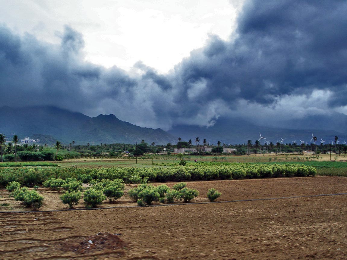
A monsoon develops when severe seasonal heating contrasts between a landmass and the adjacent ocean reorganise large-scale winds. Because vast continents warm much faster than water, a massive low-pressure area forms inland. This temperature difference creates a seasonal wind reversal that constantly pulls moist marine air onshore to produce sustained rainfall.
Key takeaways
Monsoons are driven by the different rates at which land and water absorb and retain solar heat throughout the year.
The seasonal migration of the Intertropical Convergence Zone dictates the timing of the wet summer monsoon season and the dry winter withdrawal.
Massive geographic features, including the Tibetan Plateau, act as elevated heat pumps that intensify regional precipitation patterns.
Shifting moisture transport during monsoon onset can increase the likelihood of tropical cyclone formation in nearby ocean basins.
How do monsoons form?
Monsoons form because land and sea masses experience differential heating over the seasons. As continental rock and soil absorb solar radiation significantly faster than deep ocean water, a vast low-pressure zone develops over the land. This expanding thermal low initiates a seasonal wind shift that leads to distinct wet and dry seasons, primarily affecting tropical regions by drawing moist marine air inland where it rises, cools, and condenses into heavy precipitation (education.nationalgeographic.org).
The physics of differential heating and specific heat capacity
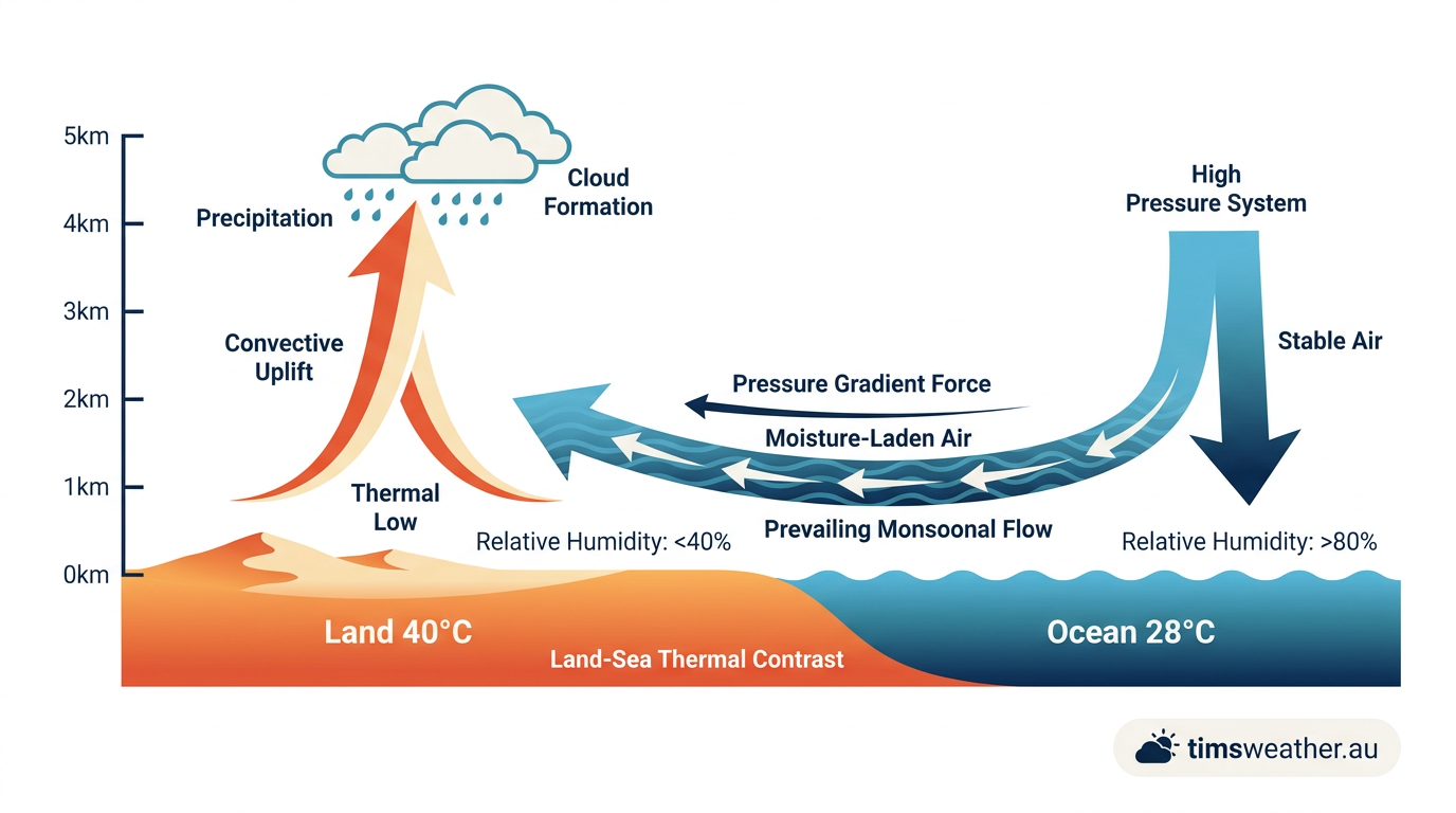
To understand the mechanics of this seasonal wind reversal, meteorologists first look at specific heat capacity. Water has a significantly higher specific heat capacity than soil or rock, meaning it requires much more thermal energy to raise its temperature by a single degree. The oceans are also in constant motion. Convection currents mix the water, distributing solar heat deep below the surface, while continuous evaporation cools the upper layer. As a result, ocean surface temperatures rise slowly and remain relatively stable even during the hottest months of the year.
Landmasses conduct heat poorly compared to the oceans. Solar radiation only heats the top few millimetres of the soil or rock. Because the heat cannot penetrate deeply into the earth, the surface temperature spikes rapidly during the long, hot days of late spring and early summer. This immense land-sea thermal contrast creates a pronounced atmospheric response. As the surface air over the continent heats up, it expands and becomes less buoyant. This warm air rises high into the troposphere, leaving behind a massive surface area of low atmospheric pressure, commonly known as a thermal low.
Meanwhile, the air over the cooler ocean remains relatively dense, maintaining a broad area of higher surface pressure. The atmosphere constantly seeks equilibrium, forcing air to flow from the high-pressure marine environment toward the low-pressure continental void. These mechanics echo the basic principles of how do low-pressure systems form, but they operate on a massive continental scale that defines the regional weather for months at a time.
The role of latent heat of condensation
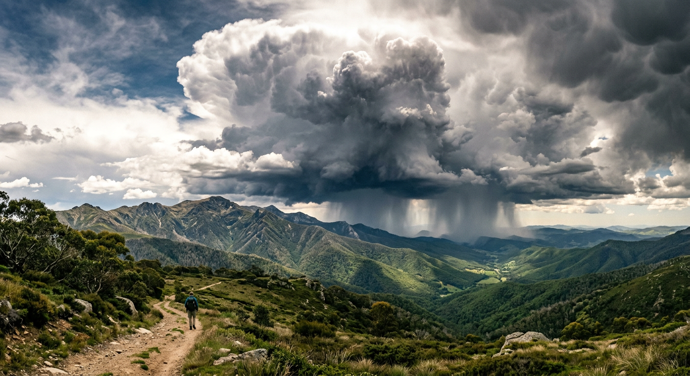
Once this inland moisture transport begins, atmospheric thermodynamics takes over to sustain the weather system. As the humid ocean air moves inland and converges on the thermal low, the converging winds force the air upward. The rising air cools to its dew point, causing the invisible water vapour to condense into towering cumulonimbus clouds. This phase change from gas to liquid releases enormous amounts of latent heat of condensation directly into the surrounding atmosphere.
The added heat increases the buoyancy of the air, causing it to rise even faster and higher. This continuous, powerful updraft further drops the surface atmospheric pressure, which in turn sucks in even more moist air from the sea. This self-reinforcing feedback loop ensures that the intense rainfall and strong winds continue as long as the primary thermal contrast exists. How exactly how do monsoons form requires recognising this combination of initial solar heating and the subsequent, massive release of latent heat that keeps the storm clouds growing over the landmass.
The mechanism behind ITCZ migration and monsoon onset
While differential heating provides the engine, the entire monsoon cycle is dictated by Earth's axial tilt and its orbit around the sun. As the planet travels through space, the latitude receiving the most direct sunlight shifts north and south throughout the year. This shifting solar maximum drives the expansion and contraction of global weather bands, pulling the primary zone of thunderstorm activity across the equator.
Global atmospheric circulation and the Hadley Cell
The primary atmospheric circulation feature of the tropics is the Hadley Cell. Warm air rises near the equator, flows poleward at high altitudes, sinks in the subtropics, and returns toward the equator at the surface as the trade winds. The region where the trade winds of the Northern and Southern Hemispheres collide is called the Intertropical Convergence Zone (ITCZ). This planetary belt of persistent low pressure and thunderstorm activity tracks the thermal equator across the globe.
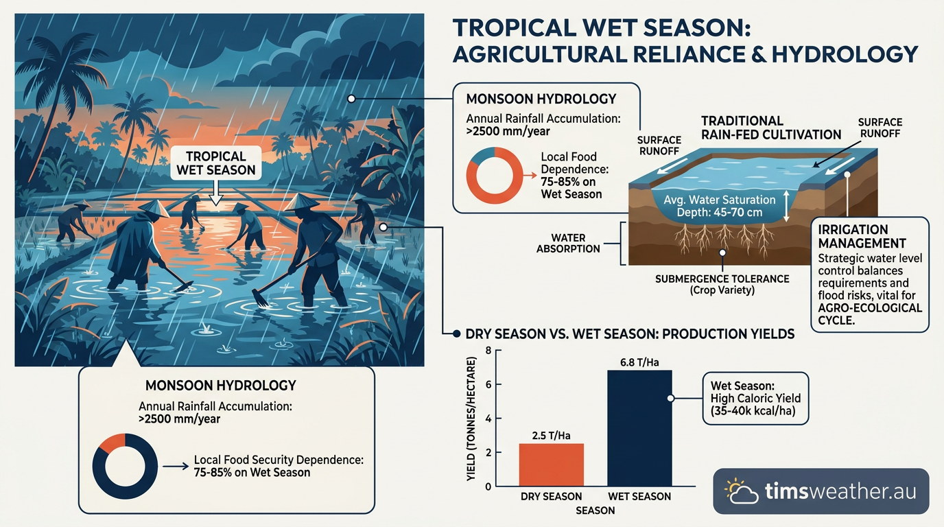
During the northern summer, the thermal equator pushes far into the Northern Hemisphere, dragging the ITCZ over massive landmasses like South Asia and Sub-Saharan Africa. The arrival of the ITCZ provides the widespread atmospheric lift necessary to turn the massive influx of marine moisture into relentless seasonal rainfall. The shift from the dry season to the wet season is sudden and highly impactful, rewriting the wind patterns for half the planet and triggering the agricultural growing season for billions of people.
Forecasting monsoon onset and intraseasonal variability
Monsoons are not purely local sea-breeze systems. Because they are coupled to the broader tropics through cross-equatorial flow and the ITCZ, they experience significant intraseasonal variability. The wet season is rarely a period of continuous rain; it is characterised by active phases with heavy downpours and break phases where the rain completely stops for weeks. This complex variability makes the precise timing of onset and breaks difficult to forecast at useful lead times, an atmospheric challenge discussed extensively by meteorological educators (www.youtube.com).
Meteorologists tracking onset look for specific atmospheric signals in the upper and lower levels of the troposphere. Research from meteorological agencies highlights that weak vertical wind shear and a strong thermal gradient between the land and the ocean are necessary conditions for a successful onset. When these conditions align, the large-scale wind reversal locks into place, moisture floods the continent, and the wet season officially begins.
The Indian Ocean Monsoon Satellite Imagery Video
The role of orography in intensifying seasonal rainfall
Differential heating builds the pressure gradient, but regional geography dictates the ultimate intensity and location of the precipitation. Mountain ranges act as formidable physical barriers that force incoming moisture rapidly upward, a process known as orographic lifting, which concentrates the rainfall into specific high-impact zones.
Why the Tibetan Plateau acts as a massive heat pump
The South Asian monsoon is uniquely powerful due to the presence of the Himalayan Plateau and the adjacent Tibetan Plateau. Spanning millions of square kilometres at an average elevation of 4,000 metres, the Tibetan Plateau functions as a massive, elevated heat pump. During the summer, the rock and thin soil directly above the plateau heat up significantly more than the free atmosphere at the exact same altitude over the distant ocean, driving seasonal changes in wind patterns that bring substantial rainfall (www.britannica.com).
This intense sensible heating generates a powerful upper-level high-pressure system known as the Tibetan High. The clockwise flow around this high-pressure centre creates a strong upper-level easterly jet stream. This upper-level wind helps ventilate the rising air over India, carrying exhaust air away and allowing the surface thermal low to deepen further. This deep surface low draws in even more moisture from the Arabian Sea and the Bay of Bengal, supercharging the precipitation patterns across the entire subcontinent.
The Coriolis effect and cross-equatorial flow
The Coriolis effect plays an essential role in steering these moisture-laden winds across the ocean basins. As air flows from the high-pressure zones of the southern Indian Ocean, it moves northward toward the equator. Once the air crosses the equator into the Northern Hemisphere, the Earth's rotation deflects it to the right. This deflection turns the incoming southeast trade winds into the famous southwest monsoon winds that strike the Indian coast at a nearly perpendicular angle. Grasping how the Coriolis effect shapes global winds, much like understanding how does the jet stream form, is required to map where the heaviest rain will fall and how the wind fields will evolve.
Comparing regional precipitation patterns and global monsoon systems
Though the term is most closely associated with the Indian Ocean, monsoon mechanics operate on multiple continents. Each system is driven by land-sea thermal contrast but produces unique weather hazards based on local topography, nearby moisture sources, and seasonal timing.
Monsoon Region | Primary Thermal Driver | Atmospheric Mechanism | Peak Rainfall Period |
|---|---|---|---|
South Asian Monsoon | Tibetan Plateau heating | ITCZ migration and cross-equatorial flow | June to September |
North American Monsoon | Sonoran Desert thermal low | Moisture transport from the Gulf of California | July to August |
West African Monsoon | Saharan heat low | Moisture drawn from the Gulf of Guinea | June to September |
Australian-Indonesian Monsoon | Northern Australian continental heating | Equatorial trough shifting southward | December to March |
The South Asian summer monsoon season
The South Asian summer monsoon typically runs from mid-June to early October. The influx of marine moisture from the Indian Ocean delivers approximately three-quarters of India's annual precipitation, driving the agricultural cycle for hundreds of millions of people. The exact onset varies across the region. For example, the World Meteorological Organization noted in 2026 that the onset across parts of the ASEAN region was near-average, though it arrived later than average in Viet Nam and Lao PDR.
The North American Monsoon
The North American Monsoon brings a sharp increase in humidity and thunderstorm activity to the Desert Southwest of the United States and northwestern Mexico. The intense heating of the Sonoran Desert creates a thermal low that pulls moisture northward from the Gulf of California and the Gulf of Mexico. This seasonal shift typically runs from June 15 to September 30, providing essential rainfall to the region while also presenting risks such as flash flooding (www.breliio.com).
This moisture provides critical summer rainfall to highly arid environments. However, the daily cycle of how do thunderstorms form over the high desert terrain frequently triggers destructive flash floods, leading authorities to classify it as New Mexico's deadliest weather season due to the increased likelihood of severe weather, heat stress, and rapidly rising waters (www.koat.com). Sudden downdrafts from these severe storms also generate towering walls of dust across the dry plains, demonstrating precisely how do haboobs form across the desert margins.
Sub-Saharan Africa and agricultural reliance
In West Africa, the Sahara Desert generates extreme thermal heat lows during the summer. This powerful low pressure pulls humid air inland from the Gulf of Guinea. The boundary where the dry Saharan air meets the moist equatorial air—the West African Monsoon trough—is highly unstable and generates massive squall lines that travel westward across the continent. Entire economies rely entirely on the exact timing and duration of this wet season.
Global impact of anomalous monsoon cycles on tropical cyclone genesis
The broad-scale winds generated by monsoon systems have profound effects on the frequency and intensity of severe weather in surrounding ocean basins. The monsoon trough acts as a vast region of enhanced cyclonic spin, or low-level vorticity, spanning thousands of kilometres, which can seed major tropical storms when the timing is right.
How monsoon moisture feeds the Western Pacific
In the Western North Pacific, typhoons frequently develop from disturbances embedded directly within the active monsoon trough. The persistent low-level wind convergence and high atmospheric moisture content create the exact thermodynamic environment required for how do tropical cyclones form. Similarly, in the northern Indian Ocean, tropical cyclones often form just before the monsoon onset in spring or immediately after its withdrawal in autumn, when vertical wind shear temporarily weakens enough to allow a storm to organize.
The El Niño-Southern Oscillation influence
Global climate oscillations heavily influence the strength of this atmospheric circulation. The El Niño-Southern Oscillation (ENSO) is the dominant factor controlling interannual variability. An El Niño event warms the central and eastern equatorial Pacific Ocean, shifting the ascending branch of the Walker Circulation away from the maritime continent. This shift tends to suppress the rising air needed over Southeast Asia and Australia, often leading to a delayed onset, highly deficient rainfall, and widespread impacts on global agriculture and water supply (www.cordulus.com).
The World Meteorological Organization's 2026 seasonal outlook explicitly linked anomalous rainfall patterns to El Niño conditions, projecting below-average South Asian rainfall and a high likelihood of below-normal precipitation in parts of the Greater Horn of Africa during the June to September wet season. A solid grasp of how does El Niño form remains central for meteorologists attempting to issue accurate seasonal rainfall forecasts, as the shifting ocean temperatures directly manipulate the intensity and timing of the global monsoon cycle.
Sources
NOAA weather and atmospheric science reference (repository.library.noaa.gov)
NOAA weather and atmospheric science reference (repository.library.noaa.gov)
Oceanic repeaters boost the global climatic impact of the Tibetan Plateau (repository.library.noaa.gov)
NOAA weather and atmospheric science reference (repository.library.noaa.gov)
NOAA weather and atmospheric science reference (repository.library.noaa.gov)
NOAA weather and atmospheric science reference (cpc.ncep.noaa.gov)
NOAA weather and atmospheric science reference (cpc.ncep.noaa.gov)
NOAA weather and atmospheric science reference (cpc.ncep.noaa.gov)
Last verified: 2026-09-15
Frequently asked questions
Monsoons form because land and sea heat up at different rates. During summer, the land warms faster than the ocean, creating low pressure that draws in moist maritime air. This air rises, cools, and condenses, leading to the widespread, sustained rain showers characteristic of the monsoon wet season.
Source: weather.gov
Further reading and resources
Explore trusted articles, books, videos and other resources to go deeper on this topic.
climas.arizona.eduReference
Monsoon - CLIMAS - The University of Arizona
Background reference on How Do Monsoons Form? The Complete Meteorological Guide from climas.arizona.edu.
windy.appArticle
Where do monsoons come from - Windy.app
In-depth coverage on How Do Monsoons Form? The Complete Meteorological Guide from windy.app.
youtube.comVideo
Monsoons: Wet, Dry, Repeat... - YouTube
Video coverage on How Do Monsoons Form? The Complete Meteorological Guide from youtube.com.
nesdis.noaa.govReference
What Is a Monsoon? | NESDIS - NOAA
Background reference on How Do Monsoons Form? The Complete Meteorological Guide from nesdis.noaa.gov.
disasterphilanthropy.orgArticle
Monsoon Seasons - Center for Disaster Philanthropy
In-depth coverage on How Do Monsoons Form? The Complete Meteorological Guide from disasterphilanthropy.org.
scied.ucar.eduReference
What Are Monsoons and Why Do They Happen?
Background reference on How Do Monsoons Form? The Complete Meteorological Guide from scied.ucar.edu.
weather.govReference
Monsoon Information Page - National Weather Service
Background reference on How Do Monsoons Form? The Complete Meteorological Guide from weather.gov.
climate.govReference
The North American Monsoon | NOAA Climate.gov
Background reference on How Do Monsoons Form? The Complete Meteorological Guide from climate.gov.
sgsup.asu.eduReference
Basics of the Arizona Monsoon & Desert Meteorology
Background reference on How Do Monsoons Form? The Complete Meteorological Guide from sgsup.asu.edu.
study.comArticle
Monsoon Winds | Definition & Causes - Lesson - Study.com
In-depth coverage on How Do Monsoons Form? The Complete Meteorological Guide from study.com.
Planning weeks ahead?
Check Australia's long-range seasonal outlook for rainfall, temperature and the climate drivers (ENSO, IOD, SAM, MJO) shaping the next three months.
View Australia's Seasonal Weather Forecast