
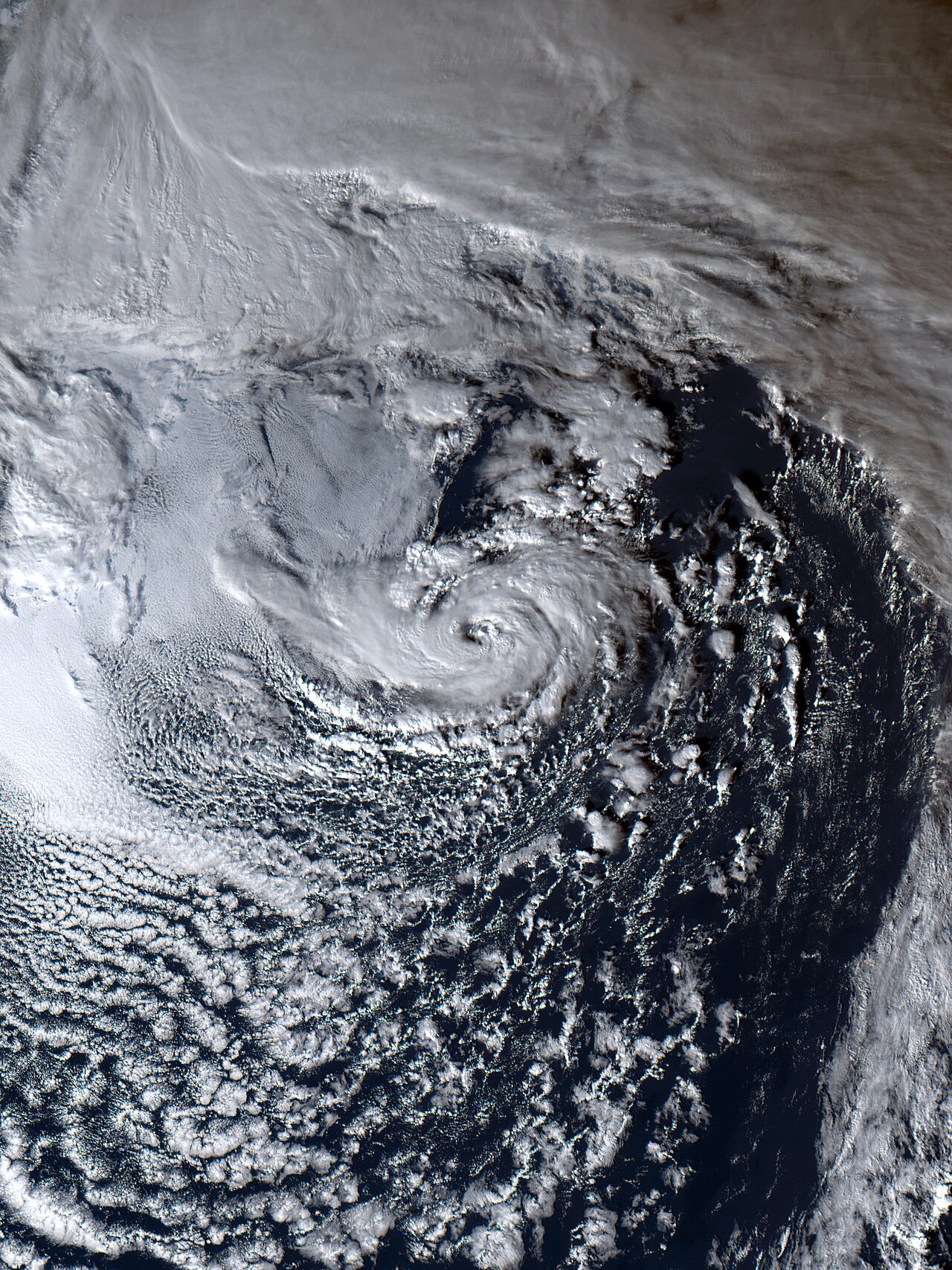
How do subtropical storms form? A subtropical cyclone develops when an upper-level cold-core low interacts with a frontal boundary over ocean waters. This hybrid process draws energy from both baroclinic temperature gradients and latent heat release, typically organising convection around a non-tropical centre.
Key takeaways
Subtropical cyclones are hybrid weather systems that blend the thermodynamics of mid-latitude fronts with tropical thunderstorms.
These systems rely on exceptionally cold air aloft rather than extremely warm ocean waters to generate atmospheric instability.
A subtropical storm typically features a broad, lopsided wind field, with maximum sustained winds located far from its centre of circulation.
Under favourable environmental conditions, a subtropical cyclone can complete a tropical transition and become a fully warm-core hurricane.
How do subtropical storms form: The hybrid paradox
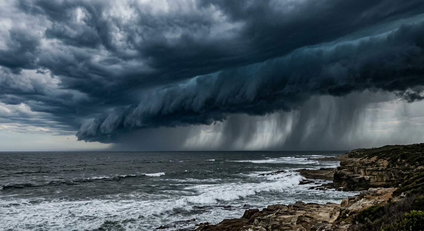
Anatomy of a Subtropical Storm: From Cold-Core to Warm-Core Transition
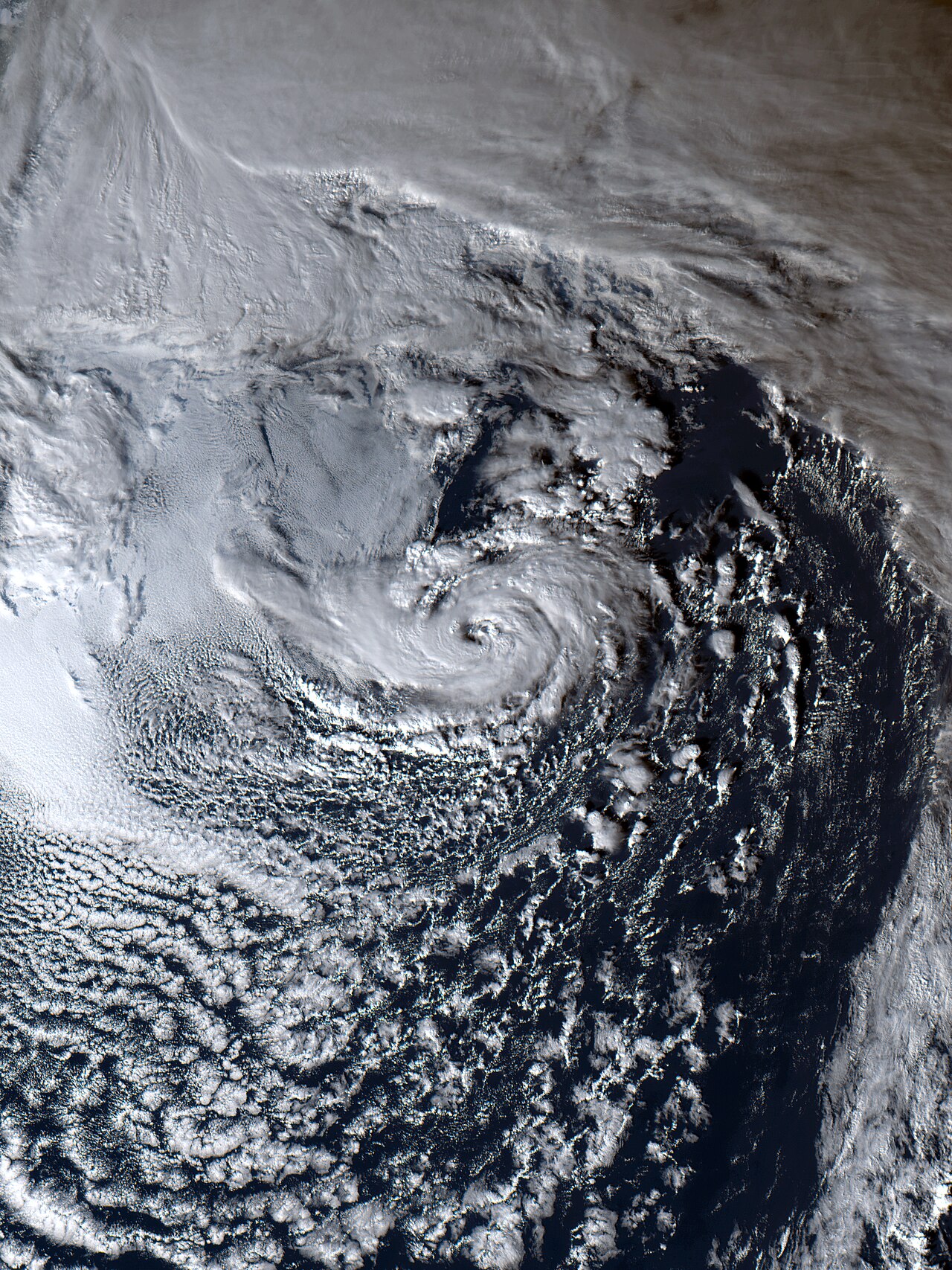
The internal subtropical cyclone anatomy is markedly different from the neat, symmetrical structure of a mature hurricane. When viewed on weather maps, a subtropical storm often appears lopsided. The system typically lacks a clear eye, and its deepest thunderstorm activity is frequently sheared off to one side of the low-pressure centre.
This asymmetry extends to the wind field symmetry. In a standard tropical cyclone, the most destructive winds are concentrated in a tight ring immediately surrounding the eye. In a subtropical cyclone, the zone of maximum winds is broad and diffuse, often positioned hundreds of kilometres away from the centre. This wide wind radius occurs because the storm is still partially attached to a baroclinic frontal boundary, meaning its energy is spread across a vast area rather than focused into a tight core.
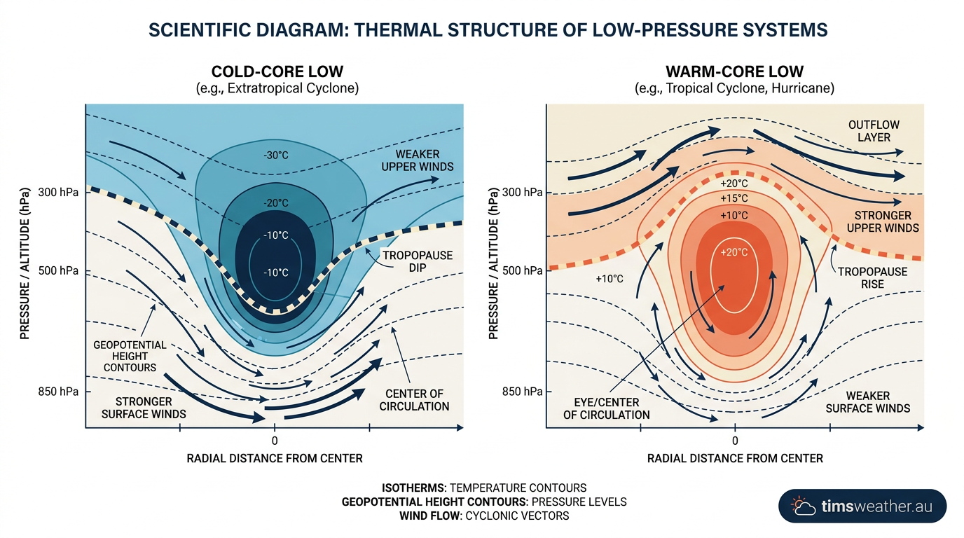
The lifecycle of these systems often involves significant structural shifts. When a mid-latitude cyclone moves over warmer water and sheds its frontal attachments, it undergoes tropical transition. During this phase, latent heat from ocean thunderstorms slowly warms the system's core. Conversely, the extratropical transition occurs when a tropical or subtropical storm moves poleward, interacting with atmospheric fronts and reverting to a purely cold-core structure. Observers watching how do cold fronts form will often see these frontal zones absorb weakening subtropical systems in the higher latitudes.
The Role of Upper-Level Lows in Triggering Subtropical Development
Subtropical cyclogenesis rarely happens in a quiet atmosphere. The most common trigger is an upper-level cold-core low pressure system that detaches from the primary westerly atmospheric flow. When the Jet stream dips sharply toward the equator, it can pinch off a pocket of freezing air high in the troposphere. To understand how does the jet stream form these cut-off features, one must look at planetary waves that become highly amplified and stall.
When this pool of cold air settles over the ocean, it creates steep lapse rates. The temperature difference between the sea surface and the upper atmosphere causes violent upward air movement. This dynamic is known as baroclinic instability. Instead of generating power purely from ocean evaporation, the developing storm extracts energy from temperature contrasts within the atmosphere.
As the air rises, it generates potential vorticity in the lower levels, which forces the surface winds to begin spinning. This spin gradually organises scattered thunderstorms into coherent convective bands. Over several days, the persistent thunderstorm activity near the centre releases enough latent heat to partially warm the atmospheric column, cementing the system's status as a hybrid cyclone.
How Sea Surface Temperature Thresholds Differ for Subtropical Systems
The thermal requirements for subtropical systems present a sharp contrast to classic tropical development. Standard tropical cyclone formation requires Sea Surface Temperature (SST) values of at least 26.5 degrees Celsius across a deep ocean layer. This massive reservoir of heat is necessary to fuel the intense evaporation that drives purely warm-core storms. Without this heat, a standard tropical wave will fail to organise. This thermodynamic limit is a core principle in meteorology when examining how do tropical cyclones form.
Subtropical storms, however, rewrite these ocean temperature rules. Because they are driven by cold air aloft, they require much less heat from the ocean to achieve necessary atmospheric buoyancy. Subtropical cyclones can form over waters ranging from about 19°C to 31°C, with a mode near 24°C; they do not routinely form only over waters between 20°C and 23°C. The presence of upper-level cold pools creates an environment where even modest ocean warmth is sufficient to trigger deep convection and sea surface temperatures become less of a limiting factor.
This lower threshold explains why subtropical systems often form outside the peak months of the hurricane season. During early spring or late autumn, ocean waters may be too cool for pure tropical cyclogenesis, but the atmosphere is volatile enough to support hybrid development when a stray mid-latitude low wanders into the subtropics.
Distinguishing Subtropical from Tropical Cyclogenesis: A Thermal Profile
Properly categorising a developing cyclone requires careful analysis of its thermal profile and wind distribution. The National Hurricane Center (NHC) and the World Meteorological Organization (WMO) maintain strict operational criteria for these hybrid systems.
Feature | Subtropical Cyclone | Tropical Cyclone |
|---|---|---|
Energy Source | Baroclinic gradients and latent heat | Latent heat release exclusively |
Core Temperature | Weak warm core in lower levels, cold aloft | Deep, symmetrical warm core throughout |
Wind Field Radius | Broad; strongest winds 150+ km from centre | Tight; strongest winds near the eyewall |
Sea Surface Temp | Often develops over cooler waters (20–23°C) | Requires warm waters (26.5°C+) |
At the lowest intensity level, a subtropical depression exhibits organised convection and a closed circulation, but its maximum sustained winds remain at 62 km/h (38 mph) or less. Once winds reach or exceed this threshold, the system is upgraded to a subtropical storm. National forecasting agencies use specific rules for the classification of tropical cyclones and their subtropical counterparts to ensure accurate public warnings.
A common question is whether a subtropical storm can transition entirely and gain hurricane status. The answer is yes. If the system remains over moderately warm water and avoids hostile wind shear, the ongoing thunderstorms will eventually build a deep warm core, eliminating the remaining cold-core characteristics.
Once it achieves a fully tropical profile, the system is evaluated against the Saffir-Simpson Hurricane Wind Scale. Learning how do hurricanes form from hybrid origins highlights the fluid nature of atmospheric mechanics, where a storm's initial structure does not dictate its final intensity.
Global Distribution and Forecasting Challenges
While hybrid systems can develop in multiple ocean basins, the North Atlantic Ocean is particularly well known for generating these storms. Analysis of historical tracking databases reveals that Atlantic subtropical cyclones frequently cluster between 25 and 35 degrees latitude. In these zones, the transition between tropical air masses and mid-latitude weather systems creates an ideal breeding ground for baroclinic instability.
The WMO Manual on the Global Data-processing and Forecasting System provides guidelines for tracking these hybrid systems, as they often slip through the cracks of standard forecast models. Because they form in marginal environments, their rapid development can surprise forecasters.
For example, Subtropical Storm Karen, tracked by the NOAA in early 2025, demonstrated how a non-tropical low could quickly generate organised convection and become a named system before completing an extratropical transition.
How these storms is highly relevant for seasonal forecasting. During certain climate phases, such as strong El Niño events, atmospheric shear suppresses pure tropical cyclogenesis in the deep tropics. In these years, systems forming in higher latitudes become significant contributors to tropical activity. Recognising the conditions that dictate how do tropical storms form from subtropical origins helps meteorologists predict seasonal landfall risks accurately, proving that a storm does not need to start as a pure tropical wave to pose a serious threat to coastal communities.
Sources
TCFAQ A16) Why do tropical cyclones require 80°F (26.5°C) (aoml.noaa.gov)
NOAA weather and atmospheric science reference (aoml.noaa.gov)
severeweather.wmo.int PDF reference (severeweather.wmo.int)
severeweather.wmo.int PDF reference (severeweather.wmo.int)
NOAA weather and atmospheric science reference (star.nesdis.noaa.gov)
NOAA weather and atmospheric science reference (nhc.noaa.gov)
NOAA weather and atmospheric science reference (wpc.ncep.noaa.gov)
NOAA weather and atmospheric science reference (repository.library.noaa.gov)
Last verified: 2026-09-14
Frequently asked questions
Subtropical storms form when a low-pressure system derives energy from both warm ocean air and colder air aloft. They typically develop beneath an upper-level low or trough over subtropical waters. This hybrid process combines the convection of tropical systems with the baroclinic energy found in mid-latitude weather patterns.
Source: aoml.noaa.gov
Further reading and resources
Explore trusted articles, books, videos and other resources to go deeper on this topic.
blog.ucs.orgArticle
Hurricanes, Nor'easters, Subtropical Storms! What's the Difference?
In-depth coverage on How Do Subtropical Storms Form: The Hybrid Cyclone Explained from blog.ucs.org.
undrr.orgArticle
Sub-Tropical Cyclone (MH0308) - UNDRR
In-depth coverage on How Do Subtropical Storms Form: The Hybrid Cyclone Explained from undrr.org.
weather.govReference
(Sub/Extra)Tropical Stuff - National Weather Service
Background reference on How Do Subtropical Storms Form: The Hybrid Cyclone Explained from weather.gov.
nytimes.comArticle
A Subtropical Storm Is and Isn't Tropical - The New York Times
In-depth coverage on How Do Subtropical Storms Form: The Hybrid Cyclone Explained from nytimes.com.
weather.comArticle
What Is A Subtropical Storm And How Is It Different From A Tropical Storm?
In-depth coverage on How Do Subtropical Storms Form: The Hybrid Cyclone Explained from weather.com.
skybrary.aeroArticle
South Atlantic Tropical and Subtropical Cyclones - SKYbrary
In-depth coverage on How Do Subtropical Storms Form: The Hybrid Cyclone Explained from skybrary.aero.
en.wikipedia.orgReference
Subtropical cyclone - Wikipedia
Background reference on How Do Subtropical Storms Form: The Hybrid Cyclone Explained from en.wikipedia.org.
noaa.govReference
Tropical Cyclone Introduction - NOAA
Background reference on How Do Subtropical Storms Form: The Hybrid Cyclone Explained from noaa.gov.
gpm.nasa.govReference
Rare Subtropical Storm Forms Off the Coast of Chile
Background reference on How Do Subtropical Storms Form: The Hybrid Cyclone Explained from gpm.nasa.gov.
journals.ametsoc.orgArticle
Atlantic Subtropical Storms. Part I: Diagnostic Criteria and Composite ...
In-depth coverage on How Do Subtropical Storms Form: The Hybrid Cyclone Explained from journals.ametsoc.org.
Planning weeks ahead?
Check Australia's long-range seasonal outlook for rainfall, temperature and the climate drivers (ENSO, IOD, SAM, MJO) shaping the next three months.
View Australia's Seasonal Weather Forecast