
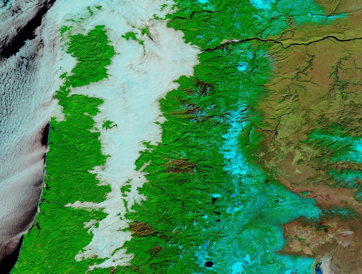
How does freezing fog form? It forms when tiny water droplets stay liquid in air at or below 0°C, then freeze on contact with cold surfaces. These supercooled water droplets usually appear in saturated air after radiative cooling has cooled the ground and the air near it. The result is poor visibility and a white coating of rime ice on trees, fences, roads and aircraft surfaces.
Key takeaways
- Black ice is the resulting surface hazard, not the atmospheric condition itself, which is a common point of driver confusion.
- It forms in saturated air when radiative cooling and a thermal inversion cool the air near the ground to sub-zero temperatures.
- Rime ice gets its white, granular look because the rapid freezing process traps tiny pockets of air within the ice.
- Riming can make roads, bridges and aircraft surfaces slippery very quickly.
- In Australia, the Bureau of Meteorology (BOM) links fog events to temperature inversions, especially in colder highland areas such as the Australian Alps and Tasmanian Highlands during winter cold snaps.
How does freezing fog form?
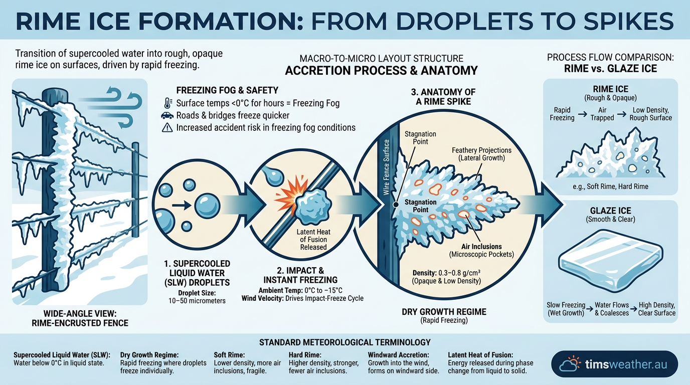
Freezing fog forms when the air is saturated, the temperature drops below 0°C, and the fog droplets do not freeze in mid-air. Instead, they remain as supercooled liquid water until they touch a cold surface. That contact acts as a nucleation point, so the droplet freezes at once and leaves behind a fine layer of ice.
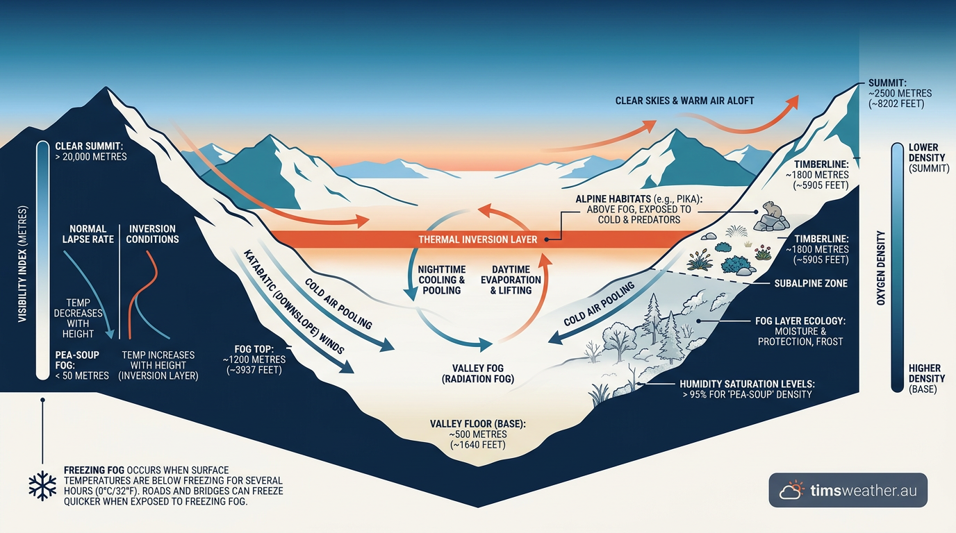
The Bureau of Meteorology (BOM) explains that fog often develops when air cools to its dew point, and temperature inversions can trap that cool, moist air near the ground. The article The Role of Temperature Inversions in Australian Fog Events covers why these setups matter in Australia. In a freezing fog event, the key difference is that the droplets are sitting in sub-zero temperatures, so they are ready to freeze on contact.
What role do supercooled water droplets play?
Supercooled water droplets are liquid droplets that exist below 0°C. They can stay liquid because they have not found a good trigger to start freezing. Those triggers are called nucleation points, and they are often tiny particles or a rough surface. In fog, the droplets stay suspended until they hit a branch, power line, windscreen or road surface that is cold enough to make them freeze.
Why do radiative cooling and thermal inversion matter?
Radiative cooling helps the ground lose heat overnight, especially on clear and calm nights. The ground then cools the thin layer of air above it. If a thermal inversion is present, that colder air can stay trapped near the surface under a warmer layer above. That setup encourages fog formation, then keeps the fog near the ground long enough for freezing fog to develop if surface temperatures fall below 0°C.
What does the dew point depression tell us?
Dew point depression is the difference between the air temperature and the dew point. A small dew point depression means the air is close to saturation, so fog can form more easily. When the air cools further, condensation adds more tiny droplets to the fog bank. If the ground and surrounding objects are below freezing, those droplets can become supercooled liquid water and freeze on contact.
What happens when freezing fog hits a surface?
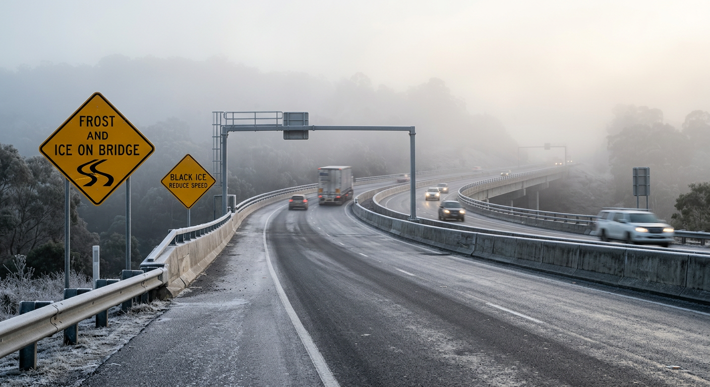
When the droplets strike a cold object, they freeze instantly and build up surface accretion. The coating is usually called rime ice, and the process is known as riming. The ice tends to collect on the **windward side** of objects because that is where the supercooled fog droplets hit first, but the source material does not support this wording as a general explanation of freezing fog formation. On roads and bridges, the same process can create a thin, hard film that is difficult to see and easy to slip on.
Why does rime ice look white and rough?
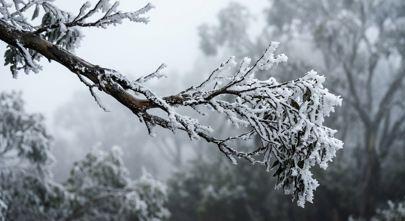
Rime ice looks white because the droplets freeze quickly and trap tiny pockets of air. That gives the ice a frosty, granular finish rather than a clear glaze. On vegetation, it can also create hoar frost formation, especially where the droplets freeze onto fine twigs and leaves in calm, cold conditions.
Is freezing fog the same as black ice?
No. Freezing fog is the weather condition in the air. Black ice is the icy layer on the surface. Freezing fog can cause black ice when droplets freeze on a road or bridge deck, but the two terms are not interchangeable. If you are driving in sub-zero temperatures, treat bridges, overpasses and shaded roads as higher-risk spots.
Freezing fog vs other fog types
Fog is a cloud at ground level, but not all fog behaves the same way. The temperature of the air and the surface decides whether the fog stays liquid, freezes on contact, or forms ice crystals directly.
| Fog type | Typical temperature setup | What is in the air | Common surface effect |
|---|---|---|---|
| Radiation fog | Often near 0°C or above | Liquid droplets | Damp surfaces |
| Freezing fog | At or below 0°C | Supercooled water droplets | Rime ice, black ice |
| Ice fog | Well below 0°C | Ice crystals | Frosty haze, little liquid icing |
| Advection fog | Depends on the air and sea surface | Liquid droplets | Moist, persistent low cloud |
That last point matters for aviation. Freezing fog can leave a thin film of ice on aircraft surfaces, which is why ground crews need to check for contamination before taxi and take-off.
Where does freezing fog happen in Australia?
It is uncommon, but it can occur in the coldest parts of Australia during winter, especially in the Australian Alps and the Tasmanian Highlands. Those areas are more likely to see the combination of clear nights, cold air drainage and strong radiative cooling that supports fog formation and, on colder mornings, freezing fog. For the latest local advice, check BOM forecasts and warnings for your district.
What should you do in freezing fog?
If you are out early on a sub-zero morning, slow down, leave extra space and be ready for sudden changes in grip. If you are near an airport or airstrip, expect de-icing checks and possible delays. On the ground, watch for icy patches on bridges, ramps, footpaths and shaded roads where freezing fog can leave a slick film without much warning.
Related guides
Frequently asked questions
Freezing fog forms when liquid water droplets in the air become supercooled, meaning they remain liquid despite temperatures being at or below 0°C. When these droplets encounter a cold surface like a road or tree, they freeze instantly on contact, creating a thin glaze of ice known as rime.
Source: nesdis.noaa.gov
Further reading and resources
Explore trusted articles, books, videos and other resources to go deeper on this topic.
weather.govReference
Freezing Fog
Background reference on How Does Freezing Fog Form? The Science of Supercooled Water Droplets from weather.gov.
mountwashington.orgArticle
Freezing Fog and Rime Ice; what are they?
In-depth coverage on How Does Freezing Fog Form? The Science of Supercooled Water Droplets from mountwashington.org.
www6.slac.stanford.eduReference
Unlocking the mysteries of freezing in supercooled water ...
Background reference on How Does Freezing Fog Form? The Science of Supercooled Water Droplets from www6.slac.stanford.edu.
aquawater.comArticle
The Science Behind Supercooled Water
In-depth coverage on How Does Freezing Fog Form? The Science of Supercooled Water Droplets from aquawater.com.
elementalscience.comArticle
Freezing Fog {InstaScience}
In-depth coverage on How Does Freezing Fog Form? The Science of Supercooled Water Droplets from elementalscience.com.
How Fog Forms
Background reference on How Does Freezing Fog Form? The Science of Supercooled Water Droplets from weather.gov.
wvtm13.comArticle
What is freezing fog?
In-depth coverage on How Does Freezing Fog Form? The Science of Supercooled Water Droplets from wvtm13.com.
skybrary.aeroArticle
Freezing Fog | SKYbrary Aviation Safety
In-depth coverage on How Does Freezing Fog Form? The Science of Supercooled Water Droplets from skybrary.aero.
en.wikipedia.orgReference
Fog
Background reference on How Does Freezing Fog Form? The Science of Supercooled Water Droplets from en.wikipedia.org.
journals.ametsoc.orgArticle
Chapter 4 Ice Fog: The Current State of Knowledge and Future Challenges
In-depth coverage on How Does Freezing Fog Form? The Science of Supercooled Water Droplets from journals.ametsoc.org.
Planning weeks ahead?
Check Australia's long-range seasonal outlook for rainfall, temperature and the climate drivers (ENSO, IOD, SAM, MJO) shaping the next three months.
View Australia's Seasonal Weather Forecast