
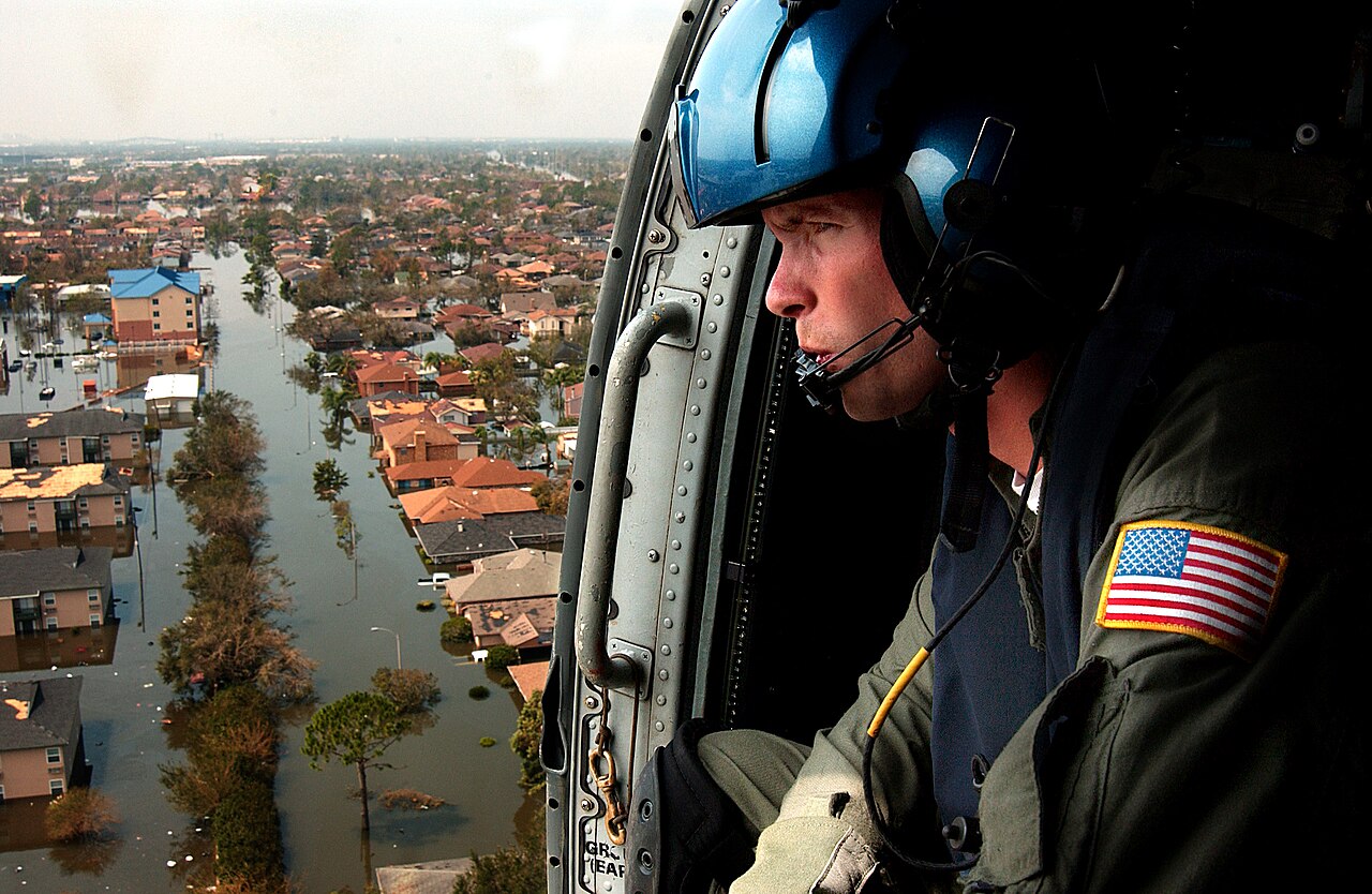
Hurricane Katrina flood failures were primarily caused by the catastrophic breach of the New Orleans hurricane levee and floodwall system. Forensic investigations identified critical design flaws, including unstable soil foundations, inadequate sheet pile depths, and the unintended funnelling effects of navigation channels that amplified surge pressures against the infrastructure during the storm.
Key takeaways
Over 50 levee breaches inundated approximately 80 percent of New Orleans following the storm's landfall on 29 August 2005.
Engineering reviews concluded that foundation instability and inadequate sheet-pile embedment caused many floodwalls to collapse before water could even overtop them.
The United States Army Corps of Engineers was found largely responsible for the systemic design and construction flaws within the regional protection network.
The disaster prompted the creation of the advanced Hurricane and Storm Damage Risk Reduction System to replace the deficient infrastructure.
Emergency response efforts were severely hampered by the suddenness of the New Orleans hurricane infrastructure collapse, leaving thousands stranded in deep water.
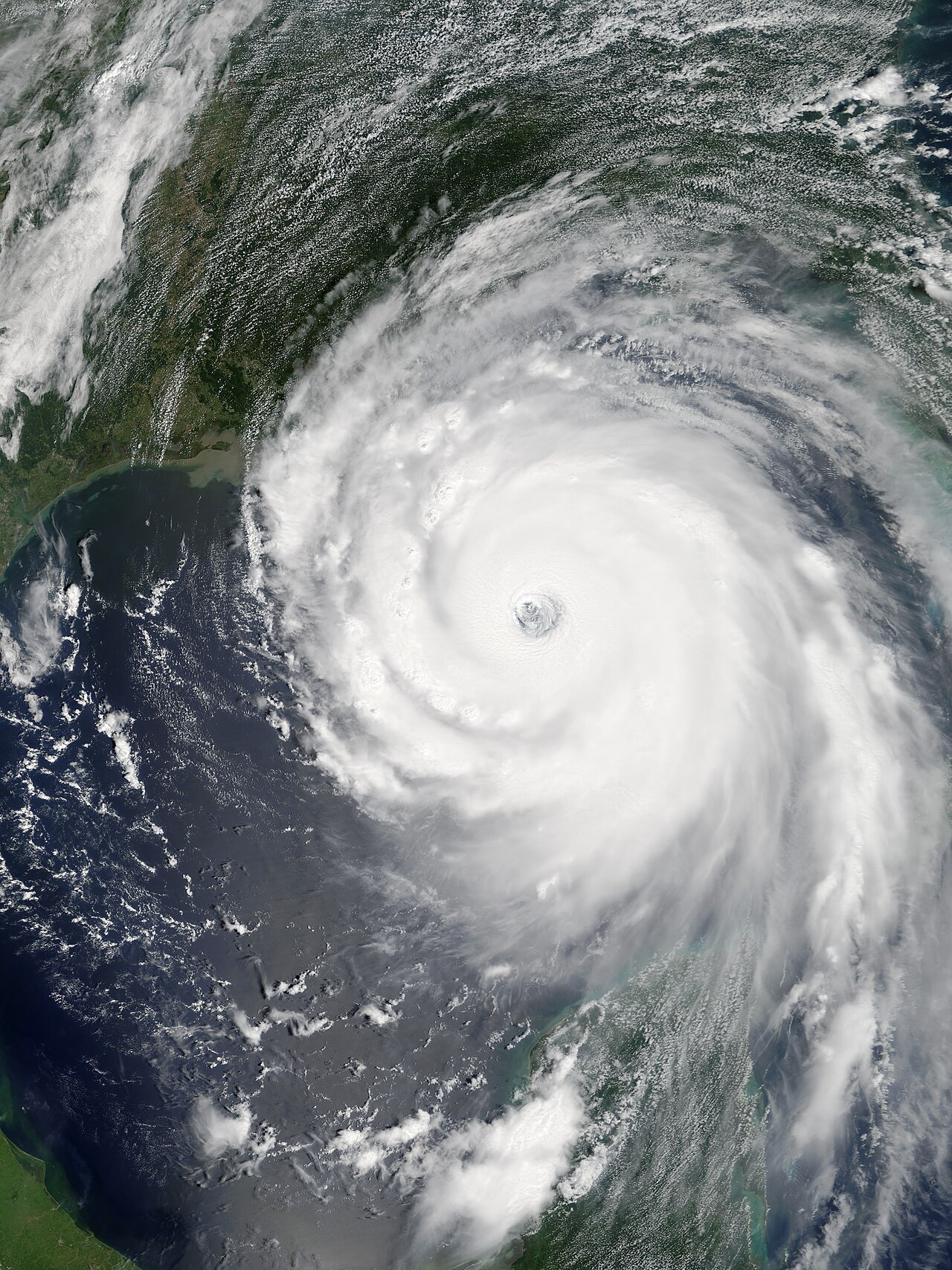
The meteorological event: Hurricane Katrina at landfall
Formation and intensification across the Gulf Coast
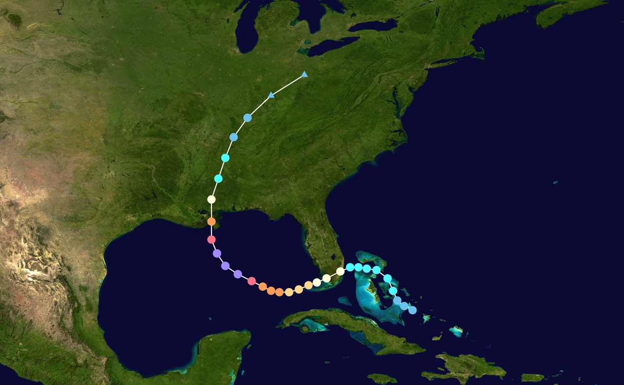
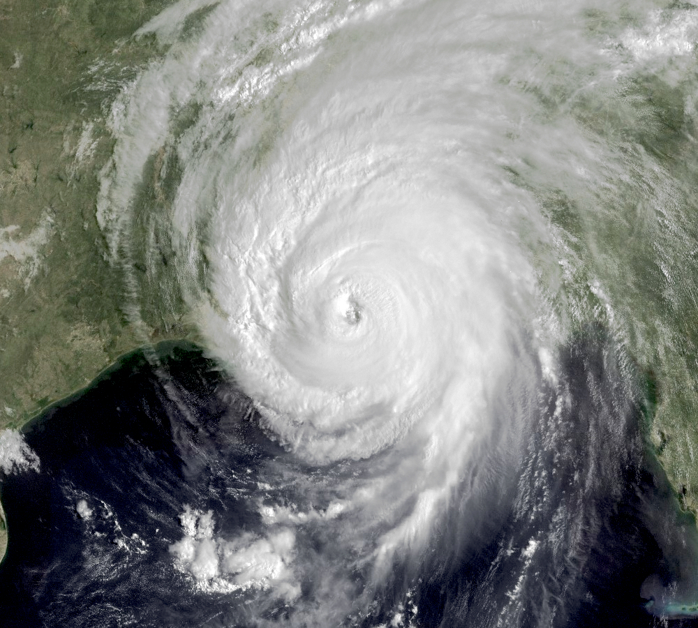
Before it tested the limits of civil engineering, the storm was an immense meteorological phenomenon. To understand how do hurricanes form, meteorologists study the interaction between warm ocean waters, atmospheric moisture, and favourable wind patterns. The system originated as a tropical depression over the Bahamas before crossing southern Florida.
Meteorologists studying how do tropical depressions form note that the process requires a pre-existing weather disturbance, warm surface temperatures, and low wind shear. As the system entered the exceptionally warm waters of the Gulf of Mexico, rapid intensification transformed it into a massive and powerful hurricane.
It intensified into a Category 5 hurricane over the open water before making landfall in Louisiana on 29 August 2005 as a severe Category 3 storm (National Geographic).
The system carried maximum sustained winds of 193 km/h (120 mph). Under the hurricane categories explained by the Saffir-Simpson Hurricane Wind Scale, a Category 3 event is capable of causing devastating damage.
The sheer size of the wind field pushed an enormous dome of water ahead of the storm, creating a catastrophic storm surge that threatened the low-lying coastlines of Louisiana and Mississippi. The prolonged counter-clockwise circulation over the Gulf of Mexico gathered a massive volume of water, setting it on a direct collision course with the artificial levees bordering the region.
According to historical analyses of the event, the resulting devastation made it one of the costliest natural disasters in United States history, with damages estimated at roughly $125 billion (Britannica).
The immense volume of water displaced by the storm placed unprecedented pressure on the regional infrastructure. This combination of meteorological intensity and pre-existing structural weaknesses set the stage for a historic systemic failure.
The National Weather Service warnings
As the hurricane approached the Gulf Coast, meteorological agencies recognised the severe threat it posed to the region. The National Weather Service (NWS) issued strongly worded alerts predicting unprecedented destruction, specifically warning of extensive storm surge and the potential for long-term power outages and structural damage.
Their forecasting models accurately tracked the storm's path toward New Orleans and the surrounding parishes, plotting the exact timeline of worsening conditions.
A comprehensive assessment of the event highlighted that the NWS was highly effective in its forecasting and communication efforts during the critical window from 23 to 31 August 2005 (National Weather Service). The total human cost eventually surpassed 1,350 fatalities across the disaster zone.
The alerts made it clear that the approaching storm surge would severely test the New Orleans hurricane flood protection system. Forecasters detailed the likelihood of overtopping levees and extreme inundation for areas sitting below sea level. The physical infrastructure surrounding the city was fundamentally unequipped to withstand the forces it was about to encounter.
Storm surge dynamics and wind field physics
The destructive power of a hurricane is heavily dependent on the structure of its core. How how does the eye of a hurricane form explains the intense pressure gradients that drive the most destructive winds near the storm's centre. The lower the central pressure drops, the stronger the surrounding wind field becomes.
As the air pressure inside the storm falls, it allows the ocean surface to bulge slightly upward. While this barometric effect contributes to a higher water level, the vast majority of a storm surge is mechanically driven by the sheer friction of intense winds scraping across the ocean surface over hundreds of kilometres.
By studying how do low-pressure systems form, atmospheric scientists understand that the large-scale convergence of air creates immense inward wind flow. In the case of this storm, the sheer breadth of the low-pressure wind field was exceptional. The water pushed by these winds encountered the shallow continental shelf of the Gulf Coast, which forced the water column upward.
The complex topography of the coastline, featuring bays, inlets, and narrow shipping channels, provided no space for the surging water to disperse, driving it directly against the concrete walls meant to protect the urban population.
Systemic collapse: The mechanics behind Hurricane Katrina flood failures
What were the primary infrastructure failures that led to the Hurricane Katrina flood?
Hurricane Katrina flood failures were primarily caused by the catastrophic breach of the New Orleans hurricane levee and floodwall system. Forensic investigations identified critical design flaws, including unstable soil foundations, inadequate sheet pile depths, and the unintended funnelling effects of navigation channels that amplified surge pressures against the infrastructure during the storm.
The vulnerability of the 17th Street Canal and London Avenue Canal
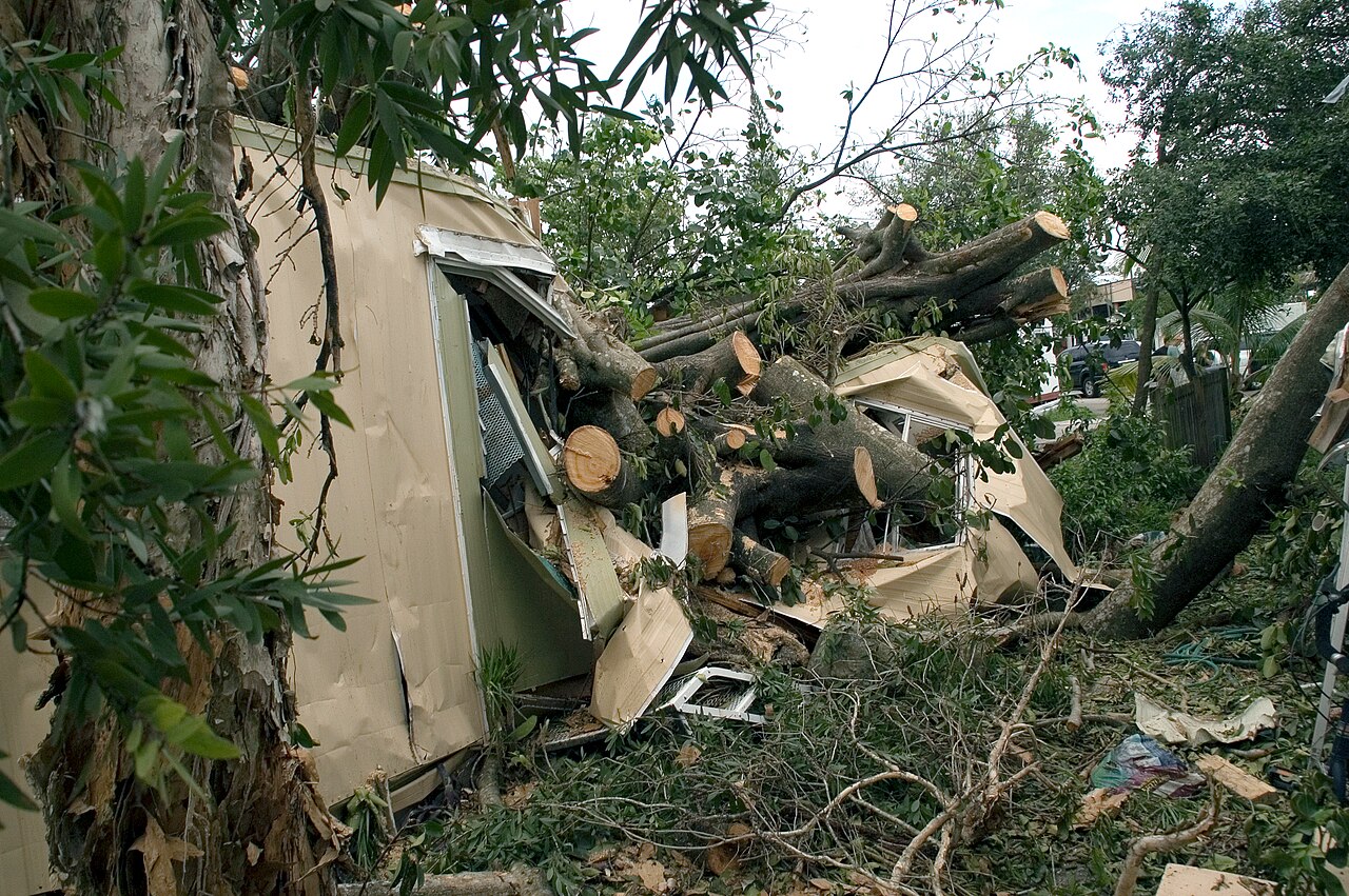
The city of New Orleans relies on a complex network of levees, floodwalls, and pumping stations due to its unique topography, much of which sits below sea level. When the storm arrived, this protection network experienced a systemic collapse. Investigations following the disaster revealed over 50 levee failures, which directly led to the inundation of roughly 80 percent of New Orleans (Wikipedia).
The most consequential Hurricane Katrina levee breaches occurred along the major drainage canals that connect the city to Lake Pontchartrain. The 17th Street Canal and the London Avenue Canal experienced catastrophic failures that defied initial expectations. Engineers initially assumed that storm surge had simply overtopped the walls, pouring into the city. However, forensic analysis proved otherwise.
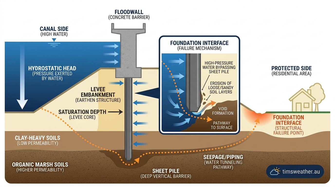
At the 17th Street Canal, the floodwall failed while the water level was still below the top of the barrier. The wall was pushed laterally by the immense hydrostatic pressure of the rising water, snapping the concrete and opening a massive gap that allowed Lake Pontchartrain to pour directly into adjacent urban neighbourhoods.
The collapse mechanism: Water pressure and structural limits
The structural mechanics of a floodwall are designed around a delicate balance of forces. The wall must hold back the lateral pressure of the water on one side while relying on the passive resistance of the soil on the other side.
When studying how do tropical cyclones form and impact coastal areas, civil engineers calculate the maximum expected water height to determine the necessary strength of the barrier. The forces exerted during this event exceeded the foundational tolerances of the I-walls.
As water levels rose within the canals, the horizontal force pushed outward against the concrete barriers. Because the walls were rigidly attached to steel sheet piles driven into the ground, this lateral force created a tremendous bending moment. The soil behind the walls began to yield.
Once the concrete panels shifted even slightly, small gaps opened between the wall and the soil on the canal side. Water rushed down into these gaps, applying hydrostatic pressure not just against the face of the wall, but deep underground against the embedded steel pile, vastly accelerating the collapse.
Breach Location | Primary Failure Mechanism | Engineering Design Oversight |
|---|---|---|
17th Street Canal | Wall displacement prior to overtopping | Inadequate sheet-pile depth and miscalculated soil shear strength |
London Avenue Canal | Foundation seepage and blow-out | Failure to account for porous sand layers beneath the peat |
Industrial Canal | Surge amplification and overtopping | Hazard creep from surrounding urban development and channel funnelling |
Lower Ninth Ward | Catastrophic structural disintegration | Lack of concrete armouring against wave action and surge force |
Geotechnical engineering failures: Beyond the design specifications
Miscalculations of soil strength and foundation stability
The core of the disaster lay deep underground. New Orleans is built on deltaic soil, heavily composed of soft clays, peat, and porous sands. When engineers designed the I-walls, which are concrete walls built atop steel sheet piles driven into the ground, they relied on outdated or overly optimistic assumptions about the shear strength of these soils. They did not fully account for how the complex stratigraphy would behave when completely saturated and placed under extreme lateral pressure.
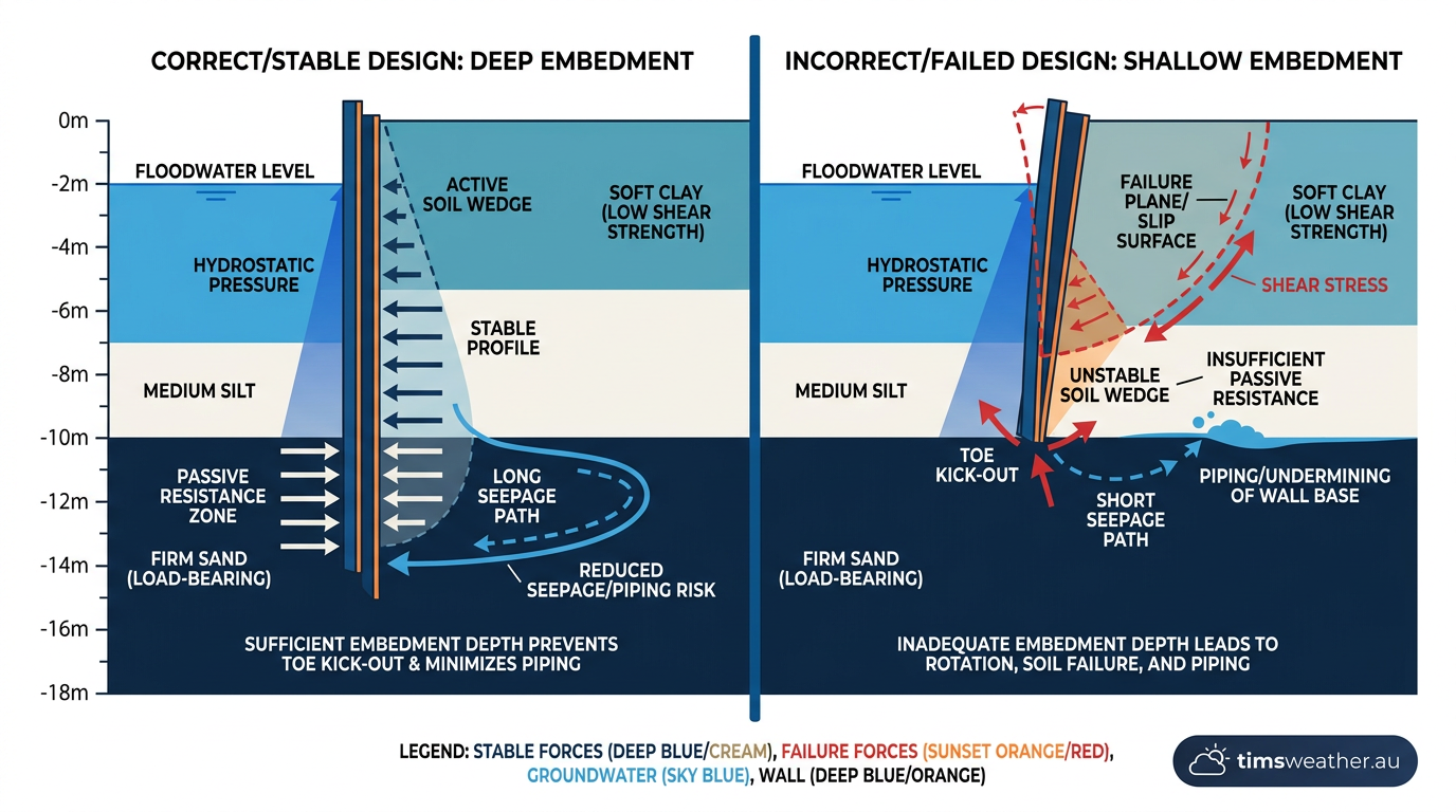
Post-disaster engineering reviews highlighted that the original design specifications drastically miscalculated the soil stability beneath the levees. Civil engineering demands accurate geotechnical data to ensure that foundations will not shift under load. Because the foundation soils in New Orleans were fundamentally weaker than the calculations suggested, the massive weight of the canal water pushed the walls sideways, shearing the soil along weak horizontal planes. The ground simply gave way, tearing the concrete barriers apart.
Inadequate sheet-pile embedment and seepage
Another major geotechnical failure involved the depth of the steel sheet piles used to anchor the floodwalls. The piles were driven to depths that engineers believed were sufficient to block water from seeping underneath. In reality, the depths were highly inadequate for the specific geological conditions of the region. At the London Avenue Canal, water pressure forced moisture through a highly permeable layer of sand situated just beneath a soft peat layer.
This subsurface water movement, known as seepage, increased the water pressure on the protected, dry side of the wall. The upward pressure eventually caused the soil to lose its structural integrity and burst upwards, a process known in geotechnical engineering as a blow-out. With the soil foundation compromised from below, the concrete floodwalls lost all lateral support and collapsed. This technical failure confirmed that the infrastructure collapse was a human engineering failure, not merely an unavoidable consequence of a strong storm.
The reality of hazard creep and urban vulnerability
The failure of the infrastructure also highlighted a dangerous phenomenon known as hazard creep. This concept describes a situation where the construction of flood protection systems encourages further urban development in low-lying, vulnerable areas. As more homes and businesses are built behind the levees, the potential damages increase exponentially if those protections eventually fail (YouTube).
For decades, the existence of the levee network gave residents a false sense of security. Neighbourhoods expanded into former marshlands that sat significantly below sea level. When the walls breached, these topographic bowls filled rapidly, trapping the newly developed communities under deep water. The engineering miscalculations meant that the exact structures designed to protect the population ultimately facilitated a much larger catastrophe by encouraging dense settlement in inherently unstable terrain.
The role of navigational channels in hurricane surge amplification
The Industrial Canal and surge funnelling
While foundation issues plagued the drainage canals, a different set of physical dynamics caused the catastrophic failures along the eastern side of the city. The region is intersected by several large maritime shipping routes, notably the Industrial Canal and other associated deep-water pathways. These long, straight, and deep waterways inadvertently acted as massive funnels for the incoming storm surge.
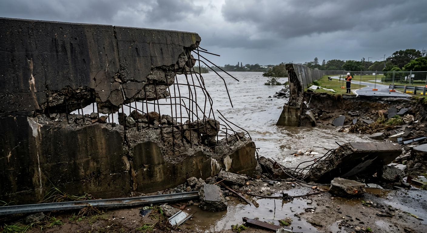
As the massive wind field drove water westward from the Gulf of Mexico, the navigational channels concentrated the incoming volume of water into a confined space. This funnelling effect dramatically amplified the surge height and concentrated wave energy.
The levees and floodwalls bordering the Industrial Canal were subjected to hydrodynamic forces far exceeding their design limits. Unlike the drainage canals, some sections of the Industrial Canal defences were heavily overtopped by the immense wall of water, leading to rapid and violent scouring that eroded the earthen embankments from the inside out.
Catastrophic impacts on the Lower Ninth Ward and St. Bernard Parish
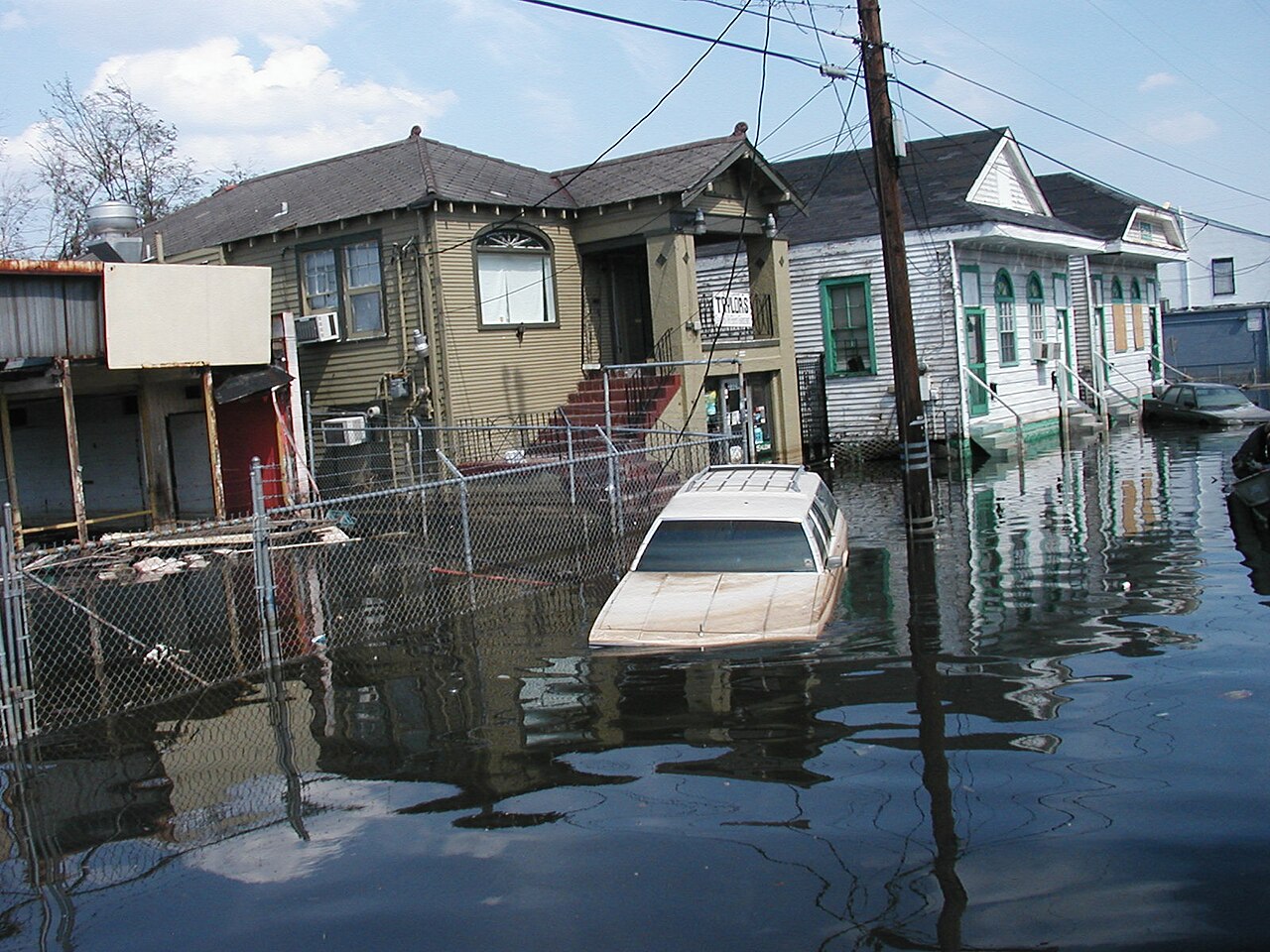
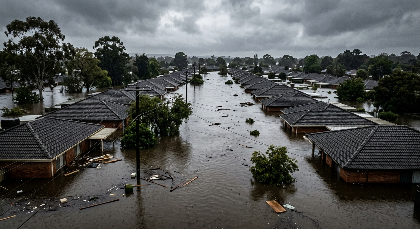
The failure of the infrastructure along the Industrial Canal resulted in some of the most severe inundation of the entire event. The adjacent Lower Ninth Ward and St. Bernard Parish were almost entirely flooded. The force of the water breaking through the barriers was so intense that it detached homes from their foundations, moved heavy vehicles, and completely destroyed entire city blocks in a matter of minutes.
Because these areas were in close proximity to the breach points and situated at very low elevations, the water rose incredibly fast, leaving residents with almost no time to escape to higher ground.
The rapid, violent inundation of these neighbourhoods became the tragic defining image of the disaster, illustrating the lethal consequences of inadequate coastal engineering adjacent to densely populated residential zones. The depth of the floodwaters in these districts meant that survival often depended on climbing onto roofs and awaiting rescue from the air.
Hydrodynamic forces and concrete armouring
The lack of concrete armouring on the interior slopes of many earthen levees allowed them to degrade rapidly once overtopped. In a well-designed system, an overtopped levee should still maintain its structural shape, acting as a submerged barrier that slows the flow of water. Without protective armouring, the fast-moving surge scoured the dirt away, completely erasing sections of the levee network.
Engineers noted that if the embankments had been reinforced with proper materials, the catastrophic volume of water entering the eastern part of the city could have been reduced. This specific oversight contributed heavily to the New Orleans hurricane infrastructure collapse, proving that earthen barriers alone are insufficient against the sheer hydrodynamic power of a severe tropical cyclone. The lack of resilience in these specific sections doomed the adjacent neighbourhoods to massive, unavoidable flooding.
Waterway Feature | Hydraulic Impact | Consequence for Defences |
|---|---|---|
Navigational Channels | Concentration of surge volume | Increased hydrostatic pressure beyond design capacity |
Shallow Continental Shelf | Upward deflection of water column | Unusually high storm surge elevation |
Unarmoured Earthen Embankments | Rapid dirt scouring and erosion | Complete structural erasure when overtopped |
Cascading failures: How infrastructure collapse stalled emergency response
Breakdown in Hurricane Katrina disaster management
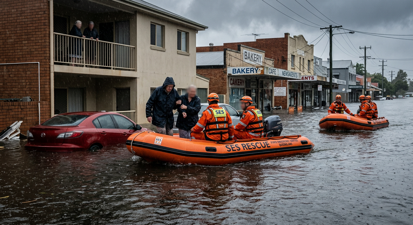
The physical destruction of the floodwalls triggered a secondary crisis. The Hurricane Katrina emergency response failure was directly tied to the suddenness and depth of the urban flooding. Local, state, and federal emergency plans relied on the assumption that the city would remain largely dry, allowing rescue vehicles to work through the streets. When 80 percent of the city filled with water, all standard disaster management protocols became instantly obsolete.
Police stations, fire departments, and hospitals were flooded, destroying communications equipment and severely limiting the ability of first responders to coordinate. Emergency vehicles were submerged, forcing rescue teams to rely entirely on small boats and helicopters. The systemic failure during Hurricane Katrina meant that the very agencies tasked with saving lives were themselves paralysed by the infrastructure collapse, leaving stranded residents to wait days for official assistance.
The Federal Emergency Management Agency (FEMA) coordination issues
The Federal Emergency Management Agency (FEMA) faced immense criticism for its slow and disorganised reaction to the crisis. While the scale of the disaster was historic, the agency was hampered by severe logistical bottlenecks and poor communication with state officials. Supplies of food, water, and medical equipment were staged too far from the affected zones or delayed by bureaucratic confusion. The flooding of major highway routes into the city meant that relief convoys could not reach the population centres.
The agency struggled to comprehend the full scope of the disaster in the immediate aftermath. Because power and telecommunications grids had failed entirely, situational awareness was extremely poor. Firsthand reports of the levee breaches took hours or even days to reach federal decision-makers, significantly delaying the deployment of active-duty military units and heavy-lift helicopters needed for mass evacuations. This lack of situational clarity compounded the suffering of those trapped in the floodwaters.
The human toll of systemic failure during Hurricane Katrina
The combination of structural failure and administrative delays created a desperate humanitarian situation. Tens of thousands of residents who had been unable or unwilling to evacuate before the storm were trapped in attics, on roofs, or in overwhelmed designated shelters like the Superdome. Conditions in these locations deteriorated rapidly as temperatures rose, sanitation facilities failed, and food supplies dwindled.
The disaster exposed deep societal vulnerabilities, as low-income residents and the elderly disproportionately bore the brunt of the impacts. The inability of emergency services to reach these populations quickly highlighted a profound failure in evacuation planning for those without personal transportation. The disaster management failures underscored a painful lesson that physical infrastructure and emergency readiness must be integrated smoothly to protect vulnerable urban communities.
Accountability and legal precedents post-Hurricane Katrina
The Interagency Performance Evaluation Task Force (IPET) findings
Following the disaster, the federal government convened the Interagency Performance Evaluation Task Force (IPET) to conduct an exhaustive, independent review of the levee failures. The IPET report was a watershed document in civil engineering, confirming that the New Orleans hurricane flood protection system was a system in name only. It was actually a disjointed collection of individual projects built to varying standards over several decades.
The task force concluded that the system had fatal design flaws, particularly regarding the use of I-walls in poor soil conditions. The IPET findings firmly rejected the initial narrative that the storm was simply too massive for any human-made structure to resist. Instead, it proved that the system failed at stress levels well below those it was theoretically designed to withstand. This forensic engineering analysis shifted the public understanding of the event from a natural disaster to a catastrophic human error.
The United States Army Corps of Engineers and design culpability
The United States Army Corps of Engineers (USACE) bore the primary responsibility for the design and construction of the federal levee system. The investigations revealed that the Corps had frequently prioritised cost-saving measures over structural resilience. By choosing shorter sheet piles and relying on inadequate soil testing, the agency inadvertently compromised the safety of the entire city.
The USACE eventually took responsibility for the engineering failures, a rare admission of fault from a federal agency. However, due to the Sovereign Immunity doctrine under the Flood Control Act of 1928, the federal government was largely protected from financial liability in the civil lawsuits brought by affected residents. The legal battles highlighted the difficulty of holding government agencies financially accountable for large-scale engineering failures, even when explicit design flaws are proven.
Grassroots advocacy and the New Orleans Levee District
In the wake of the disaster, grassroots organisations demanded systemic changes to how flood protection was managed. Groups highlighted that the real cause of the flooding was not just the weather, but the collapse of federally designed levees (Nonprofit Leadership Podcast). This advocacy helped keep the focus on engineering accountability rather than simply blaming natural forces.
Locally, the fragmented oversight of the New Orleans Levee District was completely overhauled. Before the storm, multiple levee boards managed different sections of the infrastructure, often with conflicting priorities and insufficient engineering expertise. The disaster prompted the state of Louisiana to consolidate these local boards into a single, unified authority with strict engineering requirements for its commissioners, ensuring a more scientific and coordinated approach to regional flood defence.
Modernising New Orleans: The post-hurricane flood protection analysis
Designing the Hurricane and Storm Damage Risk Reduction System
The complete destruction of the old levees mandated a total reimagining of the city's defences. The result of the extensive post-hurricane flood protection analysis was the authorisation of the Hurricane and Storm Damage Risk Reduction System (HSDRRS). This new network was designed to defend against a 100-year storm surge event, using modern geotechnical standards and integrated risk assessment models that the previous system severely lacked.
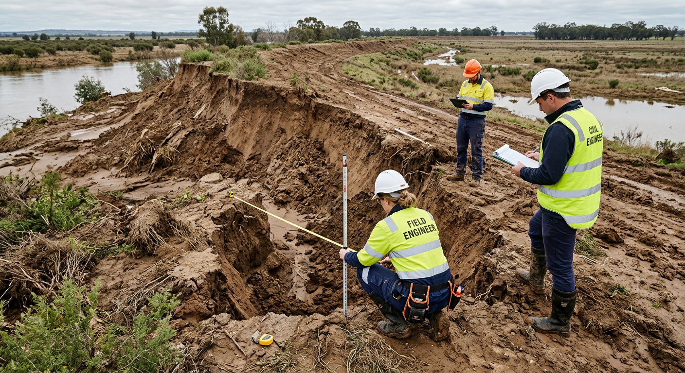
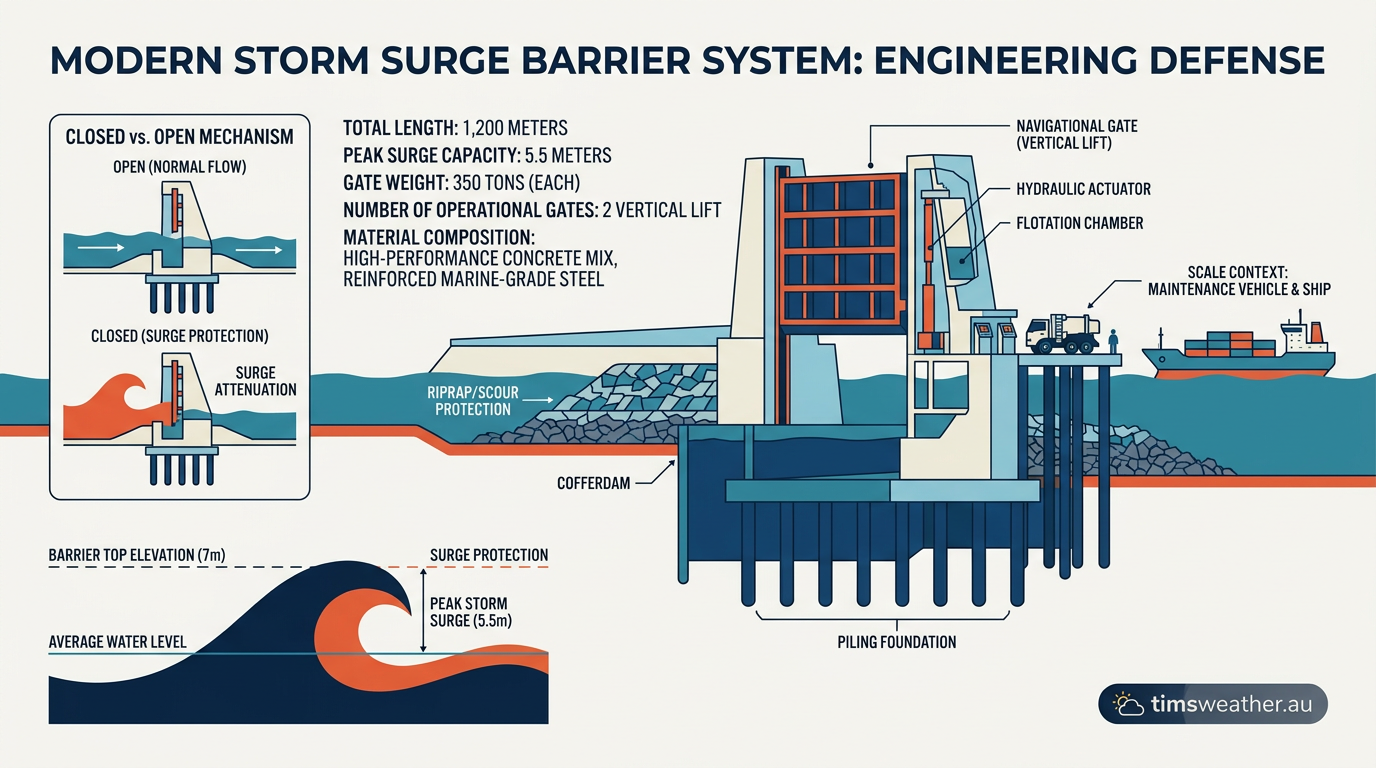
The federal government invested billions of dollars to build the HSDRRS. The project involved constructing massive new surge barriers, closing vulnerable outfall canals to the lake, and building the largest drainage pump stations in the world. The design philosophy shifted from merely building higher walls to creating a resilient, interconnected system that accounts for soil subsidence, sea-level rise, and the complex hydrology of the Gulf Coast.
Transitioning from I-walls to T-walls and advanced pumping grids
The most significant engineering change was the abandonment of the vulnerable I-wall design in favour of reinforced T-walls. T-walls have a wide concrete base supported by steel piles driven deep into the ground at opposing angles. This design directs the immense lateral force of the water downward into the stable soil, making the walls highly resistant to the bending and shear forces that destroyed the 17th Street Canal.
In addition to stronger walls, the new system addressed the vulnerability of the drainage canals by installing massive closure gates and permanent pump stations where the canals meet Lake Pontchartrain. During a hurricane threat, these gates are sealed to prevent storm surge from entering the city's interior, while the massive pumps pull rainwater out of the canals and push it into the lake, entirely eliminating the risk of the canals bursting from surge pressure.
Long-term lessons for global coastal infrastructure
The tragedy in New Orleans serves as a global case study for coastal cities facing rising sea levels and intensifying tropical cyclones. The primary lesson is that infrastructure must be evaluated as an interdependent system; a single weak point can compromise the entire network. Engineering designs must account for changing environmental conditions and worst-case scenarios, rather than relying on historical averages.
The transition from a fragile, fragmented levee network to the comprehensive HSDRRS represents a monumental achievement in civil engineering. It stands as a physical reminder of the cost of inadequate design and the absolute necessity of rigorous, science-based infrastructure planning to protect vulnerable urban environments from the devastating power of the ocean.
Last verified: 2026-09-23
Frequently asked questions
The levee failures stemmed from a combination of poor engineering design, inadequate construction, and foundation instability rather than just the storm surge. Multiple floodwalls and embankments collapsed before they were even overtopped, confirming that the protective infrastructure lacked the structural integrity required to withstand the immense pressure of the hurricane.
Source: en.wikipedia.org
Further reading and resources
Explore trusted articles, books, videos and other resources to go deeper on this topic.
nationalgeographic.comArticle
How Hurricane Katrina Became a Historic Catastrophe
In-depth coverage on Hurricane Katrina: The Failures Behind the Flood from nationalgeographic.com.
pmc.ncbi.nlm.nih.govReference
The Katrina disaster and its lessons - PMC
Background reference on Hurricane Katrina: The Failures Behind the Flood from pmc.ncbi.nlm.nih.gov.
youtube.comVideo
The Mind-Blowing Flaw That Flooded New Orleans - YouTube
Video coverage on Hurricane Katrina: The Failures Behind the Flood from youtube.com.
cato.orgArticle
Hurricane Katrina: Remembering the Federal Failures | Cato at Liberty Blog
In-depth coverage on Hurricane Katrina: The Failures Behind the Flood from cato.org.
worldvision.orgArticle
Hurricane Katrina: Facts, FAQs, and how to help - World Vision
In-depth coverage on Hurricane Katrina: The Failures Behind the Flood from worldvision.org.
news.research.gatech.eduReference
Twenty Years After Katrina: How Levee Failures Changed America
Background reference on Hurricane Katrina: The Failures Behind the Flood from news.research.gatech.edu.
biotech.law.lsu.eduReference
[PDF] What Went Wrong and Why
Background reference on Hurricane Katrina: The Failures Behind the Flood from biotech.law.lsu.edu.
nonprofitleadershippodcast.orgArticle
The Story Behind the Real Cause of Hurricane Katrina's Devastating ...
In-depth coverage on Hurricane Katrina: The Failures Behind the Flood from nonprofitleadershippodcast.org.
georgewbush-whitehouse.archives.govReference
Hurricane Katrina: Lessons Learned - Chapter One: Katrina in Perspective
Background reference on Hurricane Katrina: The Failures Behind the Flood from georgewbush-whitehouse.archives.gov.
en.wikipedia.orgReference
Hurricane Katrina - Wikipedia
Background reference on Hurricane Katrina: The Failures Behind the Flood from en.wikipedia.org.
Planning weeks ahead?
Check Australia's long-range seasonal outlook for rainfall, temperature and the climate drivers (ENSO, IOD, SAM, MJO) shaping the next three months.
View Australia's Seasonal Weather Forecast