
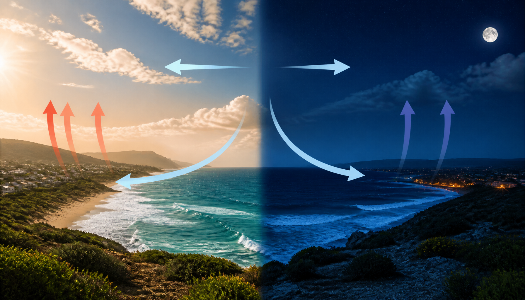
A sea breeze and land breeze system describes the diurnal wind cycle along coastlines, driven by differential heating between land and water. A sea breeze blows onshore during the day as the sun heats the land, while a land breeze blows offshore at night as the land cools rapidly.
Key takeaways
The daily cycle of coastal winds relies on the thermal energy differences between landmasses and large bodies of water.
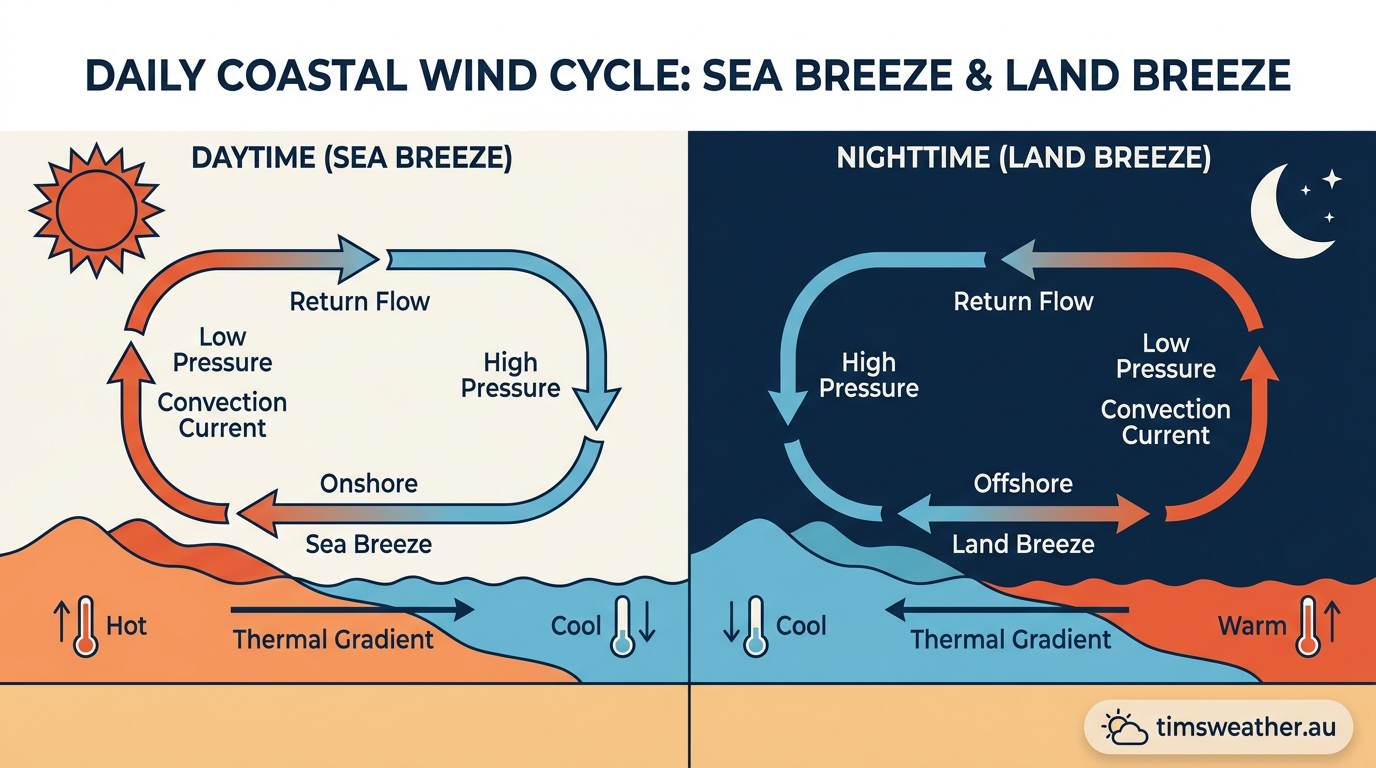
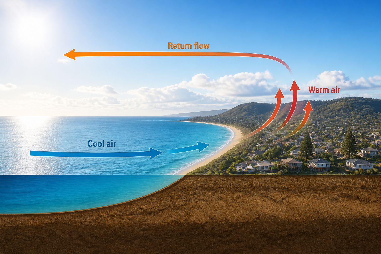
During the day, heating lowers surface pressure over land, drawing in cooler maritime air to form a sea breeze.
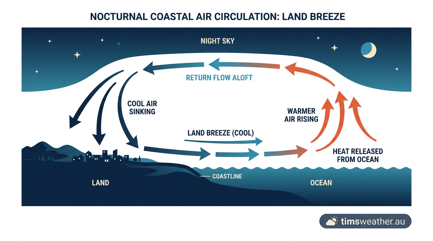
At night, the process reverses as land cools quickly, creating high pressure that pushes a land breeze offshore.
These mesoscale coastal weather systems directly influence local cloud formation, thunderstorm development and shoreline temperature moderation.
Recent atmospheric modelling indicates that warming oceans may alter the land-sea temperature contrast, potentially weakening these daily wind patterns.
The thermodynamics of the diurnal wind cycle
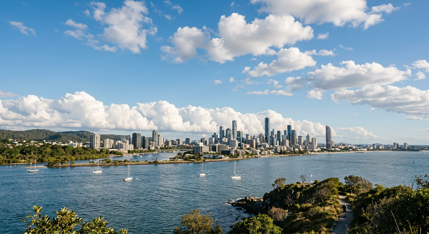
The continuous daily switch between onshore and offshore winds is fundamentally a thermodynamic process. While solar radiation delivers energy equally to land and ocean surfaces along a coastline, these two environments respond to that incoming thermal energy in vastly different ways.
Specific heat capacity and differential heating
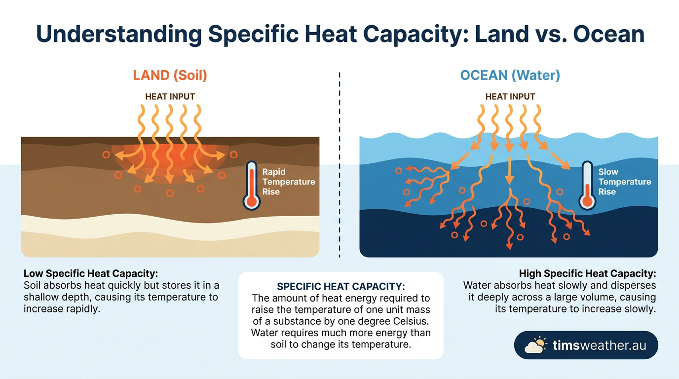
The primary driver of the coastal diurnal wind cycle is differential heating. Water has a very high specific heat capacity, meaning it requires a massive input of energy to raise its temperature by a single degree. In addition, the ocean is fluid, allowing internal convection to mix absorbed heat downward through a deep column of water. Soil, sand and rock have a much lower specific heat capacity and cannot circulate heat vertically. As a result, incoming sunlight concentrates entirely on the top few centimetres of the land surface.
According to the climate glossary published by MeteoSwiss, this stark difference in thermal properties forces the land surface to heat up rapidly during the daylight hours and lose its heat equally fast after sunset, establishing the temperature gradients required for local thermal circulation.
Pressure gradient force in action
Because temperature and atmospheric pressure are physically linked, this unequal heating distorts the pressure field along the coast. Warm land transfers heat to the air immediately above it through conduction. This air expands, becomes less dense and rises. As the air column lifts, surface atmospheric pressure over the land drops. Meanwhile, the cooler air over the ocean remains dense, maintaining a relatively higher surface pressure. The atmosphere always attempts to equalise differences in pressure, activating the pressure gradient force. This force physically pushes the heavier maritime air inland to fill the void, initiating the daytime wind.
The sea breeze and land breeze system explained
What is the sea breeze and land breeze system? It is a daily coastal wind cycle caused by land and water heating and cooling at different rates.
By day, the land warms faster than the sea, air rises over the coast, and cooler marine air moves inland. By night, the land cools faster, pressure rises over the coast, and the flow reverses offshore. This small circulation sits within the lower atmosphere and can be strong enough to shape cloud lines, coastal temperatures and local showers.
If you live near the coast, you can often feel the switch without a weather chart. A calm morning may turn breezy by late morning, then ease again after sunset as the land breeze begins. For a broader picture of how pressure and wind fit together, see how low-pressure systems form, how radiation fog forms and pressure gradient force.
The strength of each phase depends on the temperature contrast, cloud cover, season and the local coastline shape. A wide, open shoreline lets the breeze establish more cleanly than a sheltered bay or a steep escarpment. That is why the same coast can feel quite different from one day to the next.
How do sea breezes form during the day?
How do sea breezes form during the day? They form when land heats faster than the sea, so the air over the coast warms, rises and leaves a small area of lower pressure behind.
Cooler, denser air over the water then moves inland to replace it. That onshore flow is the sea breeze, and the process is driven by the pressure gradient force, the same basic push that moves air from higher pressure to lower pressure in many weather systems.
The breeze usually strengthens through the late morning and afternoon as the land-sea temperature contrast grows. If you are near an exposed coast, you may notice a sudden shift from light winds to a fresher onshore flow, often with a line of cumulus cloud just inland where the air starts to rise.
how radiation fog forms and how low-pressure systems form.
What causes the land breeze at night?
After sunset, the solar energy supply is cut off, and the physical mechanisms that drove the daytime winds rapidly dismantle, setting the stage for the nocturnal reversal.
Rapid nocturnal cooling and offshore winds
Without incoming solar radiation, the land begins to emit longwave infrared radiation back into space. Because soil has a low heat capacity, its surface temperature plummets. The air in contact with the ground cools via conduction, becoming dense and heavy. This subsidence creates a shallow dome of high pressure over the land.
The ocean, retaining its stored heat, remains relatively warm, causing the air above it to rise and form a weak area of low pressure. As explained in educational meteorology animations by Geography & Science, this causes the surface wind to reverse direction, flowing from the land out to sea.
At night, the clear, calm skies required for a strong offshore wind are also the exact conditions that explain how does radiation fog form over inland valleys, as rapid terrestrial cooling is essential for both phenomena.
Why land breezes are typically weaker
The nighttime offshore wind is almost always weaker and shallower than its daytime counterpart. The temperature drop at night rarely matches the extreme temperature spike caused by the midday sun, so the resulting pressure gradient is less intense. Also, the land breeze must fight against surface friction as it moves through trees, buildings and rough terrain before reaching the water, which bleeds away its momentum. The boundary layer for this nocturnal wind is often only 100 to 300 metres deep.
Comparing onshore and offshore winds
To fully understand the diurnal wind cycle, it is helpful to place the two phases side by side. While they operate on the same physical principles, their structures and impacts differ significantly.
Feature | Sea Breeze (Day) | Land Breeze (Night) |
|---|---|---|
Thermal Driver | Land heats faster than the ocean | Land cools faster than the ocean |
Pressure Pattern | Low pressure over land, High over sea | High pressure over land, Low over sea |
Flow Direction | Onshore (ocean to land) | Offshore (land to ocean) |
Typical Depth | 500 to 1,000 metres | 100 to 300 metres |
This daily atmospheric oscillation is a defining feature of coastal climates, actively preventing extreme heat accumulation during summer afternoons while keeping coastal nights slightly cooler than inland regions.
Bridging mesoscale meteorology and large-scale weather
While thermal circulation dictates the local wind direction, these coastal breezes do not exist in a vacuum. They constantly interact with planetary-scale forces and background weather systems.
The Coriolis effect and wind deflection
Though the pressure gradient force initiates the wind perpendicular to the coastline, the Coriolis effect begins to alter its path as the air moves over the Earth's rotating surface. Over the course of the afternoon, the Coriolis effect turns the incoming sea breeze.
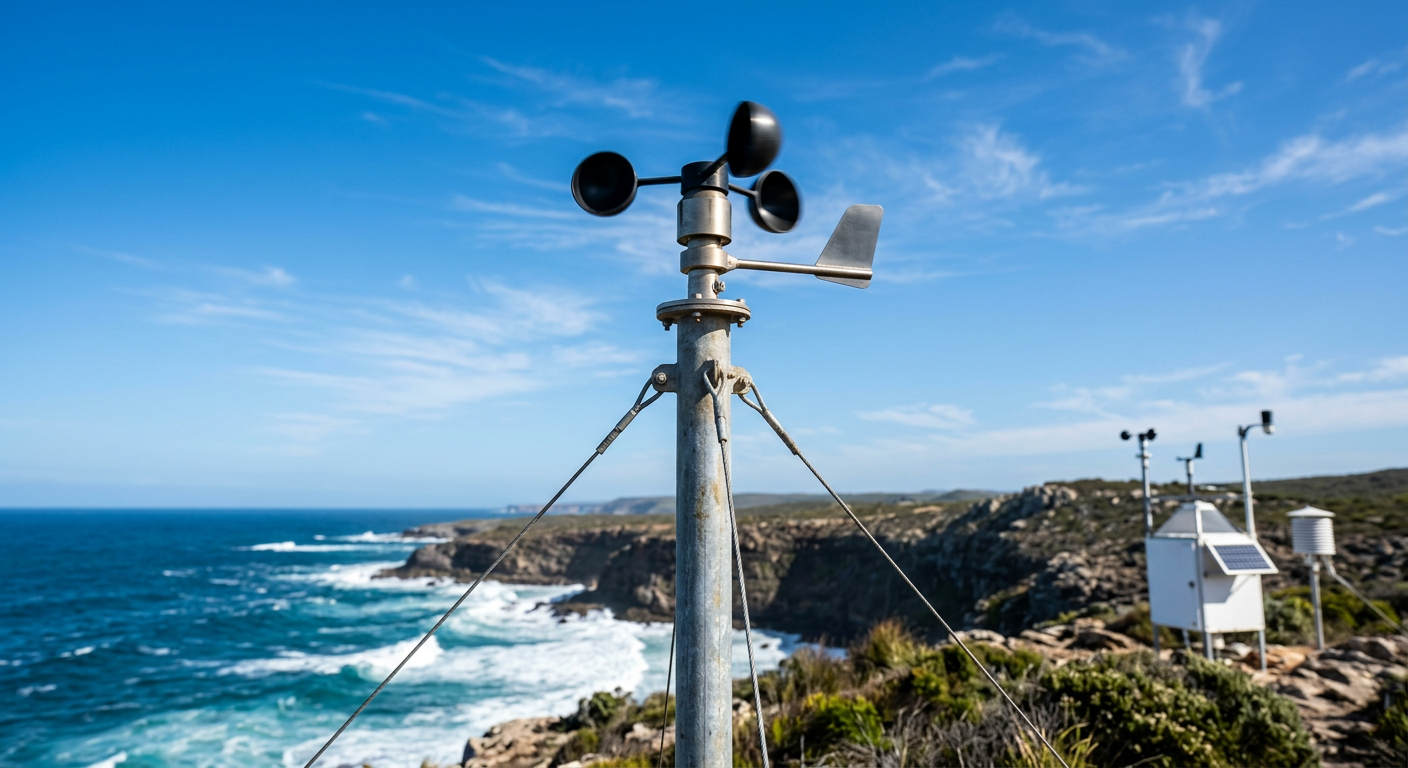
In the Northern Hemisphere, the wind is deflected to the right, causing a breeze that started out blowing directly inland to gradually veer and blow parallel to the shore by late afternoon. This turning motion is consistently documented in anemometer records from coastal weather stations operated by the National Weather Service.
Interaction with synoptic-scale winds
The strength of a local thermal breeze depends heavily on the synoptic background wind. If the large-scale atmospheric flow is dominated by strong high-pressure systems generating fierce regional winds, the local sea breeze may be completely overpowered or suppressed.
The World Meteorological Organization categorises these local winds as true mesoscale features, meaning they thrive best when the prevailing background winds are light. As highlighted for aviation safety by the PPL Club, pilots must anticipate these wind shifts when flying near coastlines, as the transition between synoptic winds and mesoscale thermal winds can cause unexpected turbulence and wind shear.
Unlike the massive Hadley cell, which is a permanent global circulation driven by equatorial heating, the coastal wind cycle is highly transient, living and dying with the daily path of the sun.
Impact of coastal breeze formation on local weather
The arrival of an onshore or offshore breeze does much more than change the wind direction; it fundamentally alters the local weather, triggering cloud formation and shifting air masses.
Convection initiation and thunderstorm development
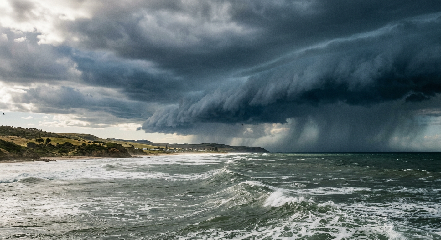
The sea-breeze front acts effectively as a miniature cold front. As the dense marine air surges inland, it undercuts the warm, unstable air sitting over the land, forcing it to rise rapidly. High-resolution NOAA satellite imagery frequently captures this process, displaying a distinct line of cumulus clouds marking the exact boundary of the inland penetration. For meteorologists studying how do thunderstorms form, the sea-breeze front is a primary focus for daytime convection. In humid environments, this rapid lifting often initiates severe afternoon thunderstorms.
When coastal winds interact with broader synoptic moisture pools, they can occasionally support the development of mesoscale convective systems, delivering heavy and concentrated rainfall to regions situated just inland from the coast.
Air quality and pollutant recirculation
Beyond natural weather phenomena, the diurnal wind cycle plays a critical role in urban air quality. During the day, the onshore wind pushes industrial and vehicle pollution inland. At night, the offshore breeze can drag those same pollutants back toward the city and out over the water, trapping them in a continuous recirculation loop. The behaviour of these trapped pollutants is heavily monitored by environmental agencies, as summarised in coastal weather updates by Tech International, highlighting the importance of breeze ventilation for public health.
How climate change alters the daily cycle of coastal winds
As global temperatures rise, the thermodynamic balance that drives coastal wind shifts is being altered, potentially changing weather patterns for millions of coastal residents.
Ocean warming and thermal contrast
Because the entire diurnal wind cycle relies on a stark temperature difference between land and water, shifting baselines can disrupt the system. A 2026 review in Nature Climate Change noted that rapid ocean warming is weakening the thermal contrast in some coastal cities. If the ocean starts the day exceptionally warm, the land must reach even higher temperatures to create the necessary pressure gradient for a sea breeze.
Advanced atmospheric projections modelled by researchers in ScienceDirect, using WRF-Chem and BEP+BEM simulations for the Metropolitan Area of Barcelona, indicate that climate change will significantly alter sea-land breeze dynamics by the year 2100. The models project that sea-land breezes will become faster directly along the coast but suffer from reduced inland penetration. This physical restriction of the boundary layer is forecast to trap urban emissions more tightly against the coastline, leading to significant increases in ground-level ozone and compounding urban air quality risks in a warmer world.
Sources
Publications | Climate Change Research Centre (unsw.edu.au)
Bureau of Meteorology weather reference (bom.gov.au)
Winds of change drive 'alarming' rate of ocean warming (unsw.edu.au)
NOAA weather and atmospheric science reference (psl.noaa.gov)
CSIRO atmospheric science reference (csiro.au)
Surface Ocean Currents (oceanservice.noaa.gov)
Causes of extreme sea levels (research.csiro.au)
The Coriolis Effect - Currents: NOAA's National Ocean Service Education (oceanservice.noaa.gov)
Last verified: 2026-09-24
Frequently asked questions
A sea breeze is an onshore wind that forms when land heats up faster than the ocean. As the land warms, the air above it rises, creating a low-pressure zone. Cooler, higher-pressure air from the sea then rushes inland to replace the rising air, resulting in a refreshing coastal breeze.
Source: bom.gov.au
Further reading and resources
Explore trusted articles, books, videos and other resources to go deeper on this topic.
youtube.comVideo
Land breeze and Sea breeze - YouTube
Video coverage on Sea Breezes and Land Breezes: The Daily Wind Switch from youtube.com.
meteoswiss.admin.chArticle
Land and sea breezes - MeteoSwiss
In-depth coverage on Sea Breezes and Land Breezes: The Daily Wind Switch from meteoswiss.admin.ch.
quora.comArticle
What happens during land breeze and sea breeze? - Quora
In-depth coverage on Sea Breezes and Land Breezes: The Daily Wind Switch from quora.com.
pplclub.co.ukArticle
The Pilot's Ultimate Guide to Land and Sea Breezes | PPL Club
In-depth coverage on Sea Breezes and Land Breezes: The Daily Wind Switch from pplclub.co.uk.
yachtingmonthly.comArticle
Land and Sea breeze basics: how to make the most of your coastal sailing
In-depth coverage on Sea Breezes and Land Breezes: The Daily Wind Switch from yachtingmonthly.com.
scribd.comArticle
Sea and Land Breeze Explained | PDF | Science & Mathematics - Scribd
In-depth coverage on Sea Breezes and Land Breezes: The Daily Wind Switch from scribd.com.
noaa.govReference
The Sea Breeze | National Oceanic and Atmospheric Administration
Background reference on Sea Breezes and Land Breezes: The Daily Wind Switch from noaa.gov.
mdpi.comArticle
Dynamics of the Land–Sea Breeze System and the Surface Current ...
In-depth coverage on Sea Breezes and Land Breezes: The Daily Wind Switch from mdpi.com.
community.windy.comArticle
Modelling of land and sea breezes - Windy Community
In-depth coverage on Sea Breezes and Land Breezes: The Daily Wind Switch from community.windy.com.
ck12.orgArticle
What is the difference between a land breeze and a sea breeze? - CK-12
In-depth coverage on Sea Breezes and Land Breezes: The Daily Wind Switch from ck12.org.
Planning weeks ahead?
Check Australia's long-range seasonal outlook for rainfall, temperature and the climate drivers (ENSO, IOD, SAM, MJO) shaping the next three months.
View Australia's Seasonal Weather Forecast