
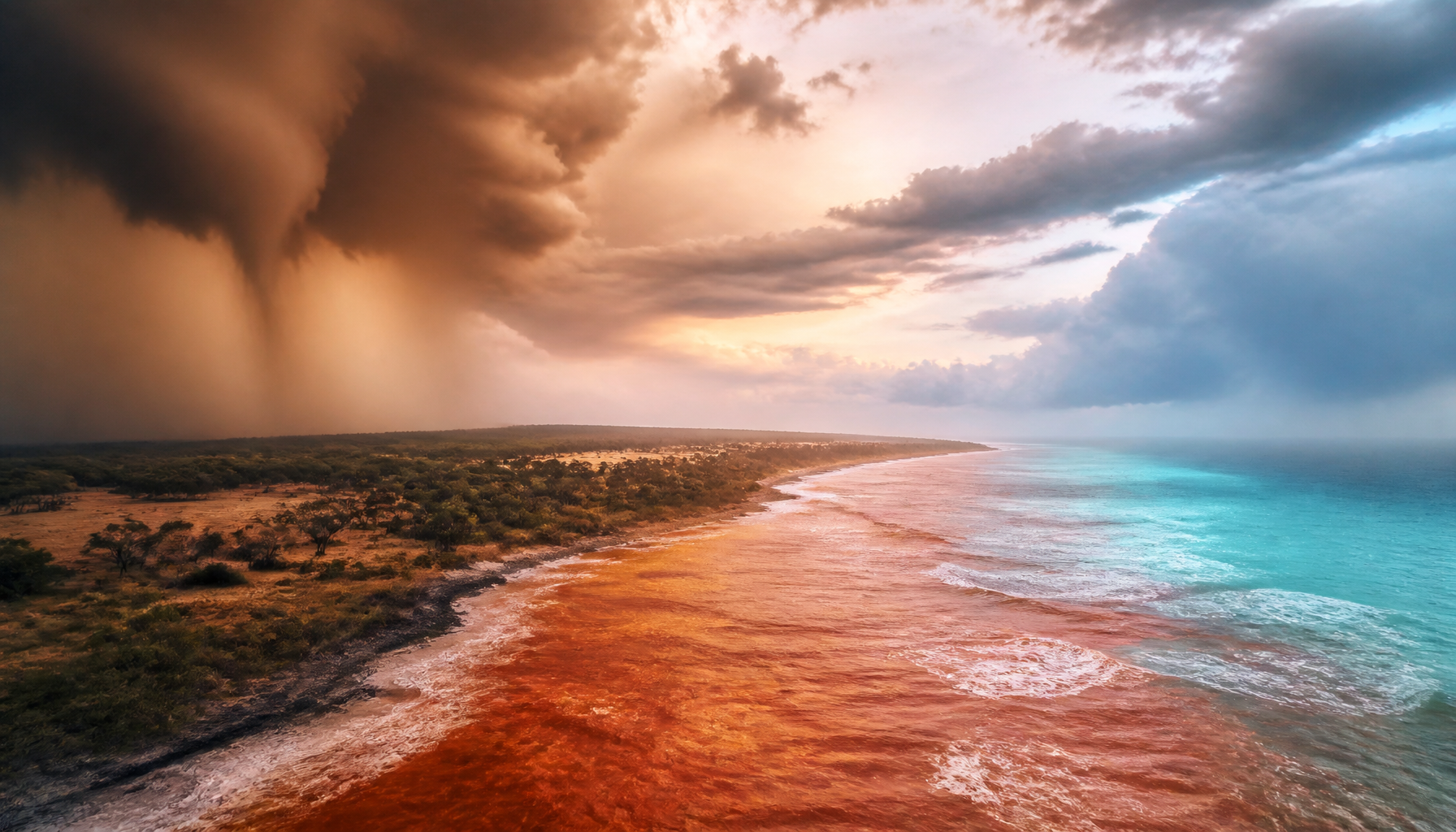
The Super El Niño Australia impact heading into the 2026/27 season is highly uncertain due to record-warm sea surface temperatures surrounding the continent. While the rapidly intensifying 2026 El Niño typically suppresses rainfall, anomalous warming in the Coral and Tasman Seas provides competing moisture sources, complicating the standard drought outlooks.
Key takeaways
The powerful 2026 El Niño typically brings drier and hotter conditions to eastern and southern Australia during winter and spring.
Record-warm coastal waters off New South Wales and Tasmania increase evaporation, potentially generating localised heavy rainfall despite broader dry trends.
A positive Indian Ocean Dipole is forecast to develop in spring 2026, which would reinforce the drying effect across southern and central states.
Fore
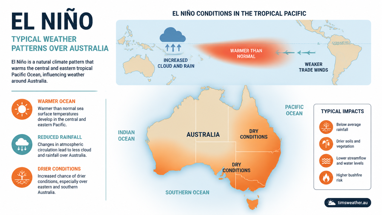
Diagram illustrating the standard Super El Niño Australia impact on seasonal rainfall and temperatures.
Where the climate drivers stand right now (late August 2026)
The starting point for the 2026/27 wet season is unusual on two fronts at once: one of the strongest El Niño events on record in the Pacific, and near-record warm water sitting right against the Australian coast.
El Niño: the Bureau of Meteorology's ENSO Wrap-Up of 11 August 2026 describes El Niño as firmly established and still intensifying, with the relative Niño3.4 index near +2.20 °C and record-high upper-ocean heat content beneath the equatorial Pacific (www.bom.gov.au).
How strong it may get: the NOAA Climate Prediction Center's 13 August 2026 update puts the chance of a very strong event above 90 per cent, and gives roughly a 69 per cent chance of a historic event exceeding +2.5 °C by late 2026 (www.cpc.ncep.noaa.gov).
Indian Ocean Dipole: officially neutral, but the index has sat above the +0.4 °C threshold for about three weeks and most models favour a positive IOD becoming established through spring. A positive IOD would push in the same drying direction as El Niño.
Local sea surface temperatures: waters around parts of the country, especially off southern New South Wales and Tasmania, are running about 2 to 3 °C above average against a backdrop of record global ocean warmth. That is the moisture source no previous strong El Niño had to this degree.
In plain terms, the Pacific is telling Australia to dry out while the water off the coast is telling the atmosphere it has plenty of moisture to work with. For a wider view of how these drivers combine, see our explainer on Australian climate drivers and the current Australia seasonal weather forecast.
Analysing the Super El Niño Australia impact
To comprehend how current climate variables interact, we must first look at what the El Niño Southern Oscillation (ENSO) traditionally brings to the continent. The Bureau of Meteorology notes that El Niño shifts Australian rainfall and temperature patterns toward drier conditions in winter and spring, with the strongest climate influence usually occurring from June to December (www.bom.gov.au). The classical impacts involve below-average winter and spring rainfall across eastern and southern areas, paired with higher daytime temperatures and clearer nights.
Since 1900, Australia has experienced 28 distinct El Niño events, each leaving a distinct mark on agricultural and water resources (en.wikipedia.org). During a standard event, the easterly trade winds weaken or reverse, allowing warm water that normally pools near Australia to shift eastward toward South America. This leaves cooler waters off the Australian east coast, which in turn reduces evaporation and strips the atmosphere of the moisture needed to form widespread rain clouds. The result is often a longer frost season, a delayed onset to the northern wet season, and fewer tropical cyclones crossing the coast.
A recent high-impact benchmark is the 2015 to 2016 El Niño. During this period, Australia recorded its third-driest spring on record. Initially, from April to August 2015, some inland areas of Western Australia, New South Wales and eastern Victoria actually received above-average rainfall. However, by spring, the drying influence strengthened significantly, and an early heatwave in October severely reduced crop production across the Murray-Darling Basin (www.bom.gov.au).
A "Super" El Niño occurs when sea surface temperature anomalies in the central and eastern Pacific soar well above typical thresholds. During these intense phases, global weather patterns are heavily distorted, leading to extreme weather events that can threaten global agriculture, fisheries, and water supplies (www.wri.org). Yet, current observations show a deviation from the historical norm: the waters directly surrounding Australia remain anomalously warm, setting up a clash of climate drivers.
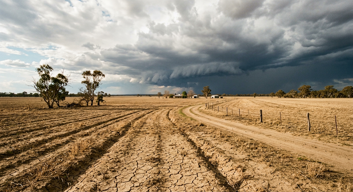
A dry farm field in Australia showing the drought effects of El Niño alongside building storm clouds.
Could record-warm Australian waters disrupt the expected Super El Niño dry season?
Yes, record-warm sea surface temperatures can disrupt the standard El Niño dry season by acting as a substantial local moisture source. Marine heatwaves increase evaporation, injecting latent heat and humidity into the lower atmosphere. If a passing weather system taps into this enriched moisture, it can trigger intense, isolated rainfall events that locally offset the broader drought conditions normally associated with a strong El Niño.
This localised anomalous warming fundamentally changes how atmospheric circulation shifts over the continent. Normally, the descending branch of the Walker Circulation sits squarely over eastern Australia during El Niño, suppressing convection and promoting high pressure. However, widespread marine heatwaves in the Coral Sea and Tasman Sea fight this suppression. When ocean waters reach near-record temperatures, the resulting evaporation increases atmospheric instability. For meteorologists watching high and low pressure systems Australia explained on synoptic charts, this added moisture can turn a weak trough into a significant rain event.
Moisture convergence from the Tasman and Coral Seas provides the necessary fuel for late-season storm activity. When easterly winds push this humid marine air inland over the Great Dividing Range, it is forced upward. This orographic lifting cools the air to its dew point, forcing condensation. Understanding dew point vs humidity is vital here, as higher dew points indicate a greater raw volume of water vapour available to convert into precipitation. Consequently, eastern coastal strips and adjacent ranges may still record average or even above-average rainfall totals while communities further inland suffer severe deficits.
Climate driver interaction: The Indian Ocean Dipole and ENSO
The Pacific Ocean does not control Australian weather in isolation. The Indian Ocean Dipole (IOD) plays a massive role in shaping winter and spring rainfall, particularly for southern and central regions. The IOD is defined by the difference in sea surface temperatures between the western Indian Ocean and the eastern Indian Ocean near Indonesia. When discussing the broader outlook, forecasters must weigh the tug-of-war between the Indian Ocean Dipole, ENSO, and localised marine anomalies.
During a positive IOD phase, cooler waters dominate the ocean off north-west Australia while warmer waters pool near the Horn of Africa. This configuration reduces the formation of north-west cloud bands, effectively cutting off a major moisture supply that normally feeds rain systems traversing the continent. When a positive IOD occurs simultaneously with an El Niño event, the drying effects are typically compounded, leading to severe rainfall deficiencies across the southern half of the country (www.bom.gov.au). The combined force of these two climate drivers creates a formidable barrier to incoming weather systems.
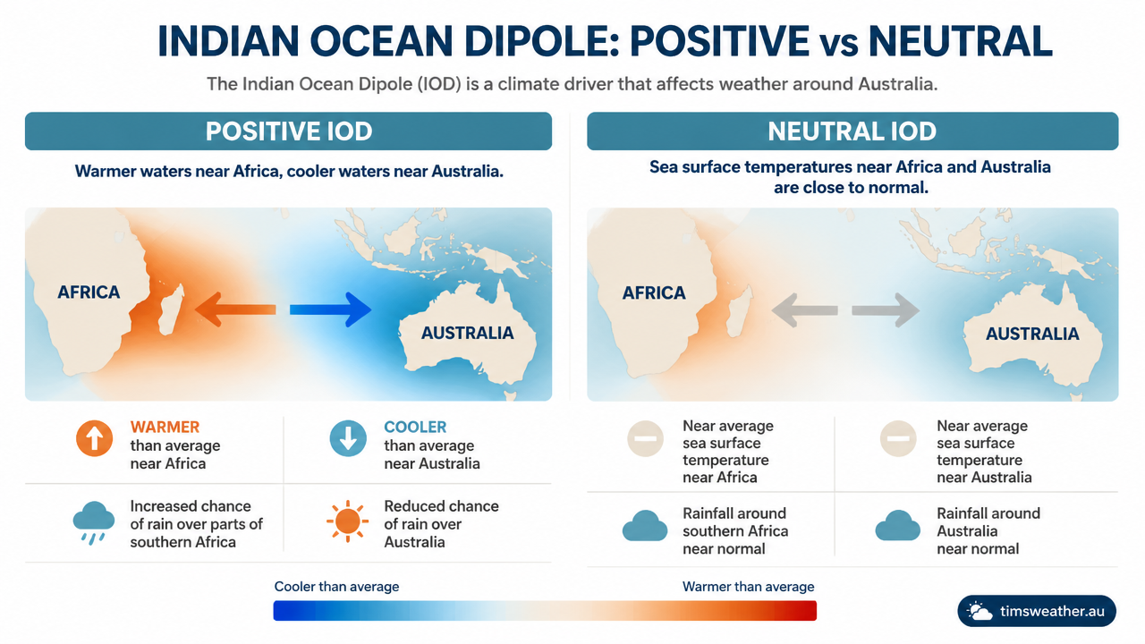
Chart comparing positive and neutral Indian Ocean Dipole phases and their sea surface temperature anomalies.
However, the current thermal state of the oceans introduces uncertainty. The Bureau of Meteorology closely monitors the interaction between these large-scale drivers and local sea surface conditions. If the IOD remains neutral but coastal waters stay unusually warm, the flow of Australian air masses can become highly modified. Cool, dry air moving over a boiling ocean rapidly absorbs heat and moisture, fundamentally altering its physical properties before it reaches the coast.
Climate Driver
Typical Impact
Anomalous Interaction Effect
El Niño (ENSO)
Suppresses winter and spring rainfall in eastern Australia.
Drying effect may be locally masked if warm coastal waters increase humidity.
Positive IOD
Reduces rainfall across southern and central Australia.
Reinforces El Niño drought, making heavy rain events highly improbable.
Marine Heatwaves
Raises local air temperatures and humidity.
Provides fuel for isolated heavy thunderstorms, despite high atmospheric pressure.
Southern Annular Mode (SAM)
Shifts westerly winds north (negative) or south (positive).
A positive SAM during El Niño can pull moist ocean air onshore, causing surprise rain.
How marine heatwaves change rainfall variability and storm risk
The decoupling of typical ENSO-rainfall correlations caused by extreme oceanic warming is a prominent topic among climate scientists. Historically, an El Niño declaration practically guaranteed widespread agricultural hardship. Today, the intense warming in the Coral Sea is shifting those certainties. If you examine the Australian Cyclone Wet Season Outlook, the presence of elevated sea surface temperatures means that while the total number of cyclones might be reduced by El Niño wind shear, any storm that does manage to develop has access to an immense reservoir of thermal energy.
This dynamic heavily impacts regional farming. In the Western Australian wheat belt, producers depend entirely on winter fronts moving off the Indian Ocean. If those waters are warm, the fronts carry sufficient moisture. Conversely, the Murray-Darling Basin relies on spring rain to finish winter crops and prepare soil for summer planting. Here, the conflicting signals of a dry El Niño descending air mass and moist coastal easterlies create high rainfall variability. A single intense thunderstorm fed by marine heatwave evaporation can dump a month's worth of rain on one property while leaving the neighbouring farm completely dry.
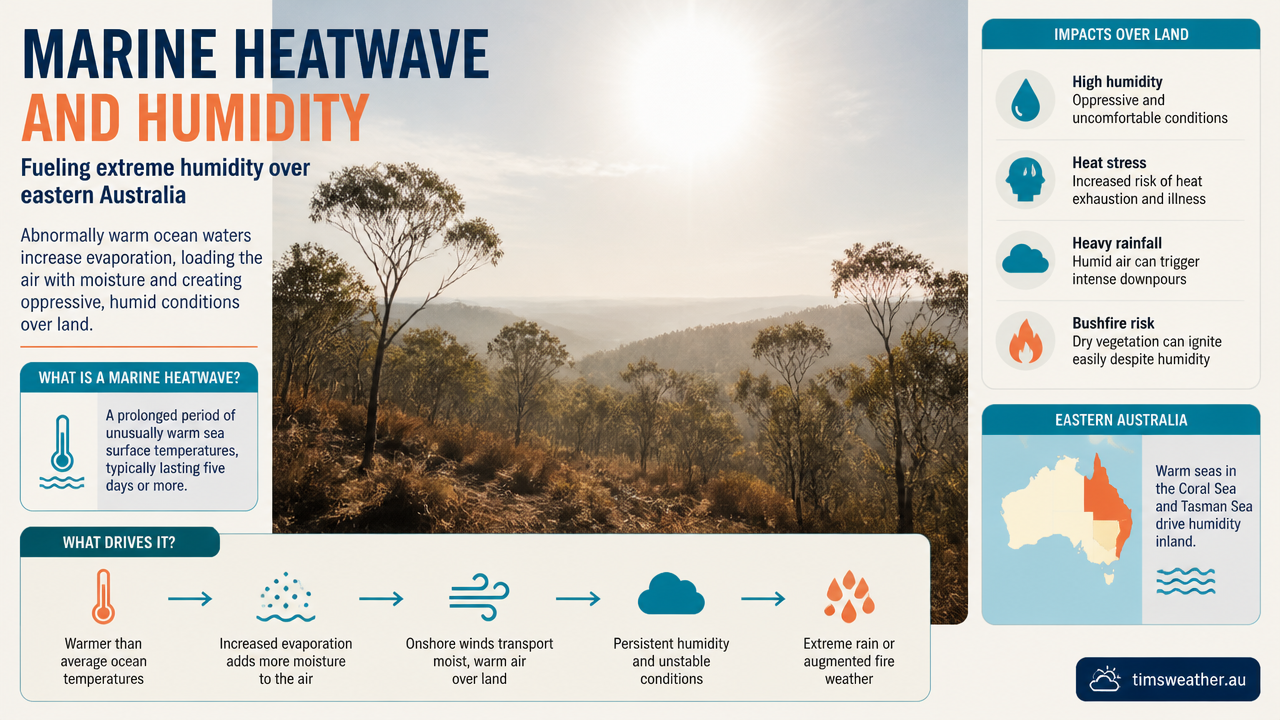
Humid and hazy bushland in eastern Australia highlighting summer bushfire risk conditions.
For eastern seaboard communities, this moisture has serious implications for summer bushfire risk management. While El Niño increases daytime temperatures and dries out forest fuels, high coastal humidity can complicate fire behaviour. Humid air can slow the spread of low-intensity fires, but if a strong cold front sweeps through, it can interact with the humid, hot air to produce dry lightning. This phenomenon acts as an ignition source across vast, inaccessible forest tracts, forcing emergency agencies to plan for both intense heatwaves and rapid-onset thunderstorm activity.
Predictive uncertainty and the Bureau of Meteorology outlook
Predicting the exact outcome of a Super El Niño is highly complex because historical models are struggling to account for the modern background state of the climate. The historic drought-only narrative often fails to capture the nuances of climate change-influenced variability in Australian weather patterns. Climate models from CSIRO and the Bureau of Meteorology highlight variations such as the 'Modoki' El Niño, where the maximum ocean warming occurs in the central Pacific rather than the eastern Pacific (en.wikipedia.org). This specific spatial pattern alters the position of atmospheric circulation cells, slightly shifting where the dry descending air lands over Australia.
Because El Niño is a risk amplifier for dry and hot conditions rather than a deterministic forecast of drought, forecasters stress the importance of probability. Current Bureau of Meteorology climate guidance indicates that when El Niño is established, rainfall is more likely to be below average across parts of the south and east, while temperatures are strongly favoured to be above average (www.bom.gov.au). However, this does not rule out heavy rain events. The Great Barrier Reef weather observations confirm that local sea surface temperatures remain elevated, feeding continuous energy into the boundary layer.
Ultimately, the presence of record-warm waters offshore means that while the broader synoptic setup favours drought, the local environment is primed for rapid convection. If a trough triggers atmospheric instability, the resulting weather can easily bypass the broader dry expectations. Australian residents, particularly those in fire-prone or flood-prone regions, must prepare for a season defined by heightened extremes on both ends of the spectrum.
Three scenarios for the 2026/27 wet season
Nobody can forecast a whole season in detail months ahead. What forecasters can do is sketch the plausible pathways and describe what each would feel like on the ground. These are scenarios, not forecasts.
Scenario one: El Niño wins (most likely)
The Pacific signal dominates, a positive Indian Ocean Dipole locks in through spring, and the descending air over eastern Australia wins the argument. Spring 2026 turns hot and dry, the northern wet season starts late and slowly, and rainfall deficits build through the southern and eastern cropping belts. Farmers face reduced spring finishing rain in the Murray-Darling Basin, water authorities watch storage draw-down through summer, and fire agencies plan for an early and long season. The warm coastal water still shows up, mostly as humid, uncomfortable heat rather than rain.
Scenario two: the tug-of-war (plausible)
Inland Australia dries out as expected, but the coastal fringe does not read the script. Easterly flow over abnormally warm water feeds moisture into troughs and east coast lows, so coastal New South Wales, south-east Queensland and eastern Victoria record near-average or even above-average totals in short, sharp bursts while country 200 km inland stays in deficit. Seasonal averages look deceptively reasonable, but the rain arrives in a handful of events, which is poor for pasture and soil moisture and awkward for flood-prone catchments. This split outcome is where the current ocean state makes 2026/27 genuinely different from 1997/98 or 2015/16.
Scenario three: ocean heat wins locally (least likely)
Marine heatwave conditions persist or intensify, and the atmosphere over the Tasman and Coral Seas becomes unusually unstable. Total system numbers stay low, in line with El Niño, but the systems that do form are wetter and more intense, delivering flash flooding, damaging thunderstorms and possibly one or two high-impact tropical systems late in the season. In this pathway seasonal rainfall totals may end up near or above average in places while drought persists elsewhere, and the main risk shifts from long dryness to short, extreme events. Anyone tracking storm risk should follow our rainfall forecast and cyclone and wet season outlook pages as the season develops.
What to watch next
Rather than waiting for a single seasonal verdict, track the same indicators forecasters do:
BOM ENSO Wrap-Up, updated fortnightly, for the official El Niño status and any shift in the outlook.
Relative Niño3.4 anomaly, to see whether the event keeps strengthening past +2.5 °C or begins to plateau.
Southern Oscillation Index (SOI), a sustained strongly negative value confirms the atmosphere is coupled to the ocean signal.
Indian Ocean Dipole index, because a confirmed positive IOD would tilt the odds firmly towards scenario one.
Southern Annular Mode (SAM), since positive SAM spells can push moist easterlies onto the east coast and produce surprise rain.
MJO phase, which controls bursts of tropical moisture and often decides when the northern wet season finally kicks off.
Coastal sea surface temperature anomalies, the fuel gauge for the marine heatwave side of the tug-of-war. Growers can follow the practical implications on our farmers weather Australia hub.
Further reading
Frequently asked questions
Yes, warmer surrounding seas can add atmospheric moisture and occasionally soften the typical dryness linked to El Niño. However, they rarely cancel it out entirely. A strong El Niño generally continues to suppress rainfall across eastern Australia, particularly if the Indian Ocean Dipole also shifts into a positive phase.
Source: bom.gov.au
Further reading and resources
Explore trusted articles, books, videos and other resources to go deeper on this topic.
pbs.orgArticle
El Nino is here. It'll be big, bad and costly, scientists fear - PBS
In-depth coverage on Could record-warm Australian waters disrupt the expected Super El Niño dry season? from pbs.org.
bbc.comArticle
El Niño has begun, scientists say, and could bring record heat - BBC
In-depth coverage on Could record-warm Australian waters disrupt the expected Super El Niño dry season? from bbc.com.
bom.gov.auReference
El Niño: what it means for Australia's climate | The Bureau of Meteorology
Background reference on Could record-warm Australian waters disrupt the expected Super El Niño dry season? from bom.gov.au.
interactive.carbonbrief.orgArticle
Explainer: How the 'super El Niño' will reshape the world's weather
In-depth coverage on Could record-warm Australian waters disrupt the expected Super El Niño dry season? from interactive.carbonbrief.org.
youtube.comVideo
Australia Just Hit Super El Niño +2.0°C! What Happens Next? - YouTube
Video coverage on Could record-warm Australian waters disrupt the expected Super El Niño dry season? from youtube.com.
wrrc.arizona.eduReference
The Global Impacts of El Niño | Water Resources Research Center
Background reference on Could record-warm Australian waters disrupt the expected Super El Niño dry season? from wrrc.arizona.edu.
en.wikipedia.orgReference
Effects of the El Niño–Southern Oscillation in Australia - Wikipedia
Background reference on Could record-warm Australian waters disrupt the expected Super El Niño dry season? from en.wikipedia.org.
wri.orgArticle
How Might a 'Super El Niño' Affect Food, Forests and Water?
In-depth coverage on Could record-warm Australian waters disrupt the expected Super El Niño dry season? from wri.org.
noaa.govReference
Understanding El Niño & ENSO - NOAA
Background reference on Could record-warm Australian waters disrupt the expected Super El Niño dry season? from noaa.gov.
Southern hemisphere monitoring - BoM
Background reference on Could record-warm Australian waters disrupt the expected Super El Niño dry season? from bom.gov.au.
Planning weeks ahead?
Check Australia's long-range seasonal outlook for rainfall, temperature and the climate drivers (ENSO, IOD, SAM, MJO) shaping the next three months.
View Australia's Seasonal Weather Forecast