
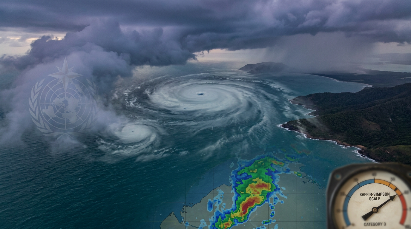
The physics behind the Fujiwhara effect and interacting cyclones involve two distinct low-pressure systems rotating around a shared centre of mass. When tropical cyclones move within a specific distance of each other, they lock into a binary interaction that drastically alters their expected paths and introduces high uncertainty into atmospheric forecasts.
Key takeaways
Binary cyclones influence each other when their outer circulations overlap, typically within 1,400 kilometres.
The interaction causes both systems to orbit around a shared mathematical point known as the barycenter.
Track prediction becomes highly complex because standard atmospheric steering currents are disrupted.
While merging cyclones can occur, the stronger system usually shears the weaker one apart rather than combining into a single mega-storm.
The Discovery of Binary Cyclones
Meteorologists have long known that atmospheric vortices do not operate in isolation. The formal scientific description of this phenomenon dates back to a foundational 1921 paper by Japanese meteorologist Sakuhei Fujiwhara (en.wikipedia.org). He observed the behaviour of water vortices and translated those fluid dynamics to the atmosphere, demonstrating that two distinct cyclonic systems will exert a mutual pull when they draw near.
During the early and mid-twentieth century, empirical observations of mutually orbiting cyclones relied heavily on scattered ship reports and island barometers. Forecasters plotting these systems by hand often struggled to determine if sudden track changes were caused by large-scale atmospheric steering currents or by a local binary interaction of cyclones. The lack of continuous visual data meant that many encounters went undocumented over open ocean basins.
What is the Fujiwhara effect and interacting cyclones?
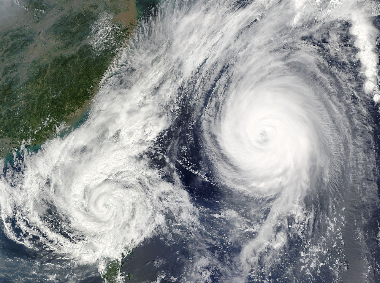
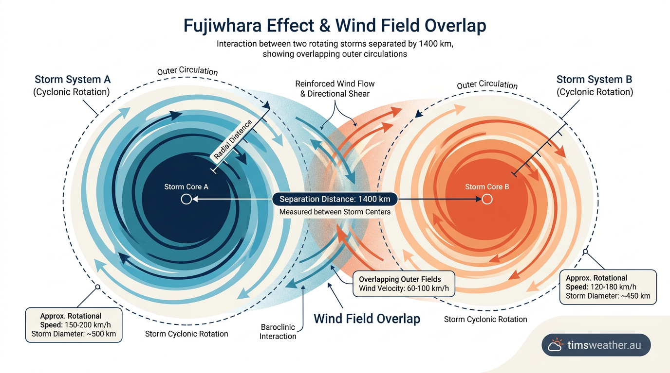
The Fujiwhara effect and interacting cyclones occur when two tropical cyclones come within approximately 1,400 kilometers of each other. This binary interaction causes the cyclones to rotate around a common center of mass. Depending on their relative intensity and distance, the cyclones may move toward each other, merge into a single entity, or undergo complex track deflections.
Transitioning to Satellite Observation
The advent of modern geostationary satellite imagery transformed the understanding of tropical cyclone dynamics. Meteorologists can now watch in real time as two independent systems approach each other and begin their orbital dance. Modern satellite data confirms that the Fujiwhara effect is a relatively common outcome when active storm seasons produce multiple systems in close succession across a single basin. These visual confirmations aligned perfectly with Fujiwhara's century-old fluid equations.
How Atmospheric Steering and Fluid Dynamics Drive the Interaction
To understand how cyclones interact, meteorologists look to the conservation of angular momentum. Tropical cyclones are large masses of rapidly rotating air. When they travel through an environment with weak background winds, their own massive wind fields become the dominant force in the local atmosphere. If two systems drift close enough, the outer circulation of one cyclone begins to blow against the outer circulation of the other.
Widely cited meteorological guidance places the standard Fujiwara distance at roughly 1,400 kilometres (about 850 miles) for large tropical cyclones (www.13newsnow.com). For smaller systems, this distance must be much shorter for any meaningful interaction to occur. The exact threshold is highly storm-dependent and relies on the radial extent of the wind fields.
When the distance threshold is breached, standard upper-level steering breaks down. Usually, cyclones are pushed along by large high-pressure systems or drawn poleward by passing troughs. In a binary interaction, the storms begin to steer each other. This local steering overrides the background atmospheric flow, causing the cyclones to deviate sharply from their expected tracks.
Finding the Barycenter
The pivot point around which both cyclones rotate is called the barycenter. In meteorological fluid dynamics, the barycenter represents the centre of mass between the two vortices. If the two cyclones are identical in size and intensity, the barycenter sits exactly halfway between them, and the storms will orbit each other symmetrically.
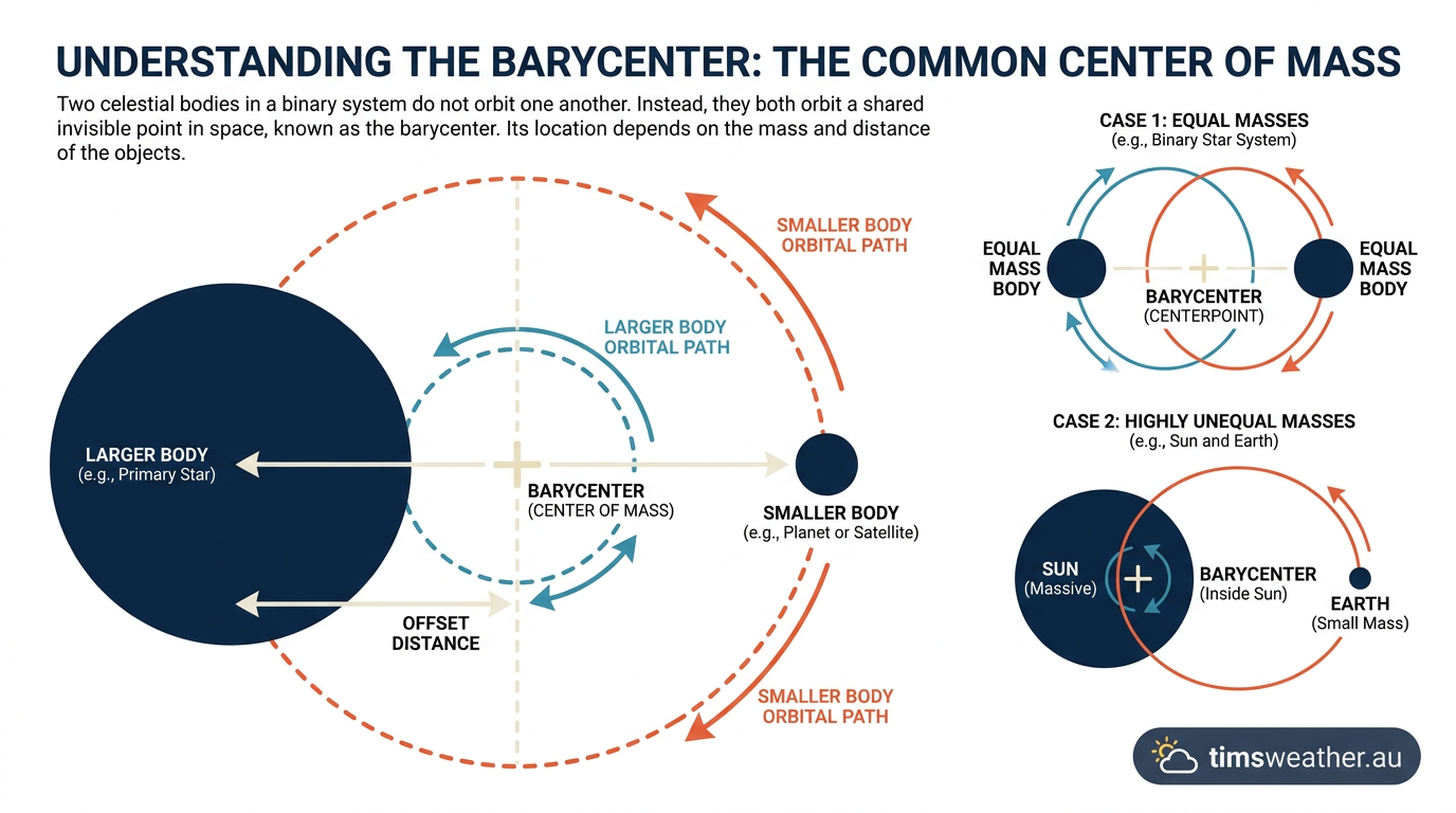
In reality, symmetrical binary cyclones are exceptionally rare. One system is almost always larger or more intense than the other. The stronger cyclone exerts a greater gravitational-like pull on the environment, dragging the barycenter closer to its own cyclone vortex core. As a result, the smaller cyclone orbits rapidly around the larger one, while the larger cyclone only wobbles slightly off its original path.
The Role of the Coriolis Effect
The underlying rotation of the Earth also shapes the outcome. Driven by the Coriolis effect, the mutual rotation during the capture phase is counter-clockwise in the Northern Hemisphere and clockwise in the Southern Hemisphere. The storms will continue to rotate around the barycenter until either their internal structure breaks down or an external atmospheric force pulls them apart.
Stages of Binary Cyclone Systems
The interaction between two cyclones is not a static event. It progresses through several distinct stages as the systems move through the ocean basin. While no two interactions are identical, fluid dynamics dictate a predictable sequence of events when the required conditions are met.
Interaction Stage | Cyclonic Behavior | Likely Outcome |
|---|---|---|
Approach | Outer wind fields begin to overlap | Forward speed slows as local steering competes with background flow. |
Capture | Systems lock into shared rotation | Cyclones begin to orbit around a mutual barycenter. |
Absorption | Stronger cyclone dominates the center | The weaker system is heavily sheared and structurally integrated. |
Escape | Environmental steering takes over | Cyclones separate and resume independent trajectories. |
Distinguishing Between Interaction and Extratropical Transition
Meteorologists must carefully separate true binary interaction from other structural changes. As tropical cyclones move toward the poles, they often encounter strong jet streams or cooler ocean waters. This environment can force a storm to transition into an extratropical system.
If two cyclones are interacting while simultaneously undergoing transition, the physics become incredibly complex. A storm losing its tropical characteristics expands its wind field significantly, which can suddenly decrease the distance required for a Fujiwhara capture. Forecasters must determine whether a sudden track shift is caused by the nearby storm or by the broader atmospheric conditions forcing the transition.

Historical Case Studies of Binary Cyclone Systems
Historical data recorded in the International Best Track Archive for Climate Stewardship (IBTrACS) provides numerous examples of the Fujiwhara effect. Analysing these past events helps agencies refine their forecast models and better understand how tropical cyclone intensity fluctuates during an interaction.
Atlantic Basin Encounters
A classic example of binary cyclone systems occurred in 1995 with cyclones Iris and Humberto (www.cnn.com). The two systems engaged in a clear orbital dance, significantly altering the track of Iris and delaying its expected forward progression. This event provided valuable data for early computer models attempting to simulate mutually orbiting cyclones over the Atlantic basin.
More recently, meteorologists observed structural interactions involving Tropical Storm Humberto and Invest 94L, a developing system that later became Imelda (www.pnj.com). The close proximity required detailed satellite analysis to determine if their outer bands would lock into a shared orbit before making landfall.
Western North Pacific Events
In 2009, Typhoon Parma and Typhoon Melor engaged in a complex interaction in the western North Pacific. This event created severe headaches for forecasters, as Parma became quasi-stationary near the Philippines. The interaction disrupted the expected track, demonstrating how a stronger storm can pin a weaker storm in place by dominating the local steering flow.
Similar concerns arose in 2026 when forecasters monitored cyclones Higos and Mekkhala. The proximity of these two systems prompted intense forecast discussions over a possible Fujiwhara interaction near Japan. While they ultimately maintained enough distance to avoid total absorption, their outer wind fields interacted sufficiently to complicate regional rainfall forecasts.
Australian Region Interactions
The Australian region witnessed a highly publicised interaction in 2021 involving tropical cyclones Seroja and Odette. The binary interaction between tropical cyclones (www.facebook.com) caused Odette to orbit around the much larger Seroja. Odette was eventually sheared apart by Seroja's massive outflow, while Seroja itself was slingshotted toward the Western Australian coast.
Predictive Modeling Challenges for Interacting Cyclones
Cyclone track prediction is one of the most demanding tasks in meteorology, and a binary interaction magnifies that difficulty exponentially. For agencies like the National Hurricane Center and the Joint Typhoon Warning Center, the Fujiwhara effect represents a worst-case scenario for track certainty.
Forecast models rely on initialising the exact position, size, and strength of a storm. When two systems are interacting, a minor error in calculating the size of one storm cascades into massive errors for both storms. If a computer model misjudges the distance between the two centres by just a few kilometres, the simulated orbital speed will be entirely wrong, projecting a landfall hundreds of kilometres away from the actual threat zone.
Ensemble Models and Spaghetti Plots
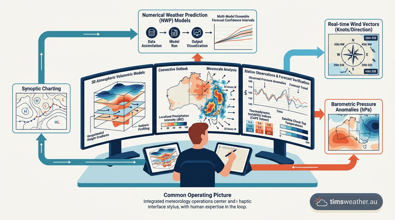
To combat this, meteorologists rely heavily on ensemble modelling from the European Centre for Medium-Range Weather Forecasts (ECMWF) and the National Oceanic and Atmospheric Administration (NOAA). Instead of running a single prediction, ensemble models run dozens of slightly altered simulations to generate a spread of possible outcomes. During a binary interaction, the resulting spaghetti plots often look chaotic, reflecting the high sensitivity of the fluid dynamics involved.
The Expanding Cone of Uncertainty
When the Fujiwhara effect is active, forecasters must widen the official cone of uncertainty. Because the storms are constantly trading angular momentum, their forward speed can suddenly accelerate, stall, or even loop backwards. This erratic movement forces emergency managers to prepare much larger stretches of coastline for potential impacts.
Communication during these events is difficult. The public expects linear, predictable paths. When meteorologists explain that a storm might perform a complete loop due to a neighbouring system, it can lead to confusion. Clear communication regarding the physics of the interaction is necessary to maintain public trust during extended warning periods.
Meteorological Implications for Cyclone Intensity Forecasts
While track changes are the most visible result of the Fujiwhara effect, the impact on tropical cyclone intensity is equally significant. A common public misconception is that merging cyclones will combine their energy to create a stronger, more devastating system. In reality, the meteorological dynamics of a merger are highly destructive to storm structure.
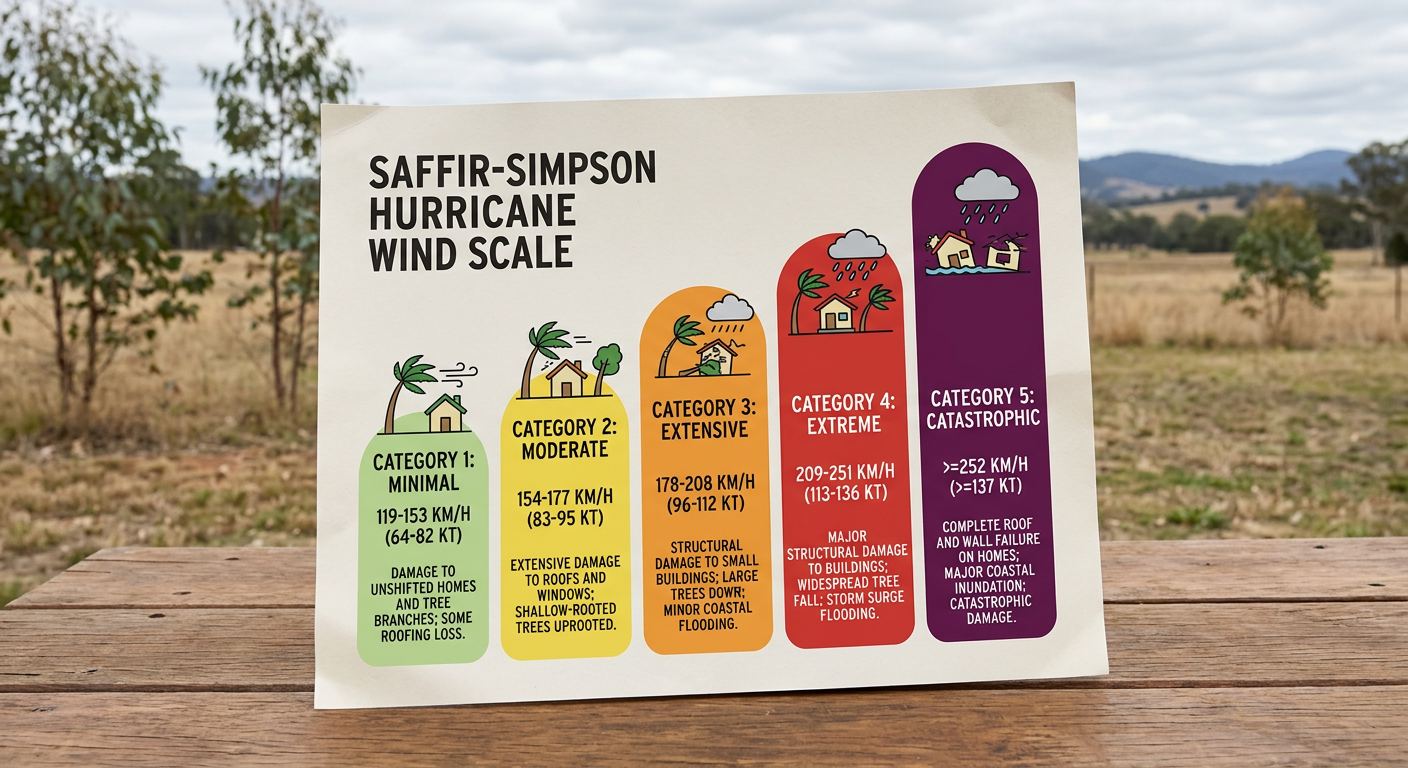
When storms get close, they begin to share the same atmospheric environment. Tropical cyclones require abundant warm, moist air and low vertical wind shear to thrive. A neighbouring storm disrupts this delicate balance. The strong upper-level outflow from the dominant cyclone often blasts the top off the weaker system, introducing severe wind shear that quickly degrades its intensity on the Saffir-Simpson Scale.
Debunking the Mega-Storm Myth
The idea of two cyclones smoothly merging into a single mega-storm is a cinematic invention, not a meteorological reality. While one system can absorb the remnants of another, the process disrupts the weaker one (www.fox35orlando.com) violently. The physical tearing of the smaller cyclone's vortex core expends massive amounts of energy.
Structural Degradation and Shearing
As documented by the World Meteorological Organization, the weaker system usually loses its closed circulation entirely. The remnant moisture may eventually wrap into the larger storm, but the process of absorbing that moisture often triggers an eyewall replacement cycle or introduces dry air into the primary core, causing the dominant storm to temporarily weaken as well. This complex structural degradation was observed when hurricanes Humberto and Imelda (www.youtube.com) interacted, illustrating how atmospheric competition degrades core wind fields.
Ultimately, the Fujiwhara effect acts as a great disruptor. It limits how effectively meteorologists can predict how do tropical cyclones form and mature in crowded basins. By forcing storms to compete for the same atmospheric resources, binary interactions often serve to limit the maximum potential intensity of both systems involved, even as they make the resulting tracks significantly harder to forecast.
Whether examining how do tropical storms form initially, or how they transition into decaying low-pressure zones, the presence of a second cyclone entirely rewrites the expected life cycle. Forecasting these events requires constant vigilance, deep meteorological expertise, and an understanding that when two cyclones meet, chaos governs the atmosphere.
Sources
Global Guide To Tropical Cyclone Forecasting.Xml (cyclone.wmo.int)
severeweather.wmo.int PDF reference (severeweather.wmo.int)
cyclone.wmo.int PDF reference (cyclone.wmo.int)
cyclone.wmo.int PDF reference (cyclone.wmo.int)
NOAA weather and atmospheric science reference (nhc.noaa.gov)
NOAA weather and atmospheric science reference (ncei.noaa.gov)
Typhoon Parma kills 15 in the Philippines (abc.net.au)
Mariners Weather Log Vol. 53, No. 2, August 2009 (vos.noaa.gov)
Last verified: 2026-09-18
Frequently asked questions
The Fujiwhara effect occurs when two tropical cyclones come close enough to interact, causing them to orbit a shared centre. This phenomenon can significantly alter their individual tracks and intensities. Depending on their relative sizes and strengths, the systems may merge, repel each other, or one may weaken the other.
Source: accuweather.com
Further reading and resources
Explore trusted articles, books, videos and other resources to go deeper on this topic.
cnn.comArticle
Here's what can happen when two hurricanes get too close together
In-depth coverage on The Fujiwhara Effect: What Happens When Two Cyclones Meet from cnn.com.
rainviewer.comArticle
The Rare Fujiwhara Effect: When Hurricanes Collide | RainViewer Blog
In-depth coverage on The Fujiwhara Effect: What Happens When Two Cyclones Meet from rainviewer.com.
weather.govReference
Fujiwhara Effect - National Weather Service
Background reference on The Fujiwhara Effect: What Happens When Two Cyclones Meet from weather.gov.
youtube.comVideo
Fujiwhara Effect: Here's what could happen when two hurricanes collide
Video coverage on The Fujiwhara Effect: What Happens When Two Cyclones Meet from youtube.com.
Did we just witness a ONCE IN A LIFETIME event? - YouTube
Video coverage on The Fujiwhara Effect: What Happens When Two Cyclones Meet from youtube.com.
en.wikipedia.orgReference
Fujiwhara effect - Wikipedia
Background reference on The Fujiwhara Effect: What Happens When Two Cyclones Meet from en.wikipedia.org.
Planning weeks ahead?
Check Australia's long-range seasonal outlook for rainfall, temperature and the climate drivers (ENSO, IOD, SAM, MJO) shaping the next three months.
View Australia's Seasonal Weather Forecast