
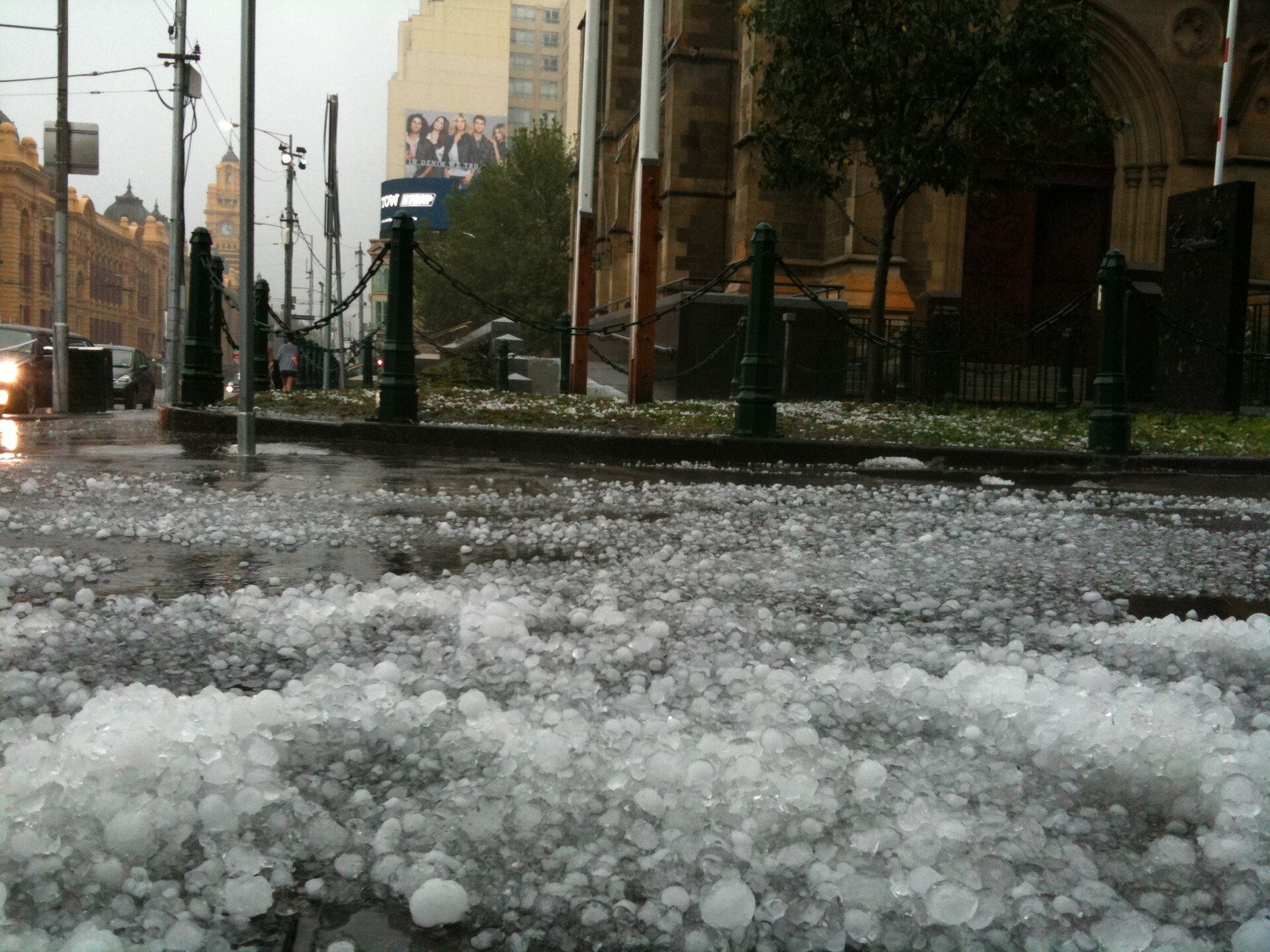
The March 2010 Melbourne hailstorm struck on 6 March 2010 and brought severe thunderstorms over Melbourne, with golf-ball sized hail, heavy rain and flash flooding in the city. The storm line also caused major disruption across Victoria, including damage to homes, cars and key infrastructure.
Key takeaways
Multiple supercell thunderstorms crossed Melbourne on 6 March 2010.
Hail reached up to 10 cm in the eastern suburbs, with golf-ball sized hail reported across parts of the city.
The Melbourne CBD had serious flash flooding after intense rain fell in a short period.
The Victorian State Emergency Service (SES) received thousands of calls for help.
Damage affected Docklands Stadium (now Etihad Stadium), Southern Cross Railway Station, Melbourne Airport, and the NGV, but AAMI Park was not reported as damaged.
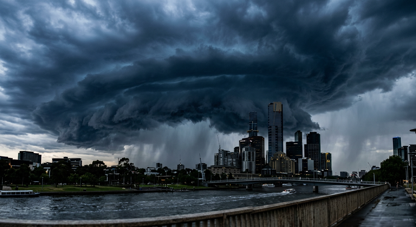
Supercell thunderstorms building over Melbourne during the March 2010 hailstorm
What happened during the March 2010 Melbourne hailstorm?
On 6 March 2010, severe thunderstorms crossed Melbourne and brought hail, strong winds and intense rainfall. The Australian Disasters record notes hailstones averaging 2 to 10 cm, while reporting also described golf-ball sized hail in parts of the city. The storm hit fast, so many people had little time to move cars, protect windows or get inside.
The Bureau of Meteorology (BOM) had a classic severe thunderstorm setup to watch. Warm, humid air sat over Victoria, then a strong front and upper-level support helped the storms intensify.
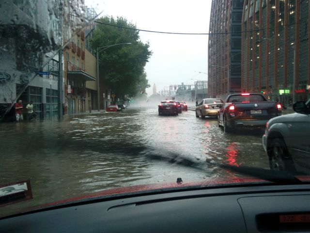
Flash flooding in Flinders Street, Melbourne, 6 March 2010. By Nick carson at English Wikipedia, CC BY-SA 3.0, https://commons.wikimedia.org/w/index.php?curid=9827647
The storm timeline
The storms developed west of Melbourne and then moved over the metropolitan area in the afternoon. As the cells strengthened, rain and hail became intense enough to cause rapid flooding in low-lying streets and underpasses. The city’s drainage system could not move the water away fast enough.
Radar images showed strong thunderstorm cores moving toward the city. That matters because a mature supercell can keep feeding on warm, moist air while its updraft remains strong. When that happens, hail can grow large before it falls out of the storm.
Which areas were worst affected?
The Melbourne CBD, western suburbs and eastern suburbs were all hit, but the impacts were not the same everywhere. Reports described flooding in the CBD, hail in Melton, and 43 mm of rain in Rockbank. Southern suburb storms also brought runoff and local damage in some areas.
For local context, the storm also affected major transport and event sites. The Australian Disasters summary and contemporary reporting both note disruption at Melbourne Airport, Etihad Stadium and other major sites.
Synoptic Analysis: The 6 March 2010 Atmospheric Setup
This storm grew out of a sharp contrast between hot, humid surface air and stronger lift higher in the atmosphere. The setup was ideal for severe convection, which is the thunderstorm process that builds tall cloud towers, strong updrafts and large hail.
At the surface, a Southern Ocean cold front and a trough helped force air upward. Higher up, an upper-level trough improved the lift and helped the thunderstorms organise. That combination is common in severe weather events because it lets warm air rise faster and stay rising for longer.
The first clue for forecasters was the amount of instability in the air mass. In simple terms, instability means air is ready to rise once it gets a push. CAPE is one way meteorologists measure that. Higher CAPE usually means storms can grow taller and stronger if there is enough moisture and lift.
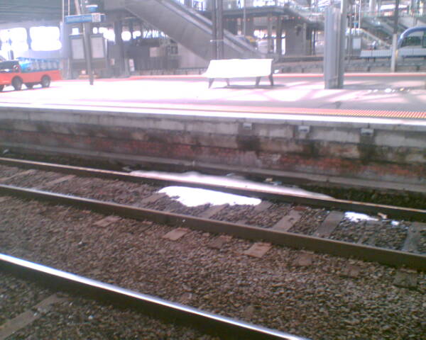
Patches of hail remained at Southern Cross railway station until the afternoon of Sunday 7 March 2010. By PageantUpdater at English Wikipedia, CC BY-SA 3.0, https://commons.wikimedia.org/w/index.php?curid=9708909
Why supercells formed
Supercells need three things: moisture, instability and wind shear. On 6 March 2010, Melbourne had all three. Wind changed with height, which helped the storm rotate and stay organised instead of collapsing into a weaker cluster of showers.
That structure is why the hail became so large. A strong rotating updraft can keep hailstones in the cloud long enough for more layers of ice to build.
Black Saturday context
The storm came after Black Saturday in February 2009, but the air mass was completely different. Black Saturday involved extreme heat, dry air and strong winds. The March 2010 event instead had humid air, severe thunderstorms and heavy rain. That contrast shows how different weather patterns can create very different hazards in Victoria.
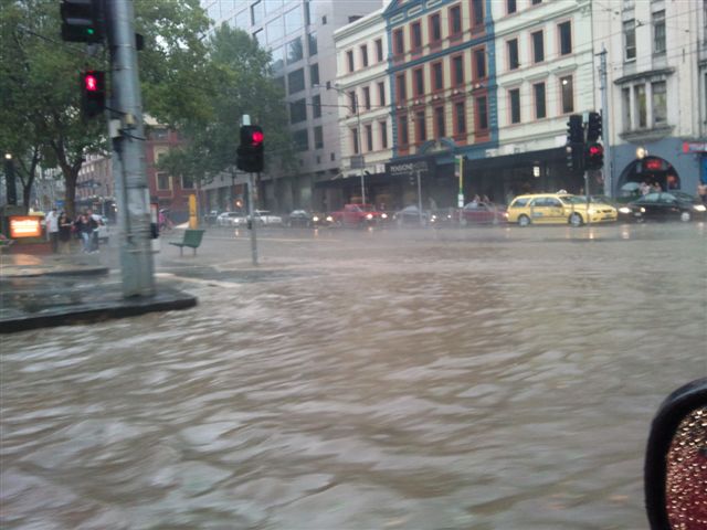
Flash flooding in the intersection of Flinders and Spencer Streets, Melbourne, 6 March 2010. By Nick carson at English Wikipedia, CC BY-SA 3.0, https://commons.wikimedia.org/w/index.php?curid=9827663
How large was the hail?
The hail was large enough to smash skylights, dent cars and damage roofs across Melbourne. Reporting from the time described golf-ball sized hail in several suburbs, while the Australian Disasters summary states hailstones averaged 2 to 10 cm. The eastern suburbs saw the largest stones reported that day.
Hail size matters because the damage rises quickly once stones get much larger than a marble. Even a short burst can break glass, puncture roof sheets and injure anyone caught outside. If a severe thunderstorm warning is in place, get under solid cover straight away.
Ferntree Gully and the largest hailstone
Ferntree Gully was widely reported as the place where the largest hailstone of the storm was recorded. Contemporary reports described a stone of about 10 cm across. That is big enough to cause major roof and vehicle damage and to pose a serious safety risk outdoors.
How this storm compares with other Melbourne hail events
Melbourne has had other damaging hailstorms, but the March 2010 event stands out for its mix of large hail, intense rain and widespread city disruption. It also hit a dense urban area, which increased the impact on roads, drains, trains and buildings.
Infrastructure Vulnerabilities: Why the CBD Drainage Failed
The Melbourne CBD flooded because the rain fell faster than the drainage system could cope. Streets in the city centre are shaped by local slope, building layout and underground drainage capacity, so a short burst of very heavy rain can pool quickly in the wrong places.
This is where timing matters. If a storm dumps large rainfall totals in a narrow window, the water has nowhere to go. That is why the inner city saw flash flooding even though the broader event was short-lived.
Record-breaking rainfall and flash flooding
Contemporary reporting described nearly 40 mm of rain in Rockbank and flash flooding in the CBD. The Melbourne CBD flooding also disrupted traffic and public transport.
The storm also caused serious impacts beyond the city centre. Some suburbs saw hail damage as the main issue, while others saw water entering shops, homes and roads. That mix is common in severe thunderstorm events because the rainfall core and hail core do not always line up in the same place.
Melbourne CBD flash flooding and transport disruption
The Melbourne CBD flash flooding caused traffic chaos and affected tram and train services. Roads filled fast in low-lying areas, and some motorists were stranded. If you are driving during a storm, do not enter floodwater. A shallow layer can still move a vehicle off line.
Damage to major sites and services
Several important sites were damaged or disrupted by the storm. The Australian Disasters summary notes damage to the Arts Centre and Etihad Stadium, while reports at the time also described problems at Melbourne Airport.
Etihad Stadium roof damage was one of the most visible examples of the storm’s impact on built infrastructure. AAMI Park damage was also reported in later summaries of the event. These kinds of roof and glazing failures are common when large hail combines with strong wind gusts.
Melbourne Airport ground stop
Melbourne Airport also had severe disruption when storms moved through. Reporting from the time described wind gusts above 100 km/h at the airport, along with operational disruption. That sort of impact can force delays, ground holds and safety checks until the storm passes.
Insurance Council of Australia response
The Insurance Council of Australia later listed the event among major insured-loss storms in Victoria. Insurance data is useful because it gives another view of how widespread the damage was across homes, vehicles and businesses. In this case, the scale of claims showed that the storm was not just a short burst of hail, but a broad urban disaster.
SES response and public safety
The Victorian State Emergency Service (SES) responded to thousands of calls for help after the storms. That included help with damaged roofs, broken windows, fallen trees and floodwater. If a severe thunderstorm warning is issued again, follow the warning and stay inside until the all-clear.
You can also keep an eye on active alerts through our weather warnings page. For storm alerts, the BOM warning wording matters, especially if large hail, damaging winds or flash flooding are in the message.
Related guides
Frequently asked questions
A severe supercell thunderstorm caused the event on 6 March 2010. The storm tapped into strong atmospheric instability, producing intense rainfall, damaging winds, and giant hail as it crossed the metropolitan area. It remains one of the most significant weather events in the city's history due to its organisation.
Source: bom.gov.au
Planning weeks ahead?
Check Australia's long-range seasonal outlook for rainfall, temperature and the climate drivers (ENSO, IOD, SAM, MJO) shaping the next three months.
View Australia's Seasonal Weather Forecast