
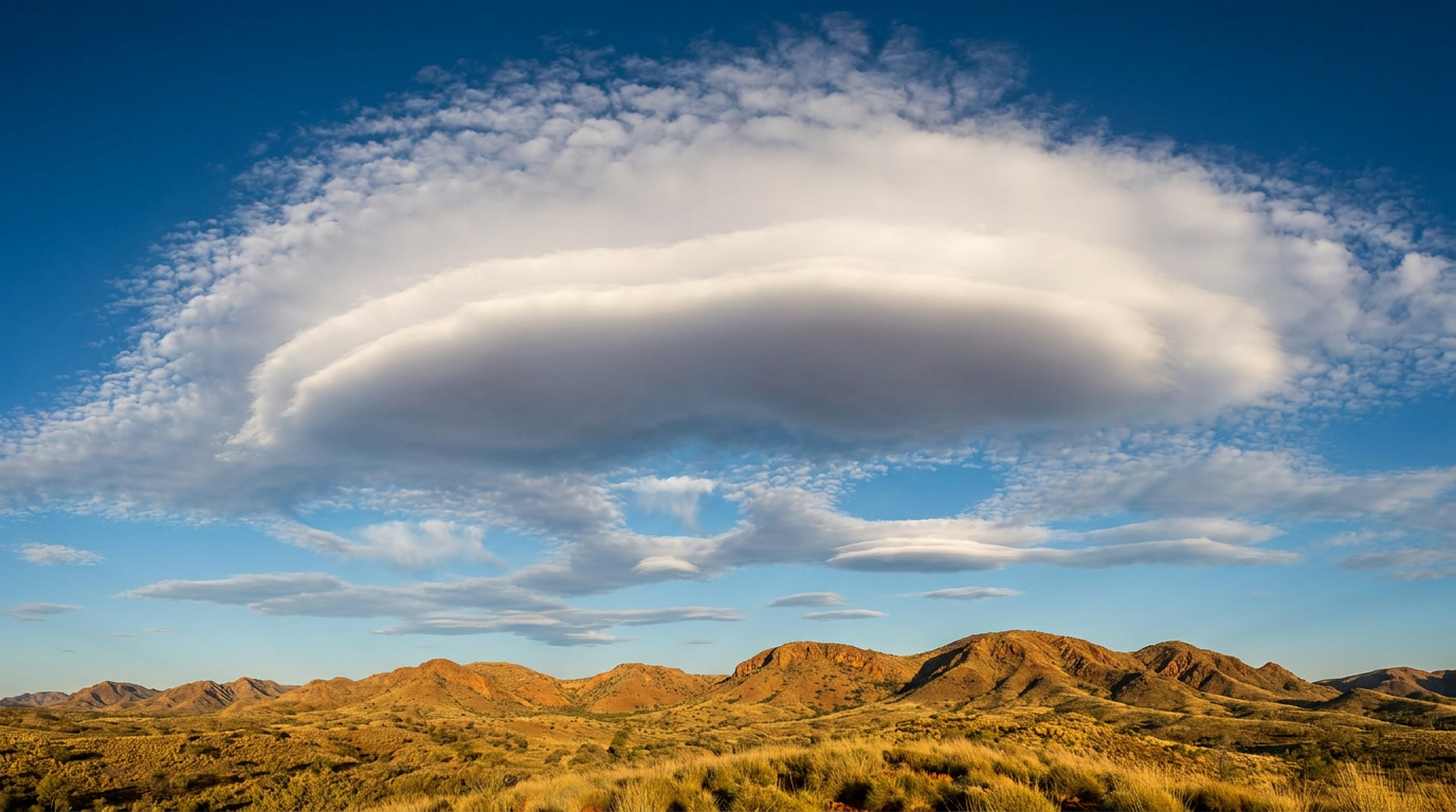
Rare Cloud Formations
Unusual cloud formations are often described as appearing when moisture, atmospheric stability, wind shear and temperature align in a fairly specific way. There does not appear to be a single official ranking of the rarest clouds, and what counts as rare can vary by location, season and daily conditions. Many unusual cloud features also seem brief, which may be one reason they are not often seen.
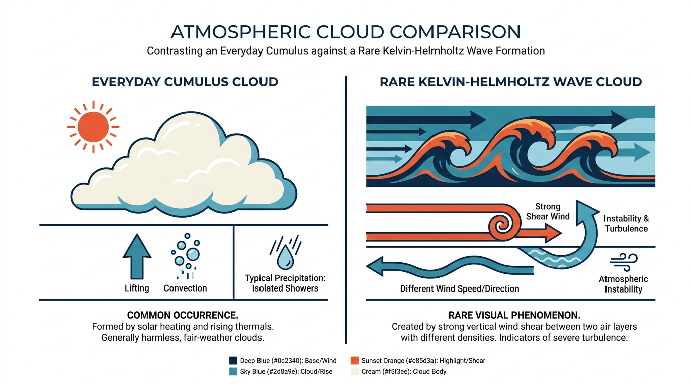
Diagram comparing common cumulus clouds with rare Kelvin-Helmholtz wave formations
Before looking at less familiar forms, it can help to start with the broader cloud categories often used in everyday forecasting. In general, these patterns can offer clues about changing weather.
Cloud Type | Typical Altitude | Weather Indicator |
|---|---|---|
Cumulus | Low level | Often linked with fair weather, although some can build into showers later in the day. |
Stratus | Low level | Layered cloud commonly associated with grey skies and sometimes drizzle or mist. |
Altocumulus | Mid level | May suggest moisture aloft and, at times, more changeable conditions. |
Cirrus | High level | Thin high cloud that is often taken as a sign that weather may change. |
Cirrocumulus | High level | Small ripples that are sometimes described as a mackerel sky. |
Cumulonimbus | Deep vertical cloud | Thunderstorm cloud often associated with heavy rain, hail and gusty winds. |
High clouds are often dominated by ice crystals, while mid and low clouds more often contain water droplets or a mix of droplets and ice. For local forecast guidance, the Learn Hub may be a useful starting point.
Notable Unusual Cloud Types
The cloud forms below are often described as uncommon because they may require fairly specific atmospheric conditions. Some are treated as cloud types, while others are better understood as unusual features or optical effects seen within cloud layers.
1. Noctilucent Clouds
Noctilucent clouds are often described as extremely high clouds that may be seen after sunset or before sunrise when they catch sunlight from below the horizon. They are generally discussed as forming well above the main weather-producing layer and are often only visible briefly in twilight.
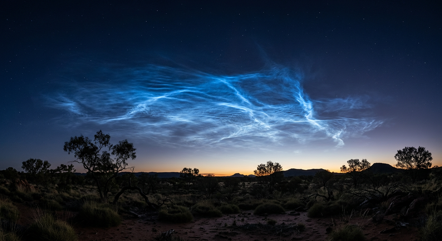
Bright glowing blue noctilucent clouds visible against a dark twilight sky
2. Morning Glory Cloud (Roll Cloud)
The Morning Glory is the name commonly used for a striking roll-cloud formation that may appear as a long, low, tube-shaped cloud. Roll clouds are often noted for travelling as a single organised feature, sometimes with a smooth leading edge and clearly defined form.
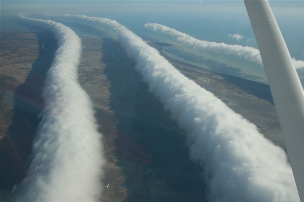
A spectacular Morning Glory roll cloud rolls in across the Gulf of Carpentaria — one of the most famous rare cloud formations on Earth and an iconic sight in northern Australia each spring. Image: “MorningGloryCloudBurketownFromPlane.jpg” by Mick Petroff, via Wikimedia Commons (CC BY-SA 3.0).
3. Kelvin-Helmholtz Clouds
Kelvin-Helmholtz clouds are generally described as forming when adjacent air layers move at different speeds, creating shear along the boundary between them. The top of the cloud can curl into wave-like shapes that resemble breaking ocean waves.

Kelvin-Helmholtz waves form when faster air slides over slower, moister air below, producing this rare breaking-wave cloud pattern. Image: “Kelvin Helmholtz cloud formation during Hartford sunset.jpg” by Paul Danese, via Wikimedia Commons (CC0).
4. Mammatus Clouds
Mammatus clouds often appear as pouch-like bulges hanging from the underside of a cloud base, frequently beneath the anvil region of a thunderstorm cloud. They are often linked with stormy environments, although their presence alone does not confirm severe weather at the surface.
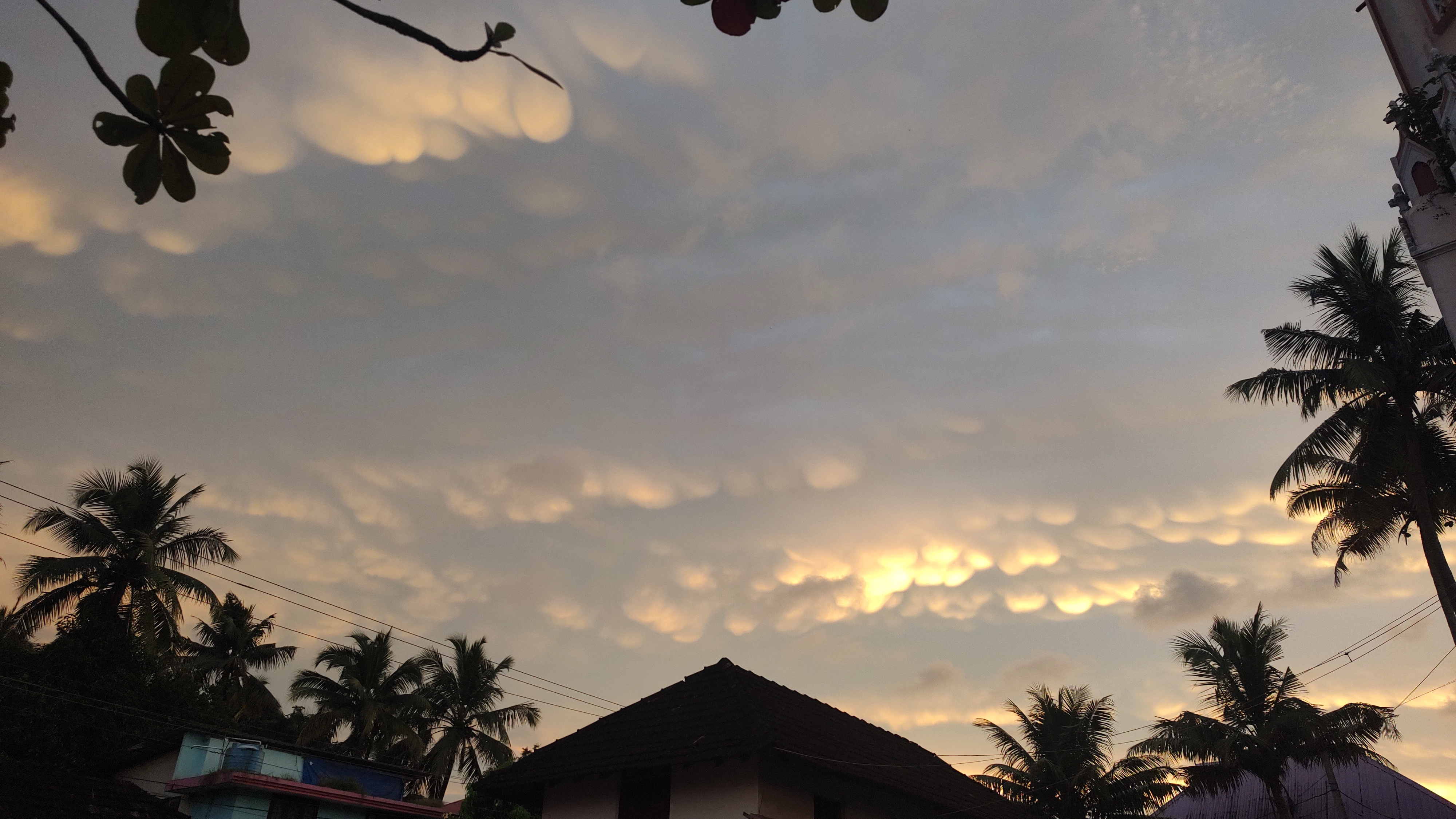
Mammatus clouds bulge downward beneath a thunderstorm anvil — typically a sign that severe weather has just passed or is nearby. Image: “Mammatus cloud at Thrissur puthenpeedika.jpg” by IGNATIOUS VAPPUZHA, via Wikimedia Commons (CC0).
5. Cumulonimbus Pileus
A pileus cloud is generally described as a smooth cap that can form above a rapidly growing cumulus or thunderstorm cloud. It is usually explained as developing when rising air lifts moist air above the growing cloud top, allowing condensation to form a cap.
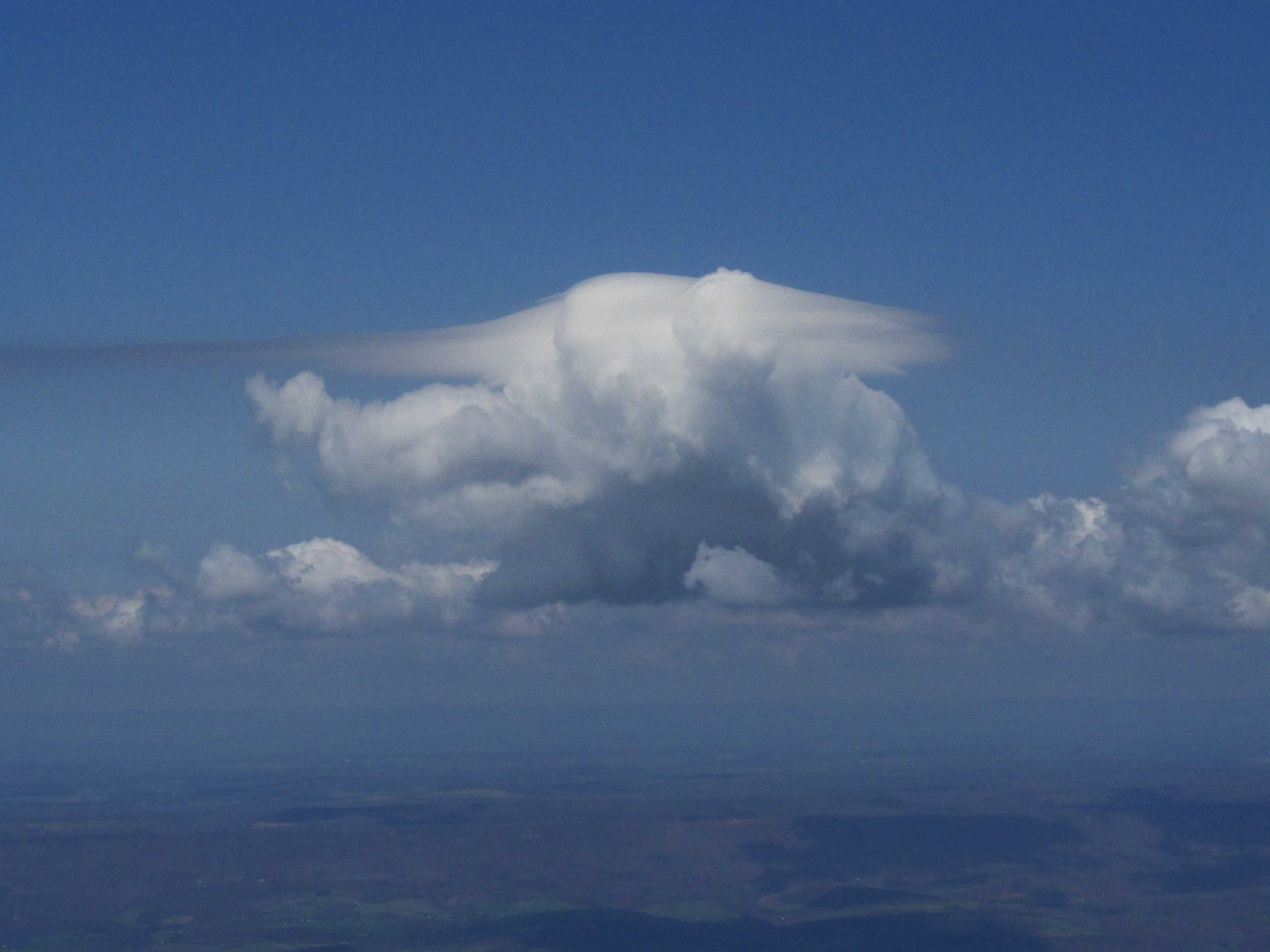
A delicate pileus cap forms above a fast-growing cumulonimbus, marking violently rising air punching through moist layers aloft. Image: “Cumulus pileus.jpg” by User:Dhaluza, via Wikimedia Commons (CC BY 2.5).
6. Pyrocumulonimbus
Pyrocumulonimbus clouds are often discussed in connection with intense fires, when strong heat and updraughts may carry smoke and moisture high into the atmosphere. Such clouds may generate lightning and can coincide with dangerous fire behaviour.
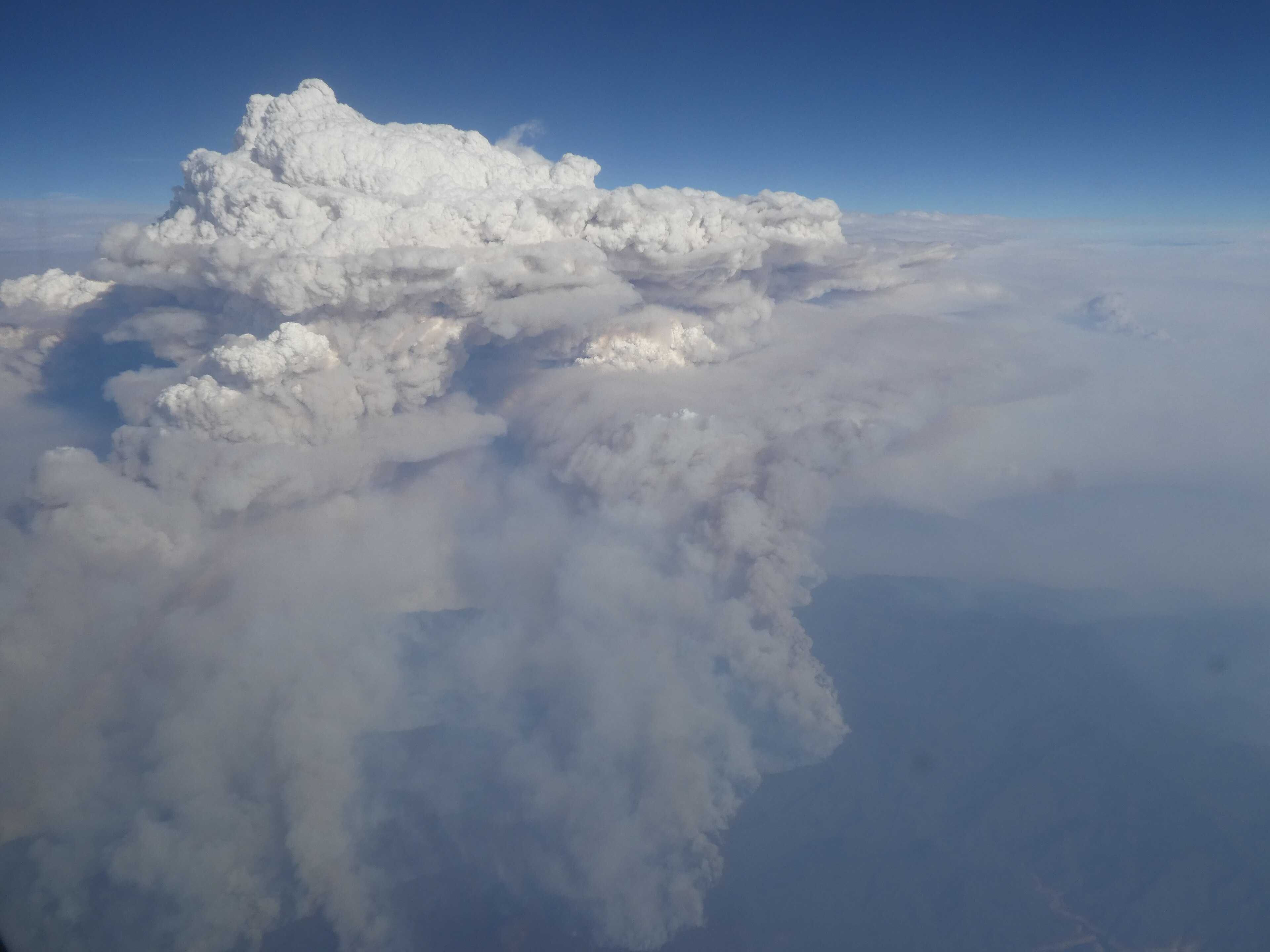
A pyrocumulonimbus — a fire-generated thunderstorm — towers above an intense Australian bushfire, capable of producing its own lightning and dangerous downdrafts. Image: “Pyrocumulonimbus over Victoria.jpg” by Merrin Macleod, via Wikimedia Commons (CC BY-SA 4.0).
7. Fallstreak Hole (Hole-Punch Cloud)
A fallstreak hole is a circular gap that can appear in a cloud layer, often discussed as occurring when ice crystals develop in an area of supercooled droplets. As those ice crystals grow and fall, they may leave a clearer patch behind.
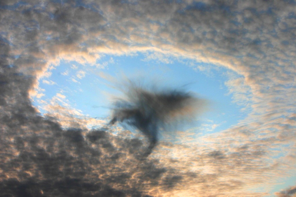
A fallstreak hole forms when supercooled cloud droplets suddenly freeze and fall as ice crystals, leaving a clear gap in the cloud deck. Image: “HolePunchCloud.jpg” by H. Raab (User:Vesta), via Wikimedia Commons (CC BY-SA 3.0).
8. Cirrus Uncinus
Cirrus uncinus are hook-shaped high clouds made of ice crystals. They are sometimes called mares' tails and are often taken as a sign of moisture and stronger winds aloft.
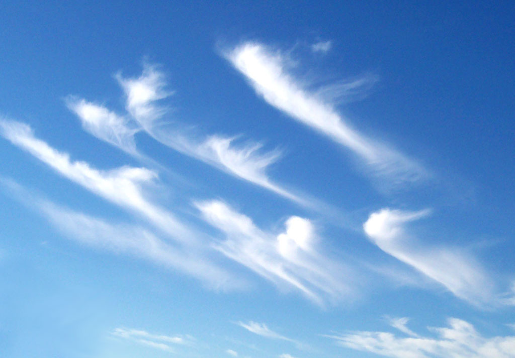
Wispy cirrus uncinus, also known as “mares’ tails,” often signal an approaching warm front and changing weather within a day or two. Image: “Cirrus clouds2.jpg” by Unknown, via Wikimedia Commons (CC BY-SA 3.0).
9. Lenticular Clouds
Lenticular clouds are commonly described as forming when moist air flows over hills or mountains and sets up standing waves in the atmosphere. They usually have a smooth, lens-like shape and can appear almost stationary for long periods.
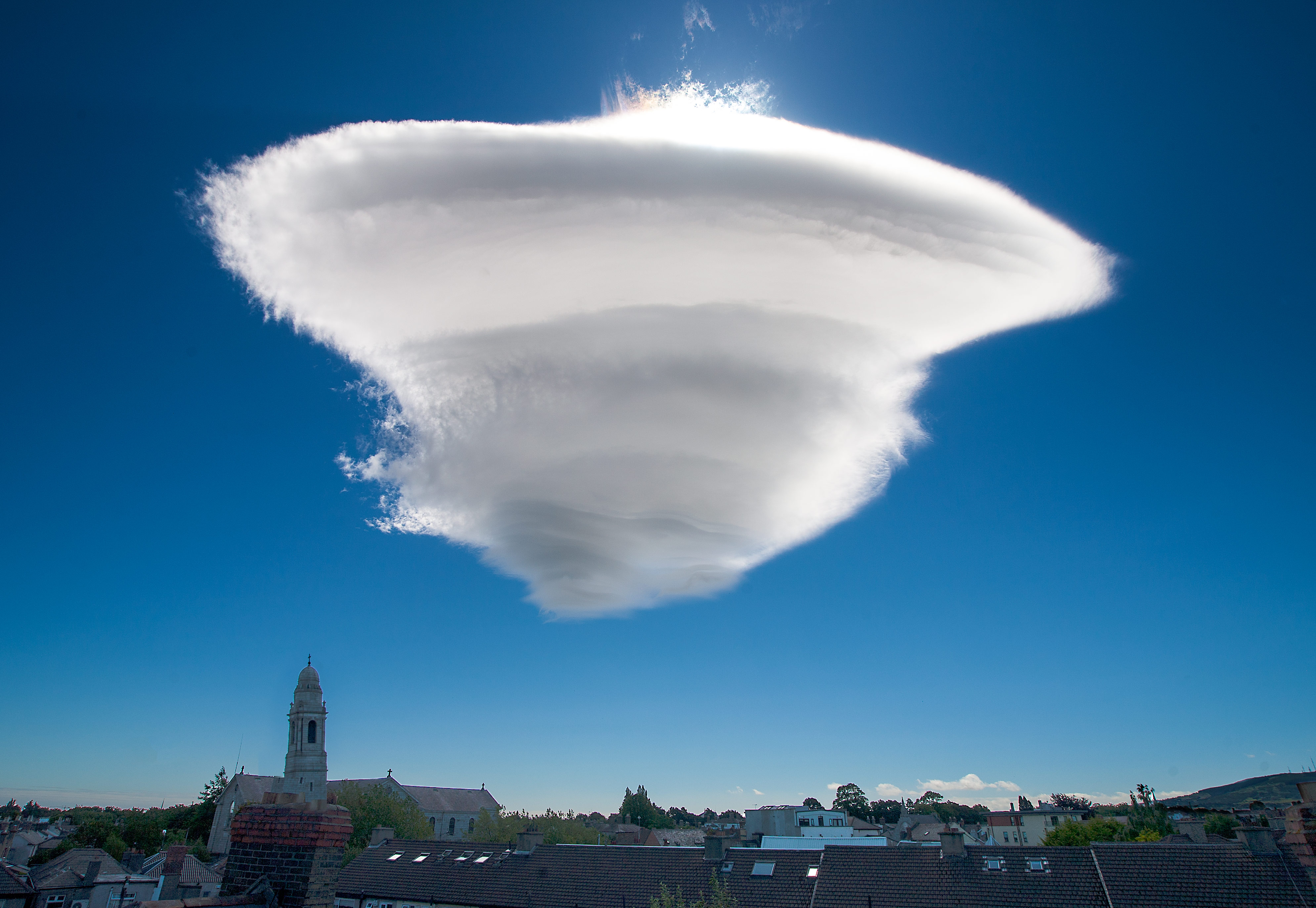
A smooth, lens-shaped lenticular cloud hovers above a mountain peak, formed by moist air flowing over the terrain and condensing in the wave crest. Image: “Lenticular Cloud over Harold's Cross Dublin Ireland 30-6-15.jpg” by Omnisource5, via Wikimedia Commons (CC BY-SA 4.0).
10. Asperitas Clouds
Asperitas is a term used for an uncommon-looking cloud feature with a rough, wave-like underside. Its surface can resemble a choppy sea from below, which is why observers often find it especially distinctive.
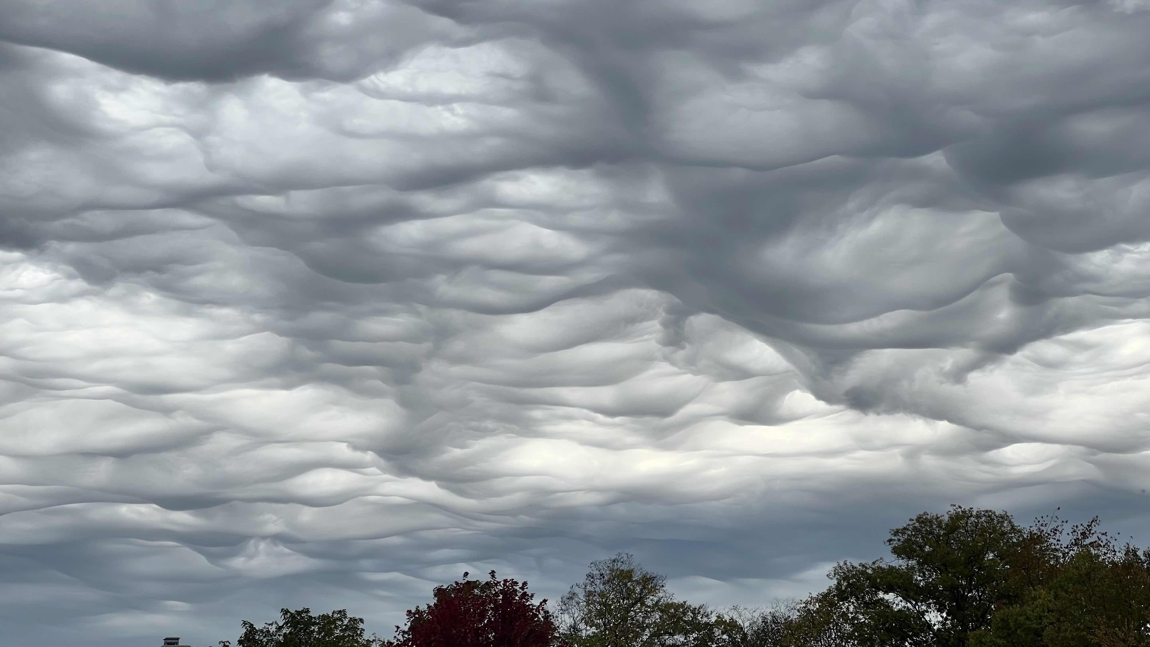
Asperitas clouds display a dramatic, wave-tossed underside — the newest cloud classification recognised by the World Meteorological Organization. Image: “Asperitas clouds over Dayton, Ohio on October 21, 2023.jpg” by Joshua Kitchens, via Wikimedia Commons (Public domain).
11. Cloud Iridescence
Cloud iridescence (also called irisation) appears as soft pastel bands of green, pink, purple and gold along the edges of thin clouds when sunlight is diffracted by very small, uniformly sized water droplets or ice crystals. It is most often seen in altocumulus, cirrocumulus and lenticular clouds within about 10° of the Sun, and is closely related to the more circular corona effect. Sightings are brief and easy to miss because the geometry between the observer, cloud and Sun has to be just right.
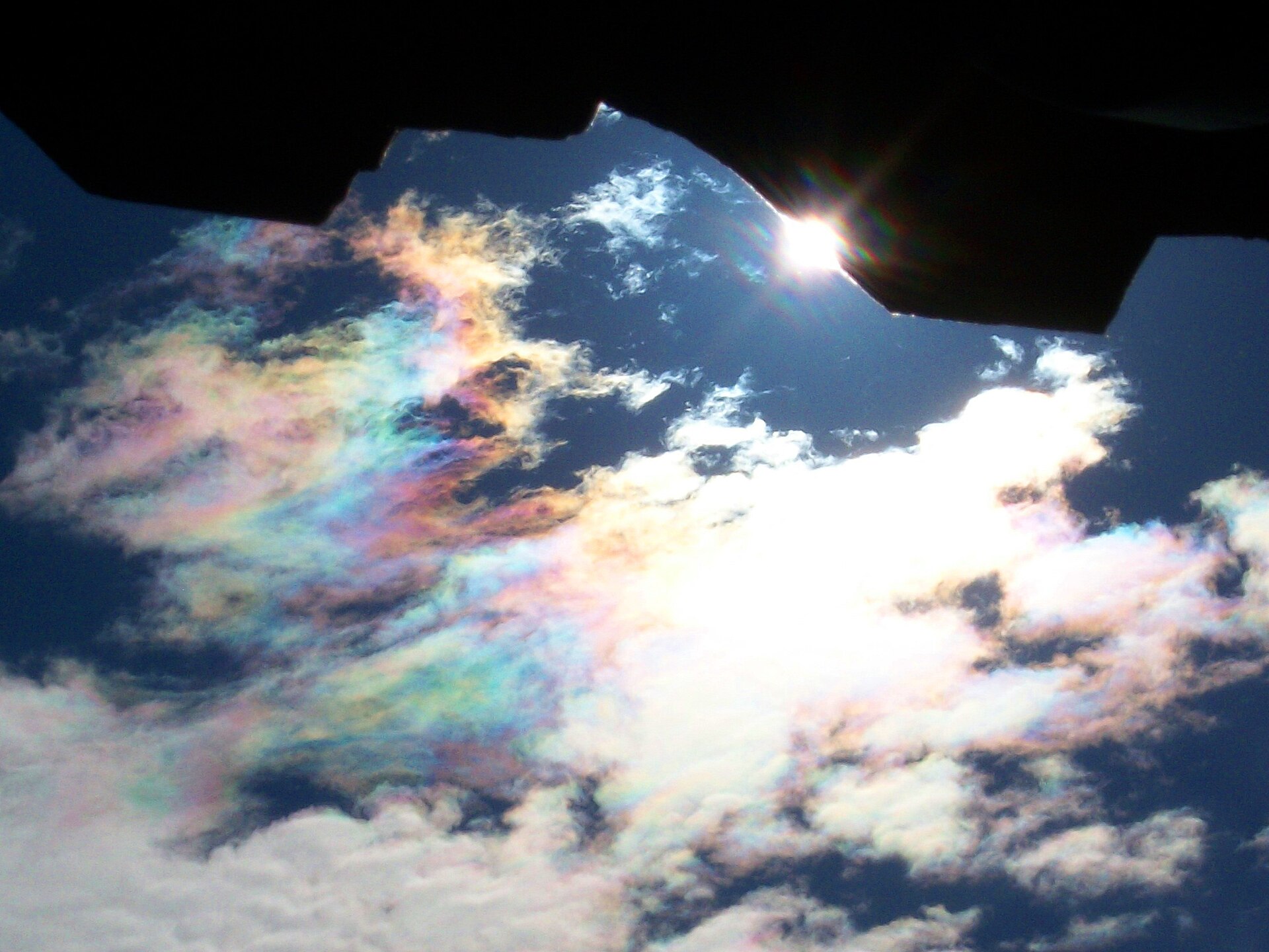
Highly iridising altocumulus showing pastel diffraction colours along the cloud edge. Image: “Highly iridising altocumulus” by C messier, via Wikimedia Commons (CC BY-SA 3.0).
12. Horseshoe Vortex Cloud
Horseshoe vortex clouds are short-lived, U-shaped cloud features that may form when a small rotating column of air (a horizontal vortex) is tilted and stretched by rising thermals or wind shear. The rotation makes the cloud curl into a horseshoe or crescent shape, often only for a minute or two before dissipating. They are usually described as one of the briefest cloud sightings, which is one reason they are so rarely observed.
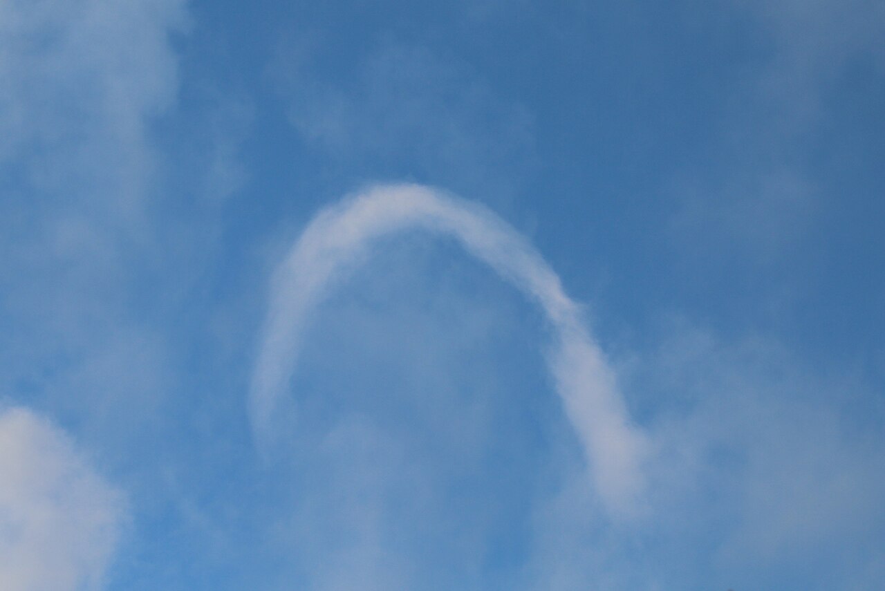
Witness a rare horseshoe vortex cloud against a blue sky, illustrating this unique Australian atmospheric phenomenon. By GerritR - Own work, CC BY-SA 4.0, https://commons.wikimedia.org/w/index.php?curid=67274628
13. Nacreous clouds
Nacreous clouds, also known as mother-of-pearl clouds, are a rare type of polar stratospheric cloud that forms 15–25 km above Earth's surface in the stratosphere when temperatures drop below about −85°C. They are best seen during winter at high latitudes, just before sunrise or after sunset, when sunlight shining from below the horizon is diffracted by tiny, uniform ice crystals, producing their spectacular iridescent colours of pink, green, blue, and purple. While admired for their beauty, nacreous clouds are also scientifically significant because they can contribute to chemical reactions that lead to ozone depletion in the polar stratosphere.
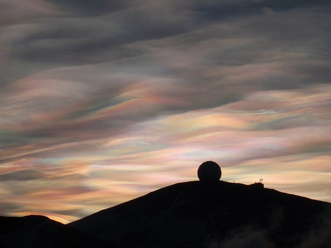
Nacreous clouds over the NASA Radome, McMurdo Station, Antarctica. This radome cover a telecommunication antenna used for space-to-ground communications support to dozens of Expendable Launch Vehicles and polar-orbiting satellites. By Alan Light from Charlotte, USA. At Commons: Alan R Light (talk · contribs) - Nacreous Clouds over the NASA Radome -4-, CC BY 2.0, https://commons.wikimedia.org/w/index.php?curid=14503960
Notable Unusual Cloud Sightings
Some memorable cloud reports are associated with storms, sea-breeze boundaries and thin cloud layers lit by low-angle sunlight. Checking the Rainfall & Thunderstorm Forecast can help highlight where active cloud development may be more likely.
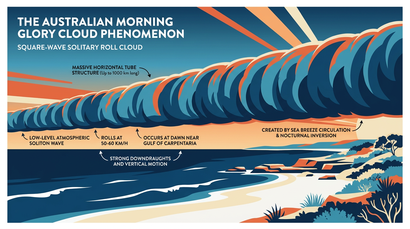
A long dramatic roll cloud stretching over a coastal region
Long thunderstorm lines
From an aircraft or satellite view, a line of thunderstorm cells can sometimes stretch across a large part of the sky when storms organise along a trough or convergence boundary. These lines may produce heavy rain, hail and strong wind gusts, particularly in unstable conditions.
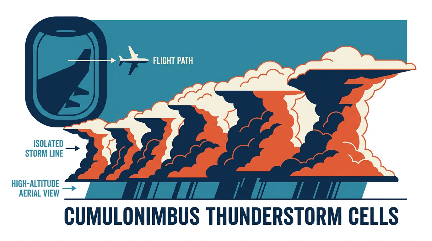
Aerial photograph of a 150 km long line of isolated thunderstorm cells taken from an airplane
Roll clouds
Roll clouds can appear along sea-breeze fronts or outflow boundaries after earlier storms. They are long, low clouds that seem to roll horizontally through the sky and can be visually impressive even when they do not produce severe weather.
If a cloud formation is linked to active thunderstorms or bushfire smoke, it is worth checking the Weather Warnings page before heading outdoors. For more technical terms, the Weather Glossary can help translate the jargon.
Related guides
Sources
- Types of Clouds (nesdis.noaa.gov)
- Rare 'roll cloud' stuns beachgoers in Portugal during heatwave (bbc.com)
- Rare Roll Cloud Stuns Portugal Beaches (youtube.com)
- Predicting the Weather With Clouds (sunsail.com)
- Pilot captures extraordinary 150km phenomenon from plane window (au.news.yahoo.com)
- No, these rainbow clouds over Indonesia are not AI (popsci.com)
Last verified: 2026-06-30
Frequently asked questions
Some of the rarest clouds in Australia include Kelvin-Helmholtz clouds, noctilucent clouds, lenticular clouds, pileus clouds, and asperitas. These formations need very specific wind, moisture, and stability conditions, which is why they are uncommon and often short-lived.
Source: bom.gov.au
Further reading and resources
Explore trusted articles, books, videos and other resources to go deeper on this topic.
www.nesdis.noaa.govReference
Types of Clouds
This reference page provides a general overview of cloud types, including some that can form rare variations, helping to contextualize what makes a cloud rare.
www.bbc.comArticle
Rare 'roll cloud' stuns beachgoers in Portugal during heatwave - BBC
This article provides a real-world example and visual of a rare roll cloud formation during a heatwave.
www.youtube.comVideo
Rare Roll Cloud Stuns Portugal Beaches | WION Climate ...
Provides a video example of a rare roll cloud, offering a dynamic visual perspective of this phenomenon.
www.sunsail.comArticle
Predicting the Weather With Clouds - Sunsail
This article discusses various cloud types, including Cirrocumulus, which can sometimes form rare patterns like a 'mackerel sky'.
au.news.yahoo.comArticle
Pilot captures extraordinary 150km phenomenon from plane window - a rare view
Explores the sighting of visually striking, long lines of thunderstorm cells, which are discussed as a 'notable unusual cloud sighting' in the article.
www.popsci.comArticle
No, these rainbow clouds over Indonesia are not AI
This article focuses on iridescent clouds, a specific rare cloud phenomenon mentioned and described in the main article.
Planning weeks ahead?
Check Australia's long-range seasonal outlook for rainfall, temperature and the climate drivers (ENSO, IOD, SAM, MJO) shaping the next three months.
View Australia's Seasonal Weather Forecast