
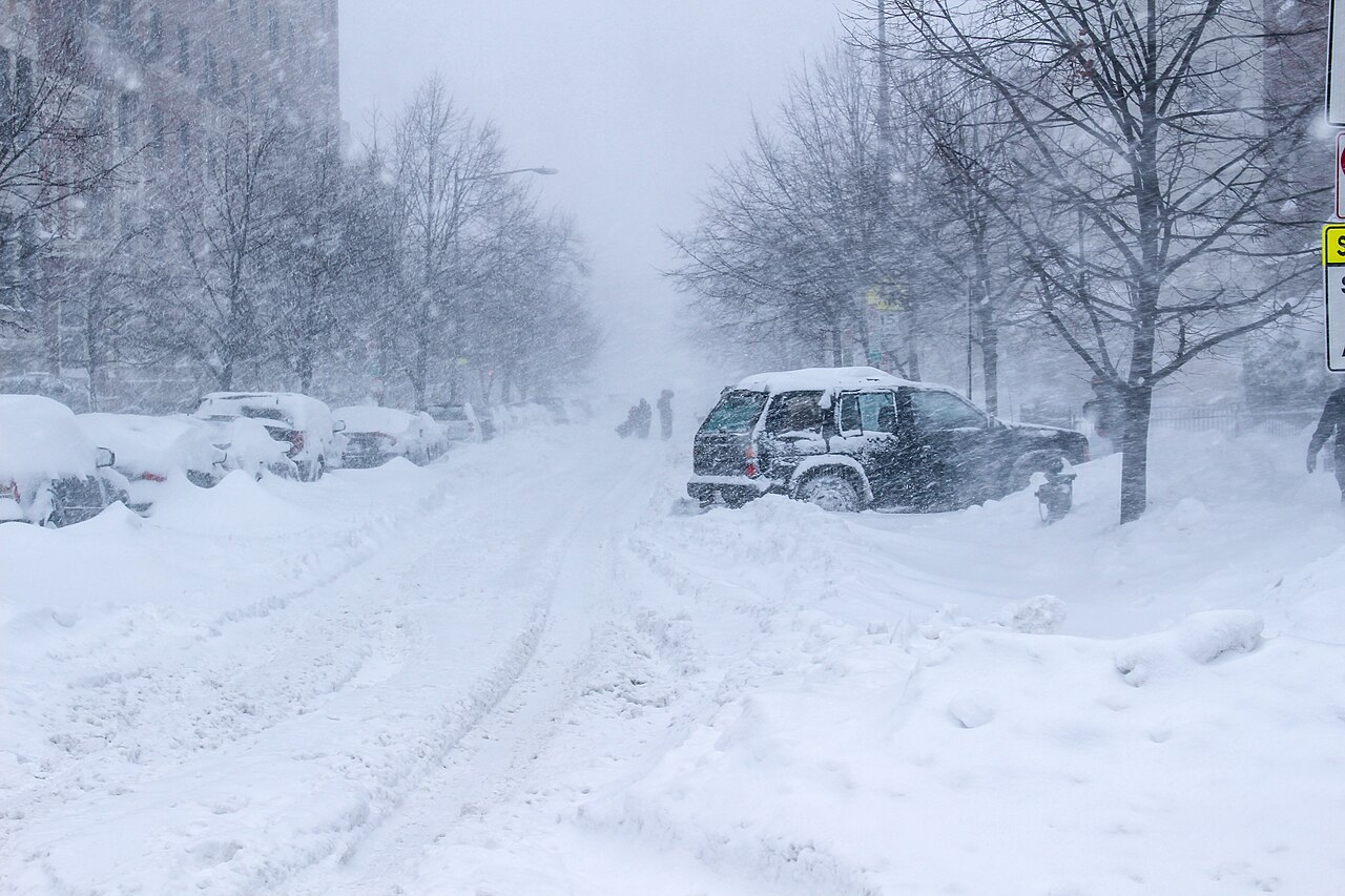
How do blizzards form? It comes down to three things working together: sustained winds of at least 56 km/h, visibility below 400 metres in blowing snow, and temperatures at or below freezing. That is the National Weather Service definition used in the United States, and it focuses on weather conditions rather than snow depth alone Britannica.
Key takeaways
The National Weather Service (NWS) defines a blizzard by wind speed and visibility, not by how much snow has fallen.
Blizzards usually form within or beside low-pressure systems where cold fronts, strong isobars and a steep pressure gradient force air to move quickly.
Moisture convergence and cyclogenesis help build the storm, while sub-freezing temperatures keep precipitation as snow.
Blizzard conditions can develop without new snowfall if wind lifts old snow from the ground into the air Reconnect with Nature.
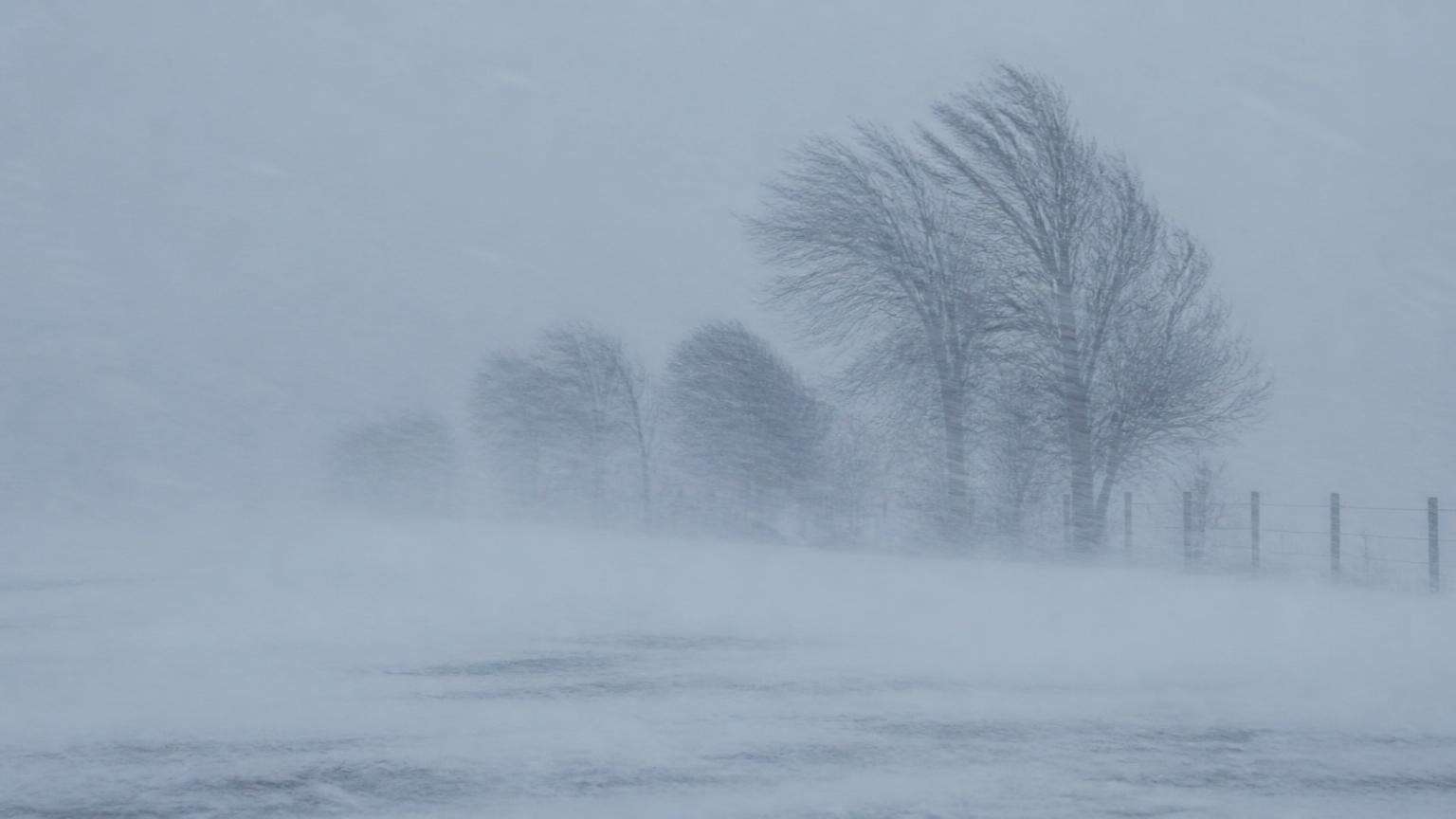
Blizzard conditions are defined by wind and visibility, not snowfall totals — here blowing snow reduces visibility to near zero.
What makes a blizzard different from a snowstorm?
A snowstorm is any winter weather event that produces snow, but a blizzard has strict, quantified visibility criteria and wind thresholds. When analysing snowstorm dynamics, the specific terminology matters because the public risk changes dramatically when wind starts driving snow sideways and cutting visibility to almost nothing (low-pressure systems that deepen through cyclogenesis. Cyclogenesis is the process of a cyclone forming or strengthening, and in mid-latitudes it often happens along sharp temperature boundaries where cold air meets warmer, moisture-laden air
Those boundaries are often marked by packed isobars. When the spacing between isobars tightens, the pressure gradient force increases, and air accelerates from higher pressure towards lower pressure. That is why wind speeds can ramp up quickly around a developing storm FOX Weather.
Cold fronts also matter. A passing cold front can force warm air upward, which helps develop cloud bands and snow-producing lift. When that lift combines with moisture convergence, the storm has more fuel for snow and stronger gusts FOX Weather.
In many blizzards, the storm centre sits close enough to a cold air mass that temperatures stay sub-freezing through the event. That keeps the precipitation as snow and stops it from melting into rain before it reaches the ground Britannica.
If you want the bigger storm picture, think of this as a winter version of the same pressure-driven mechanics that shape other rotating systems, including hurricanes in a different basin and tropical cyclones more broadly. The physics is different in detail, but the central idea is the same: air moves towards lower pressure and the atmosphere tries to balance the contrast Britannica.
The Thermodynamic Engine: Why Moisture Matters More Than Cold
Cold air alone does not make a blizzard. You also need moisture. Without enough vapour in the air, there is nothing to turn into the snow that wind can then pick up and blow around. That is why the most effective blizzards form where cold air meets a source of moisture, not in dry, still air over land FOX Weather.
Moisture convergence helps concentrate that vapour into a narrower zone of rising air. The rising air cools, condensation and ice-crystal growth begin, and snowfall increases. Once the snow reaches the surface, strong winds can keep it airborne and extend the whiteout far beyond the heaviest snow band Reconnect with Nature.
This is also why some storm systems become much worse when they slow down or stall. If the lift continues in the same place, snow can pile up while wind keeps moving it around, which raises the risk of long-lasting ground blizzard conditions Britannica.
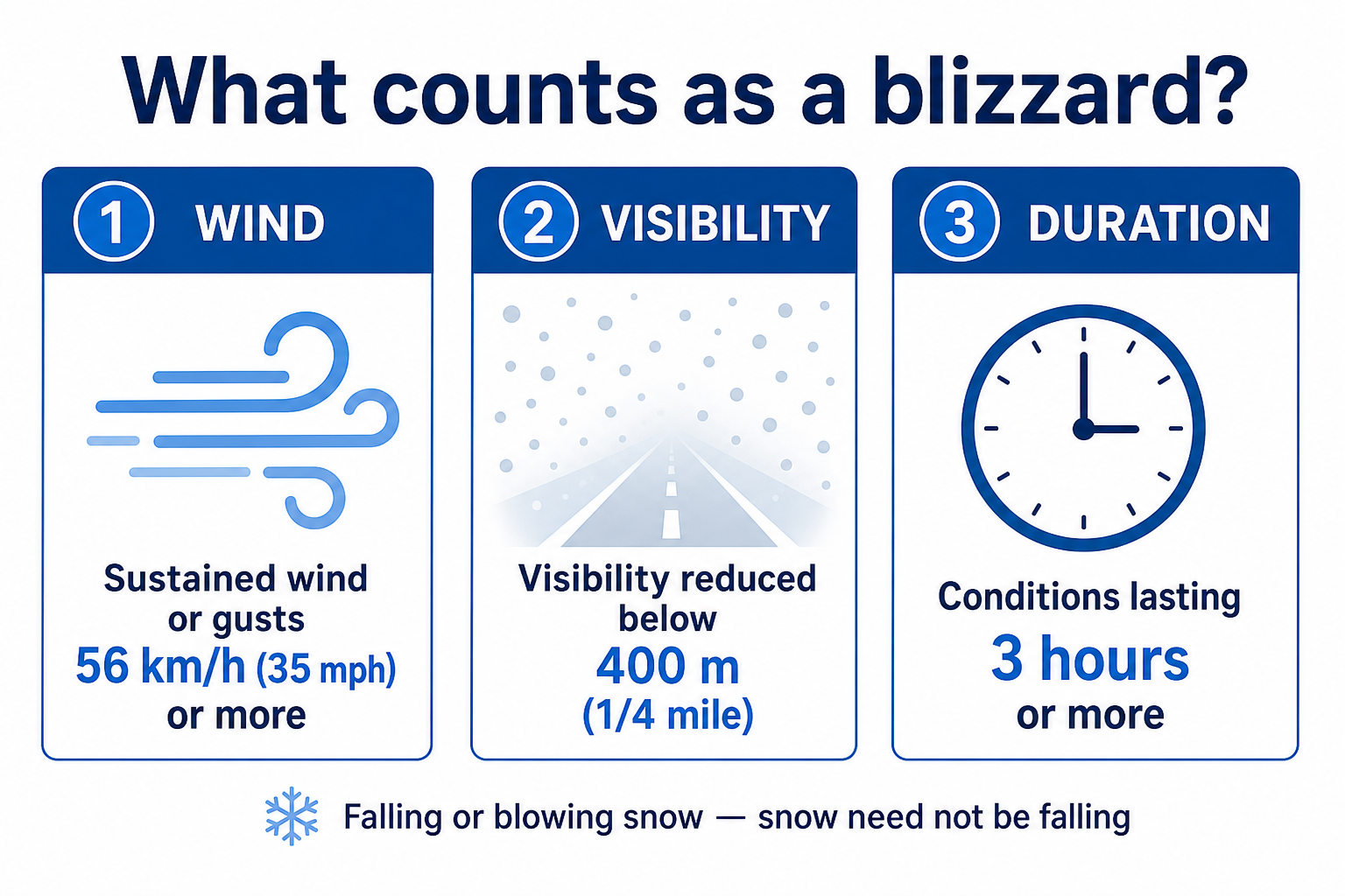
The three official blizzard criteria — wind, visibility and duration. Snow does not have to be falling.
From extratropical cyclones to whiteouts
Most blizzards are tied to extratropical cyclones, not tropical systems. These are the large low-pressure systems that develop in the mid-latitudes where warm and cold air masses meet. Their developmental lifecycle often begins with a temperature contrast, then strengthens as the pressure field tightens and the storm matures Britannica.
When the cyclone deepens, the wind field expands. Snow may fall in one part of the system while another part brings strong, dry winds. If those winds pass over fresh snow or loose surface snow, visibility can collapse fast. That is the path from winter storm development to a full whiteout FOX Weather.
Topography can help or hinder the process. In some settings, orographic lift adds extra upward motion as air is forced over higher ground. That can squeeze out more snow on the windward side of ranges, then leave colder, faster-moving air to descend on the far side. The result can be sharp local changes in snowfall and visibility Britannica.
For readers comparing storm types, the same broad idea appears in other forms of frontal weather too. A cold front can organise uplift and gusts, while broader pressure patterns, such as high and low pressure systems, set the stage for the wind field that follows. That is the pressure-gradient story at work FOX Weather.
Visibility criteria and why they matter
Visibility criteria are the part of blizzard classification people feel most directly. Once snow and wind combine to reduce visibility below 0.4 km for hours, roads, airports and open country can become unsafe very quickly Britannica.
That reduction in visibility comes from two sources at once. Some snow is falling from the cloud, and some is being lifted from the surface by the wind. The eye cannot separate the two in a whiteout, which is why drivers often lose depth perception before they lose all sight of the road Reconnect with Nature.
Because the NWS definition depends on wind and visibility, blizzard warnings can be issued even after the main snowfall has ended. If the air remains cold enough and the snow cover stays loose, the storm can continue as a ground blizzard well after the cloud band moves away FOX Weather.
How to stay safe in a blizzard
If a blizzard warning is issued, treat it as a travel and exposure problem first. Stay indoors if you can, check heating and power supplies, and keep warm clothing, water and food ready in case the storm lasts longer than expected DomiDocs.
On the road, avoid unnecessary travel. Whiteout conditions can erase lane markings, and strong winds can push snow back across already cleared roads. If you are caught out, stop only where it is safe, stay with the vehicle, and keep the exhaust clear if snow builds up around it DomiDocs.
In towns and suburbs, check local warnings often. Snow drifts can block entries and exits, and wind-driven snow can refill cleared paths in minutes. A blizzard is not only a snow problem, it is also a wind and visibility problem Reconnect with Nature.
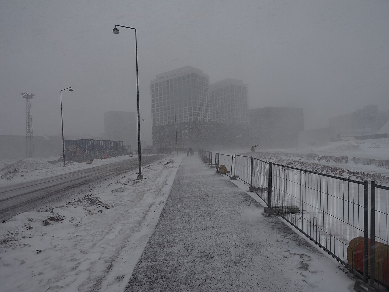
Heavy snowfall and low visibility blanket an urban street, showcasing the harsh conditions created by blizzards and how they form. (A view of Jätkäsaari, Helsinki, Finland, during a brief but intense blizzard on a March evening.) By JIP - Own work, CC BY-SA 4.0, https://commons.wikimedia.org/w/index.php?curid=112896810
Frequently asked questions
Blizzards form when cold air, moisture, and lift combine in the atmosphere. Strong winds drag freezing air across a region, creating low pressure that sucks in moisture. When this moisture meets the cold air, it turns into snow, while high-velocity winds reduce visibility and cause significant drifting.
Source: pbs.org
Further reading and resources
Explore trusted articles, books, videos and other resources to go deeper on this topic.
kids.nationalgeographic.comArticle
Blizzards
In-depth coverage on How Do Blizzards Form? The Complete Meteorological Guide from kids.nationalgeographic.com.
education.nationalgeographic.orgArticle
Blizzard - National Geographic Education
In-depth coverage on How Do Blizzards Form? The Complete Meteorological Guide from education.nationalgeographic.org.
weathercompany.comArticle
The guide to snowstorm and blizzard forecasting
In-depth coverage on How Do Blizzards Form? The Complete Meteorological Guide from weathercompany.com.
youtube.comVideo
What is a Blizzard? | Weather Science | SciShow Kids - YouTube
Video coverage on How Do Blizzards Form? The Complete Meteorological Guide from youtube.com.
weather.govReference
Winter Storms and Blizzards
Background reference on How Do Blizzards Form? The Complete Meteorological Guide from weather.gov.
ebsco.comArticle
Blizzards, Freezes, Ice Storms, and Hail - EBSCO
In-depth coverage on How Do Blizzards Form? The Complete Meteorological Guide from ebsco.com.
scied.ucar.eduReference
Blizzards - UCAR Center for Science Education
Background reference on How Do Blizzards Form? The Complete Meteorological Guide from scied.ucar.edu.
en.wikipedia.orgReference
Blizzard
Background reference on How Do Blizzards Form? The Complete Meteorological Guide from en.wikipedia.org.
weatherwizkids.comArticle
How Winter Storms Form
In-depth coverage on How Do Blizzards Form? The Complete Meteorological Guide from weatherwizkids.com.
almanac.comArticle
What Makes a Blizzard—and Why They're Hard to Predict
In-depth coverage on How Do Blizzards Form? The Complete Meteorological Guide from almanac.com.
Planning weeks ahead?
Check Australia's long-range seasonal outlook for rainfall, temperature and the climate drivers (ENSO, IOD, SAM, MJO) shaping the next three months.
View Australia's Seasonal Weather Forecast