
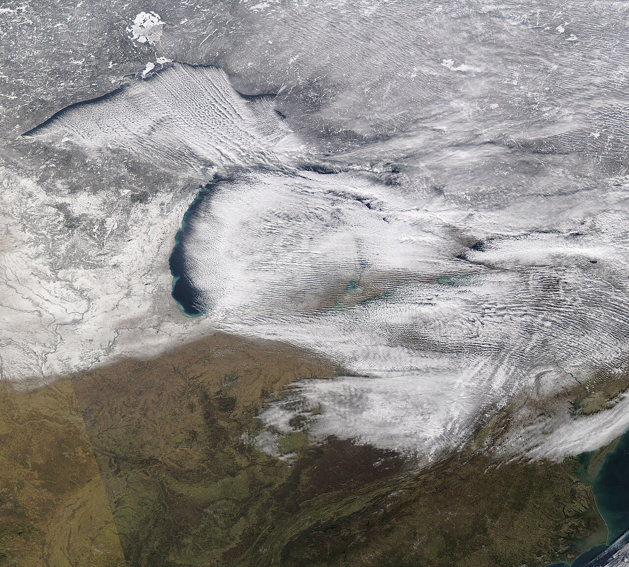
Lake-effect snow is a mesoscale winter phenomenon that occurs when cold, dry air flows over relatively warm, unfrozen lake water, picks up heat and moisture, and then releases intense, narrow snow bands downwind. This highly localised process can produce extreme accumulation totals over very short distances while neighbouring areas remain dry.
Key takeaways
- Significant temperature gradients between Arctic air masses and open water drive intense heavy precipitation.
- Longer fetch distances allow the cold air to absorb massive amounts of moisture before reaching the downwind shore.
- Snow squalls form in narrow mesoscale bands, often burying specific communities while adjacent towns see sunshine.
- Topographic features downwind of the water enhance snowfall rates significantly through continuous orographic lift.
- As winter progresses and lakes freeze over, the primary moisture source is cut off and the severe snow bands cease.
What is lake-effect snow?
To understand the mechanics of winter storm dynamics, meteorologists separate massive, continent-spanning weather fronts from localised mesoscale weather systems. While a standard winter storm covers hundreds of thousands of square kilometres, lake-effect snow is a highly concentrated event. It relies entirely on the presence of a large body of open water sitting beneath an advancing cold air mass. The resulting precipitation is incredibly dense, often falling at rates of 50 to 75 millimetres (2 to 3 inches) per hour, creating dangerous whiteout conditions in narrow corridors. The phenomenon is most famous in the Great Lakes region of North America, but similar processes occur globally.
How does lake-effect snow form over warm lakes?
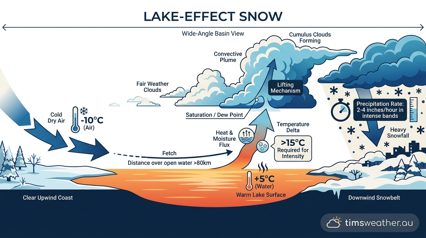
Lake-effect snow occurs when frigid Arctic air moves over a relatively warm, ice-free lake. The lake moisture flux transfers heat and water vapor into the lower atmosphere, creating intense atmospheric instability. This process triggers convective cloud development, resulting in narrow, localized snow squalls that dump extreme snowfall totals on downwind communities.
The role of atmospheric instability
Cold air moving over warm water creates profound boundary layer instability. The lake surface continuously heats the lowest layer of the atmosphere. Because warm air is less dense, it rises rapidly into the colder air above. For this process to operate efficiently, there must be a significant temperature difference between the air mass and the lake, generally requiring at least a 7°C (13°F) gradient. This steep temperature gradient acts as the primary engine for vertical lift, forcing the warm, moist air upward until it cools and condenses into towering snow-producing clouds.
Oceanic and regional variations
While the Great Lakes region is the textbook example of this phenomenon, similar thermodynamics occur worldwide. In East Asia, bitter winter winds blowing from Siberia cross the relatively warm Sea of Japan, dumping massive snowfalls on the Japanese west coast. Meteorologists also document ocean-effect snow over warm ocean waters, and even gulf-effect snow in places like Florida during rare extreme winter outbreaks. The underlying physics remain identical regardless of the water body, relying entirely on the temperature contrast between the surface and the air above.
The Physics of Fetch: Why Lake Length Matters
The severity of a resulting snowstorm is heavily dependent on the trajectory the wind takes over the water. Meteorologists call this trajectory the fetch distance, and it is a defining metric in winter forecasting.
Fetch distance and moisture absorption
Fetch distance is the total length of open water the cold air travels across before making landfall. For a substantial band to form, the air must generally traverse a minimum of 100 kilometres (about 60 miles) of open water. The longer the air remains over the warm surface, the more sensible heat and moisture it absorbs. If the wind aligns with the longest axis of a lake, the air parcel has maximum time to collect moisture. This is why a west-southwest wind blowing lengthwise across Lake Erie or Lake Ontario produces the most historically extreme snowfalls in cities like Buffalo and Syracuse.
Wind shear and band organization
Moisture absorption alone is not enough to create a catastrophic event. The wind must also be highly aligned through the vertical column of the atmosphere. If there is significant directional wind shear, meaning the wind changes direction drastically with height, the rising convective clouds will be torn apart before they can organise. Ideal conditions feature less than 30 degrees of directional change from the surface up to the 700 hPa pressure level. When winds are perfectly aligned, they bundle the rising moisture into distinct parallel lines. You can often see cloud streets form on satellite imagery long before the snow reaches the shore.
The Coriolis effect and surface friction
As the air mass moves across the water, it is also influenced by the Coriolis effect, which imparts a slight curvature to the wind trajectory. However, the most immediate physical change occurs when the clouds reach the opposite shore. The sudden transition from a smooth water surface to rough land introduces immense surface friction. This friction forces the lower-level winds to slow down, causing the incoming air to pile up and converge. This forced convergence pushes the air even higher into the atmosphere, rapidly accelerating the condensation process and triggering intense precipitation just inland from the coast.
Micro-Climates and Mesoscale Banding Patterns
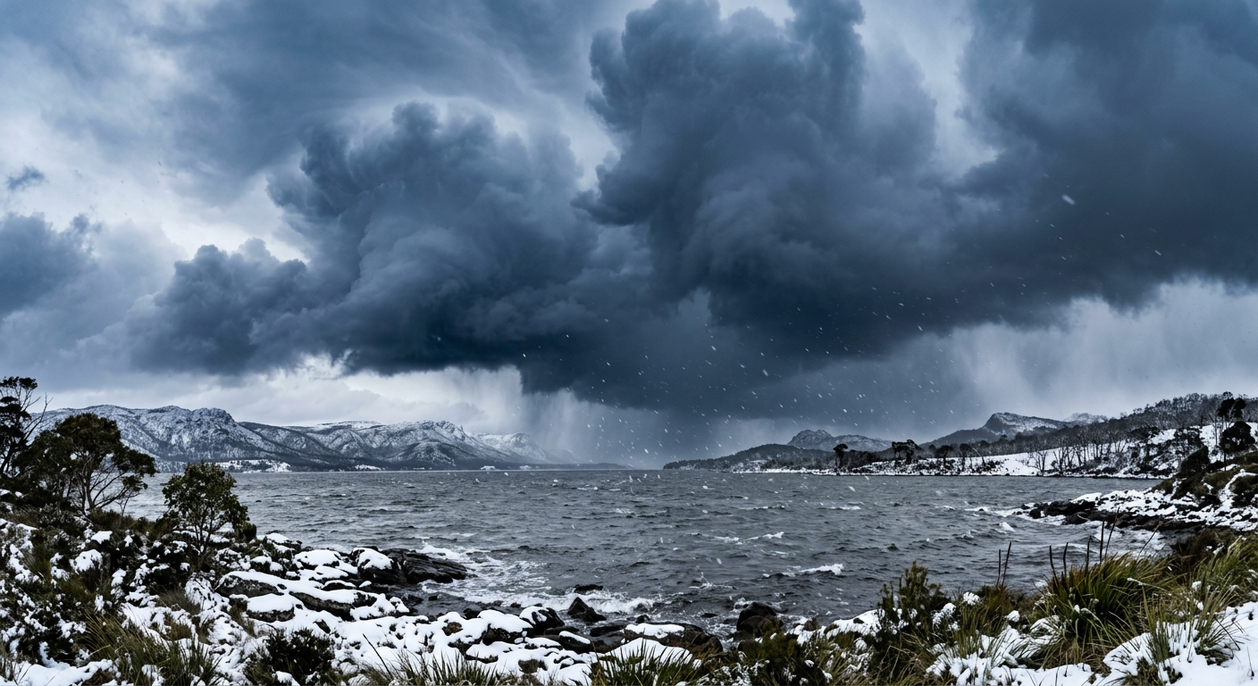
Because the driving forces are restricted to the water footprint and immediate wind trajectory, lake-effect snow creates highly specific micro-climates. It is common for one suburb to be buried under half a metre of snow while a town just 10 kilometres away enjoys clear skies and dry roads.
Single-band versus multi-band formations
The layout of the snow depends heavily on the orientation of the wind relative to the lake. When the prevailing wind blows parallel to the major axis of a long lake, a single dominant band usually develops. This single band acts like a giant atmospheric fire hose, drawing immense amounts of moisture into one stationary corridor. Inside this band, snowfall rates can be staggering. Conversely, when winds blow across the shorter width of a lake, multiple smaller bands form parallel to each other. These multi-band events distribute the snow over a much wider geographical area, but the intensity within any single band is generally much lower due to the shorter fetch distance.
Orographic lift and the Tug Hill Plateau effect
Terrain heavily modifies where and how hard the snow falls. When the moisture-laden air hits rising terrain, the effect of surface friction is multiplied by orographic lift. The Tug Hill Plateau, located east of Lake Ontario, rises hundreds of metres above the lake surface. As the single-band clouds slam into this plateau, the topographic uplift squeezes out almost all available moisture. This creates some of the highest annual snowfall totals recorded in North America. The combination of long fetch and immediate elevation gain makes this plateau a textbook environment for studying the causes of intense lake snow bands.
Historical case studies: Extreme local variability
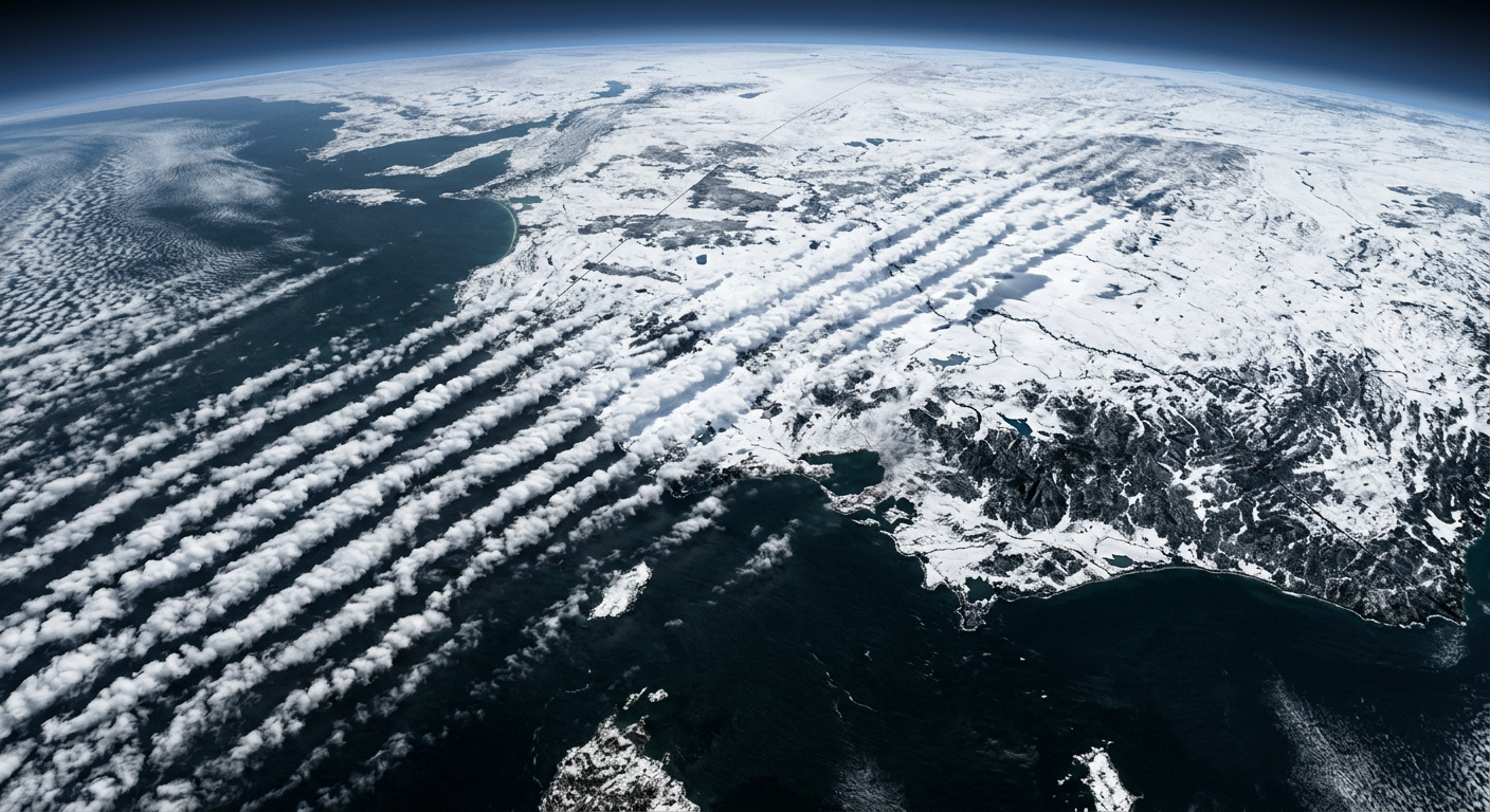
Recent documentation highlights how disruptive these narrow bands can be to local communities. A 9 to 10 November 2025 event in northeast Illinois and northwest Indiana produced blinding snowfall rates exceeding 50 millimetres (2 inches) per hour, dropping localised totals near 30 centimetres (1 foot) in highly restricted areas. Later in the same season, a 30 to 31 January 2026 event brought extreme rates of over 75 millimetres (3 inches) per hour, burying northwest Indiana under 25 to 28 centimetres (10 to 11 inches) of snow. The severity and location of these extremes depend entirely on wind direction, often impacting western Michigan and northern Indiana while leaving nearby areas completely dry.
Lake-Effect vs. Synoptic Storms: Distinguishing the Mechanisms
It is helpful to separate lake snows from traditional broad-scale winter storms. Both produce dangerous conditions, but their origins, structures and predictability are entirely different.
Synoptic-scale forcing versus local thermodynamics
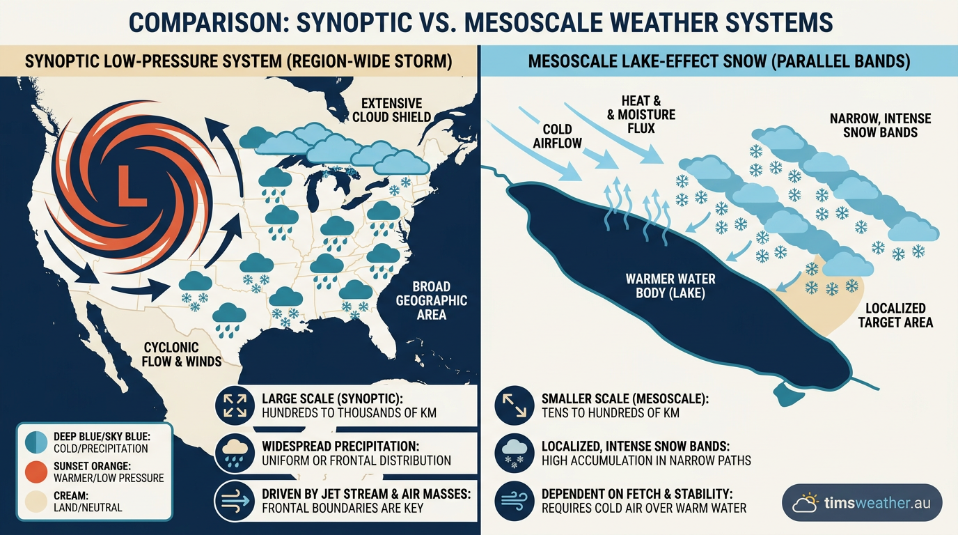
Broad winter storms are driven by synoptic-scale forcing. When we look at how low-pressure systems form, we see large boundaries between different air masses interacting over thousands of kilometres. These systems draw moisture from vast oceans and rely on the jet stream to provide broad atmospheric lift. In contrast, lake-effect snow is entirely dependent on local thermodynamics. It requires no frontal boundary and no upper-level storm system to trigger precipitation. It is purely the result of cold air moving over a localized heat source.
Why lake-effect snow causes snow squalls instead of broad blizzards
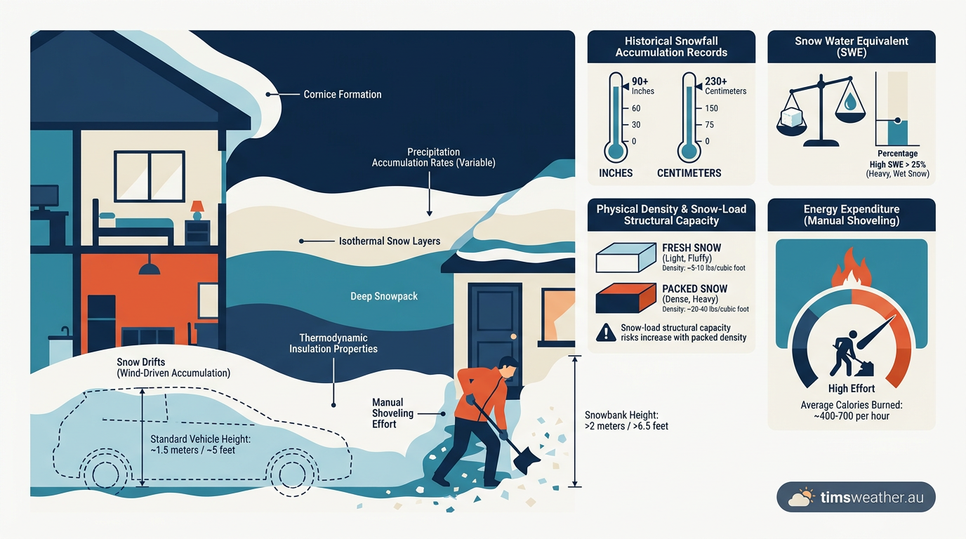
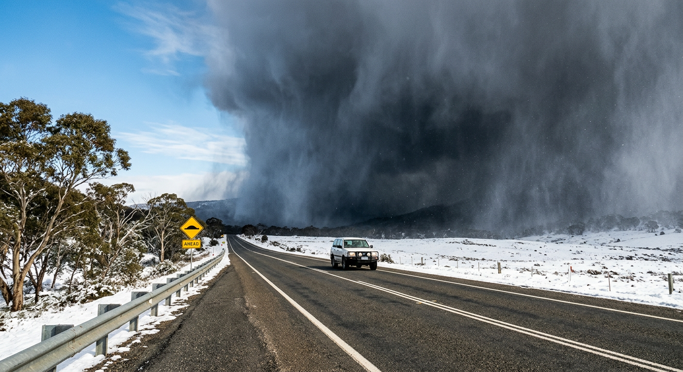
Because synoptic storms cover massive areas, they produce widespread, continuous cyclonic snowfall that can last for a day or two. When powerful winds combine with this broad precipitation, you can see blizzards form that shut down entire states. Lake-effect snow, however, is restricted to narrow mesoscale corridors. This results in rapid snow squalls rather than continent-spanning blizzards. A driver moving down a highway might pass from clear skies into a total whiteout instantly as they intersect a band, a phenomenon that makes forecasting and driving exceptionally treacherous.
Distinguishing cyclonic snowfall from mesoscale bands
Cyclonic snowfall falls relatively evenly across a wide radius around a central low-pressure circulation. The intensity rises and falls gradually as the storm system slowly drifts across the map. Mesoscale snow bands are linear, highly concentrated, and entirely decoupled from any central pressure circulation. They behave more like thunderstorms than traditional winter storms, complete with intense updrafts and occasional lightning strikes, commonly referred to as thundersnow.
| Meteorological Factor | Impact on Snowfall | Key Indicator |
|---|---|---|
| Air-to-Water Temp Gradient | Drives vertical instability | ≥7°C difference at 850 hPa |
| Fetch Distance | Determines total moisture | >100 km open water fetch |
| Directional Wind Shear | Controls band organization | <30° shift from surface to 700 hPa |
| Topographic Uplift | Enhances localized rates | Downwind elevation increases |
Why Non-Frozen Lakes Create The Most Extreme Events
The time of year plays a major role in the severity of these events. The most extreme snowfalls rarely occur in the dead of winter. Instead, they are most prevalent from late fall through winter before the lakes freeze completely.
The thermodynamics of lake moisture flux
During summer and early autumn, massive bodies of water absorb and store a vast amount of solar radiation. Water has a high specific heat capacity, meaning it cools down much slower than the surrounding land. When you learn what is the polar vortex and see its deep Arctic air masses dislodge and sweep southward in November or December, the temperature difference between the frigid air and the still-warm water is at its absolute maximum. This massive gradient drives an aggressive lake moisture flux, dumping legendary early-season totals on cities before the lakes have a chance to cool.
Saturated vapor pressure and latent heat release
The scientific mechanism behind this early-season intensity relies on saturated vapour pressure. Warm water evaporates much faster than cold water. The warm lake surface rapidly evaporates into the very dry, cold air above it. As this moisture rises and condenses, it undergoes a phase change from gas to liquid, and then to solid ice crystals. Each phase change involves a tremendous latent heat release. This heat is released directly into the rising cloud, making the air more buoyant and forcing the updraft to accelerate higher into the atmosphere. The warmer the lake, the more latent heat is released, and the more violent the snow bands become.
The transition to ice cover
As the winter season progresses, the constant extraction of heat by continuous cold air masses eventually cools the water surface. Once the surface temperature drops to freezing, ice begins to form. As lake ice expands, the direct moisture supply drops significantly. A solid layer of ice effectively caps the lake moisture flux, cutting off the heat engine that drives the instability. Once a lake freezes over entirely, the intense snow bands typically weaken and cease until the spring thaw.
Predicting the Death Bands: How Meteorologists Forecast Localized Totals
Forecasting mesoscale weather systems is notoriously difficult. A shift in wind direction of just a few degrees can move a catastrophic band of snow away from a major city and into a sparsely populated rural area.
ECMWF and GFS model resolutions for mesoscale events
Meteorologists rely heavily on numerical weather prediction models, but different models have different strengths. Global models like the GFS and the ECMWF use relatively large grid spacings, often calculating data points 9 to 20 kilometres apart. Because a single intense snow band might only be 5 to 10 kilometres wide, global models frequently struggle to resolve its exact placement or intensity. Forecasters must instead turn to high-resolution mesoscale models, which calculate data every 3 kilometres or less, to accurately map exactly where the heaviest precipitation will anchor. Even then, minute-by-minute observation is required.
Analysing satellite imagery from the GOES-R series
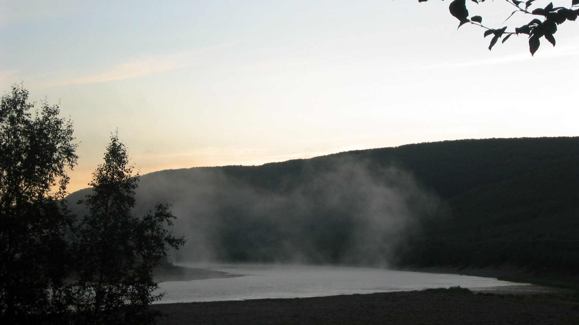
Real-time observation relies heavily on advanced geostationary satellites. The GOES-R satellite series provides meteorologists with continuous, high-definition visible and infrared imagery. By watching these satellite loops, forecasters can see the exact moment the convective clouds begin to organise over the open water. The satellite imagery clearly shows the transition from scattered cumulus puffs into dense, highly organised parallel lines. Combining this visual data with Doppler radar allows forecasters to issue highly specific, short-term warnings for the communities directly in the path of the incoming squall.
Measuring lake effect snowfall accumulation
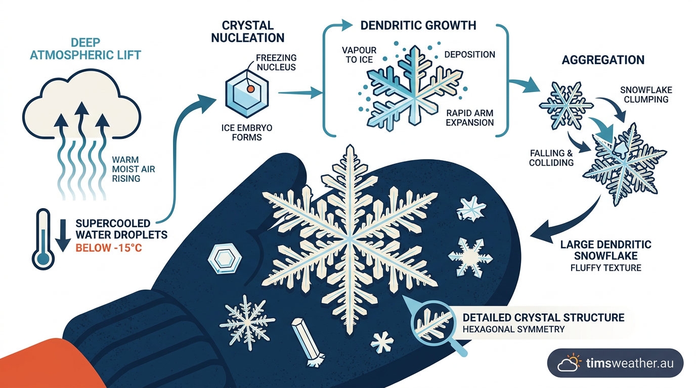
Recording the exact amount of snow that falls during these events presents its own set of challenges. Traditional winter storms often produce a snow-to-liquid ratio of about 10:1, meaning 10 millimetres of snow melts down to 1 millimetre of water. However, the extreme vertical lift inside a lake-effect band creates massive, fluffy dendritic snowflakes that stack loosely. When investigating how do snowflakes form in these specific updrafts, scientists find the snow-to-liquid ratio can easily reach 20:1 or even 30:1. The snow is incredibly deep but contains very little water weight. Also, the strong winds associated with the squalls cause massive drifting, making it difficult for automated sensors or human observers to find a flat, representative area to take an accurate measurement.
Safety Tips for Lake Effect Snow Events
The highly localised nature of these mesoscale events makes them exceptionally dangerous for motorists and residents caught off guard by the rapidly changing conditions.
Highway hazards and sudden whiteouts
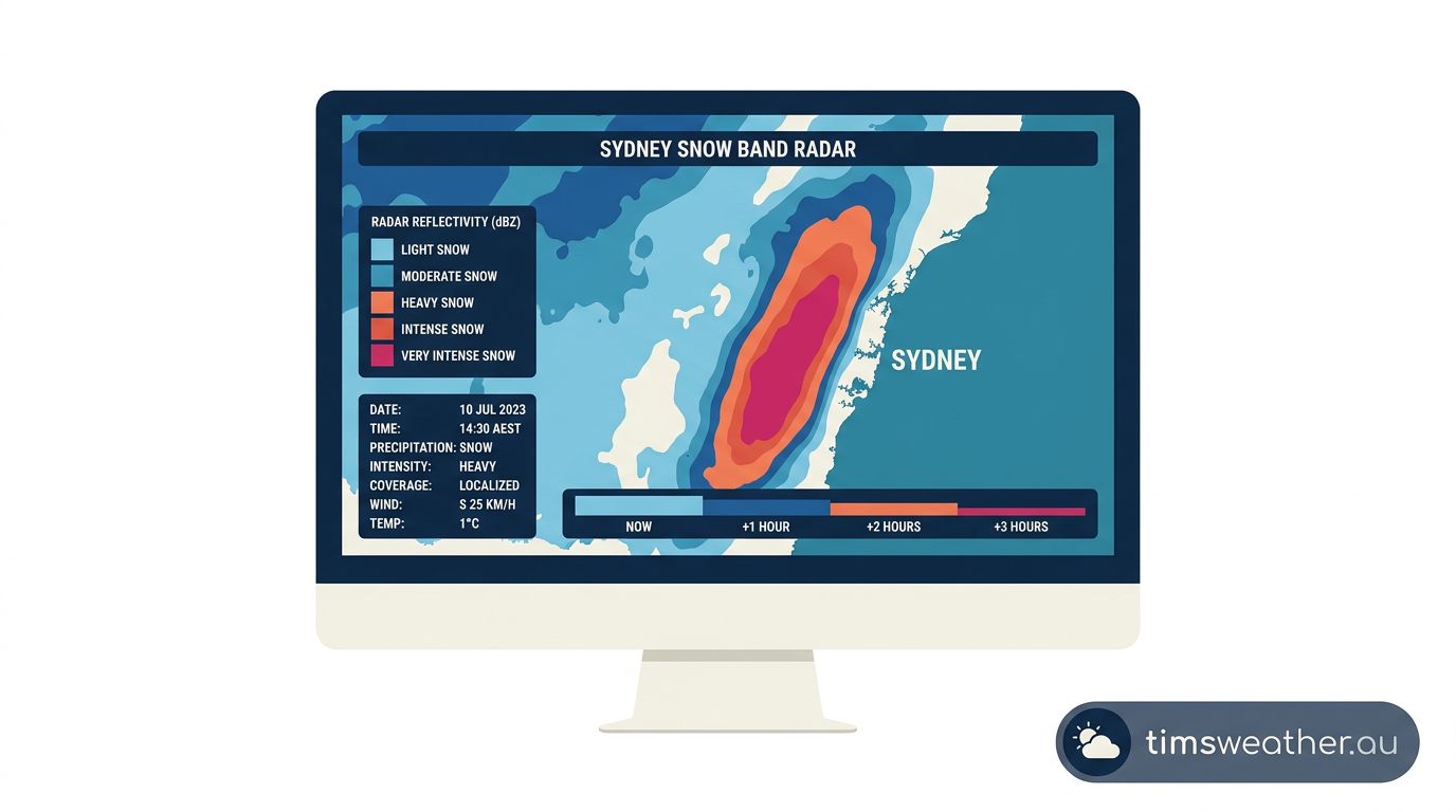
The primary hazard is the sudden transition from clear weather to zero visibility. Drivers travelling at highway speeds can enter a heavy snow band with absolutely no warning. Because the snow falls so rapidly, road crews often cannot clear the highways fast enough to prevent thick accumulation. This combination of blinding whiteout conditions and slippery roads frequently leads to severe multi-vehicle accidents. Public safety agencies urge motorists to avoid travel entirely when intense squalls are forecast for their route.
Recognising warning signs
If you are travelling downwind of a large water body during a cold air outbreak, pay close attention to the sky. A dark, low-hanging wall of clouds on the horizon is a clear visual indicator of an intense band. You might experience bright sunshine in one moment, only to see a sheer wall of dark grey approaching rapidly. Always monitor local weather advisories and be prepared to delay travel until the wind shifts and the band moves away from major thoroughfares.
Cold air exposure and rapid temperature drops
Because these events are driven by Arctic air masses, the temperature inside the snow band is incredibly cold. The combination of heavy, wet snow, strong winds, and freezing temperatures creates severe exposure risks for anyone stranded on the roads or caught outdoors. Learning how do cold fronts form and move can help residents anticipate these dangerous sudden temperature drops and ensure they have emergency supplies in their vehicles.
Climate Change and the Future of Winter Storm Dynamics
As global temperatures rise, the mechanics of these mesoscale events are shifting in complex and sometimes counterintuitive ways.
Impact of warm water on snowfall
Paradoxically, a warming climate can initially lead to more intense lake-effect snowstorms. Because the summers are warmer and last longer, the lakes absorb more heat. When winter arrives, the lakes take much longer to cool down and freeze over. A reduction in ice cover means that the open-water fetch distance remains intact deeper into the season. With the moisture source completely uninhibited, the passing cold air masses can continue to generate severe snow bands much later into January and February than historical averages would suggest.
Shifting seasonal patterns
The timing of the most severe events is slowly shifting later into the winter. Historically, November and December were the peak months for extreme totals, but prolonged warm water temperatures mean that deep winter cold outbreaks are now encountering unfrozen water well into the new year. This extends the danger period for coastal communities, forcing them to maintain snow clearing operations for a longer duration of the season.
Long-term atmospheric trends
However, this increase in intensity is likely a transitional phase. As background atmospheric temperatures continue to rise globally, the air masses crossing the lakes will eventually become too warm to support snowfall. If the air temperature sits just above freezing, the massive lake moisture flux will still occur, but the resulting precipitation will fall as heavy rain instead of snow. Meteorologists are closely monitoring these trends to understand how long the current era of extreme snow totals will persist.
Last verified: 2026-09-22
Frequently asked questions
Lake-effect snow occurs when bitter cold air moves over relatively warm, unfrozen lake water. As the air passes over the water, it absorbs significant heat and moisture. When this unstable air moves inland and rises, it cools rapidly, releasing the collected moisture as intense, concentrated bands of snowfall.
Source: weather.gov
Further reading and resources
Explore trusted articles, books, videos and other resources to go deeper on this topic.
youtube.comVideo
The Science Behind Lake-Effect Snow - YouTube
Video coverage on Lake-Effect Snow: How a Warm Lake Buries a City from youtube.com.
nesdis.noaa.govReference
What Is Lake Effect Snow? | NESDIS - NOAA
Background reference on Lake-Effect Snow: How a Warm Lake Buries a City from nesdis.noaa.gov.
foxweather.comArticle
What is lake-effect snow? - FOX Weather
In-depth coverage on Lake-Effect Snow: How a Warm Lake Buries a City from foxweather.com.
washingtonpost.comArticle
What is lake-effect snow and how does it form? Here's what to know.
In-depth coverage on Lake-Effect Snow: How a Warm Lake Buries a City from washingtonpost.com.
weather.govReference
What is a Lake Effect Snow? - National Weather Service
Background reference on Lake-Effect Snow: How a Warm Lake Buries a City from weather.gov.
accuweather.comArticle
Everything you should know about lake-effect snow - AccuWeather
In-depth coverage on Lake-Effect Snow: How a Warm Lake Buries a City from accuweather.com.
climate.govReference
The paradox of lake effect snow: global warming could ... - Climate
Background reference on Lake-Effect Snow: How a Warm Lake Buries a City from climate.gov.
Here's how different temperatures produce specific types of 'effect snow'
In-depth coverage on Lake-Effect Snow: How a Warm Lake Buries a City from foxweather.com.
canr.msu.eduReference
Could warm Great Lakes bring significant lake effect snow to ...
Background reference on Lake-Effect Snow: How a Warm Lake Buries a City from canr.msu.edu.
en.wikipedia.orgReference
Lake-effect snow - Wikipedia
Background reference on Lake-Effect Snow: How a Warm Lake Buries a City from en.wikipedia.org.
Planning weeks ahead?
Check Australia's long-range seasonal outlook for rainfall, temperature and the climate drivers (ENSO, IOD, SAM, MJO) shaping the next three months.
View Australia's Seasonal Weather Forecast