
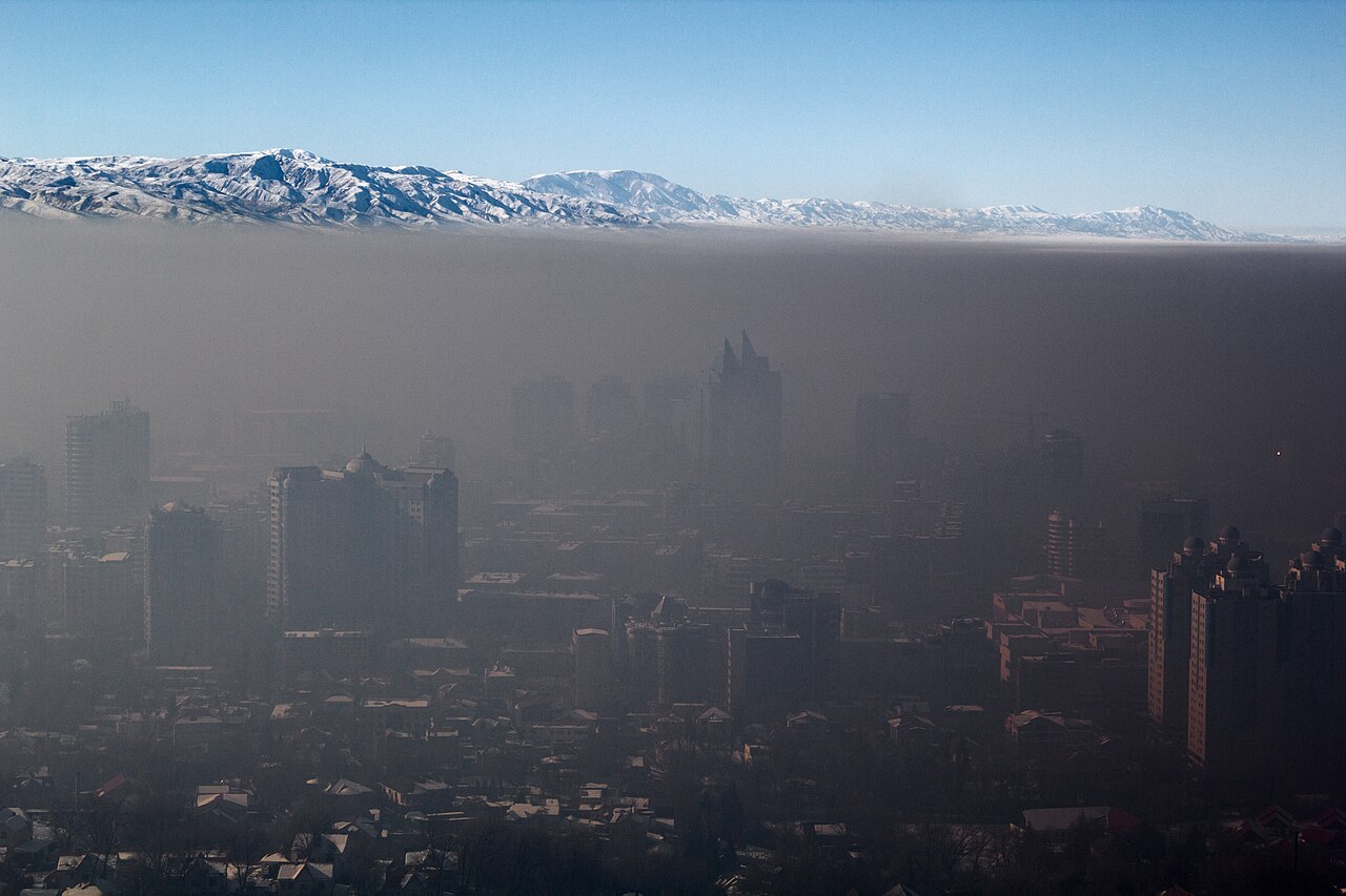
How do temperature inversions form? A temperature inversion forms when the normal vertical temperature gradient of the troposphere reverses, causing a layer of warmer air to sit directly above cooler air near the surface. This creates an environment of absolute stability that acts as a physical lid, trapping pollutants and suppressing vertical atmospheric mixing.
Key takeaways
Temperature inversions reverse the standard environmental lapse rate, creating a highly stable layer where temperature increases with altitude.
Radiative cooling on clear nights, large-scale subsidence in high-pressure systems, and cold air pooling in valleys are the primary formation mechanisms.
This meteorological phenomenon heavily restricts the planetary boundary layer, causing severe urban smog and trapping hazardous particulates near the ground.
Meteorologists launch radiosondes and use Skew-T log-P diagrams to detect the specific temperature gradient kink that identifies an inversion layer aloft.
Inversions influence synoptic weather patterns across the globe, from generating dense marine advection fog to halting the intensification of tropical cyclones.
The structure of the troposphere and standard atmosphere
To fully grasp the mechanics behind inversion layers, you must first look at the standard thermodynamic behaviour of the Earth's lower atmosphere. The troposphere is the lowest layer of the atmosphere, containing almost all measurable atmospheric moisture and weather events. The troposphere is heated from the bottom up. The Earth's surface absorbs shortwave solar radiation during the day and constantly transfers that thermal energy to the air immediately above it through conduction and convection.
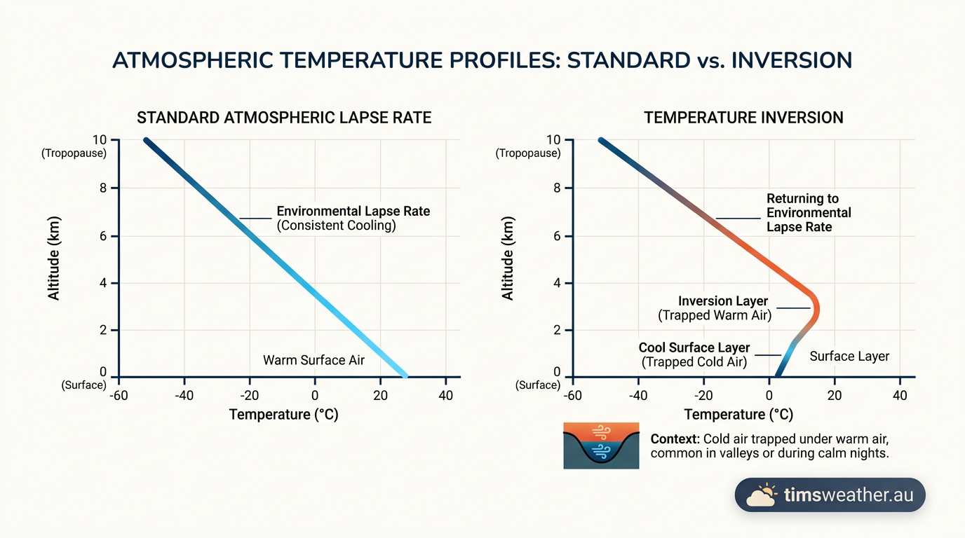
Because the primary heat source is located at the surface, air temperatures naturally decrease as you move higher up in the troposphere. As a parcel of air rises, it encounters lower atmospheric pressure, forcing it to expand. This expansion requires energy, which causes the air parcel to cool adiabatically. According to reference data from the Britannica meteorology section, the global average rate of this temperature drop is 6.5 °C for every kilometre of altitude gained. This continuous cooling with height allows warmer, less dense air at the surface to rise freely, creating the vertical mixing required to form clouds, disperse smoke, and generate surface winds.
Temperature inversion vs standard atmosphere
A thermal inversion occurs when this standard temperature profile flips completely. Instead of cooling with height, a specific layer of the atmosphere begins to warm with height. This creates a powerful zone of absolute stability. Because cold air is denser and heavier than warm air, the cooler air near the surface remains stubbornly in place. It is entirely unable to rise through the warmer, lighter air resting on top of it. This configuration fundamentally shuts down atmospheric convection and vertical mixing until solar heating or strong winds can break the inversion layer.
How do temperature inversions form across different environments?
While the thermodynamic result of an inversion is always a highly stable layer of air, the physical mechanisms that create these layers vary drastically depending on the time of day, the local topography, and the prevailing synoptic weather pattern.
How do temperature inversions form?
Temperature inversions form when the normal vertical temperature gradient of the troposphere reverses, causing warmer air to sit above cooler air. This process typically occurs through nocturnal radiative cooling of the surface, large-scale atmospheric subsidence within high-pressure systems, or the horizontal advection of warm air over a cold surface, resulting in increased atmospheric stability.
Nocturnal radiation and surface inversions
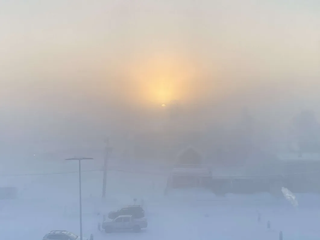
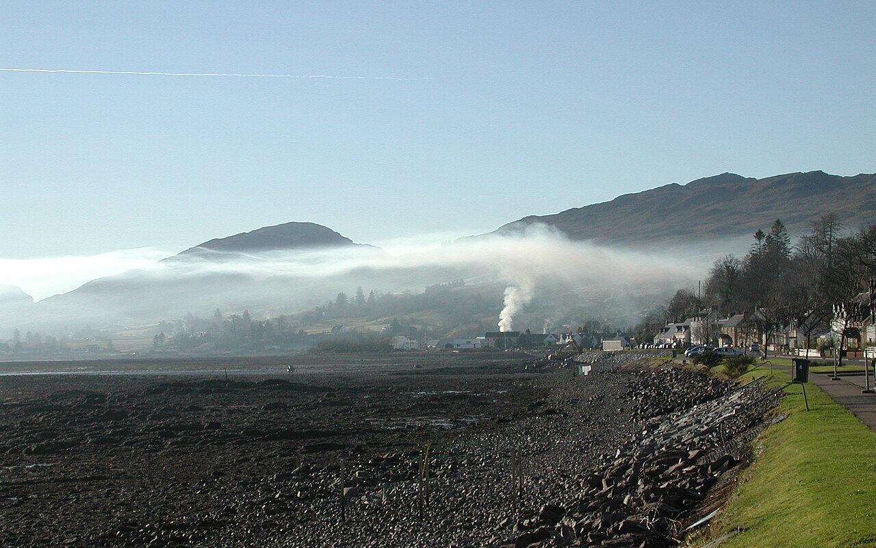
The most common type of inversion happens overnight. When the sun sets, the Earth's surface stops absorbing solar energy and begins emitting longwave infrared radiation back into space. On clear nights with very light winds, this radiational cooling happens rapidly. The ground quickly becomes colder than the air above it. The ground then cools the lowest few metres of the atmosphere through direct contact. Because air is a poor conductor of heat, the air hundreds of metres aloft remains relatively warm, creating a shallow but distinct thermal inversion. Observing how does radiation fog form demonstrates this exact process in action, as the trapped surface air cools past its dew point and condensates into thick, low-lying fog.
The role of synoptic-scale subsidence
While radiation inversions are shallow and short-lived, subsidence inversions cover massive geographic areas and can last for weeks. These form under the influence of slow-moving anticyclones. If you study how do high-pressure systems form, you will see that they are driven by broad zones of descending air in the mid-to-upper troposphere. As this air sinks towards the surface, it is subjected to increasing atmospheric pressure. This pressure compresses the air mass, forcing it to warm up adiabatically. The sinking, warming air eventually hits the cooler air resting near the surface, acting like a giant, warm lid over an entire region.
Topographic pooling and cold-air drainage
In mountainous regions and deep valleys, local topography exaggerates the inversion process. Cold air is dense and heavily affected by gravity. At night, air that cools along high mountain ridges flows downhill like water, draining into valleys and basins. This process is known as katabatic flow. The valleys gradually fill with deep pools of dense, freezing air, while the warmer air is pushed upwards. Analysing valley fog formation shows that these topographic basins can hold cold air in place for days, particularly during the winter months when the sun stays too low in the sky to effectively heat the valley floor.
Thermodynamic parcel theory and measuring stability
To definitively state whether an inversion is present, professional meteorologists depend on empirical vertical profiles. They launch weather balloons known as radiosondes twice a day from stations around the world. These instruments transmit continuous temperature, humidity, and pressure readings as they ascend through the troposphere.
Reading the temperature gradient kink
Meteorologists plot these upper-air soundings on specialised graphs called Skew-T log-P diagrams. On a standard day, the plotted temperature line drifts steadily to the left as altitude increases, reflecting the normal environmental lapse rate. When an inversion is present, the temperature line abruptly kinks and zigs sharply to the right, indicating a layer where temperatures are actively climbing with height. Training materials from the Bureau of Meteorology aviation standards emphasize that identifying this kink is essential for forecasters, as it shows exactly where weather systems will be suppressed and where convection will fail.
Absolute stability and parcel buoyancy
The mechanical strength of a thermal inversion relies entirely on buoyancy. Thermodynamic parcel theory states that a parcel of air will only rise if it remains warmer, and therefore less dense, than the surrounding environment. If a warm air parcel rising from the heated ground hits an inversion layer, it suddenly finds itself surrounded by ambient air that is warmer than it is. The parcel instantly loses its positive buoyancy, becomes negatively buoyant, and sinks back down. Data collected by the NOAA Earth System Research Laboratories confirms that this creates an environment of absolute stability, acting as an invisible ceiling that strictly caps the planetary boundary layer.
Why do temperature inversions trap pollution?
While inversions are natural meteorological phenomena, their interaction with heavy human activity creates significant environmental and health crises. When the atmosphere is heavily stratified, the normal mechanisms that disperse smoke, vehicle exhaust, and industrial emissions fail completely.
Mechanical drivers suppressing vertical mixing
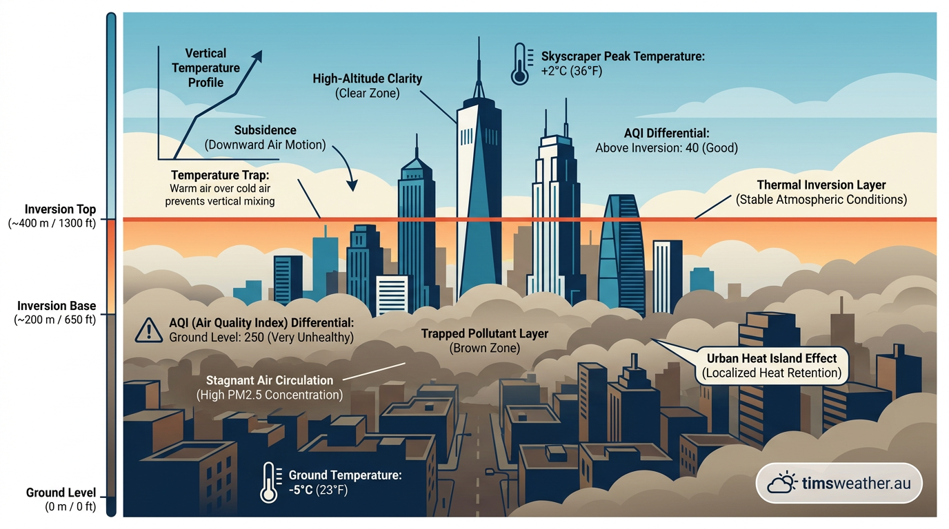
In a standard, unstable atmosphere, daytime heating causes warm thermals to rise vigorously. These thermals carry surface-level pollutants high into the troposphere, where upper-level jet streams and synoptic winds disperse them globally. An inversion stops this dispersal process completely. Smoke and exhaust from a city rise only until they hit the base of the warm inversion layer. Upon losing their buoyancy, the pollutants flatten out horizontally, forming a distinct, visible smog line across the sky.
An educational overview by What Is Nosy highlights that particulate matter and ground-level ozone become aggressively concentrated during these events. Because the planetary boundary layer is compressed into a very shallow space, the exact same daily volume of urban pollution is forced into a much smaller volume of air, causing the air quality index to rapidly degrade.
Impact of inversions on urban air quality
Urban heat islands further complicate this dynamic. Cities generate massive amounts of waste heat and trap solar energy in concrete, altering the local temperature gradient just enough to interact poorly with the surrounding stable air. A 2026 peer-reviewed study published in Atmospheric Chemistry and Physics documented how these anomalous spatiotemporal patterns result in dense, persistent smog layers that conform exactly to the topography of the urban environment.
Historically, the most severe example of this interaction was the Great Smog of London in 1952, where a massive anticyclonic subsidence inversion trapped toxic coal smoke over the city for five days, severely restricting visibility and impacting thousands. Modern examples occur frequently in Salt Lake City, Utah, where winter high-pressure systems trap cold, polluted air inside the bowl-shaped valley, creating hazardous breathing conditions that persist until a strong weather front physically flushes the cold air out of the basin.
Meteorological triggers of inversions
Categorising the physical drivers behind different inversion events is highly useful for predicting their duration and their specific impacts on local weather systems.
Inversion Type | Primary Mechanism | Typical Duration | Atmospheric Impact |
|---|---|---|---|
Radiation Inversion | Rapid nocturnal cooling of the Earth's surface under clear skies. | Overnight to early morning; usually breaks shortly after sunrise. | Causes surface fog, heavy dew, and trapped overnight smoke in low-lying areas. |
Subsidence Inversion | Broad sinking and adiabatic warming of air within high-pressure systems. | Several days to weeks; persists until the high-pressure system shifts. | Creates widespread dry haze, caps cloud development completely, and drives severe urban smog. |
Advection Inversion | Horizontal movement of a warm air mass directly over a colder surface. | Highly variable; depends entirely on sustained wind direction and ocean temperatures. | Forms dense, persistent coastal fog banks and distinct marine boundary layers. |
Topographic Inversion | Drainage of dense, freezing air down mountain slopes into a closed basin. | Can last for weeks during mid-winter when solar heating remains weak. | Traps valley pollution, creates localised freezing events, and severely degrades air quality. |
Regional examples and complex interactions
While inversions are infamous for their detrimental impact on urban air quality, they also play a major role in broader synoptic weather patterns. They govern everything from coastal sea breezes to the life cycle of the world's most destructive oceanic storms.
Advection and the marine boundary layer
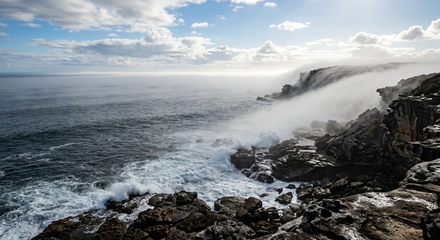
Coastal temperature inversions often result from the interaction between warm inland air, sea breezes, and cold ocean currents. On the western coast of the United States, the cold California Current heavily chills the air directly above the Pacific Ocean. When the Pacific High pressure system sets up off the coast, it pushes warm, subsiding air over this chilled surface layer. The environmental health experts at R-PUR environmental guidelines note that this stark thermal barrier traps moisture and pollution near the surface, forming a persistent marine boundary layer. This setup regularly rolls inland as heavy coastal fog. Learning about advection fog formation is essential for marine navigation, as the fog bank will not lift until solar heating is strong enough to burn through the inversion layer. In many cases, the moisture trapped beneath the inversion simply spreads out to aid stratocumulus cloud formation across the coast.
Inversions as barriers to tropical cyclone intensification
In the tropics, strong inversions act as natural speed bumps for severe weather. The Trade Wind Inversion is a semi-permanent feature of the tropical atmosphere caused by sinking air on the outer edges of the Hadley Cell. If you review how do hurricanes form, you will find that these storms require deep, vertically uninhibited convection to build their massive eyewall structures. If a developing tropical depression encounters a strong trade wind inversion, the rising thunderstorms hit the warm, stable layer aloft and are forced to flatten out. This cuts off the storm's thermodynamic engine, caps the updrafts, and actively prevents the cyclone from intensifying into a mature hurricane or typhoon.
Does wind prevent temperature inversions?
A common question is whether heavy winds can prevent an inversion from taking hold. The answer is yes, because strong wind introduces heavy mechanical mixing into the boundary layer. When wind speeds are high, friction with the Earth's surface creates turbulent eddies that force the cold surface air to mix violently with the warmer air aloft. This constant churning prevents the atmosphere from separating into distinct, stratified temperature layers.
However, if an inversion is already heavily entrenched, particularly a deep topographic inversion in a winter valley, light surface winds will not be enough to break it. The wind must be powerful enough to overcome the massive negative buoyancy of the cold air pool. Often, it takes a powerful synoptic event to clear the basin. Seeing how do cold fronts form and move across a sector demonstrates the immense mechanical force required to scour away a stubborn, multi-day winter inversion, replacing the stagnant stable air with a fresh, unstable air mass.
Last verified: 2026-09-17
Frequently asked questions
Inversions typically form after sunset when the ground loses heat rapidly via radiation. This process cools the air directly in contact with the surface. Because the air higher up remains warmer, a stable layer develops, trapping the denser, colder air near the ground and preventing normal atmospheric mixing.
Source: acp.copernicus.org
Further reading and resources
Explore trusted articles, books, videos and other resources to go deeper on this topic.
agriculture.basf.usArticle
Understanding and recognizing temperature inversions
In-depth coverage on How Do Temperature Inversions Form? The Complete Meteorological Guide from agriculture.basf.us.
pilotinstitute.comArticle
Inversions in Meteorology: How They Impact Pilots and Weather
In-depth coverage on How Do Temperature Inversions Form? The Complete Meteorological Guide from pilotinstitute.com.
britannica.comReference
Temperature inversion | Definition & Facts | Britannica
Background reference on How Do Temperature Inversions Form? The Complete Meteorological Guide from britannica.com.
youtube.comVideo
What is a Temperature Inversion? - For Student Pilots - YouTube
Video coverage on How Do Temperature Inversions Form? The Complete Meteorological Guide from youtube.com.
weather.govReference
Temperatures - The Inversion
Background reference on How Do Temperature Inversions Form? The Complete Meteorological Guide from weather.gov.
[PDF] What Is An Inversion? - National Weather Service
Background reference on How Do Temperature Inversions Form? The Complete Meteorological Guide from weather.gov.
avalanche.orgArticle
Temperature Inversion - Avalanche.org
In-depth coverage on How Do Temperature Inversions Form? The Complete Meteorological Guide from avalanche.org.
agriculture.vic.gov.auReference
Recognising surface temperature inversions | Managing spray drift
Background reference on How Do Temperature Inversions Form? The Complete Meteorological Guide from agriculture.vic.gov.au.
en.wikipedia.orgReference
Inversion (meteorology) - Wikipedia
Background reference on How Do Temperature Inversions Form? The Complete Meteorological Guide from en.wikipedia.org.
ndsu.eduReference
Air Temperature Inversions Causes, Characteristics and Potential Effects ...
Background reference on How Do Temperature Inversions Form? The Complete Meteorological Guide from ndsu.edu.
Planning weeks ahead?
Check Australia's long-range seasonal outlook for rainfall, temperature and the climate drivers (ENSO, IOD, SAM, MJO) shaping the next three months.
View Australia's Seasonal Weather Forecast